583:"}},"text\/plain":{"en":{"":"checksum"}}},"{\"value\":\"07fc40a83d60f4f27dcffc1f39485819e31bebce\",\"type\":\"string\"}":{"text\/html":{"en":{"P4092":"07fc40a83d60f4f27dcffc1f39485819e31bebce"}},"text\/plain":{"en":{"P4092":"07fc40a83d60f4f27dcffc1f39485819e31bebce"}}},"{\"value\":{\"entity-type\":\"property\",\"numeric-id\":459,\"id\":\"P459\"},\"type\":\"wikibase-entityid\"}":{"text\/html":{"en":{"":"
507:"}},"text\/plain":{"en":{"":"inception"}}},"{\"value\":{\"time\":\"+2010-09-26T00:00:00Z\",\"timezone\":0,\"before\":0,\"after\":0,\"precision\":11,\"calendarmodel\":\"http:\\\/\\\/www.wikidata.org\\\/entity\\\/Q1985727\"},\"type\":\"time\"}":{"text\/html":{"en":{"P571":"26 September 2010"}},"text\/plain":{"en":{"P571":"26 September 2010"}}}}": -->
38:
253:
579:
264:
94:
545:"}},"text\/plain":{"en":{"":"media type"}}},"{\"value\":\"image\\\/svg+xml\",\"type\":\"string\"}":{"text\/html":{"en":{"P1163":"image\/svg+xml"}},"text\/plain":{"en":{"P1163":"image\/svg+xml"}}}}": -->
587:"}},"text\/plain":{"en":{"":"determination method"}}},"{\"value\":{\"entity-type\":\"item\",\"numeric-id\":13414952,\"id\":\"Q13414952\"},\"type\":\"wikibase-entityid\"}":{"text\/html":{"en":{"P459":"
650:"}},"text\/plain":{"en":{"":"data size"}}},"{\"value\":{\"amount\":\"+1738267\",\"unit\":\"http:\\\/\\\/www.wikidata.org\\\/entity\\\/Q8799\"},\"type\":\"quantity\"}":{"text\/html":{"en":{"P3575":"1,738,267
463:"}},"text\/plain":{"en":{"":"copyright license"}}},"{\"value\":{\"entity-type\":\"item\",\"numeric-id\":14946043,\"id\":\"Q14946043\"},\"type\":\"wikibase-entityid\"}":{"text\/html":{"en":{"P275":"
419:"}},"text\/plain":{"en":{"":"copyright status"}}},"{\"value\":{\"entity-type\":\"item\",\"numeric-id\":50423863,\"id\":\"Q50423863\"},\"type\":\"wikibase-entityid\"}":{"text\/html":{"en":{"P6216":"
695:"}},"text\/plain":{"en":{"":"height"}}},"{\"value\":{\"amount\":\"+1048\",\"unit\":\"http:\\\/\\\/www.wikidata.org\\\/entity\\\/Q355198\"},\"type\":\"quantity\"}":{"text\/html":{"en":{"P2048":"1,048
740:"}},"text\/plain":{"en":{"":"width"}}},"{\"value\":{\"amount\":\"+1425\",\"unit\":\"http:\\\/\\\/www.wikidata.org\\\/entity\\\/Q355198\"},\"type\":\"quantity\"}":{"text\/html":{"en":{"P2049":"1,425
736:
1392:
311:– You must give appropriate credit, provide a link to the license, and indicate if changes were made. You may do so in any reasonable manner, but not in any way that suggests the licensor endorses you or your use.
844:, UK with the following information shown: *Administrative borders *Coastline, lakes and rivers *Roads and railways *Urban areas Equirectangular map projection on WGS 84 datum, with N/S stretched 1
588:
464:
420:
737:
692:
647:
580:
542:
416:
932:
584:
504:
460:
1364:
855:
1651:
467:"}},"text\/plain":{"en":{"P275":"Creative Commons Attribution-ShareAlike 3.0 Unported"}}}}": -->
68:
64:
60:
56:
52:
48:
42:
357:
352:
242:
105:
1337:
77:
1222:
632:
490:
446:
318:
1242:
1037:
907:
751:
706:
661:
598:
552:
430:
942:
1232:
625:
514:
474:
405:
972:
917:
1262:
1032:
213:
274:
1182:
854:
More than 100 pages use this file. The following list shows the first 100 pages that use this file only. A
1382:
1267:
1172:
1057:
1047:
1027:
654:"}},"text\/plain":{"en":{"P3575":"1,738,267 byte"}}}}": -->
317:– If you remix, transform, or build upon the material, you must distribute your contributions under the
1042:
1022:
1067:
744:"}},"text\/plain":{"en":{"P2049":"1,425 pixel"}}}}": -->
699:"}},"text\/plain":{"en":{"P2048":"1,048 pixel"}}}}": -->
423:"}},"text\/plain":{"en":{"P6216":"copyrighted"}}}}": -->
1237:
912:
1007:
199:
1202:
113:
1352:
1077:
1447:
1227:
822:
817:
591:"}},"text\/plain":{"en":{"P459":"SHA-1"}}}}": -->
37:
1402:
1112:
1062:
271:
8:
1312:
1137:
1197:
1152:
922:
1252:
1017:
977:
100:
395:
1422:
1277:
1187:
1117:
1102:
1087:
1012:
962:
196:
982:
1347:
1342:
1307:
1292:
1272:
1257:
1192:
1157:
1072:
1052:
957:
872:
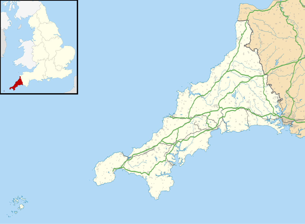
867:
230:
1327:
1282:
1212:
1142:
1097:
987:
927:
897:
892:
882:
833:
217:
937:
1177:
1167:
1107:
1642:
1437:
1322:
1217:
1207:
1127:
862:
761:
716:
671:
608:
562:
524:
484:
440:
1162:
1122:
997:
992:
967:
952:
159:
Equirectangular map projection on WGS 84 datum, with N/S stretched 150%
1357:
1302:
1297:
1147:
1132:
1002:
1332:
1287:
1092:
1082:
877:
206:
Administrative borders and coastline data from
Boundary-Line product.
139:
1477:
1627:
1247:
947:
887:
841:
790:
Click on a date/time to view the file as it appeared at that time.
282:
Contains
Ordnance Survey data © Crown copyright and database right
1452:
1432:
1317:
902:
1472:
1602:
1612:
1562:
1427:
82:(SVG file, nominally 1,425 × 1,048 pixels, file size: 1.66 MB)
1502:
1497:
1412:
1542:
1622:
1572:
1567:
1557:
1527:
933:
Church of St
Morwenna and St John the Baptist, Morwenstow
185:
88:
1637:
1507:
1617:
1587:
1537:
1517:
1482:
1462:
381:
Add a one-line explanation of what this file represents
1632:
1607:
1577:
1532:
1467:
1442:
1597:
1547:
852:
1592:
1487:
1373:
788:
491:
Creative
Commons Attribution-ShareAlike 3.0 Unported
465:
Creative
Commons Attribution-ShareAlike 3.0 Unported
112:
Commons is a freely licensed media file repository.
1522:
1512:
1457:
1582:
1552:
1492:
1417:
209:All other geographic data from Meridian 2 product.
1403:Plantilya:Location map United Kingdom Cornwall
328:https://creativecommons.org/licenses/by-sa/3.0
93:
334:Creative Commons Attribution-Share Alike 3.0
252:
237:
181:
130:
1448:Plantilla:Mapa de localización de Cornualles
347:
226:
191:
14:
741:
696:
651:
294:– to copy, distribute and transmit the work
142:, UK with the following information shown:
41:Size of this PNG preview of this SVG file:
358:File:Cornwall UK mainland location map.svg
1383:قالب:Location map United Kingdom Cornwall
1375:The following other wikis use this file:
1223:St Bartholomew's Church, Lostwithiel
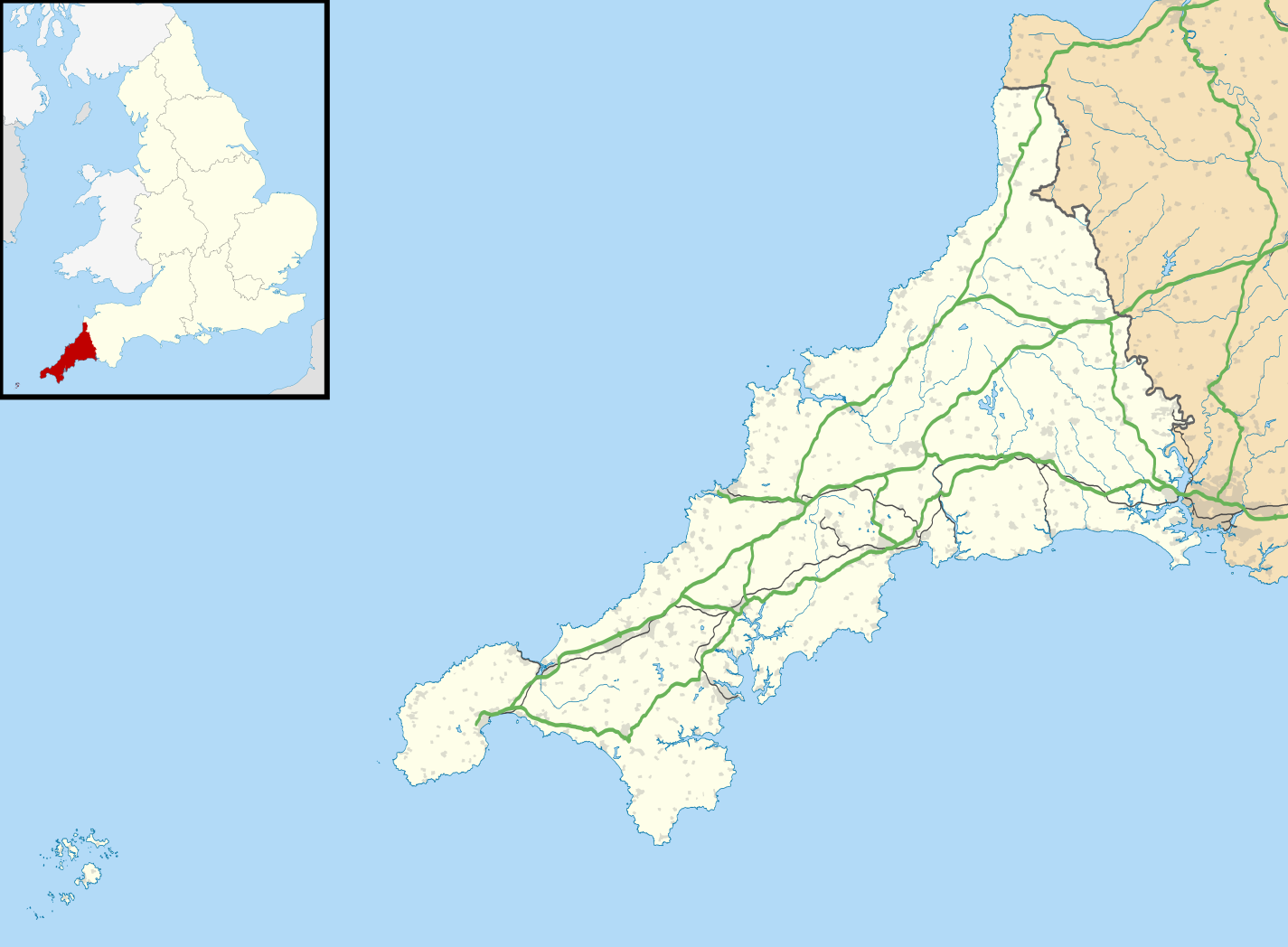
353:File:Cornwall UK district map (blank).svg
1338:Trinity House National Lighthouse Museum
614:07fc40a83d60f4f27dcffc1f39485819e31bebce
1243:St Enodoc's Church, Trebetherick
124:
275:Attribution-Share Alike 3.0 Unported
233:, created using Ordnance Survey data
1233:St Carantoc's Church, Crantock
1038:List of monastic houses in Cornwall
908:Camborne Redruth Community Hospital
781:
263:
258:
13:
943:Cornish rotten and pocket boroughs
840:{{Information |Description=Map of
394:
388:
380:
249:
125:
75:
1663:
1423:Plantilla discusión:Ficha de isla
1263:St Michael's Hospital, Hayle
973:HMS Raleigh (shore establishment)
918:Caradon Hill transmitting station
393:
1393:Шаблон:ПК Великобритания Корнуол
371:
305:Under the following conditions:
270:This file is licensed under the
262:
257:
251:
92:
31:
21:
368:
1643:Indian Queens (St Columb Road)
1438:Aeropuerto de Newquay Cornwall
1370:
1033:List of lighthouses in England
785:
367:
26:
1:
1183:Redruth transmitting station
849:
401:Items portrayed in this file
133:Cornwall UK location map.svg
7:
1399:Usage on ceb.wikipedia.org
1268:The Hurlers (stone circles)
1173:RNAS Culdrose (HMS Seahawk)
1058:Mount Edgcumbe Country Park
1048:Lostwithiel Stannary Palace
1028:Levant Mine and Beam Engine
149:Coastline, lakes and rivers
10:
1668:
1409:Usage on es.wikipedia.org
1389:Usage on bg.wikipedia.org
1379:Usage on ar.wikipedia.org
1238:St Catherine's Castle
1043:List of places in Cornwall
1023:Lawrence House, Launceston
319:same or compatible license
127:
1068:Mount Wellington Tin Mine
1008:King Doniert's Stone
782:
360:- Without Isles of Scilly
16:
913:Camborne School of Mines
818:18:43, 26 September 2010
370:
285:
214:England location map.svg
99:This is a file from the
36:
1478:Blackwater (Cornualles)
1228:St Buryan's Church
1203:Royal Cornwall Hospital
839:
184:
103:. Information from its
1628:Millbrook (Cornualles)
1353:West Cornwall Hospital
1078:Nine Maidens stone row
146:Administrative borders
106:description page there
1453:St Ives (Cornualles)
1113:Perranporth Airfield
1063:Mount Edgcumbe House
626:determination method
585:determination method
69:1,425 × 1,048 pixels
65:2,560 × 1,883 pixels
1473:Ashton (Cornualles)
1313:Trengwainton Garden
1138:Predannack Airfield
300:– to adapt the work
212:Inset derived from
162:Geographic limits:
47:Other resolutions:
1603:Bugle (Inglaterra)
1198:Roseland Peninsula
1153:RAF Davidstow Moor
923:Carn Brea, Redruth
152:Roads and railways
61:1,280 × 941 pixels
57:1,024 × 753 pixels
1652:more global usage
1613:Higher Boscaswell
1563:Bude (Inglaterra)
1428:Catedral de Truro
1371:Global file usage
1253:St Germans Priory
1018:Launceston Castle
983:Hawker's Hut
978:Hall for Cornwall
847:
743:
698:
653:
530:26 September 2010
475:copyright license
461:copyright license
387:
379:
364:
363:
246:
243:Reusing this file
186:26 September 2010
121:
120:
101:Wikimedia Commons
32:Global file usage
1659:
1278:Tolverne Cottage
1188:Restormel Castle
1118:Picklecombe Fort
1103:Penpol, Lesnewth
1088:Pendennis Castle
1013:Lanhydrock House
963:Godolphin Estate
830:
792:
770:
725:
680:
635:
630:
431:copyright status
417:copyright status
385:
377:
341:
338:
335:
332:
329:
321:as the original.
283:
272:Creative Commons
266:
265:
261:
260:
255:
254:
240:
187:
134:
128:
117:
96:
95:
89:
83:
72:
53:640 × 471 pixels
49:320 × 235 pixels
43:800 × 588 pixels
1667:
1666:
1662:
1661:
1660:
1658:
1657:
1656:
1503:Mabe Burnthouse
1498:Godolphin Cross
1433:Bahía de Carbis
1413:Islas Sorlingas
1369:
1348:Truro Cathedral
1343:Truro Aerodrome
1308:Trematon Castle
1293:Tregenna Castle
1273:Tintagel Castle
1258:St Mawes Castle
1193:Rillaton Barrow
1158:RAF Perranporth
1073:Newquay Airport
1053:Mining Exchange
958:Geevor Tin Mine
873:Bodmin Hospital
868:Bodmin Airfield
848:
836:
828:
784:
783:
780:
779:
778:
777:
776:
775:
774:
773:
771:
768:
758:
757:
756:
754:
735:
734:
733:
732:
731:
730:
729:
728:
726:
723:
713:
712:
711:
709:
690:
689:
688:
687:
686:
685:
684:
683:
681:
678:
668:
667:
666:
664:
645:
644:
643:
642:
641:
640:
639:
638:
637:
636:
631:
628:
619:
618:
617:
615:
605:
604:
603:
601:
578:
577:
576:
575:
574:
573:
572:
571:
569:
559:
558:
557:
555:
540:
539:
538:
537:
536:
535:
534:
533:
531:
521:
520:
519:
517:
502:
501:
500:
499:
498:
497:
496:
495:
493:
481:
480:
479:
477:
458:
457:
456:
455:
454:
453:
452:
451:
449:
437:
436:
435:
433:
414:
413:
412:
411:
410:
408:
392:
391:
390:
383:
382:
365:
343:
342:
339:
336:
333:
330:
327:
326:
284:
281:
278:
267:
197:Ordnance Survey
132:
123:
122:
111:
110:
109:is shown below.
85:
81:
74:
73:
46:
12:
11:
5:
1665:
1654:of this file.
1648:
1647:
1646:
1645:
1640:
1635:
1630:
1625:
1620:
1615:
1610:
1605:
1600:
1595:
1590:
1585:
1580:
1575:
1570:
1565:
1560:
1555:
1550:
1545:
1543:Grampound Road
1540:
1535:
1530:
1525:
1520:
1515:
1510:
1505:
1500:
1495:
1490:
1485:
1480:
1475:
1470:
1465:
1460:
1455:
1450:
1445:
1440:
1435:
1430:
1425:
1420:
1415:
1407:
1406:
1405:
1397:
1396:
1395:
1387:
1386:
1385:
1372:
1367:to this file.
1361:
1360:
1355:
1350:
1345:
1340:
1335:
1330:
1328:Trethevy Quoit
1325:
1320:
1315:
1310:
1305:
1300:
1295:
1290:
1285:
1283:Tregantle Fort
1280:
1275:
1270:
1265:
1260:
1255:
1250:
1245:
1240:
1235:
1230:
1225:
1220:
1215:
1213:Scraesdon Fort
1210:
1205:
1200:
1195:
1190:
1185:
1180:
1175:
1170:
1165:
1160:
1155:
1150:
1145:
1143:Prideaux Place
1140:
1135:
1130:
1125:
1120:
1115:
1110:
1105:
1100:
1098:Penlee Battery
1095:
1090:
1085:
1080:
1075:
1070:
1065:
1060:
1055:
1050:
1045:
1040:
1035:
1030:
1025:
1020:
1015:
1010:
1005:
1000:
995:
990:
988:Headland Hotel
985:
980:
975:
970:
965:
960:
955:
950:
945:
940:
935:
930:
928:Castle Horneck
925:
920:
915:
910:
905:
900:
898:Botallack Mine
895:
893:Bossiney Haven
890:
885:
883:Bonython Manor
880:
875:
870:
865:
858:is available.
851:
846:
845:
838:
834:
831:
827:1,425 × 1,048
825:
820:
815:
811:
810:
807:
804:
801:
798:
795:
787:
772:
766:
764:
763:
762:
760:
759:
755:
750:
748:
747:
746:
745:
739:
727:
721:
719:
718:
717:
715:
714:
710:
705:
703:
702:
701:
700:
694:
682:
676:
674:
673:
672:
670:
669:
665:
660:
658:
657:
656:
655:
649:
624:
623:
622:
621:
620:
616:
613:
611:
610:
609:
607:
606:
602:
597:
595:
594:
593:
592:
590:
586:
582:
570:
567:
565:
564:
563:
561:
560:
556:
551:
549:
548:
547:
546:
544:
532:
529:
527:
526:
525:
523:
522:
518:
513:
511:
510:
509:
508:
506:
494:
489:
487:
486:
485:
483:
482:
478:
473:
471:
470:
469:
468:
466:
462:
450:
445:
443:
442:
441:
439:
438:
434:
429:
427:
426:
425:
424:
422:
418:
409:
404:
402:
399:
398:
397:
396:
384:
376:
375:
372:
369:
362:
361:
349:
348:Other versions
345:
344:
325:
324:
323:
322:
312:
303:
302:
301:
295:
288:You are free:
279:
269:
268:
250:
247:
235:
234:
228:
224:
223:
222:
221:
210:
207:
193:
189:
188:
183:
179:
178:
177:
176:
173:
170:
167:
157:
156:
153:
150:
147:
135:
126:
119:
118:
97:
87:
86:
40:
35:
34:
29:
24:
19:
9:
6:
4:
3:
2:
1664:
1655:
1653:
1644:
1641:
1639:
1636:
1634:
1631:
1629:
1626:
1624:
1621:
1619:
1616:
1614:
1611:
1609:
1606:
1604:
1601:
1599:
1596:
1594:
1591:
1589:
1586:
1584:
1581:
1579:
1576:
1574:
1571:
1569:
1566:
1564:
1561:
1559:
1556:
1554:
1551:
1549:
1546:
1544:
1541:
1539:
1536:
1534:
1531:
1529:
1526:
1524:
1521:
1519:
1516:
1514:
1511:
1509:
1506:
1504:
1501:
1499:
1496:
1494:
1491:
1489:
1486:
1484:
1481:
1479:
1476:
1474:
1471:
1469:
1466:
1464:
1461:
1459:
1456:
1454:
1451:
1449:
1446:
1444:
1441:
1439:
1436:
1434:
1431:
1429:
1426:
1424:
1421:
1419:
1416:
1414:
1411:
1410:
1408:
1404:
1401:
1400:
1398:
1394:
1391:
1390:
1388:
1384:
1381:
1380:
1378:
1377:
1376:
1368:
1366:
1359:
1356:
1354:
1351:
1349:
1346:
1344:
1341:
1339:
1336:
1334:
1331:
1329:
1326:
1324:
1321:
1319:
1316:
1314:
1311:
1309:
1306:
1304:
1301:
1299:
1296:
1294:
1291:
1289:
1286:
1284:
1281:
1279:
1276:
1274:
1271:
1269:
1266:
1264:
1261:
1259:
1256:
1254:
1251:
1249:
1246:
1244:
1241:
1239:
1236:
1234:
1231:
1229:
1226:
1224:
1221:
1219:
1216:
1214:
1211:
1209:
1206:
1204:
1201:
1199:
1196:
1194:
1191:
1189:
1186:
1184:
1181:
1179:
1178:RRH Portreath
1176:
1174:
1171:
1169:
1168:RAF St Mawgan
1166:
1164:
1161:
1159:
1156:
1154:
1151:
1149:
1146:
1144:
1141:
1139:
1136:
1134:
1131:
1129:
1126:
1124:
1121:
1119:
1116:
1114:
1111:
1109:
1108:Penryn Campus
1106:
1104:
1101:
1099:
1096:
1094:
1091:
1089:
1086:
1084:
1081:
1079:
1076:
1074:
1071:
1069:
1066:
1064:
1061:
1059:
1056:
1054:
1051:
1049:
1046:
1044:
1041:
1039:
1036:
1034:
1031:
1029:
1026:
1024:
1021:
1019:
1016:
1014:
1011:
1009:
1006:
1004:
1001:
999:
996:
994:
991:
989:
986:
984:
981:
979:
976:
974:
971:
969:
966:
964:
961:
959:
956:
954:
951:
949:
946:
944:
941:
939:
936:
934:
931:
929:
926:
924:
921:
919:
916:
914:
911:
909:
906:
904:
901:
899:
896:
894:
891:
889:
886:
884:
881:
879:
876:
874:
871:
869:
866:
864:
861:
860:
859:
857:
843:
837:
832:
826:
824:
821:
819:
816:
813:
812:
808:
805:
802:
799:
796:
794:
793:
791:
765:
753:
749:
720:
708:
704:
675:
663:
659:
634:
627:
612:
600:
596:
568:image/svg+xml
566:
554:
550:
528:
516:
512:
492:
488:
476:
472:
448:
444:
432:
428:
407:
403:
400:
373:
366:
359:
356:
354:
350:
346:
331:CC BY-SA 3.0
320:
316:
313:
310:
307:
306:
304:
299:
296:
293:
290:
289:
287:
286:
280:Attribution:
276:
273:
256:
248:
244:
239:
236:
232:
229:
225:
219:
215:
211:
208:
205:
204:
203:
201:
198:
194:
190:
180:
175:South: 49.83N
174:
172:North: 51.04N
171:
168:
165:
164:
163:
160:
154:
151:
148:
145:
144:
143:
141:
136:
129:
115:
108:
107:
102:
98:
91:
90:
84:
79:
78:Original file
70:
66:
62:
58:
54:
50:
44:
39:
33:
30:
28:
25:
23:
20:
18:
15:
1649:
1623:Port Gaverne
1573:Mawnan Smith
1568:Marhamchurch
1558:Harrowbarrow
1528:Gorran Haven
1374:
1362:
1323:Treryn Dinas
1218:South Crofty
1208:Runnel Stone
1128:Poldice mine
863:Antony House
853:
789:
786:File history
355:- Blank map
351:
314:
308:
297:
291:
195:
161:
158:
137:
114:You can help
104:
76:
22:File history
1638:Mount Hawke
1508:Goldsithney
1163:RAF St Eval
1123:Place House
998:Jamaica Inn
993:Ince Castle
968:Goldsithney
953:Dupath Well
938:Chûn Castle
447:copyrighted
421:copyrighted
315:share alike
309:attribution
169:East: 4.00W
166:West: 6.47W
155:Urban areas
131:Description
1618:Callington
1588:Mevagissey
1538:Gunnislake
1518:Goonhavern
1483:Four Lanes
1463:St Austell
1365:more links
1358:Wheal Jane
1303:Trelissick
1298:Tregothnan
1148:RAF Cleave
1133:Port Eliot
1003:John Knill
850:File usage
803:Dimensions
677:1,738,267
553:media type
543:media type
238:Permission
27:File usage
1633:Mousehole
1608:Camelford
1578:Menheniot
1533:Grampound
1468:Boscastle
1443:Hugh Town
1333:Trevenson
1288:Tregarden
1093:Penhallam
1083:Pencarrow
878:Bokiddick
856:full list
835:Nilfanion
829:(1.66 MB)
800:Thumbnail
797:Date/Time
662:data size
648:data size
515:inception
505:inception
231:Nilfanion
1598:Calstock
1548:Marazion
1248:St Ervan
948:Cotehele
888:Boskenna
842:Cornwall
599:checksum
581:checksum
374:Captions
298:to remix
292:to share
277:license.
218:Spischot
200:OpenData
140:Cornwall
1593:Helston
1488:Gerrans
1318:Trerice
903:Brisons
814:current
809:Comment
406:depicts
389:Padstow
378:English
138:Map of
80:
1523:Breage
1513:Madron
1458:Bodmin
767:1,425
722:1,048
707:height
693:height
386:French
227:Author
192:Source
1650:View
1583:Hayle
1553:Gweek
1493:Fowey
1418:Truro
1363:View
769:pixel
752:width
742:pixel
738:width
724:pixel
697:pixel
633:SHA-1
589:SHA-1
806:User
679:byte
652:byte
340:true
337:true
182:Date
17:File
216:by
629::
202:.
67:|
63:|
59:|
55:|
51:|
45:.
245:)
241:(
220:.
116:.
71:.

.svg)