844:"}},"text\/plain":{"en":{"":"coordinates of the point of view"}}},"{\"value\":{\"latitude\":51.040179,\"longitude\":-3.54896,\"altitude\":null,\"precision\":1.0e-6,\"globe\":\"http:\\\/\\\/www.wikidata.org\\\/entity\\\/Q2\"},\"type\":\"globecoordinate\"}":{"text\/html":{"en":{"P1259":"51\u00b02'24.644"N, 3\u00b032'56.256"W"}},"text\/plain":{"en":{"P1259":"51\u00b02'24.644\"N, 3\u00b032'56.256\"W"}}}}": -->
504:"}},"text\/plain":{"en":{"":"author name string"}}},"{\"value\":\"ChurchCrawler\",\"type\":\"string\"}":{"text\/html":{"en":{"P2093":"ChurchCrawler"}},"text\/plain":{"en":{"P2093":"ChurchCrawler"}}},"{\"value\":{\"entity-type\":\"property\",\"numeric-id\":3831,\"id\":\"P3831\"},\"type\":\"wikibase-entityid\"}":{"text\/html":{"en":{"":"
687:"}},"text\/plain":{"en":{"":"inception"}}},"{\"value\":{\"time\":\"+2005-09-15T00:00:00Z\",\"timezone\":0,\"before\":0,\"after\":0,\"precision\":11,\"calendarmodel\":\"http:\\\/\\\/www.wikidata.org\\\/entity\\\/Q1985727\"},\"type\":\"time\"}":{"text\/html":{"en":{"P571":"15 September 2005"}},"text\/plain":{"en":{"P571":"15 September 2005"}}}}": -->
721:
488:
278:
297:
335:
340:
87:
1009:"}},"text\/plain":{"en":{"":"f-number"}}},"{\"value\":{\"amount\":\"+4.5\",\"unit\":\"1\"},\"type\":\"quantity\"}":{"text\/html":{"en":{"P6790":"4.5"}},"text\/plain":{"en":{"P6790":"4.5"}}}}": -->
926:"}},"text\/plain":{"en":{"":"ISO speed"}}},"{\"value\":{\"amount\":\"+80\",\"unit\":\"1\"},\"type\":\"quantity\"}":{"text\/html":{"en":{"P6789":"80"}},"text\/plain":{"en":{"P6789":"80"}}}}": -->
500:"}},"text\/plain":{"en":{"P2699":"https:\/\/www.geograph.org.uk\/profile\/2694"}}},"{\"value\":{\"entity-type\":\"property\",\"numeric-id\":2093,\"id\":\"P2093\"},\"type\":\"wikibase-entityid\"}":{"text\/html":{"en":{"":"
729:"}},"text\/plain":{"en":{"P7482":"file available on the internet"}}},"{\"value\":{\"entity-type\":\"property\",\"numeric-id\":137,\"id\":\"P137\"},\"type\":\"wikibase-entityid\"}":{"text\/html":{"en":{"":"
737:"}},"text\/plain":{"en":{"P137":"Geograph Britain and Ireland"}}},"{\"value\":{\"entity-type\":\"property\",\"numeric-id\":7384,\"id\":\"P7384\"},\"type\":\"wikibase-entityid\"}":{"text\/html":{"en":{"":"
508:"}},"text\/plain":{"en":{"":"object of statement has role"}}},"{\"value\":{\"entity-type\":\"item\",\"numeric-id\":33231,\"id\":\"Q33231\"},\"type\":\"wikibase-entityid\"}":{"text\/html":{"en":{"P3831":"
882:"}},"text\/plain":{"en":{"":"location of creation"}}},"{\"value\":{\"entity-type\":\"item\",\"numeric-id\":54554249,\"id\":\"Q54554249\"},\"type\":\"wikibase-entityid\"}":{"text\/html":{"en":{"P1071":"
964:"}},"text\/plain":{"en":{"":"exposure time"}}},"{\"value\":{\"amount\":\"+0.00625\",\"unit\":\"http:\\\/\\\/www.wikidata.org\\\/entity\\\/Q11574\"},\"type\":\"quantity\"}":{"text\/html":{"en":{"P6757":"0.00625
643:"}},"text\/plain":{"en":{"":"copyright license"}}},"{\"value\":{\"entity-type\":\"item\",\"numeric-id\":19068220,\"id\":\"Q19068220\"},\"type\":\"wikibase-entityid\"}":{"text\/html":{"en":{"P275":"
599:"}},"text\/plain":{"en":{"":"copyright status"}}},"{\"value\":{\"entity-type\":\"item\",\"numeric-id\":50423863,\"id\":\"Q50423863\"},\"type\":\"wikibase-entityid\"}":{"text\/html":{"en":{"P6216":"
725:"}},"text\/plain":{"en":{"":"source of file"}}},"{\"value\":{\"entity-type\":\"item\",\"numeric-id\":74228490,\"id\":\"Q74228490\"},\"type\":\"wikibase-entityid\"}":{"text\/html":{"en":{"P7482":"
1047:"}},"text\/plain":{"en":{"":"focal length"}}},"{\"value\":{\"amount\":\"+9.1\",\"unit\":\"http:\\\/\\\/www.wikidata.org\\\/entity\\\/Q174789\"},\"type\":\"quantity\"}":{"text\/html":{"en":{"P2151":"9.1
445:"}},"text\/plain":{"en":{"":"depicts"}}},"{\"value\":{\"entity-type\":\"item\",\"numeric-id\":17556008,\"id\":\"Q17556008\"},\"type\":\"wikibase-entityid\"}":{"text\/html":{"en":{"P180":"
733:"}},"text\/plain":{"en":{"":"operator"}}},"{\"value\":{\"entity-type\":\"item\",\"numeric-id\":1503119,\"id\":\"Q1503119\"},\"type\":\"wikibase-entityid\"}":{"text\/html":{"en":{"P137":"
745:"}},"text\/plain":{"en":{"P7384":"66251"}}},"{\"value\":{\"entity-type\":\"property\",\"numeric-id\":973,\"id\":\"P973\"},\"type\":\"wikibase-entityid\"}":{"text\/html":{"en":{"":"
492:"}},"text\/plain":{"en":{"":"creator"}}},"{\"value\":{\"entity-type\":\"property\",\"numeric-id\":2699,\"id\":\"P2699\"},\"type\":\"wikibase-entityid\"}":{"text\/html":{"en":{"":"
1043:
749:"}},"text\/plain":{"en":{"":"described at URL"}}},"{\"value\":\"https:\\\/\\\/www.geograph.org.uk\\\/photo\\\/66251\",\"type\":\"string\"}":{"text\/html":{"en":{"P973":"
496:"}},"text\/plain":{"en":{"":"URL"}}},"{\"value\":\"https:\\\/\\\/www.geograph.org.uk\\\/profile\\\/2694\",\"type\":\"string\"}":{"text\/html":{"en":{"P2699":"
1130:
741:"}},"text\/plain":{"en":{"":"geograph.org.uk image ID"}}},"{\"value\":\"66251\",\"type\":\"string\"}":{"text\/html":{"en":{"P7384":"
387:– You must give appropriate credit, provide a link to the license, and indicate if changes were made. You may do so in any reasonable manner, but not in any way that suggests the licensor endorses you or your use.
261:
255:
883:
726:
644:
600:
446:
742:
734:
509:
1044:
1006:
961:
923:
879:
841:
738:
722:
596:
505:
501:
493:
746:
730:
684:
640:
497:
489:
442:
750:
1147:{{Information |Description=DULVERTON, Somerset |Source=From |Date=2005-09-15 |Author= |Permission=Creative Commons Attribution Share-alike lice
647:"}},"text\/plain":{"en":{"P275":"Creative Commons Attribution-ShareAlike 2.0 Generic"}}}}": -->
1166:
192:
1468:
1392:
753:"}},"text\/plain":{"en":{"P973":"https:\/\/www.geograph.org.uk\/photo\/66251"}}}}": -->
909:
776:
670:
626:
475:
271:
796:
304:
1362:
This file contains additional information, probably added from the digital camera or scanner used to create or digitize it.
394:
581:
1058:
1016:
975:
933:
893:
851:
804:
760:
610:
574:
561:
546:
1171:
53:
47:
819:
789:
694:
654:
519:
459:
98:
886:"}},"text\/plain":{"en":{"P1071":"Somerset West and Taunton"}}}}": -->
66:
1499:
350:
449:"}},"text\/plain":{"en":{"P180":"Church of All Saints"}}}}": -->
1365:
If the file has been modified from its original state, some details may not fully reflect the modified file.
1051:"}},"text\/plain":{"en":{"P2151":"9.1 millimetre"}}}}": -->
968:"}},"text\/plain":{"en":{"P6757":"0.00625 second"}}}}": -->
393:– If you remix, transform, or build upon the material, you must distribute your contributions under the
311:
on the
Geograph website for the photographer's contact details. The copyright on this image is owned by
512:"}},"text\/plain":{"en":{"P3831":"photographer"}}}}": -->
125:
603:"}},"text\/plain":{"en":{"P6216":"copyrighted"}}}}": -->
130:
106:
224:
1194:
1547:
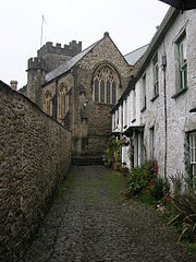
1254:
553:
347:
208:
826:
811:
8:
1583:
1382:
291:
277:
1329:
1129:
1124:
57:
42:
316:
93:
1565:
1399:
1176:
1439:
181:
171:
1601:
1068:
1026:
985:
943:
903:
861:
770:
704:
664:
620:
529:
469:
296:
1419:
1161:
1140:
308:
1409:
1097:
Click on a date/time to view the file as it appeared at that time.
1224:
263:
256:
51° 02′ 24.64″ N, 3° 32′ 56.26″ W
1349:
1304:
160:
81:
1294:
1204:
435:
Add a one-line explanation of what this file represents
1324:
1314:
1284:
1274:
1264:
1244:
1234:
1214:
1155:
1339:
1185:
1095:
199:
Creative
Commons Attribution Share-alike license 2.0
105:
Commons is a freely licensed media file repository.
671:
Creative
Commons Attribution-ShareAlike 2.0 Generic
645:
Creative
Commons Attribution-ShareAlike 2.0 Generic
71:(480 × 640 pixels, file size: 108 KB, MIME type:
1588:Flash did not fire, compulsory flash suppression
404:https://creativecommons.org/licenses/by-sa/2.0
86:
410:Creative Commons Attribution-Share Alike 2.0
328:
187:
156:
145:
1330:Somerset'teki civil parishlerin listesi
498:https:\/\/www.geograph.org.uk\/profile\/2694
177:
166:
14:
1167:Grade II* listed buildings in West Somerset
1048:
965:
751:https:\/\/www.geograph.org.uk\/photo\/66251
370:– to copy, distribute and transmit the work
1187:The following other wikis use this file:
554:https://www.geograph.org.uk/profile/2694
827:https://www.geograph.org.uk/photo/66251
270:View this and other nearby images on:
1157:The following 4 pages use this file:
231:
117:
315:and is licensed for reuse under the
246:
1088:
351:Attribution-Share Alike 2.0 Generic
339:
334:
319:Attribution-ShareAlike 2.0 license.
13:
1360:
1346:Usage on zh-min-nan.wikipedia.org
1172:List of civil parishes in Somerset
440:
434:
325:
302:
123:
118:
64:
1634:
1367:
439:
1430:Date and time of data generation
852:coordinates of the point of view
842:coordinates of the point of view
425:
381:Under the following conditions:
346:This file is licensed under the
338:
333:
327:
295:
276:
262:
85:
31:
21:
1374:OLYMPUS DIGITAL CAMERA
422:
1182:
1092:
777:file available on the internet
727:file available on the internet
421:
303:This image was taken from the
26:
1:
1622:A directly photographed image
36:
1152:
867:51°2'24.644"N, 3°32'56.256"W
797:Geograph Britain and Ireland
735:Geograph Britain and Ireland
575:object of statement has role
506:object of statement has role
455:Items portrayed in this file
7:
1510:Date and time of digitizing
1357:
1291:Usage on lld.wikipedia.org
1221:Usage on en.wikivoyage.org
1201:Usage on ceb.wikipedia.org
1191:Usage on azb.wikipedia.org
10:
1639:
1593:Supported Flashpix version
1336:Usage on www.wikidata.org
1321:Usage on tr.wikipedia.org
1311:Usage on pl.wikipedia.org
1301:Usage on nl.wikipedia.org
1281:Usage on la.wikipedia.org
1271:Usage on ga.wikipedia.org
1261:Usage on fr.wikipedia.org
1251:Usage on fa.wikipedia.org
1241:Usage on eu.wikipedia.org
1231:Usage on es.wikipedia.org
1211:Usage on cy.wikipedia.org
395:same or compatible license
237:ChurchCrawler /
218:ChurchCrawler /
142:
119:
1518:Meaning of each component
1475:File change date and time
1089:
910:Somerset West and Taunton
884:Somerset West and Taunton
16:
1513:12:32, 15 September 2005
1478:12:32, 15 September 2005
1433:12:32, 15 September 2005
805:geograph.org.uk image ID
739:geograph.org.uk image ID
424:
361:
92:This is a file from the
41:
1146:
1125:15:52, 14 December 2008
209:required by the license
159:
96:. Information from its
1539:Image compression mode
309:this photograph's page
282:51.040179; -3.548960
99:description page there
46:Size of this preview:
1557:Maximum land aperture
1449:Horizontal resolution
1614:Digital still camera
1225:Exmoor National Park
894:location of creation
880:location of creation
476:Church of All Saints
447:Church of All Saints
148:Dulverton church.jpg
1483:Y and C positioning
1457:Vertical resolution
1404:1/160 sec (0.00625)
1383:OLYMPUS CORPORATION
1379:Camera manufacturer
376:– to adapt the work
239:DULVERTON, Somerset
220:DULVERTON, Somerset
152:DULVERTON, Somerset
124:This is a photo of
52:Other resolutions:
562:author name string
502:author name string
1626:
1625:
1560:3.3 APEX (f/3.14)
1183:Global file usage
1150:
1050:
967:
710:15 September 2005
655:copyright license
641:copyright license
433:
324:
323:
307:collection. See
287:
286:
244:
243:
212:
196:
193:Reusing this file
161:15 September 2005
140:
139:
114:
113:
94:Wikimedia Commons
32:Global file usage
1630:
1491:Exposure Program
1368:
1137:
1099:
1077:
994:
829:
824:
820:described at URL
814:
809:
799:
794:
747:described at URL
611:copyright status
597:copyright status
584:
579:
569:
566:
556:
551:
431:
417:
414:
411:
408:
405:
397:as the original.
359:
348:Creative Commons
342:
341:
337:
336:
331:
330:
317:Creative Commons
305:Geograph project
299:
292:
283:
280:
266:
265:
259:
258:
247:
206:
190:
162:
149:
143:
133:
120:
110:
89:
88:
82:
76:
74:
61:
58:480 × 640 pixels
54:180 × 240 pixels
48:450 × 600 pixels
1638:
1637:
1633:
1632:
1631:
1629:
1628:
1627:
1356:
1181:
1151:
1143:
1135:
1091:
1090:
1087:
1086:
1085:
1084:
1083:
1082:
1081:
1080:
1078:
1075:
1065:
1064:
1063:
1061:
1042:
1041:
1040:
1039:
1038:
1037:
1036:
1035:
1033:
1023:
1022:
1021:
1019:
1004:
1003:
1002:
1001:
1000:
999:
998:
997:
995:
992:
982:
981:
980:
978:
959:
958:
957:
956:
955:
954:
953:
952:
950:
940:
939:
938:
936:
921:
920:
919:
918:
917:
916:
915:
914:
912:
900:
899:
898:
896:
877:
876:
875:
874:
873:
872:
871:
870:
868:
858:
857:
856:
854:
839:
838:
837:
836:
835:
834:
833:
832:
831:
830:
825:
822:
816:
815:
810:
807:
801:
800:
795:
792:
783:
782:
781:
779:
767:
766:
765:
763:
720:
719:
718:
717:
716:
715:
714:
713:
711:
701:
700:
699:
697:
682:
681:
680:
679:
678:
677:
676:
675:
673:
661:
660:
659:
657:
638:
637:
636:
635:
634:
633:
632:
631:
629:
617:
616:
615:
613:
594:
593:
592:
591:
590:
589:
588:
587:
586:
585:
580:
577:
571:
570:
567:
564:
558:
557:
552:
549:
540:
539:
538:
536:
526:
525:
524:
522:
487:
486:
485:
484:
483:
482:
481:
480:
478:
466:
465:
464:
462:
438:
437:
436:
419:
418:
415:
412:
409:
406:
403:
402:
360:
357:
354:
343:
320:
281:
254:
253:
250:Camera location
245:
234:
227:
215:
172:geograph.org.uk
147:
135:
129:
126:listed building
116:
115:
104:
103:
102:is shown below.
78:
72:
70:
63:
62:
51:
12:
11:
5:
1636:
1624:
1623:
1620:
1616:
1615:
1612:
1608:
1607:
1604:
1598:
1597:
1594:
1590:
1589:
1586:
1580:
1579:
1576:
1572:
1571:
1568:
1562:
1561:
1558:
1554:
1553:
1550:
1544:
1543:
1540:
1536:
1535:
1534:
1533:
1532:does not exist
1530:
1527:
1524:
1519:
1515:
1514:
1511:
1507:
1506:
1503:
1496:
1495:
1494:Normal program
1492:
1488:
1487:
1484:
1480:
1479:
1476:
1472:
1471:
1466:
1462:
1461:
1458:
1454:
1453:
1450:
1446:
1445:
1442:
1435:
1434:
1431:
1427:
1426:
1423:
1416:
1415:
1412:
1406:
1405:
1402:
1396:
1395:
1390:
1386:
1385:
1380:
1376:
1375:
1372:
1359:
1355:
1354:
1353:
1352:
1344:
1343:
1342:
1334:
1333:
1332:
1327:
1319:
1318:
1317:
1309:
1308:
1307:
1299:
1298:
1297:
1289:
1288:
1287:
1279:
1278:
1277:
1269:
1268:
1267:
1259:
1258:
1257:
1249:
1248:
1247:
1239:
1238:
1237:
1229:
1228:
1227:
1219:
1218:
1217:
1209:
1208:
1207:
1199:
1198:
1197:
1184:
1180:
1179:
1174:
1169:
1164:
1154:
1149:
1148:
1145:
1141:
1138:
1132:
1127:
1122:
1118:
1117:
1114:
1111:
1108:
1105:
1102:
1094:
1079:
1073:
1071:
1070:
1069:
1067:
1066:
1062:
1057:
1055:
1054:
1053:
1052:
1046:
1034:
1031:
1029:
1028:
1027:
1025:
1024:
1020:
1015:
1013:
1012:
1011:
1010:
1008:
996:
990:
988:
987:
986:
984:
983:
979:
974:
972:
971:
970:
969:
963:
951:
948:
946:
945:
944:
942:
941:
937:
932:
930:
929:
928:
927:
925:
913:
908:
906:
905:
904:
902:
901:
897:
892:
890:
889:
888:
887:
885:
881:
869:
866:
864:
863:
862:
860:
859:
855:
850:
848:
847:
846:
845:
843:
818:
817:
803:
802:
788:
787:
786:
785:
784:
780:
775:
773:
772:
771:
769:
768:
764:
761:source of file
759:
757:
756:
755:
754:
752:
748:
744:
740:
736:
732:
728:
724:
723:source of file
712:
709:
707:
706:
705:
703:
702:
698:
693:
691:
690:
689:
688:
686:
674:
669:
667:
666:
665:
663:
662:
658:
653:
651:
650:
649:
648:
646:
642:
630:
625:
623:
622:
621:
619:
618:
614:
609:
607:
606:
605:
604:
602:
598:
573:
572:
560:
559:
545:
544:
543:
542:
541:
537:
534:
532:
531:
530:
528:
527:
523:
518:
516:
515:
514:
513:
511:
507:
503:
499:
495:
491:
479:
474:
472:
471:
470:
468:
467:
463:
458:
456:
453:
452:
451:
450:
448:
444:
430:
429:
426:
423:
401:
400:
399:
398:
388:
379:
378:
377:
371:
364:You are free:
355:
345:
344:
326:
322:
321:
300:
285:
284:
274:
268:
251:
242:
241:
235:
232:
229:
228:
223:
216:
213:
201:
200:
197:
185:
184:
179:
175:
174:
168:
164:
163:
158:
154:
153:
150:
141:
138:
137:
112:
111:
90:
80:
79:
45:
40:
39:
34:
29:
24:
19:
9:
6:
4:
3:
2:
1635:
1621:
1618:
1617:
1613:
1610:
1609:
1605:
1603:
1600:
1599:
1595:
1592:
1591:
1587:
1585:
1582:
1581:
1577:
1574:
1573:
1569:
1567:
1566:Metering mode
1564:
1563:
1559:
1556:
1555:
1551:
1549:
1548:Exposure bias
1546:
1545:
1541:
1538:
1537:
1531:
1528:
1525:
1522:
1521:
1520:
1517:
1516:
1512:
1509:
1508:
1504:
1501:
1498:
1497:
1493:
1490:
1489:
1485:
1482:
1481:
1477:
1474:
1473:
1470:
1467:
1465:Software used
1464:
1463:
1459:
1456:
1455:
1451:
1448:
1447:
1443:
1441:
1437:
1436:
1432:
1429:
1428:
1424:
1421:
1418:
1417:
1413:
1411:
1408:
1407:
1403:
1401:
1400:Exposure time
1398:
1397:
1394:
1391:
1388:
1387:
1384:
1381:
1378:
1377:
1373:
1370:
1369:
1366:
1363:
1351:
1348:
1347:
1345:
1341:
1338:
1337:
1335:
1331:
1328:
1326:
1323:
1322:
1320:
1316:
1313:
1312:
1310:
1306:
1305:West Somerset
1303:
1302:
1300:
1296:
1293:
1292:
1290:
1286:
1283:
1282:
1280:
1276:
1273:
1272:
1270:
1266:
1263:
1262:
1260:
1256:
1253:
1252:
1250:
1246:
1243:
1242:
1240:
1236:
1233:
1232:
1230:
1226:
1223:
1222:
1220:
1216:
1213:
1212:
1210:
1206:
1203:
1202:
1200:
1196:
1193:
1192:
1190:
1189:
1188:
1178:
1177:West Somerset
1175:
1173:
1170:
1168:
1165:
1163:
1160:
1159:
1158:
1144:
1139:
1133:
1131:
1128:
1126:
1123:
1120:
1119:
1115:
1112:
1109:
1106:
1103:
1101:
1100:
1098:
1072:
1060:
1056:
1030:
1018:
1014:
989:
977:
976:exposure time
973:
962:exposure time
947:
935:
931:
911:
907:
895:
891:
865:
853:
849:
828:
821:
813:
806:
798:
791:
778:
774:
762:
758:
708:
696:
692:
672:
668:
656:
652:
628:
624:
612:
608:
583:
576:
568:ChurchCrawler
563:
555:
548:
533:
521:
517:
477:
473:
461:
457:
454:
427:
420:
407:CC BY-SA 2.0
396:
392:
389:
386:
383:
382:
380:
375:
372:
369:
366:
365:
363:
362:
358:ChurchCrawler
356:Attribution:
352:
349:
332:
318:
314:
313:ChurchCrawler
310:
306:
301:
298:
294:
293:
290:
289:
279:
275:
273:
272:OpenStreetMap
269:
267:
257:
252:
249:
248:
240:
236:
230:
226:
222: /
221:
217:
210:
205:
203:
202:
198:
194:
189:
186:
183:
182:ChurchCrawler
180:
176:
173:
169:
165:
155:
151:
144:
136:
132:
127:
122:
121:
108:
101:
100:
95:
91:
84:
83:
77:
68:
67:Original file
59:
55:
49:
44:
38:
35:
33:
30:
28:
25:
23:
20:
18:
15:
1575:Light source
1440:focal length
1389:Camera model
1364:
1361:
1186:
1156:
1096:
1093:File history
1059:focal length
1045:focal length
582:photographer
510:photographer
390:
384:
373:
367:
312:
288:
238:
225:CC BY-SA 2.0
219:
107:You can help
97:
65:
22:File history
1611:File source
1602:Color space
1371:Image title
627:copyrighted
601:copyrighted
391:share alike
385:attribution
204:Attribution
146:Description
1619:Scene type
1153:File usage
1134:480 × 640
1110:Dimensions
1076:millimetre
1049:millimetre
535:some value
188:Permission
73:image/jpeg
27:File usage
1420:ISO speed
1350:Dulverton
1325:Dulverton
1315:Dulverton
1295:Dulverton
1285:Dulverton
1275:Dulverton
1265:Dulverton
1245:Dulverton
1235:Dulverton
1215:Dulverton
1205:Dulverton
1162:Dulverton
1107:Thumbnail
1104:Date/Time
934:ISO speed
924:ISO speed
695:inception
685:inception
233:InfoField
214:InfoField
1486:Co-sited
1410:F-number
1358:Metadata
1255:دالورتون
1195:دالورتون
1136:(108 KB)
1017:f-number
1007:f-number
991:0.00625
790:operator
731:operator
428:Captions
374:to remix
368:to share
353:license.
37:Metadata
1578:Unknown
1570:Pattern
1502:version
1469:v756-81
1393:C5060WZ
1340:Q749338
1121:current
1116:Comment
520:creator
490:creator
460:depicts
443:depicts
432:English
131:1247824
128:number
69:
1460:72 dpi
1452:72 dpi
1444:9.1 mm
1422:rating
993:second
966:second
260:
178:Author
167:Source
1584:Flash
1438:Lens
1414:f/4.5
812:66251
743:66251
170:From
1606:sRGB
1500:Exif
1142:Rodw
1113:User
1074:9.1
416:true
413:true
157:Date
17:File
1505:2.2
1032:4.5
547:URL
494:URL
1529:Cr
1526:Cb
1425:80
949:80
823::
808::
793::
578::
565::
550::
56:|
50:.
1596:1
1552:0
1542:2
1523:Y
211:)
207:(
195:)
191:(
134:.
109:.
75:)
60:.
Text is available under the Creative Commons Attribution-ShareAlike License. Additional terms may apply.

