43:
361:
812:
450:
555:
675:
367:
372:
819:
99:
1107:"}},"text\/plain":{"en":{"":"media type"}}},"{\"value\":\"image\\\/svg+xml\",\"type\":\"string\"}":{"text\/html":{"en":{"P1163":"image\/svg+xml"}},"text\/plain":{"en":{"P1163":"image\/svg+xml"}}}}": -->
1019:"}},"text\/plain":{"en":{"":"copyright license"}}},"{\"value\":{\"entity-type\":\"item\",\"numeric-id\":14946043,\"id\":\"Q14946043\"},\"type\":\"wikibase-entityid\"}":{"text\/html":{"en":{"P275":"
975:"}},"text\/plain":{"en":{"":"copyright status"}}},"{\"value\":{\"entity-type\":\"item\",\"numeric-id\":50423863,\"id\":\"Q50423863\"},\"type\":\"wikibase-entityid\"}":{"text\/html":{"en":{"P6216":"
1063:"}},"text\/plain":{"en":{"":"source of file"}}},"{\"value\":{\"entity-type\":\"item\",\"numeric-id\":66458942,\"id\":\"Q66458942\"},\"type\":\"wikibase-entityid\"}":{"text\/html":{"en":{"P7482":"
1103:
1015:
1834:
1819:
1839:
453:
The frontiers depicted on the Indian maps in
Knowledge are from a neutral point of view and may differ from official government maps of India, Pakistan and China. Please consult local laws governing publication of maps before
413:– You must give appropriate credit, provide a link to the license, and indicate if changes were made. You may do so in any reasonable manner, but not in any way that suggests the licensor endorses you or your use.
795:
This map is meant to be for illustrative purpose only and is not authenticated by official government sources. Please check the list of sources and references used to create the map for a measure of accuracy and
2009:
839:
administrative boundary recognised by the international community. This UN ceasefire line is considered as a temporary solution to an ongoing conflict since the departure of the
British Raj.
848:
The depicted extent of the former territory of the
British Indian Empire, succeeded by Republic of India, may not be accepted by few countries as legal due to ongoing border disputes:
168:
2014:
799:
The usage of these maps in India, Pakistan and China are governed by different laws that restrict depictions of boundaries other than what is officially recognized by the state.
908:
The borders of the state of
Meghalaya, Assam and Arunachal Pradesh are shown as interpreted from the North-Eastern Areas (Reorganisation) Act, 1971, but has yet to be verified.
1064:
1020:
976:
1554:
1761:
1252:
1799:
1104:
1060:
972:
888:
Minor areas of eastern
Kashmir's Ladakh division, Himachal Pradesh and Uttarakhand on the Chinese frontier are claimed by China. These areas are under Indian control.
1016:
2123:
780:
The territorial boundaries of India are shown as per the actual ground situation in accordance with international practices followed by the United
Nations (
1604:
1414:
73:
69:
65:
61:
57:
53:
47:
285:
1609:
110:
1754:
1594:
1023:"}},"text\/plain":{"en":{"P275":"Creative Commons Attribution-ShareAlike 3.0 Unported"}}}}": -->
82:
787:
1579:
1829:
313:
and include a link to this page. No explicit permission is needed from me, but id appreciate an email if my work has been of help to you.
597:
520:
488:
1974:
784:
565:
344:
1574:
1090:
1046:
1002:
1734:
1614:
1674:
1589:
1564:
1559:
2134:
This file contains additional information, probably added from the digital camera or scanner used to create or digitize it.
1212:
1207:
420:
916:
The limit of the territorial waters of India extends to twelve nautical miles measured from the appropriate baseline. See
878:(shown white) is an actively contested region between India and Pakistan. Since 1984, the region is under Indian control.
1114:
1074:
986:
1749:
1729:
1694:
1569:
1067:"}},"text\/plain":{"en":{"P7482":"original creation by uploader"}}}}": -->
897:
1030:
961:
1989:
1909:
1669:
1599:
1724:
1714:
1654:
891:
A small area of
Uttarakhand adjoining the Nepal border along the Sarda river is disputed between the two countries.
217:
1664:
221:
1789:
213:
1744:
1689:
1634:
1294:
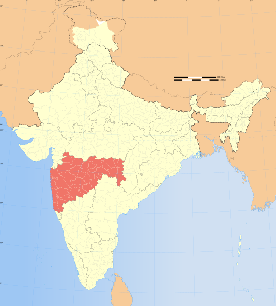
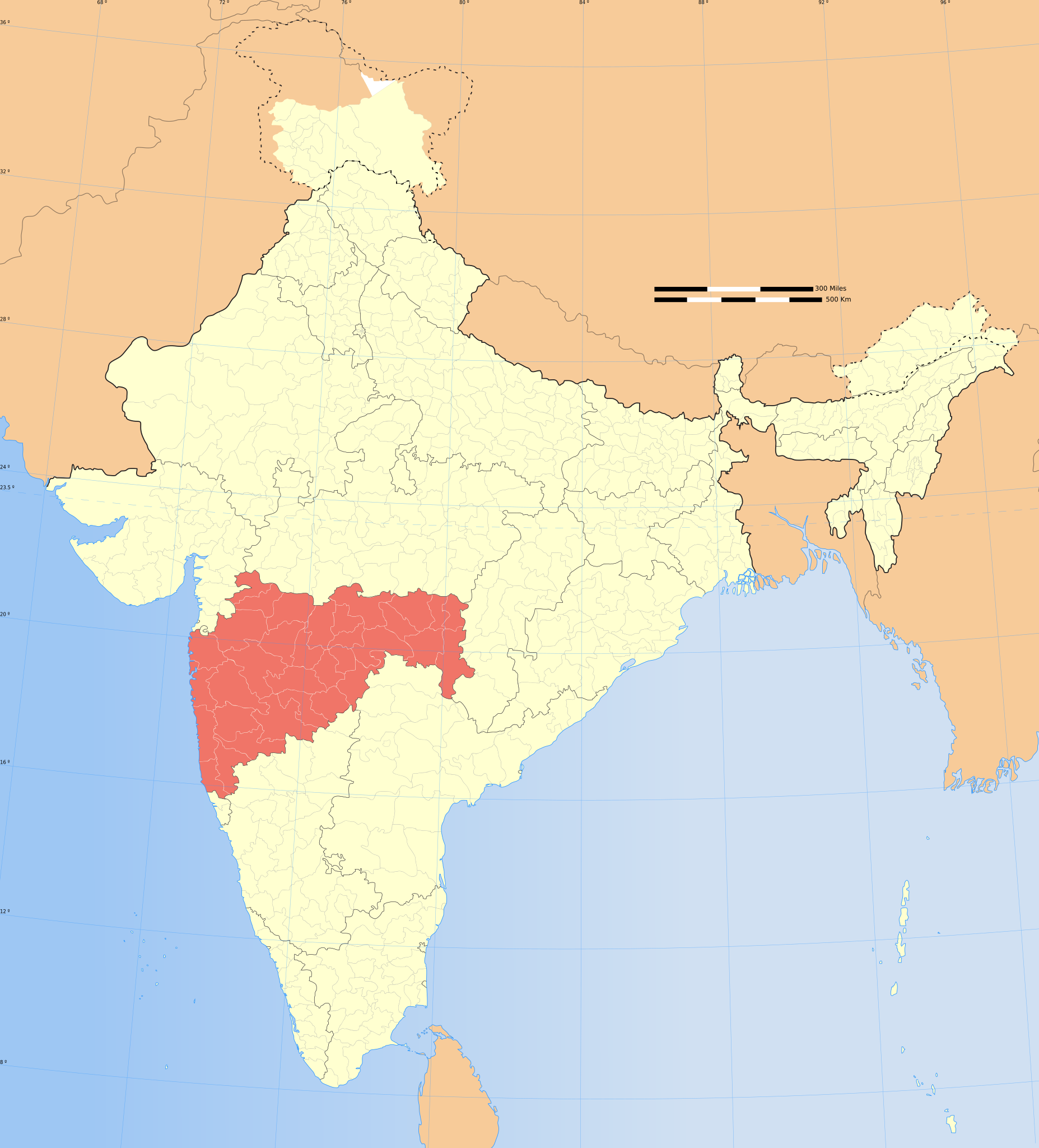
1230:{{WikiProject_India_Maps |Title=Maharashtra locator map |Description=Locator map of the state of Maharashtra,
382:
225:
1264:
2137:
If the file has been modified from its original state, some details may not fully reflect the modified file.
1984:
1934:
2044:
1719:
1709:
1684:
1649:
1251:
More than 100 pages use this file. The following list shows the first 100 pages that use this file only. A
853:
1929:
1659:
1624:
1584:
419:– If you remix, transform, or build upon the material, you must distribute your contributions under the
1739:
1704:
1644:
1359:
1924:
829: : The territory India claims is legally theirs, but the claim is disputed by China and Pakistan.
202:
1284:
979:"}},"text\/plain":{"en":{"P6216":"copyrighted"}}}}": -->
1959:
1809:
1779:
1679:
1629:
1499:
1304:
1182:
1177:
42:
257:
1619:
1514:
1484:
869:
118:
1699:
1639:
1319:
781:
1904:
1314:
1259:
917:
2024:
1474:
1454:
1389:
1364:
1274:
1269:
379:
261:
1979:
1964:
1954:
316:
If you dont want to release your work under a creative commons license, please mail me at
8:
1539:
1534:
1529:
1504:
1384:
1879:
1914:
1524:
1519:
1459:
1444:
1429:
1424:
1409:
1329:
882:
674:
1509:
1469:
1464:
1369:
1354:
1279:
1200:{{Information |Description= |Source= |Date= |Author= |Permission= |other_versions= }}
105:
951:
354:
I, the copyright holder of this work, hereby publish it under the following license:
1494:
1489:
1419:
1399:
875:
865:
636:
1874:
306:
1969:
1884:
1374:
1344:
1324:
1289:
295:
1944:
1449:
1439:
1394:
1349:
245:
790:
229:
1549:
1404:
1238:
1223:
1193:
857:
811:
612:
599:
580:
567:
535:
522:
503:
490:
1864:
318:
253:
1919:
1544:
1479:
1334:
1235:
2114:
692:
449:
1434:
1379:
1339:
1309:
1299:
1124:
1084:
1040:
996:
861:
554:
167:
2034:
2109:
885:
is almost entirely claimed by China as part of its
Tibetan territory.
693:
660:
324:
2029:
1150:
Click on a date/time to view the file as it appeared at that time.
864:). Since 1972, it is divided between all three countries. See also
2104:
2094:
2089:
801:
Please check local laws and modify the map accordingly before use.
209:
198:
2079:
1234:
with district boundaries. |Source=. |Date=August 6 2006 |Author=
241:
2099:
818:
2084:
154:
896:
For a detailed map of all disputed regions in South Asia, see
1231:
237:
87:(SVG file, nominally 1,574 × 1,738 pixels, file size: 836 KB)
1999:
180:
93:
2064:
2054:
852:
The northern
Himalayan region of the disputed territory
937:
Add a one-line explanation of what this file represents
725:
645:
If inappropriate please set warp_status = skip to hide.
471:
1894:
1854:
1249:
806:
1849:
1770:
1605:
Knowledge:Knowledge
Signpost/2014-09-24/In the media
1148:
1047:
Creative Commons Attribution-ShareAlike 3.0 Unported
1021:
Creative Commons Attribution-ShareAlike 3.0 Unported
117:
Commons is a freely licensed media file repository.
2074:
631:
162:
1415:User:Marcus334/Tiger reserves in the Western Ghats
655:
135:
2069:
715:
479:
463:
735:
328:to negotiate a custom license as per your needs.
774:
2025:Portal:Pertanian/Berita terkini/September/2015
1610:Knowledge:Knowledge Signpost/Single/2014-09-24
843:
430:https://creativecommons.org/licenses/by-sa/3.0
98:
1755:Category:WikiProject Maharashtra participants
1595:Knowledge:WikiProject India/userbox templates
436:Creative Commons Attribution-Share Alike 3.0
360:
339:
176:
145:
1580:Knowledge:Userboxes/WikiProjects/Regional/06
666:
273:
186:
14:
1880:Benutzer:Uwe Dedering/PositionskarteV2/Test
396:– to copy, distribute and transmit the work
46:Size of this PNG preview of this SVG file:
132:
1772:The following other wikis use this file:
1575:Knowledge:Userboxes/Location/India/States
860:) and the Chinese-occupied territory of (
153:Locator map of the state of Maharashtra,
699:
467:second half of 20 century and 21 century
944:
786:) and the National Geographic Society (
755:
639:Georeference the map in Wikimaps Warper
1735:Template:User interest Maharashtra/doc
1615:Knowledge talk:WikiProject Indian maps
1875:Benutzer:Uwe Dedering/MultipleMapTest
1675:Template:User citizen Maharashtra/doc
1590:Knowledge:WikiProject India/Templates
1565:Knowledge:Userboxes/Life/Residence/04
1560:Knowledge:Userboxes/Life/Ethnicity/02
911:
745:
305:If you are using the image under the
129:
1885:Benutzer Diskussion:TUBS/Archiv/2011
383:Attribution-Share Alike 3.0 Unported
307:creative commons share alike license
1141:
903:
371:
366:
13:
2132:
1945:Liste des districts du Maharashtra
1750:Category:Maharashtrian Wikipedians
1730:Template:User interest Maharashtra
1695:Template:User from Maharashtra/doc
1570:Knowledge:Userboxes/Location/India
950:
936:
898:Image:India disputed areas map.svg
817:
810:
807:Explanation of disputed boundaries
730:Explanation of disputed boundaries
694:
357:
353:
166:
130:
80:
2166:
2139:
2041:Usage on incubator.wikimedia.org
1835:২০১৭ মুম্বাইয়ের পদপিষ্ট দুর্ঘটনা
1786:Usage on be-tarask.wikipedia.org
1670:Template:User citizen Maharashtra
1600:Knowledge:WikiProject Maharashtra
949:
695:
148:India Maharashtra locator map.svg
1725:Template:User interest India/doc
1715:Template:User in Maharashtra/doc
1655:Template:User WP Maharashtra/doc
927:
833:Line of Control/Line of Conflict
673:
553:
448:
407:Under the following conditions:
378:This file is licensed under the
370:
365:
359:
278:
97:
31:
21:
1665:Template:User citizen India/doc
924:
856:is claimed by India including (
210:University of Texas map library
199:University of Texas map library
1820:महाराष्ट्र के जिला सभ के लिस्ट
1767:
1745:Template:User proud Indian/doc
1690:Template:User from Maharashtra
1635:Template:User Maharashtra/doc1
1295:Nagpur level crossing disaster
1145:
923:
881:The northeastern territory of
235:State and District boundaries:
26:
1:
2115:Distretto suburbano di Mumbai
1265:2013 Mumbai building collapse
1091:original creation by uploader
1065:original creation by uploader
858:Pakistan-administered Kashmir
637:
36:
1720:Template:User interest India
1710:Template:User in Maharashtra
1685:Template:User from India/doc
1650:Template:User WP Maharashtra
1246:
957:Items portrayed in this file
775:Depiction of India's borders
720:Depiction of India's borders
281:
258:Survey of India Map Explorer
7:
2129:
1996:Usage on hak.wikipedia.org
1861:Usage on ceb.wikipedia.org
1840:২০০০ সালের মুম্বাই ভূমিধ্বস
1660:Template:User citizen India
1625:Template:User IN states/doc
1585:Knowledge:WikiProject India
854:Indian-administered Kashmir
844:Borders of disputed regions
740:Borders of disputed regions
311:CC-by-sa PlaneMad/Wikimedia
10:
2171:
2061:Usage on it.wikipedia.org
2051:Usage on is.wikipedia.org
2021:Usage on id.wikipedia.org
2006:Usage on hi.wikipedia.org
1951:Usage on gu.wikipedia.org
1941:Usage on fr.wikipedia.org
1901:Usage on fa.wikipedia.org
1891:Usage on et.wikipedia.org
1871:Usage on de.wikipedia.org
1846:Usage on ca.wikipedia.org
1826:Usage on bn.wikipedia.org
1816:Usage on bh.wikipedia.org
1806:Usage on bg.wikipedia.org
1796:Usage on be.wikipedia.org
1776:Usage on ba.wikipedia.org
1740:Template:User proud Indian
1705:Template:User in India/doc
1645:Template:User WP India/doc
1360:User:Daniel Ducote/sandbox
705:
483:
421:same or compatible license
2035:Tanah longsor Mumbai 2021
1285:Kudaldeshkar Gaud Brahmin
1142:
650:
458:
191:
157:with district boundaries.
16:
2110:Distretto di Mumbai City
1680:Template:User from India
1630:Template:User India/doc1
1500:User:Sudhanshu Nimbalkar
1305:User:Aamiya cchakraborty
926:
827:Boundary of Indian claim
769:
472:Spatial reference system
387:
309:please credit the photo
203:India Political map 2001
104:This is a file from the
41:
1800:Штаты і тэрыторыі Індыі
1620:Template:User IN states
1515:User:The Tiger of Thane
1485:User:Shraddha.shanbhag4
1229:
1199:
1178:06:53, 29 December 2008
319:arun.planemad@gmail.com
140:Maharashtra locator map
108:. Information from its
2030:Kepolisian Maharashtra
1700:Template:User in India
1640:Template:User WP India
1320:User:Ageo020/Userboxes
920:for more information.
870:Line of Actual Control
822:
815:
661:WikiProject India Maps
459: Geotemporal data
242:2001 Census State Maps
196:International Borders:
171:
111:description page there
2105:Distretto di Yavatmal
2095:Distretto di Buldhana
2090:Distretto di Amravati
1315:User:Aditya tamhankar
1260:2000 Mumbai landslide
821:
814:
267:Map specific sources:
170:
2080:Template:Maharashtra
1865:State of Mahārāshtra
1475:User:Sagarpatil10693
1455:User:Pratishkhedekar
1390:User:Harshadwaghmare
1365:User:Deepika.sirsath
1275:2014 Mumbai stampede
1270:2014 Malin landslide
1208:17:28, 6 August 2006
246:Survey of India Maps
74:1,574 × 1,738 pixels
70:1,855 × 2,048 pixels
2100:Distretto di Washim
1540:User:Wikipearlindia
1535:User:Wiki.editAnshu
1530:User:Wasimmogal2007
1505:User:Suhebriazsaifi
1385:User:Harshadkumar11
1241:|Thumbdir=CHANGE }}
942:Traditional Chinese
651: Archival data
402:– to adapt the work
262:Columbia University
254:US Army Map Service
226:Kashmir Region 2004
222:Western Sector 1988
218:Eastern Sector 1988
214:China-India Borders
52:Other resolutions:
2085:Distretto di Akola
2010:महाराष्ट्र के जिले
1525:User:Vishalpb.mech
1520:User:Vaibhavvc1092
1460:User:Rohit.m.gutte
1445:User:Piyushak.elec
1430:User:Notthedarkweb
1425:User:Nikitabhutada
1410:User:Jaywardhan009
1330:User:Atharvaborkar
912:Territorial waters
823:
816:
760:Territorial waters
322:or catch me at my
172:
66:927 × 1,024 pixels
2158:
2157:
2124:more global usage
1768:Global file usage
1555:User:प्रसाद साळवे
1510:User:Swapnali1902
1470:User:Sachinpandit
1465:User:Rupali garje
1370:User:Eridanus3302
1355:User:Buaidh/Test7
1280:Deshastha Brahmin
1244:
1031:copyright license
1017:copyright license
943:
935:
883:Arunachal Pradesh
700:
687:
686:
646:
627:
626:
348:
345:Reusing this file
334:
333:
207:Disputed Borders:
126:
125:
106:Wikimedia Commons
32:Global file usage
2162:
2140:
2015:महाराष्ट्र पुलिस
1495:User:Snehak.elec
1490:User:Shyamli rao
1420:User:Mishra Prem
1400:User:Iamvardhana
1220:
1190:
1152:
987:copyright status
973:copyright status
941:
933:
904:Internal borders
761:
758:
751:
750:Internal borders
748:
741:
738:
731:
728:
721:
718:
711:
708:
701:
677:
644:
643:
641:
640:
623:
621:
620:
619:
614:
610:
609:
606:
605:
602:
591:
589:
588:
587:
582:
578:
577:
574:
573:
570:
557:
546:
544:
543:
542:
537:
533:
532:
529:
528:
525:
514:
512:
511:
510:
505:
501:
500:
497:
496:
493:
484:
452:
443:
440:
437:
434:
431:
423:as the original.
380:Creative Commons
374:
373:
369:
368:
363:
362:
342:
279:
193:
182:
181:29 December 2008
149:
133:
122:
101:
100:
94:
88:
77:
62:695 × 768 pixels
58:435 × 480 pixels
54:217 × 240 pixels
48:543 × 600 pixels
2170:
2169:
2165:
2164:
2163:
2161:
2160:
2159:
2128:
2045:Wp/khw/مہاراشٹر
1766:
1375:User:Fadnaviska
1345:User:Berlindian
1325:User:Anurag acj
1290:Marathi Brahmin
1245:
1239:w:user:Planemad
1226:
1218:
1196:
1188:
1144:
1143:
1140:
1139:
1138:
1137:
1136:
1135:
1134:
1133:
1131:
1121:
1120:
1119:
1117:
1102:
1101:
1100:
1099:
1098:
1097:
1096:
1095:
1093:
1081:
1080:
1079:
1077:
1058:
1057:
1056:
1055:
1054:
1053:
1052:
1051:
1049:
1037:
1036:
1035:
1033:
1014:
1013:
1012:
1011:
1010:
1009:
1008:
1007:
1005:
993:
992:
991:
989:
970:
969:
968:
967:
966:
964:
948:
947:
946:
939:
938:
914:
906:
876:Siachen glacier
866:Line of Control
846:
809:
777:
772:
767:
759:
756:
749:
746:
739:
736:
729:
726:
719:
716:
709:
706:
702:
698:
688:
681:
678:
638:
635:
617:
615:
611:
607:
603:
600:
598:
596:
585:
583:
579:
575:
571:
568:
566:
564:
540:
538:
534:
530:
526:
523:
521:
519:
508:
506:
502:
498:
494:
491:
489:
487:
446:
445:
444:
441:
438:
435:
432:
429:
428:
386:
375:
356:
355:
335:
238:Census of India
158:
147:
141:
128:
127:
116:
115:
114:is shown below.
90:
86:
79:
78:
51:
12:
11:
5:
2168:
2156:
2155:
2152:
2148:
2147:
2144:
2131:
2126:of this file.
2120:
2119:
2118:
2117:
2112:
2107:
2102:
2097:
2092:
2087:
2082:
2077:
2072:
2067:
2059:
2058:
2057:
2049:
2048:
2047:
2039:
2038:
2037:
2032:
2027:
2019:
2018:
2017:
2012:
2004:
2003:
2002:
1994:
1993:
1992:
1987:
1982:
1977:
1972:
1967:
1962:
1957:
1949:
1948:
1947:
1939:
1938:
1937:
1932:
1927:
1922:
1917:
1912:
1907:
1899:
1898:
1897:
1889:
1888:
1887:
1882:
1877:
1869:
1868:
1867:
1859:
1858:
1857:
1852:
1844:
1843:
1842:
1837:
1832:
1824:
1823:
1822:
1814:
1813:
1812:
1804:
1803:
1802:
1794:
1793:
1792:
1784:
1783:
1782:
1769:
1764:to this file.
1758:
1757:
1752:
1747:
1742:
1737:
1732:
1727:
1722:
1717:
1712:
1707:
1702:
1697:
1692:
1687:
1682:
1677:
1672:
1667:
1662:
1657:
1652:
1647:
1642:
1637:
1632:
1627:
1622:
1617:
1612:
1607:
1602:
1597:
1592:
1587:
1582:
1577:
1572:
1567:
1562:
1557:
1552:
1547:
1542:
1537:
1532:
1527:
1522:
1517:
1512:
1507:
1502:
1497:
1492:
1487:
1482:
1477:
1472:
1467:
1462:
1457:
1452:
1450:User:Poojasabe
1447:
1442:
1440:User:Peloneous
1437:
1432:
1427:
1422:
1417:
1412:
1407:
1402:
1397:
1395:User:Haxxorsid
1392:
1387:
1382:
1377:
1372:
1367:
1362:
1357:
1352:
1350:User:Bhavikp19
1347:
1342:
1337:
1332:
1327:
1322:
1317:
1312:
1307:
1302:
1297:
1292:
1287:
1282:
1277:
1272:
1267:
1262:
1255:is available.
1248:
1243:
1242:
1236:w:user:Nichalp
1228:
1224:
1221:
1217:1,639 × 1,852
1215:
1210:
1205:
1202:
1201:
1198:
1194:
1191:
1187:1,574 × 1,738
1185:
1180:
1175:
1171:
1170:
1167:
1164:
1161:
1158:
1155:
1147:
1132:
1129:
1127:
1126:
1125:
1123:
1122:
1118:
1113:
1111:
1110:
1109:
1108:
1106:
1094:
1089:
1087:
1086:
1085:
1083:
1082:
1078:
1075:source of file
1073:
1071:
1070:
1069:
1068:
1066:
1062:
1061:source of file
1050:
1045:
1043:
1042:
1041:
1039:
1038:
1034:
1029:
1027:
1026:
1025:
1024:
1022:
1018:
1006:
1001:
999:
998:
997:
995:
994:
990:
985:
983:
982:
981:
980:
978:
974:
965:
960:
958:
955:
954:
953:
952:
940:
932:
931:
928:
925:
913:
910:
905:
902:
893:
892:
889:
886:
879:
873:
862:Ladakh plateau
845:
842:
841:
840:
830:
808:
805:
804:
803:
797:
796:verifiability.
793:
776:
773:
771:
768:
766:
765:
764:
763:
753:
743:
733:
723:
697:
685:
684:
683:
682:
679:
672:
668:
667:Other versions
664:
663:
657:
653:
652:
648:
647:
633:
632:Georeferencing
629:
628:
625:
624:
613:6.25°N 96.09°E
594:
592:
561:
560:
558:
551:
548:
547:
536:37.23°N 99.0°E
517:
515:
504:36.70°N 64.8°E
481:
477:
476:
473:
469:
468:
465:
461:
460:
456:
455:
427:
426:
425:
424:
414:
405:
404:
403:
397:
390:You are free:
377:
376:
358:
352:
351:
349:
337:
336:
332:
331:
330:
329:
314:
291:was created by
282:
277:
275:
271:
270:
251:Other sources:
188:
184:
183:
178:
174:
173:
164:
160:
159:
152:
150:
143:
142:
139:
137:
131:
124:
123:
102:
92:
91:
45:
40:
39:
34:
29:
24:
19:
9:
6:
4:
3:
2:
2167:
2153:
2150:
2149:
2145:
2142:
2141:
2138:
2135:
2127:
2125:
2116:
2113:
2111:
2108:
2106:
2103:
2101:
2098:
2096:
2093:
2091:
2088:
2086:
2083:
2081:
2078:
2076:
2073:
2071:
2068:
2066:
2063:
2062:
2060:
2056:
2053:
2052:
2050:
2046:
2043:
2042:
2040:
2036:
2033:
2031:
2028:
2026:
2023:
2022:
2020:
2016:
2013:
2011:
2008:
2007:
2005:
2001:
1998:
1997:
1995:
1991:
1988:
1986:
1983:
1981:
1978:
1976:
1973:
1971:
1968:
1966:
1963:
1961:
1958:
1956:
1953:
1952:
1950:
1946:
1943:
1942:
1940:
1936:
1933:
1931:
1928:
1926:
1923:
1921:
1918:
1916:
1913:
1911:
1908:
1906:
1903:
1902:
1900:
1896:
1893:
1892:
1890:
1886:
1883:
1881:
1878:
1876:
1873:
1872:
1870:
1866:
1863:
1862:
1860:
1856:
1853:
1851:
1848:
1847:
1845:
1841:
1838:
1836:
1833:
1831:
1830:মারাঠা (বর্ণ)
1828:
1827:
1825:
1821:
1818:
1817:
1815:
1811:
1808:
1807:
1805:
1801:
1798:
1797:
1795:
1791:
1788:
1787:
1785:
1781:
1778:
1777:
1775:
1774:
1773:
1765:
1763:
1756:
1753:
1751:
1748:
1746:
1743:
1741:
1738:
1736:
1733:
1731:
1728:
1726:
1723:
1721:
1718:
1716:
1713:
1711:
1708:
1706:
1703:
1701:
1698:
1696:
1693:
1691:
1688:
1686:
1683:
1681:
1678:
1676:
1673:
1671:
1668:
1666:
1663:
1661:
1658:
1656:
1653:
1651:
1648:
1646:
1643:
1641:
1638:
1636:
1633:
1631:
1628:
1626:
1623:
1621:
1618:
1616:
1613:
1611:
1608:
1606:
1603:
1601:
1598:
1596:
1593:
1591:
1588:
1586:
1583:
1581:
1578:
1576:
1573:
1571:
1568:
1566:
1563:
1561:
1558:
1556:
1553:
1551:
1550:User:Zack1455
1548:
1546:
1543:
1541:
1538:
1536:
1533:
1531:
1528:
1526:
1523:
1521:
1518:
1516:
1513:
1511:
1508:
1506:
1503:
1501:
1498:
1496:
1493:
1491:
1488:
1486:
1483:
1481:
1478:
1476:
1473:
1471:
1468:
1466:
1463:
1461:
1458:
1456:
1453:
1451:
1448:
1446:
1443:
1441:
1438:
1436:
1433:
1431:
1428:
1426:
1423:
1421:
1418:
1416:
1413:
1411:
1408:
1406:
1405:User:Indiarec
1403:
1401:
1398:
1396:
1393:
1391:
1388:
1386:
1383:
1381:
1378:
1376:
1373:
1371:
1368:
1366:
1363:
1361:
1358:
1356:
1353:
1351:
1348:
1346:
1343:
1341:
1338:
1336:
1333:
1331:
1328:
1326:
1323:
1321:
1318:
1316:
1313:
1311:
1308:
1306:
1303:
1301:
1298:
1296:
1293:
1291:
1288:
1286:
1283:
1281:
1278:
1276:
1273:
1271:
1268:
1266:
1263:
1261:
1258:
1257:
1256:
1254:
1240:
1237:
1233:
1227:
1222:
1216:
1214:
1211:
1209:
1206:
1204:
1203:
1197:
1192:
1186:
1184:
1181:
1179:
1176:
1173:
1172:
1168:
1165:
1162:
1159:
1156:
1154:
1153:
1151:
1130:image/svg+xml
1128:
1116:
1112:
1092:
1088:
1076:
1072:
1048:
1044:
1032:
1028:
1004:
1000:
988:
984:
963:
959:
956:
929:
922:
921:
919:
909:
901:
900:
899:
890:
887:
884:
880:
877:
874:
871:
867:
863:
859:
855:
851:
850:
849:
838:
834:
831:
828:
825:
824:
820:
813:
802:
798:
794:
791:
788:
785:
782:
779:
778:
762:
754:
752:
744:
742:
734:
732:
724:
722:
714:
713:
712:
704:
703:
691:
690:
676:
671:
670:
669:
665:
662:
658:
654:
649:
642:
634:
630:
622:
595:
593:
590:
581:5.9°N 68.76°E
563:
562:
559:
556:
552:
550:
549:
545:
518:
516:
513:
486:
485:
482:
478:
474:
470:
466:
464:Date depicted
462:
457:
451:
447:
433:CC BY-SA 3.0
422:
418:
415:
412:
409:
408:
406:
401:
398:
395:
392:
391:
389:
388:
384:
381:
364:
350:
346:
341:
338:
327:
326:
321:
320:
315:
312:
308:
304:
303:
302:
301:
298:
297:
296:User:PlaneMad
293:
292:
289:
288:
283:
280:
276:
272:
268:
265:
264:
263:
259:
255:
252:
249:
247:
243:
239:
236:
233:
231:
227:
223:
219:
215:
211:
208:
205:
204:
200:
197:
194:
189:
185:
179:
175:
169:
165:
161:
156:
151:
144:
138:
134:
120:
113:
112:
107:
103:
96:
95:
89:
84:
83:Original file
75:
71:
67:
63:
59:
55:
49:
44:
38:
35:
33:
30:
28:
25:
23:
20:
18:
15:
2136:
2133:
2121:
1910:ایچالکارانجی
1771:
1759:
1545:User:Yashykt
1480:User:Sagavaj
1335:User:B.arjun
1250:
1149:
1146:File history
915:
907:
895:
894:
847:
836:
835: : The
832:
826:
800:
689:
480:Bounding box
416:
410:
399:
393:
323:
317:
310:
299:
294:
290:
286:
284:
266:
250:
234:
230:Kashmir Maps
206:
195:
190:
119:You can help
109:
81:
22:File history
2065:Maharashtra
2055:Maharashtra
2000:Maharashtra
1930:نالا سوپارا
1435:User:OpsWYD
1380:User:Gaurav
1340:User:Batram
1310:User:Adhirk
1300:Puntambekar
1003:copyrighted
977:copyrighted
618:6.25; 96.09
541:37.23; 99.0
509:36.70; 64.8
417:share alike
411:attribution
146:Description
1975:મહાબળેશ્વર
1935:شریرامپور
1790:Магараштра
1762:more links
1247:File usage
1163:Dimensions
1115:media type
1105:media type
586:5.9; 68.76
340:Permission
287:This Image
163:Map legend
27:File usage
1925:مالهگوان
1810:Махаращра
1780:Һиндостан
1253:full list
1160:Thumbnail
1157:Date/Time
680:blank map
2130:Metadata
1990:ચિખલદારા
1905:آمبارنات
1895:Marathid
1855:Marathes
1225:Planemad
1219:(750 KB)
1195:Planemad
1189:(836 KB)
930:Captions
837:de facto
696:Contents
659:Part of
400:to remix
394:to share
385:license.
192:Own work
37:Metadata
1985:માથેરાન
1915:جالگاون
1850:Marathi
1174:current
1169:Comment
962:depicts
934:English
604:96°05′E
572:68°46′E
527:99°00′E
524:37°14′N
495:64°48′E
492:36°42′N
325:Website
274:Creator
85:
2154:1738px
2151:Height
2146:1574px
2075:Nagpur
1960:અમલનેર
601:6°15′N
569:5°54′N
454:usage.
220:&
187:Source
2143:Width
2122:View
1980:ખારઘર
1965:અકોલા
1955:નાસિક
1920:جالنا
1760:View
1232:India
770:Notes
710:Notes
656:Notes
475:conic
155:India
136:Title
2070:Pune
1970:પુના
1166:User
918:this
868:and
442:true
439:true
177:Date
17:File
757:1.5
747:1.4
737:1.3
727:1.2
717:1.1
608:/
576:/
531:/
499:/
945:hs
789:,
783:,
616:/
584:/
539:/
507:/
260:,
256:,
244:-
240:-
228:-
224:-
216:-
212:-
201:-
72:|
68:|
64:|
60:|
56:|
50:.
872:.
792:)
707:1
347:)
343:(
300:.
269:.
248:.
232:.
121:.
76:.
Text is available under the Creative Commons Attribution-ShareAlike License. Additional terms may apply.

