792:"}},"text\/plain":{"en":{"":"inception"}}},"{\"value\":{\"time\":\"+2012-02-01T00:00:00Z\",\"timezone\":0,\"before\":0,\"after\":0,\"precision\":11,\"calendarmodel\":\"http:\\\/\\\/www.wikidata.org\\\/entity\\\/Q1985727\"},\"type\":\"time\"}":{"text\/html":{"en":{"P571":"1 February 2012"}},"text\/plain":{"en":{"P571":"1 February 2012"}}}}": -->
38:
593:
472:
477:
94:
605:"}},"text\/plain":{"en":{"P2093":"Tentotwo","P4174":"Tentotwo"}}},"{\"value\":{\"entity-type\":\"property\",\"numeric-id\":4174,\"id\":\"P4174\"},\"type\":\"wikibase-entityid\"}":{"text\/html":{"en":{"":"
748:"}},"text\/plain":{"en":{"":"copyright license"}}},"{\"value\":{\"entity-type\":\"item\",\"numeric-id\":14946043,\"id\":\"Q14946043\"},\"type\":\"wikibase-entityid\"}":{"text\/html":{"en":{"P275":"
704:"}},"text\/plain":{"en":{"":"copyright status"}}},"{\"value\":{\"entity-type\":\"item\",\"numeric-id\":50423863,\"id\":\"Q50423863\"},\"type\":\"wikibase-entityid\"}":{"text\/html":{"en":{"P6216":"
830:"}},"text\/plain":{"en":{"":"source of file"}}},"{\"value\":{\"entity-type\":\"item\",\"numeric-id\":66458942,\"id\":\"Q66458942\"},\"type\":\"wikibase-entityid\"}":{"text\/html":{"en":{"P7482":"
609:"}},"text\/plain":{"en":{"":"Wikimedia username"}}},"{\"value\":{\"entity-type\":\"property\",\"numeric-id\":2699,\"id\":\"P2699\"},\"type\":\"wikibase-entityid\"}":{"text\/html":{"en":{"":"
597:"}},"text\/plain":{"en":{"":"creator"}}},"{\"value\":{\"entity-type\":\"property\",\"numeric-id\":2093,\"id\":\"P2093\"},\"type\":\"wikibase-entityid\"}":{"text\/html":{"en":{"":"
826:
601:"}},"text\/plain":{"en":{"":"author name string"}}},"{\"value\":\"Tentotwo\",\"type\":\"string\"}":{"text\/html":{"en":{"P2093":"Tentotwo","P4174":"
613:"}},"text\/plain":{"en":{"":"URL"}}},"{\"value\":\"http:\\\/\\\/commons.wikimedia.org\\\/wiki\\\/User:Tentotwo\",\"type\":\"string\"}":{"text\/html":{"en":{"P2699":"
1630:
518:– You must give appropriate credit, provide a link to the license, and indicate if changes were made. You may do so in any reasonable manner, but not in any way that suggests the licensor endorses you or your use.
1425:
602:
1620:
831:
749:
705:
1635:
614:
827:
701:
610:
606:
598:
789:
745:
594:
1684:
1430:
348:
ogr2ogr-FGMT110m_land.gmt110m_land.shp ogr2ogr-FGMT110m_coastline.gmt110m_coastline.shp ogr2ogr-FGMT50m_borders.gmtne_50m_admin_0_boundary_lines_land.shp
64:
60:
68:
56:
52:
48:
42:
1272:
922:
105:
77:
1347:
752:"}},"text\/plain":{"en":{"P275":"Creative Commons Attribution-ShareAlike 3.0 Unported"}}}}": -->
617:"}},"text\/plain":{"en":{"P2699":"http:\/\/commons.wikimedia.org\/wiki\/User:Tentotwo"}}}}": -->
443:
in
Inkscape to clean up the file and save it as SVG. You should add an ocean coloured background and simplify the graticules using CTRL+L."
1362:
1222:
857:
775:
731:
1137:
1357:
525:
1187:
841:
715:
679:
664:
651:
1342:
1037:
834:"}},"text\/plain":{"en":{"P7482":"original creation by uploader"}}}}": -->
1570:
1450:
799:
759:
624:
583:
318:
http://www.naturalearthdata.com/http//www.naturalearthdata.com/download/110m/cultural/110m-admin-0-boundary-lines.zip
1087:
992:
962:
1575:
1440:
1042:
1102:
1032:
671:
487:
1530:
1147:
1302:
1262:
1162:
1092:
254:
952:
524:– If you remix, transform, or build upon the material, you must distribute your contributions under the
310:
http://www.naturalearthdata.com/http//www.naturalearthdata.com/download/110m/physical/110m-coastline.zip
1112:
708:"}},"text\/plain":{"en":{"P6216":"copyrighted"}}}}": -->
911:
906:
248:
37:
1027:
314:
http://www.naturalearthdata.com/http//www.naturalearthdata.com/download/110m/physical/110m-land.zip
1252:
113:
1590:
1122:
1405:
1337:
1242:
942:
686:
253:
1485:
1202:
484:
201:
GMT region: -R-12.856058461183775/-43.848273739920856/151.50519408595028/33.22162400070504r
8:
1297:
1237:
1152:
1062:
957:
947:
1435:
1352:
1267:
1067:
1047:
1022:
1650:
1565:
1132:
1052:
982:
100:
1390:
1332:
573:
459:
I, the copyright holder of this work, hereby publish it under the following license:
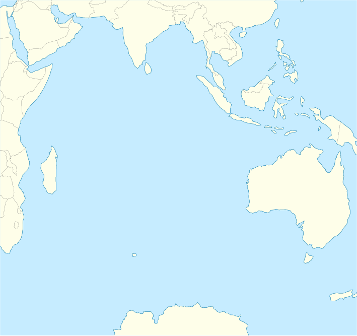
259:
1142:
1097:
1645:
1445:
1660:
1380:
1227:
1167:
1107:
987:
977:
1312:
1247:
1182:
1157:
1127:
1057:
1017:
972:
239:
1555:
289:-12.856058461183775/-43.848273739920856/151.50519408595028/33.22162400070504r
1500:
1322:
1282:
1277:
1192:
1072:
997:
149:
1560:
205:
1515:
1307:
1212:
1177:
1172:
1082:
1077:
1002:
967:
851:
809:
769:
725:
634:
1610:
1545:
1292:
1287:
1257:
1117:
1012:
1007:
1475:
1317:
1197:
1600:
1217:
1207:
1510:
1505:
879:
Click on a date/time to view the file as it appeared at that time.
1535:
1415:
1232:
1595:
1465:
1327:
250:
1525:
1490:
1470:
1550:
1540:
1460:
1520:
1670:
1665:
1495:
1410:
219:
88:
82:(SVG file, nominally 709 × 666 pixels, file size: 168 KB)
1675:
1480:
567:
Add a one-line explanation of what this file represents
1585:
1531:
Pradería templada de les islles San Pablo y Ámsterdam
936:
198:
GMT projection: -JA90.0/-20.0/180/19.998266666666666c
1571:
Módulu:Mapa de llocalización/datos/Océanu Índicu/usu
1400:
1371:
877:
776:
Creative
Commons Attribution-ShareAlike 3.0 Unported
750:
Creative
Commons Attribution-ShareAlike 3.0 Unported
155:
Projection: Lambert azimuthal equal-area projection.
112:
Commons is a freely licensed media file repository.
615:
http:\/\/commons.wikimedia.org\/wiki\/User:Tentotwo
1631:Земетресение в Индийския океан (26 декември 2004)
304:"Downloading datafiles from naturalearthdata.com"
1576:Módulu:Mapa de llocalización/datos/Océanu Índicu
411:110m_coastline.gmt-O-K-W0.535p,9/120/171>>
1273:Sir Seewoosagur Ramgoolam International Airport
535:https://creativecommons.org/licenses/by-sa/3.0
93:
1348:Template:Iranian naval port calls (2010-2020)
541:Creative Commons Attribution-Share Alike 3.0
465:
215:
135:
1406:Plantilla:Mapa de localización Oceano Indico
235:
225:
14:
501:– to copy, distribute and transmit the work
41:Size of this PNG preview of this SVG file:
687:http://commons.wikimedia.org/User:Tentotwo
399:.15p,black110m_land.gmt-K-G254/254/233>
249:Shell script for generating the map using
1651:Module:Location map/data/Indian Ocean/doc
1373:The following other wikis use this file:
1363:Module:Location map/data/Indian Ocean/doc
1223:Prince Said Ibrahim International Airport
1566:Aeropuertu de les Islles Cocos (Keeling)
1391:Vorlage:Positionskarte Indischer Ozean
1138:Great Sandy Island (Western Australia)
938:The following 85 pages use this file:
423:50m_borders.gmt-O-W100/100/100>>
1646:Module:Location map/data/Indian Ocean
1358:Module:Location map/data/Indian Ocean
124:
1381:Sjabloon:Liggingkaart Indiese Oseaan
488:Attribution-Share Alike 3.0 Unported
282:A90.0/-20.0/180/19.998266666666666c
1661:Plantilya:Location map Indian Ocean
1486:Islles Esvalixaes del Océanu Índicu
1188:Naval Support Facility Diego Garcia
870:
476:
471:
260:
258:
13:
1343:Template:Infobox airport/testcases
1038:Christmas Island Seamount Province
572:
566:
462:
458:
296:Indian_Ocean_laea_location_map.ps
142:
138:Indian Ocean laea location map.svg
125:
75:
1696:
1561:Aeropuertu d'Islla Christmas
571:
1088:Eagle Island (Western Australia)
993:Beacon Island (Houtman Abrolhos)
963:Al Maktoum International Airport
557:
512:Under the following conditions:
483:This file is licensed under the
475:
470:
464:
92:
31:
21:
1591:Şablon:Yer xəritəsi Hind okeanı
1043:Cocos (Keeling) Islands Airport
554:
143:
1426:قالب:خريطة مواقع المحيط الهندي
1368:
1103:Fujairah International Airport
1033:Christmas Island National Park
874:
553:
346:"Converting shapefiles to GMT"
26:
1:
1148:Islamic Republic of Iran Navy
858:original creation by uploader
832:original creation by uploader
298:# Get Natural Earth datafiles
1303:Velana International Airport
1263:Sandy Island (Windy Harbour)
1163:Kuwait International Airport
1093:Expulsion of the Chagossians
933:
579:Items portrayed in this file
452:
7:
1657:Usage on ceb.wikipedia.org
1607:Usage on ban.wikipedia.org
1556:Aeropuertu Sir Gaëtan Duval
1457:Usage on ast.wikipedia.org
1387:Usage on als.wikipedia.org
953:Al Bateen Executive Airport
204:Land and shoreline: 1:110m
10:
1701:
1642:Usage on bh.wikipedia.org
1627:Usage on bg.wikipedia.org
1621:Ҡалып:ПозКарта Һинд океаны
1617:Usage on ba.wikipedia.org
1582:Usage on az.wikipedia.org
1422:Usage on ar.wikipedia.org
1397:Usage on an.wikipedia.org
1377:Usage on af.wikipedia.org
526:same or compatible license
132:
127:
1113:Gan International Airport
871:
229:
16:
1636:Шаблон:ПК Индийски океан
1028:Christmas Island Airport
556:
492:
268:
99:This is a file from the
36:
1501:Islles Ḥeard y McDonald
928:
218:
103:. Information from its
1611:Taman Nasional Réunion
1546:Archipiélagu de Chagos
1431:ضفة نازاريث (موريشيوس)
1123:Geography of Sri Lanka
907:10:02, 1 February 2012
206:Natural Earth Datasets
106:description page there
1506:Mar de les Laquedives
1416:Port-Louis (Mauricio)
1338:User:Drongou/Bug57124
1253:Réunion National Park
1243:Roland Garros Airport
943:2013 Rayong oil spill
1601:Prins-Eduard adaları
1476:Islla de la Posesión
1203:Northern Coral Group
329:"Inflating archives"
274:# Set common options
148:Location map of the
65:2,180 × 2,048 pixels
61:1,090 × 1,024 pixels
1516:San Denís (Reunión)
1298:Tasmanian Seamounts
1238:Ras al Hadd Airport
1153:Jebel Dhana Airport
1063:Dampier Archipelago
958:Al Jazeirah Airport
948:Aceh Tsunami Museum
507:– to adapt the work
388:plain--BASEMAP_AXES
376:/236/255--POLAR_CAP
47:Other resolutions:
1353:Draft:Victory Bank
1268:Saya de Malha Bank
1068:Das Island Airport
1048:Colvocoresses Reef
1023:Chagos Archipelago
665:Wikimedia username
652:author name string
607:Wikimedia username
599:author name string
437:"You can now open
181:Projection center:
1685:more global usage
1511:Islles Mascareñes
1369:Global file usage
1133:Great Chagos Bank
1053:Courbet Peninsula
983:Assumption Island
931:
760:copyright license
746:copyright license
565:
380:none--PAPER_MEDIA
245:
244:
158:Area of interest:
121:
120:
101:Wikimedia Commons
32:Global file usage
1692:
1526:Islla Saint-Paul
1491:Flying Fish Cove
1471:Islles Glorioses
1143:Houtman Abrolhos
1098:Freycinet Island
919:
881:
716:copyright status
702:copyright status
689:
684:
674:
669:
659:
656:
563:
548:
545:
542:
539:
536:
528:as the original.
485:Creative Commons
479:
478:
474:
473:
468:
467:
448:
444:
441:
438:
435:
432:
429:
426:
422:
418:
414:
410:
406:
402:
398:
395:
391:
387:
384:A3--BASEMAP_TYPE
383:
379:
375:
372:
368:
364:
360:
357:
354:
351:
347:
344:
341:
338:
334:
330:
327:
324:
321:
317:
313:
309:
305:
302:
299:
295:
292:
288:
285:
281:
278:
275:
272:
264:
262:
231:
221:
147:
139:
133:
117:
96:
95:
89:
83:
72:
69:709 × 666 pixels
57:818 × 768 pixels
53:511 × 480 pixels
49:256 × 240 pixels
43:638 × 599 pixels
1700:
1699:
1695:
1694:
1693:
1691:
1690:
1689:
1551:Islla Christmas
1541:Bassas da India
1536:Islla Ámsterdam
1367:
1228:Qarnayn Airport
1168:Lorraine Island
1108:Futaysi Airport
988:Baie Saint Anne
978:Arzanah Airport
932:
925:
917:
873:
872:
869:
868:
867:
866:
865:
864:
863:
862:
860:
848:
847:
846:
844:
825:
824:
823:
822:
821:
820:
819:
818:
816:
815:1 February 2012
806:
805:
804:
802:
787:
786:
785:
784:
783:
782:
781:
780:
778:
766:
765:
764:
762:
743:
742:
741:
740:
739:
738:
737:
736:
734:
722:
721:
720:
718:
699:
698:
697:
696:
695:
694:
693:
692:
691:
690:
685:
682:
676:
675:
670:
667:
661:
660:
657:
654:
645:
644:
643:
641:
631:
630:
629:
627:
592:
591:
590:
589:
588:
586:
570:
569:
568:
551:
550:
549:
546:
543:
540:
537:
534:
533:
491:
480:
461:
460:
455:
450:
449:
446:
442:
439:
436:
433:
430:
427:
424:
420:
416:
412:
408:
404:
400:
396:
393:
392:NESW--FRAME_PEN
389:
385:
381:
377:
373:
370:
366:
362:
359:"Creating maps"
358:
355:
352:
349:
345:
342:
339:
336:
332:
328:
325:
322:
319:
315:
311:
307:
303:
300:
297:
293:
290:
286:
283:
279:
276:
273:
270:
267:
265:
261:Wayback Machine
246:
220:1 February 2012
211:
208:, borders 1:50m
137:
130:
123:
122:
111:
110:
109:is shown below.
85:
81:
74:
73:
46:
12:
11:
5:
1698:
1687:of this file.
1681:
1680:
1679:
1678:
1673:
1668:
1663:
1655:
1654:
1653:
1648:
1640:
1639:
1638:
1633:
1625:
1624:
1623:
1615:
1614:
1613:
1605:
1604:
1603:
1598:
1593:
1588:
1580:
1579:
1578:
1573:
1568:
1563:
1558:
1553:
1548:
1543:
1538:
1533:
1528:
1523:
1518:
1513:
1508:
1503:
1498:
1493:
1488:
1483:
1478:
1473:
1468:
1463:
1461:Islles Agalega
1455:
1454:
1453:
1448:
1443:
1438:
1433:
1428:
1420:
1419:
1418:
1413:
1408:
1403:
1395:
1394:
1393:
1385:
1384:
1383:
1370:
1366:
1365:
1360:
1355:
1350:
1345:
1340:
1335:
1333:Île Saint-Paul
1330:
1325:
1320:
1315:
1313:Walters Shoals
1310:
1305:
1300:
1295:
1290:
1285:
1280:
1275:
1270:
1265:
1260:
1255:
1250:
1248:Rustaq Airport
1245:
1240:
1235:
1230:
1225:
1220:
1215:
1210:
1205:
1200:
1195:
1190:
1185:
1183:Moyenne Island
1180:
1175:
1170:
1165:
1160:
1158:Khasab Airport
1155:
1150:
1145:
1140:
1135:
1130:
1128:Glauert Island
1125:
1120:
1115:
1110:
1105:
1100:
1095:
1090:
1085:
1080:
1075:
1070:
1065:
1060:
1058:Crozet Islands
1055:
1050:
1045:
1040:
1035:
1030:
1025:
1020:
1018:Centurion Bank
1015:
1010:
1005:
1000:
995:
990:
985:
980:
975:
973:Alphonse Group
970:
965:
960:
955:
950:
945:
935:
930:
929:
927:
923:
920:
914:
909:
904:
900:
899:
896:
893:
890:
887:
884:
876:
861:
856:
854:
853:
852:
850:
849:
845:
842:source of file
840:
838:
837:
836:
835:
833:
829:
828:source of file
817:
814:
812:
811:
810:
808:
807:
803:
798:
796:
795:
794:
793:
791:
779:
774:
772:
771:
770:
768:
767:
763:
758:
756:
755:
754:
753:
751:
747:
735:
730:
728:
727:
726:
724:
723:
719:
714:
712:
711:
710:
709:
707:
703:
678:
677:
663:
662:
650:
649:
648:
647:
646:
642:
639:
637:
636:
635:
633:
632:
628:
623:
621:
620:
619:
618:
616:
612:
608:
604:
600:
596:
587:
582:
580:
577:
576:
575:
574:
562:
561:
558:
555:
532:
531:
530:
529:
519:
510:
509:
508:
502:
495:You are free:
482:
481:
463:
457:
456:
454:
451:
269:
266:
247:
243:
242:
237:
233:
232:
227:
223:
222:
217:
213:
212:
210:
209:
202:
199:
195:
194:
193:
192:
189:
183:
182:
178:
177:
176:
175:
172:
169:
166:
160:
159:
156:
140:
131:
129:
126:
119:
118:
97:
87:
86:
40:
35:
34:
29:
24:
19:
9:
6:
4:
3:
2:
1697:
1688:
1686:
1677:
1674:
1672:
1669:
1667:
1664:
1662:
1659:
1658:
1656:
1652:
1649:
1647:
1644:
1643:
1641:
1637:
1634:
1632:
1629:
1628:
1626:
1622:
1619:
1618:
1616:
1612:
1609:
1608:
1606:
1602:
1599:
1597:
1596:Kroze adaları
1594:
1592:
1589:
1587:
1584:
1583:
1581:
1577:
1574:
1572:
1569:
1567:
1564:
1562:
1559:
1557:
1554:
1552:
1549:
1547:
1544:
1542:
1539:
1537:
1534:
1532:
1529:
1527:
1524:
1522:
1521:Islles Crozet
1519:
1517:
1514:
1512:
1509:
1507:
1504:
1502:
1499:
1497:
1494:
1492:
1489:
1487:
1484:
1482:
1479:
1477:
1474:
1472:
1469:
1467:
1464:
1462:
1459:
1458:
1456:
1452:
1451:أرخبيل تشاغوس
1449:
1447:
1444:
1442:
1441:جزيرة سان بول
1439:
1437:
1434:
1432:
1429:
1427:
1424:
1423:
1421:
1417:
1414:
1412:
1409:
1407:
1404:
1402:
1399:
1398:
1396:
1392:
1389:
1388:
1386:
1382:
1379:
1378:
1376:
1375:
1374:
1364:
1361:
1359:
1356:
1354:
1351:
1349:
1346:
1344:
1341:
1339:
1336:
1334:
1331:
1329:
1326:
1324:
1323:Zirku Airport
1321:
1319:
1316:
1314:
1311:
1309:
1306:
1304:
1301:
1299:
1296:
1294:
1291:
1289:
1286:
1284:
1283:Speakers Bank
1281:
1279:
1278:Sohar Airport
1276:
1274:
1271:
1269:
1266:
1264:
1261:
1259:
1256:
1254:
1251:
1249:
1246:
1244:
1241:
1239:
1236:
1234:
1231:
1229:
1226:
1224:
1221:
1219:
1216:
1214:
1211:
1209:
1206:
1204:
1201:
1199:
1196:
1194:
1193:Nazareth Bank
1191:
1189:
1186:
1184:
1181:
1179:
1176:
1174:
1171:
1169:
1166:
1164:
1161:
1159:
1156:
1154:
1151:
1149:
1146:
1144:
1141:
1139:
1136:
1134:
1131:
1129:
1126:
1124:
1121:
1119:
1116:
1114:
1111:
1109:
1106:
1104:
1101:
1099:
1096:
1094:
1091:
1089:
1086:
1084:
1081:
1079:
1076:
1074:
1073:Dibba Airport
1071:
1069:
1066:
1064:
1061:
1059:
1056:
1054:
1051:
1049:
1046:
1044:
1041:
1039:
1036:
1034:
1031:
1029:
1026:
1024:
1021:
1019:
1016:
1014:
1011:
1009:
1006:
1004:
1001:
999:
998:Blenheim Reef
996:
994:
991:
989:
986:
984:
981:
979:
976:
974:
971:
969:
966:
964:
961:
959:
956:
954:
951:
949:
946:
944:
941:
940:
939:
926:
921:
915:
913:
910:
908:
905:
902:
901:
897:
894:
891:
888:
885:
883:
882:
880:
859:
855:
843:
839:
813:
801:
797:
777:
773:
761:
757:
733:
729:
717:
713:
688:
681:
673:
666:
653:
638:
626:
622:
585:
581:
578:
559:
552:
538:CC BY-SA 3.0
527:
523:
520:
517:
514:
513:
511:
506:
503:
500:
497:
496:
494:
493:
489:
486:
469:
263:
256:
252:
241:
238:
234:
228:
224:
214:
207:
203:
200:
197:
196:
190:
187:
186:
185:
184:
180:
179:
173:
170:
167:
164:
163:
162:
161:
157:
154:
153:
151:
146:
141:
134:
115:
108:
107:
102:
98:
91:
90:
84:
79:
78:Original file
70:
66:
62:
58:
54:
50:
44:
39:
33:
30:
28:
25:
23:
20:
18:
15:
1682:
1671:Sandy Island
1466:Islla Marión
1411:Antananarivo
1372:
1308:Victory Bank
1213:Peros Banhos
1178:Meade Island
1173:Maliku Kandu
1083:Duqm Airport
1078:Diego Garcia
1003:Broken Ridge
968:Alfred Faure
937:
878:
875:File history
521:
515:
504:
498:
417:$ PROJECTION
405:$ PROJECTION
369:--PAGE_COLOR
363:$ PROJECTION
255:archive copy
188:NS: -20.0° N
150:Indian Ocean
144:
114:You can help
104:
76:
22:File history
1666:South Point
1496:Islla Oeste
1293:Sur Airport
1288:St. Brandon
1258:SS Gripfast
1118:Ganges Bank
1013:Cauvin Bank
1008:Cape Labuan
732:copyrighted
706:copyrighted
522:share alike
516:attribution
431:"...done\n"
415:GMTpsxy-m-J
403:GMTpsxy-m-J
361:GMTpsxy-m-J
353:"...done\n"
340:"...done\n"
323:"...done\n"
191:WE: 90.0° E
174:E: 150.0° E
168:S: -70.0° N
136:Description
1676:Saint Paul
1481:Islla Yeye
1318:Wight Bank
1198:Neoglyphea
934:File usage
916:709 × 666
892:Dimensions
640:some value
447:$ FILENAME
440:$ FILENAME
425:$ FILENAME
413:$ FILENAME
401:$ FILENAME
306:wget-nv-nc
277:PROJECTION
171:W: 30.0° E
165:N: 30.0° N
27:File usage
1218:Pitt Bank
1208:Owen Bank
889:Thumbnail
886:Date/Time
800:inception
790:inception
453:Licensing
331:unzip110m
271:#!/bin/sh
145:English:
1586:Kergelen
924:Tentotwo
918:(168 KB)
672:Tentotwo
658:Tentotwo
603:Tentotwo
560:Captions
505:to remix
499:to share
490:license.
421:$ REGION
409:$ REGION
367:$ REGION
291:FILENAME
240:Tentotwo
230:Own work
1446:لا ديغو
1436:براسلين
1401:Colombo
1233:RAF Gan
903:current
898:Comment
625:creator
595:creator
584:depicts
564:English
257:at the
128:Summary
80:
1328:Zond 5
284:REGION
236:Author
226:Source
1683:View
335:.zip
895:User
547:true
544:true
434:echo
428:echo
356:echo
350:echo
343:echo
337:echo
326:echo
320:echo
301:echo
216:Date
17:File
680:URL
611:URL
374:198
251:GMT
683::
668::
655::
445:gv
419:-R
407:-R
365:-R
333:\*
152:.
67:|
63:|
59:|
55:|
51:|
45:.
397:0
394:=
390:=
386:=
382:=
378:=
371:=
316:\
312:\
308:\
294:=
287:=
280:=
116:.
71:.
