43:
584:"}},"text\/plain":{"en":{"":"inception"}}},"{\"value\":{\"time\":\"+2010-07-19T00:00:00Z\",\"timezone\":0,\"before\":0,\"after\":0,\"precision\":11,\"calendarmodel\":\"http:\\\/\\\/www.wikidata.org\\\/entity\\\/Q1985727\"},\"type\":\"time\"}":{"text\/html":{"en":{"P571":"19 July 2010"}},"text\/plain":{"en":{"P571":"19 July 2010"}}}}": -->
291:
319:
261:
325:
330:
99:
622:"}},"text\/plain":{"en":{"":"media type"}}},"{\"value\":\"image\\\/svg+xml\",\"type\":\"string\"}":{"text\/html":{"en":{"P1163":"image\/svg+xml"}},"text\/plain":{"en":{"P1163":"image\/svg+xml"}}}}": -->
540:"}},"text\/plain":{"en":{"":"copyright license"}}},"{\"value\":{\"entity-type\":\"item\",\"numeric-id\":14946043,\"id\":\"Q14946043\"},\"type\":\"wikibase-entityid\"}":{"text\/html":{"en":{"P275":"
496:"}},"text\/plain":{"en":{"":"copyright status"}}},"{\"value\":{\"entity-type\":\"item\",\"numeric-id\":50423863,\"id\":\"Q50423863\"},\"type\":\"wikibase-entityid\"}":{"text\/html":{"en":{"P6216":"
729:
618:
746:{{Information |Description={{en|The island of Ireland, showing international border between Northern Ireland and Republic of Ireland, traditional provinces, traditional counties, and local authority areas in the Republic of Ireland and Northern Ireland.}}
715:
Per the Local
Government Reform Act 2014, joining both Tipperarys and both Waterfords (and removing Limerick City code). Colouring in islands, cleaning up and grouping code to remove stray objects and show Galway and Lough
371:– You must give appropriate credit, provide a link to the license, and indicate if changes were made. You may do so in any reasonable manner, but not in any way that suggests the licensor endorses you or your use.
437:{{Information |Description={{de|Positionskarte von ]}} Quadratische Plattkarte, N-S-Streckung 170 %. Geographische Begrenzung der Karte: * N: 55.6° N * S: 51.2° N * W: 11.0° W * O: 5.0° W {{en|Location
148:
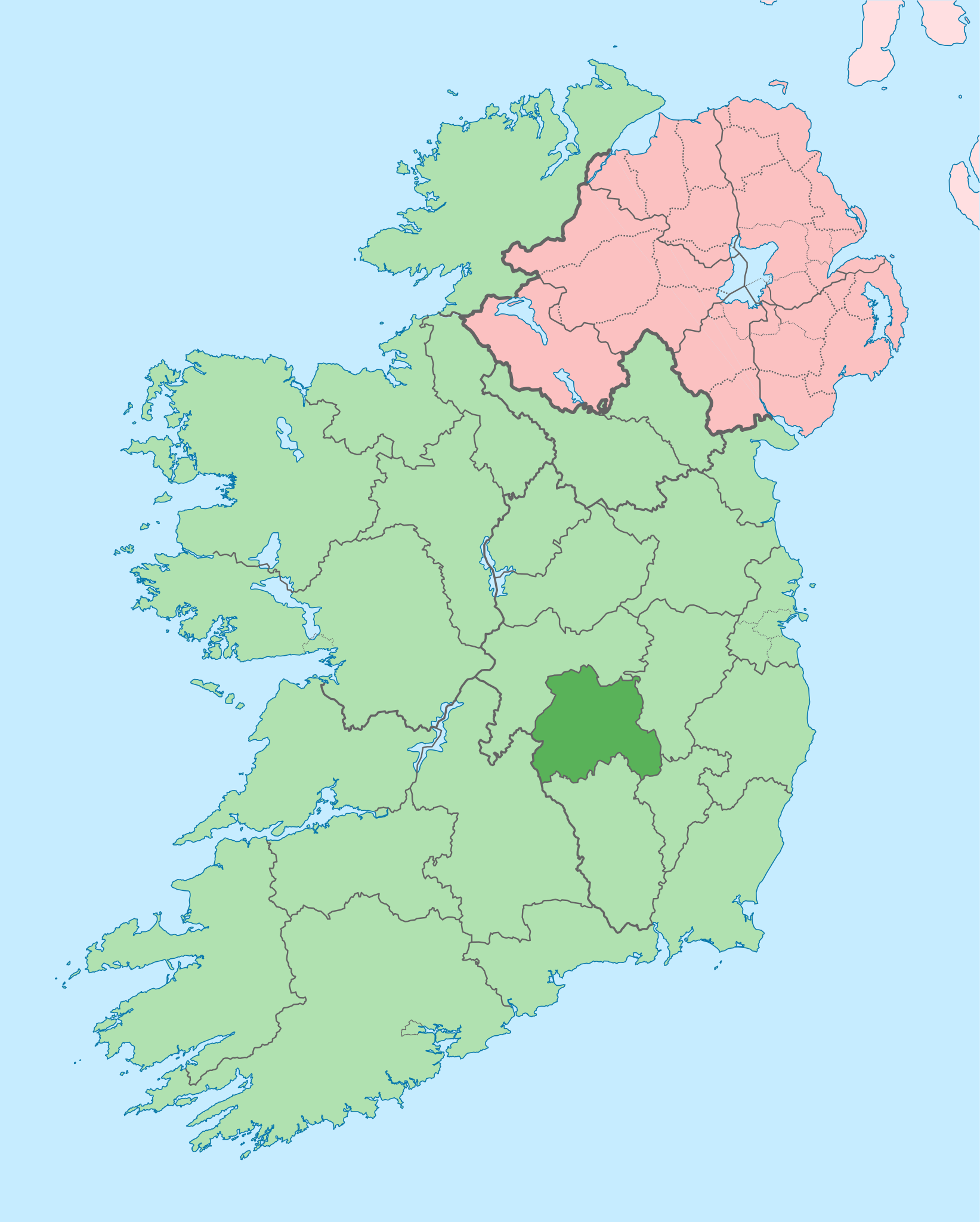
The island of
Ireland, showing international border between Ireland and Northern Ireland, traditional provinces, traditional counties, and local authority areas in Ireland and Northern Ireland.
541:
497:
1452:
301:
619:
493:
581:
537:
73:
69:
65:
61:
57:
53:
47:
110:
1125:
1120:
82:
544:"}},"text\/plain":{"en":{"P275":"Creative Commons Attribution-ShareAlike 3.0 Unported"}}}}": -->
728:
723:
415:
285:
184:
170:
197:
567:
523:
225:
206:
1463:
This file contains additional information, probably added from the digital camera or scanner used to create or digitize it.
378:
875:
629:
507:
870:
591:
551:
482:
432:
422:
221:
985:
188:
340:
1030:
1466:
If the file has been modified from its original state, some details may not fully reflect the modified file.
697:
692:
42:
1025:
377:– If you remix, transform, or build upon the material, you must distribute your contributions under the
845:
790:
500:"}},"text\/plain":{"en":{"P6216":"copyrighted"}}}}": -->
1153:
940:
885:
1135:
965:
840:
118:
1095:
1000:
1130:
1020:
1015:
446:
1045:
945:
860:
337:
279:, which means that it has been digitally altered from its original version. Modifications:
8:
1105:
1090:
1080:
770:
708:
238:
201:
192:
950:
105:
472:
312:
I, the copyright holder of this work, hereby publish it under the following license:
995:
990:
925:
865:
290:
1298:
1243:
1055:
271:
830:
214:
210:
1238:
850:
795:
296:
234:
1303:
1005:
915:
810:
739:
1388:
1338:
639:
601:
561:
517:
260:
1423:
1398:
1110:
1075:
1040:
960:
900:
895:
880:
815:
800:
1438:
1383:
1115:
1085:
1060:
1050:
1035:
970:
890:
835:
805:
785:
1428:
1173:
1010:
980:
975:
935:
930:
920:
905:
825:
760:
1193:
1065:
910:
855:
820:
665:
Click on a date/time to view the file as it appeared at that time.
1163:
1100:
775:
765:
1288:
1278:
1233:
1070:
955:
780:
157:
1393:
87:(SVG file, nominally 1,450 × 1,807 pixels, file size: 642 KB)
1293:
1268:
1183:
1373:
1343:
1353:
1313:
1258:
1198:
411:
This image is a derivative work of the following images:
93:
1403:
1358:
1348:
1308:
1248:
1188:
1443:
1378:
1333:
1203:
1418:
1413:
1408:
1368:
1318:
1228:
281:
Coloured in regions with county of article highlighted
1363:
754:
1323:
1208:
1144:
1126:
Knowledge:Graphics Lab/Map workshop/Archive/Oct 2014
1121:
Knowledge:Graphics Lab/Map workshop/Archive/May 2020
663:
568:
Creative
Commons Attribution-ShareAlike 3.0 Unported
542:
Creative
Commons Attribution-ShareAlike 3.0 Unported
117:
Commons is a freely licensed media file repository.
1433:
1328:
1218:
388:https://creativecommons.org/licenses/by-sa/3.0
98:
394:Creative Commons Attribution-Share Alike 3.0
318:
153:
135:
178:
164:
14:
354:– to copy, distribute and transmit the work
46:Size of this PNG preview of this SVG file:
1146:The following other wikis use this file:
283:. The original can be viewed here:
138:Island of Ireland location map Laois.svg
416:File:Island_of_Ireland_location_map.svg
756:The following 76 pages use this file:
406:
1299:Txantiloi:Laois konderriko udalerriak
129:
341:Attribution-Share Alike 3.0 Unported
254:
876:Borris Little, Borris, County Laois
656:
329:
324:
272:
270:
13:
1461:
871:Borris Great, Borris, County Laois
471:
465:
315:
311:
286:Island of Ireland location map.svg
185:Island_of_Ireland_location_map.svg
171:Island_of_Ireland_location_map.svg
142:
130:
80:
1495:
1468:
470:
198:Northern_Ireland_location_map.svg
1244:Wikipedista:Draceane/Plány/Irsko
456:
427:Fix incorrectly coloured isands.
365:Under the following conditions:
336:This file is licensed under the
328:
323:
317:
289:
259:
97:
31:
21:
1304:Portarlington (Laois konderria)
453:
207:Northern_Ireland_-_Counties.png
143:
1141:
986:List of Ireland-related topics
660:
452:
26:
1:
1389:Barrowhouse (Laois konderria)
1339:Ballaghmore (Laois konderria)
1031:Portarlington railway station
36:
1424:Donaghmore (Laois konderria)
1399:Castletown (Laois konderria)
751:
478:Items portrayed in this file
7:
1458:
1439:Jamestown (Laois konderria)
1384:Ballyroan (Laois konderria)
1215:Usage on ceb.wikipedia.org
1160:Usage on ast.wikipedia.org
1026:Portarlington, County Laois
418:licensed with Cc-by-sa-3.0
10:
1500:
1285:Usage on eu.wikipedia.org
1275:Usage on es.wikipedia.org
1265:Usage on eo.wikipedia.org
1255:Usage on da.wikipedia.org
1225:Usage on cs.wikipedia.org
1180:Usage on ca.wikipedia.org
1170:Usage on bg.wikipedia.org
1150:Usage on ar.wikipedia.org
379:same or compatible license
132:
846:Barrowhouse, County Laois
791:Ballaghmore, County Laois
657:
435:1450x1807 (679744 Bytes)
425:1450x1807 (679207 Bytes)
16:
1429:Durrow (Laois konderria)
941:Donaghmore, County Laois
886:Castletown, County Laois
455:
345:
295:. Modifications made by
189:Ireland_location_map.svg
104:This is a file from the
41:
1194:Plantilla:Comtat Laoise
1136:Template:Laois-geo-stub
966:Jamestown, County Laois
841:Ballyroan, County Laois
745:
714:
156:
108:. Information from its
1239:Šablona:Hrabství Laois
1096:The Swan, County Laois
1001:Middlemount (townland)
111:description page there
1131:Template:County Laois
1021:Newtown, County Laois
1016:New Inn, County Laois
433:Rannpháirtí anaithnid
431:2010-03-03T22:19:29Z
423:Rannpháirtí anaithnid
421:2010-03-06T20:43:33Z
222:Rannpháirtí anaithnid
211:Maximilian Dörrbecker
1046:Raheen, County Laois
946:Durrow, County Laois
861:Borris, County Laois
74:1,450 × 1,807 pixels
70:1,643 × 2,048 pixels
1289:Lankide:Euskaldunaa
1279:Condados de Irlanda
1106:Tinnahinch (barony)
1091:Stradbally (barony)
1081:Spink, County Laois
724:00:50, 19 July 2010
407:Original upload log
360:– to adapt the work
158:19 July 2010, 00:46
52:Other resolutions:
771:Aghaboe (townland)
693:09:13, 3 July 2020
66:822 × 1,024 pixels
1487:
1486:
1453:more global usage
1142:Global file usage
951:Emo, County Laois
749:
552:copyright license
538:copyright license
464:
308:
307:
273:retouched picture
249:
248:
233:derivative work:
220:derivative work:
126:
125:
106:Wikimedia Commons
32:Global file usage
1491:
1469:
1394:Borris-in-Ossory
996:Maryborough West
991:Maryborough East
926:Crubeen, Ireland
866:Borris-in-Ossory
736:
705:
667:
508:copyright status
494:copyright status
462:
401:
398:
395:
392:
389:
381:as the original.
338:Creative Commons
332:
331:
327:
326:
321:
320:
303:
293:
276:
274:
263:
255:
241:
228:
159:
147:
139:
133:
122:
101:
100:
94:
88:
77:
62:616 × 768 pixels
58:385 × 480 pixels
54:192 × 240 pixels
48:481 × 599 pixels
1499:
1498:
1494:
1493:
1492:
1490:
1489:
1488:
1457:
1294:Laois konderria
1269:Graflando Laois
1184:Comtat de Laois
1164:Condáu de Laois
1140:
1056:Ridge of Capard
750:
742:
734:
711:
703:
659:
658:
655:
654:
653:
652:
651:
650:
649:
648:
646:
636:
635:
634:
632:
617:
616:
615:
614:
613:
612:
611:
610:
608:
598:
597:
596:
594:
579:
578:
577:
576:
575:
574:
573:
572:
570:
558:
557:
556:
554:
535:
534:
533:
532:
531:
530:
529:
528:
526:
514:
513:
512:
510:
491:
490:
489:
488:
487:
485:
469:
468:
467:
409:
404:
403:
402:
399:
396:
393:
390:
387:
386:
344:
333:
314:
313:
264:
250:
239:
226:
149:
137:
128:
127:
116:
115:
114:is shown below.
90:
86:
79:
78:
51:
12:
11:
5:
1497:
1485:
1484:
1481:
1477:
1476:
1473:
1460:
1455:of this file.
1449:
1448:
1447:
1446:
1441:
1436:
1431:
1426:
1421:
1416:
1411:
1406:
1401:
1396:
1391:
1386:
1381:
1376:
1374:Ballyhuppahane
1371:
1366:
1361:
1356:
1351:
1346:
1341:
1336:
1331:
1326:
1321:
1316:
1311:
1306:
1301:
1296:
1291:
1283:
1282:
1281:
1273:
1272:
1271:
1263:
1262:
1261:
1253:
1252:
1251:
1246:
1241:
1236:
1234:Hrabství Laois
1231:
1223:
1222:
1221:
1213:
1212:
1211:
1206:
1201:
1196:
1191:
1186:
1178:
1177:
1176:
1168:
1167:
1166:
1158:
1157:
1156:
1143:
1139:
1138:
1133:
1128:
1123:
1118:
1113:
1108:
1103:
1098:
1093:
1088:
1083:
1078:
1073:
1068:
1063:
1058:
1053:
1048:
1043:
1038:
1033:
1028:
1023:
1018:
1013:
1008:
1003:
998:
993:
988:
983:
978:
973:
968:
963:
958:
953:
948:
943:
938:
933:
928:
923:
918:
913:
908:
903:
898:
893:
888:
883:
878:
873:
868:
863:
858:
853:
848:
843:
838:
833:
831:Ballyhuppahane
828:
823:
818:
813:
808:
803:
798:
793:
788:
783:
778:
773:
768:
763:
753:
748:
747:
744:
740:
737:
733:1,450 × 1,807
731:
726:
721:
718:
717:
713:
709:
706:
702:1,450 × 1,807
700:
695:
690:
686:
685:
682:
679:
676:
673:
670:
662:
647:
644:
642:
641:
640:
638:
637:
633:
628:
626:
625:
624:
623:
621:
609:
606:
604:
603:
602:
600:
599:
595:
590:
588:
587:
586:
585:
583:
571:
566:
564:
563:
562:
560:
559:
555:
550:
548:
547:
546:
545:
543:
539:
527:
522:
520:
519:
518:
516:
515:
511:
506:
504:
503:
502:
501:
499:
495:
486:
481:
479:
476:
475:
474:
473:
466:Laois on a map
461:
460:
457:
454:
445:Uploaded with
442:
441:
440:
439:
429:
408:
405:
385:
384:
383:
382:
372:
363:
362:
361:
355:
348:You are free:
335:
334:
316:
310:
309:
306:
305:
265:
258:
247:
246:
245:
244:
231:
218:
204:
195:
180:
176:
175:
174:
173:
166:
162:
161:
155:
151:
150:
140:
131:
124:
123:
102:
92:
91:
45:
40:
39:
34:
29:
24:
19:
9:
6:
4:
3:
2:
1496:
1482:
1479:
1478:
1474:
1471:
1470:
1467:
1464:
1456:
1454:
1445:
1442:
1440:
1437:
1435:
1432:
1430:
1427:
1425:
1422:
1420:
1417:
1415:
1412:
1410:
1407:
1405:
1402:
1400:
1397:
1395:
1392:
1390:
1387:
1385:
1382:
1380:
1377:
1375:
1372:
1370:
1367:
1365:
1362:
1360:
1357:
1355:
1352:
1350:
1347:
1345:
1344:Ballickmoyler
1342:
1340:
1337:
1335:
1332:
1330:
1327:
1325:
1322:
1320:
1317:
1315:
1312:
1310:
1307:
1305:
1302:
1300:
1297:
1295:
1292:
1290:
1287:
1286:
1284:
1280:
1277:
1276:
1274:
1270:
1267:
1266:
1264:
1260:
1257:
1256:
1254:
1250:
1247:
1245:
1242:
1240:
1237:
1235:
1232:
1230:
1227:
1226:
1224:
1220:
1217:
1216:
1214:
1210:
1207:
1205:
1202:
1200:
1197:
1195:
1192:
1190:
1187:
1185:
1182:
1181:
1179:
1175:
1172:
1171:
1169:
1165:
1162:
1161:
1159:
1155:
1152:
1151:
1149:
1148:
1147:
1137:
1134:
1132:
1129:
1127:
1124:
1122:
1119:
1117:
1114:
1112:
1109:
1107:
1104:
1102:
1099:
1097:
1094:
1092:
1089:
1087:
1084:
1082:
1079:
1077:
1074:
1072:
1069:
1067:
1064:
1062:
1059:
1057:
1054:
1052:
1049:
1047:
1044:
1042:
1039:
1037:
1034:
1032:
1029:
1027:
1024:
1022:
1019:
1017:
1014:
1012:
1009:
1007:
1004:
1002:
999:
997:
994:
992:
989:
987:
984:
982:
979:
977:
974:
972:
969:
967:
964:
962:
959:
957:
954:
952:
949:
947:
944:
942:
939:
937:
934:
932:
929:
927:
924:
922:
919:
917:
914:
912:
909:
907:
904:
902:
899:
897:
894:
892:
889:
887:
884:
882:
879:
877:
874:
872:
869:
867:
864:
862:
859:
857:
854:
852:
851:Baunreaghcong
849:
847:
844:
842:
839:
837:
834:
832:
829:
827:
824:
822:
819:
817:
814:
812:
809:
807:
804:
802:
799:
797:
796:Ballickmoyler
794:
792:
789:
787:
784:
782:
779:
777:
774:
772:
769:
767:
764:
762:
759:
758:
757:
743:
738:
732:
730:
727:
725:
722:
720:
719:
712:
710:Chipmunkdavis
707:
701:
699:
696:
694:
691:
688:
687:
683:
680:
677:
674:
671:
669:
668:
666:
645:image/svg+xml
643:
631:
627:
605:
593:
589:
569:
565:
553:
549:
525:
521:
509:
505:
484:
480:
477:
458:
451:
450:
449:
448:
438:
434:
430:
428:
424:
420:
419:
417:
414:
413:
412:
391:CC BY-SA 3.0
380:
376:
373:
370:
367:
366:
364:
359:
356:
353:
350:
349:
347:
346:
342:
339:
322:
304:
298:
294:
292:
287:
282:
278:
277:
275:
266:
262:
257:
256:
253:
252:
242:
236:
232:
229:
223:
219:
216:
212:
208:
205:
203:
199:
196:
194:
190:
186:
183:
182:
181:
177:
172:
169:
168:
167:
163:
152:
146:
141:
134:
120:
113:
112:
107:
103:
96:
95:
89:
84:
83:Original file
75:
71:
67:
63:
59:
55:
49:
44:
38:
35:
33:
30:
28:
25:
23:
20:
18:
15:
1465:
1462:
1450:
1354:Ballybrittas
1314:Mountmellick
1259:County Laois
1199:Mountmellick
1145:
1006:Mountmellick
916:County Laois
811:Ballybrittas
755:
664:
661:File history
607:19 July 2010
447:derivativeFX
444:
443:
436:
426:
410:
374:
368:
357:
351:
300:
284:
280:
269:
268:
251:
202:NordNordWest
193:NordNordWest
144:
119:You can help
109:
81:
22:File history
1404:Clonaghadoo
1359:Ballybrophy
1349:Ballinakill
1309:Port Laoise
1249:Port Laoise
1189:Port Laoise
1111:Upper Woods
1076:Slievemargy
1041:Portnahinch
961:Garraunbaun
901:Clonaghadoo
896:Clarmallagh
881:Castleconor
816:Ballybrophy
801:Ballinakill
524:copyrighted
498:copyrighted
375:share alike
369:attribution
267:This is a
136:Description
1475:1449.805px
1444:Kilbricken
1379:Ballylinan
1334:Ballacolla
1204:Stradbally
1154:مقاطعة ليش
1116:Vicarstown
1086:Stradbally
1061:Rosenallis
1051:Rathdowney
1036:Portlaoise
971:Kilbricken
891:Clandonagh
836:Ballylinan
806:Ballyadams
786:Ballacolla
752:File usage
678:Dimensions
630:media type
620:media type
27:File usage
1483:1807.07px
1419:Cullohill
1414:Crettyard
1409:Clonaslee
1369:Ballyhide
1319:Abbeyleix
1229:Abbeyleix
1011:Mountrath
981:Killeshin
976:Killenard
936:Cullohill
931:Cullenagh
921:Crettyard
906:Clonaslee
826:Ballyhide
761:Abbeyleix
675:Thumbnail
672:Date/Time
592:inception
582:inception
145:English:
1459:Metadata
1364:Ballyfin
1066:Shanahoe
911:Coolrain
856:Bordwell
821:Ballyfin
735:(815 KB)
704:(642 KB)
459:Captions
358:to remix
352:to share
343:license.
37:Metadata
1324:Aghaboe
1209:Aghaboe
1101:Timahoe
776:Arderin
766:Aghaboe
741:Mabuska
689:current
684:Comment
483:depicts
463:English
297:Mabuska
288::
235:Mabuska
85:
1480:Height
1434:Errill
1329:Arless
1071:Sletty
956:Errill
781:Arless
302:
215:Chumwa
179:Author
165:Source
1472:Width
1451:View
1219:Laois
160:(UTC)
1174:Лийш
716:Ree.
681:User
400:true
397:true
240:talk
227:talk
154:Date
17:File
187:: *
299:.
209::
200::
191::
72:|
68:|
64:|
60:|
56:|
50:.
243:)
237:(
230:)
224:(
217:)
213:(
121:.
76:.
Text is available under the Creative Commons Attribution-ShareAlike License. Additional terms may apply.
