43:
585:"}},"text\/plain":{"en":{"":"inception"}}},"{\"value\":{\"time\":\"+2010-07-19T00:00:00Z\",\"timezone\":0,\"before\":0,\"after\":0,\"precision\":11,\"calendarmodel\":\"http:\\\/\\\/www.wikidata.org\\\/entity\\\/Q1985727\"},\"type\":\"time\"}":{"text\/html":{"en":{"P571":"19 July 2010"}},"text\/plain":{"en":{"P571":"19 July 2010"}}}}": -->
292:
320:
262:
326:
331:
99:
623:"}},"text\/plain":{"en":{"":"media type"}}},"{\"value\":\"image\\\/svg+xml\",\"type\":\"string\"}":{"text\/html":{"en":{"P1163":"image\/svg+xml"}},"text\/plain":{"en":{"P1163":"image\/svg+xml"}}}}": -->
541:"}},"text\/plain":{"en":{"":"copyright license"}}},"{\"value\":{\"entity-type\":\"item\",\"numeric-id\":14946043,\"id\":\"Q14946043\"},\"type\":\"wikibase-entityid\"}":{"text\/html":{"en":{"P275":"
497:"}},"text\/plain":{"en":{"":"copyright status"}}},"{\"value\":{\"entity-type\":\"item\",\"numeric-id\":50423863,\"id\":\"Q50423863\"},\"type\":\"wikibase-entityid\"}":{"text\/html":{"en":{"P6216":"
730:
619:
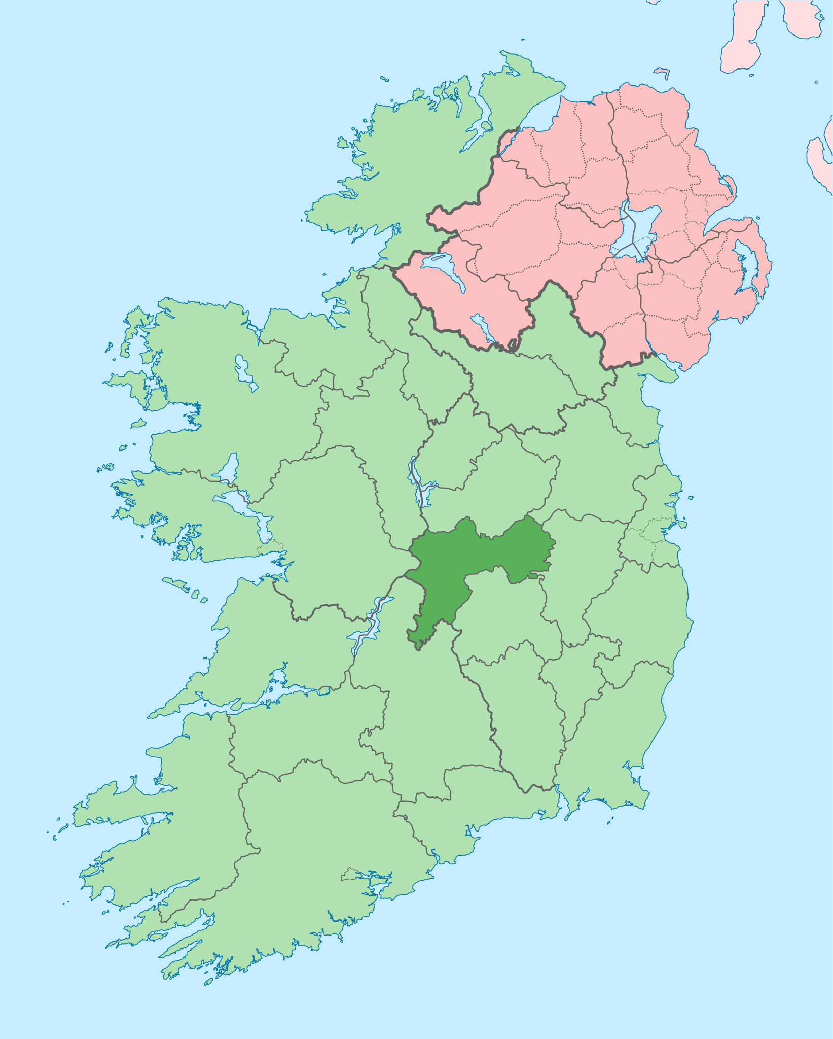
747:{{Information |Description={{en|The island of Ireland, showing international border between Northern Ireland and Republic of Ireland, traditional provinces, traditional counties, and local authority areas in the Republic of Ireland and Northern Ireland.}}
716:
Per the Local
Government Reform Act 2014, joining both Tipperarys and both Waterfords (and removing Limerick City code). Colouring in islands, cleaning up and grouping code to remove stray objects and show Galway and Lough
372:– You must give appropriate credit, provide a link to the license, and indicate if changes were made. You may do so in any reasonable manner, but not in any way that suggests the licensor endorses you or your use.
148:
The island of
Ireland, showing international border between Northern Ireland and Republic of Ireland, traditional provinces, traditional counties, and local authority areas in the Republic of Ireland and Northern
438:{{Information |Description={{de|Positionskarte von ]}} Quadratische Plattkarte, N-S-Streckung 170 %. Geographische Begrenzung der Karte: * N: 55.6° N * S: 51.2° N * W: 11.0° W * O: 5.0° W {{en|Location
542:
498:
1413:
302:
620:
494:
73:
69:
582:
538:
65:
61:
57:
53:
47:
110:
82:
1081:
1076:
545:"}},"text\/plain":{"en":{"P275":"Creative Commons Attribution-ShareAlike 3.0 Unported"}}}}": -->
729:
724:
416:
286:
185:
171:
198:
568:
524:
226:
207:
1424:
This file contains additional information, probably added from the digital camera or scanner used to create or digitize it.
916:
379:
630:
508:
1109:
592:
552:
483:
433:
423:
222:
991:
189:
341:
1427:
If the file has been modified from its original state, some details may not fully reflect the modified file.
1071:
698:
693:
42:
831:
378:– If you remix, transform, or build upon the material, you must distribute your contributions under the
981:
771:
501:"}},"text\/plain":{"en":{"P6216":"copyrighted"}}}}": -->
1091:
811:
976:
118:
1086:
891:
846:
801:
447:
1026:
1016:
836:
338:
280:, which means that it has been digitally altered from its original version. Modifications:
8:
1021:
906:
806:
796:
709:
239:
202:
193:
1066:
1051:
996:
946:
786:
105:
473:
313:
I, the copyright holder of this work, hereby publish it under the following license:
1284:
291:
1209:
1041:
1036:
926:
272:
215:
211:
1204:
886:
297:
235:
1129:
1056:
1031:
961:
866:
856:
740:
640:
602:
562:
518:
261:
1314:
1061:
936:
851:
1379:
1349:
1011:
1006:
971:
956:
881:
871:
821:
791:
776:
1404:
1324:
1339:
1046:
1001:
951:
921:
911:
876:
826:
816:
761:
1394:
1289:
1164:
1119:
1184:
986:
966:
941:
901:
861:
781:
666:
Click on a date/time to view the file as it appeared at that time.
1194:
931:
896:
841:
766:
1269:
1249:
158:
1139:
1274:
1239:
87:(SVG file, nominally 1,450 × 1,807 pixels, file size: 642 KB)
1229:
1174:
1219:
1154:
1149:
1354:
1264:
1144:
412:
This image is a derivative work of the following images:
93:
1304:
1364:
1334:
1329:
1294:
1399:
1369:
1319:
1279:
1259:
1199:
1169:
1159:
282:
Coloured in regions with county of article highlighted
1389:
1374:
1309:
1299:
755:
1384:
1359:
1344:
1100:
1082:
Knowledge:Graphics Lab/Map workshop/Archive/Oct 2014
1077:
Knowledge:Graphics Lab/Map workshop/Archive/May 2020
664:
569:
Creative
Commons Attribution-ShareAlike 3.0 Unported
543:
Creative
Commons Attribution-ShareAlike 3.0 Unported
117:
Commons is a freely licensed media file repository.
389:https://creativecommons.org/licenses/by-sa/3.0
98:
395:Creative Commons Attribution-Share Alike 3.0
319:
154:
135:
179:
165:
14:
355:– to copy, distribute and transmit the work
46:Size of this PNG preview of this SVG file:
1102:The following other wikis use this file:
138:Island of Ireland location map Offaly.svg
284:. The original can be viewed here:
417:File:Island_of_Ireland_location_map.svg
1285:Txantiloi:Offaly konderriko udalerriak
757:The following 67 pages use this file:
407:
129:
917:Durrow, County Offaly (civil parish)
342:Attribution-Share Alike 3.0 Unported
255:
657:
330:
325:
273:
271:
13:
1422:
472:
466:
316:
312:
287:Island of Ireland location map.svg
186:Island_of_Ireland_location_map.svg
172:Island_of_Ireland_location_map.svg
142:
130:
80:
1456:
1429:
471:
199:Northern_Ireland_location_map.svg
1210:Wikipedista:Draceane/Plány/Irsko
457:
428:Fix incorrectly coloured isands.
366:Under the following conditions:
337:This file is licensed under the
329:
324:
318:
290:
260:
97:
31:
21:
454:
208:Northern_Ireland_-_Counties.png
143:
1097:
992:List of Ireland-related topics
661:
453:
26:
1:
36:
1315:Blue Ball (Offaly konderria)
1072:Yellow River (County Offaly)
752:
479:Items portrayed in this file
7:
1419:
1226:Usage on en.wikivoyage.org
1181:Usage on ceb.wikipedia.org
1116:Usage on ast.wikipedia.org
832:Castlejordan (civil parish)
419:licensed with Cc-by-sa-3.0
10:
1461:
1380:Croghan (Offaly konderria)
1350:Cloghan (Offaly konderria)
1256:Usage on eu.wikipedia.org
1246:Usage on es.wikipedia.org
1236:Usage on eo.wikipedia.org
1216:Usage on da.wikipedia.org
1191:Usage on cs.wikipedia.org
1136:Usage on ca.wikipedia.org
1126:Usage on bg.wikipedia.org
1106:Usage on ar.wikipedia.org
982:Kilmanaghan (civil parish)
380:same or compatible license
132:
1405:Durrow (Offaly konderria)
1325:Brosna (Offaly konderria)
772:Ardnurcher, County Offaly
658:
436:1450x1807 (679744 Bytes)
426:1450x1807 (679207 Bytes)
16:
1340:Clara (Offaly konderria)
1092:Template:Offaly-geo-stub
812:Blue Ball, County Offaly
456:
346:
296:. Modifications made by
190:Ireland_location_map.svg
104:This is a file from the
41:
1395:Doon (Offaly konderria)
1290:Birr (Offaly konderria)
1205:Šablona:Hrabství Offaly
1165:Plantilla:Comtat Offaly
977:Killurin, County Offaly
746:
715:
157:
108:. Information from its
1087:Template:County Offaly
892:Croghan, County Offaly
847:Cloghan, County Offaly
802:Belmont, County Offaly
111:description page there
434:Rannpháirtí anaithnid
432:2010-03-03T22:19:29Z
424:Rannpháirtí anaithnid
422:2010-03-06T20:43:33Z
223:Rannpháirtí anaithnid
212:Maximilian Dörrbecker
1140:Comtat d'Offaly
1120:Condáu d'Offaly
1027:Rhode, County Offaly
1017:Rahan, County Offaly
837:Clara, County Offaly
74:1,450 × 1,807 pixels
70:1,643 × 2,048 pixels
1270:Lankide:Euskaldunaa
1250:Condados de Irlanda
1022:Rath, County Offaly
907:Doon, County Offaly
807:Birr, County Offaly
797:Ballycowan (barony)
725:01:00, 19 July 2010
408:Original upload log
361:– to adapt the work
159:19 July 2010, 00:55
52:Other resolutions:
694:09:15, 3 July 2020
66:822 × 1,024 pixels
1448:
1447:
1414:more global usage
1098:Global file usage
1067:Wolftrap Mountain
1052:Upper Philipstown
997:Lower Philipstown
947:Geashill (barony)
787:Ballyboy (barony)
750:
553:copyright license
539:copyright license
465:
309:
308:
274:retouched picture
250:
249:
234:derivative work:
221:derivative work:
126:
125:
106:Wikimedia Commons
32:Global file usage
1452:
1430:
1275:Offaly konderria
1240:Graflando Offaly
737:
706:
668:
509:copyright status
495:copyright status
463:
402:
399:
396:
393:
390:
382:as the original.
339:Creative Commons
333:
332:
328:
327:
322:
321:
304:
294:
277:
275:
264:
256:
242:
229:
160:
147:
139:
133:
122:
101:
100:
94:
88:
77:
62:616 × 768 pixels
58:385 × 480 pixels
54:192 × 240 pixels
48:481 × 599 pixels
1460:
1459:
1455:
1454:
1453:
1451:
1450:
1449:
1418:
1195:Hrabství Offaly
1096:
1042:Stillbrook Hill
1037:Shannon Harbour
927:Eglish (barony)
751:
743:
735:
712:
704:
660:
659:
656:
655:
654:
653:
652:
651:
650:
649:
647:
637:
636:
635:
633:
618:
617:
616:
615:
614:
613:
612:
611:
609:
599:
598:
597:
595:
580:
579:
578:
577:
576:
575:
574:
573:
571:
559:
558:
557:
555:
536:
535:
534:
533:
532:
531:
530:
529:
527:
515:
514:
513:
511:
492:
491:
490:
489:
488:
486:
470:
469:
468:
467:Offaly on a Map
410:
405:
404:
403:
400:
397:
394:
391:
388:
387:
345:
334:
315:
314:
265:
251:
240:
227:
150:
137:
128:
127:
116:
115:
114:is shown below.
90:
86:
79:
78:
51:
12:
11:
5:
1458:
1446:
1445:
1442:
1438:
1437:
1434:
1421:
1416:of this file.
1410:
1409:
1408:
1407:
1402:
1397:
1392:
1387:
1382:
1377:
1372:
1367:
1362:
1357:
1352:
1347:
1342:
1337:
1332:
1327:
1322:
1317:
1312:
1307:
1302:
1297:
1292:
1287:
1282:
1277:
1272:
1267:
1262:
1254:
1253:
1252:
1244:
1243:
1242:
1234:
1233:
1232:
1224:
1223:
1222:
1214:
1213:
1212:
1207:
1202:
1197:
1189:
1188:
1187:
1179:
1178:
1177:
1175:Clara (Offaly)
1172:
1167:
1162:
1157:
1152:
1147:
1142:
1134:
1133:
1132:
1124:
1123:
1122:
1114:
1113:
1112:
1099:
1095:
1094:
1089:
1084:
1079:
1074:
1069:
1064:
1059:
1054:
1049:
1044:
1039:
1034:
1029:
1024:
1019:
1014:
1009:
1004:
999:
994:
989:
984:
979:
974:
969:
964:
959:
954:
949:
944:
939:
934:
929:
924:
919:
914:
909:
904:
899:
894:
889:
884:
879:
874:
869:
864:
859:
854:
849:
844:
839:
834:
829:
824:
819:
814:
809:
804:
799:
794:
789:
784:
779:
774:
769:
764:
754:
749:
748:
745:
741:
738:
734:1,450 × 1,807
732:
727:
722:
719:
718:
714:
710:
707:
703:1,450 × 1,807
701:
696:
691:
687:
686:
683:
680:
677:
674:
671:
663:
648:
645:
643:
642:
641:
639:
638:
634:
629:
627:
626:
625:
624:
622:
610:
607:
605:
604:
603:
601:
600:
596:
591:
589:
588:
587:
586:
584:
572:
567:
565:
564:
563:
561:
560:
556:
551:
549:
548:
547:
546:
544:
540:
528:
523:
521:
520:
519:
517:
516:
512:
507:
505:
504:
503:
502:
500:
496:
487:
482:
480:
477:
476:
475:
474:
462:
461:
458:
455:
446:Uploaded with
443:
442:
441:
440:
430:
409:
406:
386:
385:
384:
383:
373:
364:
363:
362:
356:
349:You are free:
336:
335:
317:
311:
310:
307:
306:
266:
259:
248:
247:
246:
245:
232:
219:
205:
196:
181:
177:
176:
175:
174:
167:
163:
162:
156:
152:
151:
140:
131:
124:
123:
102:
92:
91:
45:
40:
39:
34:
29:
24:
19:
9:
6:
4:
3:
2:
1457:
1443:
1440:
1439:
1435:
1432:
1431:
1428:
1425:
1417:
1415:
1406:
1403:
1401:
1398:
1396:
1393:
1391:
1388:
1386:
1383:
1381:
1378:
1376:
1373:
1371:
1368:
1366:
1363:
1361:
1358:
1356:
1353:
1351:
1348:
1346:
1343:
1341:
1338:
1336:
1333:
1331:
1328:
1326:
1323:
1321:
1318:
1316:
1313:
1311:
1308:
1306:
1303:
1301:
1298:
1296:
1293:
1291:
1288:
1286:
1283:
1281:
1278:
1276:
1273:
1271:
1268:
1266:
1263:
1261:
1258:
1257:
1255:
1251:
1248:
1247:
1245:
1241:
1238:
1237:
1235:
1231:
1230:County Offaly
1228:
1227:
1225:
1221:
1220:County Offaly
1218:
1217:
1215:
1211:
1208:
1206:
1203:
1201:
1198:
1196:
1193:
1192:
1190:
1186:
1183:
1182:
1180:
1176:
1173:
1171:
1168:
1166:
1163:
1161:
1158:
1156:
1155:Birr (Offaly)
1153:
1151:
1150:Shannonbridge
1148:
1146:
1143:
1141:
1138:
1137:
1135:
1131:
1128:
1127:
1125:
1121:
1118:
1117:
1115:
1111:
1110:مقاطعة أوفالي
1108:
1107:
1105:
1104:
1103:
1093:
1090:
1088:
1085:
1083:
1080:
1078:
1075:
1073:
1070:
1068:
1065:
1063:
1060:
1058:
1055:
1053:
1050:
1048:
1045:
1043:
1040:
1038:
1035:
1033:
1030:
1028:
1025:
1023:
1020:
1018:
1015:
1013:
1010:
1008:
1005:
1003:
1000:
998:
995:
993:
990:
988:
985:
983:
980:
978:
975:
973:
970:
968:
965:
963:
960:
958:
955:
953:
950:
948:
945:
943:
940:
938:
935:
933:
930:
928:
925:
923:
920:
918:
915:
913:
910:
908:
905:
903:
900:
898:
895:
893:
890:
888:
887:County Offaly
885:
883:
880:
878:
875:
873:
870:
868:
865:
863:
860:
858:
855:
853:
850:
848:
845:
843:
840:
838:
835:
833:
830:
828:
825:
823:
820:
818:
815:
813:
810:
808:
805:
803:
800:
798:
795:
793:
790:
788:
785:
783:
780:
778:
775:
773:
770:
768:
765:
763:
760:
759:
758:
744:
739:
733:
731:
728:
726:
723:
721:
720:
713:
711:Chipmunkdavis
708:
702:
700:
697:
695:
692:
689:
688:
684:
681:
678:
675:
672:
670:
669:
667:
646:image/svg+xml
644:
632:
628:
606:
594:
590:
570:
566:
554:
550:
526:
522:
510:
506:
485:
481:
478:
459:
452:
451:
450:
449:
439:
435:
431:
429:
425:
421:
420:
418:
415:
414:
413:
392:CC BY-SA 3.0
381:
377:
374:
371:
368:
367:
365:
360:
357:
354:
351:
350:
348:
347:
343:
340:
323:
305:
299:
295:
293:
288:
283:
279:
278:
276:
267:
263:
258:
257:
254:
253:
243:
237:
233:
230:
224:
220:
217:
213:
209:
206:
204:
200:
197:
195:
191:
187:
184:
183:
182:
178:
173:
170:
169:
168:
164:
153:
146:
141:
134:
120:
113:
112:
107:
103:
96:
95:
89:
84:
83:Original file
75:
71:
67:
63:
59:
55:
49:
44:
38:
35:
33:
30:
28:
25:
23:
20:
18:
15:
1426:
1423:
1411:
1355:Clonbollogue
1265:Clonmacnoise
1145:Clonmacnoise
1101:
1057:Walsh Island
1032:River Camcor
962:Kilcumreragh
867:Clonmacnoise
857:Clonbullogue
756:
665:
662:File history
608:19 July 2010
448:derivativeFX
445:
444:
437:
427:
411:
375:
369:
358:
352:
301:
285:
281:
270:
269:
252:
203:NordNordWest
194:NordNordWest
144:
119:You can help
109:
81:
22:File history
1305:Ballycumber
1185:Uíbh Fhailí
1062:Warrenstown
937:Garrycastle
852:Clonahenoge
525:copyrighted
499:copyrighted
376:share alike
370:attribution
268:This is a
136:Description
1436:1449.805px
1365:Clonygowan
1335:Capppancur
1330:Cadamstown
1295:Ballinagar
1012:Mountbolus
1007:Mongan Bog
972:Killoughey
957:Kilcoursey
882:Coolestown
872:Clonygowan
822:Cadamstown
792:Ballybritt
777:Ballinagar
753:File usage
679:Dimensions
631:media type
621:media type
27:File usage
1444:1807.07px
1400:Dunkerrin
1370:Coolderry
1320:Bracknagh
1280:Edenderry
1260:Tullamore
1200:Tullamore
1170:Edenderry
1160:Tullamore
1047:Tullamore
1002:Moneygall
952:Horseleap
922:Edenderry
912:Dunkerrin
877:Coolderry
827:Cannakill
817:Bracknagh
762:Aghagurty
676:Thumbnail
673:Date/Time
593:inception
583:inception
145:English:
1420:Metadata
1390:Daingean
1375:Crinkill
1310:Banagher
1300:Ballyboy
987:Kinnitty
967:Killeigh
942:Geashill
902:Daingean
862:Clonlisk
782:Ballyboy
736:(815 KB)
705:(642 KB)
460:Captions
359:to remix
353:to share
344:license.
149:Ireland.
37:Metadata
1385:Cushina
1360:Clonony
1345:Clareen
932:Ferbane
897:Cushina
842:Clareen
767:Arderin
742:Mabuska
690:current
685:Comment
484:depicts
464:English
298:Mabuska
289::
236:Mabuska
85:
1441:Height
303:
216:Chumwa
180:Author
166:Source
1433:Width
1412:View
1130:Офали
161:(UTC)
717:Ree.
682:User
401:true
398:true
241:talk
228:talk
155:Date
17:File
188:: *
300:.
210::
201::
192::
72:|
68:|
64:|
60:|
56:|
50:.
244:)
238:(
231:)
225:(
218:)
214:(
121:.
76:.
Text is available under the Creative Commons Attribution-ShareAlike License. Additional terms may apply.
