348:
38:
492:"}},"text\/plain":{"en":{"":"inception"}}},"{\"value\":{\"time\":\"+2011-12-17T00:00:00Z\",\"timezone\":0,\"before\":0,\"after\":0,\"precision\":11,\"calendarmodel\":\"http:\\\/\\\/www.wikidata.org\\\/entity\\\/Q1985727\"},\"type\":\"time\"}":{"text\/html":{"en":{"P571":"17 December 2011"}},"text\/plain":{"en":{"P571":"17 December 2011"}}}}": -->
242:
248:
253:
94:
448:"}},"text\/plain":{"en":{"":"copyright license"}}},"{\"value\":{\"entity-type\":\"item\",\"numeric-id\":14946043,\"id\":\"Q14946043\"},\"type\":\"wikibase-entityid\"}":{"text\/html":{"en":{"P275":"
404:"}},"text\/plain":{"en":{"":"copyright status"}}},"{\"value\":{\"entity-type\":\"item\",\"numeric-id\":50423863,\"id\":\"Q50423863\"},\"type\":\"wikibase-entityid\"}":{"text\/html":{"en":{"P6216":"
400:
300:– You must give appropriate credit, provide a link to the license, and indicate if changes were made. You may do so in any reasonable manner, but not in any way that suggests the licensor endorses you or your use.
589:, UK. Equirectangular map projection on WGS 84 datum, with N/S stretched 180% Geographic limits: *West: 6.85W *East: 5.5W *North: 57.8N *South: 57.0N |Source=[[w:Ordnance Survey
449:
405:
1085:
401:
489:
445:
956:
60:
56:
52:
48:
42:
105:
73:
768:
743:
763:
452:"}},"text\/plain":{"en":{"P275":"Creative Commons Attribution-ShareAlike 3.0 Unported"}}}}": -->
231:
946:
941:
475:
431:
307:
341:
415:
753:
499:
459:
390:
748:
202:
758:
638:
263:
613:
608:
643:
567:
562:
64:
37:
786:
306:– If you remix, transform, or build upon the material, you must distribute your contributions under the
698:
408:"}},"text\/plain":{"en":{"P6216":"copyrighted"}}}}": -->
185:
703:
688:
113:
347:
921:
841:
738:
708:
260:
796:
8:
936:
623:
206:
658:
633:
100:
693:
380:
182:
219:
728:
713:
653:
578:
856:
733:
139:
628:
618:
896:
871:
718:
668:
663:
586:
509:
469:
425:
648:
145:
Equirectangular map projection on WGS 84 datum, with N/S stretched 180%
723:
603:
1066:
971:
906:
876:
861:
195:
Administrative borders and coastline data from
Boundary-Line product.
1031:
1016:
851:
535:
Click on a date/time to view the file as it appeared at that time.
866:
271:
Contains
Ordnance Survey data © Crown copyright and database right
831:
1076:
1046:
891:
683:
673:
1041:
1006:
996:
916:
836:
678:
976:
991:
1056:
1051:
1071:
1061:
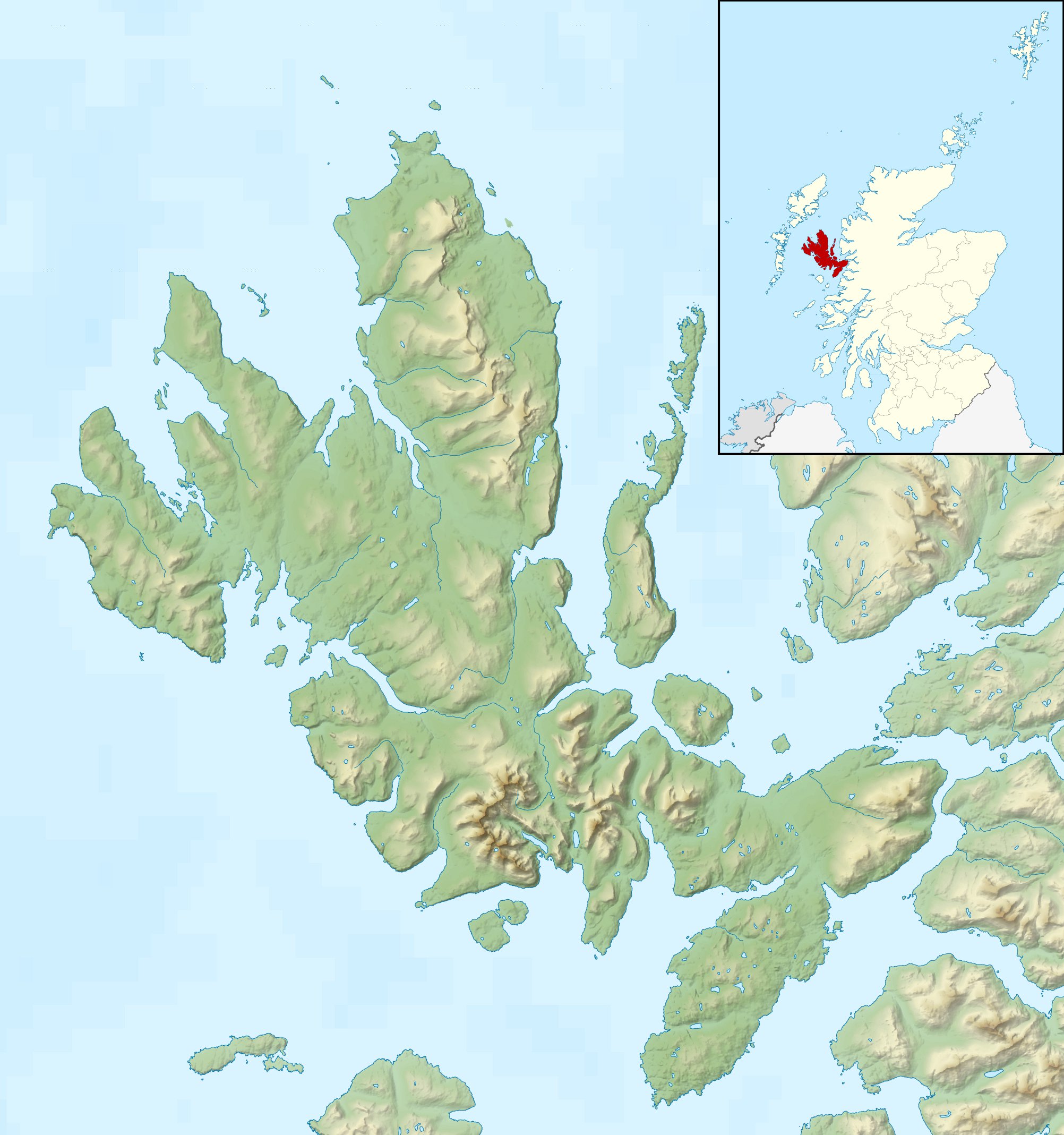
1036:
1026:
1011:
816:
171:
88:
1021:
981:
826:
881:
374:
Add a one-line explanation of what this file represents
926:
986:
597:
78:(2,004 × 2,137 pixels, file size: 462 KB, MIME type:
1001:
886:
777:
533:
476:
Creative
Commons Attribution-ShareAlike 3.0 Unported
450:
Creative
Commons Attribution-ShareAlike 3.0 Unported
112:
Commons is a freely licensed media file repository.
966:
846:
769:Module:Location map/data/Scotland Isle of Skye/doc
198:All other geographic data from Meridian 2 product.
947:モジュール:Location map/data/Scotland Isle of Skye/doc
806:
842:Vorlage:Positionskarte Schottland Highland Skye
744:User:Cactus.man/Sandbox/P-Sco/Selected articles
764:Module:Location map/data/Scotland Isle of Skye
317:https://creativecommons.org/licenses/by-sa/3.0
93:
942:モジュール:Location map/data/Scotland Isle of Skye
585:{{Information |Description=Relief map of the
323:Creative Commons Attribution-Share Alike 3.0
241:
226:
167:
130:
957:ಟೆಂಪ್ಲೇಟು:Location map Scotland Isle of Skye
797:Plantilya:Location map Scotland Isle of Skye
336:
215:
192:Relief data from Land-Form Panorama product.
177:
14:
937:Template:Location map Scotland Isle of Skye
283:– to copy, distribute and transmit the work
779:The following other wikis use this file:
346:
787:قالب:Location map Scotland Isle of Skye
133:Isle of Skye UK relief location map.jpg
599:The following 34 pages use this file:
124:
264:Attribution-Share Alike 3.0 Unported
222:, created using Ordnance Survey data
526:
252:
247:
13:
922:Modèle:Géolocalisation/Île de Skye
754:Portal:Islands/Selected article/75
379:
373:
342:File:Isle of Skye UK blank map.svg
238:
125:
71:
1097:
378:
364:
294:Under the following conditions:
259:This file is licensed under the
251:
246:
240:
201:Inset derived from derived from
92:
31:
21:
749:Portal:Islands/Selected article
361:
774:
759:Portal:Scottish islands/Island
530:
360:
203:File:Scotland location map.svg
26:
1:
614:Beinn na Caillich (Red Hills)
609:Beinn na Caillich (Kyle Rhea)
1067:Loch a' Ghille-chnapain
594:
386:Items portrayed in this file
7:
793:Usage on ceb.wikipedia.org
639:Eilean Mòr, Crowlin Islands
10:
1102:
963:Usage on nl.wikipedia.org
953:Usage on kn.wikipedia.org
933:Usage on ja.wikipedia.org
913:Usage on fr.wikipedia.org
903:Usage on fa.wikipedia.org
823:Usage on de.wikipedia.org
813:Usage on da.wikipedia.org
803:Usage on cs.wikipedia.org
783:Usage on ar.wikipedia.org
308:same or compatible license
127:
972:Scalpay (Binnen-Hebriden)
644:Eilean Mòr, Loch Dunvegan
527:
16:
699:Sgùrr a' Ghreadaidh
363:
274:
99:This is a file from the
36:
689:Scalpay, Inner Hebrides
584:
563:00:28, 17 December 2011
170:
103:. Information from its
1032:Beinn Buidhe na Creige
704:Sgùrr a' Mhadaidh
352:
106:description page there
41:Size of this preview:
1047:Stac a' Mheadais
350:
872:Sgùrr Mhic Chòinnich
739:Wiay, Inner Hebrides
709:Soay, Inner Hebrides
65:2,004 × 2,137 pixels
862:Sgùrr na Banachdich
857:Sgùrr a’ Ghreadaidh
289:– to adapt the work
148:Geographic limits:
47:Other resolutions:
353:
138:Relief map of the
61:960 × 1,024 pixels
1086:more global usage
1042:Talisker (rivier)
1017:Sgùrr nan Gillean
1007:Loch Cill Chriosd
997:Beinn na Caillich
897:Sgùrr a’ Mhadaidh
852:Sgùrr nan Gillean
775:Global file usage
659:High Pasture Cave
634:Eilean Meadhonach
592:
460:copyright license
446:copyright license
372:
357:
356:
235:
232:Reusing this file
121:
120:
101:Wikimedia Commons
32:Global file usage
1093:
917:Old Man of Storr
867:Bruach na Frìthe
624:Bruach na Frìthe
575:
537:
515:17 December 2011
416:copyright status
402:copyright status
370:
330:
327:
324:
321:
318:
310:as the original.
272:
261:Creative Commons
255:
254:
250:
249:
244:
243:
229:
173:
172:17 December 2011
134:
128:
117:
96:
95:
89:
83:
81:
68:
57:720 × 768 pixels
53:450 × 480 pixels
49:225 × 240 pixels
43:562 × 599 pixels
1101:
1100:
1096:
1095:
1094:
1092:
1091:
1090:
977:Dunvegan Castle
773:
593:
581:
573:
529:
528:
525:
524:
523:
522:
521:
520:
519:
518:
516:
506:
505:
504:
502:
487:
486:
485:
484:
483:
482:
481:
480:
478:
466:
465:
464:
462:
443:
442:
441:
440:
439:
438:
437:
436:
434:
422:
421:
420:
418:
399:
398:
397:
396:
395:
393:
377:
376:
375:
358:
332:
331:
328:
325:
322:
319:
316:
315:
273:
270:
267:
256:
183:Ordnance Survey
132:
123:
122:
111:
110:
109:is shown below.
85:
79:
77:
70:
69:
46:
12:
11:
5:
1099:
1088:of this file.
1082:
1081:
1080:
1079:
1074:
1069:
1064:
1059:
1054:
1049:
1044:
1039:
1034:
1029:
1024:
1019:
1014:
1009:
1004:
999:
994:
992:Duntulm Castle
989:
984:
979:
974:
969:
961:
960:
959:
951:
950:
949:
944:
939:
931:
930:
929:
924:
919:
911:
910:
909:
901:
900:
899:
894:
889:
884:
879:
877:Sgùrr Dubh Mòr
874:
869:
864:
859:
854:
849:
844:
839:
834:
832:Sgùrr Alasdair
829:
821:
820:
819:
811:
810:
809:
801:
800:
799:
791:
790:
789:
776:
772:
771:
766:
761:
756:
751:
746:
741:
736:
731:
729:Staffin Island
726:
721:
716:
714:Sorley MacLean
711:
706:
701:
696:
694:Sgùrr Alasdair
691:
686:
681:
676:
671:
666:
661:
656:
654:Harlosh Island
651:
646:
641:
636:
631:
626:
621:
616:
611:
606:
596:
591:
590:
583:
579:
576:
572:2,004 × 2,137
570:
565:
560:
556:
555:
552:
549:
546:
543:
540:
532:
517:
514:
512:
511:
510:
508:
507:
503:
498:
496:
495:
494:
493:
491:
479:
474:
472:
471:
470:
468:
467:
463:
458:
456:
455:
454:
453:
451:
447:
435:
430:
428:
427:
426:
424:
423:
419:
414:
412:
411:
410:
409:
407:
403:
394:
389:
387:
384:
383:
382:
381:
369:
368:
365:
362:
355:
354:
338:
337:Other versions
334:
333:
314:
313:
312:
311:
301:
292:
291:
290:
284:
277:You are free:
268:
258:
257:
239:
236:
224:
223:
217:
213:
212:
211:
210:
199:
196:
193:
179:
175:
174:
169:
165:
164:
163:
162:
159:
156:
153:
135:
126:
119:
118:
97:
87:
86:
40:
35:
34:
29:
24:
19:
9:
6:
4:
3:
2:
1098:
1089:
1087:
1078:
1077:Loch Lic-àird
1075:
1073:
1070:
1068:
1065:
1063:
1060:
1058:
1057:Huisgill Burn
1055:
1053:
1052:Sleadale Burn
1050:
1048:
1045:
1043:
1040:
1038:
1035:
1033:
1030:
1028:
1025:
1023:
1020:
1018:
1015:
1013:
1010:
1008:
1005:
1003:
1000:
998:
995:
993:
990:
988:
985:
983:
980:
978:
975:
973:
970:
968:
965:
964:
962:
958:
955:
954:
952:
948:
945:
943:
940:
938:
935:
934:
932:
928:
925:
923:
920:
918:
915:
914:
912:
908:
905:
904:
902:
898:
895:
893:
892:Sgùrr nan Eag
890:
888:
885:
883:
880:
878:
875:
873:
870:
868:
865:
863:
860:
858:
855:
853:
850:
848:
845:
843:
840:
838:
835:
833:
830:
828:
825:
824:
822:
818:
815:
814:
812:
808:
805:
804:
802:
798:
795:
794:
792:
788:
785:
784:
782:
781:
780:
770:
767:
765:
762:
760:
757:
755:
752:
750:
747:
745:
742:
740:
737:
735:
734:Tarner Island
732:
730:
727:
725:
722:
720:
717:
715:
712:
710:
707:
705:
702:
700:
697:
695:
692:
690:
687:
685:
682:
680:
677:
675:
672:
670:
667:
665:
662:
660:
657:
655:
652:
650:
647:
645:
642:
640:
637:
635:
632:
630:
627:
625:
622:
620:
617:
615:
612:
610:
607:
605:
602:
601:
600:
588:
582:
577:
571:
569:
566:
564:
561:
558:
557:
553:
550:
547:
544:
541:
539:
538:
536:
513:
501:
497:
477:
473:
461:
457:
433:
429:
417:
413:
392:
388:
385:
366:
359:
349:
345:
343:
339:
335:
320:CC BY-SA 3.0
309:
305:
302:
299:
296:
295:
293:
288:
285:
282:
279:
278:
276:
275:
269:Attribution:
265:
262:
245:
237:
233:
228:
225:
221:
218:
214:
208:
204:
200:
197:
194:
191:
190:
189:
187:
184:
180:
176:
166:
160:
157:
154:
151:
150:
149:
146:
143:
141:
136:
129:
115:
108:
107:
102:
98:
91:
90:
84:
75:
74:Original file
66:
62:
58:
54:
50:
44:
39:
33:
30:
28:
25:
23:
20:
18:
15:
1083:
1062:Loch nan Uan
1037:Talisker Bay
1027:Eynort River
1012:Loch Scavaig
817:Isle of Skye
778:
719:South Ascrib
669:Loch Snizort
664:Isle of Skye
598:
587:Isle of Skye
534:
531:File history
344:- Blank map
340:
303:
297:
286:
280:
207:NordNordWest
181:
161:South: 57.0N
158:North: 57.8N
147:
144:
140:Isle of Skye
137:
114:You can help
104:
72:
22:File history
1022:Loch Eynort
982:Castle Moil
837:Sgùrr Dearg
827:Castle Moil
649:Eilean Tigh
432:copyrighted
406:copyrighted
351:With labels
304:share alike
298:attribution
152:West: 6.85W
131:Description
882:Am Basteir
724:South Rona
629:Eilean Bàn
619:Blà Bheinn
604:Am Basteir
595:File usage
548:Dimensions
227:Permission
155:East: 5.5W
80:image/jpeg
27:File usage
927:The Storr
580:Nilfanion
545:Thumbnail
542:Date/Time
500:inception
490:inception
220:Nilfanion
987:Dun Beag
574:(462 KB)
367:Captions
287:to remix
281:to share
266:license.
186:OpenData
1072:Eas Mòr
1002:Glamaig
887:Glamaig
559:current
554:Comment
391:depicts
371:English
76:
967:Raasay
684:Raasay
674:Ornsay
216:Author
178:Source
142:, UK.
1084:View
847:Elgol
679:Pabay
907:سکای
807:Skye
551:User
329:true
326:true
168:Date
17:File
205:by
188:.
63:|
59:|
55:|
51:|
45:.
234:)
230:(
209:.
116:.
82:)
67:.
