43:
580:"}},"text\/plain":{"en":{"":"inception"}}},"{\"value\":{\"time\":\"+2012-12-12T00:00:00Z\",\"timezone\":0,\"before\":0,\"after\":0,\"precision\":11,\"calendarmodel\":\"http:\\\/\\\/www.wikidata.org\\\/entity\\\/Q1985727\"},\"type\":\"time\"}":{"text\/html":{"en":{"P571":"12 December 2012"}},"text\/plain":{"en":{"P571":"12 December 2012"}}}}": -->
381:
241:
246:
99:
393:"}},"text\/plain":{"en":{"P2093":"Htonl","P4174":"Htonl"}}},"{\"value\":{\"entity-type\":\"property\",\"numeric-id\":4174,\"id\":\"P4174\"},\"type\":\"wikibase-entityid\"}":{"text\/html":{"en":{"":"
618:"}},"text\/plain":{"en":{"":"media type"}}},"{\"value\":\"image\\\/svg+xml\",\"type\":\"string\"}":{"text\/html":{"en":{"P1163":"image\/svg+xml"}},"text\/plain":{"en":{"P1163":"image\/svg+xml"}}}}": -->
536:"}},"text\/plain":{"en":{"":"copyright license"}}},"{\"value\":{\"entity-type\":\"item\",\"numeric-id\":14946043,\"id\":\"Q14946043\"},\"type\":\"wikibase-entityid\"}":{"text\/html":{"en":{"P275":"
492:"}},"text\/plain":{"en":{"":"copyright status"}}},"{\"value\":{\"entity-type\":\"item\",\"numeric-id\":50423863,\"id\":\"Q50423863\"},\"type\":\"wikibase-entityid\"}":{"text\/html":{"en":{"P6216":"
754:
397:"}},"text\/plain":{"en":{"":"Wikimedia username"}}},"{\"value\":{\"entity-type\":\"property\",\"numeric-id\":2699,\"id\":\"P2699\"},\"type\":\"wikibase-entityid\"}":{"text\/html":{"en":{"":"
724:
385:"}},"text\/plain":{"en":{"":"creator"}}},"{\"value\":{\"entity-type\":\"property\",\"numeric-id\":2093,\"id\":\"P2093\"},\"type\":\"wikibase-entityid\"}":{"text\/html":{"en":{"":"
614:
401:"}},"text\/plain":{"en":{"":"URL"}}},"{\"value\":\"https:\\\/\\\/commons.wikimedia.org\\\/wiki\\\/user:Htonl\",\"type\":\"string\"}":{"text\/html":{"en":{"P2699":"
389:"}},"text\/plain":{"en":{"":"author name string"}}},"{\"value\":\"Htonl\",\"type\":\"string\"}":{"text\/html":{"en":{"P2093":"Htonl","P4174":"
287:– You must give appropriate credit, provide a link to the license, and indicate if changes were made. You may do so in any reasonable manner, but not in any way that suggests the licensor endorses you or your use.
390:
1299:
790:
1571:
537:
493:
402:
73:
69:
65:
615:
489:
398:
394:
386:
61:
57:
53:
47:
577:
533:
382:
328:
110:
82:
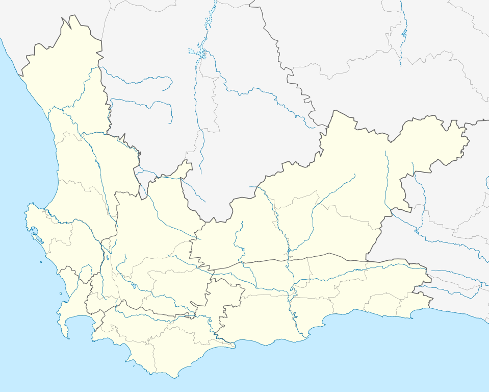
779:. Equirectangular projection. Geographic limits of the map: 17.5° to 24.5° E and 30.25° to 35° S.}} |Source =Own work, based on OpenStreetMap dat...
332:
540:"}},"text\/plain":{"en":{"P275":"Creative Commons Attribution-ShareAlike 3.0 Unported"}}}}": -->
405:"}},"text\/plain":{"en":{"P2699":"https:\/\/commons.wikimedia.org\/wiki\/user:Htonl"}}}}": -->
218:
753:
748:
723:
718:
563:
519:
1582:
This file contains additional information, probably added from the digital camera or scanner used to create or digitize it.
294:
625:
503:
467:
452:
439:
587:
547:
412:
371:
882:
256:
1585:
If the file has been modified from its original state, some details may not fully reflect the modified file.
693:
688:
459:
42:
789:
More than 100 pages use this file. The following list shows the first 100 pages that use this file only. A
1197:
293:– If you remix, transform, or build upon the material, you must distribute your contributions under the
932:
1227:
1172:
1127:
917:
902:
496:"}},"text\/plain":{"en":{"P6216":"copyrighted"}}}}": -->
1287:
1087:
1062:
997:
1217:
1077:
892:
837:
797:
118:
1082:
812:
802:
1122:
912:
822:
1292:
1252:
1202:
1187:
1152:
1137:
967:
817:
474:
253:
8:
1222:
1167:
1067:
897:
942:
907:
807:
105:
361:
228:
I, the copyright holder of this work, hereby publish it under the following license:
1237:
977:
1192:
1117:
842:
1027:
972:
847:
158:
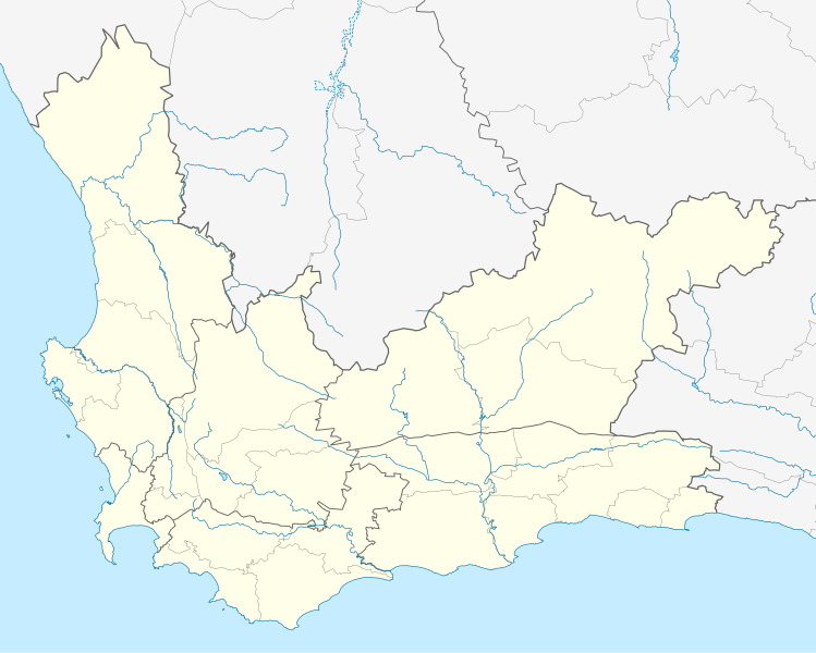
Equirectangular projection, N/S stretching 118%. Geographic limits of the map:
154:
1272:
1242:
1212:
1097:
1092:
887:
832:
1057:
1177:
1072:
1047:
1012:
776:
772:
635:
597:
557:
513:
422:
1207:
1052:
1032:
952:
922:
867:
207:
1267:
1262:
1257:
1157:
1132:
1102:
1002:
962:
937:
852:
764:
734:
704:
1282:
1277:
1232:
1182:
1147:
1112:
1042:
992:
987:
947:
877:
872:
862:
827:
1247:
1022:
1017:
1007:
957:
927:
661:
Click on a date/time to view the file as it appeared at that time.
1427:
1402:
1322:
1142:
1107:
982:
857:
1422:
1037:
1532:
1162:
1392:
1557:
1522:
1477:
87:(SVG file, nominally 1,214 × 972 pixels, file size: 204 KB)
1492:
1347:
1342:
1337:
182:
93:
1552:
1517:
1432:
1412:
1397:
1387:
1377:
1527:
1512:
1507:
1467:
1462:
1442:
1417:
1367:
1352:
1327:
355:
Add a one-line explanation of what this file represents
1562:
1542:
1537:
1497:
1482:
1472:
1452:
1437:
1407:
771:{{Information |Description ={{en|1=Location map of
329:
File:South Africa
Western Cape relief location map.svg
1502:
1457:
1447:
1317:
787:
194:
1487:
1372:
1308:
659:
564:
Creative
Commons Attribution-ShareAlike 3.0 Unported
538:
Creative
Commons Attribution-ShareAlike 3.0 Unported
117:
Commons is a freely licensed media file repository.
1547:
1357:
1332:
1382:
1362:
403:https:\/\/commons.wikimedia.org\/wiki\/user:Htonl
304:https://creativecommons.org/licenses/by-sa/3.0
98:
333:File:Blank map of the Western Cape (2011).svg
310:Creative Commons Attribution-Share Alike 3.0
234:
213:
178:
140:
324:
203:
188:
14:
270:– to copy, distribute and transmit the work
46:Size of this PNG preview of this SVG file:
143:South Africa Western Cape location map.svg
1310:The following other wikis use this file:
475:https://commons.wikimedia.org/user:Htonl
129:
257:Attribution-Share Alike 3.0 Unported
741:new version w/ vmap0-derived rivers
652:
245:
240:
13:
1580:
360:
354:
231:
227:
147:
130:
80:
1614:
1587:
359:
345:
281:Under the following conditions:
252:This file is licensed under the
244:
239:
233:
97:
31:
21:
883:Cape Town International Airport
342:
148:
1305:
656:
341:
26:
1:
36:
784:
367:Items portrayed in this file
7:
1577:
1198:Prince Albert, South Africa
10:
1619:
1314:Usage on af.wikipedia.org
933:Eerste River, Western Cape
295:same or compatible license
137:
132:
1228:Scarborough, Western Cape
1173:Paternoster, South Africa
1128:Monte Vista, Western Cape
918:Denel Overberg Test Range
903:Clanwilliam, South Africa
653:
16:
1288:Wellington, South Africa
1088:Malmesbury, South Africa
1063:Laingsburg, South Africa
998:Heidelberg, Western Cape
344:
261:
104:This is a file from the
41:
1218:Robertson, South Africa
1078:Llandudno, Western Cape
893:Century City, Cape Town
838:Bellville, South Africa
798:Arabella Country Estate
770:
749:00:24, 13 December 2012
740:
710:
181:
108:. Information from its
1083:Macassar, Western Cape
813:Atlantis, South Africa
803:Arniston, South Africa
111:description page there
1123:Montagu, South Africa
913:Darling, South Africa
823:Bantry Bay, Cape Town
719:22:42, 3 January 2013
689:19:40, 4 January 2013
1428:Malmesbury, Wes-Kaap
1403:Wellington, Wes-Kaap
1323:Heidelberg, Wes-Kaap
1293:Woodstock, Cape Town
1253:Strand, Western Cape
1203:Prince Alfred Hamlet
1188:Pinelands, Cape Town
1153:Noordhoek, Cape Town
1138:Napier, South Africa
968:George, South Africa
818:Aurora, South Africa
153:Location map of the
70:2,558 × 2,048 pixels
66:1,279 × 1,024 pixels
1223:Saron, South Africa
1168:Parow, South Africa
1068:Langa, South Africa
898:Ceres, South Africa
276:– to adapt the work
52:Other resolutions:
1423:Atlantis, Wes-Kaap
943:Elim, Western Cape
908:Clifton, Cape Town
808:Athlone, Cape Town
453:Wikimedia username
440:author name string
395:Wikimedia username
387:author name string
74:1,214 × 972 pixels
1606:
1605:
1572:more global usage
1533:Darling, Wes-Kaap
1306:Global file usage
1238:Simon's Town
978:Gordon's Bay
782:
548:copyright license
534:copyright license
353:
338:
337:
222:
219:Reusing this file
126:
125:
106:Wikimedia Commons
32:Global file usage
1610:
1588:
843:Betty's Bay
761:
731:
701:
663:
603:12 December 2012
504:copyright status
490:copyright status
477:
472:
462:
457:
447:
444:
351:
317:
314:
311:
308:
305:
297:as the original.
254:Creative Commons
248:
247:
243:
242:
237:
236:
216:
184:
183:12 December 2012
152:
144:
138:
122:
101:
100:
94:
88:
77:
62:959 × 768 pixels
58:600 × 480 pixels
54:300 × 240 pixels
48:749 × 600 pixels
1618:
1617:
1613:
1612:
1611:
1609:
1608:
1607:
1576:
1393:Plettenbergbaai
1304:
1193:Plettenberg Bay
1118:Mitchells Plain
783:
767:
759:
737:
729:
707:
699:
655:
654:
651:
650:
649:
648:
647:
646:
645:
644:
642:
632:
631:
630:
628:
613:
612:
611:
610:
609:
608:
607:
606:
604:
594:
593:
592:
590:
575:
574:
573:
572:
571:
570:
569:
568:
566:
554:
553:
552:
550:
531:
530:
529:
528:
527:
526:
525:
524:
522:
510:
509:
508:
506:
487:
486:
485:
484:
483:
482:
481:
480:
479:
478:
473:
470:
464:
463:
458:
455:
449:
448:
445:
442:
433:
432:
431:
429:
419:
418:
417:
415:
380:
379:
378:
377:
376:
374:
358:
357:
356:
339:
320:
319:
318:
315:
312:
309:
306:
303:
302:
260:
249:
230:
229:
174:
142:
135:
128:
127:
116:
115:
114:is shown below.
90:
86:
79:
78:
51:
12:
11:
5:
1616:
1604:
1603:
1600:
1596:
1595:
1592:
1579:
1574:of this file.
1568:
1567:
1566:
1565:
1560:
1558:Zoar, Wes-Kaap
1555:
1550:
1545:
1540:
1535:
1530:
1525:
1523:Elim, Wes-Kaap
1520:
1515:
1510:
1505:
1500:
1495:
1490:
1485:
1480:
1478:Matjiesfontein
1475:
1470:
1465:
1460:
1455:
1450:
1445:
1440:
1435:
1430:
1425:
1420:
1415:
1410:
1405:
1400:
1395:
1390:
1385:
1380:
1375:
1370:
1365:
1360:
1355:
1350:
1345:
1340:
1335:
1330:
1325:
1320:
1307:
1302:to this file.
1296:
1295:
1290:
1285:
1280:
1275:
1270:
1265:
1260:
1255:
1250:
1245:
1240:
1235:
1230:
1225:
1220:
1215:
1210:
1205:
1200:
1195:
1190:
1185:
1180:
1175:
1170:
1165:
1160:
1155:
1150:
1145:
1140:
1135:
1130:
1125:
1120:
1115:
1110:
1105:
1100:
1095:
1090:
1085:
1080:
1075:
1070:
1065:
1060:
1058:L'Agulhas
1055:
1050:
1045:
1040:
1035:
1030:
1028:Keurboomstrand
1025:
1020:
1015:
1010:
1005:
1000:
995:
990:
985:
980:
975:
973:George Airport
970:
965:
960:
955:
950:
945:
940:
935:
930:
925:
920:
915:
910:
905:
900:
895:
890:
885:
880:
875:
870:
865:
860:
855:
850:
848:Bloubergstrand
845:
840:
835:
830:
825:
820:
815:
810:
805:
800:
793:is available.
786:
781:
780:
777:w:South Africa
773:w:Western Cape
769:
765:
762:
756:
751:
746:
743:
742:
739:
735:
732:
726:
721:
716:
713:
712:
709:
705:
702:
696:
691:
686:
682:
681:
678:
675:
672:
669:
666:
658:
643:
640:
638:
637:
636:
634:
633:
629:
624:
622:
621:
620:
619:
617:
605:
602:
600:
599:
598:
596:
595:
591:
586:
584:
583:
582:
581:
579:
567:
562:
560:
559:
558:
556:
555:
551:
546:
544:
543:
542:
541:
539:
535:
523:
518:
516:
515:
514:
512:
511:
507:
502:
500:
499:
498:
497:
495:
491:
466:
465:
451:
450:
438:
437:
436:
435:
434:
430:
427:
425:
424:
423:
421:
420:
416:
411:
409:
408:
407:
406:
404:
400:
396:
392:
388:
384:
375:
370:
368:
365:
364:
363:
362:
350:
349:
346:
343:
336:
335:
326:
325:Other versions
322:
321:
301:
300:
299:
298:
288:
279:
278:
277:
271:
264:You are free:
251:
250:
232:
226:
225:
223:
211:
210:
205:
201:
200:
199:
198:
195:
190:
186:
185:
180:
176:
175:
173:
172:
169:
166:
163:
145:
136:
134:
131:
124:
123:
102:
92:
91:
45:
40:
39:
34:
29:
24:
19:
9:
6:
4:
3:
2:
1615:
1601:
1598:
1597:
1593:
1590:
1589:
1586:
1583:
1575:
1573:
1564:
1561:
1559:
1556:
1554:
1551:
1549:
1546:
1544:
1541:
1539:
1536:
1534:
1531:
1529:
1526:
1524:
1521:
1519:
1516:
1514:
1511:
1509:
1506:
1504:
1501:
1499:
1496:
1494:
1491:
1489:
1486:
1484:
1481:
1479:
1476:
1474:
1471:
1469:
1466:
1464:
1461:
1459:
1456:
1454:
1451:
1449:
1446:
1444:
1441:
1439:
1436:
1434:
1431:
1429:
1426:
1424:
1421:
1419:
1416:
1414:
1411:
1409:
1406:
1404:
1401:
1399:
1396:
1394:
1391:
1389:
1386:
1384:
1381:
1379:
1376:
1374:
1371:
1369:
1366:
1364:
1361:
1359:
1356:
1354:
1351:
1349:
1346:
1344:
1341:
1339:
1336:
1334:
1331:
1329:
1326:
1324:
1321:
1319:
1316:
1315:
1313:
1312:
1311:
1303:
1301:
1294:
1291:
1289:
1286:
1284:
1281:
1279:
1276:
1274:
1273:Tamboerskloof
1271:
1269:
1266:
1264:
1261:
1259:
1256:
1254:
1251:
1249:
1246:
1244:
1243:Somerset West
1241:
1239:
1236:
1234:
1231:
1229:
1226:
1224:
1221:
1219:
1216:
1214:
1213:Robben Island
1211:
1209:
1206:
1204:
1201:
1199:
1196:
1194:
1191:
1189:
1186:
1184:
1181:
1179:
1176:
1174:
1171:
1169:
1166:
1164:
1161:
1159:
1156:
1154:
1151:
1149:
1146:
1144:
1141:
1139:
1136:
1134:
1131:
1129:
1126:
1124:
1121:
1119:
1116:
1114:
1111:
1109:
1106:
1104:
1101:
1099:
1098:Melkbosstrand
1096:
1094:
1093:Masiphumelele
1091:
1089:
1086:
1084:
1081:
1079:
1076:
1074:
1071:
1069:
1066:
1064:
1061:
1059:
1056:
1054:
1051:
1049:
1046:
1044:
1041:
1039:
1036:
1034:
1031:
1029:
1026:
1024:
1021:
1019:
1016:
1014:
1011:
1009:
1006:
1004:
1001:
999:
996:
994:
991:
989:
986:
984:
981:
979:
976:
974:
971:
969:
966:
964:
961:
959:
956:
954:
951:
949:
946:
944:
941:
939:
936:
934:
931:
929:
926:
924:
921:
919:
916:
914:
911:
909:
906:
904:
901:
899:
896:
894:
891:
889:
888:Capri Village
886:
884:
881:
879:
876:
874:
871:
869:
866:
864:
861:
859:
856:
854:
851:
849:
846:
844:
841:
839:
836:
834:
833:Beaufort West
831:
829:
826:
824:
821:
819:
816:
814:
811:
809:
806:
804:
801:
799:
796:
795:
794:
792:
778:
774:
768:
763:
757:
755:
752:
750:
747:
745:
744:
738:
733:
727:
725:
722:
720:
717:
715:
714:
708:
703:
697:
695:
692:
690:
687:
684:
683:
679:
676:
673:
670:
667:
665:
664:
662:
641:image/svg+xml
639:
627:
623:
601:
589:
585:
565:
561:
549:
545:
521:
517:
505:
501:
476:
469:
461:
454:
441:
426:
414:
410:
373:
369:
366:
347:
340:
334:
330:
327:
323:
307:CC BY-SA 3.0
296:
292:
289:
286:
283:
282:
280:
275:
272:
269:
266:
265:
263:
262:
258:
255:
238:
224:
220:
215:
212:
209:
206:
202:
197:Rivers: VMAP0
196:
193:
192:
191:
187:
177:
170:
167:
164:
161:
160:
159:
156:
151:
146:
139:
120:
113:
112:
107:
103:
96:
95:
89:
84:
83:Original file
75:
71:
67:
63:
59:
55:
49:
44:
38:
35:
33:
30:
28:
25:
23:
20:
18:
15:
1584:
1581:
1569:
1493:Moorreesburg
1348:Beaufort-Wes
1343:Robbeneiland
1338:Stellenbosch
1309:
1297:
1178:Pearly Beach
1073:Langebaanweg
1048:Kraaifontein
1013:Hotagterklip
788:
758:1,214 × 972
728:1,214 × 972
698:1,214 × 972
660:
657:File history
290:
284:
273:
267:
157:
155:Western Cape
149:
119:You can help
109:
81:
22:File history
1553:Dysselsdorp
1518:Distrik Ses
1433:Paternoster
1413:Durbanville
1398:Gordonsbaai
1388:Franschhoek
1378:Touwsrivier
1208:Pringle Bay
1053:Kuils River
1033:Khayelitsha
953:Franschhoek
923:Durbanville
868:Brackenfell
520:copyrighted
494:copyrighted
291:share alike
285:attribution
162:N: 30.25° S
141:Description
1528:Wupperthal
1513:Bredasdorp
1508:Oudtshoorn
1468:Laingsburg
1463:Jacobsbaai
1443:Vredenburg
1418:Mosselbaai
1368:Swellendam
1353:Genadendal
1328:Sedgefield
1300:more links
1268:Table View
1263:Swellendam
1258:Struisbaai
1158:Oudtshoorn
1133:Mossel Bay
1103:Merweville
1003:Helderberg
963:Genadendal
938:Elands Bay
853:Blue Downs
785:File usage
674:Dimensions
626:media type
616:media type
428:some value
214:Permission
171:E: 24.5° E
168:W: 17.5° E
165:S: 35.0° S
27:File usage
1563:Piketberg
1543:Barrydale
1538:Suurbraak
1498:Robertson
1483:Simonstad
1473:Kleinmond
1453:Langebaan
1438:Hopefield
1408:Bellville
1283:Vredehoek
1278:Tygerberg
1233:Sea Point
1183:Piketberg
1148:Nelspoort
1113:Milnerton
1043:Kommetjie
993:Hartenbos
988:Gugulethu
948:Fish Hoek
878:Cape Town
873:Camps Bay
863:Botrivier
828:Barrydale
791:full list
671:Thumbnail
668:Date/Time
588:inception
578:inception
150:English:
1578:Metadata
1503:Houtbaai
1458:Velddrif
1448:Saldanha
1318:Kaapstad
1248:Stilbaai
1023:Kalk Bay
1018:Hout Bay
1008:Hermanus
958:Gansbaai
928:Edgemead
760:(202 KB)
730:(237 KB)
700:(204 KB)
348:Captions
274:to remix
268:to share
259:license.
37:Metadata
1488:Grabouw
1373:Tulbagh
1143:Ndabeni
1108:Mfuleni
983:Greyton
858:Bo-Kaap
685:current
680:Comment
413:creator
383:creator
372:depicts
352:English
133:Summary
85:
1599:Height
1548:Napier
1358:George
1333:Knysna
1038:Knysna
204:Author
189:Source
1591:Width
1570:View
1383:Mamre
1363:Paarl
1298:View
1163:Paarl
766:Htonl
736:Htonl
711:tweak
706:Htonl
460:Htonl
446:Htonl
391:Htonl
208:Htonl
1594:1214
677:User
316:true
313:true
179:Date
17:File
1602:972
468:URL
399:URL
775:,
471::
456::
443::
331:,
72:|
68:|
64:|
60:|
56:|
50:.
221:)
217:(
121:.
76:.

.svg)