854:"}},"text\/plain":{"en":{"":"coordinates of the point of view"}}},"{\"value\":{\"latitude\":52.463841,\"longitude\":-1.02115,\"altitude\":null,\"precision\":1.0e-6,\"globe\":\"http:\\\/\\\/www.wikidata.org\\\/entity\\\/Q2\"},\"type\":\"globecoordinate\"}":{"text\/html":{"en":{"P1259":"52\u00b027'49.828"N, 1\u00b01'16.140"W"}},"text\/plain":{"en":{"P1259":"52\u00b027'49.828\"N, 1\u00b01'16.140\"W"}}},"{\"value\":{\"entity-type\":\"property\",\"numeric-id\":7787,\"id\":\"P7787\"},\"type\":\"wikibase-entityid\"}":{"text\/html":{"en":{"":"
922:"}},"text\/plain":{"en":{"":"coordinates of depicted place"}}},"{\"value\":{\"latitude\":52.46416,\"longitude\":-1.0214,\"altitude\":null,\"precision\":1.0e-5,\"globe\":\"http:\\\/\\\/www.wikidata.org\\\/entity\\\/Q2\"},\"type\":\"globecoordinate\"}":{"text\/html":{"en":{"P9149":"52\u00b027'50.98"N, 1\u00b01'17.04"W"}},"text\/plain":{"en":{"P9149":"52\u00b027'50.98\"N, 1\u00b01'17.04\"W"}}},"{\"value\":{\"entity-type\":\"property\",\"numeric-id\":7787,\"id\":\"P7787\"},\"type\":\"wikibase-entityid\"}":{"text\/html":{"en":{"":"
514:"}},"text\/plain":{"en":{"":"author name string"}}},"{\"value\":\"Richard Williams\",\"type\":\"string\"}":{"text\/html":{"en":{"P2093":"Richard Williams"}},"text\/plain":{"en":{"P2093":"Richard Williams"}}},"{\"value\":{\"entity-type\":\"property\",\"numeric-id\":3831,\"id\":\"P3831\"},\"type\":\"wikibase-entityid\"}":{"text\/html":{"en":{"":"
816:"}},"text\/plain":{"en":{"":"inception"}}},"{\"value\":{\"time\":\"+2007-04-27T00:00:00Z\",\"timezone\":0,\"before\":0,\"after\":0,\"precision\":11,\"calendarmodel\":\"http:\\\/\\\/www.wikidata.org\\\/entity\\\/Q1985727\"},\"type\":\"time\"}":{"text\/html":{"en":{"P571":"27 April 2007"}},"text\/plain":{"en":{"P571":"27 April 2007"}}}}": -->
693:
498:
249:
918:
241:
313:
263:
334:
372:
377:
72:
510:"}},"text\/plain":{"en":{"P2699":"https:\/\/www.geograph.org.uk\/profile\/9248"}}},"{\"value\":{\"entity-type\":\"property\",\"numeric-id\":2093,\"id\":\"P2093\"},\"type\":\"wikibase-entityid\"}":{"text\/html":{"en":{"":"
717:"}},"text\/plain":{"en":{"P973":"https:\/\/www.geograph.org.uk\/photo\/415037"}}},"{\"value\":{\"entity-type\":\"property\",\"numeric-id\":7384,\"id\":\"P7384\"},\"type\":\"wikibase-entityid\"}":{"text\/html":{"en":{"":"
701:"}},"text\/plain":{"en":{"P7482":"file available on the internet"}}},"{\"value\":{\"entity-type\":\"property\",\"numeric-id\":137,\"id\":\"P137\"},\"type\":\"wikibase-entityid\"}":{"text\/html":{"en":{"":"
518:"}},"text\/plain":{"en":{"":"object of statement has role"}}},"{\"value\":{\"entity-type\":\"item\",\"numeric-id\":33231,\"id\":\"Q33231\"},\"type\":\"wikibase-entityid\"}":{"text\/html":{"en":{"P3831":"
709:"}},"text\/plain":{"en":{"P137":"Geograph Britain and Ireland"}}},"{\"value\":{\"entity-type\":\"property\",\"numeric-id\":973,\"id\":\"P973\"},\"type\":\"wikibase-entityid\"}":{"text\/html":{"en":{"":"
653:"}},"text\/plain":{"en":{"":"copyright license"}}},"{\"value\":{\"entity-type\":\"item\",\"numeric-id\":19068220,\"id\":\"Q19068220\"},\"type\":\"wikibase-entityid\"}":{"text\/html":{"en":{"P275":"
609:"}},"text\/plain":{"en":{"":"copyright status"}}},"{\"value\":{\"entity-type\":\"item\",\"numeric-id\":50423863,\"id\":\"Q50423863\"},\"type\":\"wikibase-entityid\"}":{"text\/html":{"en":{"P6216":"
697:"}},"text\/plain":{"en":{"":"source of file"}}},"{\"value\":{\"entity-type\":\"item\",\"numeric-id\":74228490,\"id\":\"Q74228490\"},\"type\":\"wikibase-entityid\"}":{"text\/html":{"en":{"P7482":"
1028:
926:"}},"text\/plain":{"en":{"":"heading"}}},"{\"value\":{\"amount\":\"+315\",\"unit\":\"http:\\\/\\\/www.wikidata.org\\\/entity\\\/Q28390\"},\"type\":\"quantity\"}":{"text\/html":{"en":{"P7787":"315
858:"}},"text\/plain":{"en":{"":"heading"}}},"{\"value\":{\"amount\":\"+315\",\"unit\":\"http:\\\/\\\/www.wikidata.org\\\/entity\\\/Q28390\"},\"type\":\"quantity\"}":{"text\/html":{"en":{"P7787":"315
705:"}},"text\/plain":{"en":{"":"operator"}}},"{\"value\":{\"entity-type\":\"item\",\"numeric-id\":1503119,\"id\":\"Q1503119\"},\"type\":\"wikibase-entityid\"}":{"text\/html":{"en":{"P137":"
502:"}},"text\/plain":{"en":{"":"creator"}}},"{\"value\":{\"entity-type\":\"property\",\"numeric-id\":2699,\"id\":\"P2699\"},\"type\":\"wikibase-entityid\"}":{"text\/html":{"en":{"":"
605:
282:
506:"}},"text\/plain":{"en":{"":"URL"}}},"{\"value\":\"https:\\\/\\\/www.geograph.org.uk\\\/profile\\\/9248\",\"type\":\"string\"}":{"text\/html":{"en":{"P2699":"
721:"}},"text\/plain":{"en":{"":"geograph.org.uk image ID"}}},"{\"value\":\"415037\",\"type\":\"string\"}":{"text\/html":{"en":{"P7384":"
232:
424:– You must give appropriate credit, provide a link to the license, and indicate if changes were made. You may do so in any reasonable manner, but not in any way that suggests the licensor endorses you or your use.
246:
296:
83:
1038:
51:
722:
698:
654:
610:
706:
519:
923:
919:
855:
851:
718:
694:
606:
515:
511:
503:
813:
714:
710:
702:
650:
507:
499:
1258:
657:"}},"text\/plain":{"en":{"P275":"Creative Commons Attribution-ShareAlike 2.0 Generic"}}}}": -->
169:
748:
680:
636:
306:
256:
768:
341:
1144:
This file contains additional information, probably added from the digital camera or scanner used to create or digitize it.
1027:
1022:
42:
431:
591:
964:
937:
896:
869:
791:
732:
620:
584:
571:
556:
823:
776:
761:
664:
529:
488:
1289:
387:
1147:
If the file has been modified from its original state, some details may not fully reflect the modified file.
430:– If you remix, transform, or build upon the material, you must distribute your contributions under the
348:
on the
Geograph website for the photographer's contact details. The copyright on this image is owned by
522:"}},"text\/plain":{"en":{"P3831":"photographer"}}}}": -->
613:"}},"text\/plain":{"en":{"P6216":"copyrighted"}}}}": -->
930:"}},"text\/plain":{"en":{"P7787":"315 degree"}}}}": -->
862:"}},"text\/plain":{"en":{"P7787":"315 degree"}}}}": -->
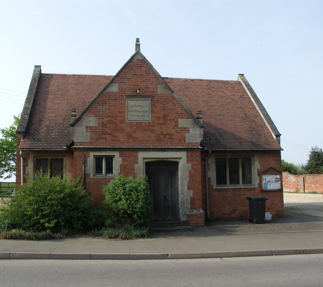
1045:== Summary == {{Information |Description=Theddingworth Village Hall. |Source=From ; transferd by
91:
725:"}},"text\/plain":{"en":{"P7384":"415037"}}}}": -->
201:
1324:
798:
783:
563:
384:
185:
8:
1360:
328:
312:
262:
1433:
353:
78:
478:
1164:
1396:
1342:
1181:
1063:
1443:
1406:
1221:
158:
143:
139:
1370:
1174:
1046:
947:
879:
833:
742:
674:
630:
539:
333:
1201:
345:
1453:
1191:
995:
Click on a date/time to view the file as it appeared at that time.
298:
248:
233:
52° 27′ 49.83″ N, 1° 01′ 16.14″ W
147:
1111:
1081:
1121:
1101:
1091:
116:
Theddingworth
Village Hall. - geograph.org.uk - 415037.jpg
52:
Theddingworth_Village_Hall._-_geograph.org.uk_-_415037.jpg
283:
52° 27′ 51″ N, 1° 01′ 17″ W
128:
66:
472:
Add a one-line explanation of what this file represents
1131:
1057:
1072:
993:
176:
Creative
Commons Attribution Share-alike license 2.0
90:
Commons is a freely licensed media file repository.
681:
Creative
Commons Attribution-ShareAlike 2.0 Generic
655:
Creative
Commons Attribution-ShareAlike 2.0 Generic
1365:Flash did not fire, compulsory flash suppression
56:(640 × 568 pixels, file size: 83 KB, MIME type:
441:https://creativecommons.org/licenses/by-sa/2.0
71:
447:Creative Commons Attribution-Share Alike 2.0
365:
164:
124:
113:
715:https:\/\/www.geograph.org.uk\/photo\/415037
508:https:\/\/www.geograph.org.uk\/profile\/9248
154:
134:
14:
927:
859:
407:– to copy, distribute and transmit the work
1074:The following other wikis use this file:
784:https://www.geograph.org.uk/photo/415037
564:https://www.geograph.org.uk/profile/9248
305:View this and other nearby images on:
255:View this and other nearby images on:
208:
102:
352:and is licensed for reuse under the
273:
223:
1059:The following page uses this file:
986:
388:Attribution-Share Alike 2.0 Generic
376:
371:
356:Attribution-ShareAlike 2.0 license.
13:
1142:
477:
471:
362:
339:
103:
49:
1478:
1149:
476:
1212:Date and time of data generation
870:coordinates of the point of view
852:coordinates of the point of view
462:
418:Under the following conditions:
383:This file is licensed under the
375:
370:
364:
332:
311:
297:
289:
261:
247:
239:
70:
31:
21:
1156:KONICA MINOLTA DIGITAL CAMERA
1040:File Upload Bot (Magnus Manske)
459:
46:No higher resolution available.
1069:
990:
749:file available on the internet
699:file available on the internet
458:
340:This image was taken from the
26:
1:
938:coordinates of depicted place
920:coordinates of depicted place
214:Richard Williams /
195:Richard Williams /
36:
1054:
885:52°27'49.828"N, 1°1'16.140"W
769:Geograph Britain and Ireland
707:Geograph Britain and Ireland
585:object of statement has role
516:object of statement has role
484:Items portrayed in this file
324:
288:
238:
7:
1300:Date and time of digitizing
1139:
1108:Usage on lld.wikipedia.org
1078:Usage on ceb.wikipedia.org
216:Theddingworth Village Hall.
197:Theddingworth Village Hall.
120:Theddingworth Village Hall.
10:
1483:
1417:Focal length in 35 mm film
1128:Usage on www.wikidata.org
1118:Usage on pl.wikipedia.org
1098:Usage on fr.wikipedia.org
1088:Usage on cy.wikipedia.org
953:52°27'50.98"N, 1°1'17.04"W
432:same or compatible license
110:
105:
1265:File change date and time
987:
16:
792:geograph.org.uk image ID
719:geograph.org.uk image ID
461:
398:
77:This is a file from the
41:
1380:Custom image processing
1044:
1023:02:26, 30 November 2009
186:required by the license
127:
81:. Information from its
1463:Subject distance range
1308:Image compression mode
346:this photograph's page
317:52.464160; -1.021400
267:52.463841; -1.021150
84:description page there
1334:Maximum land aperture
1239:Horizontal resolution
1303:16:08, 27 April 2007
1268:16:08, 27 April 2007
1215:16:08, 27 April 2007
148:geograph_org2commons
1273:Y and C positioning
1259:DiMAGE A200 Ver1.01
1247:Vertical resolution
1161:Camera manufacturer
413:– to adapt the work
1425:Scene capture type
1401:Auto white balance
572:author name string
512:author name string
1470:
1469:
1186:1/200 sec (0.005)
1070:Global file usage
1052:
929:
861:
665:copyright license
651:copyright license
470:
361:
360:
344:collection. See
322:
321:
272:
271:
221:
220:
189:
173:
170:Reusing this file
142:; transferred by
99:
98:
79:Wikimedia Commons
32:Global file usage
1474:
1281:Exposure Program
1150:
1035:
997:
975:
974:
969:
907:
906:
901:
801:
796:
786:
781:
777:described at URL
771:
766:
711:described at URL
621:copyright status
607:copyright status
594:
589:
579:
578:Richard Williams
576:
566:
561:
468:
454:
451:
448:
445:
442:
434:as the original.
396:
395:Richard Williams
385:Creative Commons
379:
378:
374:
373:
368:
367:
354:Creative Commons
350:Richard Williams
342:Geograph project
336:
329:
318:
315:
301:
300:
294:
293:
292:
286:
285:
274:
268:
265:
251:
250:
244:
243:
242:
236:
235:
224:
183:
167:
159:Richard Williams
130:
117:
111:
95:
74:
73:
67:
61:
59:
1482:
1481:
1477:
1476:
1475:
1473:
1472:
1471:
1337:3 APEX (f/2.83)
1316:APEX brightness
1138:
1068:
1053:
1041:
1033:
989:
988:
985:
984:
983:
982:
981:
980:
979:
978:
977:
976:
972:
970:
967:
958:
957:
956:
954:
944:
943:
942:
940:
917:
916:
915:
914:
913:
912:
911:
910:
909:
908:
904:
902:
899:
890:
889:
888:
886:
876:
875:
874:
872:
849:
848:
847:
846:
845:
844:
843:
842:
840:
830:
829:
828:
826:
811:
810:
809:
808:
807:
806:
805:
804:
803:
802:
797:
794:
788:
787:
782:
779:
773:
772:
767:
764:
755:
754:
753:
751:
739:
738:
737:
735:
692:
691:
690:
689:
688:
687:
686:
685:
683:
671:
670:
669:
667:
648:
647:
646:
645:
644:
643:
642:
641:
639:
627:
626:
625:
623:
604:
603:
602:
601:
600:
599:
598:
597:
596:
595:
590:
587:
581:
580:
577:
574:
568:
567:
562:
559:
550:
549:
548:
546:
536:
535:
534:
532:
497:
496:
495:
494:
493:
491:
475:
474:
473:
456:
455:
452:
449:
446:
443:
440:
439:
397:
394:
391:
380:
357:
327:
316:
290:
281:
280:
277:Object location
266:
240:
231:
230:
227:Camera location
222:
211:
204:
192:
140:geograph.org.uk
115:
108:
101:
100:
89:
88:
87:is shown below.
63:
57:
55:
48:
47:
12:
11:
5:
1480:
1468:
1467:
1464:
1460:
1459:
1456:
1450:
1449:
1446:
1440:
1439:
1436:
1430:
1429:
1426:
1422:
1421:
1418:
1414:
1413:
1410:
1403:
1402:
1399:
1393:
1392:
1389:
1385:
1384:
1383:Normal process
1381:
1377:
1376:
1373:
1367:
1366:
1363:
1357:
1356:
1353:
1349:
1348:
1345:
1339:
1338:
1335:
1331:
1330:
1327:
1321:
1320:
1317:
1313:
1312:
1309:
1305:
1304:
1301:
1297:
1296:
1293:
1286:
1285:
1284:Normal program
1282:
1278:
1277:
1274:
1270:
1269:
1266:
1262:
1261:
1256:
1252:
1251:
1248:
1244:
1243:
1240:
1236:
1235:
1232:
1228:
1227:
1224:
1217:
1216:
1213:
1209:
1208:
1205:
1198:
1197:
1194:
1188:
1187:
1184:
1178:
1177:
1172:
1168:
1167:
1165:KONICA MINOLTA
1162:
1158:
1157:
1154:
1141:
1137:
1136:
1135:
1134:
1126:
1125:
1124:
1116:
1115:
1114:
1106:
1105:
1104:
1096:
1095:
1094:
1086:
1085:
1084:
1071:
1067:
1066:
1056:
1051:
1050:
1043:
1039:
1036:
1030:
1025:
1020:
1016:
1015:
1012:
1009:
1006:
1003:
1000:
992:
963:
962:
961:
960:
959:
955:
952:
950:
949:
948:
946:
945:
941:
936:
934:
933:
932:
931:
925:
921:
895:
894:
893:
892:
891:
887:
884:
882:
881:
880:
878:
877:
873:
868:
866:
865:
864:
863:
857:
853:
841:
838:
836:
835:
834:
832:
831:
827:
822:
820:
819:
818:
817:
815:
790:
789:
775:
774:
760:
759:
758:
757:
756:
752:
747:
745:
744:
743:
741:
740:
736:
733:source of file
731:
729:
728:
727:
726:
724:
720:
716:
712:
708:
704:
700:
696:
695:source of file
684:
679:
677:
676:
675:
673:
672:
668:
663:
661:
660:
659:
658:
656:
652:
640:
635:
633:
632:
631:
629:
628:
624:
619:
617:
616:
615:
614:
612:
608:
583:
582:
570:
569:
555:
554:
553:
552:
551:
547:
544:
542:
541:
540:
538:
537:
533:
528:
526:
525:
524:
523:
521:
517:
513:
509:
505:
501:
492:
487:
485:
482:
481:
480:
479:
467:
466:
463:
460:
438:
437:
436:
435:
425:
416:
415:
414:
408:
401:You are free:
392:
382:
381:
363:
359:
358:
337:
326:
323:
320:
319:
309:
303:
278:
270:
269:
259:
253:
228:
219:
218:
212:
209:
206:
205:
200:
193:
190:
178:
177:
174:
162:
161:
156:
152:
151:
136:
132:
131:
126:
122:
121:
118:
109:
107:
104:
97:
96:
75:
65:
64:
45:
40:
39:
34:
29:
24:
19:
9:
6:
4:
3:
2:
1479:
1465:
1462:
1461:
1457:
1455:
1452:
1451:
1447:
1445:
1442:
1441:
1437:
1435:
1432:
1431:
1427:
1424:
1423:
1419:
1416:
1415:
1411:
1408:
1405:
1404:
1400:
1398:
1397:White balance
1395:
1394:
1391:Auto exposure
1390:
1388:Exposure mode
1387:
1386:
1382:
1379:
1378:
1374:
1372:
1369:
1368:
1364:
1362:
1359:
1358:
1354:
1351:
1350:
1346:
1344:
1343:Metering mode
1341:
1340:
1336:
1333:
1332:
1328:
1326:
1325:Exposure bias
1323:
1322:
1318:
1315:
1314:
1310:
1307:
1306:
1302:
1299:
1298:
1294:
1291:
1288:
1287:
1283:
1280:
1279:
1275:
1272:
1271:
1267:
1264:
1263:
1260:
1257:
1255:Software used
1254:
1253:
1249:
1246:
1245:
1241:
1238:
1237:
1233:
1230:
1229:
1225:
1223:
1219:
1218:
1214:
1211:
1210:
1206:
1203:
1200:
1199:
1195:
1193:
1190:
1189:
1185:
1183:
1182:Exposure time
1180:
1179:
1176:
1173:
1170:
1169:
1166:
1163:
1160:
1159:
1155:
1152:
1151:
1148:
1145:
1133:
1130:
1129:
1127:
1123:
1122:Theddingworth
1120:
1119:
1117:
1113:
1112:Theddingworth
1110:
1109:
1107:
1103:
1102:Theddingworth
1100:
1099:
1097:
1093:
1092:Theddingworth
1090:
1089:
1087:
1083:
1082:Theddingworth
1080:
1079:
1077:
1076:
1075:
1065:
1064:Theddingworth
1062:
1061:
1060:
1048:
1042:
1037:
1031:
1029:
1026:
1024:
1021:
1018:
1017:
1013:
1010:
1007:
1004:
1001:
999:
998:
996:
966:
951:
939:
935:
898:
883:
871:
867:
839:27 April 2007
837:
825:
821:
800:
793:
785:
778:
770:
763:
750:
746:
734:
730:
682:
678:
666:
662:
638:
634:
622:
618:
593:
586:
573:
565:
558:
543:
531:
527:
490:
486:
483:
464:
457:
444:CC BY-SA 2.0
433:
429:
426:
423:
420:
419:
417:
412:
409:
406:
403:
402:
400:
399:
393:Attribution:
389:
386:
369:
355:
351:
347:
343:
338:
335:
331:
330:
314:
310:
308:
307:OpenStreetMap
304:
302:
284:
279:
276:
275:
264:
260:
258:
257:OpenStreetMap
254:
252:
234:
229:
226:
225:
217:
213:
207:
203:
199: /
198:
194:
187:
182:
180:
179:
175:
171:
166:
163:
160:
157:
153:
149:
145:
141:
137:
133:
129:27 April 2007
123:
119:
112:
93:
86:
85:
80:
76:
69:
68:
62:
53:
44:
38:
35:
33:
30:
28:
25:
23:
20:
18:
15:
1466:Distant view
1407:Digital zoom
1352:Light source
1222:focal length
1171:Camera model
1146:
1143:
1073:
1058:
994:
991:File history
592:photographer
520:photographer
427:
421:
410:
404:
349:
287:
237:
215:
202:CC BY-SA 2.0
196:
92:You can help
82:
50:
22:File history
1371:Color space
1231:Orientation
1175:DiMAGE A200
1153:Image title
1047:User:oxyman
637:copyrighted
611:copyrighted
428:share alike
422:attribution
181:Attribution
144:User:oxyman
114:Description
1444:Saturation
1055:File usage
1032:640 × 568
1008:Dimensions
545:some value
165:Permission
58:image/jpeg
27:File usage
1454:Sharpness
1202:ISO speed
1005:Thumbnail
1002:Date/Time
824:inception
814:inception
325:Licensing
210:InfoField
191:InfoField
1434:Contrast
1428:Standard
1276:Co-sited
1192:F-number
1140:Metadata
1132:Q7777674
1049:using .
762:operator
703:operator
465:Captions
411:to remix
405:to share
390:license.
37:Metadata
1355:Unknown
1347:Pattern
1292:version
1034:(83 KB)
1019:current
1014:Comment
965:heading
924:heading
897:heading
856:heading
530:creator
500:creator
489:depicts
469:English
106:Summary
54:
1458:Normal
1448:Normal
1438:Normal
1250:72 dpi
1242:72 dpi
1234:Normal
1226:7.2 mm
1204:rating
973:degree
928:degree
905:degree
860:degree
799:415037
723:415037
295:
245:
155:Author
146:using
135:Source
1420:28 mm
1409:ratio
1361:Flash
1220:Lens
138:From
1375:sRGB
1295:2.21
1290:Exif
1011:User
971:315
903:315
453:true
450:true
125:Date
17:File
1319:8.2
1196:f/5
557:URL
504:URL
1207:50
968::
900::
795::
780::
765::
588::
575::
560::
1412:0
1329:0
1311:4
188:)
184:(
172:)
168:(
150:.
94:.
60:)
Text is available under the Creative Commons Attribution-ShareAlike License. Additional terms may apply.
_region:GB-GBN_heading:315.00&language=en)
