493:"}},"text\/plain":{"en":{"":"inception"}}},"{\"value\":{\"time\":\"+2010-09-26T00:00:00Z\",\"timezone\":0,\"before\":0,\"after\":0,\"precision\":11,\"calendarmodel\":\"http:\\\/\\\/www.wikidata.org\\\/entity\\\/Q1985727\"},\"type\":\"time\"}":{"text\/html":{"en":{"P571":"26 September 2010"}},"text\/plain":{"en":{"P571":"26 September 2010"}}}}": -->
38:
253:
259:
264:
94:
449:"}},"text\/plain":{"en":{"":"copyright license"}}},"{\"value\":{\"entity-type\":\"item\",\"numeric-id\":14946043,\"id\":\"Q14946043\"},\"type\":\"wikibase-entityid\"}":{"text\/html":{"en":{"P275":"
405:"}},"text\/plain":{"en":{"":"copyright status"}}},"{\"value\":{\"entity-type\":\"item\",\"numeric-id\":50423863,\"id\":\"Q50423863\"},\"type\":\"wikibase-entityid\"}":{"text\/html":{"en":{"P6216":"
401:
311:– You must give appropriate credit, provide a link to the license, and indicate if changes were made. You may do so in any reasonable manner, but not in any way that suggests the licensor endorses you or your use.
590:, UK with the following information shown: *Administrative borders *Coastline, lakes and rivers *Roads and railways *Urban areas Equirectangular map projection on WGS 84 datum, with N/S stretche
450:
406:
402:
490:
446:
679:
952:
779:
453:"}},"text\/plain":{"en":{"P275":"Creative Commons Attribution-ShareAlike 3.0 Unported"}}}}": -->
68:
64:
60:
56:
52:
48:
42:
799:
242:
789:
784:
105:
77:
476:
432:
794:
689:
942:
213:
318:
937:
867:
754:
416:
500:
460:
391:
684:
619:
274:
709:
694:
317:– If you remix, transform, or build upon the material, you must distribute your contributions under the
664:
1077:
409:"}},"text\/plain":{"en":{"P6216":"copyrighted"}}}}": -->
1087:
629:
351:
199:
1017:
113:
892:
817:
1117:
1072:
568:
563:
37:
1042:
872:
624:
271:
8:
749:
1102:
1062:
1037:
654:
649:
614:
217:
902:
100:
381:
1097:
1057:
674:
639:
196:
847:
230:
1142:
1127:
932:
579:
857:
774:
669:
634:
510:
470:
426:
1007:
982:
659:
1137:
1002:
987:
159:
Equirectangular map projection on WGS 84 datum, with N/S stretched 160%
739:
734:
724:
704:
699:
604:
769:
764:
744:
609:
206:
Administrative borders and coastline data from
Boundary-Line product.
868:
Wikiproyecto:Ilustración/Taller de
Cartografía/Realizaciones/Europa
536:
Click on a date/time to view the file as it appeared at that time.
139:
282:
Contains
Ordnance Survey data © Crown copyright and database right
759:
729:
714:
644:
587:
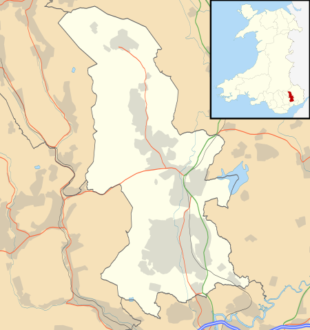
719:
82:(SVG file, nominally 1,187 × 1,266 pixels, file size: 496 KB)
1047:
185:
88:
827:
992:
680:
List of Sites of
Special Scientific Interest in Torfaen
375:
Add a one-line explanation of what this file represents
1112:
1027:
977:
972:
922:
877:
837:
598:
967:
962:
912:
882:
808:
534:
477:
Creative
Commons Attribution-ShareAlike 3.0 Unported
451:
Creative
Commons Attribution-ShareAlike 3.0 Unported
112:
Commons is a freely licensed media file repository.
209:All other geographic data from Meridian 2 product.
780:User:Robevans123/sandbox/All Saints, Llanfrechfa
1018:Format:Harta de localizare Țara Galilor Torfaen
1078:Modül:Konum haritası/veri/Galler Torfaen/belge
328:https://creativecommons.org/licenses/by-sa/3.0
93:
334:Creative Commons Attribution-Share Alike 3.0
252:
237:
181:
130:
347:
226:
191:
14:
294:– to copy, distribute and transmit the work
142:, UK with the following information shown:
41:Size of this PNG preview of this SVG file:
1103:Module:Location map/data/Wales Torfaen/doc
1063:Module:Location map/data/Wales Torfaen/doc
1043:Module:Location map/data/Wales Torfaen/doc
800:Module:Location map/data/Wales Torfaen/doc
943:モジュール:Location map/data/Wales Torfaen/doc
873:Plantilla:Mapa de localización de Torfaen
810:The following other wikis use this file:
790:User:Robevans123/sandbox/Henllys, Torfaen
1073:Modül:Konum haritası/veri/Galler Torfaen
785:User:Robevans123/sandbox/Cwmbran Central
586:{{Information |Description=Blank map of
1098:Module:Location map/data/Wales Torfaen
1058:Module:Location map/data/Wales Torfaen
1038:Module:Location map/data/Wales Torfaen
795:Module:Location map/data/Wales Torfaen
690:List of scheduled monuments in Torfaen
600:The following 40 pages use this file:
938:モジュール:Location map/data/Wales Torfaen
214:File: United Kingdom location map.svg
124:
953:ಟೆಂಪ್ಲೇಟು:Location map Wales Torfaen
848:Plantilya:Location map Wales Torfaen
755:St Michael's Church, Llantarnam
275:Attribution-Share Alike 3.0 Unported
233:, created using Ordnance Survey data
1143:Template:Location map Wales Torfaen
933:Template:Location map Wales Torfaen
527:
263:
258:
13:
1128:Batakan:Location map Wales Torfaen
1118:Bản mẫu:Location map Wales Torfaen
380:
374:
249:
125:
75:
1156:
379:
858:Nodyn:Location map Wales Torfaen
685:List of monastic houses in Wales
365:
305:Under the following conditions:
270:This file is licensed under the
262:
257:
251:
92:
31:
21:
893:الگو:Location map Wales Torfaen
818:قالب:Location map Wales Torfaen
362:
1034:Usage on simple.wikipedia.org
903:Modèle:Géolocalisation/Torfaen
805:
620:Blaenavon Industrial Landscape
531:
361:
26:
1:
710:Municipal Offices, Blaenavon
595:
387:Items portrayed in this file
7:
1124:Usage on war.wikipedia.org
844:Usage on ceb.wikipedia.org
824:Usage on bar.wikipedia.org
695:Llanfrechfa Grange Hospital
149:Coastline, lakes and rivers
133:Torfaen UK location map.svg
10:
1161:
1134:Usage on zh.wikipedia.org
1109:Usage on vi.wikipedia.org
1094:Usage on uz.wikipedia.org
1084:Usage on uk.wikipedia.org
1069:Usage on tr.wikipedia.org
1054:Usage on si.wikipedia.org
1024:Usage on sh.wikipedia.org
1014:Usage on ro.wikipedia.org
999:Usage on pl.wikibooks.org
959:Usage on pl.wikipedia.org
949:Usage on kn.wikipedia.org
929:Usage on ja.wikipedia.org
919:Usage on hr.wikipedia.org
909:Usage on gv.wikipedia.org
899:Usage on fr.wikipedia.org
889:Usage on fa.wikipedia.org
864:Usage on es.wikipedia.org
854:Usage on cy.wikipedia.org
834:Usage on br.wikipedia.org
814:Usage on ar.wikipedia.org
665:Grange University Hospital
319:same or compatible license
127:
528:
16:
630:County Hospital, Torfaen
564:19:45, 26 September 2010
364:
285:
99:This is a file from the
36:
1008:Moduł:Mapa/dane/Torfaen
983:Moduł:Mapa/dane/Torfaen
585:
352:File:Torfaen UK map.svg
184:
103:. Information from its
1003:Moduł:Mapa/dane/GB-TOF
988:Moduł:Mapa/dane/GB-TOF
146:Administrative borders
106:description page there
625:County Hall, Cwmbran
69:1,187 × 1,266 pixels
65:1,920 × 2,048 pixels
750:Pontypool Town Hall
300:– to adapt the work
212:Inset derived from
162:Geographic limits:
47:Other resolutions:
655:Forge Row, Cwmavon
650:Fairwater, Torfaen
615:Blaenavon Hospital
152:Roads and railways
61:960 × 1,024 pixels
806:Global file usage
593:
516:26 September 2010
461:copyright license
447:copyright license
373:
358:
357:
246:
243:Reusing this file
186:26 September 2010
121:
120:
101:Wikimedia Commons
32:Global file usage
1152:
675:Henllys, Torfaen
640:Cwmavon, Torfaen
576:
538:
417:copyright status
403:copyright status
371:
341:
338:
335:
332:
329:
321:as the original.
283:
272:Creative Commons
266:
265:
261:
260:
255:
254:
240:
187:
134:
128:
117:
96:
95:
89:
83:
72:
57:720 × 768 pixels
53:450 × 480 pixels
49:225 × 240 pixels
43:562 × 599 pixels
1160:
1159:
1155:
1154:
1153:
1151:
1150:
1149:
804:
594:
582:
574:
530:
529:
526:
525:
524:
523:
522:
521:
520:
519:
517:
507:
506:
505:
503:
488:
487:
486:
485:
484:
483:
482:
481:
479:
467:
466:
465:
463:
444:
443:
442:
441:
440:
439:
438:
437:
435:
423:
422:
421:
419:
400:
399:
398:
397:
396:
394:
378:
377:
376:
359:
343:
342:
339:
336:
333:
330:
327:
326:
284:
281:
278:
267:
197:Ordnance Survey
132:
123:
122:
111:
110:
109:is shown below.
85:
81:
74:
73:
46:
12:
11:
5:
1158:
1148:
1147:
1146:
1145:
1140:
1132:
1131:
1130:
1122:
1121:
1120:
1115:
1107:
1106:
1105:
1100:
1092:
1091:
1090:
1082:
1081:
1080:
1075:
1067:
1066:
1065:
1060:
1052:
1051:
1050:
1045:
1040:
1032:
1031:
1030:
1022:
1021:
1020:
1012:
1011:
1010:
1005:
997:
996:
995:
990:
985:
980:
975:
970:
965:
957:
956:
955:
947:
946:
945:
940:
935:
927:
926:
925:
917:
916:
915:
907:
906:
905:
897:
896:
895:
887:
886:
885:
880:
875:
870:
862:
861:
860:
852:
851:
850:
842:
841:
840:
832:
831:
830:
822:
821:
820:
807:
803:
802:
797:
792:
787:
782:
777:
772:
767:
762:
757:
752:
747:
742:
737:
732:
727:
722:
717:
712:
707:
702:
697:
692:
687:
682:
677:
672:
667:
662:
657:
652:
647:
642:
637:
632:
627:
622:
617:
612:
607:
597:
592:
591:
584:
580:
577:
573:1,187 × 1,266
571:
566:
561:
557:
556:
553:
550:
547:
544:
541:
533:
518:
515:
513:
512:
511:
509:
508:
504:
499:
497:
496:
495:
494:
492:
480:
475:
473:
472:
471:
469:
468:
464:
459:
457:
456:
455:
454:
452:
448:
436:
431:
429:
428:
427:
425:
424:
420:
415:
413:
412:
411:
410:
408:
404:
395:
390:
388:
385:
384:
383:
382:
370:
369:
366:
363:
356:
355:
349:
348:Other versions
345:
344:
325:
324:
323:
322:
312:
303:
302:
301:
295:
288:You are free:
279:
269:
268:
250:
247:
235:
234:
228:
224:
223:
222:
221:
210:
207:
193:
189:
188:
183:
179:
178:
177:
176:
173:
170:
167:
157:
156:
153:
150:
147:
135:
126:
119:
118:
97:
87:
86:
40:
35:
34:
29:
24:
19:
9:
6:
4:
3:
2:
1157:
1144:
1141:
1139:
1136:
1135:
1133:
1129:
1126:
1125:
1123:
1119:
1116:
1114:
1111:
1110:
1108:
1104:
1101:
1099:
1096:
1095:
1093:
1089:
1086:
1085:
1083:
1079:
1076:
1074:
1071:
1070:
1068:
1064:
1061:
1059:
1056:
1055:
1053:
1049:
1046:
1044:
1041:
1039:
1036:
1035:
1033:
1029:
1026:
1025:
1023:
1019:
1016:
1015:
1013:
1009:
1006:
1004:
1001:
1000:
998:
994:
991:
989:
986:
984:
981:
979:
976:
974:
971:
969:
966:
964:
961:
960:
958:
954:
951:
950:
948:
944:
941:
939:
936:
934:
931:
930:
928:
924:
921:
920:
918:
914:
911:
910:
908:
904:
901:
900:
898:
894:
891:
890:
888:
884:
881:
879:
876:
874:
871:
869:
866:
865:
863:
859:
856:
855:
853:
849:
846:
845:
843:
839:
836:
835:
833:
829:
826:
825:
823:
819:
816:
815:
813:
812:
811:
801:
798:
796:
793:
791:
788:
786:
783:
781:
778:
776:
775:Upper Cwmbran
773:
771:
768:
766:
763:
761:
758:
756:
753:
751:
748:
746:
743:
741:
738:
736:
733:
731:
728:
726:
723:
721:
718:
716:
713:
711:
708:
706:
703:
701:
698:
696:
693:
691:
688:
686:
683:
681:
678:
676:
673:
671:
670:Griffithstown
668:
666:
663:
661:
658:
656:
653:
651:
648:
646:
643:
641:
638:
636:
635:Croesyceiliog
633:
631:
628:
626:
623:
621:
618:
616:
613:
611:
608:
606:
603:
602:
601:
589:
583:
578:
572:
570:
567:
565:
562:
559:
558:
554:
551:
548:
545:
542:
540:
539:
537:
514:
502:
498:
478:
474:
462:
458:
434:
430:
418:
414:
393:
389:
386:
367:
360:
353:
350:
346:
331:CC BY-SA 3.0
320:
316:
313:
310:
307:
306:
304:
299:
296:
293:
290:
289:
287:
286:
280:Attribution:
276:
273:
256:
248:
244:
239:
236:
232:
229:
225:
219:
215:
211:
208:
205:
204:
203:
201:
198:
194:
190:
180:
175:South: 51.60N
174:
172:North: 51.80N
171:
168:
165:
164:
163:
160:
154:
151:
148:
145:
144:
143:
141:
138:Blank map of
136:
129:
115:
108:
107:
102:
98:
91:
90:
84:
79:
78:Original file
70:
66:
62:
58:
54:
50:
44:
39:
33:
30:
28:
25:
23:
20:
18:
15:
809:
599:
535:
532:File history
314:
308:
297:
291:
218:NordNordWest
195:
161:
158:
137:
114:You can help
104:
76:
22:File history
660:Garn-yr-erw
433:copyrighted
407:copyrighted
354:- Blank map
315:share alike
309:attribution
169:East: 2.90W
166:West: 3.20W
155:Urban areas
131:Description
993:Abersychan
828:Abersychan
740:Pontymoile
735:Pontnewydd
725:Pen Tranch
705:Llanyrafon
700:Llantarnam
605:Abersychan
596:File usage
549:Dimensions
238:Permission
27:File usage
1113:Blaenavon
1088:Блайневон
1048:Blaenavon
1028:Blaenavon
978:Blaenavon
973:Pontypool
923:Blaenavon
878:Pontypool
838:Fairwater
770:Two Locks
765:Trevethin
745:Pontypool
610:Blaenavon
581:Nilfanion
546:Thumbnail
543:Date/Time
501:inception
491:inception
231:Nilfanion
575:(496 KB)
368:Captions
298:to remix
292:to share
277:license.
200:OpenData
968:Cwmbran
963:Torfaen
913:Torfaen
883:Cwmbran
760:Torfaen
730:Ponthir
715:New Inn
645:Cwmbran
588:Torfaen
560:current
555:Comment
392:depicts
372:English
140:Torfaen
80:
720:Panteg
227:Author
192:Source
552:User
340:true
337:true
182:Date
17:File
1138:龐蒂浦
216:by
202:.
67:|
63:|
59:|
55:|
51:|
45:.
245:)
241:(
220:.
116:.
71:.
