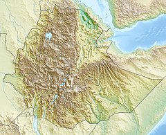
33:
40:
233:. The Kessem River passes an altitude drop from more than 2,000 m on a flow length of ca.130 km. The steep gradient of the river profile is the reason for its turbulent flow regime, which is also reflected in its name. The lowlands of the upper Germama was the location of the former
252:
began construction of a dam on the
Germama in 2005, which would help irrigate areas along both sides of the river, and in the Dofen and Kebena Mountains. In December 2008, a spokesman for the Ministry announced that the project was 98% complete.
282:
Knoche, Malte; Fischer, Christian; Pohl, Eric; Krause, Peter; Merz, Ralf (2014). "Combined uncertainty of hydrological model complexity and satellite-based forcing data evaluated in two data-scarce semi-arid catchments in
Ethiopia".
249:
329:
226:
579:
376:
242:
510:
157:
32:
572:
317:
269:
369:
92:
608:
565:
598:
362:
397:
385:
229:, flowing east to the Awash, its course delineating a few kilometers of the northern boundary of the
341:
332:, Ethiopian Ministry of Water Resources website, published 19 June 2007 (accessed 14 July 2009)
345:
603:
490:
292:
8:
230:
296:
553:
450:
300:
215:
304:
238:
495:
221:
The
Germama is not a navigable stream, and flows with a great volume during the
549:
592:
525:
512:
445:
440:
410:
354:
172:
159:
107:
94:
420:
241:; the lower course defines the northern boundary of the Shewan district of
222:
485:
480:
475:
470:
465:
415:
405:
203:
143:
138:
460:
435:
425:
430:
389:
207:
61:
320:(pdf) The Nordic Africa Institute website (accessed 22 April 2022)
272:(pdf) The Nordic Africa Institute website (accessed 22 April 2022)
342:"5b Brr. Kesem, Tendaho projects nearing completion: Ministry"
234:
218:
word which means "frolicking", "boisterous", or "frisky".
281:
548:This article related to a river in Ethiopia is a
590:
384:
573:
370:
580:
566:
377:
363:
270:"Local History in Ethiopia, Gena-Gerwane"
318:"Local History in Ethiopia, Bua-Buotaro"
591:
358:
39:
543:
13:
14:
620:
38:
31:
330:"Kesem Tendaho Narrated Report"
202:) River, is a tributary of the
335:
323:
311:
275:
263:
151: • coordinates
86: • coordinates
1:
305:10.1016/j.jhydrol.2014.10.003
68:Physical characteristics
552:. You can help Knowledge by
129:1,989 m (6,526 ft)
125: • elevation
7:
250:Ministry of Water Resources
10:
625:
542:
396:
149:
137:
133:
123:
84:
76:
72:
67:
57:
52:
26:
21:
348:(accessed 29 April 2009)
256:
346:Ethiopian News Agency
609:Ethiopia river stubs
285:Journal of Hydrology
522: /
297:2014JHyd..519.2049K
231:Awash National Park
225:. It rises west of
169: /
104: /
599:Rivers of Ethiopia
526:9.2250°N 40.0969°E
108:9.1104°N 39.1969°E
561:
560:
504:
503:
188:
187:
173:9.2229°N 40.144°E
616:
582:
575:
568:
544:
537:
536:
534:
533:
532:
527:
523:
520:
519:
518:
515:
379:
372:
365:
356:
355:
349:
339:
333:
327:
321:
315:
309:
308:
279:
273:
267:
184:
183:
181:
180:
179:
174:
170:
167:
166:
165:
162:
126:
119:
118:
116:
115:
114:
109:
105:
102:
101:
100:
97:
87:
42:
41:
35:
19:
18:
624:
623:
619:
618:
617:
615:
614:
613:
589:
588:
587:
586:
540:
531:9.2250; 40.0969
530:
528:
524:
521:
516:
513:
511:
509:
508:
507:
505:
500:
392:
383:
353:
352:
340:
336:
328:
324:
316:
312:
280:
276:
268:
264:
259:
214:comes from the
177:
175:
171:
168:
163:
160:
158:
156:
155:
152:
124:
113:9.1104; 39.1969
112:
110:
106:
103:
98:
95:
93:
91:
90:
85:
48:
47:
46:
45:
44:
43:
17:
12:
11:
5:
622:
612:
611:
606:
601:
585:
584:
577:
570:
562:
559:
558:
502:
501:
499:
498:
493:
488:
483:
478:
473:
468:
463:
458:
453:
448:
443:
438:
433:
428:
423:
418:
413:
408:
402:
400:
394:
393:
386:Largest rivers
382:
381:
374:
367:
359:
351:
350:
334:
322:
310:
274:
261:
260:
258:
255:
248:The Ethiopian
186:
185:
178:9.2229; 40.144
153:
150:
147:
146:
141:
135:
134:
131:
130:
127:
121:
120:
88:
82:
81:
78:
74:
73:
70:
69:
65:
64:
59:
55:
54:
50:
49:
37:
36:
30:
29:
28:
27:
24:
23:
15:
9:
6:
4:
3:
2:
621:
610:
607:
605:
602:
600:
597:
596:
594:
583:
578:
576:
571:
569:
564:
563:
557:
555:
551:
546:
545:
541:
538:
535:
497:
494:
492:
489:
487:
484:
482:
479:
477:
474:
472:
469:
467:
464:
462:
459:
457:
454:
452:
449:
447:
444:
442:
439:
437:
434:
432:
429:
427:
424:
422:
419:
417:
414:
412:
409:
407:
404:
403:
401:
399:
395:
391:
387:
380:
375:
373:
368:
366:
361:
360:
357:
347:
343:
338:
331:
326:
319:
314:
306:
302:
298:
294:
291:: 2049–2066.
290:
286:
278:
271:
266:
262:
254:
251:
246:
244:
240:
236:
232:
228:
227:Kese Koremash
224:
219:
217:
213:
209:
205:
201:
197:
193:
182:
154:
148:
145:
142:
140:
136:
132:
128:
122:
117:
89:
83:
79:
75:
71:
66:
63:
60:
56:
51:
34:
25:
22:Germama River
20:
554:expanding it
547:
539:
506:
455:
451:Ganale Dorya
337:
325:
313:
288:
284:
277:
265:
247:
237:district of
223:rainy season
220:
211:
199:
195:
191:
189:
604:Awash River
529: /
210:. The name
204:Awash River
176: /
144:Awash River
111: /
593:Categories
517:40°05′49″E
164:40°08′38″E
99:39°11′49″E
514:9°13′30″N
431:Blue Nile
161:9°13′22″N
96:9°06′37″N
390:Ethiopia
208:Ethiopia
62:Ethiopia
53:Location
456:Germama
446:Galetti
441:Didessa
411:Atbarah
293:Bibcode
216:Amharic
212:Germama
192:Germama
58:Country
496:Tekezé
421:Ayesha
398:Rivers
243:Menjar
235:Shewan
200:Kessem
80:
77:Source
486:Muger
481:Mille
476:Mareb
471:Jamma
466:Guder
416:Awash
406:Akobo
257:Notes
239:Bulga
196:Kesem
139:Mouth
16:River
550:stub
461:Gibe
436:Dawa
426:Baro
194:(or
190:The
491:Omo
388:of
301:doi
289:519
206:in
198:or
595::
344:,
299:.
287:.
245:.
581:e
574:t
567:v
556:.
378:e
371:t
364:v
307:.
303::
295::
Text is available under the Creative Commons Attribution-ShareAlike License. Additional terms may apply.
