47:
575:
54:
284:
lies at the mouth of the river, to the northeast of the village. Several of the village buildings are located on the sandy beach and others are located further inland under the protection of vegetation. Geologically the village lies on a part of Irian Jaya called the
263:
in the world. A reserve has been proposed, known as the Wewe-Koor Nature
Reserve, which would protect this stretch of the coastline. Along with the proposed Jamursba-Medi and Sausapor reserves the three reserves combined would protect 85 km of the coastline.
410:
277:
46:
414:
505:
The geology and tectonics of
Eastern Indonesia: proceedings of the CCOP-IOC SEATAR Working Group Meeting, Bandung, Indonesia, 9–14 July 1979
635:
286:
273:
81:
616:
645:
640:
528:
507:. Journal of structural geology, Volume 2 of Pergamon International Library of Science, Technology, Engin, Pergamon Press.
436:
512:
471:
367:
463:
Perspectives on the Bird's Head of Irian, Jaya, Indonesia: proceedings of the
Conference, Leiden, 13–17 October 1997
461:
609:
145:
602:
236:
In the 1950s, the Koor river basin was explored by the Dutch. The area was affected by a very large
225:
67:
249:
241:
237:
133:
121:
310:
331:
8:
590:
260:
360:
Bird's Head approaches: Irian Jaya studies, a programme for interdisciplinary research
508:
467:
363:
192:
563:
213:
138:
347:. Lembaga Ekonomi dan Kemasyarakatan Nasional, Lembaga Ilmu Pengetahuan Indonesia.
582:
281:
217:
126:
535:
586:
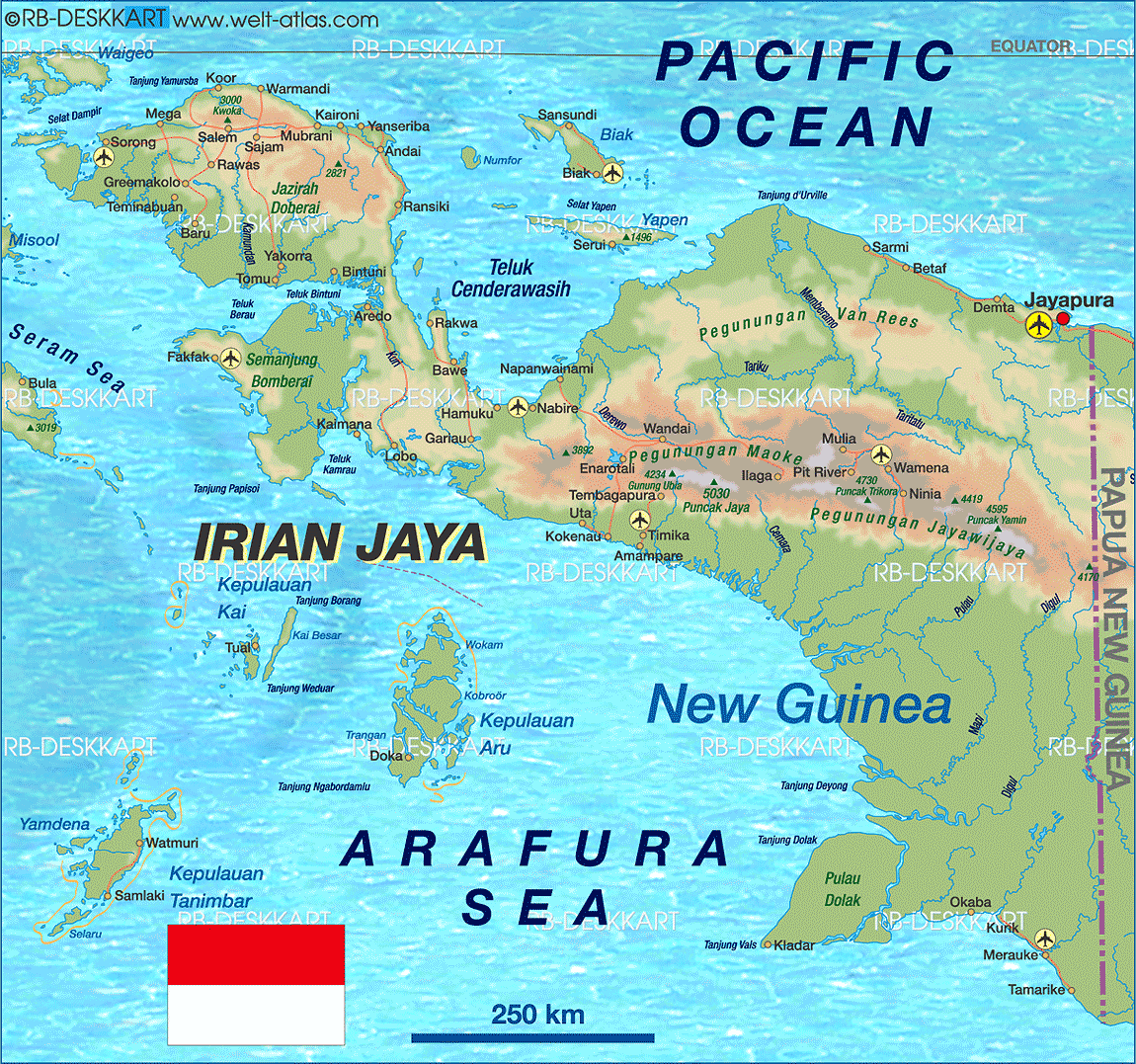
280:, a rugged massif which has a maximum elevation of around 1700 metres. A sand
629:
290:
96:
83:
443:
442:. Departemen Pekeriaan Umum, Papuaweb.org. December 19, 2010. Archived from
574:
488:
459:
383:
255:
Koor and this stretch of coast of northwest Papua are noted for their
256:
221:
183:
411:"West Papua Jamursba-Medi, Sausapor and Wewe-Koor Nature Reserves"
245:
228:. As of 1994 it was reported to have a population of 589 people.
188:
209:
150:
502:
357:
248:
to the east of Koor. The earthquakes prompted a widespread
564:
Photo of a Dutch expedition from 1954 along the Koor River
244:
of 7.6 and 7.4, that had their epicentre near the town of
345:
Maluku dan Irian Jaya Volume 3, Issue 1 of
Buletin LEKNAS
272:
Koor is located on the western side of the mouth of the
460:
Miedema, Jelle; Odé, Cecilia; A. C. Dam, Rien (1998).
342:
627:
259:, possessing one of the largest colonies of the
289:. The villagers speak a language known as the
610:
617:
603:
628:
503:Barber, A.J.; Wiryosujono, S. (1981).
413:. Indonesia Traveling. Archived from
276:. The Koor River flows down from the
18:Village in Southwest Papua, Indonesia
569:
405:
403:
401:
358:Bartstra, Gert-Jan Bartstra (1998).
165:18.14 km (7.00 sq mi)
636:Populated places in Southwest Papua
13:
14:
657:
557:
398:
573:
238:earthquake doublet in early 2009
52:
45:
646:Southwest Papua geography stubs
521:
496:
384:"Major Quake, Papua, Indonesia"
66:Location of the village in the
534:. Papuaweb.org. Archived from
480:
453:
429:
376:
351:
336:
325:
303:
1:
311:"Trengganu Meets Competition"
296:
224:on the northern coast of the
641:Populated places in Tambrauw
589:. You can help Knowledge by
293:, common to this coastline.
267:
53:
7:
386:. Wildland. January 4, 2009
343:Masinambow, E.K.M. (1994).
10:
662:
568:
231:
182:
174:
169:
161:
156:
144:
132:
120:
112:
77:
40:
33:
23:
362:. Taylor & Francis.
466:. Rodopi. p. 729.
252:in the Pacific region.
585:location article is a
449:on September 20, 2014.
437:"Propinsi Irian Jaya"
226:Bird's Head Peninsula
68:Bird's Head Peninsula
278:Tosem-Koor Mountains
417:on October 13, 2010
93: /
261:leatherback turtle
175: • Total
162: • Total
598:
597:
242:moment magnitudes
199:
198:
97:0.383°S 132.333°E
653:
619:
612:
605:
577:
570:
551:
550:
548:
546:
541:on March 1, 2011
540:
533:
525:
519:
518:
500:
494:
493:
484:
478:
477:
457:
451:
450:
448:
441:
433:
427:
426:
424:
422:
407:
396:
395:
393:
391:
380:
374:
373:
355:
349:
348:
340:
334:
329:
323:
322:
320:
318:
307:
240:, with recorded
214:Tambrauw Regency
208:is a village in
108:
107:
105:
104:
103:
98:
94:
91:
90:
89:
86:
56:
55:
49:
21:
20:
661:
660:
656:
655:
654:
652:
651:
650:
626:
625:
624:
623:
583:Southwest Papua
560:
555:
554:
544:
542:
538:
531:
527:
526:
522:
515:
501:
497:
486:
485:
481:
474:
458:
454:
446:
439:
435:
434:
430:
420:
418:
409:
408:
399:
389:
387:
382:
381:
377:
370:
356:
352:
341:
337:
330:
326:
316:
314:
309:
308:
304:
299:
270:
234:
218:Southwest Papua
127:Southwest Papua
102:-0.383; 132.333
101:
99:
95:
92:
87:
84:
82:
80:
79:
73:
72:
71:
70:
64:
63:
62:
61:
57:
36:
29:
26:
19:
12:
11:
5:
659:
649:
648:
643:
638:
622:
621:
614:
607:
599:
596:
595:
578:
567:
566:
559:
558:External links
556:
553:
552:
520:
513:
495:
492:(Map). Google.
479:
472:
452:
428:
397:
375:
368:
350:
335:
324:
301:
300:
298:
295:
269:
266:
233:
230:
197:
196:
186:
180:
179:
176:
172:
171:
167:
166:
163:
159:
158:
154:
153:
148:
142:
141:
136:
130:
129:
124:
118:
117:
114:
110:
109:
75:
74:
65:
59:
58:
51:
50:
44:
43:
42:
41:
38:
37:
34:
31:
30:
27:
24:
17:
9:
6:
4:
3:
2:
658:
647:
644:
642:
639:
637:
634:
633:
631:
620:
615:
613:
608:
606:
601:
600:
594:
592:
588:
584:
579:
576:
572:
571:
565:
562:
561:
537:
530:
524:
516:
514:0-08-028732-8
510:
506:
499:
491:
490:
483:
475:
473:90-420-0644-7
469:
465:
464:
456:
445:
438:
432:
416:
412:
406:
404:
402:
385:
379:
371:
369:90-5410-683-2
365:
361:
354:
346:
339:
333:
328:
312:
306:
302:
294:
292:
291:Abun language
288:
283:
279:
275:
265:
262:
258:
253:
251:
250:tsunami alert
247:
243:
239:
229:
227:
223:
219:
215:
211:
207:
203:
194:
190:
187:
185:
181:
177:
173:
168:
164:
160:
155:
152:
149:
147:
143:
140:
137:
135:
131:
128:
125:
123:
119:
115:
111:
106:
78:Coordinates:
76:
69:
48:
39:
32:
28:Kampung Kwoor
22:
16:
591:expanding it
580:
545:December 19,
543:. Retrieved
536:the original
523:
504:
498:
487:
482:
462:
455:
444:the original
431:
421:December 19,
419:. Retrieved
415:the original
390:December 19,
388:. Retrieved
378:
359:
353:
344:
338:
327:
317:December 19,
315:. Retrieved
313:. Sea Turtle
305:
271:
254:
235:
205:
201:
200:
15:
489:Google Maps
100: /
630:Categories
332:Welt Atlas
297:References
287:Koor Fault
274:Koor River
257:seaturtles
170:Population
268:Geography
222:Indonesia
184:Time zone
116:Indonesia
146:District
139:Tambrauw
122:Province
88:132°20′E
246:Waibeem
232:History
134:Regency
113:Country
35:Village
529:"ABUN"
511:
470:
366:
85:0°23′S
581:This
539:(PDF)
532:(PDF)
447:(PDF)
440:(PDF)
210:Kwoor
202:Kwoor
189:UTC+9
151:Kwoor
587:stub
547:2010
509:ISBN
468:ISBN
423:2010
392:2010
364:ISBN
319:2010
282:spit
206:Koor
157:Area
60:Koor
25:Koor
216:of
204:or
193:WIT
178:333
632::
400:^
220:,
212:,
618:e
611:t
604:v
593:.
549:.
517:.
476:.
425:.
394:.
372:.
321:.
195:)
191:(
Text is available under the Creative Commons Attribution-ShareAlike License. Additional terms may apply.
