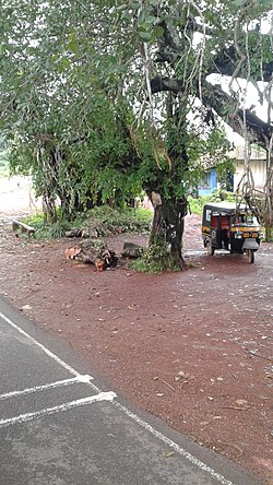
56:
329:, Muliyar village had a population of 25,095 with 12,248 males and 12,847 females. Muliyar village has an area of 34.27 km (13.23 sq mi) with 4,980 families residing in it. The average female sex ratio was 1049 lower than the state average of 1084. In Muliyar, 12.4% of the population was under 6 years of age. Muliyar had an average literacy of 88.7% lower than the state average of 94%; male literacy was 92.9% and female literacy was 84.8%.
40:
518:
125:
63:
390:
484:
394:
87:
506:
604:
514:
438:
499:
137:
55:
599:
492:
463:
263:
149:
306:
416:
181:
373:
39:
326:
255:
8:
343:
563:
523:
282:
238:
154:
310:
568:
314:
278:
166:
313:. The village covers 34.27 square kilometres (13.23 sq mi) of land in
593:
578:
102:
89:
573:
547:
542:
537:
353:
302:
251:
246:
393:. Registrar General & Census Commissioner, India. Archived from
391:"Census of India : Villages with population 5000 & above"
348:
290:
142:
517:
338:
301:
Muliyar is located about 12 kilometres (7.5 mi) east of
286:
161:
130:
469:. Directorate of Census Operations-Kerala. 1 October 2011
374:"The Kerala Official Language (Legislation) Act, 1969"
464:"District Census Handbook - Kasaragod District 2011"
591:
500:
507:
493:
383:
592:
488:
204:34.27 km (13.23 sq mi)
13:
14:
616:
605:Panchayats in Kasaragod district
516:
417:"Cherkala routes with distances"
123:
61:
54:
38:
320:
62:
456:
431:
409:
366:
1:
359:
296:
7:
332:
10:
621:
522:Cities and subdivisons of
556:
530:
444:. keralaczma.gov.in. 2012
262:
245:
234:
229:
225:730/km (1,900/sq mi)
221:
213:
208:
200:
195:
187:
177:
172:
160:
148:
136:
118:
83:
75:Location in Kerala, India
49:
37:
30:
23:
305:. It is situated along
191:Muliyar Grama Panchayat
103:12.507409°N 75.095684°E
309:, to the north of the
182:Panchayati Raj (India)
600:Cherkala - Jalsoor Rd
235: • Official
18:Town in Kerala, India
264:Vehicle registration
222: • Density
108:12.507409; 75.095684
419:. keralatourism.org
99: /
524:Kasaragod district
397:on 8 December 2008
283:Kasaragod district
214: • Total
201: • Total
587:
586:
311:Chandragiri River
277:is a village and
272:
271:
188: • Body
178: • Type
612:
521:
520:
509:
502:
495:
486:
485:
479:
478:
476:
474:
468:
460:
454:
453:
451:
449:
443:
435:
429:
428:
426:
424:
413:
407:
406:
404:
402:
387:
381:
380:
378:
370:
307:State Highway 55
129:
127:
126:
114:
113:
111:
110:
109:
104:
100:
97:
96:
95:
92:
65:
64:
58:
44:Muliyar bus stop
42:
21:
20:
620:
619:
615:
614:
613:
611:
610:
609:
590:
589:
588:
583:
552:
526:
515:
513:
483:
482:
472:
470:
466:
462:
461:
457:
447:
445:
441:
437:
436:
432:
422:
420:
415:
414:
410:
400:
398:
389:
388:
384:
376:
372:
371:
367:
362:
335:
323:
315:Kasaragod taluk
299:
279:Grama Panchayat
124:
122:
107:
105:
101:
98:
93:
90:
88:
86:
85:
79:
78:
77:
76:
73:
72:
71:
70:
66:
45:
33:
26:
19:
12:
11:
5:
618:
608:
607:
602:
585:
584:
582:
581:
576:
571:
566:
560:
558:
554:
553:
551:
550:
545:
540:
534:
532:
531:Municipalities
528:
527:
512:
511:
504:
497:
489:
481:
480:
455:
430:
408:
382:
364:
363:
361:
358:
357:
356:
351:
346:
341:
334:
331:
322:
319:
298:
295:
270:
269:
266:
260:
259:
249:
243:
242:
236:
232:
231:
227:
226:
223:
219:
218:
215:
211:
210:
206:
205:
202:
198:
197:
193:
192:
189:
185:
184:
179:
175:
174:
170:
169:
164:
158:
157:
152:
146:
145:
140:
134:
133:
120:
116:
115:
81:
80:
74:
68:
67:
60:
59:
53:
52:
51:
50:
47:
46:
43:
35:
34:
31:
28:
27:
24:
17:
9:
6:
4:
3:
2:
617:
606:
603:
601:
598:
597:
595:
580:
577:
575:
572:
570:
567:
565:
562:
561:
559:
555:
549:
546:
544:
541:
539:
536:
535:
533:
529:
525:
519:
510:
505:
503:
498:
496:
491:
490:
487:
465:
459:
440:
434:
418:
412:
396:
392:
386:
375:
369:
365:
355:
352:
350:
347:
345:
342:
340:
337:
336:
330:
328:
318:
316:
312:
308:
304:
294:
292:
288:
284:
280:
276:
267:
265:
261:
257:
253:
250:
248:
244:
240:
237:
233:
228:
224:
220:
216:
212:
207:
203:
199:
194:
190:
186:
183:
180:
176:
171:
168:
165:
163:
159:
156:
153:
151:
147:
144:
141:
139:
135:
132:
121:
117:
112:
84:Coordinates:
82:
57:
48:
41:
36:
29:
22:
16:
574:Vellarikundu
564:Manjeshwaram
471:. Retrieved
458:
446:. Retrieved
433:
421:. Retrieved
411:
399:. Retrieved
395:the original
385:
368:
324:
321:Demographics
300:
274:
273:
15:
548:Nileshwaram
439:"Draft Map"
401:10 December
327:2011 Census
106: /
594:Categories
473:22 January
448:22 January
423:22 January
360:References
209:Population
173:Government
94:75°05′44″E
91:12°30′27″N
569:Kasaragod
543:Kanhangad
538:Kasaragod
354:Delampady
303:Kasaragod
297:Geography
289:state of
247:Time zone
241:, English
239:Malayalam
230:Languages
167:Kasaragod
155:Kasaragod
344:Mulleria
333:See also
281:and in
252:UTC+5:30
150:District
579:Hosdurg
349:Karadka
285:in the
275:Muliyar
119:Country
69:Muliyar
25:Muliyar
557:Taluks
325:As of
291:Kerala
287:Indian
217:25,095
143:Kerala
128:
467:(PDF)
442:(PDF)
377:(PDF)
339:Adhur
268:KL-14
162:Taluk
138:State
131:India
475:2021
450:2021
425:2021
403:2008
196:Area
32:Town
256:IST
596::
317:.
293:.
508:e
501:t
494:v
477:.
452:.
427:.
405:.
379:.
258:)
254:(
Text is available under the Creative Commons Attribution-ShareAlike License. Additional terms may apply.

