65:
77:
729:
51:
177:
435:
In the township the population was spread out, with 34.0% under the age of 18, 8.5% from 18 to 24, 23.6% from 25 to 44, 23.9% from 45 to 64, and 9.9% who were 65 years of age or older. The median age was 33 years. For every 100 females, there were 137.8 males. For every 100 females age 18 and over,
431:
living together, 4.9% had a female householder with no husband present, and 18.5% were non-families. 16.6% of all households were made up of individuals, and 5.7% had someone living alone who was 65 years of age or older. The average household size was 2.85 and the average family size was 3.22.
391:
of 2000, there were 856 people, 265 households, and 215 families living in the township. The population density was 33.2 inhabitants per square mile (12.8/km). There were 400 housing units at an average density of 15.5/sq mi (6.0/km). The racial makeup of the township was 90.77%
64:
951:
439:
The median income for a household in the township was $ 37,125, and the median income for a family was $ 45,000. Males had a median income of $ 31,500 versus $ 21,923 for females. The
995:
627:
304:, the township has a total area of 25.8 square miles (66.8 km), of which 25.8 square miles (66.8 km) is land and 0.04% is water.
1000:
19:
832:
782:
762:
990:
827:
777:
772:
752:
747:
76:
837:
822:
797:
787:
757:
842:
802:
767:
817:
620:
246:
463:
493:
605:
544:
289:
613:
1005:
847:
209:
109:
812:
409:
397:
401:
427:
There were 265 households, out of which 35.8% had children under the age of 18 living with them, 75.5% were
910:
708:
928:
915:
589:
413:
301:
807:
637:
265:
114:
713:
703:
353:
338:
273:
900:
698:
688:
659:
443:
for the township was $ 13,083. About 15.0% of families and 19.1% of the population were below the
234:
87:
50:
895:
870:
865:
857:
739:
693:
683:
285:
261:
55:
41:
563:
670:
635:
417:
525:
718:
549:
935:
905:
421:
219:
8:
880:
678:
405:
393:
890:
513:
440:
984:
966:
953:
239:
447:, including 26.7% of those under age 18 and 21.4% of those age 65 or over.
444:
269:
102:
652:
69:
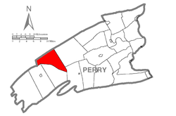
Map of Perry County, Pennsylvania highlighting
Northeast Madison Township
97:
200:
428:
539:
388:
226:
205:
585:
18:
487:
485:
483:
481:
478:
456:
996:Harrisburg–Carlisle metropolitan statistical area
982:
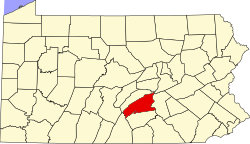
272:, United States. The population was 828 at the
20:Madison Township, Pennsylvania (disambiguation)
556:
621:
494:"City and Town Population Totals: 2020-2021"
628:
614:
424:of any race were 3.27% of the population.
1001:Townships in Perry County, Pennsylvania
25:Township in Pennsylvania, United States
983:
540:"National Register Information System"
331:
609:
153:25.77 sq mi (66.74 km)
145:25.80 sq mi (66.84 km)
991:Populated places established in 1755
545:National Register of Historic Places
416:, and 1.52% from two or more races.
290:National Register of Historic Places
532:
161:0.04 sq mi (0.10 km)
13:
727:
636:Municipalities and communities of
578:
564:"Census of Population and Housing"
491:
321:
14:
1017:
81:Map of Perry County, Pennsylvania
176:
175:
75:
63:
49:
307:
1:
466:. United States Census Bureau
450:
295:
7:
590:United States Census Bureau
464:"2016 U.S. Gazetteer Files"
302:United States Census Bureau
195:30.58/sq mi (11.81/km)
184: • Estimate
32:Northeast Madison Township,
10:
1022:
639:Perry County, Pennsylvania
279:
258:Northeast Madison Township
17:
1006:Townships in Pennsylvania
924:
879:
856:
738:
725:
669:
650:
380:
367:
352:
337:
330:
325:
320:
317:
245:
233:
216:
199:
191:
183:
170:
165:
157:
149:
141:
136:
128:
120:
108:
96:
86:
74:
62:
48:
39:
30:
436:there were 119.0 males.
286:Waggoner Covered Bridge
56:Waggoner Covered Bridge
732:
967:40.37472°N 77.37639°W
731:
586:"U.S. Census website"
550:National Park Service
381:U.S. Decennial Census
313:Historical population
218: • Summer (
937:United States portal
192: • Density
972:40.37472; -77.37639
963: /
930:Pennsylvania portal
492:Bureau, US Census.
314:
733:
524:has generic name (
500:. US Census Bureau
312:
171: • Total
158: • Water
142: • Total
946:
945:
818:Southwest Madison
793:Northeast Madison
441:per capita income
385:
384:
300:According to the
288:was added to the
255:
254:
150: • Land
1013:
978:
977:
975:
974:
973:
968:
964:
961:
960:
959:
956:
938:
931:
730:
662:
655:
645:
640:
630:
623:
616:
607:
606:
601:
600:
598:
596:
582:
576:
575:
573:
571:
560:
554:
553:
536:
530:
529:
523:
519:
517:
509:
507:
505:
489:
476:
475:
473:
471:
460:
410:Pacific Islander
398:African American
333:
328:
323:
315:
311:
223:
179:
178:
79:
67:
53:
28:
27:
1021:
1020:
1016:
1015:
1014:
1012:
1011:
1010:
981:
980:
971:
969:
965:
962:
957:
954:
952:
950:
949:
947:
942:
936:
929:
920:
882:
875:
852:
734:
728:
723:
665:
660:
653:
646:
643:
638:
634:
604:
594:
592:
584:
583:
579:
569:
567:
562:
561:
557:
552:. July 9, 2010.
538:
537:
533:
521:
520:
511:
510:
503:
501:
490:
479:
469:
467:
462:
461:
457:
453:
429:married couples
402:Native American
326:
310:
298:
282:
217:
82:
70:
58:
44:
35:
33:
26:
23:
12:
11:
5:
1019:
1009:
1008:
1003:
998:
993:
944:
943:
941:
940:
933:
925:
922:
921:
919:
918:
913:
911:New Germantown
908:
903:
898:
893:
887:
885:
881:Unincorporated
877:
876:
874:
873:
868:
862:
860:
854:
853:
851:
850:
845:
840:
835:
830:
825:
820:
815:
810:
805:
800:
795:
790:
785:
780:
775:
770:
765:
760:
755:
750:
744:
742:
736:
735:
726:
724:
722:
721:
716:
711:
706:
701:
696:
691:
686:
681:
675:
673:
667:
666:
651:
648:
647:
633:
632:
625:
618:
610:
603:
602:
577:
555:
531:
477:
454:
452:
449:
383:
382:
378:
377:
374:
372:
369:
365:
364:
361:
359:
356:
350:
349:
346:
344:
341:
335:
334:
329:
324:
319:
309:
306:
297:
294:
281:
278:
253:
252:
249:
243:
242:
237:
231:
230:
224:
214:
213:
203:
197:
196:
193:
189:
188:
185:
181:
180:
172:
168:
167:
163:
162:
159:
155:
154:
151:
147:
146:
143:
139:
138:
134:
133:
130:
126:
125:
122:
118:
117:
112:
106:
105:
100:
94:
93:
90:
84:
83:
80:
72:
71:
68:
60:
59:
54:
46:
45:
40:
37:
36:
31:
24:
9:
6:
4:
3:
2:
1018:
1007:
1004:
1002:
999:
997:
994:
992:
989:
988:
986:
979:
976:
939:
934:
932:
927:
926:
923:
917:
916:Shermans Dale
914:
912:
909:
907:
904:
902:
899:
897:
894:
892:
889:
888:
886:
884:
878:
872:
869:
867:
864:
863:
861:
859:
855:
849:
846:
844:
841:
839:
836:
834:
831:
829:
826:
824:
821:
819:
816:
814:
811:
809:
806:
804:
801:
799:
796:
794:
791:
789:
786:
784:
781:
779:
776:
774:
771:
769:
766:
764:
761:
759:
756:
754:
751:
749:
746:
745:
743:
741:
737:
720:
717:
715:
712:
710:
707:
705:
702:
700:
697:
695:
692:
690:
687:
685:
682:
680:
677:
676:
674:
672:
668:
664:
663:
656:
649:
644:United States
641:
631:
626:
624:
619:
617:
612:
611:
608:
591:
587:
581:
565:
559:
551:
547:
546:
541:
535:
527:
515:
499:
495:
488:
486:
484:
482:
465:
459:
455:
448:
446:
442:
437:
433:
430:
425:
423:
419:
415:
412:, 1.75% from
411:
407:
403:
399:
395:
390:
379:
375:
373:
370:
366:
362:
360:
357:
355:
351:
347:
345:
342:
340:
336:
316:
305:
303:
293:
291:
287:
277:
275:
271:
267:
263:
259:
250:
248:
244:
241:
238:
236:
232:
228:
225:
221:
215:
211:
210:Eastern (EST)
207:
204:
202:
198:
194:
190:
186:
182:
173:
169:
164:
160:
156:
152:
148:
144:
140:
135:
131:
127:
123:
119:
116:
113:
111:
107:
104:
101:
99:
95:
92:United States
91:
89:
85:
78:
73:
66:
61:
57:
52:
47:
43:
38:
29:
21:
16:
948:
792:
658:
593:. Retrieved
580:
568:. Retrieved
566:. Census.gov
558:
543:
534:
522:|last1=
502:. Retrieved
497:
468:. Retrieved
458:
445:poverty line
438:
434:
426:
386:
308:Demographics
299:
283:
270:Pennsylvania
266:Perry County
257:
256:
251:42-099-54968
129:Incorporated
103:Pennsylvania
34:Pennsylvania
15:
970: /
883:communities
714:New Buffalo
704:Millerstown
654:County seat
595:January 31,
414:other races
368:2021 (est.)
274:2020 census
985:Categories
958:77°22′35″W
955:40°22′29″N
901:Green Park
848:Wheatfield
709:Bloomfield
699:Marysville
689:Landisburg
661:Bloomfield
498:Census.gov
470:August 14,
451:References
387:As of the
166:Population
896:Dellville
871:Loysville
866:Ickesburg
833:Tuscarora
783:Liverpool
763:Greenwood
740:Townships
694:Liverpool
684:Duncannon
296:Geography
292:in 1980.
247:FIPS code
235:Area code
201:Time zone
671:Boroughs
514:cite web
504:July 12,
418:Hispanic
408:, 0.12%
404:, 0.23%
400:, 0.35%
396:, 5.26%
262:township
42:Township
828:Toboyne
813:Saville
778:Juniata
773:Jackson
753:Carroll
748:Buffalo
719:Newport
570:June 4,
280:History
121:Settled
88:Country
906:Perdix
838:Tyrone
823:Spring
798:Oliver
788:Miller
758:Centre
422:Latino
389:census
318:Census
110:County
843:Watts
679:Blain
406:Asian
394:White
260:is a
229:(EDT)
227:UTC-4
206:UTC-5
115:Perry
98:State
891:Cove
858:CDPs
803:Penn
768:Howe
597:2008
572:2016
526:help
506:2022
472:2017
376:0.4%
363:5.3%
354:2020
339:2010
327:Note
322:Pop.
284:The
174:828
137:Area
132:1755
124:1755
808:Rye
420:or
371:831
358:828
343:786
264:in
240:717
220:DST
187:831
987::
657::
642:,
588:.
548:.
542:.
518::
516:}}
512:{{
496:.
480:^
332:%±
276:.
268:,
629:e
622:t
615:v
599:.
574:.
528:)
508:.
474:.
348:—
222:)
212:)
208:(
22:.
Text is available under the Creative Commons Attribution-ShareAlike License. Additional terms may apply.


