821:"}},"text\/plain":{"en":{"":"coordinates of the point of view"}}},"{\"value\":{\"latitude\":52.70384,\"longitude\":-2.4801,\"altitude\":null,\"precision\":1.0e-5,\"globe\":\"http:\\\/\\\/www.wikidata.org\\\/entity\\\/Q2\"},\"type\":\"globecoordinate\"}":{"text\/html":{"en":{"P1259":"52\u00b042'13.82"N, 2\u00b028'48.36"W"}},"text\/plain":{"en":{"P1259":"52\u00b042'13.82\"N, 2\u00b028'48.36\"W"}}},"{\"value\":{\"entity-type\":\"property\",\"numeric-id\":7787,\"id\":\"P7787\"},\"type\":\"wikibase-entityid\"}":{"text\/html":{"en":{"":"
927:"}},"text\/plain":{"en":{"":"coordinates of depicted place"}}},"{\"value\":{\"latitude\":52.70411,\"longitude\":-2.4798,\"altitude\":null,\"precision\":1.0e-5,\"globe\":\"http:\\\/\\\/www.wikidata.org\\\/entity\\\/Q2\"},\"type\":\"globecoordinate\"}":{"text\/html":{"en":{"P9149":"52\u00b042'14.80"N, 2\u00b028'47.28"W"}},"text\/plain":{"en":{"P9149":"52\u00b042'14.80\"N, 2\u00b028'47.28\"W"}}},"{\"value\":{\"entity-type\":\"property\",\"numeric-id\":7787,\"id\":\"P7787\"},\"type\":\"wikibase-entityid\"}":{"text\/html":{"en":{"":"
43:
889:"}},"text\/plain":{"en":{"":"inception"}}},"{\"value\":{\"time\":\"+2010-02-19T00:00:00Z\",\"timezone\":0,\"before\":0,\"after\":0,\"precision\":11,\"calendarmodel\":\"http:\\\/\\\/www.wikidata.org\\\/entity\\\/Q1985727\"},\"type\":\"time\"}":{"text\/html":{"en":{"P571":"19 February 2010"}},"text\/plain":{"en":{"P571":"19 February 2010"}}}}": -->
698:
304:
254:
923:
246:
318:
268:
339:
377:
382:
95:
523:"}},"text\/plain":{"en":{"P2699":"https:\/\/www.geograph.org.uk\/profile\/31233"}}},"{\"value\":{\"entity-type\":\"property\",\"numeric-id\":2093,\"id\":\"P2093\"},\"type\":\"wikibase-entityid\"}":{"text\/html":{"en":{"":"
722:"}},"text\/plain":{"en":{"P973":"https:\/\/www.geograph.org.uk\/photo\/1716799"}}},"{\"value\":{\"entity-type\":\"property\",\"numeric-id\":137,\"id\":\"P137\"},\"type\":\"wikibase-entityid\"}":{"text\/html":{"en":{"":"
706:"}},"text\/plain":{"en":{"P7482":"file available on the internet"}}},"{\"value\":{\"entity-type\":\"property\",\"numeric-id\":7384,\"id\":\"P7384\"},\"type\":\"wikibase-entityid\"}":{"text\/html":{"en":{"":"
527:"}},"text\/plain":{"en":{"":"author name string"}}},"{\"value\":\"Gordon Cragg\",\"type\":\"string\"}":{"text\/html":{"en":{"P2093":"Gordon Cragg"}},"text\/plain":{"en":{"P2093":"Gordon Cragg"}}}}": -->
511:"}},"text\/plain":{"en":{"":"object of statement has role"}}},"{\"value\":{\"entity-type\":\"item\",\"numeric-id\":33231,\"id\":\"Q33231\"},\"type\":\"wikibase-entityid\"}":{"text\/html":{"en":{"P3831":"
658:"}},"text\/plain":{"en":{"":"copyright license"}}},"{\"value\":{\"entity-type\":\"item\",\"numeric-id\":19068220,\"id\":\"Q19068220\"},\"type\":\"wikibase-entityid\"}":{"text\/html":{"en":{"P275":"
614:"}},"text\/plain":{"en":{"":"copyright status"}}},"{\"value\":{\"entity-type\":\"item\",\"numeric-id\":50423863,\"id\":\"Q50423863\"},\"type\":\"wikibase-entityid\"}":{"text\/html":{"en":{"P6216":"
702:"}},"text\/plain":{"en":{"":"source of file"}}},"{\"value\":{\"entity-type\":\"item\",\"numeric-id\":74228490,\"id\":\"Q74228490\"},\"type\":\"wikibase-entityid\"}":{"text\/html":{"en":{"P7482":"
515:"}},"text\/plain":{"en":{"P3831":"photographer"}}},"{\"value\":{\"entity-type\":\"property\",\"numeric-id\":2699,\"id\":\"P2699\"},\"type\":\"wikibase-entityid\"}":{"text\/html":{"en":{"":"
726:"}},"text\/plain":{"en":{"":"operator"}}},"{\"value\":{\"entity-type\":\"item\",\"numeric-id\":1503119,\"id\":\"Q1503119\"},\"type\":\"wikibase-entityid\"}":{"text\/html":{"en":{"P137":"
1033:
931:"}},"text\/plain":{"en":{"":"heading"}}},"{\"value\":{\"amount\":\"+45\",\"unit\":\"http:\\\/\\\/www.wikidata.org\\\/entity\\\/Q28390\"},\"type\":\"quantity\"}":{"text\/html":{"en":{"P7787":"45
825:"}},"text\/plain":{"en":{"":"heading"}}},"{\"value\":{\"amount\":\"+45\",\"unit\":\"http:\\\/\\\/www.wikidata.org\\\/entity\\\/Q28390\"},\"type\":\"quantity\"}":{"text\/html":{"en":{"P7787":"45
714:"}},"text\/plain":{"en":{"P7384":"1716799"}}},"{\"value\":{\"entity-type\":\"property\",\"numeric-id\":973,\"id\":\"P973\"},\"type\":\"wikibase-entityid\"}":{"text\/html":{"en":{"":"
507:"}},"text\/plain":{"en":{"":"creator"}}},"{\"value\":{\"entity-type\":\"property\",\"numeric-id\":3831,\"id\":\"P3831\"},\"type\":\"wikibase-entityid\"}":{"text\/html":{"en":{"":"
610:
710:"}},"text\/plain":{"en":{"":"geograph.org.uk image ID"}}},"{\"value\":\"1716799\",\"type\":\"string\"}":{"text\/html":{"en":{"P7384":"
237:
429:– You must give appropriate credit, provide a link to the license, and indicate if changes were made. You may do so in any reasonable manner, but not in any way that suggests the licensor endorses you or your use.
301:
251:
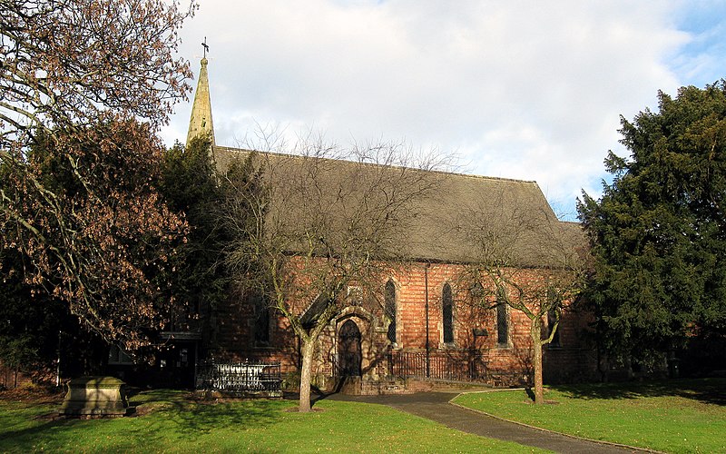
1050:== {{int:filedesc}} == {{Information |description={{en|1=Holy Trinity , Hadley Holy Trinity, the parish church of Hadley, Telford.}} |date=2010-02-19 |source=From |author=[http://www.geograph.org.
61:
57:
53:
47:
106:
74:
711:
703:
659:
615:
727:
512:
928:
924:
822:
818:
707:
699:
611:
524:
516:
508:
719:
520:
886:
723:
715:
655:
504:
1043:
662:"}},"text\/plain":{"en":{"P275":"Creative Commons Attribution-ShareAlike 2.0 Generic"}}}}": -->
753:
685:
641:
311:
261:
803:
346:
1095:
This file contains additional information, probably added from the digital camera or scanner used to create or digitize it.
436:
568:
1032:
1027:
65:
42:
969:
942:
863:
836:
766:
737:
625:
591:
576:
561:
896:
796:
781:
669:
534:
493:
730:"}},"text\/plain":{"en":{"P137":"Geograph Britain and Ireland"}}}}": -->
392:
1098:
If the file has been modified from its original state, some details may not fully reflect the modified file.
435:– If you remix, transform, or build upon the material, you must distribute your contributions under the
353:
on the
Geograph website for the photographer's contact details. The copyright on this image is owned by
618:"}},"text\/plain":{"en":{"P6216":"copyrighted"}}}}": -->
935:"}},"text\/plain":{"en":{"P7787":"45 degree"}}}}": -->
829:"}},"text\/plain":{"en":{"P7787":"45 degree"}}}}": -->
114:
206:
788:
773:
583:
389:
190:
8:
333:
1064:
317:
267:
358:
101:
483:
179:
169:
952:
906:
846:
747:
679:
635:
544:
338:
350:
1000:
Click on a date/time to view the file as it appeared at that time.
1082:
303:
253:
288:
52° 42′ 15″ N, 2° 28′ 47″ W
238:
52° 42′ 14″ N, 2° 28′ 48″ W
158:
89:
477:
Add a one-line explanation of what this file represents
149:
Holy
Trinity parish church, Hadley, Telford, Shropshire
1058:
139:
Holy
Trinity , Hadley - geograph.org.uk - 1716799.jpg
1073:
998:
113:
Commons is a freely licensed media file repository.
79:(1,500 × 938 pixels, file size: 1.31 MB, MIME type:
686:
Creative
Commons Attribution-ShareAlike 2.0 Generic
660:
Creative
Commons Attribution-ShareAlike 2.0 Generic
446:https://creativecommons.org/licenses/by-sa/2.0
94:
720:https:\/\/www.geograph.org.uk\/photo\/1716799
521:https:\/\/www.geograph.org.uk\/profile\/31233
452:Creative Commons Attribution-Share Alike 2.0
370:
154:
136:
175:
164:
14:
932:
826:
412:– to copy, distribute and transmit the work
1075:The following other wikis use this file:
789:https://www.geograph.org.uk/photo/1716799
584:https://www.geograph.org.uk/profile/31233
310:View this and other nearby images on:
260:View this and other nearby images on:
213:
125:
357:and is licensed for reuse under the
278:
228:
1060:The following page uses this file:
991:
393:Attribution-Share Alike 2.0 Generic
381:
376:
361:Attribution-ShareAlike 2.0 license.
13:
1093:
482:
476:
367:
344:
143:
126:
72:
1119:
1100:
481:
837:coordinates of the point of view
819:coordinates of the point of view
467:
423:Under the following conditions:
388:This file is licensed under the
380:
375:
369:
337:
316:
302:
294:
266:
252:
244:
93:
31:
21:
464:
144:
1070:
995:
754:file available on the internet
704:file available on the internet
463:
345:This image was taken from the
26:
1:
943:coordinates of depicted place
925:coordinates of depicted place
36:
1055:
804:Geograph Britain and Ireland
728:Geograph Britain and Ireland
562:object of statement has role
509:object of statement has role
489:Items portrayed in this file
329:
7:
1090:
958:52°42'14.80"N, 2°28'47.28"W
852:52°42'13.82"N, 2°28'48.36"W
293:
243:
10:
1124:
1079:Usage on pl.wikipedia.org
437:same or compatible license
133:
128:
992:
219:Gordon Cragg /
200:Gordon Cragg /
16:
767:geograph.org.uk image ID
708:geograph.org.uk image ID
466:
403:
100:This is a file from the
41:
1049:
191:required by the license
157:
104:. Information from its
351:this photograph's page
322:52.704110; -2.479800
272:52.703840; -2.480100
107:description page there
46:Size of this preview:
221:Holy Trinity , Hadley
202:Holy Trinity , Hadley
1083:Hadley (Shropshire)
1028:08:29, 5 March 2011
418:– to adapt the work
52:Other resolutions:
1065:Hadley, Shropshire
592:author name string
525:author name string
66:1,500 × 938 pixels
62:1,024 × 640 pixels
1111:
1110:
1071:Global file usage
1053:
934:
828:
670:copyright license
656:copyright license
475:
366:
365:
349:collection. See
327:
326:
277:
276:
226:
225:
194:
122:
121:
102:Wikimedia Commons
32:Global file usage
1115:
1101:
1040:
1002:
980:
979:
974:
912:19 February 2010
874:
873:
868:
806:
801:
791:
786:
782:described at URL
776:
771:
716:described at URL
626:copyright status
612:copyright status
599:
596:
586:
581:
571:
566:
473:
459:
456:
453:
450:
447:
439:as the original.
401:
390:Creative Commons
384:
383:
379:
378:
373:
372:
359:Creative Commons
347:Geograph project
341:
334:
323:
320:
306:
305:
299:
298:
297:
291:
290:
279:
273:
270:
256:
255:
249:
248:
247:
241:
240:
229:
188:
160:
159:19 February 2010
148:
140:
134:
118:
97:
96:
90:
84:
82:
69:
58:640 × 400 pixels
54:320 × 200 pixels
48:800 × 500 pixels
1123:
1122:
1118:
1117:
1116:
1114:
1113:
1112:
1089:
1069:
1054:
1046:
1038:
994:
993:
990:
989:
988:
987:
986:
985:
984:
983:
982:
981:
977:
975:
972:
963:
962:
961:
959:
949:
948:
947:
945:
922:
921:
920:
919:
918:
917:
916:
915:
913:
903:
902:
901:
899:
884:
883:
882:
881:
880:
879:
878:
877:
876:
875:
871:
869:
866:
857:
856:
855:
853:
843:
842:
841:
839:
816:
815:
814:
813:
812:
811:
810:
809:
808:
807:
802:
799:
793:
792:
787:
784:
778:
777:
772:
769:
760:
759:
758:
756:
744:
743:
742:
740:
697:
696:
695:
694:
693:
692:
691:
690:
688:
676:
675:
674:
672:
653:
652:
651:
650:
649:
648:
647:
646:
644:
632:
631:
630:
628:
609:
608:
607:
606:
605:
604:
603:
602:
601:
600:
597:
594:
588:
587:
582:
579:
573:
572:
567:
564:
555:
554:
553:
551:
541:
540:
539:
537:
502:
501:
500:
499:
498:
496:
480:
479:
478:
461:
460:
457:
454:
451:
448:
445:
444:
402:
399:
396:
385:
362:
332:
321:
295:
286:
285:
282:Object location
271:
245:
236:
235:
232:Camera location
227:
216:
209:
197:
170:geograph.org.uk
150:
138:
131:
124:
123:
112:
111:
110:is shown below.
86:
80:
78:
71:
70:
51:
12:
11:
5:
1121:
1109:
1108:
1105:
1092:
1088:
1087:
1086:
1085:
1072:
1068:
1067:
1057:
1052:
1051:
1048:
1044:
1041:
1035:
1030:
1025:
1021:
1020:
1017:
1014:
1011:
1008:
1005:
997:
968:
967:
966:
965:
964:
960:
957:
955:
954:
953:
951:
950:
946:
941:
939:
938:
937:
936:
930:
926:
914:
911:
909:
908:
907:
905:
904:
900:
895:
893:
892:
891:
890:
888:
862:
861:
860:
859:
858:
854:
851:
849:
848:
847:
845:
844:
840:
835:
833:
832:
831:
830:
824:
820:
795:
794:
780:
779:
765:
764:
763:
762:
761:
757:
752:
750:
749:
748:
746:
745:
741:
738:source of file
736:
734:
733:
732:
731:
729:
725:
721:
717:
713:
709:
705:
701:
700:source of file
689:
684:
682:
681:
680:
678:
677:
673:
668:
666:
665:
664:
663:
661:
657:
645:
640:
638:
637:
636:
634:
633:
629:
624:
622:
621:
620:
619:
617:
613:
590:
589:
575:
574:
560:
559:
558:
557:
556:
552:
549:
547:
546:
545:
543:
542:
538:
533:
531:
530:
529:
528:
526:
522:
518:
514:
510:
506:
497:
492:
490:
487:
486:
485:
484:
472:
471:
468:
465:
443:
442:
441:
440:
430:
421:
420:
419:
413:
406:You are free:
397:
387:
386:
368:
364:
363:
342:
331:
328:
325:
324:
314:
308:
283:
275:
274:
264:
258:
233:
224:
223:
217:
214:
211:
210:
205:
198:
195:
183:
182:
177:
173:
172:
166:
162:
161:
156:
152:
151:
141:
132:
130:
127:
120:
119:
98:
88:
87:
45:
40:
39:
34:
29:
24:
19:
9:
6:
4:
3:
2:
1120:
1106:
1103:
1102:
1099:
1096:
1084:
1081:
1080:
1078:
1077:
1076:
1066:
1063:
1062:
1061:
1047:
1042:
1036:
1034:
1031:
1029:
1026:
1023:
1022:
1018:
1015:
1012:
1009:
1006:
1004:
1003:
1001:
971:
956:
944:
940:
910:
898:
894:
865:
850:
838:
834:
805:
798:
790:
783:
775:
768:
755:
751:
739:
735:
687:
683:
671:
667:
643:
639:
627:
623:
593:
585:
578:
570:
563:
548:
536:
532:
495:
491:
488:
469:
462:
449:CC BY-SA 2.0
438:
434:
431:
428:
425:
424:
422:
417:
414:
411:
408:
407:
405:
404:
398:Attribution:
394:
391:
374:
360:
356:
352:
348:
343:
340:
336:
335:
319:
315:
313:
312:OpenStreetMap
309:
307:
289:
284:
281:
280:
269:
265:
263:
262:OpenStreetMap
259:
257:
239:
234:
231:
230:
222:
218:
212:
208:
204: /
203:
199:
192:
187:
185:
184:
181:
178:
174:
171:
167:
163:
153:
147:
142:
135:
116:
109:
108:
103:
99:
92:
91:
85:
76:
75:Original file
67:
63:
59:
55:
49:
44:
38:
35:
33:
30:
28:
25:
23:
20:
18:
15:
1097:
1094:
1074:
1059:
1037:1,500 × 938
999:
996:File history
598:Gordon Cragg
569:photographer
513:photographer
432:
426:
415:
409:
400:Gordon Cragg
355:Gordon Cragg
354:
292:
242:
220:
207:CC BY-SA 2.0
201:
180:Gordon Cragg
145:
115:You can help
105:
73:
22:File history
1045:GeographBot
642:copyrighted
616:copyrighted
433:share alike
427:attribution
186:Attribution
137:Description
1104:_error
1056:File usage
1013:Dimensions
550:some value
81:image/jpeg
27:File usage
1039:(1.31 MB)
1010:Thumbnail
1007:Date/Time
897:inception
887:inception
330:Licensing
215:InfoField
196:InfoField
146:English:
1091:Metadata
797:operator
724:operator
470:Captions
416:to remix
410:to share
395:license.
37:Metadata
1024:current
1019:Comment
970:heading
929:heading
864:heading
823:heading
774:1716799
712:1716799
535:creator
505:creator
494:depicts
474:English
129:Summary
77:
978:degree
933:degree
872:degree
827:degree
300:
250:
176:Author
165:Source
168:From
1016:User
458:true
455:true
155:Date
17:File
976:45
870:45
577:URL
517:URL
973::
867::
800::
785::
770::
595::
580::
565::
64:|
60:|
56:|
50:.
1107:0
193:)
189:(
117:.
83:)
68:.
Text is available under the Creative Commons Attribution-ShareAlike License. Additional terms may apply.

_heading:45.00&language=en)
_heading:45.00&language=en)
