640:"}},"text\/plain":{"en":{"":"coordinates of the point of view"}}},"{\"value\":{\"latitude\":51.740035,\"longitude\":-3.361759,\"altitude\":null,\"precision\":1.0e-6,\"globe\":\"http:\\\/\\\/www.wikidata.org\\\/entity\\\/Q2\"},\"type\":\"globecoordinate\"}":{"text\/html":{"en":{"P1259":"51\u00b044'24.126"N, 3\u00b021'42.332"W"}},"text\/plain":{"en":{"P1259":"51\u00b044'24.126\"N, 3\u00b021'42.332\"W"}}},"{\"value\":{\"entity-type\":\"property\",\"numeric-id\":7787,\"id\":\"P7787\"},\"type\":\"wikibase-entityid\"}":{"text\/html":{"en":{"":"
903:"}},"text\/plain":{"en":{"":"checksum"}}},"{\"value\":\"349b8d8c47366e940bc56d9576a6346279dc9ff0\",\"type\":\"string\"}":{"text\/html":{"en":{"P4092":"349b8d8c47366e940bc56d9576a6346279dc9ff0"}},"text\/plain":{"en":{"P4092":"349b8d8c47366e940bc56d9576a6346279dc9ff0"}}},"{\"value\":{\"entity-type\":\"property\",\"numeric-id\":459,\"id\":\"P459\"},\"type\":\"wikibase-entityid\"}":{"text\/html":{"en":{"":"
457:"}},"text\/plain":{"en":{"":"author name string"}}},"{\"value\":\"Colin Pyle\",\"type\":\"string\"}":{"text\/html":{"en":{"P2093":"Colin Pyle"}},"text\/plain":{"en":{"P2093":"Colin Pyle"}}},"{\"value\":{\"entity-type\":\"property\",\"numeric-id\":3831,\"id\":\"P3831\"},\"type\":\"wikibase-entityid\"}":{"text\/html":{"en":{"":"
827:"}},"text\/plain":{"en":{"":"inception"}}},"{\"value\":{\"time\":\"+2012-05-07T00:00:00Z\",\"timezone\":0,\"before\":0,\"after\":0,\"precision\":11,\"calendarmodel\":\"http:\\\/\\\/www.wikidata.org\\\/entity\\\/Q1985727\"},\"type\":\"time\"}":{"text\/html":{"en":{"P571":"7 May 2012"}},"text\/plain":{"en":{"P571":"7 May 2012"}}}}": -->
704:
242:
899:
256:
277:
315:
320:
67:
453:"}},"text\/plain":{"en":{"P2699":"https:\/\/www.geograph.org.uk\/profile\/25416"}}},"{\"value\":{\"entity-type\":\"property\",\"numeric-id\":2093,\"id\":\"P2093\"},\"type\":\"wikibase-entityid\"}":{"text\/html":{"en":{"":"
728:"}},"text\/plain":{"en":{"P973":"https:\/\/www.geograph.org.uk\/photo\/2951641"}}},"{\"value\":{\"entity-type\":\"property\",\"numeric-id\":7384,\"id\":\"P7384\"},\"type\":\"wikibase-entityid\"}":{"text\/html":{"en":{"":"
712:"}},"text\/plain":{"en":{"P7482":"file available on the internet"}}},"{\"value\":{\"entity-type\":\"property\",\"numeric-id\":137,\"id\":\"P137\"},\"type\":\"wikibase-entityid\"}":{"text\/html":{"en":{"":"
461:"}},"text\/plain":{"en":{"":"object of statement has role"}}},"{\"value\":{\"entity-type\":\"item\",\"numeric-id\":33231,\"id\":\"Q33231\"},\"type\":\"wikibase-entityid\"}":{"text\/html":{"en":{"P3831":"
720:"}},"text\/plain":{"en":{"P137":"Geograph Britain and Ireland"}}},"{\"value\":{\"entity-type\":\"property\",\"numeric-id\":973,\"id\":\"P973\"},\"type\":\"wikibase-entityid\"}":{"text\/html":{"en":{"":"
1143:
907:"}},"text\/plain":{"en":{"":"determination method"}}},"{\"value\":{\"entity-type\":\"item\",\"numeric-id\":13414952,\"id\":\"Q13414952\"},\"type\":\"wikibase-entityid\"}":{"text\/html":{"en":{"P459":"
865:"}},"text\/plain":{"en":{"":"media type"}}},"{\"value\":\"image\\\/jpeg\",\"type\":\"string\"}":{"text\/html":{"en":{"P1163":"image\/jpeg"}},"text\/plain":{"en":{"P1163":"image\/jpeg"}}}}": -->
596:"}},"text\/plain":{"en":{"":"copyright license"}}},"{\"value\":{\"entity-type\":\"item\",\"numeric-id\":19068220,\"id\":\"Q19068220\"},\"type\":\"wikibase-entityid\"}":{"text\/html":{"en":{"P275":"
552:"}},"text\/plain":{"en":{"":"copyright status"}}},"{\"value\":{\"entity-type\":\"item\",\"numeric-id\":50423863,\"id\":\"Q50423863\"},\"type\":\"wikibase-entityid\"}":{"text\/html":{"en":{"P6216":"
708:"}},"text\/plain":{"en":{"":"source of file"}}},"{\"value\":{\"entity-type\":\"item\",\"numeric-id\":74228490,\"id\":\"Q74228490\"},\"type\":\"wikibase-entityid\"}":{"text\/html":{"en":{"P7482":"
970:"}},"text\/plain":{"en":{"":"data size"}}},"{\"value\":{\"amount\":\"+61822\",\"unit\":\"http:\\\/\\\/www.wikidata.org\\\/entity\\\/Q8799\"},\"type\":\"quantity\"}":{"text\/html":{"en":{"P3575":"61,822
1015:"}},"text\/plain":{"en":{"":"height"}}},"{\"value\":{\"amount\":\"+392\",\"unit\":\"http:\\\/\\\/www.wikidata.org\\\/entity\\\/Q355198\"},\"type\":\"quantity\"}":{"text\/html":{"en":{"P2048":"392
716:"}},"text\/plain":{"en":{"":"operator"}}},"{\"value\":{\"entity-type\":\"item\",\"numeric-id\":1503119,\"id\":\"Q1503119\"},\"type\":\"wikibase-entityid\"}":{"text\/html":{"en":{"P137":"
1060:"}},"text\/plain":{"en":{"":"width"}}},"{\"value\":{\"amount\":\"+546\",\"unit\":\"http:\\\/\\\/www.wikidata.org\\\/entity\\\/Q355198\"},\"type\":\"quantity\"}":{"text\/html":{"en":{"P2049":"546
644:"}},"text\/plain":{"en":{"":"heading"}}},"{\"value\":{\"amount\":\"+0\",\"unit\":\"http:\\\/\\\/www.wikidata.org\\\/entity\\\/Q28390\"},\"type\":\"quantity\"}":{"text\/html":{"en":{"P7787":"0
445:"}},"text\/plain":{"en":{"":"creator"}}},"{\"value\":{\"entity-type\":\"property\",\"numeric-id\":2699,\"id\":\"P2699\"},\"type\":\"wikibase-entityid\"}":{"text\/html":{"en":{"":"
1056:
449:"}},"text\/plain":{"en":{"":"URL"}}},"{\"value\":\"https:\\\/\\\/www.geograph.org.uk\\\/profile\\\/25416\",\"type\":\"string\"}":{"text\/html":{"en":{"P2699":"
732:"}},"text\/plain":{"en":{"":"geograph.org.uk image ID"}}},"{\"value\":\"2951641\",\"type\":\"string\"}":{"text\/html":{"en":{"P7384":"
225:
367:– You must give appropriate credit, provide a link to the license, and indicate if changes were made. You may do so in any reasonable manner, but not in any way that suggests the licensor endorses you or your use.
239:
78:
46:
733:
908:
709:
597:
553:
717:
462:
1057:
1012:
967:
900:
862:
729:
705:
641:
637:
549:
458:
454:
446:
725:
450:
904:
824:
721:
713:
593:
442:
1160:{{Information |Description={{en|1=A4060 near Cwmblacks Farm, Merthyr Tydfil, Wales}} |Source=From |Date=2012-05-07 |Author= |Permission=Crea...
600:"}},"text\/plain":{"en":{"P275":"Creative Commons Attribution-ShareAlike 2.0 Generic"}}}}": -->
162:
1142:
1137:
37:
952:
759:
623:
579:
249:
779:
1213:
284:
1185:
This file contains additional information, probably added from the digital camera or scanner used to create or digitize it.
374:
534:
1071:
1026:
981:
918:
872:
802:
743:
682:
655:
563:
527:
514:
499:
945:
834:
787:
772:
607:
472:
431:
330:
1188:
If the file has been modified from its original state, some details may not fully reflect the modified file.
373:– If you remix, transform, or build upon the material, you must distribute your contributions under the
291:
on the
Geograph website for the photographer's contact details. The copyright on this image is owned by
465:"}},"text\/plain":{"en":{"P3831":"photographer"}}}}": -->
974:"}},"text\/plain":{"en":{"P3575":"61,822 byte"}}}}": -->
556:"}},"text\/plain":{"en":{"P6216":"copyrighted"}}}}": -->
1064:"}},"text\/plain":{"en":{"P2049":"546 pixel"}}}}": -->
1019:"}},"text\/plain":{"en":{"P2048":"392 pixel"}}}}": -->
648:"}},"text\/plain":{"en":{"P7787":"0 degree"}}}}": -->
736:"}},"text\/plain":{"en":{"P7384":"2951641"}}}}": -->
86:
194:
911:"}},"text\/plain":{"en":{"P459":"SHA-1"}}}}": -->
809:
794:
506:
327:
178:
8:
271:
255:
296:
73:
421:
1153:
151:
141:
1081:
1036:
991:
928:
882:
844:
753:
665:
617:
573:
482:
1252:
276:
1174:
288:
1110:
Click on a date/time to view the file as it appeared at that time.
241:
226:
51° 44′ 24.13″ N, 3° 21′ 42.33″ W
111:
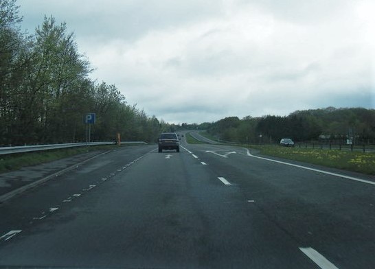
A4060 near
Cwmblacks Farm, Merthyr Tydfil 2951641 3f324ad0.jpg
47:
A4060_near_Cwmblacks_Farm,_Merthyr_Tydfil_2951641_3f324ad0.jpg
130:
61:
415:
Add a one-line explanation of what this file represents
1168:
1108:
169:
Creative
Commons Attribution Share-alike license 2.0
85:
Commons is a freely licensed media file repository.
624:
Creative
Commons Attribution-ShareAlike 2.0 Generic
598:
Creative
Commons Attribution-ShareAlike 2.0 Generic
121:A4060 near Cwmblacks Farm, Merthyr Tydfil, Wales
51:(546 × 392 pixels, file size: 60 KB, MIME type:
384:https://creativecommons.org/licenses/by-sa/2.0
66:
726:https:\/\/www.geograph.org.uk\/photo\/2951641
451:https:\/\/www.geograph.org.uk\/profile\/25416
390:Creative Commons Attribution-Share Alike 2.0
308:
157:
126:
108:
147:
136:
14:
1061:
1016:
971:
645:
350:– to copy, distribute and transmit the work
795:https://www.geograph.org.uk/photo/2951641
507:https://www.geograph.org.uk/profile/25416
934:349b8d8c47366e940bc56d9576a6346279dc9ff0
248:View this and other nearby images on:
1214:Windows Photo Editor 10.0.10011.16384
201:
97:
295:and is licensed for reuse under the
216:
1170:The following page uses this file:
1101:
331:Attribution-Share Alike 2.0 Generic
319:
314:
299:Attribution-ShareAlike 2.0 license.
13:
1183:
420:
414:
305:
282:
115:
98:
44:
1269:
1190:
419:
1194:Date and time of data generation
656:coordinates of the point of view
638:coordinates of the point of view
405:
361:Under the following conditions:
326:This file is licensed under the
318:
313:
307:
275:
254:
240:
232:
65:
21:
402:
116:
41:No higher resolution available.
1105:
760:file available on the internet
710:file available on the internet
401:
283:This image was taken from the
26:
1:
671:51°44'24.126"N, 3°21'42.332"W
31:
1244:DateTimeDigitized subseconds
1165:
780:Geograph Britain and Ireland
718:Geograph Britain and Ireland
528:object of statement has role
459:object of statement has role
427:Items portrayed in this file
267:
7:
1236:DateTimeOriginal subseconds
1228:Date and time of digitizing
1180:
10:
1274:
375:same or compatible license
231:
105:
100:
1220:File change date and time
1102:
209:A4060 near Cwmblacks Farm
190:A4060 near Cwmblacks Farm
16:
803:geograph.org.uk image ID
730:geograph.org.uk image ID
404:
341:
72:This is a file from the
36:
1159:
207:Colin Pyle /
188:Colin Pyle /
179:required by the license
129:
76:. Information from its
289:this photograph's page
260:51.740035; -3.361759
79:description page there
946:determination method
905:determination method
1231:18:32, 5 March 2016
1223:18:35, 5 March 2016
1197:18:32, 5 March 2016
1138:18:37, 5 March 2016
356:– to adapt the work
515:author name string
455:author name string
1261:
1260:
1163:
1063:
1018:
973:
647:
608:copyright license
594:copyright license
413:
304:
303:
287:collection. See
265:
264:
214:
213:
182:
166:
163:Reusing this file
94:
93:
74:Wikimedia Commons
1265:
1191:
1150:
1112:
1090:
1045:
1000:
955:
950:
812:
807:
797:
792:
788:described at URL
782:
777:
722:described at URL
693:
692:
687:
564:copyright status
550:copyright status
537:
532:
522:
519:
509:
504:
411:
397:
394:
391:
388:
385:
377:as the original.
339:
328:Creative Commons
322:
321:
317:
316:
311:
310:
297:Creative Commons
285:Geograph project
279:
272:
261:
258:
244:
243:
237:
236:
235:
229:
228:
217:
176:
160:
132:
120:
112:
106:
90:
69:
68:
62:
56:
54:
1273:
1272:
1268:
1267:
1266:
1264:
1263:
1262:
1179:
1164:
1156:
1148:
1104:
1103:
1100:
1099:
1098:
1097:
1096:
1095:
1094:
1093:
1091:
1088:
1078:
1077:
1076:
1074:
1055:
1054:
1053:
1052:
1051:
1050:
1049:
1048:
1046:
1043:
1033:
1032:
1031:
1029:
1010:
1009:
1008:
1007:
1006:
1005:
1004:
1003:
1001:
998:
988:
987:
986:
984:
965:
964:
963:
962:
961:
960:
959:
958:
957:
956:
951:
948:
939:
938:
937:
935:
925:
924:
923:
921:
898:
897:
896:
895:
894:
893:
892:
891:
889:
879:
878:
877:
875:
860:
859:
858:
857:
856:
855:
854:
853:
851:
841:
840:
839:
837:
822:
821:
820:
819:
818:
817:
816:
815:
814:
813:
808:
805:
799:
798:
793:
790:
784:
783:
778:
775:
766:
765:
764:
762:
750:
749:
748:
746:
703:
702:
701:
700:
699:
698:
697:
696:
695:
694:
690:
688:
685:
676:
675:
674:
672:
662:
661:
660:
658:
635:
634:
633:
632:
631:
630:
629:
628:
626:
614:
613:
612:
610:
591:
590:
589:
588:
587:
586:
585:
584:
582:
570:
569:
568:
566:
547:
546:
545:
544:
543:
542:
541:
540:
539:
538:
533:
530:
524:
523:
520:
517:
511:
510:
505:
502:
493:
492:
491:
489:
479:
478:
477:
475:
440:
439:
438:
437:
436:
434:
418:
417:
416:
399:
398:
395:
392:
389:
386:
383:
382:
340:
337:
334:
323:
300:
270:
259:
233:
224:
223:
220:Camera location
215:
204:
197:
185:
142:geograph.org.uk
122:
110:
103:
96:
95:
84:
83:
82:is shown below.
58:
52:
50:
43:
42:
12:
11:
5:
1271:
1259:
1258:
1255:
1249:
1248:
1245:
1241:
1240:
1237:
1233:
1232:
1229:
1225:
1224:
1221:
1217:
1216:
1211:
1207:
1206:
1203:
1199:
1198:
1195:
1182:
1178:
1177:
1167:
1162:
1161:
1158:
1154:
1151:
1145:
1140:
1135:
1131:
1130:
1127:
1124:
1121:
1118:
1115:
1107:
1092:
1086:
1084:
1083:
1082:
1080:
1079:
1075:
1070:
1068:
1067:
1066:
1065:
1059:
1047:
1041:
1039:
1038:
1037:
1035:
1034:
1030:
1025:
1023:
1022:
1021:
1020:
1014:
1002:
996:
994:
993:
992:
990:
989:
985:
980:
978:
977:
976:
975:
969:
944:
943:
942:
941:
940:
936:
933:
931:
930:
929:
927:
926:
922:
917:
915:
914:
913:
912:
910:
906:
902:
890:
887:
885:
884:
883:
881:
880:
876:
871:
869:
868:
867:
866:
864:
852:
849:
847:
846:
845:
843:
842:
838:
833:
831:
830:
829:
828:
826:
801:
800:
786:
785:
771:
770:
769:
768:
767:
763:
758:
756:
755:
754:
752:
751:
747:
744:source of file
742:
740:
739:
738:
737:
735:
731:
727:
723:
719:
715:
711:
707:
706:source of file
681:
680:
679:
678:
677:
673:
670:
668:
667:
666:
664:
663:
659:
654:
652:
651:
650:
649:
643:
639:
627:
622:
620:
619:
618:
616:
615:
611:
606:
604:
603:
602:
601:
599:
595:
583:
578:
576:
575:
574:
572:
571:
567:
562:
560:
559:
558:
557:
555:
551:
526:
525:
513:
512:
498:
497:
496:
495:
494:
490:
487:
485:
484:
483:
481:
480:
476:
471:
469:
468:
467:
466:
464:
460:
456:
452:
448:
444:
435:
430:
428:
425:
424:
423:
422:
410:
409:
406:
403:
381:
380:
379:
378:
368:
359:
358:
357:
351:
344:You are free:
335:
325:
324:
306:
302:
301:
280:
269:
266:
263:
262:
252:
246:
221:
212:
211:
205:
202:
199:
198:
193:
186:
183:
171:
170:
167:
155:
154:
149:
145:
144:
138:
134:
133:
128:
124:
123:
113:
104:
102:
99:
92:
91:
70:
60:
59:
40:
35:
34:
29:
24:
19:
9:
6:
4:
3:
2:
1270:
1256:
1254:
1251:
1250:
1246:
1243:
1242:
1238:
1235:
1234:
1230:
1227:
1226:
1222:
1219:
1218:
1215:
1212:
1210:Software used
1209:
1208:
1204:
1201:
1200:
1196:
1193:
1192:
1189:
1186:
1176:
1173:
1172:
1171:
1157:
1152:
1146:
1144:
1141:
1139:
1136:
1133:
1132:
1128:
1125:
1122:
1119:
1116:
1114:
1113:
1111:
1085:
1073:
1069:
1040:
1028:
1024:
995:
983:
979:
954:
947:
932:
920:
916:
886:
874:
870:
848:
836:
832:
811:
804:
796:
789:
781:
774:
761:
757:
745:
741:
684:
669:
657:
653:
625:
621:
609:
605:
581:
577:
565:
561:
536:
529:
516:
508:
501:
486:
474:
470:
433:
429:
426:
407:
400:
387:CC BY-SA 2.0
376:
372:
369:
366:
363:
362:
360:
355:
352:
349:
346:
345:
343:
342:
336:Attribution:
332:
329:
312:
298:
294:
290:
286:
281:
278:
274:
273:
257:
253:
251:
250:OpenStreetMap
247:
245:
227:
222:
219:
218:
210:
206:
200:
196:
192: /
191:
187:
180:
175:
173:
172:
168:
164:
159:
156:
153:
150:
146:
143:
139:
135:
125:
119:
114:
107:
88:
81:
80:
75:
71:
64:
63:
57:
48:
39:
33:
30:
28:
25:
23:
20:
18:
15:
1187:
1184:
1169:
1109:
1106:File history
535:photographer
463:photographer
370:
364:
353:
347:
292:
230:
208:
195:CC BY-SA 2.0
189:
117:
87:You can help
77:
45:
22:File history
1253:Color space
1202:Orientation
1155:Seth Whales
580:copyrighted
554:copyrighted
371:share alike
365:attribution
174:Attribution
109:Description
1175:A4060 road
1166:File usage
1147:546 × 392
1123:Dimensions
888:image/jpeg
873:media type
863:media type
850:7 May 2012
521:Colin Pyle
488:some value
338:Colin Pyle
293:Colin Pyle
158:Permission
152:Colin Pyle
131:7 May 2012
53:image/jpeg
27:File usage
1120:Thumbnail
1117:Date/Time
982:data size
968:data size
835:inception
825:inception
268:Licensing
203:InfoField
184:InfoField
118:English:
1181:Metadata
919:checksum
901:checksum
773:operator
714:operator
408:Captions
354:to remix
348:to share
333:license.
32:Metadata
1149:(60 KB)
1134:current
1129:Comment
997:61,822
810:2951641
734:2951641
683:heading
642:heading
473:creator
443:creator
432:depicts
412:English
101:Summary
49:
1205:Normal
1027:height
1013:height
691:degree
646:degree
238:
148:Author
137:Source
1089:pixel
1072:width
1062:pixel
1058:width
1044:pixel
1017:pixel
953:SHA-1
909:SHA-1
140:From
1257:sRGB
1126:User
1087:546
1042:392
999:byte
972:byte
396:true
393:true
127:Date
17:File
500:URL
447:URL
1247:00
1239:00
949::
806::
791::
776::
689:0
686::
531::
518::
503::
181:)
177:(
165:)
161:(
89:.
55:)
