847:"}},"text\/plain":{"en":{"":"coordinates of the point of view"}}},"{\"value\":{\"latitude\":51.259201,\"longitude\":-3.009707,\"altitude\":null,\"precision\":1.0e-6,\"globe\":\"http:\\\/\\\/www.wikidata.org\\\/entity\\\/Q2\"},\"type\":\"globecoordinate\"}":{"text\/html":{"en":{"P1259":"51\u00b015'33.124"N, 3\u00b00'34.945"W"}},"text\/plain":{"en":{"P1259":"51\u00b015'33.124\"N, 3\u00b00'34.945\"W"}}},"{\"value\":{\"entity-type\":\"property\",\"numeric-id\":7787,\"id\":\"P7787\"},\"type\":\"wikibase-entityid\"}":{"text\/html":{"en":{"":"
915:"}},"text\/plain":{"en":{"":"coordinates of depicted place"}}},"{\"value\":{\"latitude\":51.26041,\"longitude\":-3.0102,\"altitude\":null,\"precision\":1.0e-5,\"globe\":\"http:\\\/\\\/www.wikidata.org\\\/entity\\\/Q2\"},\"type\":\"globecoordinate\"}":{"text\/html":{"en":{"P9149":"51\u00b015'37.48"N, 3\u00b00'36.72"W"}},"text\/plain":{"en":{"P9149":"51\u00b015'37.48\"N, 3\u00b00'36.72\"W"}}},"{\"value\":{\"entity-type\":\"property\",\"numeric-id\":7787,\"id\":\"P7787\"},\"type\":\"wikibase-entityid\"}":{"text\/html":{"en":{"":"
1021:"}},"text\/plain":{"en":{"":"checksum"}}},"{\"value\":\"783d8b2b78f4b3946cf8ddce321fc2cca7e4a712\",\"type\":\"string\"}":{"text\/html":{"en":{"P4092":"783d8b2b78f4b3946cf8ddce321fc2cca7e4a712"}},"text\/plain":{"en":{"P4092":"783d8b2b78f4b3946cf8ddce321fc2cca7e4a712"}}},"{\"value\":{\"entity-type\":\"property\",\"numeric-id\":459,\"id\":\"P459\"},\"type\":\"wikibase-entityid\"}":{"text\/html":{"en":{"":"
507:"}},"text\/plain":{"en":{"":"author name string"}}},"{\"value\":\"Ken Grainger\",\"type\":\"string\"}":{"text\/html":{"en":{"P2093":"Ken Grainger"}},"text\/plain":{"en":{"P2093":"Ken Grainger"}}},"{\"value\":{\"entity-type\":\"property\",\"numeric-id\":3831,\"id\":\"P3831\"},\"type\":\"wikibase-entityid\"}":{"text\/html":{"en":{"":"
809:"}},"text\/plain":{"en":{"":"inception"}}},"{\"value\":{\"time\":\"+2011-11-01T00:00:00Z\",\"timezone\":0,\"before\":0,\"after\":0,\"precision\":11,\"calendarmodel\":\"http:\\\/\\\/www.wikidata.org\\\/entity\\\/Q1985727\"},\"type\":\"time\"}":{"text\/html":{"en":{"P571":"1 November 2011"}},"text\/plain":{"en":{"P571":"1 November 2011"}}}}": -->
686:
292:
242:
284:
234:
1017:
256:
327:
365:
370:
67:
503:"}},"text\/plain":{"en":{"P2699":"https:\/\/www.geograph.org.uk\/profile\/28395"}}},"{\"value\":{\"entity-type\":\"property\",\"numeric-id\":2093,\"id\":\"P2093\"},\"type\":\"wikibase-entityid\"}":{"text\/html":{"en":{"":"
710:"}},"text\/plain":{"en":{"P973":"https:\/\/www.geograph.org.uk\/photo\/2675482"}}},"{\"value\":{\"entity-type\":\"property\",\"numeric-id\":7384,\"id\":\"P7384\"},\"type\":\"wikibase-entityid\"}":{"text\/html":{"en":{"":"
694:"}},"text\/plain":{"en":{"P7482":"file available on the internet"}}},"{\"value\":{\"entity-type\":\"property\",\"numeric-id\":137,\"id\":\"P137\"},\"type\":\"wikibase-entityid\"}":{"text\/html":{"en":{"":"
511:"}},"text\/plain":{"en":{"":"object of statement has role"}}},"{\"value\":{\"entity-type\":\"item\",\"numeric-id\":33231,\"id\":\"Q33231\"},\"type\":\"wikibase-entityid\"}":{"text\/html":{"en":{"P3831":"
702:"}},"text\/plain":{"en":{"P137":"Geograph Britain and Ireland"}}},"{\"value\":{\"entity-type\":\"property\",\"numeric-id\":973,\"id\":\"P973\"},\"type\":\"wikibase-entityid\"}":{"text\/html":{"en":{"":"
1025:"}},"text\/plain":{"en":{"":"determination method"}}},"{\"value\":{\"entity-type\":\"item\",\"numeric-id\":13414952,\"id\":\"Q13414952\"},\"type\":\"wikibase-entityid\"}":{"text\/html":{"en":{"P459":"
983:"}},"text\/plain":{"en":{"":"media type"}}},"{\"value\":\"image\\\/jpeg\",\"type\":\"string\"}":{"text\/html":{"en":{"P1163":"image\/jpeg"}},"text\/plain":{"en":{"P1163":"image\/jpeg"}}}}": -->
646:"}},"text\/plain":{"en":{"":"copyright license"}}},"{\"value\":{\"entity-type\":\"item\",\"numeric-id\":19068220,\"id\":\"Q19068220\"},\"type\":\"wikibase-entityid\"}":{"text\/html":{"en":{"P275":"
602:"}},"text\/plain":{"en":{"":"copyright status"}}},"{\"value\":{\"entity-type\":\"item\",\"numeric-id\":50423863,\"id\":\"Q50423863\"},\"type\":\"wikibase-entityid\"}":{"text\/html":{"en":{"P6216":"
690:"}},"text\/plain":{"en":{"":"source of file"}}},"{\"value\":{\"entity-type\":\"item\",\"numeric-id\":74228490,\"id\":\"Q74228490\"},\"type\":\"wikibase-entityid\"}":{"text\/html":{"en":{"P7482":"
1088:"}},"text\/plain":{"en":{"":"data size"}}},"{\"value\":{\"amount\":\"+144387\",\"unit\":\"http:\\\/\\\/www.wikidata.org\\\/entity\\\/Q8799\"},\"type\":\"quantity\"}":{"text\/html":{"en":{"P3575":"144,387
1261:
1133:"}},"text\/plain":{"en":{"":"height"}}},"{\"value\":{\"amount\":\"+480\",\"unit\":\"http:\\\/\\\/www.wikidata.org\\\/entity\\\/Q355198\"},\"type\":\"quantity\"}":{"text\/html":{"en":{"P2048":"480
919:"}},"text\/plain":{"en":{"":"heading"}}},"{\"value\":{\"amount\":\"+337\",\"unit\":\"http:\\\/\\\/www.wikidata.org\\\/entity\\\/Q28390\"},\"type\":\"quantity\"}":{"text\/html":{"en":{"P7787":"337
851:"}},"text\/plain":{"en":{"":"heading"}}},"{\"value\":{\"amount\":\"+337\",\"unit\":\"http:\\\/\\\/www.wikidata.org\\\/entity\\\/Q28390\"},\"type\":\"quantity\"}":{"text\/html":{"en":{"P7787":"337
698:"}},"text\/plain":{"en":{"":"operator"}}},"{\"value\":{\"entity-type\":\"item\",\"numeric-id\":1503119,\"id\":\"Q1503119\"},\"type\":\"wikibase-entityid\"}":{"text\/html":{"en":{"P137":"
1178:"}},"text\/plain":{"en":{"":"width"}}},"{\"value\":{\"amount\":\"+640\",\"unit\":\"http:\\\/\\\/www.wikidata.org\\\/entity\\\/Q355198\"},\"type\":\"quantity\"}":{"text\/html":{"en":{"P2049":"640
495:"}},"text\/plain":{"en":{"":"creator"}}},"{\"value\":{\"entity-type\":\"property\",\"numeric-id\":2699,\"id\":\"P2699\"},\"type\":\"wikibase-entityid\"}":{"text\/html":{"en":{"":"
1174:
38:
714:"}},"text\/plain":{"en":{"":"geograph.org.uk image ID"}}},"{\"value\":\"2675482\",\"type\":\"string\"}":{"text\/html":{"en":{"P7384":"
225:
417:– You must give appropriate credit, provide a link to the license, and indicate if changes were made. You may do so in any reasonable manner, but not in any way that suggests the licensor endorses you or your use.
239:
289:
46:
78:
715:
1026:
691:
647:
603:
699:
512:
1175:
1130:
1085:
1018:
980:
916:
912:
848:
844:
711:
687:
599:
508:
504:
496:
707:
500:
1022:
806:
703:
695:
643:
492:
650:"}},"text\/plain":{"en":{"P275":"Creative Commons Attribution-ShareAlike 2.0 Generic"}}}}": -->
162:
1070:
741:
673:
629:
299:
249:
761:
334:
1303:
This file contains additional information, probably added from the digital camera or scanner used to create or digitize it.
1260:
1255:
424:
37:
584:
1189:
1144:
1099:
1036:
990:
957:
930:
889:
862:
784:
725:
613:
577:
564:
549:
1063:
816:
769:
754:
657:
522:
481:
380:
1292:
1029:"}},"text\/plain":{"en":{"P459":"saquina cha\u00faque"}}}}": -->
1306:
If the file has been modified from its original state, some details may not fully reflect the modified file.
423:– If you remix, transform, or build upon the material, you must distribute your contributions under the
341:
on the
Geograph website for the photographer's contact details. The copyright on this image is owned by
1092:"}},"text\/plain":{"en":{"P3575":"144,387 byte"}}}}": -->
515:"}},"text\/plain":{"en":{"P3831":"photographer"}}}}": -->
606:"}},"text\/plain":{"en":{"P6216":"copyrighted"}}}}": -->
923:"}},"text\/plain":{"en":{"P7787":"337 degree"}}}}": -->
855:"}},"text\/plain":{"en":{"P7787":"337 degree"}}}}": -->
1182:"}},"text\/plain":{"en":{"P2049":"640 pixel"}}}}": -->
1137:"}},"text\/plain":{"en":{"P2048":"480 pixel"}}}}": -->
718:"}},"text\/plain":{"en":{"P7384":"2675482"}}}}": -->
86:
194:
791:
776:
556:
377:
178:
8:
321:
305:
255:
346:
73:
471:
151:
141:
1199:
1154:
1109:
1046:
1000:
940:
872:
826:
735:
667:
623:
532:
326:
338:
1271:
1228:
Click on a date/time to view the file as it appeared at that time.
291:
241:
226:
51° 15′ 33.12″ N, 3° 00′ 34.95″ W
276:
51° 15′ 37.5″ N, 3° 00′ 37″ W
130:
61:
465:
Add a one-line explanation of what this file represents
1286:
111:
Burnham and Berrow Golf Course (geograph 2675482).jpg
47:
Burnham_and_Berrow_Golf_Course_(geograph_2675482).jpg
1226:
169:
Creative
Commons Attribution Share-alike license 2.0
85:
Commons is a freely licensed media file repository.
674:
Creative
Commons Attribution-ShareAlike 2.0 Generic
648:
Creative
Commons Attribution-ShareAlike 2.0 Generic
51:(640 × 480 pixels, file size: 141 KB, MIME type:
434:https://creativecommons.org/licenses/by-sa/2.0
66:
708:https:\/\/www.geograph.org.uk\/photo\/2675482
501:https:\/\/www.geograph.org.uk\/profile\/28395
440:Creative Commons Attribution-Share Alike 2.0
358:
157:
126:
108:
147:
136:
14:
1179:
1134:
1089:
920:
852:
400:– to copy, distribute and transmit the work
777:https://www.geograph.org.uk/photo/2675482
557:https://www.geograph.org.uk/profile/28395
1052:783d8b2b78f4b3946cf8ddce321fc2cca7e4a712
1278:Transferred from geograph.co.uk using
298:View this and other nearby images on:
248:View this and other nearby images on:
201:
97:
345:and is licensed for reuse under the
266:
216:
1288:The following page uses this file:
1219:
381:Attribution-Share Alike 2.0 Generic
369:
364:
349:Attribution-ShareAlike 2.0 license.
13:
1301:
470:
464:
355:
332:
115:
98:
44:
1327:
1308:
469:
863:coordinates of the point of view
845:coordinates of the point of view
455:
411:Under the following conditions:
376:This file is licensed under the
368:
363:
357:
325:
304:
290:
282:
254:
240:
232:
65:
21:
452:
116:
41:No higher resolution available.
1293:Burnham & Berrow Golf Club
1223:
742:file available on the internet
692:file available on the internet
451:
333:This image was taken from the
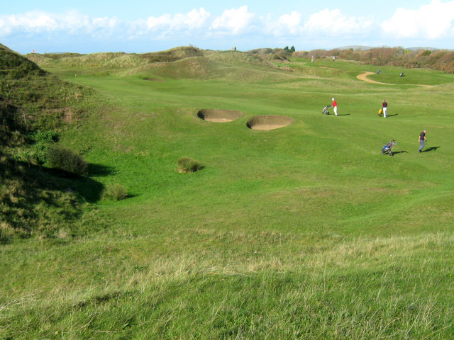
209:Burnham and Berrow Golf Course
190:Burnham and Berrow Golf Course
121:Burnham and Berrow Golf Course
26:
1:
931:coordinates of depicted place
913:coordinates of depicted place
31:
1315:LEAD Technologies Inc. V1.01
1283:
878:51°15'33.124"N, 3°0'34.945"W
762:Geograph Britain and Ireland
700:Geograph Britain and Ireland
578:object of statement has role
509:object of statement has role
477:Items portrayed in this file
317:
281:
231:
7:
1298:
10:
1332:
946:51°15'37.48"N, 3°0'36.72"W
425:same or compatible license
105:
100:
1220:
207:Ken Grainger /
188:Ken Grainger /
16:
785:geograph.org.uk image ID
712:geograph.org.uk image ID
454:
391:
72:This is a file from the
36:
1277:
1256:19:10, 9 September 2016
179:required by the license
129:
76:. Information from its
339:this photograph's page
310:51.260410; -3.010200
260:51.259201; -3.009707
79:description page there
1064:determination method
1027:saquina cha\u00faque
1023:determination method
406:– to adapt the work
565:author name string
505:author name string
1319:
1318:
1312:JPEG file comment
1281:
1181:
1136:
1091:
922:
854:
658:copyright license
644:copyright license
463:
354:
353:
337:collection. See
315:
314:
265:
264:
214:
213:
182:
166:
163:Reusing this file
94:
93:
74:Wikimedia Commons
1323:
1309:
1268:
1230:
1208:
1163:
1118:
1073:
1068:
968:
967:
962:
900:
899:
894:
794:
789:
779:
774:
770:described at URL
764:
759:
704:described at URL
614:copyright status
600:copyright status
587:
582:
572:
569:
559:
554:
461:
447:
444:
441:
438:
435:
427:as the original.
389:
378:Creative Commons
372:
371:
367:
366:
361:
360:
347:Creative Commons
335:Geograph project
329:
322:
311:
308:
294:
293:
287:
286:
285:
279:
278:
267:
261:
258:
244:
243:
237:
236:
235:
229:
228:
217:
176:
160:
132:
120:
112:
106:
90:
69:
68:
62:
56:
54:
1331:
1330:
1326:
1325:
1324:
1322:
1321:
1320:
1297:
1282:
1274:
1266:
1222:
1221:
1218:
1217:
1216:
1215:
1214:
1213:
1212:
1211:
1209:
1206:
1196:
1195:
1194:
1192:
1173:
1172:
1171:
1170:
1169:
1168:
1167:
1166:
1164:
1161:
1151:
1150:
1149:
1147:
1128:
1127:
1126:
1125:
1124:
1123:
1122:
1121:
1119:
1116:
1106:
1105:
1104:
1102:
1083:
1082:
1081:
1080:
1079:
1078:
1077:
1076:
1075:
1074:
1071:saquina chaúque
1069:
1066:
1057:
1056:
1055:
1053:
1043:
1042:
1041:
1039:
1016:
1015:
1014:
1013:
1012:
1011:
1010:
1009:
1007:
997:
996:
995:
993:
978:
977:
976:
975:
974:
973:
972:
971:
970:
969:
965:
963:
960:
951:
950:
949:
947:
937:
936:
935:
933:
910:
909:
908:
907:
906:
905:
904:
903:
902:
901:
897:
895:
892:
883:
882:
881:
879:
869:
868:
867:
865:
842:
841:
840:
839:
838:
837:
836:
835:
833:
832:1 November 2011
823:
822:
821:
819:
804:
803:
802:
801:
800:
799:
798:
797:
796:
795:
790:
787:
781:
780:
775:
772:
766:
765:
760:
757:
748:
747:
746:
744:
732:
731:
730:
728:
685:
684:
683:
682:
681:
680:
679:
678:
676:
664:
663:
662:
660:
641:
640:
639:
638:
637:
636:
635:
634:
632:
620:
619:
618:
616:
597:
596:
595:
594:
593:
592:
591:
590:
589:
588:
583:
580:
574:
573:
570:
567:
561:
560:
555:
552:
543:
542:
541:
539:
529:
528:
527:
525:
490:
489:
488:
487:
486:
484:
468:
467:
466:
449:
448:
445:
442:
439:
436:
433:
432:
390:
387:
384:
373:
350:
320:
309:
283:
274:
273:
270:Object location
259:
233:
224:
223:
220:Camera location
215:
204:
197:
185:
142:geograph.org.uk
131:1 November 2011
122:
110:
103:
96:
95:
84:
83:
82:is shown below.
58:
52:
50:
43:
42:
12:
11:
5:
1329:
1317:
1316:
1313:
1300:
1296:
1295:
1285:
1280:
1279:
1276:
1272:
1269:
1263:
1258:
1253:
1249:
1248:
1245:
1242:
1239:
1236:
1233:
1225:
1210:
1204:
1202:
1201:
1200:
1198:
1197:
1193:
1188:
1186:
1185:
1184:
1183:
1177:
1165:
1159:
1157:
1156:
1155:
1153:
1152:
1148:
1143:
1141:
1140:
1139:
1138:
1132:
1120:
1114:
1112:
1111:
1110:
1108:
1107:
1103:
1098:
1096:
1095:
1094:
1093:
1087:
1062:
1061:
1060:
1059:
1058:
1054:
1051:
1049:
1048:
1047:
1045:
1044:
1040:
1035:
1033:
1032:
1031:
1030:
1028:
1024:
1020:
1008:
1005:
1003:
1002:
1001:
999:
998:
994:
989:
987:
986:
985:
984:
982:
956:
955:
954:
953:
952:
948:
945:
943:
942:
941:
939:
938:
934:
929:
927:
926:
925:
924:
918:
914:
888:
887:
886:
885:
884:
880:
877:
875:
874:
873:
871:
870:
866:
861:
859:
858:
857:
856:
850:
846:
834:
831:
829:
828:
827:
825:
824:
820:
815:
813:
812:
811:
810:
808:
783:
782:
768:
767:
753:
752:
751:
750:
749:
745:
740:
738:
737:
736:
734:
733:
729:
726:source of file
724:
722:
721:
720:
719:
717:
713:
709:
705:
701:
697:
693:
689:
688:source of file
677:
672:
670:
669:
668:
666:
665:
661:
656:
654:
653:
652:
651:
649:
645:
633:
628:
626:
625:
624:
622:
621:
617:
612:
610:
609:
608:
607:
605:
601:
576:
575:
563:
562:
548:
547:
546:
545:
544:
540:
537:
535:
534:
533:
531:
530:
526:
521:
519:
518:
517:
516:
514:
510:
506:
502:
498:
494:
485:
480:
478:
475:
474:
473:
472:
460:
459:
456:
453:
431:
430:
429:
428:
418:
409:
408:
407:
401:
394:You are free:
385:
375:
374:
356:
352:
351:
330:
319:
316:
313:
312:
302:
296:
271:
263:
262:
252:
246:
221:
212:
211:
205:
202:
199:
198:
193:
186:
183:
171:
170:
167:
155:
154:
149:
145:
144:
138:
134:
133:
128:
124:
123:
113:
104:
102:
99:
92:
91:
70:
60:
59:
40:
35:
34:
29:
24:
19:
9:
6:
4:
3:
2:
1328:
1314:
1311:
1310:
1307:
1304:
1294:
1291:
1290:
1289:
1275:
1270:
1264:
1262:
1259:
1257:
1254:
1251:
1250:
1246:
1243:
1240:
1237:
1234:
1232:
1231:
1229:
1203:
1191:
1187:
1158:
1146:
1142:
1113:
1101:
1097:
1072:
1065:
1050:
1038:
1034:
1004:
992:
988:
959:
944:
932:
928:
891:
876:
864:
860:
830:
818:
814:
793:
786:
778:
771:
763:
756:
743:
739:
727:
723:
675:
671:
659:
655:
631:
627:
615:
611:
586:
579:
566:
558:
551:
536:
524:
520:
483:
479:
476:
457:
450:
437:CC BY-SA 2.0
426:
422:
419:
416:
413:
412:
410:
405:
402:
399:
396:
395:
393:
392:
386:Attribution:
382:
379:
362:
348:
344:
340:
336:
331:
328:
324:
323:
307:
303:
301:
300:OpenStreetMap
297:
295:
277:
272:
269:
268:
257:
253:
251:
250:OpenStreetMap
247:
245:
227:
222:
219:
218:
210:
206:
200:
196:
192: /
191:
187:
180:
175:
173:
172:
168:
164:
159:
156:
153:
150:
146:
143:
139:
135:
125:
119:
114:
107:
88:
81:
80:
75:
71:
64:
63:
57:
48:
39:
33:
30:
28:
25:
23:
20:
18:
15:
1305:
1302:
1287:
1227:
1224:File history
585:photographer
571:Ken Grainger
513:photographer
420:
414:
403:
397:
388:Ken Grainger
343:Ken Grainger
342:
280:
230:
208:
195:CC BY-SA 2.0
189:
152:Ken Grainger
117:
87:You can help
77:
45:
22:File history
630:copyrighted
604:copyrighted
421:share alike
415:attribution
174:Attribution
109:Description
1284:File usage
1265:640 × 480
1241:Dimensions
1006:image/jpeg
991:media type
981:media type
538:some value
158:Permission
53:image/jpeg
27:File usage
1238:Thumbnail
1235:Date/Time
1100:data size
1086:data size
817:inception
807:inception
318:Licensing
203:InfoField
184:InfoField
118:English:
1299:Metadata
1267:(141 KB)
1115:144,387
1037:checksum
1019:checksum
755:operator
696:operator
458:Captions
404:to remix
398:to share
383:license.
32:Metadata
1252:current
1247:Comment
958:heading
917:heading
890:heading
849:heading
792:2675482
716:2675482
523:creator
493:creator
482:depicts
462:English
101:Summary
49:
1145:height
1131:height
966:degree
921:degree
898:degree
853:degree
288:
238:
148:Author
137:Source
1207:pixel
1190:width
1180:pixel
1176:width
1162:pixel
1135:pixel
140:From
1273:Rodw
1244:User
1205:640
1160:480
1117:byte
1090:byte
964:337
896:337
446:true
443:true
127:Date
17:File
550:URL
497:URL
1067::
961::
893::
788::
773::
758::
581::
568::
553::
181:)
177:(
165:)
161:(
89:.
55:)
Text is available under the Creative Commons Attribution-ShareAlike License. Additional terms may apply.
.jpg)
.jpg¶ms=051.259201_N_-003.009707_E_globe:Earth_type:camera_heading:337.00_source:geograph&language=en)
.jpg¶ms=051.260410_N_-003.010200_E_globe:Earth_class:object_type:object_source:geograph-osgb36(ST29605173)_region:GB-GBN_heading:337.00&language=en)
