798:"}},"text\/plain":{"en":{"":"coordinates of the point of view"}}},"{\"value\":{\"latitude\":51.50301,\"longitude\":-0.6655,\"altitude\":null,\"precision\":1.0e-5,\"globe\":\"http:\\\/\\\/www.wikidata.org\\\/entity\\\/Q2\"},\"type\":\"globecoordinate\"}":{"text\/html":{"en":{"P1259":"51\u00b030'10.84"N, 0\u00b039'55.80"W"}},"text\/plain":{"en":{"P1259":"51\u00b030'10.84\"N, 0\u00b039'55.80\"W"}}},"{\"value\":{\"entity-type\":\"property\",\"numeric-id\":7787,\"id\":\"P7787\"},\"type\":\"wikibase-entityid\"}":{"text\/html":{"en":{"":"
904:"}},"text\/plain":{"en":{"":"coordinates of depicted place"}}},"{\"value\":{\"latitude\":51.50311,\"longitude\":-0.6658,\"altitude\":null,\"precision\":1.0e-5,\"globe\":\"http:\\\/\\\/www.wikidata.org\\\/entity\\\/Q2\"},\"type\":\"globecoordinate\"}":{"text\/html":{"en":{"P9149":"51\u00b030'11.20"N, 0\u00b039'56.88"W"}},"text\/plain":{"en":{"P9149":"51\u00b030'11.20\"N, 0\u00b039'56.88\"W"}}},"{\"value\":{\"entity-type\":\"property\",\"numeric-id\":7787,\"id\":\"P7787\"},\"type\":\"wikibase-entityid\"}":{"text\/html":{"en":{"":"
488:"}},"text\/plain":{"en":{"":"author name string"}}},"{\"value\":\"Kevin White\",\"type\":\"string\"}":{"text\/html":{"en":{"P2093":"Kevin White"}},"text\/plain":{"en":{"P2093":"Kevin White"}}},"{\"value\":{\"entity-type\":\"property\",\"numeric-id\":2699,\"id\":\"P2699\"},\"type\":\"wikibase-entityid\"}":{"text\/html":{"en":{"":"
866:"}},"text\/plain":{"en":{"":"inception"}}},"{\"value\":{\"time\":\"+2008-08-21T00:00:00Z\",\"timezone\":0,\"before\":0,\"after\":0,\"precision\":11,\"calendarmodel\":\"http:\\\/\\\/www.wikidata.org\\\/entity\\\/Q1985727\"},\"type\":\"time\"}":{"text\/html":{"en":{"P571":"21 August 2008"}},"text\/plain":{"en":{"P571":"21 August 2008"}}}}": -->
675:
281:
231:
273:
223:
900:
245:
316:
354:
359:
72:
496:"}},"text\/plain":{"en":{"P2699":"https:\/\/www.geograph.org.uk\/profile\/40851"}}},"{\"value\":{\"entity-type\":\"property\",\"numeric-id\":3831,\"id\":\"P3831\"},\"type\":\"wikibase-entityid\"}":{"text\/html":{"en":{"":"
691:"}},"text\/plain":{"en":{"P973":"https:\/\/www.geograph.org.uk\/photo\/1496320"}}},"{\"value\":{\"entity-type\":\"property\",\"numeric-id\":7384,\"id\":\"P7384\"},\"type\":\"wikibase-entityid\"}":{"text\/html":{"en":{"":"
683:"}},"text\/plain":{"en":{"P7482":"file available on the internet"}}},"{\"value\":{\"entity-type\":\"property\",\"numeric-id\":973,\"id\":\"P973\"},\"type\":\"wikibase-entityid\"}":{"text\/html":{"en":{"":"
500:"}},"text\/plain":{"en":{"":"object of statement has role"}}},"{\"value\":{\"entity-type\":\"item\",\"numeric-id\":33231,\"id\":\"Q33231\"},\"type\":\"wikibase-entityid\"}":{"text\/html":{"en":{"P3831":"
635:"}},"text\/plain":{"en":{"":"copyright license"}}},"{\"value\":{\"entity-type\":\"item\",\"numeric-id\":19068220,\"id\":\"Q19068220\"},\"type\":\"wikibase-entityid\"}":{"text\/html":{"en":{"P275":"
591:"}},"text\/plain":{"en":{"":"copyright status"}}},"{\"value\":{\"entity-type\":\"item\",\"numeric-id\":50423863,\"id\":\"Q50423863\"},\"type\":\"wikibase-entityid\"}":{"text\/html":{"en":{"P6216":"
679:"}},"text\/plain":{"en":{"":"source of file"}}},"{\"value\":{\"entity-type\":\"item\",\"numeric-id\":74228490,\"id\":\"Q74228490\"},\"type\":\"wikibase-entityid\"}":{"text\/html":{"en":{"P7482":"
908:"}},"text\/plain":{"en":{"":"heading"}}},"{\"value\":{\"amount\":\"+292\",\"unit\":\"http:\\\/\\\/www.wikidata.org\\\/entity\\\/Q28390\"},\"type\":\"quantity\"}":{"text\/html":{"en":{"P7787":"292
802:"}},"text\/plain":{"en":{"":"heading"}}},"{\"value\":{\"amount\":\"+292\",\"unit\":\"http:\\\/\\\/www.wikidata.org\\\/entity\\\/Q28390\"},\"type\":\"quantity\"}":{"text\/html":{"en":{"P7787":"292
703:"}},"text\/plain":{"en":{"":"operator"}}},"{\"value\":{\"entity-type\":\"item\",\"numeric-id\":1503119,\"id\":\"Q1503119\"},\"type\":\"wikibase-entityid\"}":{"text\/html":{"en":{"P137":"
699:"}},"text\/plain":{"en":{"P7384":"1496320"}}},"{\"value\":{\"entity-type\":\"property\",\"numeric-id\":137,\"id\":\"P137\"},\"type\":\"wikibase-entityid\"}":{"text\/html":{"en":{"":"
484:"}},"text\/plain":{"en":{"":"creator"}}},"{\"value\":{\"entity-type\":\"property\",\"numeric-id\":2093,\"id\":\"P2093\"},\"type\":\"wikibase-entityid\"}":{"text\/html":{"en":{"":"
587:
687:"}},"text\/plain":{"en":{"":"described at URL"}}},"{\"value\":\"https:\\\/\\\/www.geograph.org.uk\\\/photo\\\/1496320\",\"type\":\"string\"}":{"text\/html":{"en":{"P973":"
492:"}},"text\/plain":{"en":{"":"URL"}}},"{\"value\":\"https:\\\/\\\/www.geograph.org.uk\\\/profile\\\/40851\",\"type\":\"string\"}":{"text\/html":{"en":{"P2699":"
695:"}},"text\/plain":{"en":{"":"geograph.org.uk image ID"}}},"{\"value\":\"1496320\",\"type\":\"string\"}":{"text\/html":{"en":{"P7384":"
43:
264:
214:
406:– You must give appropriate credit, provide a link to the license, and indicate if changes were made. You may do so in any reasonable manner, but not in any way that suggests the licensor endorses you or your use.
278:
228:
696:
680:
636:
592:
704:
501:
905:
901:
799:
795:
692:
676:
588:
497:
489:
485:
688:
493:
863:
700:
684:
632:
481:
83:
51:
1020:
1027:== {{int:filedesc}} == {{Information |description={{en|1=Dorney Court}} |date=2008-08-21 |source=From |author= |permission= |other_versions= }
639:"}},"text\/plain":{"en":{"P275":"Creative Commons Attribution-ShareAlike 2.0 Generic"}}}}": -->
1051:
730:
662:
618:
288:
238:
780:
323:
1142:
This file contains additional information, probably added from the digital camera or scanner used to create or digitize it.
413:
573:
946:
919:
840:
813:
758:
714:
602:
566:
551:
538:
1061:
873:
773:
743:
646:
511:
470:
707:"}},"text\/plain":{"en":{"P137":"Geograph Britain and Ireland"}}}}": -->
1009:
1004:
369:
42:
1145:
If the file has been modified from its original state, some details may not fully reflect the modified file.
1056:
412:– If you remix, transform, or build upon the material, you must distribute your contributions under the
330:
on the
Geograph website for the photographer's contact details. The copyright on this image is owned by
1129:
504:"}},"text\/plain":{"en":{"P3831":"photographer"}}}}": -->
595:"}},"text\/plain":{"en":{"P6216":"copyrighted"}}}}": -->
912:"}},"text\/plain":{"en":{"P7787":"292 degree"}}}}": -->
806:"}},"text\/plain":{"en":{"P7787":"292 degree"}}}}": -->
91:
765:
750:
558:
366:
167:
8:
1084:
310:
294:
244:
1099:
335:
78:
460:
183:
1066:
1094:
156:
146:
1046:
929:
883:
823:
724:
656:
612:
521:
315:
327:
1104:
977:
Click on a date/time to view the file as it appeared at that time.
280:
230:
1041:
1109:
265:
51° 30′ 11″ N, 0° 39′ 57″ W
215:
51° 30′ 11″ N, 0° 39′ 56″ W
135:
66:
454:
Add a one-line explanation of what this file represents
1119:
1035:
1075:
975:
90:
Commons is a freely licensed media file repository.
663:
Creative
Commons Attribution-ShareAlike 2.0 Generic
637:
Creative
Commons Attribution-ShareAlike 2.0 Generic
56:(640 × 480 pixels, file size: 99 KB, MIME type:
423:https://creativecommons.org/licenses/by-sa/2.0
71:
689:https:\/\/www.geograph.org.uk\/photo\/1496320
494:https:\/\/www.geograph.org.uk\/profile\/40851
429:Creative Commons Attribution-Share Alike 2.0
347:
131:
113:
152:
141:
116:Dorney Court - geograph.org.uk - 1496320.jpg
52:Dorney_Court_-_geograph.org.uk_-_1496320.jpg
14:
1085:Grade I listed buildings in Buckinghamshire
1052:Grade I listed buildings in Buckinghamshire
909:
803:
389:– to copy, distribute and transmit the work
1077:The following other wikis use this file:
751:https://www.geograph.org.uk/photo/1496320
559:https://www.geograph.org.uk/profile/40851
287:View this and other nearby images on:
237:View this and other nearby images on:
1037:The following 6 pages use this file:
190:
102:
334:and is licensed for reuse under the
255:
205:
1100:Liste des musées du Buckinghamshire
968:
370:Attribution-Share Alike 2.0 Generic
358:
353:
338:Attribution-ShareAlike 2.0 license.
13:
1140:
1095:Saison 8 d'Inspecteur Barnaby
1062:List of museums in Buckinghamshire
459:
453:
344:
321:
120:
103:
49:
1166:
1147:
458:
814:coordinates of the point of view
796:coordinates of the point of view
444:
400:Under the following conditions:
365:This file is licensed under the
357:
352:
346:
314:
293:
279:
271:
243:
229:
221:
70:
31:
21:
441:
121:
46:No higher resolution available.
1072:
972:
731:file available on the internet
681:file available on the internet
440:
322:This image was taken from the
26:
1:
920:coordinates of depicted place
902:coordinates of depicted place
36:
1032:
781:Geograph Britain and Ireland
705:Geograph Britain and Ireland
567:object of statement has role
498:object of statement has role
466:Items portrayed in this file
306:
270:
220:
7:
1137:
1081:Usage on dag.wikipedia.org
935:51°30'11.20"N, 0°39'56.88"W
829:51°30'10.84"N, 0°39'55.80"W
10:
1171:
1126:Usage on zh.wikipedia.org
1116:Usage on www.wikidata.org
1091:Usage on fr.wikipedia.org
414:same or compatible license
110:
105:
969:
16:
1105:All Is True (film, 2018)
1057:James Palmer (1585–1658)
759:geograph.org.uk image ID
693:geograph.org.uk image ID
443:
380:
196:Kevin White /
177:Kevin White /
77:This is a file from the
41:
1026:
168:required by the license
134:
81:. Information from its
328:this photograph's page
299:51.503110; -0.665800
249:51.503010; -0.665500
84:description page there
1005:17:01, 2 March 2011
395:– to adapt the work
539:author name string
486:author name string
1158:
1157:
1073:Global file usage
1030:
911:
805:
647:copyright license
633:copyright license
452:
343:
342:
326:collection. See
304:
303:
254:
253:
203:
202:
171:
99:
98:
79:Wikimedia Commons
32:Global file usage
1162:
1148:
1017:
979:
957:
956:
951:
851:
850:
845:
783:
778:
768:
763:
753:
748:
744:described at URL
685:described at URL
603:copyright status
589:copyright status
576:
571:
561:
556:
546:
543:
450:
436:
433:
430:
427:
424:
416:as the original.
378:
367:Creative Commons
361:
360:
356:
355:
350:
349:
336:Creative Commons
324:Geograph project
318:
311:
300:
297:
283:
282:
276:
275:
274:
268:
267:
256:
250:
247:
233:
232:
226:
225:
224:
218:
217:
206:
165:
137:
125:
117:
111:
95:
74:
73:
67:
61:
59:
1170:
1169:
1165:
1164:
1163:
1161:
1160:
1159:
1136:
1071:
1067:William Garrard
1031:
1023:
1015:
971:
970:
967:
966:
965:
964:
963:
962:
961:
960:
959:
958:
954:
952:
949:
940:
939:
938:
936:
926:
925:
924:
922:
899:
898:
897:
896:
895:
894:
893:
892:
890:
880:
879:
878:
876:
861:
860:
859:
858:
857:
856:
855:
854:
853:
852:
848:
846:
843:
834:
833:
832:
830:
820:
819:
818:
816:
793:
792:
791:
790:
789:
788:
787:
786:
785:
784:
779:
776:
770:
769:
764:
761:
755:
754:
749:
746:
737:
736:
735:
733:
721:
720:
719:
717:
674:
673:
672:
671:
670:
669:
668:
667:
665:
653:
652:
651:
649:
630:
629:
628:
627:
626:
625:
624:
623:
621:
609:
608:
607:
605:
586:
585:
584:
583:
582:
581:
580:
579:
578:
577:
572:
569:
563:
562:
557:
554:
548:
547:
544:
541:
532:
531:
530:
528:
518:
517:
516:
514:
479:
478:
477:
476:
475:
473:
457:
456:
455:
438:
437:
434:
431:
428:
425:
422:
421:
379:
376:
373:
362:
339:
309:
298:
272:
263:
262:
259:Object location
248:
222:
213:
212:
209:Camera location
204:
193:
186:
174:
147:geograph.org.uk
127:
115:
108:
101:
100:
89:
88:
87:is shown below.
63:
57:
55:
48:
47:
12:
11:
5:
1168:
1156:
1155:
1152:
1139:
1135:
1134:
1133:
1132:
1124:
1123:
1122:
1114:
1113:
1112:
1107:
1102:
1097:
1089:
1088:
1087:
1074:
1070:
1069:
1064:
1059:
1054:
1049:
1044:
1034:
1029:
1028:
1025:
1021:
1018:
1012:
1007:
1002:
998:
997:
994:
991:
988:
985:
982:
974:
945:
944:
943:
942:
941:
937:
934:
932:
931:
930:
928:
927:
923:
918:
916:
915:
914:
913:
907:
903:
891:
889:21 August 2008
888:
886:
885:
884:
882:
881:
877:
872:
870:
869:
868:
867:
865:
839:
838:
837:
836:
835:
831:
828:
826:
825:
824:
822:
821:
817:
812:
810:
809:
808:
807:
801:
797:
772:
771:
757:
756:
742:
741:
740:
739:
738:
734:
729:
727:
726:
725:
723:
722:
718:
715:source of file
713:
711:
710:
709:
708:
706:
702:
698:
694:
690:
686:
682:
678:
677:source of file
666:
661:
659:
658:
657:
655:
654:
650:
645:
643:
642:
641:
640:
638:
634:
622:
617:
615:
614:
613:
611:
610:
606:
601:
599:
598:
597:
596:
594:
590:
565:
564:
550:
549:
537:
536:
535:
534:
533:
529:
526:
524:
523:
522:
520:
519:
515:
510:
508:
507:
506:
505:
503:
499:
495:
491:
487:
483:
474:
469:
467:
464:
463:
462:
461:
449:
448:
445:
442:
420:
419:
418:
417:
407:
398:
397:
396:
390:
383:You are free:
374:
364:
363:
345:
341:
340:
319:
308:
305:
302:
301:
291:
285:
260:
252:
251:
241:
235:
210:
201:
200:
194:
191:
188:
187:
182:
175:
172:
160:
159:
154:
150:
149:
143:
139:
138:
136:21 August 2008
133:
129:
128:
118:
109:
107:
104:
97:
96:
75:
65:
64:
45:
40:
39:
34:
29:
24:
19:
9:
6:
4:
3:
2:
1167:
1153:
1150:
1149:
1146:
1143:
1131:
1128:
1127:
1125:
1121:
1118:
1117:
1115:
1111:
1108:
1106:
1103:
1101:
1098:
1096:
1093:
1092:
1090:
1086:
1083:
1082:
1080:
1079:
1078:
1068:
1065:
1063:
1060:
1058:
1055:
1053:
1050:
1048:
1045:
1043:
1040:
1039:
1038:
1024:
1019:
1013:
1011:
1008:
1006:
1003:
1000:
999:
995:
992:
989:
986:
983:
981:
980:
978:
948:
933:
921:
917:
887:
875:
871:
842:
827:
815:
811:
782:
775:
767:
760:
752:
745:
732:
728:
716:
712:
664:
660:
648:
644:
620:
616:
604:
600:
575:
568:
560:
553:
540:
525:
513:
509:
472:
468:
465:
446:
439:
426:CC BY-SA 2.0
415:
411:
408:
405:
402:
401:
399:
394:
391:
388:
385:
384:
382:
381:
375:Attribution:
371:
368:
351:
337:
333:
329:
325:
320:
317:
313:
312:
296:
292:
290:
289:OpenStreetMap
286:
284:
266:
261:
258:
257:
246:
242:
240:
239:OpenStreetMap
236:
234:
216:
211:
208:
207:
199:
195:
189:
185:
181: /
180:
176:
169:
164:
162:
161:
158:
155:
151:
148:
144:
140:
130:
124:
119:
112:
93:
86:
85:
80:
76:
69:
68:
62:
53:
44:
38:
35:
33:
30:
28:
25:
23:
20:
18:
15:
1144:
1141:
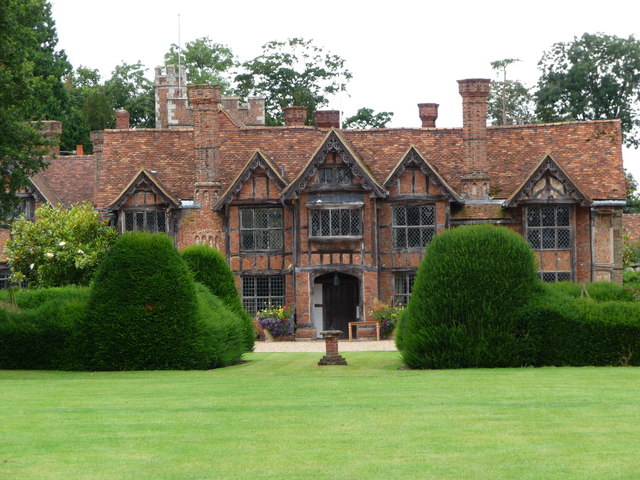
1110:Dorney Court
1076:
1047:Dorney Court
1036:
976:
973:File history
574:photographer
502:photographer
409:
403:
392:
386:
331:
269:
219:
198:Dorney Court
197:
184:CC BY-SA 2.0
179:Dorney Court
178:
126:Dorney Court
122:
92:You can help
82:
50:
22:File history
1022:GeographBot
619:copyrighted
593:copyrighted
545:Kevin White
410:share alike
404:attribution
377:Kevin White
332:Kevin White
163:Attribution
157:Kevin White
114:Description
1151:_error
1033:File usage
1014:640 × 480
990:Dimensions
527:some value
58:image/jpeg
27:File usage
1130:多尼 (白金漢郡)
987:Thumbnail
984:Date/Time
874:inception
864:inception
307:Licensing
192:InfoField
173:InfoField
123:English:
1138:Metadata
1120:Q5298112
774:operator
701:operator
447:Captions
393:to remix
387:to share
372:license.
37:Metadata
1016:(99 KB)
1001:current
996:Comment
947:heading
906:heading
841:heading
800:heading
766:1496320
697:1496320
512:creator
482:creator
471:depicts
451:English
106:Summary
54:
1042:Dorney
955:degree
910:degree
849:degree
804:degree
277:
227:
153:Author
142:Source
145:From
993:User
953:292
847:292
435:true
432:true
132:Date
17:File
552:URL
490:URL
950::
844::
777::
762::
747::
570::
555::
542::
1154:0
170:)
166:(
94:.
60:)
Text is available under the Creative Commons Attribution-ShareAlike License. Additional terms may apply.
_heading:292.00&language=en)
_heading:292.00&language=en)
