626:"}},"text\/plain":{"en":{"":"coordinates of the point of view"}}},"{\"value\":{\"latitude\":53.28595,\"longitude\":-2.6245,\"altitude\":null,\"precision\":1.0e-5,\"globe\":\"http:\\\/\\\/www.wikidata.org\\\/entity\\\/Q2\"},\"type\":\"globecoordinate\"}":{"text\/html":{"en":{"P1259":"53\u00b017'9.42"N, 2\u00b037'28.20"W"}},"text\/plain":{"en":{"P1259":"53\u00b017'9.42\"N, 2\u00b037'28.20\"W"}}},"{\"value\":{\"entity-type\":\"property\",\"numeric-id\":7787,\"id\":\"P7787\"},\"type\":\"wikibase-entityid\"}":{"text\/html":{"en":{"":"
694:"}},"text\/plain":{"en":{"":"coordinates of depicted place"}}},"{\"value\":{\"latitude\":53.28639,\"longitude\":-2.6251,\"altitude\":null,\"precision\":1.0e-5,\"globe\":\"http:\\\/\\\/www.wikidata.org\\\/entity\\\/Q2\"},\"type\":\"globecoordinate\"}":{"text\/html":{"en":{"P9149":"53\u00b017'11.00"N, 2\u00b037'30.36"W"}},"text\/plain":{"en":{"P9149":"53\u00b017'11.00\"N, 2\u00b037'30.36\"W"}}},"{\"value\":{\"entity-type\":\"property\",\"numeric-id\":7787,\"id\":\"P7787\"},\"type\":\"wikibase-entityid\"}":{"text\/html":{"en":{"":"
588:"}},"text\/plain":{"en":{"":"inception"}}},"{\"value\":{\"time\":\"+2010-11-29T00:00:00Z\",\"timezone\":0,\"before\":0,\"after\":0,\"precision\":11,\"calendarmodel\":\"http:\\\/\\\/www.wikidata.org\\\/entity\\\/Q1985727\"},\"type\":\"time\"}":{"text\/html":{"en":{"P571":"29 November 2010"}},"text\/plain":{"en":{"P571":"29 November 2010"}}}}": -->
218:
431:
381:
690:
373:
445:
395:
186:
224:
229:
86:
38:
544:"}},"text\/plain":{"en":{"":"copyright license"}}},"{\"value\":{\"entity-type\":\"item\",\"numeric-id\":19068220,\"id\":\"Q19068220\"},\"type\":\"wikibase-entityid\"}":{"text\/html":{"en":{"P275":"
500:"}},"text\/plain":{"en":{"":"copyright status"}}},"{\"value\":{\"entity-type\":\"item\",\"numeric-id\":50423863,\"id\":\"Q50423863\"},\"type\":\"wikibase-entityid\"}":{"text\/html":{"en":{"P6216":"
630:"}},"text\/plain":{"en":{"":"heading"}}},"{\"value\":{\"amount\":\"+315.0\",\"unit\":\"http:\\\/\\\/www.wikidata.org\\\/entity\\\/Q28390\"},\"type\":\"quantity\"}":{"text\/html":{"en":{"P7787":"315.0
698:"}},"text\/plain":{"en":{"":"heading"}}},"{\"value\":{\"amount\":\"+315\",\"unit\":\"http:\\\/\\\/www.wikidata.org\\\/entity\\\/Q28390\"},\"type\":\"quantity\"}":{"text\/html":{"en":{"P7787":"315
496:
584:
847:{{Information |Description ={{en|1=Footbridge on the River Weaver southwest of Dutton Lock}} |Source ={{geograph|2183985|Colin Park}} |Author =Colin Park |Date =29 November 2010 |Permission ={{geograph|2183985|Colin Par...
414:
894:
364:
276:– You must give appropriate credit, provide a link to the license, and indicate if changes were made. You may do so in any reasonable manner, but not in any way that suggests the licensor endorses you or your use.
428:
378:
545:
501:
810:
695:
691:
627:
623:
497:
585:
541:
52:
48:
42:
97:
65:
548:"}},"text\/plain":{"en":{"P275":"Creative Commons Attribution-ShareAlike 2.0 Generic"}}}}": -->
173:
571:
527:
438:
388:
829:
824:
193:
283:
736:
709:
668:
641:
511:
595:
555:
486:
884:
239:
282:– If you remix, transform, or build upon the material, you must distribute your contributions under the
200:
on the
Geograph website for the photographer's contact details. The copyright on this image is owned by
634:"}},"text\/plain":{"en":{"P7787":"315.0 degree"}}}}": -->
799:
794:
504:"}},"text\/plain":{"en":{"P6216":"copyrighted"}}}}": -->
56:
37:
702:"}},"text\/plain":{"en":{"P7787":"315 degree"}}}}": -->
105:
333:
840:
317:
236:
8:
866:
180:
444:
394:
205:
92:
476:
861:
154:
719:
651:
605:
565:
521:
185:
197:
924:
767:
Click on a date/time to view the file as it appeared at that time.
430:
380:
944:
914:
904:
954:
934:
964:
415:
53° 17′ 11″ N, 2° 37′ 30″ W
365:
53° 17′ 09″ N, 2° 37′ 28″ W
144:
80:
470:
Add a one-line explanation of what this file represents
348:
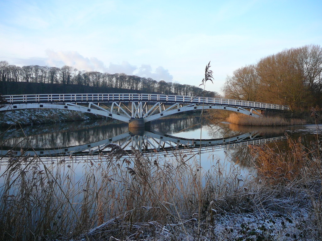
Footbridge on the River Weaver southwest of Dutton Lock
329:
Footbridge on the River Weaver southwest of Dutton Lock
135:
Footbridge on the River Weaver southwest of Dutton Lock
979:
974:
855:
875:
765:
104:
Commons is a freely licensed media file repository.
572:
Creative
Commons Attribution-ShareAlike 2.0 Generic
546:
Creative
Commons Attribution-ShareAlike 2.0 Generic
70:(1,024 × 768 pixels, file size: 263 KB, MIME type:
293:https://creativecommons.org/licenses/by-sa/2.0
85:
299:Creative Commons Attribution-Share Alike 2.0
217:
168:
140:
122:
160:
150:
14:
699:
631:
259:– to copy, distribute and transmit the work
877:The following other wikis use this file:
817:Higher-resolution version from Geograph.
895:دوتون (قريه فى تشيشير ويست اند تشيستير)
437:View this and other nearby images on:
387:View this and other nearby images on:
857:The following 2 pages use this file:
340:
116:
405:
355:
204:and is licensed for reuse under the
758:
240:Attribution-Share Alike 2.0 Generic
228:
223:
208:Attribution-ShareAlike 2.0 license.
13:
475:
469:
214:
191:
129:
117:
63:
993:
474:
125:Dutton Horse Bridge, Cheshire.jpg
642:coordinates of the point of view
624:coordinates of the point of view
460:
443:
429:
421:
393:
379:
371:
270:Under the following conditions:
235:This file is licensed under the
227:
222:
216:
184:
84:
31:
21:
457:
130:
872:
762:
456:
192:This image was taken from the
26:
1:
710:coordinates of depicted place
692:coordinates of depicted place
852:
482:Items portrayed in this file
420:
370:
7:
941:Usage on lld.wikipedia.org
901:Usage on ceb.wikipedia.org
891:Usage on arz.wikipedia.org
725:53°17'11.00"N, 2°37'30.36"W
10:
998:
971:Usage on www.wikidata.org
961:Usage on tr.wikipedia.org
951:Usage on pl.wikipedia.org
931:Usage on fr.wikipedia.org
921:Usage on es.wikipedia.org
911:Usage on cy.wikipedia.org
881:Usage on ar.wikipedia.org
657:53°17'9.42"N, 2°37'28.20"W
284:same or compatible license
119:
759:
16:
795:17:31, 11 September 2017
459:
250:
91:This is a file from the
36:
846:
816:
346:Colin Park /
327:Colin Park /
318:required by the license
143:
95:. Information from its
925:Puente de Dutton Horse
825:21:33, 6 December 2012
449:53.286390; -2.625100
399:53.285950; -2.624500
198:this photograph's page
98:description page there
41:Size of this preview:
867:Dutton Horse Bridge
812:Geograph Update Bot
265:– to adapt the work
47:Other resolutions:
915:Dutton, Swydd Gaer
57:1,024 × 768 pixels
955:Dutton (Cheshire)
945:Dutton (Cheshire)
935:Dutton (Cheshire)
905:Dutton (distrito)
873:Global file usage
850:
701:
633:
556:copyright license
542:copyright license
468:
454:
453:
404:
403:
353:
352:
321:
213:
212:
196:collection. See
177:
174:Reusing this file
113:
112:
93:Wikimedia Commons
32:Global file usage
989:
965:Dutton, Cheshire
862:Dutton, Cheshire
837:
807:
769:
747:
746:
741:
679:
678:
673:
611:29 November 2010
512:copyright status
498:copyright status
466:
450:
447:
433:
432:
426:
425:
424:
418:
417:
406:
400:
397:
383:
382:
376:
375:
374:
368:
367:
356:
315:
306:
303:
300:
297:
294:
286:as the original.
248:
237:Creative Commons
231:
230:
226:
225:
220:
219:
206:Creative Commons
194:Geograph project
188:
181:
171:
146:
145:29 November 2010
134:
126:
120:
109:
88:
87:
81:
75:
73:
60:
53:640 × 480 pixels
49:320 × 240 pixels
43:800 × 600 pixels
997:
996:
992:
991:
990:
988:
987:
986:
871:
851:
843:
842:Espresso Addict
835:
813:
805:
761:
760:
757:
756:
755:
754:
753:
752:
751:
750:
749:
748:
744:
742:
739:
730:
729:
728:
726:
716:
715:
714:
712:
689:
688:
687:
686:
685:
684:
683:
682:
681:
680:
676:
674:
671:
662:
661:
660:
658:
648:
647:
646:
644:
621:
620:
619:
618:
617:
616:
615:
614:
612:
602:
601:
600:
598:
583:
582:
581:
580:
579:
578:
577:
576:
574:
562:
561:
560:
558:
539:
538:
537:
536:
535:
534:
533:
532:
530:
518:
517:
516:
514:
495:
494:
493:
492:
491:
489:
473:
472:
471:
448:
422:
413:
412:
409:Object location
398:
372:
363:
362:
359:Camera location
354:
343:
336:
324:
308:
307:
304:
301:
298:
295:
292:
291:
249:
246:
243:
232:
209:
155:geograph.org.uk
136:
124:
115:
114:
103:
102:
101:is shown below.
77:
71:
69:
62:
61:
46:
12:
11:
5:
995:
985:
984:
983:
982:
977:
969:
968:
967:
959:
958:
957:
949:
948:
947:
939:
938:
937:
929:
928:
927:
919:
918:
917:
909:
908:
907:
899:
898:
897:
889:
888:
887:
885:دوتون (تشيشير)
874:
870:
869:
864:
854:
849:
848:
845:
841:
838:
832:
827:
822:
819:
818:
815:
811:
808:
802:
797:
792:
788:
787:
784:
781:
778:
775:
772:
764:
735:
734:
733:
732:
731:
727:
724:
722:
721:
720:
718:
717:
713:
708:
706:
705:
704:
703:
697:
693:
667:
666:
665:
664:
663:
659:
656:
654:
653:
652:
650:
649:
645:
640:
638:
637:
636:
635:
629:
625:
613:
610:
608:
607:
606:
604:
603:
599:
594:
592:
591:
590:
589:
587:
575:
570:
568:
567:
566:
564:
563:
559:
554:
552:
551:
550:
549:
547:
543:
531:
526:
524:
523:
522:
520:
519:
515:
510:
508:
507:
506:
505:
503:
499:
490:
485:
483:
480:
479:
478:
477:
465:
464:
461:
458:
452:
451:
441:
435:
410:
402:
401:
391:
385:
360:
351:
350:
344:
341:
338:
337:
332:
325:
322:
310:
309:
290:
289:
288:
287:
277:
268:
267:
266:
260:
253:You are free:
244:
234:
233:
215:
211:
210:
189:
178:
166:
165:
162:
158:
157:
152:
148:
147:
142:
138:
137:
127:
118:
111:
110:
89:
79:
78:
40:
35:
34:
29:
24:
19:
9:
6:
4:
3:
2:
994:
981:
978:
976:
973:
972:
970:
966:
963:
962:
960:
956:
953:
952:
950:
946:
943:
942:
940:
936:
933:
932:
930:
926:
923:
922:
920:
916:
913:
912:
910:
906:
903:
902:
900:
896:
893:
892:
890:
886:
883:
882:
880:
879:
878:
868:
865:
863:
860:
859:
858:
844:
839:
833:
831:
828:
826:
823:
821:
820:
814:
809:
803:
801:
798:
796:
793:
790:
789:
785:
782:
779:
776:
773:
771:
770:
768:
738:
723:
711:
707:
670:
655:
643:
639:
609:
597:
593:
573:
569:
557:
553:
529:
525:
513:
509:
488:
484:
481:
462:
455:
446:
442:
440:
439:OpenStreetMap
436:
434:
416:
411:
408:
407:
396:
392:
390:
389:OpenStreetMap
386:
384:
366:
361:
358:
357:
349:
345:
339:
335:
331: /
330:
326:
319:
314:
312:
311:
296:CC BY-SA 2.0
285:
281:
278:
275:
272:
271:
269:
264:
261:
258:
255:
254:
252:
251:
245:Attribution:
241:
238:
221:
207:
203:
199:
195:
190:
187:
183:
182:
179:
175:
170:
167:
163:
159:
156:
153:
149:
139:
133:
128:
121:
107:
100:
99:
94:
90:
83:
82:
76:
67:
66:Original file
58:
54:
50:
44:
39:
33:
30:
28:
25:
23:
20:
18:
15:
876:
856:
804:1,024 × 768
766:
763:File history
419:
369:
347:
334:CC BY-SA 2.0
328:
279:
273:
262:
256:
201:
131:
106:You can help
96:
64:
22:File history
528:copyrighted
502:copyrighted
313:Attribution
280:share alike
274:attribution
123:Description
853:File usage
834:640 × 480
780:Dimensions
247:Colin Park
202:Colin Park
169:Permission
164:Colin Park
72:image/jpeg
27:File usage
777:Thumbnail
774:Date/Time
596:inception
586:inception
342:InfoField
323:InfoField
132:English:
980:Q5317552
975:Q5317542
836:(103 KB)
806:(263 KB)
463:Captions
263:to remix
257:to share
242:license.
791:current
786:Comment
737:heading
696:heading
669:heading
628:heading
487:depicts
467:English
68:
745:degree
700:degree
677:degree
675:315.0
632:degree
427:
377:
161:Author
151:Source
783:User
743:315
305:true
302:true
141:Date
17:File
740::
672::
55:|
51:|
45:.
320:)
316:(
176:)
172:(
108:.
74:)
59:.
Text is available under the Creative Commons Attribution-ShareAlike License. Additional terms may apply.

_heading:315.00&language=en)
_heading:315.00&language=en)