836:"}},"text\/plain":{"en":{"":"coordinates of the point of view"}}},"{\"value\":{\"latitude\":51.3054,\"longitude\":-1.542,\"altitude\":null,\"precision\":0.0001,\"globe\":\"http:\\\/\\\/www.wikidata.org\\\/entity\\\/Q2\"},\"type\":\"globecoordinate\"}":{"text\/html":{"en":{"P1259":"51\u00b018'19.4"N, 1\u00b032'31.2"W"}},"text\/plain":{"en":{"P1259":"51\u00b018'19.4\"N, 1\u00b032'31.2\"W"}}},"{\"value\":{\"entity-type\":\"property\",\"numeric-id\":7787,\"id\":\"P7787\"},\"type\":\"wikibase-entityid\"}":{"text\/html":{"en":{"":"
904:"}},"text\/plain":{"en":{"":"coordinates of depicted place"}}},"{\"value\":{\"latitude\":51.3063,\"longitude\":-1.54,\"altitude\":null,\"precision\":0.0001,\"globe\":\"http:\\\/\\\/www.wikidata.org\\\/entity\\\/Q2\"},\"type\":\"globecoordinate\"}":{"text\/html":{"en":{"P9149":"51\u00b018'22.7"N, 1\u00b032'24.0"W"}},"text\/plain":{"en":{"P9149":"51\u00b018'22.7\"N, 1\u00b032'24.0\"W"}}},"{\"value\":{\"entity-type\":\"property\",\"numeric-id\":7787,\"id\":\"P7787\"},\"type\":\"wikibase-entityid\"}":{"text\/html":{"en":{"":"
488:"}},"text\/plain":{"en":{"":"author name string"}}},"{\"value\":\"Andrew Smith\",\"type\":\"string\"}":{"text\/html":{"en":{"P2093":"Andrew Smith"}},"text\/plain":{"en":{"P2093":"Andrew Smith"}}},"{\"value\":{\"entity-type\":\"property\",\"numeric-id\":2699,\"id\":\"P2699\"},\"type\":\"wikibase-entityid\"}":{"text\/html":{"en":{"":"
798:"}},"text\/plain":{"en":{"":"inception"}}},"{\"value\":{\"time\":\"+2008-02-09T00:00:00Z\",\"timezone\":0,\"before\":0,\"after\":0,\"precision\":11,\"calendarmodel\":\"http:\\\/\\\/www.wikidata.org\\\/entity\\\/Q1985727\"},\"type\":\"time\"}":{"text\/html":{"en":{"P571":"9 February 2008"}},"text\/plain":{"en":{"P571":"9 February 2008"}}}}": -->
675:
281:
231:
900:
223:
295:
245:
316:
354:
359:
72:
496:"}},"text\/plain":{"en":{"P2699":"https:\/\/www.geograph.org.uk\/profile\/2562"}}},"{\"value\":{\"entity-type\":\"property\",\"numeric-id\":3831,\"id\":\"P3831\"},\"type\":\"wikibase-entityid\"}":{"text\/html":{"en":{"":"
683:"}},"text\/plain":{"en":{"P7482":"file available on the internet"}}},"{\"value\":{\"entity-type\":\"property\",\"numeric-id\":7384,\"id\":\"P7384\"},\"type\":\"wikibase-entityid\"}":{"text\/html":{"en":{"":"
500:"}},"text\/plain":{"en":{"":"object of statement has role"}}},"{\"value\":{\"entity-type\":\"item\",\"numeric-id\":33231,\"id\":\"Q33231\"},\"type\":\"wikibase-entityid\"}":{"text\/html":{"en":{"P3831":"
699:"}},"text\/plain":{"en":{"P137":"Geograph Britain and Ireland"}}},"{\"value\":{\"entity-type\":\"property\",\"numeric-id\":973,\"id\":\"P973\"},\"type\":\"wikibase-entityid\"}":{"text\/html":{"en":{"":"
635:"}},"text\/plain":{"en":{"":"copyright license"}}},"{\"value\":{\"entity-type\":\"item\",\"numeric-id\":19068220,\"id\":\"Q19068220\"},\"type\":\"wikibase-entityid\"}":{"text\/html":{"en":{"P275":"
591:"}},"text\/plain":{"en":{"":"copyright status"}}},"{\"value\":{\"entity-type\":\"item\",\"numeric-id\":50423863,\"id\":\"Q50423863\"},\"type\":\"wikibase-entityid\"}":{"text\/html":{"en":{"P6216":"
679:"}},"text\/plain":{"en":{"":"source of file"}}},"{\"value\":{\"entity-type\":\"item\",\"numeric-id\":74228490,\"id\":\"Q74228490\"},\"type\":\"wikibase-entityid\"}":{"text\/html":{"en":{"P7482":"
695:"}},"text\/plain":{"en":{"":"operator"}}},"{\"value\":{\"entity-type\":\"item\",\"numeric-id\":1503119,\"id\":\"Q1503119\"},\"type\":\"wikibase-entityid\"}":{"text\/html":{"en":{"P137":"
908:"}},"text\/plain":{"en":{"":"heading"}}},"{\"value\":{\"amount\":\"+45\",\"unit\":\"http:\\\/\\\/www.wikidata.org\\\/entity\\\/Q28390\"},\"type\":\"quantity\"}":{"text\/html":{"en":{"P7787":"45
840:"}},"text\/plain":{"en":{"":"heading"}}},"{\"value\":{\"amount\":\"+45\",\"unit\":\"http:\\\/\\\/www.wikidata.org\\\/entity\\\/Q28390\"},\"type\":\"quantity\"}":{"text\/html":{"en":{"P7787":"45
691:"}},"text\/plain":{"en":{"P7384":"692531"}}},"{\"value\":{\"entity-type\":\"property\",\"numeric-id\":137,\"id\":\"P137\"},\"type\":\"wikibase-entityid\"}":{"text\/html":{"en":{"":"
484:"}},"text\/plain":{"en":{"":"creator"}}},"{\"value\":{\"entity-type\":\"property\",\"numeric-id\":2093,\"id\":\"P2093\"},\"type\":\"wikibase-entityid\"}":{"text\/html":{"en":{"":"
587:
703:"}},"text\/plain":{"en":{"":"described at URL"}}},"{\"value\":\"https:\\\/\\\/www.geograph.org.uk\\\/photo\\\/692531\",\"type\":\"string\"}":{"text\/html":{"en":{"P973":"
492:"}},"text\/plain":{"en":{"":"URL"}}},"{\"value\":\"https:\\\/\\\/www.geograph.org.uk\\\/profile\\\/2562\",\"type\":\"string\"}":{"text\/html":{"en":{"P2699":"
687:"}},"text\/plain":{"en":{"":"geograph.org.uk image ID"}}},"{\"value\":\"692531\",\"type\":\"string\"}":{"text\/html":{"en":{"P7384":"
1027:== {{int:filedesc}} == {{Information |description={{en|1=Fosbury Looking along the inner wall of the Iron Age hillfort towards Oakhill Wood. In the foreground is a breach in the bank where a farm track now enters the middle of the fort.}} |date=2008-02-09
264:
43:
214:
406:– You must give appropriate credit, provide a link to the license, and indicate if changes were made. You may do so in any reasonable manner, but not in any way that suggests the licensor endorses you or your use.
228:
278:
126:
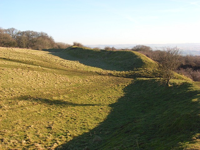
Fosbury
Looking along the inner wall of the Iron Age hillfort towards Oakhill Wood. In the foreground is a breach in the bank where a farm track now enters the middle of the fort.
688:
680:
636:
592:
696:
501:
905:
901:
837:
833:
684:
676:
588:
497:
489:
485:
795:
704:
700:
692:
632:
493:
481:
83:
1020:
51:
639:"}},"text\/plain":{"en":{"P275":"Creative Commons Attribution-ShareAlike 2.0 Generic"}}}}": -->
1099:
707:"}},"text\/plain":{"en":{"P973":"https:\/\/www.geograph.org.uk\/photo\/692531"}}}}": -->
730:
662:
618:
288:
238:
765:
323:
1077:
This file contains additional information, probably added from the digital camera or scanner used to create or digitize it.
413:
573:
946:
919:
878:
851:
743:
714:
602:
566:
551:
538:
805:
773:
758:
646:
511:
470:
1212:
369:
1080:
If the file has been modified from its original state, some details may not fully reflect the modified file.
1046:
1009:
1004:
412:– If you remix, transform, or build upon the material, you must distribute your contributions under the
330:
on the
Geograph website for the photographer's contact details. The copyright on this image is owned by
42:
504:"}},"text\/plain":{"en":{"P3831":"photographer"}}}}": -->
595:"}},"text\/plain":{"en":{"P6216":"copyrighted"}}}}": -->
912:"}},"text\/plain":{"en":{"P7787":"45 degree"}}}}": -->
844:"}},"text\/plain":{"en":{"P7787":"45 degree"}}}}": -->
91:
183:
1255:
780:
750:
558:
366:
167:
8:
1291:
310:
294:
244:
335:
78:
460:
1319:
1273:
1114:
1154:
1041:
156:
146:
929:
861:
815:
724:
656:
612:
521:
1301:
315:
1134:
327:
1337:
1124:
977:
Click on a date/time to view the file as it appeared at that time.
280:
230:
1089:
265:
51° 18′ 23″ N, 1° 32′ 24″ W
215:
51° 18′ 19″ N, 1° 32′ 31″ W
135:
66:
454:
Add a one-line explanation of what this file represents
1064:
1035:
1055:
975:
90:
Commons is a freely licensed media file repository.
663:
Creative
Commons Attribution-ShareAlike 2.0 Generic
637:
Creative
Commons Attribution-ShareAlike 2.0 Generic
56:(640 × 480 pixels, file size: 139 KB, MIME type:
1296:Flash did not fire, compulsory flash suppression
423:https://creativecommons.org/licenses/by-sa/2.0
71:
429:Creative Commons Attribution-Share Alike 2.0
347:
131:
113:
705:https:\/\/www.geograph.org.uk\/photo\/692531
494:https:\/\/www.geograph.org.uk\/profile\/2562
152:
141:
14:
909:
841:
389:– to copy, distribute and transmit the work
1057:The following other wikis use this file:
781:https://www.geograph.org.uk/photo/692531
559:https://www.geograph.org.uk/profile/2562
287:View this and other nearby images on:
237:View this and other nearby images on:
116:Fosbury - geograph.org.uk - 692531.jpg
52:Fosbury_-_geograph.org.uk_-_692531.jpg
1037:The following 2 pages use this file:
190:
102:
334:and is licensed for reuse under the
255:
205:
968:
370:Attribution-Share Alike 2.0 Generic
358:
353:
338:Attribution-ShareAlike 2.0 license.
13:
1075:
459:
453:
344:
321:
120:
103:
49:
1354:
1082:
458:
1145:Date and time of data generation
852:coordinates of the point of view
834:coordinates of the point of view
444:
400:Under the following conditions:
365:This file is licensed under the
357:
352:
346:
314:
293:
279:
271:
243:
229:
221:
70:
31:
21:
441:
121:
46:No higher resolution available.
1119:1/310 sec (0.0032258064516129)
1052:
972:
731:file available on the internet
681:file available on the internet
440:
322:This image was taken from the
26:
1:
920:coordinates of depicted place
902:coordinates of depicted place
36:
1047:User:MartinPoulter/Hillforts
1032:
766:Geograph Britain and Ireland
697:Geograph Britain and Ireland
567:object of statement has role
498:object of statement has role
466:Items portrayed in this file
306:
7:
1223:Date and time of digitizing
1072:
270:
220:
10:
1359:
1061:Usage on www.wikidata.org
414:same or compatible license
110:
105:
1188:File change date and time
1109:(C) by Caplio R4 User
969:
935:51°18'22.7"N, 1°32'24.0"W
867:51°18'19.4"N, 1°32'31.2"W
196:Andrew Smith /
177:Andrew Smith /
16:
744:geograph.org.uk image ID
685:geograph.org.uk image ID
443:
380:
77:This is a file from the
41:
1026:
168:required by the license
134:
81:. Information from its
1231:Image compression mode
1226:09:42, 9 February 2008
1191:09:42, 9 February 2008
1148:09:42, 9 February 2008
1005:05:00, 8 February 2011
328:this photograph's page
299:51.306300; -1.540000
249:51.305400; -1.542000
84:description page there
1265:Maximum land aperture
1172:Horizontal resolution
1196:Y and C positioning
1180:Vertical resolution
1086:Camera manufacturer
395:– to adapt the work
1329:Scene capture type
1324:Auto white balance
539:author name string
486:author name string
1346:
1345:
1268:3.3 APEX (f/3.14)
1053:Global file usage
1030:
911:
843:
647:copyright license
633:copyright license
452:
343:
342:
326:collection. See
304:
303:
254:
253:
203:
202:
171:
99:
98:
79:Wikimedia Commons
32:Global file usage
1350:
1204:Exposure Program
1106:Copyright holder
1083:
1017:
979:
957:
956:
951:
889:
888:
883:
783:
778:
774:described at URL
768:
763:
753:
748:
701:described at URL
603:copyright status
589:copyright status
576:
571:
561:
556:
546:
543:
450:
436:
433:
430:
427:
424:
416:as the original.
378:
367:Creative Commons
361:
360:
356:
355:
350:
349:
336:Creative Commons
324:Geograph project
318:
311:
300:
297:
283:
282:
276:
275:
274:
268:
267:
256:
250:
247:
233:
232:
226:
225:
224:
218:
217:
206:
165:
137:
125:
117:
111:
95:
74:
73:
67:
61:
59:
1358:
1357:
1353:
1352:
1351:
1349:
1348:
1347:
1247:APEX brightness
1100:Caplio R4
1071:
1051:
1031:
1023:
1015:
971:
970:
967:
966:
965:
964:
963:
962:
961:
960:
959:
958:
954:
952:
949:
940:
939:
938:
936:
926:
925:
924:
922:
899:
898:
897:
896:
895:
894:
893:
892:
891:
890:
886:
884:
881:
872:
871:
870:
868:
858:
857:
856:
854:
831:
830:
829:
828:
827:
826:
825:
824:
822:
821:9 February 2008
812:
811:
810:
808:
793:
792:
791:
790:
789:
788:
787:
786:
785:
784:
779:
776:
770:
769:
764:
761:
755:
754:
749:
746:
737:
736:
735:
733:
721:
720:
719:
717:
674:
673:
672:
671:
670:
669:
668:
667:
665:
653:
652:
651:
649:
630:
629:
628:
627:
626:
625:
624:
623:
621:
609:
608:
607:
605:
586:
585:
584:
583:
582:
581:
580:
579:
578:
577:
572:
569:
563:
562:
557:
554:
548:
547:
544:
541:
532:
531:
530:
528:
518:
517:
516:
514:
479:
478:
477:
476:
475:
473:
457:
456:
455:
438:
437:
434:
431:
428:
425:
422:
421:
379:
376:
373:
362:
339:
309:
298:
272:
263:
262:
259:Object location
248:
222:
213:
212:
209:Camera location
204:
193:
186:
174:
147:geograph.org.uk
136:9 February 2008
127:
115:
108:
101:
100:
89:
88:
87:is shown below.
63:
57:
55:
48:
47:
12:
11:
5:
1356:
1344:
1343:
1340:
1334:
1333:
1330:
1326:
1325:
1322:
1316:
1315:
1312:
1308:
1307:
1304:
1298:
1297:
1294:
1288:
1287:
1284:
1280:
1279:
1276:
1270:
1269:
1266:
1262:
1261:
1258:
1252:
1251:
1248:
1244:
1243:
1240:
1236:
1235:
1232:
1228:
1227:
1224:
1220:
1219:
1216:
1209:
1208:
1207:Normal program
1205:
1201:
1200:
1197:
1193:
1192:
1189:
1185:
1184:
1181:
1177:
1176:
1173:
1169:
1168:
1165:
1161:
1160:
1157:
1150:
1149:
1146:
1142:
1141:
1138:
1131:
1130:
1127:
1121:
1120:
1117:
1111:
1110:
1107:
1103:
1102:
1097:
1093:
1092:
1087:
1074:
1070:
1069:
1068:
1067:
1054:
1050:
1049:
1044:
1034:
1029:
1028:
1025:
1021:
1018:
1012:
1007:
1002:
998:
997:
994:
991:
988:
985:
982:
974:
945:
944:
943:
942:
941:
937:
934:
932:
931:
930:
928:
927:
923:
918:
916:
915:
914:
913:
907:
903:
877:
876:
875:
874:
873:
869:
866:
864:
863:
862:
860:
859:
855:
850:
848:
847:
846:
845:
839:
835:
823:
820:
818:
817:
816:
814:
813:
809:
804:
802:
801:
800:
799:
797:
772:
771:
757:
756:
742:
741:
740:
739:
738:
734:
729:
727:
726:
725:
723:
722:
718:
715:source of file
713:
711:
710:
709:
708:
706:
702:
698:
694:
690:
686:
682:
678:
677:source of file
666:
661:
659:
658:
657:
655:
654:
650:
645:
643:
642:
641:
640:
638:
634:
622:
617:
615:
614:
613:
611:
610:
606:
601:
599:
598:
597:
596:
594:
590:
565:
564:
550:
549:
537:
536:
535:
534:
533:
529:
526:
524:
523:
522:
520:
519:
515:
510:
508:
507:
506:
505:
503:
499:
495:
491:
487:
483:
474:
469:
467:
464:
463:
462:
461:
449:
448:
445:
442:
420:
419:
418:
417:
407:
398:
397:
396:
390:
383:You are free:
374:
364:
363:
345:
341:
340:
319:
308:
305:
302:
301:
291:
285:
260:
252:
251:
241:
235:
210:
201:
200:
194:
191:
188:
187:
182:
175:
172:
160:
159:
154:
150:
149:
143:
139:
138:
133:
129:
128:
118:
109:
107:
104:
97:
96:
75:
65:
64:
45:
40:
39:
34:
29:
24:
19:
9:
6:
4:
3:
2:
1355:
1341:
1339:
1336:
1335:
1331:
1328:
1327:
1323:
1321:
1320:White balance
1318:
1317:
1314:Auto exposure
1313:
1311:Exposure mode
1310:
1309:
1305:
1303:
1300:
1299:
1295:
1293:
1290:
1289:
1285:
1282:
1281:
1277:
1275:
1274:Metering mode
1272:
1271:
1267:
1264:
1263:
1259:
1257:
1256:Exposure bias
1254:
1253:
1249:
1246:
1245:
1241:
1239:APEX aperture
1238:
1237:
1233:
1230:
1229:
1225:
1222:
1221:
1217:
1214:
1211:
1210:
1206:
1203:
1202:
1198:
1195:
1194:
1190:
1187:
1186:
1182:
1179:
1178:
1174:
1171:
1170:
1166:
1163:
1162:
1158:
1156:
1152:
1151:
1147:
1144:
1143:
1139:
1136:
1133:
1132:
1128:
1126:
1123:
1122:
1118:
1116:
1115:Exposure time
1113:
1112:
1108:
1105:
1104:
1101:
1098:
1095:
1094:
1091:
1088:
1085:
1084:
1081:
1078:
1066:
1063:
1062:
1060:
1059:
1058:
1048:
1045:
1043:
1040:
1039:
1038:
1024:
1019:
1013:
1011:
1008:
1006:
1003:
1000:
999:
995:
992:
989:
986:
983:
981:
980:
978:
948:
933:
921:
917:
880:
865:
853:
849:
819:
807:
803:
782:
775:
767:
760:
752:
745:
732:
728:
716:
712:
664:
660:
648:
644:
620:
616:
604:
600:
575:
568:
560:
553:
540:
525:
513:
509:
472:
468:
465:
446:
439:
426:CC BY-SA 2.0
415:
411:
408:
405:
402:
401:
399:
394:
391:
388:
385:
384:
382:
381:
375:Attribution:
371:
368:
351:
337:
333:
329:
325:
320:
317:
313:
312:
296:
292:
290:
289:OpenStreetMap
286:
284:
266:
261:
258:
257:
246:
242:
240:
239:OpenStreetMap
236:
234:
216:
211:
208:
207:
199:
195:
189:
185:
181: /
180:
176:
169:
164:
162:
161:
158:
155:
151:
148:
144:
140:
130:
124:
119:
112:
93:
86:
85:
80:
76:
69:
68:
62:
53:
44:
38:
35:
33:
30:
28:
25:
23:
20:
18:
15:
1283:Light source
1155:focal length
1096:Camera model
1079:
1076:
1056:
1042:Fosbury Camp
1036:
976:
973:File history
574:photographer
545:Andrew Smith
502:photographer
409:
403:
392:
386:
377:Andrew Smith
332:Andrew Smith
331:
269:
219:
197:
184:CC BY-SA 2.0
178:
157:Andrew Smith
122:
92:You can help
82:
50:
22:File history
1302:Color space
1164:Orientation
1090:RICOH
1022:GeographBot
619:copyrighted
593:copyrighted
410:share alike
404:attribution
163:Attribution
114:Description
1033:File usage
1014:640 × 480
990:Dimensions
527:some value
58:image/jpeg
27:File usage
1338:Sharpness
1135:ISO speed
987:Thumbnail
984:Date/Time
806:inception
796:inception
307:Licensing
192:InfoField
173:InfoField
123:English:
1332:Standard
1199:Co-sited
1125:F-number
1073:Metadata
1065:Q5473325
1016:(139 KB)
759:operator
693:operator
447:Captions
393:to remix
387:to share
372:license.
37:Metadata
1286:Unknown
1278:Pattern
1215:version
1001:current
996:Comment
947:heading
906:heading
879:heading
838:heading
512:creator
482:creator
471:depicts
451:English
198:Fosbury
179:Fosbury
106:Summary
54:
1342:Normal
1183:72 dpi
1175:72 dpi
1167:Normal
1159:7.5 mm
1137:rating
955:degree
910:degree
887:degree
842:degree
751:692531
689:692531
277:
227:
153:Author
142:Source
1292:Flash
1153:Lens
1129:f/4.4
145:From
1306:sRGB
1218:2.21
1213:Exif
993:User
435:true
432:true
132:Date
17:File
1250:5.6
1242:4.3
1234:2.8
1140:100
953:45
885:45
552:URL
490:URL
950::
882::
777::
762::
747::
570::
555::
542::
1260:0
170:)
166:(
94:.
60:)
Text is available under the Creative Commons Attribution-ShareAlike License. Additional terms may apply.
_heading:45.00&language=en)
_heading:45.00&language=en)
