816:"}},"text\/plain":{"en":{"":"coordinates of the point of view"}}},"{\"value\":{\"latitude\":51.213514,\"longitude\":-3.552337,\"altitude\":null,\"precision\":1.0e-6,\"globe\":\"http:\\\/\\\/www.wikidata.org\\\/entity\\\/Q2\"},\"type\":\"globecoordinate\"}":{"text\/html":{"en":{"P1259":"51\u00b012'48.650"N, 3\u00b033'8.413"W"}},"text\/plain":{"en":{"P1259":"51\u00b012'48.650\"N, 3\u00b033'8.413\"W"}}},"{\"value\":{\"entity-type\":\"property\",\"numeric-id\":7787,\"id\":\"P7787\"},\"type\":\"wikibase-entityid\"}":{"text\/html":{"en":{"":"
476:"}},"text\/plain":{"en":{"":"author name string"}}},"{\"value\":\"Roger Cornfoot\",\"type\":\"string\"}":{"text\/html":{"en":{"P2093":"Roger Cornfoot"}},"text\/plain":{"en":{"P2093":"Roger Cornfoot"}}},"{\"value\":{\"entity-type\":\"property\",\"numeric-id\":2699,\"id\":\"P2699\"},\"type\":\"wikibase-entityid\"}":{"text\/html":{"en":{"":"
778:"}},"text\/plain":{"en":{"":"inception"}}},"{\"value\":{\"time\":\"+2013-02-02T00:00:00Z\",\"timezone\":0,\"before\":0,\"after\":0,\"precision\":11,\"calendarmodel\":\"http:\\\/\\\/www.wikidata.org\\\/entity\\\/Q1985727\"},\"type\":\"time\"}":{"text\/html":{"en":{"P571":"2 February 2013"}},"text\/plain":{"en":{"P571":"2 February 2013"}}}}": -->
655:
261:
253:
812:
275:
296:
334:
339:
86:
952:
663:"}},"text\/plain":{"en":{"P7482":"file available on the internet"}}},"{\"value\":{\"entity-type\":\"property\",\"numeric-id\":137,\"id\":\"P137\"},\"type\":\"wikibase-entityid\"}":{"text\/html":{"en":{"":"
671:"}},"text\/plain":{"en":{"P137":"Geograph Britain and Ireland"}}},"{\"value\":{\"entity-type\":\"property\",\"numeric-id\":7384,\"id\":\"P7384\"},\"type\":\"wikibase-entityid\"}":{"text\/html":{"en":{"":"
468:"}},"text\/plain":{"en":{"":"object of statement has role"}}},"{\"value\":{\"entity-type\":\"item\",\"numeric-id\":33231,\"id\":\"Q33231\"},\"type\":\"wikibase-entityid\"}":{"text\/html":{"en":{"P3831":"
615:"}},"text\/plain":{"en":{"":"copyright license"}}},"{\"value\":{\"entity-type\":\"item\",\"numeric-id\":19068220,\"id\":\"Q19068220\"},\"type\":\"wikibase-entityid\"}":{"text\/html":{"en":{"P275":"
571:"}},"text\/plain":{"en":{"":"copyright status"}}},"{\"value\":{\"entity-type\":\"item\",\"numeric-id\":50423863,\"id\":\"Q50423863\"},\"type\":\"wikibase-entityid\"}":{"text\/html":{"en":{"P6216":"
659:"}},"text\/plain":{"en":{"":"source of file"}}},"{\"value\":{\"entity-type\":\"item\",\"numeric-id\":74228490,\"id\":\"Q74228490\"},\"type\":\"wikibase-entityid\"}":{"text\/html":{"en":{"P7482":"
922:
472:"}},"text\/plain":{"en":{"P3831":"photographer"}}},"{\"value\":{\"entity-type\":\"property\",\"numeric-id\":2093,\"id\":\"P2093\"},\"type\":\"wikibase-entityid\"}":{"text\/html":{"en":{"":"
820:"}},"text\/plain":{"en":{"":"heading"}}},"{\"value\":{\"amount\":\"+112\",\"unit\":\"http:\\\/\\\/www.wikidata.org\\\/entity\\\/Q28390\"},\"type\":\"quantity\"}":{"text\/html":{"en":{"P7787":"112
667:"}},"text\/plain":{"en":{"":"operator"}}},"{\"value\":{\"entity-type\":\"item\",\"numeric-id\":1503119,\"id\":\"Q1503119\"},\"type\":\"wikibase-entityid\"}":{"text\/html":{"en":{"P137":"
679:"}},"text\/plain":{"en":{"P7384":"3319707"}}},"{\"value\":{\"entity-type\":\"property\",\"numeric-id\":973,\"id\":\"P973\"},\"type\":\"wikibase-entityid\"}":{"text\/html":{"en":{"":"
464:"}},"text\/plain":{"en":{"":"creator"}}},"{\"value\":{\"entity-type\":\"property\",\"numeric-id\":3831,\"id\":\"P3831\"},\"type\":\"wikibase-entityid\"}":{"text\/html":{"en":{"":"
567:
998:
386:– You must give appropriate credit, provide a link to the license, and indicate if changes were made. You may do so in any reasonable manner, but not in any way that suggests the licensor endorses you or your use.
258:
52:
48:
42:
97:
65:
676:
660:
616:
572:
668:
469:
932:
817:
813:
672:
656:
568:
477:
473:
465:
684:
775:
680:
664:
612:
481:
461:
988:
951:
946:
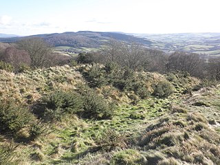
969:{{Information |Description={{en|1=Site of Bury Castle, Iron Age Fort}} |Source=From |Date=2013-02-02 |Author= |Permission=Creative Common...
619:"}},"text\/plain":{"en":{"P275":"Creative Commons Attribution-ShareAlike 2.0 Generic"}}}}": -->
181:
687:"}},"text\/plain":{"en":{"P973":"https:\/\/www.geograph.org.uk\/photo\/3319707"}}}}": -->
484:"}},"text\/plain":{"en":{"P2699":"https:\/\/www.geograph.org.uk\/profile\/8800"}}}}": -->
710:
642:
598:
268:
730:
303:
921:
916:
393:
56:
37:
525:
858:
831:
738:
694:
582:
546:
533:
518:
785:
753:
723:
626:
491:
450:
1026:
349:
392:– If you remix, transform, or build upon the material, you must distribute your contributions under the
310:
on the
Geograph website for the photographer's contact details. The copyright on this image is owned by
575:"}},"text\/plain":{"en":{"P6216":"copyrighted"}}}}": -->
824:"}},"text\/plain":{"en":{"P7787":"112 degree"}}}}": -->
105:
213:
983:
760:
745:
553:
346:
197:
8:
290:
274:
999:
Knowledge:WikiProject
Historic sites/Images of listed buildings in England without ID
993:
315:
92:
440:
160:
170:
841:
795:
704:
636:
592:
501:
295:
307:
962:
1031:
889:
Click on a date/time to view the file as it appeared at that time.
260:
245:
51° 12′ 48.65″ N, 3° 33′ 08.41″ W
1027:
Liste von Burgen und Schlössern im
Vereinigten Königreich
1016:
149:
80:
434:
Add a one-line explanation of what this file represents
130:
Geograph 3319707 Site of Bury Castle, Iron Age Fort.jpg
1051:
1041:
977:
1007:
887:
188:
Creative
Commons Attribution Share-alike license 2.0
104:
Commons is a freely licensed media file repository.
643:
Creative
Commons Attribution-ShareAlike 2.0 Generic
617:
Creative
Commons Attribution-ShareAlike 2.0 Generic
70:(1,024 × 768 pixels, file size: 237 KB, MIME type:
989:List of scheduled monuments in West Somerset (A–G)
403:https://creativecommons.org/licenses/by-sa/2.0
85:
685:https:\/\/www.geograph.org.uk\/photo\/3319707
409:Creative Commons Attribution-Share Alike 2.0
327:
176:
145:
127:
482:https:\/\/www.geograph.org.uk\/profile\/8800
166:
155:
14:
821:
369:– to copy, distribute and transmit the work
1009:The following other wikis use this file:
761:https://www.geograph.org.uk/photo/3319707
939:Higher-resolution version from Geograph.
554:https://www.geograph.org.uk/profile/8800
267:View this and other nearby images on:
979:The following 4 pages use this file:
220:
116:
314:and is licensed for reuse under the
235:
880:
350:Attribution-Share Alike 2.0 Generic
338:
333:
318:Attribution-ShareAlike 2.0 license.
13:
439:
433:
324:
301:
228:Site of Bury Castle, Iron Age Fort
209:Site of Bury Castle, Iron Age Fort
140:Site of Bury Castle, Iron Age Fort
134:
117:
63:
1065:
438:
832:coordinates of the point of view
814:coordinates of the point of view
424:
380:Under the following conditions:
345:This file is licensed under the
337:
332:
326:
294:
273:
259:
251:
84:
31:
21:
421:
135:
1004:
884:
711:file available on the internet
661:file available on the internet
420:
302:This image was taken from the
26:
1:
974:
847:51°12'48.650"N, 3°33'8.413"W
731:Geograph Britain and Ireland
669:Geograph Britain and Ireland
519:object of statement has role
466:object of statement has role
446:Items portrayed in this file
286:
250:
7:
1038:Usage on en.wikivoyage.org
1013:Usage on ceb.wikipedia.org
226:Roger Cornfoot /
207:Roger Cornfoot /
10:
1070:
1048:Usage on www.wikidata.org
1023:Usage on de.wikipedia.org
394:same or compatible license
124:
119:
881:
16:
917:23:10, 16 September 2017
739:geograph.org.uk image ID
673:geograph.org.uk image ID
423:
360:
91:This is a file from the
36:
968:
938:
198:required by the license
148:
95:. Information from its
1032:Bury Castle (Somerset)
984:Bury Castle, Selworthy
308:this photograph's page
279:51.213514; -3.552337
98:description page there
41:Size of this preview:
934:Geograph Update Bot
375:– to adapt the work
47:Other resolutions:
534:author name string
474:author name string
57:1,024 × 768 pixels
1005:Global file usage
994:User:Nev1/sandbox
972:
947:16:15, 5 May 2013
823:
627:copyright license
613:copyright license
432:
323:
322:
306:collection. See
284:
283:
233:
232:
201:
185:
182:Reusing this file
113:
112:
93:Wikimedia Commons
32:Global file usage
1061:
959:
929:
891:
869:
868:
863:
763:
758:
754:described at URL
748:
743:
733:
728:
681:described at URL
583:copyright status
569:copyright status
556:
551:
541:
538:
528:
523:
430:
416:
413:
410:
407:
404:
396:as the original.
358:
347:Creative Commons
341:
340:
336:
335:
330:
329:
316:Creative Commons
304:Geograph project
298:
291:
280:
277:
263:
262:
256:
255:
254:
248:
247:
236:
195:
179:
151:
139:
131:
125:
109:
88:
87:
81:
75:
73:
60:
53:640 × 480 pixels
49:320 × 240 pixels
43:800 × 600 pixels
1069:
1068:
1064:
1063:
1062:
1060:
1059:
1058:
1003:
973:
965:
957:
935:
927:
883:
882:
879:
878:
877:
876:
875:
874:
873:
872:
871:
870:
866:
864:
861:
852:
851:
850:
848:
838:
837:
836:
834:
811:
810:
809:
808:
807:
806:
805:
804:
802:
801:2 February 2013
792:
791:
790:
788:
773:
772:
771:
770:
769:
768:
767:
766:
765:
764:
759:
756:
750:
749:
744:
741:
735:
734:
729:
726:
717:
716:
715:
713:
701:
700:
699:
697:
654:
653:
652:
651:
650:
649:
648:
647:
645:
633:
632:
631:
629:
610:
609:
608:
607:
606:
605:
604:
603:
601:
589:
588:
587:
585:
566:
565:
564:
563:
562:
561:
560:
559:
558:
557:
552:
549:
543:
542:
539:
536:
530:
529:
524:
521:
512:
511:
510:
508:
498:
497:
496:
494:
459:
458:
457:
456:
455:
453:
437:
436:
435:
418:
417:
414:
411:
408:
405:
402:
401:
359:
356:
353:
342:
319:
289:
278:
252:
243:
242:
239:Camera location
234:
223:
216:
204:
161:geograph.org.uk
150:2 February 2013
141:
129:
122:
115:
114:
103:
102:
101:is shown below.
77:
71:
69:
62:
61:
46:
12:
11:
5:
1067:
1057:
1056:
1055:
1054:
1046:
1045:
1044:
1036:
1035:
1034:
1029:
1021:
1020:
1019:
1006:
1002:
1001:
996:
991:
986:
976:
971:
970:
967:
963:
960:
954:
949:
944:
941:
940:
937:
933:
930:
924:
919:
914:
910:
909:
906:
903:
900:
897:
894:
886:
857:
856:
855:
854:
853:
849:
846:
844:
843:
842:
840:
839:
835:
830:
828:
827:
826:
825:
819:
815:
803:
800:
798:
797:
796:
794:
793:
789:
784:
782:
781:
780:
779:
777:
752:
751:
737:
736:
722:
721:
720:
719:
718:
714:
709:
707:
706:
705:
703:
702:
698:
695:source of file
693:
691:
690:
689:
688:
686:
682:
678:
674:
670:
666:
662:
658:
657:source of file
646:
641:
639:
638:
637:
635:
634:
630:
625:
623:
622:
621:
620:
618:
614:
602:
597:
595:
594:
593:
591:
590:
586:
581:
579:
578:
577:
576:
574:
570:
545:
544:
540:Roger Cornfoot
532:
531:
517:
516:
515:
514:
513:
509:
506:
504:
503:
502:
500:
499:
495:
490:
488:
487:
486:
485:
483:
479:
475:
471:
467:
463:
454:
449:
447:
444:
443:
442:
441:
429:
428:
425:
422:
400:
399:
398:
397:
387:
378:
377:
376:
370:
363:You are free:
357:Roger Cornfoot
354:
344:
343:
325:
321:
320:
312:Roger Cornfoot
299:
288:
285:
282:
281:
271:
265:
240:
231:
230:
224:
221:
218:
217:
212:
205:
202:
190:
189:
186:
174:
173:
171:Roger Cornfoot
168:
164:
163:
157:
153:
152:
147:
143:
142:
132:
123:
121:
118:
111:
110:
89:
79:
78:
40:
35:
34:
29:
24:
19:
9:
6:
4:
3:
2:
1066:
1053:
1050:
1049:
1047:
1043:
1040:
1039:
1037:
1033:
1030:
1028:
1025:
1024:
1022:
1018:
1015:
1014:
1012:
1011:
1010:
1000:
997:
995:
992:
990:
987:
985:
982:
981:
980:
966:
961:
955:
953:
950:
948:
945:
943:
942:
936:
931:
925:
923:
920:
918:
915:
912:
911:
907:
904:
901:
898:
895:
893:
892:
890:
860:
845:
833:
829:
799:
787:
783:
762:
755:
747:
740:
732:
725:
712:
708:
696:
692:
644:
640:
628:
624:
600:
596:
584:
580:
555:
548:
535:
527:
520:
505:
493:
489:
452:
448:
445:
426:
419:
406:CC BY-SA 2.0
395:
391:
388:
385:
382:
381:
379:
374:
371:
368:
365:
364:
362:
361:
355:Attribution:
351:
348:
331:
317:
313:
309:
305:
300:
297:
293:
292:
276:
272:
270:
269:OpenStreetMap
266:
264:
246:
241:
238:
237:
229:
225:
219:
215:
211: /
210:
206:
199:
194:
192:
191:
187:
183:
178:
175:
172:
169:
165:
162:
158:
154:
144:
138:
133:
126:
107:
100:
99:
94:
90:
83:
82:
76:
67:
66:Original file
58:
54:
50:
44:
39:
33:
30:
28:
25:
23:
20:
18:
15:
1008:
978:
926:1,024 × 768
888:
885:File history
526:photographer
470:photographer
389:
383:
372:
366:
311:
249:
227:
214:CC BY-SA 2.0
208:
136:
106:You can help
96:
64:
22:File history
1017:Bury Castle
599:copyrighted
573:copyrighted
390:share alike
384:attribution
193:Attribution
128:Description
975:File usage
956:640 × 480
902:Dimensions
507:some value
177:Permission
72:image/jpeg
27:File usage
899:Thumbnail
896:Date/Time
786:inception
776:inception
287:Licensing
222:InfoField
203:InfoField
137:English:
1052:Q5001077
928:(237 KB)
724:operator
665:operator
427:Captions
373:to remix
367:to share
352:license.
1042:Porlock
958:(98 KB)
913:current
908:Comment
859:heading
818:heading
746:3319707
677:3319707
492:creator
462:creator
451:depicts
431:English
120:Summary
68:
867:degree
822:degree
257:
167:Author
156:Source
159:From
964:Rodw
905:User
865:112
415:true
412:true
146:Date
17:File
547:URL
478:URL
862::
757::
742::
727::
550::
537::
522::
55:|
51:|
45:.
200:)
196:(
184:)
180:(
108:.
74:)
59:.
Text is available under the Creative Commons Attribution-ShareAlike License. Additional terms may apply.

