882:"}},"text\/plain":{"en":{"":"coordinates of the point of view"}}},"{\"value\":{\"latitude\":52.90161,\"longitude\":1.2573,\"altitude\":null,\"precision\":1.0e-5,\"globe\":\"http:\\\/\\\/www.wikidata.org\\\/entity\\\/Q2\"},\"type\":\"globecoordinate\"}":{"text\/html":{"en":{"P1259":"52\u00b054'5.80"N, 1\u00b015'26.28"E"}},"text\/plain":{"en":{"P1259":"52\u00b054'5.80\"N, 1\u00b015'26.28\"E"}}},"{\"value\":{\"entity-type\":\"property\",\"numeric-id\":7787,\"id\":\"P7787\"},\"type\":\"wikibase-entityid\"}":{"text\/html":{"en":{"":"
994:"}},"text\/plain":{"en":{"":"coordinates of depicted place"}}},"{\"value\":{\"latitude\":52.90178,\"longitude\":1.2576,\"altitude\":null,\"precision\":1.0e-5,\"globe\":\"http:\\\/\\\/www.wikidata.org\\\/entity\\\/Q2\"},\"type\":\"globecoordinate\"}":{"text\/html":{"en":{"P9149":"52\u00b054'6.41"N, 1\u00b015'27.36"E"}},"text\/plain":{"en":{"P9149":"52\u00b054'6.41\"N, 1\u00b015'27.36\"E"}}},"{\"value\":{\"entity-type\":\"property\",\"numeric-id\":7787,\"id\":\"P7787\"},\"type\":\"wikibase-entityid\"}":{"text\/html":{"en":{"":"
534:"}},"text\/plain":{"en":{"":"author name string"}}},"{\"value\":\"Evelyn Simak\",\"type\":\"string\"}":{"text\/html":{"en":{"P2093":"Evelyn Simak"}},"text\/plain":{"en":{"P2093":"Evelyn Simak"}}},"{\"value\":{\"entity-type\":\"property\",\"numeric-id\":2699,\"id\":\"P2699\"},\"type\":\"wikibase-entityid\"}":{"text\/html":{"en":{"":"
844:"}},"text\/plain":{"en":{"":"inception"}}},"{\"value\":{\"time\":\"+2008-03-14T00:00:00Z\",\"timezone\":0,\"before\":0,\"after\":0,\"precision\":11,\"calendarmodel\":\"http:\\\/\\\/www.wikidata.org\\\/entity\\\/Q1985727\"},\"type\":\"time\"}":{"text\/html":{"en":{"P571":"14 March 2008"}},"text\/plain":{"en":{"P571":"14 March 2008"}}}}": -->
721:
300:
250:
990:
242:
314:
264:
335:
373:
43:
378:
87:
1107:"}},"text\/plain":{"en":{"":"f-number"}}},"{\"value\":{\"amount\":\"+4\",\"unit\":\"1\"},\"type\":\"quantity\"}":{"text\/html":{"en":{"P6790":"4"}},"text\/plain":{"en":{"P6790":"4"}}}}": -->
542:"}},"text\/plain":{"en":{"P2699":"https:\/\/www.geograph.org.uk\/profile\/14840"}}},"{\"value\":{\"entity-type\":\"property\",\"numeric-id\":3831,\"id\":\"P3831\"},\"type\":\"wikibase-entityid\"}":{"text\/html":{"en":{"":"
729:"}},"text\/plain":{"en":{"P7482":"file available on the internet"}}},"{\"value\":{\"entity-type\":\"property\",\"numeric-id\":7384,\"id\":\"P7384\"},\"type\":\"wikibase-entityid\"}":{"text\/html":{"en":{"":"
1062:"}},"text\/plain":{"en":{"":"exposure time"}}},"{\"value\":{\"amount\":\"+0.0015625\",\"unit\":\"http:\\\/\\\/www.wikidata.org\\\/entity\\\/Q11574\"},\"type\":\"quantity\"}":{"text\/html":{"en":{"P6757":"0.0015625
546:"}},"text\/plain":{"en":{"":"object of statement has role"}}},"{\"value\":{\"entity-type\":\"item\",\"numeric-id\":33231,\"id\":\"Q33231\"},\"type\":\"wikibase-entityid\"}":{"text\/html":{"en":{"P3831":"
745:"}},"text\/plain":{"en":{"P137":"Geograph Britain and Ireland"}}},"{\"value\":{\"entity-type\":\"property\",\"numeric-id\":973,\"id\":\"P973\"},\"type\":\"wikibase-entityid\"}":{"text\/html":{"en":{"":"
1190:"}},"text\/plain":{"en":{"":"media type"}}},"{\"value\":\"image\\\/jpeg\",\"type\":\"string\"}":{"text\/html":{"en":{"P1163":"image\/jpeg"}},"text\/plain":{"en":{"P1163":"image\/jpeg"}}}}": -->
681:"}},"text\/plain":{"en":{"":"copyright license"}}},"{\"value\":{\"entity-type\":\"item\",\"numeric-id\":19068220,\"id\":\"Q19068220\"},\"type\":\"wikibase-entityid\"}":{"text\/html":{"en":{"P275":"
637:"}},"text\/plain":{"en":{"":"copyright status"}}},"{\"value\":{\"entity-type\":\"item\",\"numeric-id\":50423863,\"id\":\"Q50423863\"},\"type\":\"wikibase-entityid\"}":{"text\/html":{"en":{"P6216":"
725:"}},"text\/plain":{"en":{"":"source of file"}}},"{\"value\":{\"entity-type\":\"item\",\"numeric-id\":74228490,\"id\":\"Q74228490\"},\"type\":\"wikibase-entityid\"}":{"text\/html":{"en":{"P7482":"
950:"}},"text\/plain":{"en":{"":"captured with"}}},"{\"value\":{\"entity-type\":\"item\",\"numeric-id\":421121,\"id\":\"Q421121\"},\"type\":\"wikibase-entityid\"}":{"text\/html":{"en":{"P4082":"
1145:"}},"text\/plain":{"en":{"":"focal length"}}},"{\"value\":{\"amount\":\"+6\",\"unit\":\"http:\\\/\\\/www.wikidata.org\\\/entity\\\/Q174789\"},\"type\":\"quantity\"}":{"text\/html":{"en":{"P2151":"6
741:"}},"text\/plain":{"en":{"":"operator"}}},"{\"value\":{\"entity-type\":\"item\",\"numeric-id\":1503119,\"id\":\"Q1503119\"},\"type\":\"wikibase-entityid\"}":{"text\/html":{"en":{"P137":"
483:"}},"text\/plain":{"en":{"":"depicts"}}},"{\"value\":{\"entity-type\":\"item\",\"numeric-id\":1483529,\"id\":\"Q1483529\"},\"type\":\"wikibase-entityid\"}":{"text\/html":{"en":{"P180":"
998:"}},"text\/plain":{"en":{"":"heading"}}},"{\"value\":{\"amount\":\"+45\",\"unit\":\"http:\\\/\\\/www.wikidata.org\\\/entity\\\/Q28390\"},\"type\":\"quantity\"}":{"text\/html":{"en":{"P7787":"45
886:"}},"text\/plain":{"en":{"":"heading"}}},"{\"value\":{\"amount\":\"+45\",\"unit\":\"http:\\\/\\\/www.wikidata.org\\\/entity\\\/Q28390\"},\"type\":\"quantity\"}":{"text\/html":{"en":{"P7787":"45
737:"}},"text\/plain":{"en":{"P7384":"724687"}}},"{\"value\":{\"entity-type\":\"property\",\"numeric-id\":137,\"id\":\"P137\"},\"type\":\"wikibase-entityid\"}":{"text\/html":{"en":{"":"
530:"}},"text\/plain":{"en":{"":"creator"}}},"{\"value\":{\"entity-type\":\"property\",\"numeric-id\":2093,\"id\":\"P2093\"},\"type\":\"wikibase-entityid\"}":{"text\/html":{"en":{"":"
1266:
1186:
733:"}},"text\/plain":{"en":{"":"geograph.org.uk image ID"}}},"{\"value\":\"724687\",\"type\":\"string\"}":{"text\/html":{"en":{"P7384":"
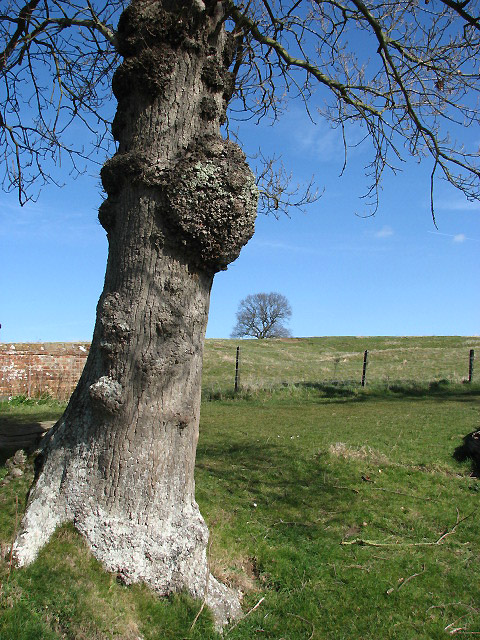
1283:== {{int:filedesc}} == {{Information |description={{en|1=Growth on tree trunk Beside footpath to Felbrigg Pond. Large rounded outgrowths on trunk or branches of trees are called burls; the wood cut from burls is often used for decorative purposes as a ven
233:
425:– You must give appropriate credit, provide a link to the license, and indicate if changes were made. You may do so in any reasonable manner, but not in any way that suggests the licensor endorses you or your use.
297:
247:
53:
47:
98:
66:
734:
726:
682:
638:
742:
484:
951:
547:
1187:
1142:
1104:
1059:
995:
991:
947:
883:
879:
730:
722:
634:
543:
535:
531:
539:
841:
750:
746:
738:
678:
527:
480:
1276:
685:"}},"text\/plain":{"en":{"P275":"Creative Commons Attribution-ShareAlike 2.0 Generic"}}}}": -->
753:"}},"text\/plain":{"en":{"P973":"https:\/\/www.geograph.org.uk\/photo\/724687"}}}}": -->
776:
708:
664:
307:
257:
811:
513:
342:
1378:
This file contains additional information, probably added from the digital camera or scanner used to create or digitize it.
977:
432:
619:
1197:
1156:
1114:
1073:
1036:
1009:
961:
924:
897:
789:
760:
648:
612:
597:
584:
851:
819:
804:
692:
557:
497:
1265:
1260:
57:
42:
1541:
954:"}},"text\/plain":{"en":{"P4082":"Canon PowerShot S3 IS"}}}}": -->
388:
1381:
If the file has been modified from its original state, some details may not fully reflect the modified file.
1315:
1066:"}},"text\/plain":{"en":{"P6757":"0.0015625 second"}}}}": -->
431:– If you remix, transform, or build upon the material, you must distribute your contributions under the
349:
on the
Geograph website for the photographer's contact details. The copyright on this image is owned by
1473:
1149:"}},"text\/plain":{"en":{"P2151":"6 millimetre"}}}}": -->
550:"}},"text\/plain":{"en":{"P3831":"photographer"}}}}": -->
641:"}},"text\/plain":{"en":{"P6216":"copyrighted"}}}}": -->
1002:"}},"text\/plain":{"en":{"P7787":"45 degree"}}}}": -->
890:"}},"text\/plain":{"en":{"P7787":"45 degree"}}}}": -->
106:
202:
1586:
1400:
487:"}},"text\/plain":{"en":{"P180":"burl"}}}}": -->
604:
826:
796:
385:
186:
8:
1614:
329:
313:
263:
354:
142:
so that the twig can elongate into a limb. Burls do not usually cause harm to trees.
93:
1390:
1604:
1568:
1512:
1407:
175:
1522:
1436:
165:
1207:
1166:
1124:
1083:
1019:
971:
907:
861:
770:
702:
658:
567:
507:
1624:
334:
1619:
Flash did not fire, compulsory flash suppression, red-eye reduction mode
143:
346:
1335:
1417:
1233:
Click on a date/time to view the file as it appeared at that time.
299:
249:
1365:
1297:
284:
52° 54′ 06″ N, 1° 15′ 27″ E
234:
52° 54′ 06″ N, 1° 15′ 26″ E
154:
81:
1355:
1345:
1291:
1306:
1231:
105:
Commons is a freely licensed media file repository.
709:
Creative
Commons Attribution-ShareAlike 2.0 Generic
683:
Creative
Commons Attribution-ShareAlike 2.0 Generic
131:
Growth on tree trunk - geograph.org.uk - 724687.jpg
1325:
71:(480 × 640 pixels, file size: 199 KB, MIME type:
442:https://creativecommons.org/licenses/by-sa/2.0
86:
540:https:\/\/www.geograph.org.uk\/profile\/14840
448:Creative Commons Attribution-Share Alike 2.0
366:
150:
128:
751:https:\/\/www.geograph.org.uk\/photo\/724687
171:
160:
14:
1146:
1063:
999:
887:
408:– to copy, distribute and transmit the work
1308:The following other wikis use this file:
605:https://www.geograph.org.uk/profile/14840
827:https://www.geograph.org.uk/photo/724687
306:View this and other nearby images on:
256:View this and other nearby images on:
209:
144:http://www.thefreedictionary.com/burl
117:
353:and is licensed for reuse under the
274:
224:
1293:The following page uses this file:
1224:
389:Attribution-Share Alike 2.0 Generic
377:
372:
357:Attribution-ShareAlike 2.0 license.
13:
1376:
478:
472:
363:
340:
135:
118:
64:
1673:
1383:
477:
1427:Date and time of data generation
898:coordinates of the point of view
880:coordinates of the point of view
463:
419:Under the following conditions:
384:This file is licensed under the
376:
371:
365:
333:
312:
298:
290:
262:
248:
240:
85:
31:
21:
460:
136:
1303:
1228:
777:file available on the internet
727:file available on the internet
459:
341:This image was taken from the
26:
1:
1010:coordinates of depicted place
992:coordinates of depicted place
36:
1288:
812:Geograph Britain and Ireland
743:Geograph Britain and Ireland
613:object of statement has role
544:object of statement has role
493:Items portrayed in this file
325:
7:
1650:Focal plane resolution unit
1552:Date and time of digitizing
1373:
1322:Usage on fr.wiktionary.org
289:
239:
10:
1678:
1661:One-chip color area sensor
1474:Adobe Photoshop CS Windows
1362:Usage on zh.wikipedia.org
1352:Usage on nn.wikipedia.org
1342:Usage on id.wikipedia.org
1332:Usage on gl.wikipedia.org
1312:Usage on ar.wikipedia.org
1025:52°54'6.41"N, 1°15'27.36"E
913:52°54'5.80"N, 1°15'26.28"E
433:same or compatible license
125:
120:
1480:File change date and time
1225:
215:Evelyn Simak /
196:Evelyn Simak /
16:
1642:Focal plane Y resolution
1634:Focal plane X resolution
790:geograph.org.uk image ID
731:geograph.org.uk image ID
462:
399:
92:This is a file from the
41:
1496:Custom image processing
1282:
1261:04:48, 19 February 2011
187:required by the license
153:
96:. Information from its
1560:Image compression mode
347:this photograph's page
318:52.901780; 1.257600
268:52.901610; 1.257300
99:description page there
46:Size of this preview:
1596:Maximum land aperture
1454:Horizontal resolution
1412:1/640 sec (0.0015625)
1401:Canon PowerShot S3 IS
978:Canon PowerShot S3 IS
952:Canon PowerShot S3 IS
473:Burls on a tree trunk
1555:12:01, 14 March 2008
1483:16:26, 14 March 2008
1430:12:01, 14 March 2008
217:Growth on tree trunk
198:Growth on tree trunk
1599:2.875 APEX (f/2.71)
1488:Y and C positioning
1462:Vertical resolution
1387:Camera manufacturer
414:– to adapt the work
52:Other resolutions:
1533:Scene capture type
1517:Auto white balance
585:author name string
532:author name string
1665:
1664:
1304:Global file usage
1286:
1148:
1065:
1001:
889:
693:copyright license
679:copyright license
471:
362:
361:
345:collection. See
323:
322:
273:
272:
222:
221:
190:
114:
113:
94:Wikimedia Commons
32:Global file usage
1669:
1645:2,844.4444444444
1637:2,840.2366863905
1384:
1273:
1235:
1175:
1092:
1047:
1046:
1041:
935:
934:
929:
829:
824:
820:described at URL
814:
809:
799:
794:
747:described at URL
649:copyright status
635:copyright status
622:
617:
607:
602:
592:
589:
469:
455:
452:
449:
446:
443:
435:as the original.
397:
386:Creative Commons
380:
379:
375:
374:
369:
368:
355:Creative Commons
343:Geograph project
337:
330:
319:
316:
302:
301:
295:
294:
293:
287:
286:
275:
269:
266:
252:
251:
245:
244:
243:
237:
236:
225:
184:
156:
140:
132:
126:
110:
89:
88:
82:
76:
74:
61:
58:480 × 640 pixels
54:180 × 240 pixels
48:450 × 600 pixels
1677:
1676:
1672:
1671:
1670:
1668:
1667:
1666:
1372:
1302:
1287:
1279:
1271:
1227:
1226:
1223:
1222:
1221:
1220:
1219:
1218:
1217:
1216:
1214:
1204:
1203:
1202:
1200:
1185:
1184:
1183:
1182:
1181:
1180:
1179:
1178:
1176:
1173:
1163:
1162:
1161:
1159:
1140:
1139:
1138:
1137:
1136:
1135:
1134:
1133:
1131:
1121:
1120:
1119:
1117:
1102:
1101:
1100:
1099:
1098:
1097:
1096:
1095:
1093:
1090:
1080:
1079:
1078:
1076:
1057:
1056:
1055:
1054:
1053:
1052:
1051:
1050:
1049:
1048:
1044:
1042:
1039:
1030:
1029:
1028:
1026:
1016:
1015:
1014:
1012:
989:
988:
987:
986:
985:
984:
983:
982:
980:
968:
967:
966:
964:
945:
944:
943:
942:
941:
940:
939:
938:
937:
936:
932:
930:
927:
918:
917:
916:
914:
904:
903:
902:
900:
877:
876:
875:
874:
873:
872:
871:
870:
868:
858:
857:
856:
854:
839:
838:
837:
836:
835:
834:
833:
832:
831:
830:
825:
822:
816:
815:
810:
807:
801:
800:
795:
792:
783:
782:
781:
779:
767:
766:
765:
763:
720:
719:
718:
717:
716:
715:
714:
713:
711:
699:
698:
697:
695:
676:
675:
674:
673:
672:
671:
670:
669:
667:
655:
654:
653:
651:
632:
631:
630:
629:
628:
627:
626:
625:
624:
623:
618:
615:
609:
608:
603:
600:
594:
593:
590:
587:
578:
577:
576:
574:
564:
563:
562:
560:
525:
524:
523:
522:
521:
520:
519:
518:
516:
504:
503:
502:
500:
476:
475:
474:
457:
456:
453:
450:
447:
444:
441:
440:
398:
395:
392:
381:
358:
328:
317:
291:
282:
281:
278:Object location
267:
241:
232:
231:
228:Camera location
223:
212:
205:
193:
166:geograph.org.uk
146:
130:
123:
116:
115:
104:
103:
102:is shown below.
78:
72:
70:
63:
62:
51:
12:
11:
5:
1675:
1663:
1662:
1659:
1658:Sensing method
1655:
1654:
1651:
1647:
1646:
1643:
1639:
1638:
1635:
1631:
1630:
1627:
1621:
1620:
1617:
1611:
1610:
1607:
1601:
1600:
1597:
1593:
1592:
1589:
1583:
1582:
1579:
1575:
1574:
1571:
1565:
1564:
1561:
1557:
1556:
1553:
1549:
1548:
1545:
1538:
1537:
1534:
1530:
1529:
1526:
1519:
1518:
1515:
1509:
1508:
1505:
1501:
1500:
1499:Normal process
1497:
1493:
1492:
1489:
1485:
1484:
1481:
1477:
1476:
1471:
1467:
1466:
1463:
1459:
1458:
1455:
1451:
1450:
1447:
1443:
1442:
1439:
1432:
1431:
1428:
1424:
1423:
1420:
1414:
1413:
1410:
1404:
1403:
1398:
1394:
1393:
1388:
1375:
1371:
1370:
1369:
1368:
1360:
1359:
1358:
1350:
1349:
1348:
1340:
1339:
1338:
1330:
1329:
1328:
1320:
1319:
1318:
1305:
1301:
1300:
1290:
1285:
1284:
1281:
1277:
1274:
1268:
1263:
1258:
1254:
1253:
1250:
1247:
1244:
1241:
1238:
1230:
1215:
1212:
1210:
1209:
1208:
1206:
1205:
1201:
1196:
1194:
1193:
1192:
1191:
1189:
1177:
1171:
1169:
1168:
1167:
1165:
1164:
1160:
1155:
1153:
1152:
1151:
1150:
1144:
1132:
1129:
1127:
1126:
1125:
1123:
1122:
1118:
1113:
1111:
1110:
1109:
1108:
1106:
1094:
1088:
1086:
1085:
1084:
1082:
1081:
1077:
1072:
1070:
1069:
1068:
1067:
1061:
1035:
1034:
1033:
1032:
1031:
1027:
1024:
1022:
1021:
1020:
1018:
1017:
1013:
1008:
1006:
1005:
1004:
1003:
997:
993:
981:
976:
974:
973:
972:
970:
969:
965:
960:
958:
957:
956:
955:
953:
949:
923:
922:
921:
920:
919:
915:
912:
910:
909:
908:
906:
905:
901:
896:
894:
893:
892:
891:
885:
881:
869:
866:
864:
863:
862:
860:
859:
855:
850:
848:
847:
846:
845:
843:
818:
817:
803:
802:
788:
787:
786:
785:
784:
780:
775:
773:
772:
771:
769:
768:
764:
761:source of file
759:
757:
756:
755:
754:
752:
748:
744:
740:
736:
732:
728:
724:
723:source of file
712:
707:
705:
704:
703:
701:
700:
696:
691:
689:
688:
687:
686:
684:
680:
668:
663:
661:
660:
659:
657:
656:
652:
647:
645:
644:
643:
642:
640:
636:
611:
610:
596:
595:
583:
582:
581:
580:
579:
575:
572:
570:
569:
568:
566:
565:
561:
556:
554:
553:
552:
551:
549:
545:
541:
537:
533:
529:
517:
512:
510:
509:
508:
506:
505:
501:
496:
494:
491:
490:
489:
488:
486:
482:
468:
467:
464:
461:
439:
438:
437:
436:
426:
417:
416:
415:
409:
402:You are free:
393:
383:
382:
364:
360:
359:
338:
327:
324:
321:
320:
310:
304:
279:
271:
270:
260:
254:
229:
220:
219:
213:
210:
207:
206:
201:
194:
191:
179:
178:
173:
169:
168:
162:
158:
157:
152:
148:
147:
133:
124:
122:
119:
112:
111:
90:
80:
79:
45:
40:
39:
34:
29:
24:
19:
9:
6:
4:
3:
2:
1674:
1660:
1657:
1656:
1652:
1649:
1648:
1644:
1641:
1640:
1636:
1633:
1632:
1628:
1626:
1623:
1622:
1618:
1616:
1613:
1612:
1608:
1606:
1605:Metering mode
1603:
1602:
1598:
1595:
1594:
1590:
1588:
1587:Exposure bias
1585:
1584:
1580:
1578:APEX aperture
1577:
1576:
1572:
1570:
1569:Shutter speed
1567:
1566:
1562:
1559:
1558:
1554:
1551:
1550:
1546:
1543:
1540:
1539:
1535:
1532:
1531:
1527:
1524:
1521:
1520:
1516:
1514:
1513:White balance
1511:
1510:
1507:Auto exposure
1506:
1504:Exposure mode
1503:
1502:
1498:
1495:
1494:
1490:
1487:
1486:
1482:
1479:
1478:
1475:
1472:
1470:Software used
1469:
1468:
1464:
1461:
1460:
1456:
1453:
1452:
1448:
1445:
1444:
1440:
1438:
1434:
1433:
1429:
1426:
1425:
1421:
1419:
1416:
1415:
1411:
1409:
1408:Exposure time
1406:
1405:
1402:
1399:
1396:
1395:
1392:
1389:
1386:
1385:
1382:
1379:
1367:
1364:
1363:
1361:
1357:
1354:
1353:
1351:
1347:
1344:
1343:
1341:
1337:
1336:Nó (botánica)
1334:
1333:
1331:
1327:
1324:
1323:
1321:
1317:
1314:
1313:
1311:
1310:
1309:
1299:
1296:
1295:
1294:
1280:
1275:
1269:
1267:
1264:
1262:
1259:
1256:
1255:
1251:
1248:
1245:
1242:
1239:
1237:
1236:
1234:
1211:
1199:
1195:
1170:
1158:
1154:
1128:
1116:
1112:
1087:
1075:
1074:exposure time
1071:
1060:exposure time
1038:
1023:
1011:
1007:
979:
975:
963:
962:captured with
959:
948:captured with
926:
911:
899:
895:
867:14 March 2008
865:
853:
849:
828:
821:
813:
806:
798:
791:
778:
774:
762:
758:
710:
706:
694:
690:
666:
662:
650:
646:
621:
614:
606:
599:
586:
571:
559:
555:
515:
511:
499:
495:
492:
465:
458:
445:CC BY-SA 2.0
434:
430:
427:
424:
421:
420:
418:
413:
410:
407:
404:
403:
401:
400:
394:Attribution:
390:
387:
370:
356:
352:
348:
344:
339:
336:
332:
331:
315:
311:
309:
308:OpenStreetMap
305:
303:
285:
280:
277:
276:
265:
261:
259:
258:OpenStreetMap
255:
253:
235:
230:
227:
226:
218:
214:
208:
204:
200: /
199:
195:
188:
183:
181:
180:
177:
174:
170:
167:
163:
159:
155:14 March 2008
149:
145:
139:
134:
127:
108:
101:
100:
95:
91:
84:
83:
77:
68:
67:Original file
59:
55:
49:
44:
38:
35:
33:
30:
28:
25:
23:
20:
18:
15:
1523:Digital zoom
1437:focal length
1397:Camera model
1380:
1377:
1307:
1292:
1232:
1229:File history
1157:focal length
1143:focal length
620:photographer
591:Evelyn Simak
548:photographer
428:
422:
411:
405:
396:Evelyn Simak
351:Evelyn Simak
350:
288:
238:
216:
203:CC BY-SA 2.0
197:
176:Evelyn Simak
137:
107:You can help
97:
65:
22:File history
1625:Color space
1446:Orientation
1316:نامية جذعية
1278:GeographBot
665:copyrighted
639:copyrighted
429:share alike
423:attribution
182:Attribution
129:Description
1346:Bisul kayu
1289:File usage
1270:480 × 640
1246:Dimensions
1213:image/jpeg
1198:media type
1188:media type
1174:millimetre
1147:millimetre
1089:0.0015625
573:some value
73:image/jpeg
27:File usage
1536:Landscape
1243:Thumbnail
1240:Date/Time
852:inception
842:inception
326:Licensing
211:InfoField
192:InfoField
138:English:
1491:Centered
1418:F-number
1374:Metadata
1272:(199 KB)
1115:f-number
1105:f-number
805:operator
739:operator
466:Captions
412:to remix
406:to share
391:license.
37:Metadata
1609:Pattern
1544:version
1465:180 dpi
1457:180 dpi
1257:current
1252:Comment
1037:heading
996:heading
925:heading
884:heading
558:creator
528:creator
498:depicts
481:depicts
470:English
121:Summary
69:
1653:inches
1573:9.3125
1449:Normal
1091:second
1064:second
1045:degree
1000:degree
933:degree
888:degree
797:724687
735:724687
296:
246:
172:Author
161:Source
1615:Flash
1525:ratio
1435:Lens
1391:Canon
1356:Kåter
164:From
1629:sRGB
1542:Exif
1441:6 mm
1326:burl
1298:Burl
1249:User
514:burl
485:burl
454:true
451:true
151:Date
17:File
1547:2.2
1422:f/4
1043:45
931:45
598:URL
536:URL
1366:樹瘤
1172:6
1040::
928::
823::
808::
793::
616::
601::
588::
56:|
50:.
1591:0
1581:4
1563:3
1528:1
1130:4
189:)
185:(
109:.
75:)
60:.
Text is available under the Creative Commons Attribution-ShareAlike License. Additional terms may apply.
_heading:45.00&language=en)
_heading:45.00&language=en)
