594:"}},"text\/plain":{"en":{"":"coordinates of the point of view"}}},"{\"value\":{\"latitude\":57.69776,\"longitude\":-4.0376,\"altitude\":null,\"precision\":1.0e-5,\"globe\":\"http:\\\/\\\/www.wikidata.org\\\/entity\\\/Q2\"},\"type\":\"globecoordinate\"}":{"text\/html":{"en":{"P1259":"57\u00b041'51.94"N, 4\u00b02'15.36"W"}},"text\/plain":{"en":{"P1259":"57\u00b041'51.94\"N, 4\u00b02'15.36\"W"}}},"{\"value\":{\"entity-type\":\"property\",\"numeric-id\":7787,\"id\":\"P7787\"},\"type\":\"wikibase-entityid\"}":{"text\/html":{"en":{"":"
700:"}},"text\/plain":{"en":{"":"coordinates of depicted place"}}},"{\"value\":{\"latitude\":57.6965,\"longitude\":-4.0267,\"altitude\":null,\"precision\":1.0e-5,\"globe\":\"http:\\\/\\\/www.wikidata.org\\\/entity\\\/Q2\"},\"type\":\"globecoordinate\"}":{"text\/html":{"en":{"P9149":"57\u00b041'47.40"N, 4\u00b01'36.12"W"}},"text\/plain":{"en":{"P9149":"57\u00b041'47.40\"N, 4\u00b01'36.12\"W"}}},"{\"value\":{\"entity-type\":\"property\",\"numeric-id\":7787,\"id\":\"P7787\"},\"type\":\"wikibase-entityid\"}":{"text\/html":{"en":{"":"
38:
662:"}},"text\/plain":{"en":{"":"inception"}}},"{\"value\":{\"time\":\"+2013-01-01T00:00:00Z\",\"timezone\":0,\"before\":0,\"after\":0,\"precision\":9,\"calendarmodel\":\"http:\\\/\\\/www.wikidata.org\\\/entity\\\/Q1985727\"},\"type\":\"time\"}":{"text\/html":{"en":{"P571":"2013"}},"text\/plain":{"en":{"P571":"2013"}}}}": -->
370:
303:
253:
295:
245:
696:
267:
338:
376:
381:
94:
806:
550:"}},"text\/plain":{"en":{"":"copyright license"}}},"{\"value\":{\"entity-type\":\"item\",\"numeric-id\":19068220,\"id\":\"Q19068220\"},\"type\":\"wikibase-entityid\"}":{"text\/html":{"en":{"P275":"
506:"}},"text\/plain":{"en":{"":"copyright status"}}},"{\"value\":{\"entity-type\":\"item\",\"numeric-id\":50423863,\"id\":\"Q50423863\"},\"type\":\"wikibase-entityid\"}":{"text\/html":{"en":{"P6216":"
598:"}},"text\/plain":{"en":{"":"heading"}}},"{\"value\":{\"amount\":\"+112.0\",\"unit\":\"http:\\\/\\\/www.wikidata.org\\\/entity\\\/Q28390\"},\"type\":\"quantity\"}":{"text\/html":{"en":{"P7787":"112.0
704:"}},"text\/plain":{"en":{"":"heading"}}},"{\"value\":{\"amount\":\"+112\",\"unit\":\"http:\\\/\\\/www.wikidata.org\\\/entity\\\/Q28390\"},\"type\":\"quantity\"}":{"text\/html":{"en":{"P7787":"112
502:
236:
428:– You must give appropriate credit, provide a link to the license, and indicate if changes were made. You may do so in any reasonable manner, but not in any way that suggests the licensor endorses you or your use.
250:
300:
60:
56:
52:
48:
42:
105:
73:
551:
507:
701:
697:
595:
591:
503:
659:
547:
554:"}},"text\/plain":{"en":{"P275":"Creative Commons Attribution-ShareAlike 2.0 Generic"}}}}": -->
837:
577:
533:
310:
260:
805:
800:
64:
37:
345:
435:
742:
715:
636:
609:
517:
669:
561:
492:
391:
865:
434:– If you remix, transform, or build upon the material, you must distribute your contributions under the
352:
on the
Geograph website for the photographer's contact details. The copyright on this image is owned by
602:"}},"text\/plain":{"en":{"P7787":"112.0 degree"}}}}": -->
510:"}},"text\/plain":{"en":{"P6216":"copyrighted"}}}}": -->
708:"}},"text\/plain":{"en":{"P7787":"112 degree"}}}}": -->
113:
205:
388:
189:
8:
332:
316:
266:
357:
100:
482:
170:
855:
725:
679:
619:
571:
527:
337:
349:
816:
773:
Click on a date/time to view the file as it appeared at that time.
302:
252:
287:
57° 41′ 47.4″ N, 4° 01′ 36″ W
237:
57° 41′ 51.9″ N, 4° 02′ 15″ W
88:
476:
Add a one-line explanation of what this file represents
138:
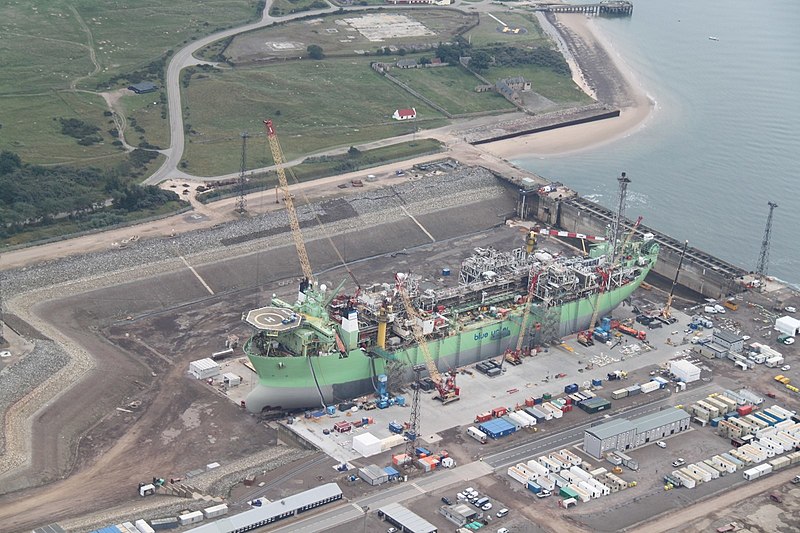
Hæwene Brim FPSO - Geograph-3619354-by-Graeme-Smith.jpg
831:
78:(1,600 × 1,067 pixels, file size: 365 KB, MIME type:
846:
771:
112:
Commons is a freely licensed media file repository.
578:
Creative
Commons Attribution-ShareAlike 2.0 Generic
552:
Creative
Commons Attribution-ShareAlike 2.0 Generic
160:
445:https://creativecommons.org/licenses/by-sa/2.0
93:
451:Creative Commons Attribution-Share Alike 2.0
369:
156:
135:
176:
166:
14:
705:
599:
411:– to copy, distribute and transmit the work
838:Floating production storage and offloading
848:The following other wikis use this file:
171:https://www.geograph.org.uk/photo/3619354
866:Peldošā ieguves un uzglabāšanas vienība
309:View this and other nearby images on:
259:View this and other nearby images on:
212:
124:
356:and is licensed for reuse under the
277:
227:
833:The following page uses this file:
764:
392:Attribution-Share Alike 2.0 Generic
380:
375:
360:Attribution-ShareAlike 2.0 license.
13:
481:
475:
366:
343:
142:
125:
71:
879:
480:
610:coordinates of the point of view
592:coordinates of the point of view
466:
422:Under the following conditions:
387:This file is licensed under the
379:
374:
368:
336:
315:
301:
293:
265:
251:
243:
92:
31:
21:
463:
143:
856:Bluewater Energy Services B.V.
843:
768:
462:
344:This image was taken from the
26:
1:
716:coordinates of depicted place
698:coordinates of depicted place
828:
488:Items portrayed in this file
328:
292:
242:
7:
10:
884:
862:Usage on lv.wikipedia.org
852:Usage on fr.wikipedia.org
731:57°41'47.40"N, 4°1'36.12"W
625:57°41'51.94"N, 4°2'15.36"W
436:same or compatible license
132:
127:
765:
218:Graeme Smith /
199:Graeme Smith /
16:
801:13:04, 20 September 2013
465:
402:
99:This is a file from the
36:
822:
190:required by the license
159:
103:. Information from its
350:this photograph's page
321:57.696500; -4.026700
271:57.697760; -4.037600
106:description page there
41:Size of this preview:
65:1,600 × 1,067 pixels
417:– to adapt the work
47:Other resolutions:
61:1,280 × 854 pixels
57:1,024 × 683 pixels
844:Global file usage
826:
707:
601:
562:copyright license
548:copyright license
474:
365:
364:
348:collection. See
326:
325:
276:
275:
225:
224:
193:
148:Bluewater's FPSO
121:
120:
101:Wikimedia Commons
32:Global file usage
875:
813:
775:
753:
752:
747:
647:
646:
641:
518:copyright status
504:copyright status
472:
458:
455:
452:
449:
446:
438:as the original.
400:
389:Creative Commons
383:
382:
378:
377:
372:
371:
358:Creative Commons
346:Geograph project
340:
333:
322:
319:
305:
304:
298:
297:
296:
290:
289:
278:
272:
269:
255:
254:
248:
247:
246:
240:
239:
228:
187:
162:
147:
139:
133:
117:
96:
95:
89:
83:
81:
68:
53:640 × 427 pixels
49:320 × 213 pixels
43:800 × 534 pixels
883:
882:
878:
877:
876:
874:
873:
872:
842:
827:
819:
811:
767:
766:
763:
762:
761:
760:
759:
758:
757:
756:
755:
754:
750:
748:
745:
736:
735:
734:
732:
722:
721:
720:
718:
695:
694:
693:
692:
691:
690:
689:
688:
686:
676:
675:
674:
672:
657:
656:
655:
654:
653:
652:
651:
650:
649:
648:
644:
642:
639:
630:
629:
628:
626:
616:
615:
614:
612:
589:
588:
587:
586:
585:
584:
583:
582:
580:
568:
567:
566:
564:
545:
544:
543:
542:
541:
540:
539:
538:
536:
524:
523:
522:
520:
501:
500:
499:
498:
497:
495:
479:
478:
477:
460:
459:
456:
453:
450:
447:
444:
443:
401:
398:
395:
384:
361:
331:
320:
294:
285:
284:
281:Object location
270:
244:
235:
234:
231:Camera location
226:
215:
208:
196:
152:
137:
130:
123:
122:
111:
110:
109:is shown below.
85:
79:
77:
70:
69:
46:
12:
11:
5:
881:
871:
870:
869:
868:
860:
859:
858:
845:
841:
840:
830:
825:
824:
821:
817:
814:
810:1,600 × 1,067
808:
803:
798:
794:
793:
790:
787:
784:
781:
778:
770:
741:
740:
739:
738:
737:
733:
730:
728:
727:
726:
724:
723:
719:
714:
712:
711:
710:
709:
703:
699:
687:
684:
682:
681:
680:
678:
677:
673:
668:
666:
665:
664:
663:
661:
635:
634:
633:
632:
631:
627:
624:
622:
621:
620:
618:
617:
613:
608:
606:
605:
604:
603:
597:
593:
581:
576:
574:
573:
572:
570:
569:
565:
560:
558:
557:
556:
555:
553:
549:
537:
532:
530:
529:
528:
526:
525:
521:
516:
514:
513:
512:
511:
509:
505:
496:
491:
489:
486:
485:
484:
483:
471:
470:
467:
464:
442:
441:
440:
439:
429:
420:
419:
418:
412:
405:You are free:
396:
386:
385:
367:
363:
362:
341:
330:
327:
324:
323:
313:
307:
282:
274:
273:
263:
257:
232:
223:
222:
216:
213:
210:
209:
204:
197:
194:
182:
181:
178:
174:
173:
168:
164:
163:
158:
154:
153:
140:
131:
129:
126:
119:
118:
97:
87:
86:
40:
35:
34:
29:
24:
19:
9:
6:
4:
3:
2:
880:
867:
864:
863:
861:
857:
854:
853:
851:
850:
849:
839:
836:
835:
834:
820:
815:
809:
807:
804:
802:
799:
796:
795:
791:
788:
785:
782:
779:
777:
776:
774:
744:
729:
717:
713:
683:
671:
667:
638:
623:
611:
607:
579:
575:
563:
559:
535:
531:
519:
515:
494:
490:
487:
468:
461:
448:CC BY-SA 2.0
437:
433:
430:
427:
424:
423:
421:
416:
413:
410:
407:
406:
404:
403:
397:Attribution:
393:
390:
373:
359:
355:
351:
347:
342:
339:
335:
334:
318:
314:
312:
311:OpenStreetMap
308:
306:
288:
283:
280:
279:
268:
264:
262:
261:OpenStreetMap
258:
256:
238:
233:
230:
229:
221:
217:
211:
207:
203: /
202:
198:
191:
186:
184:
183:
179:
175:
172:
169:
165:
155:
151:
146:
141:
134:
115:
108:
107:
102:
98:
91:
90:
84:
75:
74:Original file
66:
62:
58:
54:
50:
44:
39:
33:
30:
28:
25:
23:
20:
18:
15:
847:
832:
772:
769:File history
431:
425:
414:
408:
399:Graeme Smith
354:Graeme Smith
353:
291:
241:
219:
206:CC BY-SA 2.0
200:
180:Graeme Smith
149:
144:
114:You can help
104:
72:
22:File history
534:copyrighted
508:copyrighted
432:share alike
426:attribution
185:Attribution
150:Hæwene Brim
136:Description
829:File usage
786:Dimensions
80:image/jpeg
27:File usage
783:Thumbnail
780:Date/Time
670:inception
660:inception
329:Licensing
214:InfoField
195:InfoField
145:English:
812:(365 KB)
469:Captions
415:to remix
409:to share
394:license.
220:Dry Dock
201:Dry Dock
797:current
792:Comment
743:heading
702:heading
637:heading
596:heading
493:depicts
473:English
128:Summary
76:
751:degree
706:degree
645:degree
643:112.0
600:degree
299:
249:
177:Author
167:Source
818:4ing
789:User
749:112
685:2013
457:true
454:true
161:2013
157:Date
17:File
746::
640::
63:|
59:|
55:|
51:|
45:.
192:)
188:(
116:.
82:)
67:.
Text is available under the Creative Commons Attribution-ShareAlike License. Additional terms may apply.

_heading:112.00&language=en)
_heading:112.00&language=en)
