862:"}},"text\/plain":{"en":{"":"coordinates of depicted place"}}},"{\"value\":{\"latitude\":53.71372,\"longitude\":-0.4462,\"altitude\":null,\"precision\":1.0e-5,\"globe\":\"http:\\\/\\\/www.wikidata.org\\\/entity\\\/Q2\"},\"type\":\"globecoordinate\"}":{"text\/html":{"en":{"P9149":"53\u00b042'49.39"N, 0\u00b026'46.32"W"}},"text\/plain":{"en":{"P9149":"53\u00b042'49.39\"N, 0\u00b026'46.32\"W"}}},"{\"value\":{\"entity-type\":\"property\",\"numeric-id\":7787,\"id\":\"P7787\"},\"type\":\"wikibase-entityid\"}":{"text\/html":{"en":{"":"
514:"}},"text\/plain":{"en":{"":"author name string"}}},"{\"value\":\"David Wright\",\"type\":\"string\"}":{"text\/html":{"en":{"P2093":"David Wright"}},"text\/plain":{"en":{"P2093":"David Wright"}}},"{\"value\":{\"entity-type\":\"property\",\"numeric-id\":3831,\"id\":\"P3831\"},\"type\":\"wikibase-entityid\"}":{"text\/html":{"en":{"":"
705:"}},"text\/plain":{"en":{"":"inception"}}},"{\"value\":{\"time\":\"+2008-11-05T00:00:00Z\",\"timezone\":0,\"before\":0,\"after\":0,\"precision\":11,\"calendarmodel\":\"http:\\\/\\\/www.wikidata.org\\\/entity\\\/Q1985727\"},\"type\":\"time\"}":{"text\/html":{"en":{"P571":"5 November 2008"}},"text\/plain":{"en":{"P571":"5 November 2008"}}}}": -->
739:
307:
257:
299:
249:
858:
271:
342:
380:
385:
72:
747:"}},"text\/plain":{"en":{"P7482":"file available on the internet"}}},"{\"value\":{\"entity-type\":\"property\",\"numeric-id\":7384,\"id\":\"P7384\"},\"type\":\"wikibase-entityid\"}":{"text\/html":{"en":{"":"
518:"}},"text\/plain":{"en":{"":"object of statement has role"}}},"{\"value\":{\"entity-type\":\"item\",\"numeric-id\":33231,\"id\":\"Q33231\"},\"type\":\"wikibase-entityid\"}":{"text\/html":{"en":{"P3831":"
763:"}},"text\/plain":{"en":{"P137":"Geograph Britain and Ireland"}}},"{\"value\":{\"entity-type\":\"property\",\"numeric-id\":973,\"id\":\"P973\"},\"type\":\"wikibase-entityid\"}":{"text\/html":{"en":{"":"
661:"}},"text\/plain":{"en":{"":"copyright license"}}},"{\"value\":{\"entity-type\":\"item\",\"numeric-id\":19068220,\"id\":\"Q19068220\"},\"type\":\"wikibase-entityid\"}":{"text\/html":{"en":{"P275":"
617:"}},"text\/plain":{"en":{"":"copyright status"}}},"{\"value\":{\"entity-type\":\"item\",\"numeric-id\":50423863,\"id\":\"Q50423863\"},\"type\":\"wikibase-entityid\"}":{"text\/html":{"en":{"P6216":"
743:"}},"text\/plain":{"en":{"":"source of file"}}},"{\"value\":{\"entity-type\":\"item\",\"numeric-id\":74228490,\"id\":\"Q74228490\"},\"type\":\"wikibase-entityid\"}":{"text\/html":{"en":{"P7482":"
522:"}},"text\/plain":{"en":{"P3831":"photographer"}}},"{\"value\":{\"entity-type\":\"property\",\"numeric-id\":2699,\"id\":\"P2699\"},\"type\":\"wikibase-entityid\"}":{"text\/html":{"en":{"":"
866:"}},"text\/plain":{"en":{"":"heading"}}},"{\"value\":{\"amount\":\"+247\",\"unit\":\"http:\\\/\\\/www.wikidata.org\\\/entity\\\/Q28390\"},\"type\":\"quantity\"}":{"text\/html":{"en":{"P7787":"247
759:"}},"text\/plain":{"en":{"":"operator"}}},"{\"value\":{\"entity-type\":\"item\",\"numeric-id\":1503119,\"id\":\"Q1503119\"},\"type\":\"wikibase-entityid\"}":{"text\/html":{"en":{"P137":"
755:"}},"text\/plain":{"en":{"P7384":"1035270"}}},"{\"value\":{\"entity-type\":\"property\",\"numeric-id\":137,\"id\":\"P137\"},\"type\":\"wikibase-entityid\"}":{"text\/html":{"en":{"":"
510:"}},"text\/plain":{"en":{"":"creator"}}},"{\"value\":{\"entity-type\":\"property\",\"numeric-id\":2093,\"id\":\"P2093\"},\"type\":\"wikibase-entityid\"}":{"text\/html":{"en":{"":"
613:
701:
290:
751:"}},"text\/plain":{"en":{"":"geograph.org.uk image ID"}}},"{\"value\":\"1035270\",\"type\":\"string\"}":{"text\/html":{"en":{"P7384":"
240:
432:– You must give appropriate credit, provide a link to the license, and indicate if changes were made. You may do so in any reasonable manner, but not in any way that suggests the licensor endorses you or your use.
304:
254:
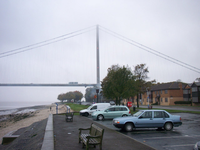
985:== {{int:filedesc}} == {{Information |description={{en|1=Hessle Viewpoint The beacon is visible just above the white van.}} |date=2008-11-05 |source=From |author=[http://www.geograph.org.uk/profil
752:
744:
662:
618:
760:
83:
51:
519:
863:
859:
748:
740:
614:
523:
515:
511:
768:
764:
756:
702:
658:
527:
507:
978:
665:"}},"text\/plain":{"en":{"P275":"Creative Commons Attribution-ShareAlike 2.0 Generic"}}}}": -->
177:
771:"}},"text\/plain":{"en":{"P973":"https:\/\/www.geograph.org.uk\/photo\/1035270"}}}}": -->
530:"}},"text\/plain":{"en":{"P2699":"https:\/\/www.geograph.org.uk\/profile\/1782"}}}}": -->
794:
688:
644:
314:
264:
829:
349:
1030:
This file contains additional information, probably added from the digital camera or scanner used to create or digitize it.
439:
584:
904:
877:
807:
778:
628:
592:
577:
564:
837:
822:
712:
672:
537:
496:
967:
962:
42:
395:
1033:
If the file has been modified from its original state, some details may not fully reflect the modified file.
438:– If you remix, transform, or build upon the material, you must distribute your contributions under the
356:
on the
Geograph website for the photographer's contact details. The copyright on this image is owned by
131:
621:"}},"text\/plain":{"en":{"P6216":"copyrighted"}}}}": -->
870:"}},"text\/plain":{"en":{"P7787":"247 degree"}}}}": -->
91:
209:
844:
814:
599:
392:
193:
8:
336:
320:
270:
361:
78:
486:
156:
166:
887:
788:
722:
682:
638:
547:
341:
353:
935:
Click on a date/time to view the file as it appeared at that time.
127:
306:
256:
999:
291:
53° 42′ 49″ N, 0° 26′ 46″ W
241:
53° 42′ 51″ N, 0° 26′ 41″ W
145:
66:
480:
Add a one-line explanation of what this file represents
993:
1008:
933:
184:
Creative
Commons Attribution Share-alike license 2.0
90:
Commons is a freely licensed media file repository.
1017:
689:
Creative
Commons Attribution-ShareAlike 2.0 Generic
663:
Creative
Commons Attribution-ShareAlike 2.0 Generic
116:Hessle Viewpoint - geograph.org.uk - 1035270.jpg
56:(640 × 481 pixels, file size: 59 KB, MIME type:
52:Hessle_Viewpoint_-_geograph.org.uk_-_1035270.jpg
136:The beacon is visible just above the white van.
449:https://creativecommons.org/licenses/by-sa/2.0
71:
769:https:\/\/www.geograph.org.uk\/photo\/1035270
455:Creative Commons Attribution-Share Alike 2.0
373:
172:
141:
113:
528:https:\/\/www.geograph.org.uk\/profile\/1782
162:
151:
14:
867:
415:– to copy, distribute and transmit the work
1010:The following other wikis use this file:
845:https://www.geograph.org.uk/photo/1035270
600:https://www.geograph.org.uk/profile/1782
313:View this and other nearby images on:
263:View this and other nearby images on:
216:
102:
360:and is licensed for reuse under the
281:
231:
995:The following page uses this file:
926:
396:Attribution-Share Alike 2.0 Generic
384:
379:
364:Attribution-ShareAlike 2.0 license.
13:
1028:
485:
479:
370:
347:
120:
103:
49:
1054:
1035:
484:
470:
426:Under the following conditions:
391:This file is licensed under the
383:
378:
372:
340:
319:
305:
297:
269:
255:
247:
70:
31:
21:
467:
121:
46:No higher resolution available.
1005:
930:
795:file available on the internet
745:file available on the internet
466:
348:This image was taken from the
26:
1:
878:coordinates of depicted place
860:coordinates of depicted place
36:
990:
830:Geograph Britain and Ireland
761:Geograph Britain and Ireland
578:object of statement has role
516:object of statement has role
492:Items portrayed in this file
332:
296:
246:
7:
1025:
893:53°42'49.39"N, 0°26'46.32"W
10:
1059:
1014:Usage on tr.wikipedia.org
440:same or compatible license
110:
105:
927:
222:David Wright /
203:David Wright /
16:
808:geograph.org.uk image ID
749:geograph.org.uk image ID
469:
406:
132:East Riding of Yorkshire
77:This is a file from the
41:
984:
963:18:02, 23 February 2011
194:required by the license
144:
81:. Information from its
354:this photograph's page
325:53.713720; -0.446200
275:53.714060; -0.444700
84:description page there
421:– to adapt the work
565:author name string
512:author name string
126:Hessle Viewpoint,
1046:
1045:
1006:Global file usage
988:
869:
673:copyright license
659:copyright license
478:
369:
368:
352:collection. See
330:
329:
280:
279:
229:
228:
197:
181:
178:Reusing this file
99:
98:
79:Wikimedia Commons
32:Global file usage
1050:
1036:
975:
937:
915:
914:
909:
847:
842:
838:described at URL
832:
827:
817:
812:
765:described at URL
629:copyright status
615:copyright status
602:
597:
587:
582:
572:
569:
476:
462:
459:
456:
453:
450:
442:as the original.
404:
393:Creative Commons
387:
386:
382:
381:
376:
375:
362:Creative Commons
350:Geograph project
344:
337:
326:
323:
309:
308:
302:
301:
300:
294:
293:
282:
276:
273:
259:
258:
252:
251:
250:
244:
243:
232:
224:Hessle Viewpoint
205:Hessle Viewpoint
191:
175:
147:
125:
117:
111:
95:
74:
73:
67:
61:
59:
1058:
1057:
1053:
1052:
1051:
1049:
1048:
1047:
1024:
1004:
989:
981:
973:
929:
928:
925:
924:
923:
922:
921:
920:
919:
918:
917:
916:
912:
910:
907:
898:
897:
896:
894:
884:
883:
882:
880:
857:
856:
855:
854:
853:
852:
851:
850:
849:
848:
843:
840:
834:
833:
828:
825:
819:
818:
813:
810:
801:
800:
799:
797:
785:
784:
783:
781:
738:
737:
736:
735:
734:
733:
732:
731:
729:
728:5 November 2008
719:
718:
717:
715:
700:
699:
698:
697:
696:
695:
694:
693:
691:
679:
678:
677:
675:
656:
655:
654:
653:
652:
651:
650:
649:
647:
635:
634:
633:
631:
612:
611:
610:
609:
608:
607:
606:
605:
604:
603:
598:
595:
589:
588:
583:
580:
574:
573:
570:
567:
558:
557:
556:
554:
544:
543:
542:
540:
505:
504:
503:
502:
501:
499:
483:
482:
481:
464:
463:
460:
457:
454:
451:
448:
447:
405:
402:
399:
388:
365:
335:
324:
298:
289:
288:
285:Object location
274:
248:
239:
238:
235:Camera location
230:
219:
212:
200:
157:geograph.org.uk
146:5 November 2008
137:
115:
108:
101:
100:
89:
88:
87:is shown below.
63:
57:
55:
48:
47:
12:
11:
5:
1056:
1044:
1043:
1040:
1027:
1023:
1022:
1021:
1020:
1007:
1003:
1002:
992:
987:
986:
983:
979:
976:
970:
965:
960:
956:
955:
952:
949:
946:
943:
940:
932:
903:
902:
901:
900:
899:
895:
892:
890:
889:
888:
886:
885:
881:
876:
874:
873:
872:
871:
865:
861:
836:
835:
821:
820:
806:
805:
804:
803:
802:
798:
793:
791:
790:
789:
787:
786:
782:
779:source of file
777:
775:
774:
773:
772:
770:
766:
762:
758:
754:
750:
746:
742:
741:source of file
730:
727:
725:
724:
723:
721:
720:
716:
711:
709:
708:
707:
706:
704:
692:
687:
685:
684:
683:
681:
680:
676:
671:
669:
668:
667:
666:
664:
660:
648:
643:
641:
640:
639:
637:
636:
632:
627:
625:
624:
623:
622:
620:
616:
591:
590:
576:
575:
563:
562:
561:
560:
559:
555:
552:
550:
549:
548:
546:
545:
541:
536:
534:
533:
532:
531:
529:
525:
521:
517:
513:
509:
500:
495:
493:
490:
489:
488:
487:
475:
474:
471:
468:
446:
445:
444:
443:
433:
424:
423:
422:
416:
409:You are free:
400:
390:
389:
371:
367:
366:
345:
334:
331:
328:
327:
317:
311:
286:
278:
277:
267:
261:
236:
227:
226:
220:
217:
214:
213:
208:
201:
198:
186:
185:
182:
170:
169:
164:
160:
159:
153:
149:
148:
143:
139:
138:
118:
109:
107:
104:
97:
96:
75:
65:
64:
45:
40:
39:
34:
29:
24:
19:
9:
6:
4:
3:
2:
1055:
1041:
1038:
1037:
1034:
1031:
1019:
1016:
1015:
1013:
1012:
1011:
1001:
998:
997:
996:
982:
977:
971:
969:
966:
964:
961:
958:
957:
953:
950:
947:
944:
941:
939:
938:
936:
906:
891:
879:
875:
846:
839:
831:
824:
816:
809:
796:
792:
780:
776:
726:
714:
710:
690:
686:
674:
670:
646:
642:
630:
626:
601:
594:
586:
579:
566:
551:
539:
535:
498:
494:
491:
472:
465:
452:CC BY-SA 2.0
441:
437:
434:
431:
428:
427:
425:
420:
417:
414:
411:
410:
408:
407:
401:Attribution:
397:
394:
377:
363:
359:
355:
351:
346:
343:
339:
338:
322:
318:
316:
315:OpenStreetMap
312:
310:
292:
287:
284:
283:
272:
268:
266:
265:OpenStreetMap
262:
260:
242:
237:
234:
233:
225:
221:
215:
211:
207: /
206:
202:
195:
190:
188:
187:
183:
179:
174:
171:
168:
165:
161:
158:
154:
150:
140:
135:
133:
129:
124:
119:
112:
93:
86:
85:
80:
76:
69:
68:
62:
53:
44:
38:
35:
33:
30:
28:
25:
23:
20:
18:
15:
1032:
1029:
1009:
994:
934:
931:File history
585:photographer
571:David Wright
520:photographer
435:
429:
418:
412:
403:David Wright
358:David Wright
357:
295:
245:
223:
210:CC BY-SA 2.0
204:
167:David Wright
122:
92:You can help
82:
50:
22:File history
980:GeographBot
645:copyrighted
619:copyrighted
436:share alike
430:attribution
189:Attribution
114:Description
1039:_error
991:File usage
972:640 × 481
948:Dimensions
553:some value
173:Permission
134:, England.
58:image/jpeg
27:File usage
945:Thumbnail
942:Date/Time
713:inception
703:inception
333:Licensing
218:InfoField
199:InfoField
123:English:
1026:Metadata
823:operator
757:operator
473:Captions
419:to remix
413:to share
398:license.
37:Metadata
974:(59 KB)
959:current
954:Comment
905:heading
864:heading
815:1035270
753:1035270
538:creator
508:creator
497:depicts
477:English
106:Summary
54:
1018:Hessle
1000:Hessle
913:degree
868:degree
303:
253:
163:Author
152:Source
128:Hessle
155:From
951:User
911:247
461:true
458:true
142:Date
17:File
593:URL
524:URL
908::
841::
826::
811::
596::
581::
568::
130:,
1042:0
196:)
192:(
180:)
176:(
94:.
60:)
Text is available under the Creative Commons Attribution-ShareAlike License. Additional terms may apply.
_heading:247.00&language=en)
_heading:247.00&language=en)
