1141:"}},"text\/plain":{"en":{"":"coordinates of the point of view"}}},"{\"value\":{\"latitude\":53.89992569740396,\"longitude\":-2.774603126869344,\"altitude\":null,\"precision\":0.0001,\"globe\":\"http:\\\/\\\/www.wikidata.org\\\/entity\\\/Q2\"},\"type\":\"globecoordinate\"}":{"text\/html":{"en":{"P1259":"53\u00b053'59.6"N, 2\u00b046'28.6"W"}},"text\/plain":{"en":{"P1259":"53\u00b053'59.6\"N, 2\u00b046'28.6\"W"}}},"{\"value\":{\"entity-type\":\"property\",\"numeric-id\":7787,\"id\":\"P7787\"},\"type\":\"wikibase-entityid\"}":{"text\/html":{"en":{"":"
38:
1209:"}},"text\/plain":{"en":{"":"coordinates of depicted place"}}},"{\"value\":{\"latitude\":53.90046542364698,\"longitude\":-2.7743091995204416,\"altitude\":null,\"precision\":0.0001,\"globe\":\"http:\\\/\\\/www.wikidata.org\\\/entity\\\/Q2\"},\"type\":\"globecoordinate\"}":{"text\/html":{"en":{"P9149":"53\u00b054'1.8"N, 2\u00b046'27.5"W"}},"text\/plain":{"en":{"P9149":"53\u00b054'1.8\"N, 2\u00b046'27.5\"W"}}}}": -->
705:"}},"text\/plain":{"en":{"":"author name string"}}},"{\"value\":\"Phil and Juliette Platt\",\"type\":\"string\"}":{"text\/html":{"en":{"P2093":"Phil and Juliette Platt"}},"text\/plain":{"en":{"P2093":"Phil and Juliette Platt"}}},"{\"value\":{\"entity-type\":\"property\",\"numeric-id\":2699,\"id\":\"P2699\"},\"type\":\"wikibase-entityid\"}":{"text\/html":{"en":{"":"
425:
359:
303:
239:
218:
202:
186:
170:
153:
1103:"}},"text\/plain":{"en":{"":"inception"}}},"{\"value\":{\"time\":\"+2016-08-09T00:00:00Z\",\"timezone\":0,\"before\":0,\"after\":0,\"precision\":11,\"calendarmodel\":\"http:\\\/\\\/www.wikidata.org\\\/entity\\\/Q1985727\"},\"type\":\"time\"}":{"text\/html":{"en":{"P571":"9 August 2016"}},"text\/plain":{"en":{"P571":"9 August 2016"}}}}": -->
980:
366:
318:
840:
380:
332:
403:
449:
454:
863:"}},"text\/plain":{"en":{"":"author name string"}}},"{\"value\":\"Phil and Juliette Platt\",\"type\":\"string\"}":{"text\/html":{"en":{"P2093":"Phil and Juliette Platt"}},"text\/plain":{"en":{"P2093":"Phil and Juliette Platt"}}}}": -->
94:
1501:"}},"text\/plain":{"en":{"":"ISO speed"}}},"{\"value\":{\"amount\":\"+320\",\"unit\":\"1\"},\"type\":\"quantity\"}":{"text\/html":{"en":{"P6789":"320"}},"text\/plain":{"en":{"P6789":"320"}}}}": -->
1418:"}},"text\/plain":{"en":{"":"f-number"}}},"{\"value\":{\"amount\":\"+3.5\",\"unit\":\"1\"},\"type\":\"quantity\"}":{"text\/html":{"en":{"P6790":"3.5"}},"text\/plain":{"en":{"P6790":"3.5"}}}}": -->
848:"}},"text\/plain":{"en":{"P275":"Creative Commons Attribution-ShareAlike 2.0 Generic"}}},"{\"value\":{\"entity-type\":\"property\",\"numeric-id\":1476,\"id\":\"P1476\"},\"type\":\"wikibase-entityid\"}":{"text\/html":{"en":{"":"
988:"}},"text\/plain":{"en":{"P7482":"file available on the internet"}}},"{\"value\":{\"entity-type\":\"property\",\"numeric-id\":137,\"id\":\"P137\"},\"type\":\"wikibase-entityid\"}":{"text\/html":{"en":{"":"
996:"}},"text\/plain":{"en":{"P137":"Geograph Britain and Ireland"}}},"{\"value\":{\"entity-type\":\"property\",\"numeric-id\":7384,\"id\":\"P7384\"},\"type\":\"wikibase-entityid\"}":{"text\/html":{"en":{"":"
697:"}},"text\/plain":{"en":{"":"object of statement has role"}}},"{\"value\":{\"entity-type\":\"item\",\"numeric-id\":33231,\"id\":\"Q33231\"},\"type\":\"wikibase-entityid\"}":{"text\/html":{"en":{"P3831":"
1247:"}},"text\/plain":{"en":{"":"location of creation"}}},"{\"value\":{\"entity-type\":\"item\",\"numeric-id\":1494566,\"id\":\"Q1494566\"},\"type\":\"wikibase-entityid\"}":{"text\/html":{"en":{"P1071":"
1291:"}},"text\/plain":{"en":{"":"media type"}}},"{\"value\":\"image\\\/jpeg\",\"type\":\"string\"}":{"text\/html":{"en":{"P1163":"image\/jpeg"}},"text\/plain":{"en":{"P1163":"image\/jpeg"}}}}": -->
859:"}},"text\/plain":{"en":{"P1476":"High Street, Garstang"}}},"{\"value\":{\"entity-type\":\"property\",\"numeric-id\":2093,\"id\":\"P2093\"},\"type\":\"wikibase-entityid\"}":{"text\/html":{"en":{"":"
844:"}},"text\/plain":{"en":{"":"copyright license"}}},"{\"value\":{\"entity-type\":\"item\",\"numeric-id\":19068220,\"id\":\"Q19068220\"},\"type\":\"wikibase-entityid\"}":{"text\/html":{"en":{"P275":"
800:"}},"text\/plain":{"en":{"":"copyright status"}}},"{\"value\":{\"entity-type\":\"item\",\"numeric-id\":50423863,\"id\":\"Q50423863\"},\"type\":\"wikibase-entityid\"}":{"text\/html":{"en":{"P6216":"
566:"}},"text\/plain":{"en":{"P180":"commercial building"}}},"{\"value\":{\"entity-type\":\"item\",\"numeric-id\":34442,\"id\":\"Q34442\"},\"type\":\"wikibase-entityid\"}":{"text\/html":{"en":{"P180":"
1373:"}},"text\/plain":{"en":{"":"exposure time"}}},"{\"value\":{\"amount\":\"+0.001\",\"unit\":\"http:\\\/\\\/www.wikidata.org\\\/entity\\\/Q11574\"},\"type\":\"quantity\"}":{"text\/html":{"en":{"P6757":"0.001
984:"}},"text\/plain":{"en":{"":"source of file"}}},"{\"value\":{\"entity-type\":\"item\",\"numeric-id\":74228490,\"id\":\"Q74228490\"},\"type\":\"wikibase-entityid\"}":{"text\/html":{"en":{"P7482":"
1329:"}},"text\/plain":{"en":{"":"captured with"}}},"{\"value\":{\"entity-type\":\"item\",\"numeric-id\":20889048,\"id\":\"Q20889048\"},\"type\":\"wikibase-entityid\"}":{"text\/html":{"en":{"P4082":"
1456:"}},"text\/plain":{"en":{"":"focal length"}}},"{\"value\":{\"amount\":\"+4.5\",\"unit\":\"http:\\\/\\\/www.wikidata.org\\\/entity\\\/Q174789\"},\"type\":\"quantity\"}":{"text\/html":{"en":{"P2151":"4.5
701:"}},"text\/plain":{"en":{"P3831":"photographer"}}},"{\"value\":{\"entity-type\":\"property\",\"numeric-id\":2093,\"id\":\"P2093\"},\"type\":\"wikibase-entityid\"}":{"text\/html":{"en":{"":"
574:"}},"text\/plain":{"en":{"P180":"city center"}}},"{\"value\":{\"entity-type\":\"item\",\"numeric-id\":79007,\"id\":\"Q79007\"},\"type\":\"wikibase-entityid\"}":{"text\/html":{"en":{"P180":"
578:"}},"text\/plain":{"en":{"P180":"street"}}},"{\"value\":{\"entity-type\":\"item\",\"numeric-id\":1494566,\"id\":\"Q1494566\"},\"type\":\"wikibase-entityid\"}":{"text\/html":{"en":{"P180":"
992:"}},"text\/plain":{"en":{"":"operator"}}},"{\"value\":{\"entity-type\":\"item\",\"numeric-id\":1503119,\"id\":\"Q1503119\"},\"type\":\"wikibase-entityid\"}":{"text\/html":{"en":{"P137":"
940:"}},"text\/plain":{"en":{"":"instance of"}}},"{\"value\":{\"entity-type\":\"item\",\"numeric-id\":125191,\"id\":\"Q125191\"},\"type\":\"wikibase-entityid\"}":{"text\/html":{"en":{"P31":"
570:"}},"text\/plain":{"en":{"P180":"road"}}},"{\"value\":{\"entity-type\":\"item\",\"numeric-id\":1468524,\"id\":\"Q1468524\"},\"type\":\"wikibase-entityid\"}":{"text\/html":{"en":{"P180":"
1577:
1145:"}},"text\/plain":{"en":{"":"heading"}}},"{\"value\":{\"amount\":\"+22\",\"unit\":\"http:\\\/\\\/www.wikidata.org\\\/entity\\\/Q28390\"},\"type\":\"quantity\"}":{"text\/html":{"en":{"P7787":"22
562:"}},"text\/plain":{"en":{"":"depicts"}}},"{\"value\":{\"entity-type\":\"item\",\"numeric-id\":655686,\"id\":\"Q655686\"},\"type\":\"wikibase-entityid\"}":{"text\/html":{"en":{"P180":"
1004:"}},"text\/plain":{"en":{"P7384":"5067356"}}},"{\"value\":{\"entity-type\":\"property\",\"numeric-id\":973,\"id\":\"P973\"},\"type\":\"wikibase-entityid\"}":{"text\/html":{"en":{"":"
693:"}},"text\/plain":{"en":{"":"creator"}}},"{\"value\":{\"entity-type\":\"property\",\"numeric-id\":3831,\"id\":\"P3831\"},\"type\":\"wikibase-entityid\"}":{"text\/html":{"en":{"":"
1497:
295:
504:– You must give appropriate credit, provide a link to the license, and indicate if changes were made. You may do so in any reasonable manner, but not in any way that suggests the licensor endorses you or your use.
363:
315:
60:
56:
52:
48:
42:
105:
73:
1001:
1330:
985:
845:
801:
1248:
993:
579:
571:
941:
563:
698:
575:
567:
1498:
1453:
1415:
1370:
1326:
1288:
1244:
1206:
1142:
1138:
997:
981:
860:
849:
797:
706:
702:
694:
1009:
710:
1100:
1005:
989:
841:
690:
559:
937:
152:
358:
302:
238:
201:
424:
217:
185:
169:
1587:
713:"}},"text\/plain":{"en":{"P2699":"https:\/\/www.geograph.org.uk\/profile\/60932"}}}}": -->
1012:"}},"text\/plain":{"en":{"P973":"https:\/\/www.geograph.org.uk\/photo\/5067356"}}}}": -->
1356:
1035:
886:
827:
373:
325:
1274:
1055:
676:
642:
1972:
410:
1619:
This file contains additional information, probably added from the digital camera or scanner used to create or digitize it.
967:
608:
511:
754:
659:
625:
1576:
1571:
64:
37:
1508:
1467:
1425:
1384:
1340:
1298:
1258:
1216:
1183:
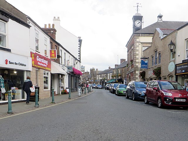
1156:
1063:
1019:
917:
899:
811:
775:
762:
747:
1110:
1078:
1048:
870:
720:
592:
951:
1333:"}},"text\/plain":{"en":{"P4082":"Canon PowerShot SX280 HS"}}}}": -->
1738:
464:
1622:
If the file has been modified from its original state, some details may not fully reflect the modified file.
1460:"}},"text\/plain":{"en":{"P2151":"4.5 millimetre"}}}}": -->
510:– If you remix, transform, or build upon the material, you must distribute your contributions under the
417:
on the
Geograph website for the photographer's contact details. The copyright on this image is owned by
1377:"}},"text\/plain":{"en":{"P6757":"0.001 second"}}}}": -->
804:"}},"text\/plain":{"en":{"P6216":"copyrighted"}}}}": -->
257:
1641:
1149:"}},"text\/plain":{"en":{"P7787":"22 degree"}}}}": -->
1251:"}},"text\/plain":{"en":{"P1071":"Garstang"}}}}": -->
944:"}},"text\/plain":{"en":{"P31":"photograph"}}}}": -->
582:"}},"text\/plain":{"en":{"P180":"Garstang"}}}}": -->
113:
262:
1804:
1085:
1070:
782:
251:
856:
461:
8:
1832:
250:
397:
379:
331:
274:
430:
100:
853:
1631:
1608:
269:
1594:
Uploading geograph.org.uk image from https://www.geograph.org.uk/photo/5067356
1916:
1822:
1786:
1648:
419:
212:
196:
1926:
1688:
1518:
1477:
1435:
1394:
1350:
1308:
1268:
1226:
1166:
1120:
1029:
961:
880:
821:
730:
670:
653:
636:
619:
602:
244:
231:
256:
1850:
402:
268:
1668:
414:
1658:
1544:
Click on a date/time to view the file as it appeared at that time.
365:
317:
167:
commercial building, road, city center, street, Garstang
352:
53° 54′ 01.7″ N, 2° 46′ 28″ W
296:
53° 53′ 59.7″ N, 2° 46′ 29″ W
245:
232:
180:
88:
78:(2,668 × 1,998 pixels, file size: 2.89 MB, MIME type:
1602:
140:
High Street, Garstang - geograph.org.uk - 5067356.jpg
1542:
275:
112:
Commons is a freely licensed media file repository.
887:
Creative
Commons Attribution-ShareAlike 2.0 Generic
846:
Creative
Commons Attribution-ShareAlike 2.0 Generic
1837:Flash did not fire, compulsory flash suppression
521:https://creativecommons.org/licenses/by-sa/2.0
93:
1010:https:\/\/www.geograph.org.uk\/photo\/5067356
711:https:\/\/www.geograph.org.uk\/profile\/60932
527:Creative Commons Attribution-Share Alike 2.0
442:
176:
137:
208:
192:
14:
1457:
1374:
1146:
487:– to copy, distribute and transmit the work
423:
357:
301:
237:
216:
200:
184:
168:
151:
1086:https://www.geograph.org.uk/photo/5067356
783:https://www.geograph.org.uk/profile/60932
263:
372:View this and other nearby images on:
324:View this and other nearby images on:
1973:Microsoft Photo Gallery 16.4.3528.331
124:
429:and is licensed for reuse under the
342:
286:
1604:The following page uses this file:
1535:
465:Attribution-Share Alike 2.0 Generic
453:
448:
433:Attribution-ShareAlike 2.0 license.
13:
1617:
557:
551:
439:
408:
144:
125:
71:
1986:
1624:
556:
1948:BBFB956C59144761904CEFE72063A2D1
1679:Date and time of data generation
1157:coordinates of the point of view
1139:coordinates of the point of view
542:
498:Under the following conditions:
460:This file is licensed under the
452:
447:
441:
401:
378:
364:
330:
316:
308:
92:
21:
539:
475:by Phil and Juliette Platt
1539:
1036:file available on the internet
986:file available on the internet
538:
409:This image was taken from the
392:
26:
1:
1217:coordinates of depicted place
1207:coordinates of depicted place
31:
1599:
1056:Geograph Britain and Ireland
994:Geograph Britain and Ireland
748:object of statement has role
695:object of statement has role
588:Items portrayed in this file
391:
307:
197:Geograph Britain and Ireland
128:
7:
1876:Focal plane resolution unit
1749:Date and time of digitizing
1614:
150:High Street, Garstang
10:
1991:
1887:One-chip color area sensor
1842:Supported Flashpix version
909:
512:same or compatible license
134:
127:
1757:Meaning of each component
1722:File change date and time
1536:
1172:53°53'59.6"N, 2°46'28.6"W
906:
16:
1868:Focal plane Y resolution
1860:Focal plane X resolution
1642:Canon PowerShot SX280 HS
1357:Canon PowerShot SX280 HS
1331:Canon PowerShot SX280 HS
1232:53°54'1.8"N, 2°46'27.5"W
1064:geograph.org.uk image ID
998:geograph.org.uk image ID
541:
478:
99:This is a file from the
36:
1900:Custom image processing
1593:
924:Phil and Juliette Platt
769:Phil and Juliette Platt
420:Phil and Juliette Platt
213:Phil and Juliette Platt
179:
103:. Information from its
1778:Image compression mode
415:this photograph's page
384:53.900465; -2.774309
336:53.899926; -2.774603
106:description page there
41:Size of this preview:
1814:Maximum land aperture
1706:Horizontal resolution
907:High Street, Garstang
854:High Street, Garstang
552:High Street, Garstang
473:High Street, Garstang
1895:Digital still camera
1752:13:09, 9 August 2016
1725:15:23, 9 August 2016
1682:13:09, 9 August 2016
1259:location of creation
1245:location of creation
65:2,668 × 1,998 pixels
1817:3.625 APEX (f/3.51)
1730:Y and C positioning
1714:Vertical resolution
1653:1/1,000 sec (0.001)
1628:Camera manufacturer
609:commercial building
564:commercial building
493:– to adapt the work
47:Other resolutions:
1937:Scene capture type
1921:Auto white balance
1572:18:04, 6 July 2023
918:author name string
861:author name string
763:author name string
703:author name string
264:North West England
61:1,280 × 959 pixels
57:1,024 × 767 pixels
1978:
1977:
1961:Rating (out of 5)
1597:
1459:
1376:
1148:
871:copyright license
858:
855:
842:copyright license
550:
438:
437:
413:collection. See
389:
388:
341:
340:
284:
283:
279:
225:Place of creation
121:
120:
101:Wikimedia Commons
1982:
1871:16,393.442622951
1863:16,393.442622951
1625:
1584:
1546:
1486:
1403:
1194:
1193:
1188:
1088:
1083:
1079:described at URL
1073:
1068:
1058:
1053:
1006:described at URL
925:
922:
912:
911:
908:
904:
812:copyright status
798:copyright status
785:
780:
770:
767:
757:
752:
548:
534:
531:
528:
525:
522:
514:as the original.
476:
462:Creative Commons
456:
455:
451:
450:
445:
444:
431:Creative Commons
427:
411:Geograph project
405:
398:
394:
385:
382:
368:
367:
361:
355:
354:
343:
337:
334:
320:
319:
313:
312:
311:
305:
299:
298:
287:
277:
271:
265:
259:
253:
247:
243:
241:
234:
220:
204:
188:
182:
172:
155:
149:
141:
135:
130:
117:
96:
95:
89:
83:
81:
68:
53:640 × 479 pixels
49:320 × 240 pixels
43:800 × 599 pixels
1990:
1989:
1985:
1984:
1983:
1981:
1980:
1979:
1953:GPS tag version
1945:Unique image ID
1613:
1609:Borough of Wyre
1598:
1590:
1582:
1538:
1537:
1534:
1533:
1532:
1531:
1530:
1529:
1528:
1527:
1525:
1515:
1514:
1513:
1511:
1496:
1495:
1494:
1493:
1492:
1491:
1490:
1489:
1487:
1484:
1474:
1473:
1472:
1470:
1451:
1450:
1449:
1448:
1447:
1446:
1445:
1444:
1442:
1432:
1431:
1430:
1428:
1413:
1412:
1411:
1410:
1409:
1408:
1407:
1406:
1404:
1401:
1391:
1390:
1389:
1387:
1368:
1367:
1366:
1365:
1364:
1363:
1362:
1361:
1359:
1347:
1346:
1345:
1343:
1324:
1323:
1322:
1321:
1320:
1319:
1318:
1317:
1315:
1305:
1304:
1303:
1301:
1286:
1285:
1284:
1283:
1282:
1281:
1280:
1279:
1277:
1265:
1264:
1263:
1261:
1242:
1241:
1240:
1239:
1238:
1237:
1236:
1235:
1233:
1223:
1222:
1221:
1219:
1204:
1203:
1202:
1201:
1200:
1199:
1198:
1197:
1196:
1195:
1191:
1189:
1186:
1177:
1176:
1175:
1173:
1163:
1162:
1161:
1159:
1136:
1135:
1134:
1133:
1132:
1131:
1130:
1129:
1127:
1117:
1116:
1115:
1113:
1098:
1097:
1096:
1095:
1094:
1093:
1092:
1091:
1090:
1089:
1084:
1081:
1075:
1074:
1069:
1066:
1060:
1059:
1054:
1051:
1042:
1041:
1040:
1038:
1026:
1025:
1024:
1022:
979:
978:
977:
976:
975:
974:
973:
972:
970:
958:
957:
956:
954:
935:
934:
933:
932:
931:
930:
929:
928:
927:
926:
923:
920:
914:
913:
905:
902:
893:
892:
891:
889:
877:
876:
875:
873:
839:
838:
837:
836:
835:
834:
833:
832:
830:
818:
817:
816:
814:
795:
794:
793:
792:
791:
790:
789:
788:
787:
786:
781:
778:
772:
771:
768:
765:
759:
758:
753:
750:
741:
740:
739:
737:
727:
726:
725:
723:
688:
687:
686:
685:
684:
683:
682:
681:
679:
668:
667:
666:
665:
664:
662:
651:
650:
649:
648:
647:
645:
634:
633:
632:
631:
630:
628:
617:
616:
615:
614:
613:
611:
599:
598:
597:
595:
555:
554:
553:
536:
535:
532:
529:
526:
523:
520:
519:
477:
471:
468:
457:
434:
396:
383:
350:
349:
346:Object location
335:
309:
294:
293:
290:Camera location
285:
228:
164:
156:
145:
139:
132:
123:
122:
111:
110:
109:is shown below.
85:
79:
77:
70:
69:
46:
12:
11:
5:
1988:
1976:
1975:
1970:
1966:
1965:
1962:
1958:
1957:
1954:
1950:
1949:
1946:
1942:
1941:
1938:
1934:
1933:
1930:
1923:
1922:
1919:
1913:
1912:
1909:
1905:
1904:
1903:Normal process
1901:
1897:
1896:
1893:
1889:
1888:
1885:
1884:Sensing method
1881:
1880:
1877:
1873:
1872:
1869:
1865:
1864:
1861:
1857:
1856:
1853:
1847:
1846:
1843:
1839:
1838:
1835:
1829:
1828:
1825:
1819:
1818:
1815:
1811:
1810:
1807:
1801:
1800:
1797:
1793:
1792:
1789:
1783:
1782:
1779:
1775:
1774:
1773:
1772:
1771:does not exist
1769:
1766:
1763:
1758:
1754:
1753:
1750:
1746:
1745:
1742:
1735:
1734:
1731:
1727:
1726:
1723:
1719:
1718:
1715:
1711:
1710:
1707:
1703:
1702:
1699:
1695:
1694:
1691:
1684:
1683:
1680:
1676:
1675:
1672:
1665:
1664:
1661:
1655:
1654:
1651:
1645:
1644:
1639:
1635:
1634:
1629:
1616:
1612:
1611:
1601:
1596:
1595:
1592:
1588:
1585:
1581:2,668 × 1,998
1579:
1574:
1569:
1565:
1564:
1561:
1558:
1555:
1552:
1549:
1541:
1526:
1523:
1521:
1520:
1519:
1517:
1516:
1512:
1507:
1505:
1504:
1503:
1502:
1500:
1488:
1482:
1480:
1479:
1478:
1476:
1475:
1471:
1466:
1464:
1463:
1462:
1461:
1455:
1443:
1440:
1438:
1437:
1436:
1434:
1433:
1429:
1424:
1422:
1421:
1420:
1419:
1417:
1405:
1399:
1397:
1396:
1395:
1393:
1392:
1388:
1383:
1381:
1380:
1379:
1378:
1372:
1360:
1355:
1353:
1352:
1351:
1349:
1348:
1344:
1339:
1337:
1336:
1335:
1334:
1332:
1328:
1316:
1313:
1311:
1310:
1309:
1307:
1306:
1302:
1297:
1295:
1294:
1293:
1292:
1290:
1278:
1273:
1271:
1270:
1269:
1267:
1266:
1262:
1257:
1255:
1254:
1253:
1252:
1250:
1246:
1234:
1231:
1229:
1228:
1227:
1225:
1224:
1220:
1215:
1213:
1212:
1211:
1210:
1208:
1182:
1181:
1180:
1179:
1178:
1174:
1171:
1169:
1168:
1167:
1165:
1164:
1160:
1155:
1153:
1152:
1151:
1150:
1144:
1140:
1128:
1125:
1123:
1122:
1121:
1119:
1118:
1114:
1109:
1107:
1106:
1105:
1104:
1102:
1077:
1076:
1062:
1061:
1047:
1046:
1045:
1044:
1043:
1039:
1034:
1032:
1031:
1030:
1028:
1027:
1023:
1020:source of file
1018:
1016:
1015:
1014:
1013:
1011:
1007:
1003:
999:
995:
991:
987:
983:
982:source of file
971:
966:
964:
963:
962:
960:
959:
955:
950:
948:
947:
946:
945:
943:
939:
916:
915:
898:
897:
896:
895:
894:
890:
885:
883:
882:
881:
879:
878:
874:
869:
867:
866:
865:
864:
862:
851:
847:
843:
831:
826:
824:
823:
822:
820:
819:
815:
810:
808:
807:
806:
805:
803:
799:
774:
773:
761:
760:
746:
745:
744:
743:
742:
738:
735:
733:
732:
731:
729:
728:
724:
719:
717:
716:
715:
714:
712:
708:
704:
700:
696:
692:
680:
675:
673:
672:
671:
669:
663:
658:
656:
655:
654:
652:
646:
641:
639:
638:
637:
635:
629:
624:
622:
621:
620:
618:
612:
607:
605:
604:
603:
601:
600:
596:
591:
589:
586:
585:
584:
583:
581:
577:
573:
569:
565:
561:
547:
546:
543:
540:
518:
517:
516:
515:
505:
496:
495:
494:
488:
481:You are free:
469:
459:
458:
440:
436:
435:
406:
395:
390:
387:
386:
376:
370:
347:
339:
338:
328:
322:
291:
282:
281:
276:United Kingdom
229:
226:
222:
221:
210:
206:
205:
194:
190:
189:
178:
174:
173:
165:
162:
158:
157:
142:
133:
131:
126:
119:
118:
97:
87:
86:
40:
35:
34:
29:
24:
19:
9:
6:
4:
3:
2:
1987:
1974:
1971:
1969:Software used
1968:
1967:
1963:
1960:
1959:
1955:
1952:
1951:
1947:
1944:
1943:
1939:
1936:
1935:
1931:
1928:
1925:
1924:
1920:
1918:
1917:White balance
1915:
1914:
1911:Auto exposure
1910:
1908:Exposure mode
1907:
1906:
1902:
1899:
1898:
1894:
1891:
1890:
1886:
1883:
1882:
1878:
1875:
1874:
1870:
1867:
1866:
1862:
1859:
1858:
1854:
1852:
1849:
1848:
1844:
1841:
1840:
1836:
1834:
1831:
1830:
1826:
1824:
1823:Metering mode
1821:
1820:
1816:
1813:
1812:
1808:
1806:
1805:Exposure bias
1803:
1802:
1798:
1796:APEX aperture
1795:
1794:
1790:
1788:
1787:Shutter speed
1785:
1784:
1780:
1777:
1776:
1770:
1767:
1764:
1761:
1760:
1759:
1756:
1755:
1751:
1748:
1747:
1743:
1740:
1737:
1736:
1732:
1729:
1728:
1724:
1721:
1720:
1716:
1713:
1712:
1708:
1705:
1704:
1700:
1697:
1696:
1692:
1690:
1686:
1685:
1681:
1678:
1677:
1673:
1670:
1667:
1666:
1662:
1660:
1657:
1656:
1652:
1650:
1649:Exposure time
1647:
1646:
1643:
1640:
1637:
1636:
1633:
1630:
1627:
1626:
1623:
1620:
1610:
1607:
1606:
1605:
1591:
1586:
1580:
1578:
1575:
1573:
1570:
1567:
1566:
1562:
1559:
1556:
1553:
1550:
1548:
1547:
1545:
1522:
1510:
1506:
1481:
1469:
1465:
1439:
1427:
1423:
1398:
1386:
1385:exposure time
1382:
1371:exposure time
1358:
1354:
1342:
1341:captured with
1338:
1327:captured with
1312:
1300:
1296:
1276:
1272:
1260:
1256:
1230:
1218:
1214:
1185:
1170:
1158:
1154:
1126:9 August 2016
1124:
1112:
1108:
1087:
1080:
1072:
1065:
1057:
1050:
1037:
1033:
1021:
1017:
969:
965:
953:
949:
919:
901:
888:
884:
872:
868:
829:
825:
813:
809:
784:
777:
764:
756:
749:
734:
722:
718:
678:
674:
661:
657:
644:
640:
627:
623:
610:
606:
594:
590:
587:
544:
537:
524:CC BY-SA 2.0
513:
509:
506:
503:
500:
499:
497:
492:
489:
486:
483:
482:
480:
479:
474:
470:Attribution:
466:
463:
446:
432:
428:
426:
421:
416:
412:
407:
404:
400:
399:
381:
377:
375:
374:OpenStreetMap
371:
369:
360:
353:
348:
345:
344:
333:
329:
327:
326:OpenStreetMap
323:
321:
304:
297:
292:
289:
288:
278:
272:
266:
260:
254:
248:
240:
235:
230:
224:
223:
219:
214:
211:
207:
203:
198:
195:
191:
187:
181:9 August 2016
175:
171:
166:
160:
159:
154:
148:
143:
136:
115:
108:
107:
102:
98:
91:
90:
84:
75:
74:Original file
66:
62:
58:
54:
50:
44:
39:
33:
30:
28:
25:
23:
20:
18:
15:
1927:Digital zoom
1689:focal length
1638:Camera model
1621:
1618:
1603:
1543:
1540:File history
1468:focal length
1454:focal length
755:photographer
699:photographer
507:
501:
490:
484:
472:
418:
306:
146:
114:You can help
104:
72:
22:File history
1892:File source
1851:Color space
1698:Orientation
1589:GeographBot
952:instance of
938:instance of
828:copyrighted
802:copyrighted
643:city center
572:city center
508:share alike
502:attribution
138:Description
1600:File usage
1557:Dimensions
1485:millimetre
1458:millimetre
1314:image/jpeg
1299:media type
1289:media type
968:photograph
942:photograph
736:some value
258:Lancashire
80:image/jpeg
27:File usage
1669:ISO speed
1583:(2.89 MB)
1554:Thumbnail
1551:Date/Time
1509:ISO speed
1499:ISO speed
1111:inception
1101:inception
910:(English)
857:(English)
393:Licensing
227:InfoField
163:InfoField
1940:Standard
1733:Co-sited
1659:F-number
1615:Metadata
1426:f-number
1416:f-number
1275:Garstang
1249:Garstang
1049:operator
990:operator
677:Garstang
580:Garstang
545:Captions
491:to remix
485:to share
467:license.
246:Garstang
233:Garstang
147:English:
32:Metadata
1956:2.3.0.0
1827:Pattern
1791:9.96875
1741:version
1717:180 dpi
1709:180 dpi
1568:current
1563:Comment
1184:heading
1143:heading
1071:5067356
1002:5067356
721:creator
691:creator
593:depicts
560:depicts
549:English
270:England
161:Depicts
129:Summary
76:
1879:inches
1701:Normal
1693:4.5 mm
1671:rating
1402:second
1400:0.001
1375:second
1192:degree
1147:degree
660:street
576:street
422:
362:
356:
314:
300:
236:
215:
209:Author
199:
193:Source
183:
1929:ratio
1833:Flash
1799:3.625
1687:Lens
1663:f/3.5
1632:Canon
900:title
850:title
1855:sRGB
1739:Exif
1560:User
1483:4.5
626:road
568:road
533:true
530:true
252:Wyre
177:Date
17:File
1744:2.3
1674:320
1524:320
1441:3.5
1190:22
776:URL
707:URL
1768:Cr
1765:Cb
1187::
1082::
1067::
1052::
921::
903::
779::
766::
751::
63:|
59:|
55:|
51:|
45:.
1964:0
1932:1
1845:1
1809:0
1781:3
1762:Y
280:)
273:→
267:→
261:→
255:→
249:→
242:(
116:.
82:)
67:.
Text is available under the Creative Commons Attribution-ShareAlike License. Additional terms may apply.
