1081:"}},"text\/plain":{"en":{"":"coordinates of the point of view"}}},"{\"value\":{\"latitude\":55.83658148664125,\"longitude\":-4.513021248569316,\"altitude\":null,\"precision\":0.0001,\"globe\":\"http:\\\/\\\/www.wikidata.org\\\/entity\\\/Q2\"},\"type\":\"globecoordinate\"}":{"text\/html":{"en":{"P1259":"55\u00b050'11.8"N, 4\u00b030'46.8"W"}},"text\/plain":{"en":{"P1259":"55\u00b050'11.8\"N, 4\u00b030'46.8\"W"}}},"{\"value\":{\"entity-type\":\"property\",\"numeric-id\":7787,\"id\":\"P7787\"},\"type\":\"wikibase-entityid\"}":{"text\/html":{"en":{"":"
1149:"}},"text\/plain":{"en":{"":"coordinates of depicted place"}}},"{\"value\":{\"latitude\":55.836506429170086,\"longitude\":-4.512378389923179,\"altitude\":null,\"precision\":0.0001,\"globe\":\"http:\\\/\\\/www.wikidata.org\\\/entity\\\/Q2\"},\"type\":\"globecoordinate\"}":{"text\/html":{"en":{"P9149":"55\u00b050'11.4"N, 4\u00b030'44.6"W"}},"text\/plain":{"en":{"P9149":"55\u00b050'11.4\"N, 4\u00b030'44.6\"W"}}}}": -->
792:"}},"text\/plain":{"en":{"":"author name string"}}},"{\"value\":\"Lairich Rig\",\"type\":\"string\"}":{"text\/html":{"en":{"P2093":"Lairich Rig"}},"text\/plain":{"en":{"P2093":"Lairich Rig"}}},"{\"value\":{\"entity-type\":\"property\",\"numeric-id\":1476,\"id\":\"P1476\"},\"type\":\"wikibase-entityid\"}":{"text\/html":{"en":{"":"
386:
320:
264:
212:
191:
175:
159:
143:
126:
1043:"}},"text\/plain":{"en":{"":"inception"}}},"{\"value\":{\"time\":\"+2011-08-22T00:00:00Z\",\"timezone\":0,\"before\":0,\"after\":0,\"precision\":11,\"calendarmodel\":\"http:\\\/\\\/www.wikidata.org\\\/entity\\\/Q1985727\"},\"type\":\"time\"}":{"text\/html":{"en":{"P571":"22 August 2011"}},"text\/plain":{"en":{"P571":"22 August 2011"}}}}": -->
920:
327:
279:
780:
1077:
293:
364:
410:
415:
67:
788:"}},"text\/plain":{"en":{"P275":"Creative Commons Attribution-ShareAlike 2.0 Generic"}}},"{\"value\":{\"entity-type\":\"property\",\"numeric-id\":2093,\"id\":\"P2093\"},\"type\":\"wikibase-entityid\"}":{"text\/html":{"en":{"":"
641:"}},"text\/plain":{"en":{"P2699":"https:\/\/www.geograph.org.uk\/profile\/22713"}}},"{\"value\":{\"entity-type\":\"property\",\"numeric-id\":3831,\"id\":\"P3831\"},\"type\":\"wikibase-entityid\"}":{"text\/html":{"en":{"":"
928:"}},"text\/plain":{"en":{"P7482":"file available on the internet"}}},"{\"value\":{\"entity-type\":\"property\",\"numeric-id\":7384,\"id\":\"P7384\"},\"type\":\"wikibase-entityid\"}":{"text\/html":{"en":{"":"
653:"}},"text\/plain":{"en":{"":"author name string"}}},"{\"value\":\"Lairich Rig\",\"type\":\"string\"}":{"text\/html":{"en":{"P2093":"Lairich Rig"}},"text\/plain":{"en":{"P2093":"Lairich Rig"}}}}": -->
645:"}},"text\/plain":{"en":{"":"object of statement has role"}}},"{\"value\":{\"entity-type\":\"item\",\"numeric-id\":33231,\"id\":\"Q33231\"},\"type\":\"wikibase-entityid\"}":{"text\/html":{"en":{"P3831":"
944:"}},"text\/plain":{"en":{"P137":"Geograph Britain and Ireland"}}},"{\"value\":{\"entity-type\":\"property\",\"numeric-id\":973,\"id\":\"P973\"},\"type\":\"wikibase-entityid\"}":{"text\/html":{"en":{"":"
1187:"}},"text\/plain":{"en":{"":"location of creation"}}},"{\"value\":{\"entity-type\":\"item\",\"numeric-id\":68826302,\"id\":\"Q68826302\"},\"type\":\"wikibase-entityid\"}":{"text\/html":{"en":{"P1071":"
784:"}},"text\/plain":{"en":{"":"copyright license"}}},"{\"value\":{\"entity-type\":\"item\",\"numeric-id\":19068220,\"id\":\"Q19068220\"},\"type\":\"wikibase-entityid\"}":{"text\/html":{"en":{"P275":"
740:"}},"text\/plain":{"en":{"":"copyright status"}}},"{\"value\":{\"entity-type\":\"item\",\"numeric-id\":50423863,\"id\":\"Q50423863\"},\"type\":\"wikibase-entityid\"}":{"text\/html":{"en":{"P6216":"
1269:
924:"}},"text\/plain":{"en":{"":"source of file"}}},"{\"value\":{\"entity-type\":\"item\",\"numeric-id\":74228490,\"id\":\"Q74228490\"},\"type\":\"wikibase-entityid\"}":{"text\/html":{"en":{"P7482":"
531:"}},"text\/plain":{"en":{"P180":"war memorial"}}},"{\"value\":{\"entity-type\":\"item\",\"numeric-id\":3126170,\"id\":\"Q3126170\"},\"type\":\"wikibase-entityid\"}":{"text\/html":{"en":{"P180":"
535:"}},"text\/plain":{"en":{"P180":"bandstand"}}},"{\"value\":{\"entity-type\":\"item\",\"numeric-id\":68826302,\"id\":\"Q68826302\"},\"type\":\"wikibase-entityid\"}":{"text\/html":{"en":{"P180":"
527:"}},"text\/plain":{"en":{"P180":"public space"}}},"{\"value\":{\"entity-type\":\"item\",\"numeric-id\":575759,\"id\":\"Q575759\"},\"type\":\"wikibase-entityid\"}":{"text\/html":{"en":{"P180":"
649:"}},"text\/plain":{"en":{"P3831":"photographer"}}},"{\"value\":{\"entity-type\":\"property\",\"numeric-id\":2093,\"id\":\"P2093\"},\"type\":\"wikibase-entityid\"}":{"text\/html":{"en":{"":"
1085:"}},"text\/plain":{"en":{"":"heading"}}},"{\"value\":{\"amount\":\"+112\",\"unit\":\"http:\\\/\\\/www.wikidata.org\\\/entity\\\/Q28390\"},\"type\":\"quantity\"}":{"text\/html":{"en":{"P7787":"112
940:"}},"text\/plain":{"en":{"":"operator"}}},"{\"value\":{\"entity-type\":\"item\",\"numeric-id\":1503119,\"id\":\"Q1503119\"},\"type\":\"wikibase-entityid\"}":{"text\/html":{"en":{"P137":"
880:"}},"text\/plain":{"en":{"":"instance of"}}},"{\"value\":{\"entity-type\":\"item\",\"numeric-id\":125191,\"id\":\"Q125191\"},\"type\":\"wikibase-entityid\"}":{"text\/html":{"en":{"P31":"
523:"}},"text\/plain":{"en":{"":"depicts"}}},"{\"value\":{\"entity-type\":\"item\",\"numeric-id\":294440,\"id\":\"Q294440\"},\"type\":\"wikibase-entityid\"}":{"text\/html":{"en":{"P180":"
936:"}},"text\/plain":{"en":{"P7384":"2579859"}}},"{\"value\":{\"entity-type\":\"property\",\"numeric-id\":137,\"id\":\"P137\"},\"type\":\"wikibase-entityid\"}":{"text\/html":{"en":{"":"
633:"}},"text\/plain":{"en":{"":"creator"}}},"{\"value\":{\"entity-type\":\"property\",\"numeric-id\":2699,\"id\":\"P2699\"},\"type\":\"wikibase-entityid\"}":{"text\/html":{"en":{"":"
1183:
637:"}},"text\/plain":{"en":{"":"URL"}}},"{\"value\":\"https:\\\/\\\/www.geograph.org.uk\\\/profile\\\/22713\",\"type\":\"string\"}":{"text\/html":{"en":{"P2699":"
932:"}},"text\/plain":{"en":{"":"geograph.org.uk image ID"}}},"{\"value\":\"2579859\",\"type\":\"string\"}":{"text\/html":{"en":{"P7384":"
256:
312:
465:– You must give appropriate credit, provide a link to the license, and indicate if changes were made. You may do so in any reasonable manner, but not in any way that suggests the licensor endorses you or your use.
324:
276:
78:
46:
933:
1188:
925:
785:
741:
536:
941:
532:
881:
528:
524:
646:
1184:
1146:
1082:
1078:
929:
921:
793:
789:
737:
650:
642:
634:
949:
638:
1040:
945:
937:
781:
630:
520:
125:
877:
319:
263:
211:
174:
385:
190:
158:
142:
1279:
952:"}},"text\/plain":{"en":{"P973":"https:\/\/www.geograph.org.uk\/photo\/2579859"}}}}": -->
1214:
975:
826:
767:
616:
334:
286:
1010:
599:
1268:
1263:
371:
37:
907:
582:
565:
472:
709:
1198:
1156:
1123:
1096:
988:
959:
852:
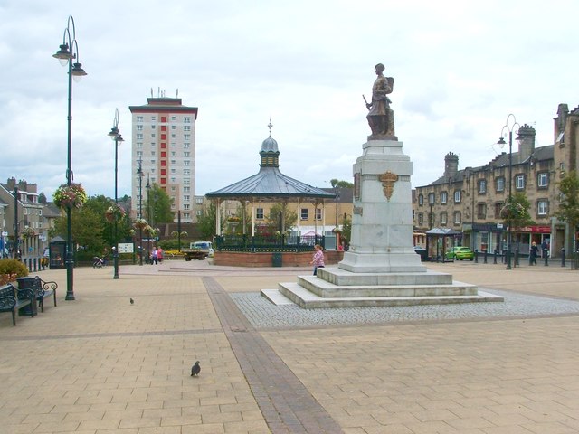
839:
751:
717:
702:
687:
1050:
1018:
1003:
810:
660:
549:
891:
803:"}},"text\/plain":{"en":{"P1476":"Houston Square, Johnstone"}}}}": -->
425:
471:– If you remix, transform, or build upon the material, you must distribute your contributions under the
378:
on the
Geograph website for the photographer's contact details. The copyright on this image is owned by
744:"}},"text\/plain":{"en":{"P6216":"copyrighted"}}}}": -->
1089:"}},"text\/plain":{"en":{"P7787":"112 degree"}}}}": -->
884:"}},"text\/plain":{"en":{"P31":"photograph"}}}}": -->
1191:"}},"text\/plain":{"en":{"P1071":"Paisley"}}}}": -->
86:
539:"}},"text\/plain":{"en":{"P180":"Paisley"}}}}": -->
223:
1025:
995:
694:
800:
422:
8:
358:
340:
292:
235:
391:
73:
797:
230:
1286:
Uploading geograph.org.uk image from https://www.geograph.org.uk/photo/2579859
380:
185:
169:
1208:
1166:
1106:
1060:
969:
901:
820:
761:
670:
610:
593:
576:
559:
229:
217:
204:
363:
375:
1300:
1236:
Click on a date/time to view the file as it appeared at that time.
326:
278:
313:
55° 50′ 11.4″ N, 4° 30′ 45″ W
257:
55° 50′ 11.7″ N, 4° 30′ 47″ W
153:
113:
Houston Square, Johnstone - geograph.org.uk - 2579859.jpg
61:
47:
Houston_Square,_Johnstone_-_geograph.org.uk_-_2579859.jpg
1318:
1294:
1309:
1234:
236:
140:
public space, war memorial, bandstand, Paisley
85:
Commons is a freely licensed media file repository.
827:
Creative
Commons Attribution-ShareAlike 2.0 Generic
786:
Creative
Commons Attribution-ShareAlike 2.0 Generic
224:
51:(640 × 480 pixels, file size: 63 KB, MIME type:
482:https://creativecommons.org/licenses/by-sa/2.0
66:
950:https:\/\/www.geograph.org.uk\/photo\/2579859
639:https:\/\/www.geograph.org.uk\/profile\/22713
488:Creative Commons Attribution-Share Alike 2.0
403:
149:
110:
181:
165:
14:
1086:
448:– to copy, distribute and transmit the work
384:
318:
262:
210:
189:
173:
157:
141:
124:
1311:The following other wikis use this file:
1026:https://www.geograph.org.uk/photo/2579859
695:https://www.geograph.org.uk/profile/22713
218:
205:
333:View this and other nearby images on:
285:View this and other nearby images on:
97:
390:and is licensed for reuse under the
303:
247:
1296:The following page uses this file:
1227:
426:Attribution-Share Alike 2.0 Generic
414:
409:
394:Attribution-ShareAlike 2.0 license.
13:
518:
512:
400:
369:
117:
98:
44:
1332:
517:
1097:coordinates of the point of view
1079:coordinates of the point of view
503:
459:Under the following conditions:
421:This file is licensed under the
413:
408:
402:
362:
339:
325:
291:
277:
269:
65:
31:
21:
500:
123:Houston Square, Johnstone
41:No higher resolution available.
1306:
1231:
976:file available on the internet
926:file available on the internet
499:
370:This image was taken from the
353:
26:
1:
1157:coordinates of depicted place
1147:coordinates of depicted place
268:
1291:
1011:Geograph Britain and Ireland
942:Geograph Britain and Ireland
703:object of statement has role
643:object of statement has role
545:Items portrayed in this file
352:
170:Geograph Britain and Ireland
101:
7:
10:
1337:
1315:Usage on www.wikidata.org
862:
473:same or compatible license
107:
100:
1228:
1172:55°50'11.4"N, 4°30'44.6"W
1112:55°50'11.8"N, 4°30'46.8"W
860:Houston Square, Johnstone
859:
798:Houston Square, Johnstone
513:Houston Square, Johnstone
434:Houston Square, Johnstone
16:
989:geograph.org.uk image ID
930:geograph.org.uk image ID
502:
439:
72:This is a file from the
36:
1285:
1264:05:30, 6 September 2021
152:
76:. Information from its
376:this photograph's page
345:55.836506; -4.512378
297:55.836581; -4.513021
79:description page there
1199:location of creation
1185:location of creation
454:– to adapt the work
436:by Lairich Rig
840:author name string
790:author name string
718:author name string
651:author name string
1307:Global file usage
1289:
1088:
811:copyright license
802:
799:
782:copyright license
511:
399:
398:
374:collection. See
350:
349:
302:
301:
245:
244:
240:
225:East Renfrewshire
198:Place of creation
94:
93:
74:Wikimedia Commons
32:Global file usage
1328:
1276:
1238:
1134:
1133:
1128:
1028:
1023:
1019:described at URL
1013:
1008:
998:
993:
946:described at URL
865:
864:
861:
857:
847:
844:
752:copyright status
738:copyright status
725:
722:
712:
707:
697:
692:
509:
495:
492:
489:
486:
483:
475:as the original.
437:
423:Creative Commons
417:
416:
412:
411:
406:
405:
392:Creative Commons
388:
372:Geograph project
366:
359:
355:
346:
343:
329:
328:
322:
316:
315:
304:
298:
295:
281:
280:
274:
273:
272:
266:
260:
259:
248:
238:
232:
226:
220:
216:
214:
207:
193:
177:
161:
155:
145:
128:
122:
114:
108:
103:
90:
69:
68:
62:
56:
54:
1336:
1335:
1331:
1330:
1329:
1327:
1326:
1325:
1305:
1290:
1282:
1274:
1230:
1229:
1226:
1225:
1224:
1223:
1222:
1221:
1220:
1219:
1217:
1205:
1204:
1203:
1201:
1182:
1181:
1180:
1179:
1178:
1177:
1176:
1175:
1173:
1163:
1162:
1161:
1159:
1144:
1143:
1142:
1141:
1140:
1139:
1138:
1137:
1136:
1135:
1131:
1129:
1126:
1117:
1116:
1115:
1113:
1103:
1102:
1101:
1099:
1076:
1075:
1074:
1073:
1072:
1071:
1070:
1069:
1067:
1057:
1056:
1055:
1053:
1038:
1037:
1036:
1035:
1034:
1033:
1032:
1031:
1030:
1029:
1024:
1021:
1015:
1014:
1009:
1006:
1000:
999:
994:
991:
982:
981:
980:
978:
966:
965:
964:
962:
919:
918:
917:
916:
915:
914:
913:
912:
910:
898:
897:
896:
894:
875:
874:
873:
872:
871:
870:
869:
868:
867:
866:
858:
855:
849:
848:
845:
842:
833:
832:
831:
829:
817:
816:
815:
813:
779:
778:
777:
776:
775:
774:
773:
772:
770:
758:
757:
756:
754:
735:
734:
733:
732:
731:
730:
729:
728:
727:
726:
723:
720:
714:
713:
708:
705:
699:
698:
693:
690:
681:
680:
679:
677:
667:
666:
665:
663:
628:
627:
626:
625:
624:
623:
622:
621:
619:
608:
607:
606:
605:
604:
602:
591:
590:
589:
588:
587:
585:
574:
573:
572:
571:
570:
568:
556:
555:
554:
552:
516:
515:
514:
497:
496:
493:
490:
487:
484:
481:
480:
438:
432:
429:
418:
395:
357:
344:
311:
310:
307:Object location
296:
270:
255:
254:
251:Camera location
246:
201:
137:
129:
118:
112:
105:
96:
95:
84:
83:
82:is shown below.
58:
52:
50:
43:
42:
12:
11:
5:
1334:
1324:
1323:
1322:
1321:
1308:
1304:
1303:
1293:
1288:
1287:
1284:
1280:
1277:
1271:
1266:
1261:
1257:
1256:
1253:
1250:
1247:
1244:
1241:
1233:
1218:
1213:
1211:
1210:
1209:
1207:
1206:
1202:
1197:
1195:
1194:
1193:
1192:
1190:
1186:
1174:
1171:
1169:
1168:
1167:
1165:
1164:
1160:
1155:
1153:
1152:
1151:
1150:
1148:
1122:
1121:
1120:
1119:
1118:
1114:
1111:
1109:
1108:
1107:
1105:
1104:
1100:
1095:
1093:
1092:
1091:
1090:
1084:
1080:
1068:
1066:22 August 2011
1065:
1063:
1062:
1061:
1059:
1058:
1054:
1049:
1047:
1046:
1045:
1044:
1042:
1017:
1016:
1002:
1001:
987:
986:
985:
984:
983:
979:
974:
972:
971:
970:
968:
967:
963:
960:source of file
958:
956:
955:
954:
953:
951:
947:
943:
939:
935:
931:
927:
923:
922:source of file
911:
906:
904:
903:
902:
900:
899:
895:
890:
888:
887:
886:
885:
883:
879:
851:
850:
838:
837:
836:
835:
834:
830:
825:
823:
822:
821:
819:
818:
814:
809:
807:
806:
805:
804:
795:
791:
787:
783:
771:
766:
764:
763:
762:
760:
759:
755:
750:
748:
747:
746:
745:
743:
739:
716:
715:
701:
700:
686:
685:
684:
683:
682:
678:
675:
673:
672:
671:
669:
668:
664:
659:
657:
656:
655:
654:
652:
648:
644:
640:
636:
632:
620:
615:
613:
612:
611:
609:
603:
598:
596:
595:
594:
592:
586:
581:
579:
578:
577:
575:
569:
564:
562:
561:
560:
558:
557:
553:
548:
546:
543:
542:
541:
540:
538:
534:
530:
526:
522:
508:
507:
504:
501:
479:
478:
477:
476:
466:
457:
456:
455:
449:
442:You are free:
430:
420:
419:
401:
397:
396:
367:
356:
351:
348:
347:
337:
331:
308:
300:
299:
289:
283:
252:
243:
242:
237:United Kingdom
202:
199:
195:
194:
183:
179:
178:
167:
163:
162:
154:22 August 2011
151:
147:
146:
138:
135:
131:
130:
115:
106:
104:
99:
92:
91:
70:
60:
59:
40:
35:
34:
29:
24:
19:
9:
6:
4:
3:
2:
1333:
1320:
1317:
1316:
1314:
1313:
1312:
1302:
1299:
1298:
1297:
1283:
1278:
1272:
1270:
1267:
1265:
1262:
1259:
1258:
1254:
1251:
1248:
1245:
1242:
1240:
1239:
1237:
1216:
1212:
1200:
1196:
1170:
1158:
1154:
1125:
1110:
1098:
1094:
1064:
1052:
1048:
1027:
1020:
1012:
1005:
997:
990:
977:
973:
961:
957:
909:
905:
893:
889:
854:
841:
828:
824:
812:
808:
769:
765:
753:
749:
719:
711:
704:
696:
689:
674:
662:
658:
618:
614:
601:
597:
584:
580:
567:
563:
551:
547:
544:
505:
498:
485:CC BY-SA 2.0
474:
470:
467:
464:
461:
460:
458:
453:
450:
447:
444:
443:
441:
440:
435:
431:Attribution:
427:
424:
407:
393:
389:
387:
382:
377:
373:
368:
365:
361:
360:
342:
338:
336:
335:OpenStreetMap
332:
330:
321:
314:
309:
306:
305:
294:
290:
288:
287:OpenStreetMap
284:
282:
265:
258:
253:
250:
249:
239:
233:
227:
221:
213:
208:
203:
197:
196:
192:
187:
184:
180:
176:
171:
168:
164:
160:
148:
144:
139:
133:
132:
127:
121:
116:
109:
88:
81:
80:
75:
71:
64:
63:
57:
48:
39:
33:
30:
28:
25:
23:
20:
18:
15:
1310:
1295:
1235:
1232:File history
710:photographer
647:photographer
583:war memorial
566:public space
529:war memorial
525:public space
468:
462:
451:
445:
433:
379:
267:
119:
87:You can help
77:
45:
22:File history
1281:GeographBot
892:instance of
878:instance of
846:Lairich Rig
768:copyrighted
742:copyrighted
724:Lairich Rig
469:share alike
463:attribution
381:Lairich Rig
186:Lairich Rig
111:Description
1319:Q114169412
1292:File usage
1273:640 × 480
1249:Dimensions
908:photograph
882:photograph
676:some value
53:image/jpeg
27:File usage
1301:Johnstone
1246:Thumbnail
1243:Date/Time
1051:inception
1041:inception
863:(English)
801:(English)
600:bandstand
533:bandstand
354:Licensing
200:InfoField
136:InfoField
1004:operator
938:operator
506:Captions
452:to remix
446:to share
428:license.
231:Scotland
120:English:
1275:(63 KB)
1260:current
1255:Comment
1215:Paisley
1189:Paisley
1124:heading
1083:heading
996:2579859
934:2579859
661:creator
631:creator
617:Paisley
550:depicts
537:Paisley
521:depicts
510:English
219:Paisley
206:Paisley
134:Depicts
102:Summary
49:
1132:degree
1087:degree
383:
323:
317:
275:
261:
209:
188:
182:Author
172:
166:Source
156:
853:title
794:title
1252:User
1130:112
494:true
491:true
150:Date
17:File
688:URL
635:URL
1127::
1022::
1007::
992::
856::
843::
721::
706::
691::
241:)
234:→
228:→
222:→
215:(
89:.
55:)
Text is available under the Creative Commons Attribution-ShareAlike License. Additional terms may apply.