38:
356:
807:
445:
550:
670:
362:
367:
814:
94:
1094:"}},"text\/plain":{"en":{"":"media type"}}},"{\"value\":\"image\\\/svg+xml\",\"type\":\"string\"}":{"text\/html":{"en":{"P1163":"image\/svg+xml"}},"text\/plain":{"en":{"P1163":"image\/svg+xml"}}}}": -->
1006:"}},"text\/plain":{"en":{"":"copyright license"}}},"{\"value\":{\"entity-type\":\"item\",\"numeric-id\":14946043,\"id\":\"Q14946043\"},\"type\":\"wikibase-entityid\"}":{"text\/html":{"en":{"P275":"
962:"}},"text\/plain":{"en":{"":"copyright status"}}},"{\"value\":{\"entity-type\":\"item\",\"numeric-id\":50423863,\"id\":\"Q50423863\"},\"type\":\"wikibase-entityid\"}":{"text\/html":{"en":{"P6216":"
1050:"}},"text\/plain":{"en":{"":"source of file"}}},"{\"value\":{\"entity-type\":\"item\",\"numeric-id\":66458942,\"id\":\"Q66458942\"},\"type\":\"wikibase-entityid\"}":{"text\/html":{"en":{"P7482":"
1090:
1170:
448:
The frontiers depicted on the Indian maps in
Knowledge are from a neutral point of view and may differ from official government maps of India, Pakistan and China. Please consult local laws governing publication of maps before
408:– You must give appropriate credit, provide a link to the license, and indicate if changes were made. You may do so in any reasonable manner, but not in any way that suggests the licensor endorses you or your use.
790:
This map is meant to be for illustrative purpose only and is not authenticated by official government sources. Please check the list of sources and references used to create the map for a measure of accuracy and
834:
administrative boundary recognised by the international community. This UN ceasefire line is considered as a temporary solution to an ongoing conflict since the departure of the
British Raj.
843:
The depicted extent of the former territory of the
British Indian Empire, succeeded by Republic of India, may not be accepted by few countries as legal due to ongoing border disputes:
1910:
163:
794:
The usage of these maps in India, Pakistan and China are governed by different laws that restrict depictions of boundaries other than what is officially recognized by the state.
903:
The borders of the state of
Meghalaya, Assam and Arunachal Pradesh are shown as interpreted from the North-Eastern Areas (Reorganisation) Act, 1971, but has yet to be verified.
1051:
1007:
963:
1695:
1091:
1047:
959:
883:
Minor areas of eastern
Kashmir's Ladakh division, Himachal Pradesh and Uttarakhand on the Chinese frontier are claimed by China. These areas are under Indian control.
1003:
1885:
775:
The territorial boundaries of India are shown as per the actual ground situation in accordance with international practices followed by the United
Nations (
1999:
1825:
1307:
1477:
68:
64:
1875:
60:
56:
52:
48:
42:
280:
1492:
1427:
1010:"}},"text\/plain":{"en":{"P275":"Creative Commons Attribution-ShareAlike 3.0 Unported"}}}}": -->
782:
1652:
1472:
105:
1900:
1642:
308:
and include a link to this page. No explicit permission is needed from me, but id appreciate an email if my work has been of help to you.
77:
779:
339:
592:
515:
483:
1462:
560:
1795:
1437:
1077:
1033:
989:
1880:
1855:
1865:
1487:
1452:
1442:
1780:
1667:
1617:
1432:
415:
1199:
1194:
911:
The limit of the territorial waters of India extends to twelve nautical miles measured from the appropriate baseline. See
1557:
873:(shown white) is an actively contested region between India and Pakistan. Since 1984, the region is under Indian control.
1101:
1061:
973:
1457:
1447:
1407:
1054:"}},"text\/plain":{"en":{"P7482":"original creation by uploader"}}}}": -->
892:
1017:
948:
1930:
1895:
1662:
1647:
1612:
1607:
1577:
1467:
1397:
886:
A small area of
Uttarakhand adjoining the Nepal border along the Sarda river is disputed between the two countries.
212:
1637:
1552:
1547:
1497:
1402:
216:
208:
1800:
1627:
1597:
1537:
377:
220:
1282:
1915:
1890:
1870:
1845:
1602:
1572:
1567:
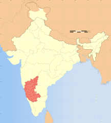
1517:
848:
1217:{{WikiProject_India_Maps |Title=Karnataka locator map |Description=Locator map of the state of Karnataka,
1790:
1785:
1775:
1632:
1542:
1507:
1482:
414:– If you remix, transform, or build upon the material, you must distribute your contributions under the
1622:
1592:
1587:
1532:
1527:
824: : The territory India claims is legally theirs, but the claim is disputed by China and Pakistan.
197:
966:"}},"text\/plain":{"en":{"P6216":"copyrighted"}}}}": -->
1935:
1905:
1860:
1705:
1685:
1562:
1512:
252:
1657:
1502:
1169:
1164:
864:
113:
37:
1582:
1522:
1392:
1347:
1317:
1272:
776:
1745:
912:
1312:
1242:
374:
256:
1850:
311:
If you dont want to release your work under a creative commons license, please mail me at
8:
1377:
1357:
1760:
1417:
1302:
1297:
1292:
877:
669:
1352:
1287:
1267:
1187:{{Information |Description= |Source= |Date= |Author= |Permission= |other_versions= }}
100:
938:
349:
I, the copyright holder of this work, hereby publish it under the following license:
1387:
1342:
870:
860:
631:
301:
1925:
1920:
1815:
1810:
1805:
1755:
1422:
1412:
1337:
1262:
1252:
290:
1372:
1362:
1277:
1247:
240:
785:
224:
1332:
1327:
1322:
1225:
1210:
1180:
852:
806:
607:
594:
575:
562:
530:
517:
498:
485:
313:
248:
1765:
1367:
1257:
1222:
687:
444:
1382:
1111:
1071:
1027:
983:
856:
549:
162:
1770:
1725:
880:
is almost entirely claimed by China as part of its
Tibetan territory.
688:
655:
319:
1980:
1137:
Click on a date/time to view the file as it appeared at that time.
859:). Since 1972, it is divided between all three countries. See also
1970:
796:
Please check local laws and modify the map accordingly before use.
204:
193:
1975:
1221:
with district boundaries. |Source=. |Date=August 6 2006 |Author=
236:
1965:
813:
1990:
1985:
149:
891:
For a detailed map of all disputed regions in South Asia, see
1218:
232:
82:(SVG file, nominally 1,574 × 1,738 pixels, file size: 836 KB)
175:
88:
847:
The northern
Himalayan region of the disputed territory
1835:
1715:
932:
Add a one-line explanation of what this file represents
720:
640:
If inappropriate please set warp_status = skip to hide.
466:
1960:
1955:
1945:
1735:
1236:
801:
1676:
1135:
1034:
Creative
Commons Attribution-ShareAlike 3.0 Unported
1008:
Creative Commons Attribution-ShareAlike 3.0 Unported
112:
Commons is a freely licensed media file repository.
626:
157:
650:
130:
710:
474:
458:
1478:Knowledge:Userboxes/WikiProjects/alphabetical/15
730:
323:to negotiate a custom license as per your needs.
769:
838:
425:https://creativecommons.org/licenses/by-sa/3.0
93:
1493:Knowledge:WikiProject India/userbox templates
1428:Knowledge:Help desk/Archives/2021 September 1
1308:User:Joelton Ivson/Gather lists/24270 – India
431:Creative Commons Attribution-Share Alike 3.0
355:
334:
171:
140:
1653:Category:Wikipedians interested in Karnataka
1473:Knowledge:Userboxes/WikiProjects/Regional/05
661:
268:
181:
14:
1643:Category:WikiProject Karnataka participants
391:– to copy, distribute and transmit the work
41:Size of this PNG preview of this SVG file:
127:
1678:The following other wikis use this file:
1463:Knowledge:Userboxes/Location/India/States
855:) and the Chinese-occupied territory of (
694:
462:second half of 20 century and 21 century
1438:Knowledge:Userboxes/Life/Citizenship/04
781:) and the National Geographic Society (
750:
634:Georeference the map in Wikimaps Warper
148:Locator map of the state of Karnataka,
1238:The following 86 pages use this file:
1488:Knowledge:WikiProject India/Templates
1453:Knowledge:Userboxes/Life/Residence/04
1443:Knowledge:Userboxes/Life/Ethnicity/02
906:
740:
300:If you are using the image under the
124:
1668:Portal:Geography/Featured article/13
1618:Template:User interest Karnataka/doc
1433:Knowledge:Userboxes/Life/Ancestry/06
378:Attribution-Share Alike 3.0 Unported
302:creative commons share alike license
1558:Template:User citizen Karnataka/doc
1128:
898:
366:
361:
13:
1458:Knowledge:Userboxes/Location/India
1448:Knowledge:Userboxes/Life/Origin/04
1408:User:Sourish Paul Shyamnagar India
937:
931:
893:Image:India disputed areas map.svg
812:
805:
802:Explanation of disputed boundaries
725:Explanation of disputed boundaries
689:
352:
348:
161:
125:
75:
2011:
1663:Portal:Geography/Featured article
1648:Category:Wikipedians in Karnataka
936:
690:
1613:Template:User interest Karnataka
1608:Template:User interest India/doc
1578:Template:User from Karnataka/doc
1468:Knowledge:Userboxes/Travel/India
1398:User:Souravmohanty2005/Userboxes
922:
828:Line of Control/Line of Conflict
668:
548:
443:
402:Under the following conditions:
373:This file is licensed under the
365:
360:
354:
273:
92:
31:
21:
1638:Category:Karnatakan Wikipedians
1553:Template:User citizen Karnataka
1548:Template:User citizen India/doc
1498:Knowledge:WikiProject Karnataka
1403:User:Souravmohanty2005/sandbox2
919:
851:is claimed by India including (
205:University of Texas map library
194:University of Texas map library
143:India Karnataka locator map.svg
1673:
1628:Template:User proud Indian/doc
1598:Template:User in Karnataka/doc
1538:Template:User WP Karnataka/doc
1132:
918:
876:The northeastern territory of
230:State and District boundaries:
26:
1:
1283:User:Encyclopediaofvidyasagar
1078:original creation by uploader
1052:original creation by uploader
853:Pakistan-administered Kashmir
632:
1603:Template:User interest India
1573:Template:User from Karnataka
1568:Template:User from India/doc
1518:Template:User Karnataka/doc1
1233:
944:Items portrayed in this file
770:Depiction of India's borders
715:Depiction of India's borders
276:
253:Survey of India Map Explorer
7:
1832:Usage on hak.wikipedia.org
1722:Usage on ceb.wikipedia.org
1712:Usage on cdo.wikipedia.org
1633:Category:Flora of Karnataka
1543:Template:User citizen India
1508:Template:User IN states/doc
1483:Knowledge:WikiProject India
849:Indian-administered Kashmir
839:Borders of disputed regions
735:Borders of disputed regions
306:CC-by-sa PlaneMad/Wikimedia
10:
2016:
1952:Usage on it.wikipedia.org
1942:Usage on is.wikipedia.org
1842:Usage on hi.wikipedia.org
1822:Usage on gu.wikipedia.org
1752:Usage on fa.wikipedia.org
1742:Usage on dv.wikipedia.org
1732:Usage on da.wikipedia.org
1702:Usage on bg.wikipedia.org
1692:Usage on be.wikipedia.org
1682:Usage on ba.wikipedia.org
1623:Template:User proud Indian
1593:Template:User in Karnataka
1588:Template:User in India/doc
1533:Template:User WP Karnataka
1528:Template:User WP India/doc
700:
478:
416:same or compatible license
1129:
645:
453:
186:
152:with district boundaries.
16:
1563:Template:User from India
1513:Template:User India/doc1
921:
822:Boundary of Indian claim
764:
467:Spatial reference system
382:
304:please credit the photo
198:India Political map 2001
99:This is a file from the
36:
1696:Штаты і тэрыторыі Індыі
1658:Category talk:Geography
1503:Template:User IN states
1216:
1186:
1165:06:52, 29 December 2008
314:arun.planemad@gmail.com
103:. Information from its
1981:Divisione di Bangalore
1583:Template:User in India
1523:Template:User WP India
1393:User:Souravmohanty2005
1348:User:Purplemountainman
1318:User:Lokesha Kunchadka
1273:User:Chanchal Nishanth
915:for more information.
865:Line of Actual Control
817:
810:
656:WikiProject India Maps
454: Geotemporal data
237:2001 Census State Maps
191:International Borders:
166:
106:description page there
1971:Divisione di Gulbarga
816:
809:
262:Map specific sources:
165:
135:Karnataka locator map
1976:Divisione di Belgaum
1313:User:Jomonkoyippally
1243:Outline of Karnataka
1195:17:26, 6 August 2006
241:Survey of India Maps
69:1,574 × 1,738 pixels
65:1,855 × 2,048 pixels
1966:Divisione di Mysore
1378:User:Shravankumaruk
1358:User:RooinMahmood07
1228:|Thumbdir=CHANGE }}
646: Archival data
397:– to adapt the work
257:Columbia University
249:US Army Map Service
221:Kashmir Region 2004
217:Western Sector 1988
213:Eastern Sector 1988
209:China-India Borders
47:Other resolutions:
1991:Distretto di Bidar
1986:Template:Karnataka
1911:महादेव मंदिर, इतगी
1726:State of Karnātaka
1418:User:WikiEdits2003
1303:User:Jesse Viviano
1298:User:Jaywardhan009
1293:User:Hestmatematik
907:Territorial waters
818:
811:
755:Territorial waters
317:or catch me at my
167:
61:927 × 1,024 pixels
2000:more global usage
1674:Global file usage
1353:User:Rajeshsingri
1288:User:FactCheck105
1268:User:Buaidh/Test7
1231:
1018:copyright license
1004:copyright license
930:
878:Arunachal Pradesh
695:
682:
681:
641:
622:
621:
343:
340:Reusing this file
329:
328:
202:Disputed Borders:
121:
120:
101:Wikimedia Commons
32:Global file usage
2007:
1388:User:Sohom Datta
1343:User:Praveenpuva
1207:
1177:
1139:
974:copyright status
960:copyright status
928:
899:Internal borders
756:
753:
746:
745:Internal borders
743:
736:
733:
726:
723:
716:
713:
706:
703:
696:
672:
639:
638:
636:
635:
618:
616:
615:
614:
609:
605:
604:
601:
600:
597:
586:
584:
583:
582:
577:
573:
572:
569:
568:
565:
552:
541:
539:
538:
537:
532:
528:
527:
524:
523:
520:
509:
507:
506:
505:
500:
496:
495:
492:
491:
488:
479:
447:
438:
435:
432:
429:
426:
418:as the original.
375:Creative Commons
369:
368:
364:
363:
358:
357:
337:
274:
188:
177:
176:29 December 2008
144:
128:
117:
96:
95:
89:
83:
72:
57:695 × 768 pixels
53:435 × 480 pixels
49:217 × 240 pixels
43:543 × 600 pixels
2015:
2014:
2010:
2009:
2008:
2006:
2005:
2004:
1886:बनवासी, कर्नाटक
1672:
1423:User talk:HeSn3
1413:User:Thoufiq313
1338:User:Path slopu
1263:User:Bluejet007
1253:User:Aviafanboi
1232:
1226:w:user:Planemad
1213:
1205:
1183:
1175:
1131:
1130:
1127:
1126:
1125:
1124:
1123:
1122:
1121:
1120:
1118:
1108:
1107:
1106:
1104:
1089:
1088:
1087:
1086:
1085:
1084:
1083:
1082:
1080:
1068:
1067:
1066:
1064:
1045:
1044:
1043:
1042:
1041:
1040:
1039:
1038:
1036:
1024:
1023:
1022:
1020:
1001:
1000:
999:
998:
997:
996:
995:
994:
992:
980:
979:
978:
976:
957:
956:
955:
954:
953:
951:
935:
934:
933:
909:
901:
871:Siachen glacier
861:Line of Control
841:
804:
772:
767:
762:
754:
751:
744:
741:
734:
731:
724:
721:
714:
711:
704:
701:
697:
693:
683:
676:
673:
633:
630:
612:
610:
606:
602:
598:
595:
593:
591:
580:
578:
574:
570:
566:
563:
561:
559:
535:
533:
529:
525:
521:
518:
516:
514:
503:
501:
497:
493:
489:
486:
484:
482:
441:
440:
439:
436:
433:
430:
427:
424:
423:
381:
370:
351:
350:
330:
233:Census of India
153:
142:
136:
123:
122:
111:
110:
109:is shown below.
85:
81:
74:
73:
46:
12:
11:
5:
2013:
2002:of this file.
1996:
1995:
1994:
1993:
1988:
1983:
1978:
1973:
1968:
1963:
1958:
1950:
1949:
1948:
1940:
1939:
1938:
1933:
1928:
1923:
1918:
1913:
1908:
1903:
1898:
1893:
1888:
1883:
1878:
1873:
1868:
1863:
1858:
1853:
1848:
1840:
1839:
1838:
1830:
1829:
1828:
1820:
1819:
1818:
1813:
1808:
1803:
1798:
1796:کریشناراجاپورا
1793:
1788:
1783:
1778:
1773:
1768:
1763:
1758:
1750:
1749:
1748:
1740:
1739:
1738:
1730:
1729:
1728:
1720:
1719:
1718:
1710:
1709:
1708:
1700:
1699:
1698:
1690:
1689:
1688:
1675:
1671:
1670:
1665:
1660:
1655:
1650:
1645:
1640:
1635:
1630:
1625:
1620:
1615:
1610:
1605:
1600:
1595:
1590:
1585:
1580:
1575:
1570:
1565:
1560:
1555:
1550:
1545:
1540:
1535:
1530:
1525:
1520:
1515:
1510:
1505:
1500:
1495:
1490:
1485:
1480:
1475:
1470:
1465:
1460:
1455:
1450:
1445:
1440:
1435:
1430:
1425:
1420:
1415:
1410:
1405:
1400:
1395:
1390:
1385:
1380:
1375:
1373:User:ServerCSS
1370:
1365:
1363:User:Sachin126
1360:
1355:
1350:
1345:
1340:
1335:
1330:
1325:
1320:
1315:
1310:
1305:
1300:
1295:
1290:
1285:
1280:
1278:User:CodePanda
1275:
1270:
1265:
1260:
1255:
1250:
1248:User:Arpitha05
1245:
1235:
1230:
1229:
1223:w:user:Nichalp
1215:
1211:
1208:
1204:1,639 × 1,852
1202:
1197:
1192:
1189:
1188:
1185:
1181:
1178:
1174:1,574 × 1,738
1172:
1167:
1162:
1158:
1157:
1154:
1151:
1148:
1145:
1142:
1134:
1119:
1116:
1114:
1113:
1112:
1110:
1109:
1105:
1100:
1098:
1097:
1096:
1095:
1093:
1081:
1076:
1074:
1073:
1072:
1070:
1069:
1065:
1062:source of file
1060:
1058:
1057:
1056:
1055:
1053:
1049:
1048:source of file
1037:
1032:
1030:
1029:
1028:
1026:
1025:
1021:
1016:
1014:
1013:
1012:
1011:
1009:
1005:
993:
988:
986:
985:
984:
982:
981:
977:
972:
970:
969:
968:
967:
965:
961:
952:
947:
945:
942:
941:
940:
939:
927:
926:
923:
920:
908:
905:
900:
897:
888:
887:
884:
881:
874:
868:
857:Ladakh plateau
840:
837:
836:
835:
825:
803:
800:
799:
798:
792:
791:verifiability.
788:
771:
768:
766:
763:
761:
760:
759:
758:
748:
738:
728:
718:
692:
680:
679:
678:
677:
674:
667:
663:
662:Other versions
659:
658:
652:
648:
647:
643:
642:
628:
627:Georeferencing
624:
623:
620:
619:
608:6.25°N 96.09°E
589:
587:
556:
555:
553:
546:
543:
542:
531:37.23°N 99.0°E
512:
510:
499:36.70°N 64.8°E
476:
472:
471:
468:
464:
463:
460:
456:
455:
451:
450:
422:
421:
420:
419:
409:
400:
399:
398:
392:
385:You are free:
372:
371:
353:
347:
346:
344:
332:
331:
327:
326:
325:
324:
309:
286:was created by
277:
272:
270:
266:
265:
246:Other sources:
183:
179:
178:
173:
169:
168:
159:
155:
154:
147:
145:
138:
137:
134:
132:
126:
119:
118:
97:
87:
86:
40:
35:
34:
29:
24:
19:
9:
6:
4:
3:
2:
2012:
2003:
2001:
1992:
1989:
1987:
1984:
1982:
1979:
1977:
1974:
1972:
1969:
1967:
1964:
1962:
1959:
1957:
1954:
1953:
1951:
1947:
1944:
1943:
1941:
1937:
1934:
1932:
1929:
1927:
1924:
1922:
1919:
1917:
1914:
1912:
1909:
1907:
1904:
1902:
1899:
1897:
1894:
1892:
1889:
1887:
1884:
1882:
1879:
1877:
1874:
1872:
1869:
1867:
1864:
1862:
1859:
1857:
1854:
1852:
1849:
1847:
1844:
1843:
1841:
1837:
1834:
1833:
1831:
1827:
1824:
1823:
1821:
1817:
1814:
1812:
1809:
1807:
1804:
1802:
1799:
1797:
1794:
1792:
1789:
1787:
1784:
1782:
1781:بیاتاریاناپور
1779:
1777:
1774:
1772:
1769:
1767:
1764:
1762:
1759:
1757:
1754:
1753:
1751:
1747:
1744:
1743:
1741:
1737:
1734:
1733:
1731:
1727:
1724:
1723:
1721:
1717:
1714:
1713:
1711:
1707:
1704:
1703:
1701:
1697:
1694:
1693:
1691:
1687:
1684:
1683:
1681:
1680:
1679:
1669:
1666:
1664:
1661:
1659:
1656:
1654:
1651:
1649:
1646:
1644:
1641:
1639:
1636:
1634:
1631:
1629:
1626:
1624:
1621:
1619:
1616:
1614:
1611:
1609:
1606:
1604:
1601:
1599:
1596:
1594:
1591:
1589:
1586:
1584:
1581:
1579:
1576:
1574:
1571:
1569:
1566:
1564:
1561:
1559:
1556:
1554:
1551:
1549:
1546:
1544:
1541:
1539:
1536:
1534:
1531:
1529:
1526:
1524:
1521:
1519:
1516:
1514:
1511:
1509:
1506:
1504:
1501:
1499:
1496:
1494:
1491:
1489:
1486:
1484:
1481:
1479:
1476:
1474:
1471:
1469:
1466:
1464:
1461:
1459:
1456:
1454:
1451:
1449:
1446:
1444:
1441:
1439:
1436:
1434:
1431:
1429:
1426:
1424:
1421:
1419:
1416:
1414:
1411:
1409:
1406:
1404:
1401:
1399:
1396:
1394:
1391:
1389:
1386:
1384:
1381:
1379:
1376:
1374:
1371:
1369:
1366:
1364:
1361:
1359:
1356:
1354:
1351:
1349:
1346:
1344:
1341:
1339:
1336:
1334:
1333:User:N Jeevan
1331:
1329:
1328:User:Mores983
1326:
1324:
1323:User:Manthara
1321:
1319:
1316:
1314:
1311:
1309:
1306:
1304:
1301:
1299:
1296:
1294:
1291:
1289:
1286:
1284:
1281:
1279:
1276:
1274:
1271:
1269:
1266:
1264:
1261:
1259:
1256:
1254:
1251:
1249:
1246:
1244:
1241:
1240:
1239:
1227:
1224:
1220:
1214:
1209:
1203:
1201:
1198:
1196:
1193:
1191:
1190:
1184:
1179:
1173:
1171:
1168:
1166:
1163:
1160:
1159:
1155:
1152:
1149:
1146:
1143:
1141:
1140:
1138:
1117:image/svg+xml
1115:
1103:
1099:
1079:
1075:
1063:
1059:
1035:
1031:
1019:
1015:
991:
987:
975:
971:
950:
946:
943:
924:
917:
916:
914:
904:
896:
895:
894:
885:
882:
879:
875:
872:
869:
866:
862:
858:
854:
850:
846:
845:
844:
833:
829:
826:
823:
820:
819:
815:
808:
797:
793:
789:
786:
783:
780:
777:
774:
773:
757:
749:
747:
739:
737:
729:
727:
719:
717:
709:
708:
707:
699:
698:
686:
685:
671:
666:
665:
664:
660:
657:
653:
649:
644:
637:
629:
625:
617:
590:
588:
585:
576:5.9°N 68.76°E
558:
557:
554:
551:
547:
545:
544:
540:
513:
511:
508:
481:
480:
477:
473:
469:
465:
461:
459:Date depicted
457:
452:
446:
442:
428:CC BY-SA 3.0
417:
413:
410:
407:
404:
403:
401:
396:
393:
390:
387:
386:
384:
383:
379:
376:
359:
345:
341:
336:
333:
322:
321:
316:
315:
310:
307:
303:
299:
298:
297:
296:
293:
292:
291:User:PlaneMad
288:
287:
284:
283:
278:
275:
271:
267:
263:
260:
259:
258:
254:
250:
247:
244:
242:
238:
234:
231:
228:
226:
222:
218:
214:
210:
206:
203:
200:
199:
195:
192:
189:
184:
180:
174:
170:
164:
160:
156:
151:
146:
139:
133:
129:
115:
108:
107:
102:
98:
91:
90:
84:
79:
78:Original file
70:
66:
62:
58:
54:
50:
44:
39:
33:
30:
28:
25:
23:
20:
18:
15:
1997:
1901:गोकर्ण, भारत
1876:कर्नाटक/आलेख
1826:શ્રવણબેલગોડા
1677:
1368:User:Sagavaj
1258:User:B.arjun
1237:
1136:
1133:File history
910:
902:
890:
889:
842:
831:
830: : The
827:
821:
795:
684:
475:Bounding box
411:
405:
394:
388:
318:
312:
305:
294:
289:
285:
281:
279:
261:
245:
229:
225:Kashmir Maps
201:
190:
185:
114:You can help
104:
76:
22:File history
1801:ماهادواپورا
1383:User:Skancc
990:copyrighted
964:copyrighted
613:6.25; 96.09
536:37.23; 99.0
504:36.70; 64.8
412:share alike
406:attribution
141:Description
1881:नंदी दुर्ग
1856:कोडगु जिला
1791:داواناگیری
1786:داساراهالی
1776:بوماناهالی
1234:File usage
1150:Dimensions
1102:media type
1092:media type
581:5.9; 68.76
335:Permission
282:This Image
158:Map legend
27:File usage
1961:Karnataka
1956:Bangalore
1946:Karnataka
1866:तालकावेरी
1836:Karnataka
1736:Karnataka
1716:Karnataka
1706:Карнатака
1686:Һиндостан
1147:Thumbnail
1144:Date/Time
675:blank map
1931:ऐनेगुंडी
1896:कुदरेमुख
1746:މައްތޫރު
1212:Planemad
1206:(750 KB)
1182:Planemad
1176:(836 KB)
925:Captions
832:de facto
691:Contents
654:Part of
395:to remix
389:to share
380:license.
187:Own work
1916:कित्तूर
1891:तालकाड़
1871:शृंगेरी
1846:बीजापुर
1761:بلگایوم
1161:current
1156:Comment
949:depicts
929:English
599:96°05′E
567:68°46′E
522:99°00′E
519:37°14′N
490:64°48′E
487:36°42′N
320:Website
269:Creator
80:
1936:गलगनाथ
1906:सन्नति
1861:सूरतकल
1816:تومکور
1811:شیموگا
1806:رایچور
1756:گلبرگه
596:6°15′N
564:5°54′N
449:usage.
215:&
182:Source
1998:View
1851:हुबली
1766:بلاری
1219:India
765:Notes
705:Notes
651:Notes
470:conic
150:India
131:Title
1926:हलसी
1921:हूली
1771:بیدر
1153:User
913:this
863:and
437:true
434:true
172:Date
17:File
752:1.5
742:1.4
732:1.3
722:1.2
712:1.1
603:/
571:/
526:/
494:/
784:,
778:,
611:/
579:/
534:/
502:/
255:,
251:,
239:-
235:-
223:-
219:-
211:-
207:-
196:-
67:|
63:|
59:|
55:|
51:|
45:.
867:.
787:)
702:1
342:)
338:(
295:.
264:.
243:.
227:.
116:.
71:.
Text is available under the Creative Commons Attribution-ShareAlike License. Additional terms may apply.

