38:
453:"}},"text\/plain":{"en":{"":"inception"}}},"{\"value\":{\"time\":\"+2011-04-24T00:00:00Z\",\"timezone\":0,\"before\":0,\"after\":0,\"precision\":11,\"calendarmodel\":\"http:\\\/\\\/www.wikidata.org\\\/entity\\\/Q1985727\"},\"type\":\"time\"}":{"text\/html":{"en":{"P571":"24 April 2011"}},"text\/plain":{"en":{"P571":"24 April 2011"}}}}": -->
224:
230:
235:
94:
409:"}},"text\/plain":{"en":{"":"copyright license"}}},"{\"value\":{\"entity-type\":\"item\",\"numeric-id\":14946043,\"id\":\"Q14946043\"},\"type\":\"wikibase-entityid\"}":{"text\/html":{"en":{"P275":"
365:"}},"text\/plain":{"en":{"":"copyright status"}}},"{\"value\":{\"entity-type\":\"item\",\"numeric-id\":50423863,\"id\":\"Q50423863\"},\"type\":\"wikibase-entityid\"}":{"text\/html":{"en":{"P6216":"
361:
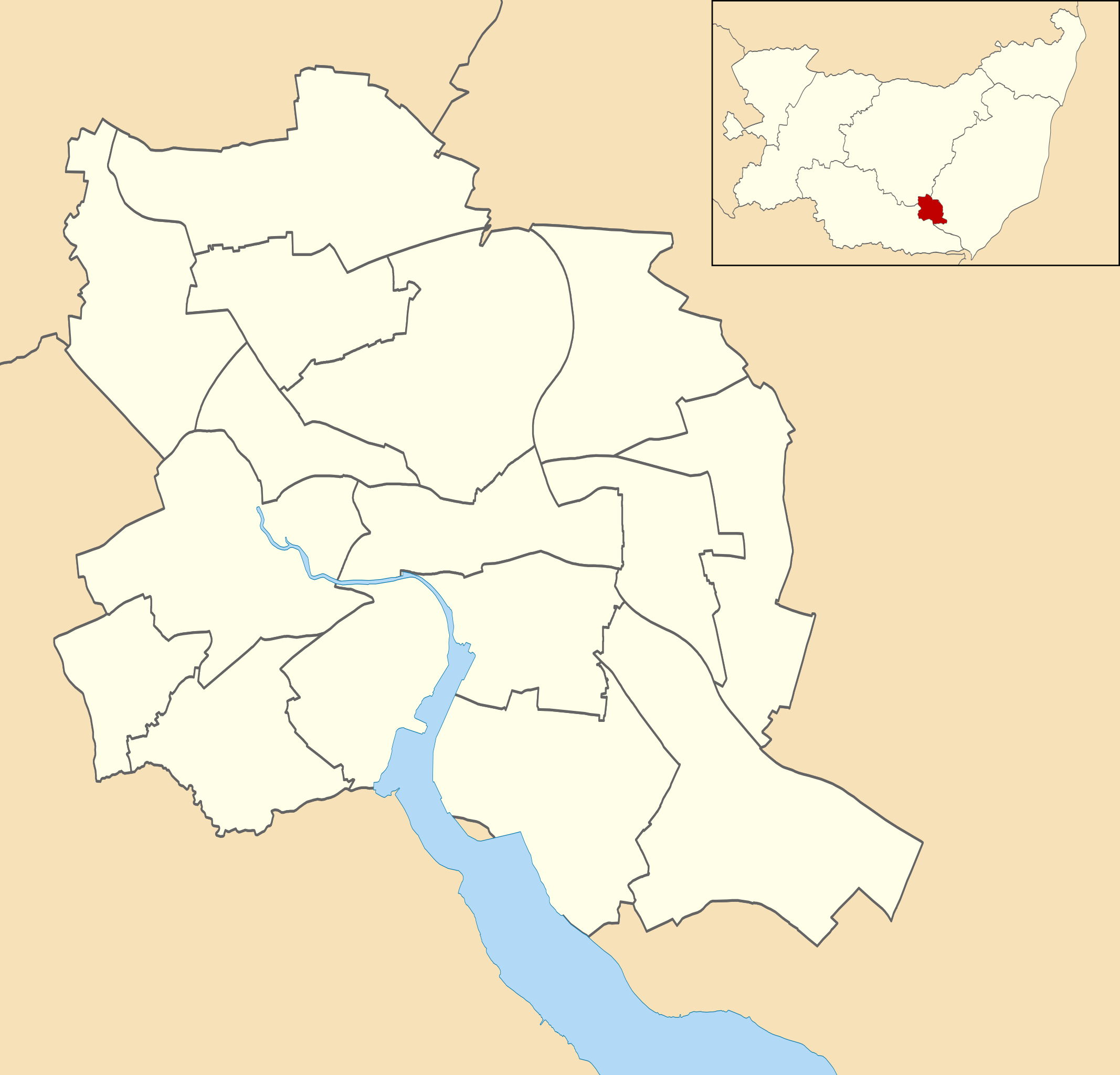
546:{{Information |Description=Map of Ipswich, Suffolk, UK with electoral wards shown. Equirectangular map projection on WGS 84 datum, with N/S stretched 160% Geographic limits: *West: 1.10E *East: 1.25E *North: 52.10N *South: 52.01N |Source=[[w:Ordnance Su
282:– You must give appropriate credit, provide a link to the license, and indicate if changes were made. You may do so in any reasonable manner, but not in any way that suggests the licensor endorses you or your use.
410:
366:
362:
450:
406:
68:
64:
60:
56:
52:
48:
42:
630:
640:
77:
105:
693:
635:
413:"}},"text\/plain":{"en":{"P275":"Creative Commons Attribution-ShareAlike 3.0 Unported"}}}}": -->
213:
436:
392:
289:
723:
605:
376:
570:
460:
420:
351:
590:
718:
615:
625:
585:
245:
528:
523:
37:
288:– If you remix, transform, or build upon the material, you must distribute your contributions under the
620:
668:
369:"}},"text\/plain":{"en":{"P6216":"copyrighted"}}}}": -->
600:
181:
113:
708:
575:
703:
580:
242:
673:
658:
8:
565:
683:
100:
341:
610:
595:
178:
560:
201:
539:
470:
430:
386:
141:
Equirectangular map projection on WGS 84 datum, with N/S stretched 160%
188:
Coastline and administrative boundary data from
Boundary-Line product.
496:
Click on a date/time to view the file as it appeared at that time.
253:
Contains
Ordnance Survey data © Crown copyright and database right
82:(SVG file, nominally 1,319 × 1,266 pixels, file size: 217 KB)
167:
88:
724:
Modül:Konum haritası/veri/Birleşik Krallık
Ipswich/belge
138:
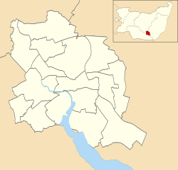
Map of
Ipswich, Suffolk, UK with electoral wards shown.
631:
User:Chelston-temp-1/List of electoral wards in
Suffolk
335:
Add a one-line explanation of what this file represents
554:
649:
494:
437:
Creative
Commons Attribution-ShareAlike 3.0 Unported
411:
Creative
Commons Attribution-ShareAlike 3.0 Unported
112:
Commons is a freely licensed media file repository.
709:
Module:Location map/data/United
Kingdom Ipswich/doc
641:
Module:Location map/data/United
Kingdom Ipswich/doc
719:Modül:Konum haritası/veri/Birleşik Krallık Ipswich
704:Module:Location map/data/United Kingdom Ipswich
636:Module:Location map/data/United Kingdom Ipswich
299:https://creativecommons.org/licenses/by-sa/3.0
93:
305:Creative Commons Attribution-Share Alike 3.0
223:
208:
163:
130:
197:
173:
14:
265:– to copy, distribute and transmit the work
41:Size of this PNG preview of this SVG file:
651:The following other wikis use this file:
556:The following 17 pages use this file:
124:
246:Attribution-Share Alike 3.0 Unported
204:, created using Ordnance Survey data
133:Ipswich UK ward map 2010 (blank).svg
606:St Mary-at-the-Quay Church, Ipswich
487:
234:
229:
13:
591:St Margaret's Church, Ipswich
571:List of electoral wards in Suffolk
340:
334:
220:
191:Lake data from Meridian 2 product.
125:
75:
737:
616:St Matthew's Church, Ipswich
339:
325:
276:Under the following conditions:
241:This file is licensed under the
233:
228:
222:
92:
31:
21:
626:St Peter's Church, Ipswich
586:St Helen's Church, Ipswich
322:
694:ಟೆಂಪ್ಲೇಟು:Location map Ipswich
684:Modèle:Géolocalisation/Ipswich
646:
491:
321:
26:
1:
551:
347:Items portrayed in this file
7:
669:پودمان:Location map Ipswich
10:
742:
715:Usage on tr.wikipedia.org
700:Usage on si.wikipedia.org
690:Usage on kn.wikipedia.org
680:Usage on fr.wikipedia.org
665:Usage on fa.wikipedia.org
655:Usage on ar.wikipedia.org
621:St Pancras Church, Ipswich
290:same or compatible license
127:
674:الگو:Location map Ipswich
659:قالب:Location map Ipswich
488:
16:
601:St Mary, Woodbridge Road
324:
256:
99:This is a file from the
36:
545:
166:
103:. Information from its
576:Mary Magdalen, Ipswich
106:description page there
581:River Church Ipswich
524:23:55, 24 April 2011
69:1,319 × 1,266 pixels
65:2,134 × 2,048 pixels
61:1,067 × 1,024 pixels
566:Ipswich Blackfriars
271:– to adapt the work
144:Geographic limits:
47:Other resolutions:
647:Global file usage
549:
421:copyright license
407:copyright license
333:
318:
317:
217:
214:Reusing this file
121:
120:
101:Wikimedia Commons
32:Global file usage
733:
611:St Mary at Stoke
596:St Mark, Ipswich
536:
498:
377:copyright status
363:copyright status
331:
312:
309:
306:
303:
300:
292:as the original.
254:
243:Creative Commons
237:
236:
232:
231:
226:
225:
211:
169:
134:
128:
117:
96:
95:
89:
83:
72:
57:800 × 768 pixels
53:500 × 480 pixels
49:250 × 240 pixels
43:625 × 600 pixels
741:
740:
736:
735:
734:
732:
731:
730:
645:
561:Ipswich Airport
550:
542:
534:
490:
489:
486:
485:
484:
483:
482:
481:
480:
479:
477:
467:
466:
465:
463:
448:
447:
446:
445:
444:
443:
442:
441:
439:
427:
426:
425:
423:
404:
403:
402:
401:
400:
399:
398:
397:
395:
383:
382:
381:
379:
360:
359:
358:
357:
356:
354:
338:
337:
336:
319:
314:
313:
310:
307:
304:
301:
298:
297:
255:
252:
249:
238:
179:Ordnance Survey
132:
123:
122:
111:
110:
109:is shown below.
85:
81:
74:
73:
46:
12:
11:
5:
739:
729:
728:
727:
726:
721:
713:
712:
711:
706:
698:
697:
696:
688:
687:
686:
678:
677:
676:
671:
663:
662:
661:
648:
644:
643:
638:
633:
628:
623:
618:
613:
608:
603:
598:
593:
588:
583:
578:
573:
568:
563:
553:
548:
547:
544:
540:
537:
533:1,319 × 1,266
531:
526:
521:
517:
516:
513:
510:
507:
504:
501:
493:
478:
475:
473:
472:
471:
469:
468:
464:
459:
457:
456:
455:
454:
452:
440:
435:
433:
432:
431:
429:
428:
424:
419:
417:
416:
415:
414:
412:
408:
396:
391:
389:
388:
387:
385:
384:
380:
375:
373:
372:
371:
370:
368:
364:
355:
350:
348:
345:
344:
343:
342:
330:
329:
326:
323:
316:
315:
296:
295:
294:
293:
283:
274:
273:
272:
266:
259:You are free:
250:
240:
239:
221:
218:
206:
205:
199:
195:
194:
193:
192:
189:
175:
171:
170:
165:
161:
160:
159:
158:
155:
152:
149:
135:
126:
119:
118:
97:
87:
86:
40:
35:
34:
29:
24:
19:
9:
6:
4:
3:
2:
738:
725:
722:
720:
717:
716:
714:
710:
707:
705:
702:
701:
699:
695:
692:
691:
689:
685:
682:
681:
679:
675:
672:
670:
667:
666:
664:
660:
657:
656:
654:
653:
652:
642:
639:
637:
634:
632:
629:
627:
624:
622:
619:
617:
614:
612:
609:
607:
604:
602:
599:
597:
594:
592:
589:
587:
584:
582:
579:
577:
574:
572:
569:
567:
564:
562:
559:
558:
557:
543:
538:
532:
530:
527:
525:
522:
519:
518:
514:
511:
508:
505:
502:
500:
499:
497:
476:24 April 2011
474:
462:
458:
438:
434:
422:
418:
394:
390:
378:
374:
353:
349:
346:
327:
320:
302:CC BY-SA 3.0
291:
287:
284:
281:
278:
277:
275:
270:
267:
264:
261:
260:
258:
257:
251:Attribution:
247:
244:
227:
219:
215:
210:
207:
203:
200:
196:
190:
187:
186:
185:
183:
180:
176:
172:
168:24 April 2011
162:
157:South: 52.01N
156:
154:North: 52.10N
153:
150:
147:
146:
145:
142:
139:
136:
129:
115:
108:
107:
102:
98:
91:
90:
84:
79:
78:Original file
70:
66:
62:
58:
54:
50:
44:
39:
33:
30:
28:
25:
23:
20:
18:
15:
650:
555:
495:
492:File history
285:
279:
268:
262:
177:
143:
140:
137:
114:You can help
104:
76:
22:File history
393:copyrighted
367:copyrighted
286:share alike
280:attribution
151:East: 1.25E
148:West: 1.10E
131:Description
552:File usage
509:Dimensions
209:Permission
27:File usage
541:Nilfanion
506:Thumbnail
503:Date/Time
461:inception
451:inception
202:Nilfanion
535:(217 KB)
328:Captions
269:to remix
263:to share
248:license.
182:OpenData
520:current
515:Comment
352:depicts
332:English
80:
198:Author
174:Source
512:User
311:true
308:true
164:Date
17:File
184:.
67:|
63:|
59:|
55:|
51:|
45:.
216:)
212:(
116:.
71:.

.svg)