498:"}},"text\/plain":{"en":{"":"inception"}}},"{\"value\":{\"time\":\"+2010-09-26T00:00:00Z\",\"timezone\":0,\"before\":0,\"after\":0,\"precision\":11,\"calendarmodel\":\"http:\\\/\\\/www.wikidata.org\\\/entity\\\/Q1985727\"},\"type\":\"time\"}":{"text\/html":{"en":{"P571":"26 September 2010"}},"text\/plain":{"en":{"P571":"26 September 2010"}}}}": -->
43:
258:
264:
269:
99:
454:"}},"text\/plain":{"en":{"":"copyright license"}}},"{\"value\":{\"entity-type\":\"item\",\"numeric-id\":14946043,\"id\":\"Q14946043\"},\"type\":\"wikibase-entityid\"}":{"text\/html":{"en":{"P275":"
410:"}},"text\/plain":{"en":{"":"copyright status"}}},"{\"value\":{\"entity-type\":\"item\",\"numeric-id\":50423863,\"id\":\"Q50423863\"},\"type\":\"wikibase-entityid\"}":{"text\/html":{"en":{"P6216":"
406:
1163:
316:– You must give appropriate credit, provide a link to the license, and indicate if changes were made. You may do so in any reasonable manner, but not in any way that suggests the licensor endorses you or your use.
595:, UK with the following information shown: *Administrative borders *Coastline, lakes and rivers *Roads and railways *Urban areas Equirectangular map projection on WGS 84 datum, wi
1083:
1115:
606:
455:
411:
407:
495:
451:
1432:
1148:
73:
69:
65:
61:
57:
53:
47:
110:
82:
458:"}},"text\/plain":{"en":{"P275":"Creative Commons Attribution-ShareAlike 3.0 Unported"}}}}": -->
758:
247:
1153:
753:
481:
437:
748:
218:
1443:
This file contains additional information, probably added from the digital camera or scanner used to create or digitize it.
323:
1348:
421:
505:
465:
396:
356:
808:
1033:
843:
1038:
279:
1446:
If the file has been modified from its original state, some details may not fully reflect the modified file.
605:
More than 100 pages use this file. The following list shows the first 100 pages that use this file only. A
322:– If you remix, transform, or build upon the material, you must distribute your contributions under the
1108:
573:
568:
42:
414:"}},"text\/plain":{"en":{"P6216":"copyrighted"}}}}": -->
204:
1403:
1143:
118:
868:
833:
1233:
913:
1353:
953:
943:
908:
863:
276:
8:
858:
798:
793:
623:
1423:
713:
222:
938:
738:
708:
144:
105:
1188:
386:
1173:
903:
723:
663:
648:
592:
201:
1193:
1408:
828:
628:
235:
1093:
888:
778:
728:
584:
1183:
1048:
998:
978:
873:
1103:
1418:
1413:
1098:
1078:
983:
933:
928:
633:
515:
475:
431:
1073:
1028:
963:
893:
1063:
164:
Equirectangular map projection on WGS 84 datum, with N/S stretched 165%
1088:
1068:
1058:
1008:
993:
923:
918:
848:
823:
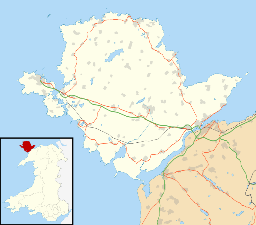
773:
703:
1053:
1013:
973:
958:
878:
838:
813:
783:
698:
683:
658:
618:
613:
211:
Administrative borders and coastline data from
Boundary-Line product.
1368:
1349:
Wikiproyecto:Ilustración/Taller de
Cartografía/Realizaciones/Europa
1208:
1043:
1003:
988:
968:
898:
883:
853:
818:
803:
763:
688:
678:
673:
668:
643:
541:
Click on a date/time to view the file as it appeared at that time.
1318:
287:
Contains
Ordnance Survey data © Crown copyright and database right
1258:
1023:
788:
768:
1298:
1213:
1084:
Ynys Feurig, Cemlyn Bay and The
Skerries Special Protection Area
1203:
1018:
948:
743:
733:
718:
693:
653:
638:
87:(SVG file, nominally 1,425 × 1,255 pixels, file size: 793 KB)
1293:
1308:
1358:
1248:
1223:
1323:
190:
93:
1373:
1198:
380:
Add a one-line explanation of what this file represents
1388:
1313:
1303:
1278:
1273:
1393:
1383:
1343:
1338:
1333:
1288:
1283:
1263:
1243:
1133:
603:
1124:
539:
482:
Creative
Commons Attribution-ShareAlike 3.0 Unported
456:
Creative
Commons Attribution-ShareAlike 3.0 Unported
117:
Commons is a freely licensed media file repository.
1378:
1363:
1328:
1268:
214:All other geographic data from Meridian 2 product.
333:https://creativecommons.org/licenses/by-sa/3.0
98:
339:Creative Commons Attribution-Share Alike 3.0
257:
242:
186:
135:
759:Cors Goch National Nature Reserve (Anglesey)
591:{{Information |Description=Blank map of the
352:
231:
196:
14:
299:– to copy, distribute and transmit the work
147:, UK with the following information shown:
46:Size of this PNG preview of this SVG file:
1354:Plantilla:Mapa de localización de Anglesey
1126:The following other wikis use this file:
754:Cors Erddreiniog National Nature Reserve
1194:Defnyddiwr:Coch Bach/template melinau
1174:Plantilya:Location map Wales Anglesey
749:Cors Bodeilio National Nature Reserve
219:File: United Kingdom location map.svg
129:
280:Attribution-Share Alike 3.0 Unported
238:, created using Ordnance Survey data
138:Isle of Anglesey UK location map.svg
532:
268:
263:
13:
1441:
1189:Rhestr o felinau gwynt ar Ynys Môn
385:
379:
254:
130:
80:
1475:
1448:
1184:Nodyn:Location map Wales Anglesey
384:
1404:الگو:Location map Wales Anglesey
1144:قالب:Location map Wales Anglesey
809:List of monastic houses in Wales
370:
357:File:Isle of Anglesey UK map.svg
310:Under the following conditions:
275:This file is licensed under the
267:
262:
256:
97:
31:
21:
1039:St Pabo's Church, Llanbabo
1034:South Stack Cliffs RSPB reserve
367:
1121:
844:Llanddona transmitting station
536:
366:
26:
1:
36:
1164:বিশ্বের প্রণালীসমূহের তালিকা
600:
392:Items portrayed in this file
7:
1438:
1170:Usage on ceb.wikipedia.org
154:Coastline, lakes and rivers
10:
1480:
1400:Usage on fa.wikipedia.org
1255:Usage on es.wikipedia.org
1240:Usage on eo.wikipedia.org
1230:Usage on el.wikipedia.org
1220:Usage on da.wikipedia.org
1180:Usage on cy.wikipedia.org
1160:Usage on bn.wikipedia.org
1140:Usage on ar.wikipedia.org
1130:Usage on af.wikipedia.org
1109:User:Redlawn/Porth Y Felin
324:same or compatible license
132:
533:
16:
569:19:34, 26 September 2010
369:
290:
104:This is a file from the
41:
590:
189:
108:. Information from its
1369:Llanfihangel yn Nhowyn
1209:Melin Sguthan, Gaerwen
869:Llanfihangel Din Sylwy
834:Llanddeusant, Anglesey
151:Administrative borders
111:description page there
1319:Newborough (Anglesey)
1149:كنيسة القديس غونللويف
914:Llantrisant, Anglesey
1259:Llanfairpwllgwyngyll
954:Penrhos Country Park
944:Newborough, Anglesey
909:Llansadwrn, Anglesey
864:Llanfairpwllgwyngyll
74:1,425 × 1,255 pixels
70:2,325 × 2,048 pixels
66:1,163 × 1,024 pixels
1299:Llanfair-yn-Neubwll
859:Llanfair-yn-Neubwll
799:Gwalchmai, Anglesey
794:Glannau Porthaethwy
624:Aberffraw (cantref)
305:– to adapt the work
217:Inset derived from
167:Geographic limits:
52:Other resolutions:
1204:Melin Mynydd Parys
1154:كابل لليغوي (ملفر)
714:Bull Bay, Anglesey
157:Roads and railways
1467:
1466:
1433:more global usage
1122:Global file usage
939:Moelfre, Anglesey
739:Cemais (Anglesey)
709:Brynteg, Anglesey
598:
521:26 September 2010
466:copyright license
452:copyright license
378:
363:
362:
251:
248:Reusing this file
191:26 September 2010
143:Blank map of the
126:
125:
106:Wikimedia Commons
32:Global file usage
1471:
1449:
904:Llannerch-y-medd
724:Caer Gybi (fort)
664:Beaumaris Castle
649:Anglesey Airport
581:
543:
422:copyright status
408:copyright status
376:
346:
343:
340:
337:
334:
326:as the original.
288:
277:Creative Commons
271:
270:
266:
265:
260:
259:
245:
192:
139:
133:
122:
101:
100:
94:
88:
77:
62:872 × 768 pixels
58:545 × 480 pixels
54:273 × 240 pixels
48:681 × 600 pixels
1479:
1478:
1474:
1473:
1472:
1470:
1469:
1468:
1437:
1294:Llanddaniel Fab
1120:
829:Llanddaniel Fab
629:Abermenai Point
599:
587:
579:
535:
534:
531:
530:
529:
528:
527:
526:
525:
524:
522:
512:
511:
510:
508:
493:
492:
491:
490:
489:
488:
487:
486:
484:
472:
471:
470:
468:
449:
448:
447:
446:
445:
444:
443:
442:
440:
428:
427:
426:
424:
405:
404:
403:
402:
401:
399:
383:
382:
381:
364:
348:
347:
344:
341:
338:
335:
332:
331:
289:
286:
283:
272:
202:Ordnance Survey
137:
128:
127:
116:
115:
114:is shown below.
90:
86:
79:
78:
51:
12:
11:
5:
1477:
1465:
1464:
1461:
1457:
1456:
1453:
1440:
1435:of this file.
1429:
1428:
1427:
1426:
1421:
1416:
1411:
1406:
1398:
1397:
1396:
1391:
1386:
1381:
1376:
1371:
1366:
1361:
1356:
1351:
1346:
1341:
1336:
1331:
1326:
1321:
1316:
1311:
1309:Llangristiolus
1306:
1301:
1296:
1291:
1286:
1281:
1276:
1271:
1266:
1261:
1253:
1252:
1251:
1246:
1238:
1237:
1236:
1228:
1227:
1226:
1218:
1217:
1216:
1214:Ffynhonnau Môn
1211:
1206:
1201:
1196:
1191:
1186:
1178:
1177:
1176:
1168:
1167:
1166:
1158:
1157:
1156:
1151:
1146:
1138:
1137:
1136:
1123:
1118:to this file.
1112:
1111:
1106:
1101:
1096:
1094:Ynys Llanddwyn
1091:
1086:
1081:
1076:
1071:
1066:
1061:
1056:
1051:
1046:
1041:
1036:
1031:
1026:
1021:
1016:
1011:
1006:
1001:
996:
991:
986:
981:
976:
971:
966:
961:
956:
951:
946:
941:
936:
931:
926:
921:
916:
911:
906:
901:
896:
891:
889:Llangristiolus
886:
881:
876:
871:
866:
861:
856:
851:
846:
841:
836:
831:
826:
821:
816:
811:
806:
801:
796:
791:
786:
781:
779:Elim, Anglesey
776:
771:
766:
761:
756:
751:
746:
741:
736:
731:
729:Caernarfon Bay
726:
721:
716:
711:
706:
701:
696:
691:
686:
681:
676:
671:
666:
661:
656:
651:
646:
641:
636:
631:
626:
621:
616:
609:is available.
602:
597:
596:
589:
585:
582:
578:1,425 × 1,255
576:
571:
566:
562:
561:
558:
555:
552:
549:
546:
538:
523:
520:
518:
517:
516:
514:
513:
509:
504:
502:
501:
500:
499:
497:
485:
480:
478:
477:
476:
474:
473:
469:
464:
462:
461:
460:
459:
457:
453:
441:
436:
434:
433:
432:
430:
429:
425:
420:
418:
417:
416:
415:
413:
409:
400:
395:
393:
390:
389:
388:
387:
375:
374:
371:
368:
361:
360:
354:
353:Other versions
350:
349:
330:
329:
328:
327:
317:
308:
307:
306:
300:
293:You are free:
284:
274:
273:
255:
252:
240:
239:
233:
229:
228:
227:
226:
215:
212:
198:
194:
193:
188:
184:
183:
182:
181:
178:
175:
172:
162:
161:
158:
155:
152:
140:
131:
124:
123:
102:
92:
91:
45:
40:
39:
34:
29:
24:
19:
9:
6:
4:
3:
2:
1476:
1462:
1459:
1458:
1454:
1451:
1450:
1447:
1444:
1436:
1434:
1425:
1422:
1420:
1417:
1415:
1412:
1410:
1407:
1405:
1402:
1401:
1399:
1395:
1392:
1390:
1387:
1385:
1382:
1380:
1377:
1375:
1372:
1370:
1367:
1365:
1362:
1360:
1359:Llangadwaladr
1357:
1355:
1352:
1350:
1347:
1345:
1342:
1340:
1337:
1335:
1332:
1330:
1327:
1325:
1322:
1320:
1317:
1315:
1312:
1310:
1307:
1305:
1302:
1300:
1297:
1295:
1292:
1290:
1287:
1285:
1282:
1280:
1277:
1275:
1272:
1270:
1267:
1265:
1262:
1260:
1257:
1256:
1254:
1250:
1249:Llangadwaladr
1247:
1245:
1242:
1241:
1239:
1235:
1232:
1231:
1229:
1225:
1222:
1221:
1219:
1215:
1212:
1210:
1207:
1205:
1202:
1200:
1197:
1195:
1192:
1190:
1187:
1185:
1182:
1181:
1179:
1175:
1172:
1171:
1169:
1165:
1162:
1161:
1159:
1155:
1152:
1150:
1147:
1145:
1142:
1141:
1139:
1135:
1132:
1131:
1129:
1128:
1127:
1119:
1117:
1110:
1107:
1105:
1102:
1100:
1097:
1095:
1092:
1090:
1087:
1085:
1082:
1080:
1077:
1075:
1072:
1070:
1067:
1065:
1062:
1060:
1057:
1055:
1052:
1050:
1049:Traeth Bychan
1047:
1045:
1042:
1040:
1037:
1035:
1032:
1030:
1027:
1025:
1022:
1020:
1017:
1015:
1012:
1010:
1007:
1005:
1002:
1000:
999:Red Wharf Bay
997:
995:
992:
990:
987:
985:
982:
980:
979:Porth Dafarch
977:
975:
972:
970:
967:
965:
962:
960:
957:
955:
952:
950:
947:
945:
942:
940:
937:
935:
932:
930:
927:
925:
922:
920:
917:
915:
912:
910:
907:
905:
902:
900:
897:
895:
892:
890:
887:
885:
882:
880:
877:
875:
874:Llangadwaladr
872:
870:
867:
865:
862:
860:
857:
855:
852:
850:
847:
845:
842:
840:
837:
835:
832:
830:
827:
825:
822:
820:
817:
815:
812:
810:
807:
805:
802:
800:
797:
795:
792:
790:
787:
785:
782:
780:
777:
775:
772:
770:
767:
765:
762:
760:
757:
755:
752:
750:
747:
745:
742:
740:
737:
735:
732:
730:
727:
725:
722:
720:
717:
715:
712:
710:
707:
705:
702:
700:
697:
695:
692:
690:
687:
685:
682:
680:
677:
675:
672:
670:
667:
665:
662:
660:
657:
655:
652:
650:
647:
645:
642:
640:
637:
635:
632:
630:
627:
625:
622:
620:
617:
615:
612:
611:
610:
608:
594:
588:
583:
577:
575:
572:
570:
567:
564:
563:
559:
556:
553:
550:
547:
545:
544:
542:
519:
507:
503:
483:
479:
467:
463:
439:
435:
423:
419:
398:
394:
391:
372:
365:
358:
355:
351:
336:CC BY-SA 3.0
325:
321:
318:
315:
312:
311:
309:
304:
301:
298:
295:
294:
292:
291:
285:Attribution:
281:
278:
261:
253:
249:
244:
241:
237:
234:
230:
224:
220:
216:
213:
210:
209:
208:
206:
203:
199:
195:
185:
180:South: 53.05N
179:
177:North: 53.45N
176:
173:
170:
169:
168:
165:
159:
156:
153:
150:
149:
148:
146:
141:
134:
120:
113:
112:
107:
103:
96:
95:
89:
84:
83:Original file
75:
71:
67:
63:
59:
55:
49:
44:
38:
35:
33:
30:
28:
25:
23:
20:
18:
15:
1445:
1442:
1430:
1324:Menai Bridge
1125:
1113:
1099:Ynys Moelfre
1079:Ynys Castell
984:RAF Holyhead
934:Middle Mouse
929:Menai Bridge
634:Afon Cadnant
604:
540:
537:File history
319:
313:
302:
296:
223:NordNordWest
200:
166:
163:
142:
119:You can help
109:
81:
22:File history
1374:Llanfechell
1074:Ynys Benlas
1029:South Stack
964:Pentre Berw
894:Llangwyllog
438:copyrighted
412:copyrighted
359:- Blank map
320:share alike
314:attribution
174:East: 4.00W
171:West: 4.75W
160:Urban areas
136:Description
1199:Melin Adda
1116:more links
1104:Ynys y Bîg
1089:Ynys Gaint
1069:West Mouse
1059:Trecastell
1009:Rhosmeirch
994:RAF Valley
924:Malltraeth
919:Lligwy Bay
849:Llandegfan
824:Llanbadrig
774:East Mouse
704:Brynrefail
601:File usage
554:Dimensions
243:Permission
27:File usage
1389:Rhosneigr
1314:Trearddur
1304:Llangefni
1279:Bodffordd
1274:Beaumaris
1054:Trearddur
1014:Rhosneigr
974:Plas Gwyn
959:Pentraeth
879:Llangefni
839:Llanddona
814:Llaingoch
784:Fedw Fawr
699:Bryngwran
684:Bodffordd
659:Beaumaris
619:Aberffraw
614:Aber Alaw
607:full list
586:Nilfanion
551:Thumbnail
548:Date/Time
506:inception
496:inception
236:Nilfanion
1439:Metadata
1394:Penysarn
1384:Rhosybol
1344:Bodewryd
1339:Llanfaes
1334:Benllech
1289:Holyhead
1284:Bodorgan
1264:Anglesey
1234:Άνγκλεσι
1224:Ynys Môn
1134:Anglesey
1064:Tŷ Croes
1044:Swellies
1004:Rhosgoch
989:RAF Mona
969:Penysarn
899:Llanidan
884:Llangoed
854:Llanfaes
819:Llanbabo
804:Holyhead
764:Cribinau
689:Bodorgan
679:Bodewryd
674:Bodedern
669:Benllech
644:Anglesey
593:Anglesey
580:(793 KB)
373:Captions
303:to remix
297:to share
282:license.
205:OpenData
145:Anglesey
37:Metadata
1424:بیومارس
1024:Rhydwyn
789:Gaerwen
769:Dwynwen
565:current
560:Comment
397:depicts
377:English
85:
1460:Height
1409:انگلسی
1379:Cemaes
1364:Dwyran
1329:Bachau
1269:Amlwch
1019:Rhosyr
949:Penmon
744:Cemlyn
734:Cemaes
719:Burwen
694:Braint
654:Bachau
639:Amlwch
232:Author
197:Source
1452:Width
1431:View
1419:املوخ
1414:بددرن
1114:View
1463:1255
1455:1425
557:User
345:true
342:true
187:Date
17:File
1244:Môn
221:by
207:.
72:|
68:|
64:|
60:|
56:|
50:.
250:)
246:(
225:.
121:.
76:.
