533:"}},"text\/plain":{"en":{"":"inception"}}},"{\"value\":{\"time\":\"+2010-09-26T00:00:00Z\",\"timezone\":0,\"before\":0,\"after\":0,\"precision\":11,\"calendarmodel\":\"http:\\\/\\\/www.wikidata.org\\\/entity\\\/Q1985727\"},\"type\":\"time\"}":{"text\/html":{"en":{"P571":"26 September 2010"}},"text\/plain":{"en":{"P571":"26 September 2010"}}}}": -->
258:
43:
264:
269:
99:
489:"}},"text\/plain":{"en":{"":"copyright license"}}},"{\"value\":{\"entity-type\":\"item\",\"numeric-id\":14946043,\"id\":\"Q14946043\"},\"type\":\"wikibase-entityid\"}":{"text\/html":{"en":{"P275":"
445:"}},"text\/plain":{"en":{"":"copyright status"}}},"{\"value\":{\"entity-type\":\"item\",\"numeric-id\":50423863,\"id\":\"Q50423863\"},\"type\":\"wikibase-entityid\"}":{"text\/html":{"en":{"P6216":"
398:"}},"text\/plain":{"en":{"":"depicts"}}},"{\"value\":{\"entity-type\":\"item\",\"numeric-id\":67479626,\"id\":\"Q67479626\"},\"type\":\"wikibase-entityid\"}":{"text\/html":{"en":{"P180":"
441:
1258:
316:– You must give appropriate credit, provide a link to the license, and indicate if changes were made. You may do so in any reasonable manner, but not in any way that suggests the licensor endorses you or your use.
630:, UK with the following information shown: *Administrative borders *Coastline, lakes and rivers *Roads and railways *Urban areas Equirectangular map projection on WGS 84 datum, with N/S stretched 160% Geo
1183:
490:
446:
399:
442:
530:
486:
395:
1173:
1150:
641:
493:"}},"text\/plain":{"en":{"P275":"Creative Commons Attribution-ShareAlike 3.0 Unported"}}}}": -->
1462:
247:
73:
69:
65:
61:
57:
53:
47:
516:
472:
428:
356:
110:
1473:
This file contains additional information, probably added from the digital camera or scanner used to create or digitize it.
323:
82:
456:
540:
500:
412:
218:
279:
1476:
If the file has been modified from its original state, some details may not fully reflect the modified file.
640:
More than 100 pages use this file. The following list shows the first 100 pages that use this file only. A
913:
322:– If you remix, transform, or build upon the material, you must distribute your contributions under the
1058:
668:
1168:
449:"}},"text\/plain":{"en":{"P6216":"copyrighted"}}}}": -->
918:
723:
204:
118:
1133:
1018:
698:
653:
648:
402:"}},"text\/plain":{"en":{"P180":"Kent"}}}}": -->
1073:
276:
898:
608:
603:
42:
8:
1083:
1008:
803:
713:
1303:
1228:
1138:
948:
718:
105:
1248:
943:
888:
808:
768:
693:
201:
1048:
1023:
958:
933:
883:
863:
235:
1088:
1043:
1028:
619:
222:
893:
1128:
1063:
993:
878:
858:
853:
828:
688:
658:
1053:
1013:
983:
973:
908:
848:
843:
838:
798:
793:
758:
743:
708:
703:
550:
510:
466:
422:
1093:
1068:
988:
868:
748:
733:
673:
164:
Equirectangular map projection on WGS 84 datum, with N/S stretched 160%
1333:
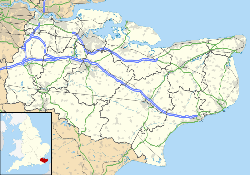
1143:
1108:
963:
953:
813:
783:
728:
678:
1118:
1113:
1038:
1033:
928:
833:
818:
778:
753:
663:
211:
Administrative borders and coastline data from
Boundary-Line product.
1078:
1003:
998:
788:
773:
576:
Click on a date/time to view the file as it appeared at that time.
287:
Contains
Ordnance Survey data © Crown copyright and database right
978:
938:
873:
683:
1193:
1123:
1103:
1098:
968:
823:
763:
87:(SVG file, nominally 1,425 × 1,000 pixels, file size: 2.11 MB)
1308:
903:
738:
144:
1218:
1288:
923:
627:
1403:
1348:
1318:
1443:
1428:
1423:
1413:
1408:
1338:
1203:
190:
93:
1208:
1448:
1393:
1368:
1358:
1293:
1268:
1238:
1453:
1378:
1373:
1363:
1278:
1398:
1388:
1353:
1298:
638:
1433:
1383:
1313:
1283:
1198:
1159:
574:
517:
Creative
Commons Attribution-ShareAlike 3.0 Unported
491:
Creative
Commons Attribution-ShareAlike 3.0 Unported
117:
Commons is a freely licensed media file repository.
1438:
1418:
1343:
1328:
1323:
214:All other geographic data from Meridian 2 product.
1273:
333:https://creativecommons.org/licenses/by-sa/3.0
98:
339:Creative Commons Attribution-Share Alike 3.0
257:
242:
186:
135:
352:
231:
196:
14:
388:Lage von Kent in dem Vereinigtes Königreich
299:– to copy, distribute and transmit the work
147:, UK with the following information shown:
46:Size of this PNG preview of this SVG file:
1259:Πρότυπο:Location map Ηνωμένο Βασίλειο Κεντ
1229:Plantilya:Location map United Kingdom Kent
1161:The following other wikis use this file:
1304:Plantilla:Mapa de localización de Kent
1249:Nodyn:Location map United Kingdom Kent
380:Location of Kent in the United Kingdom
1169:قالب:Location map United Kingdom Kent
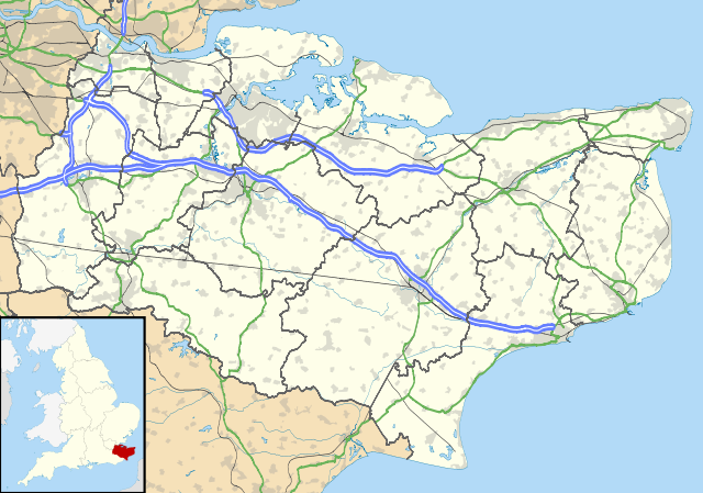
357:File:Kent UK district map (blank).svg
129:
280:Attribution-Share Alike 3.0 Unported
238:, created using Ordnance Survey data
567:
268:
263:
13:
1471:
626:{{Information |Description=Map of
393:
387:
379:
254:
130:
80:
1505:
1478:
392:
370:
310:Under the following conditions:
275:This file is licensed under the
267:
262:
256:
97:
31:
21:
367:
1156:
571:
366:
26:
1:
1184:Шаблон:ПК Великобритания Кент
36:
914:Little Kit's Coty House
635:
408:Items portrayed in this file
7:
1468:
1225:Usage on ceb.wikipedia.org
154:Coastline, lakes and rivers
10:
1510:
1334:East Malling and Larkfield
1265:Usage on es.wikipedia.org
1255:Usage on el.wikipedia.org
1245:Usage on cy.wikipedia.org
1235:Usage on cs.wikipedia.org
1215:Usage on ca.wikipedia.org
1190:Usage on br.wikipedia.org
1180:Usage on bg.wikipedia.org
1165:Usage on ar.wikipedia.org
1059:Sissinghurst Castle Garden
669:Bedgebury National Pinetum
324:same or compatible license
132:
568:
16:
919:Lullingstone Roman Villa
724:Dartford railway station
604:18:58, 26 September 2010
369:
290:
219:England location map.svg
138:Kent UK location map.svg
104:This is a file from the
41:
625:
189:
108:. Information from its
1174:تل دفن الكستناء الطويل
1074:Smythe's Megalith
151:Administrative borders
111:description page there
1134:White Cliffs of Dover
1019:Royal Tunbridge Wells
899:Kit's Coty House
699:Chestnuts Long Barrow
654:Admiralty Pier Turret
649:Addington Long Barrow
74:1,425 × 1,000 pixels
70:2,560 × 1,796 pixels
1194:Emgann Aegelesthrep
1084:St Nicholas-at-Wade
1009:Rochester Cathedral
804:Garrison Point Fort
714:Coldrum Long Barrow
305:– to adapt the work
217:Inset derived from
167:Geographic limits:
52:Other resolutions:
157:Roads and railways
66:1,280 × 898 pixels
62:1,024 × 719 pixels
1497:
1496:
1463:more global usage
1157:Global file usage
1139:White Horse Stone
949:Minster-in-Thanet
719:Dartford Crossing
633:
556:26 September 2010
501:copyright license
487:copyright license
386:
378:
363:
362:
251:
248:Reusing this file
191:26 September 2010
126:
125:
106:Wikimedia Commons
32:Global file usage
1501:
1479:
1309:Addington (Kent)
944:Medway Megaliths
889:Kingsdown, Dover
809:Gillingham, Kent
769:Edenbridge, Kent
694:Chatham Dockyard
616:
578:
457:copyright status
443:copyright status
384:
376:
346:
343:
340:
337:
334:
326:as the original.
288:
277:Creative Commons
271:
270:
266:
265:
260:
259:
245:
192:
139:
133:
122:
101:
100:
94:
88:
77:
58:640 × 449 pixels
54:320 × 225 pixels
48:800 × 561 pixels
1509:
1508:
1504:
1503:
1502:
1500:
1499:
1498:
1467:
1219:Shoreham (Kent)
1155:
1049:Shornemead Fort
1024:Sandgate Castle
959:New Tavern Fort
934:Manston Airport
894:Kit's Coty
884:Isle of Sheppey
864:Hougham Battery
634:
622:
614:
570:
569:
566:
565:
564:
563:
562:
561:
560:
559:
557:
547:
546:
545:
543:
528:
527:
526:
525:
524:
523:
522:
521:
519:
507:
506:
505:
503:
484:
483:
482:
481:
480:
479:
478:
477:
475:
463:
462:
461:
459:
440:
439:
438:
437:
436:
435:
434:
433:
431:
419:
418:
417:
415:
391:
390:
389:
382:
381:
364:
348:
347:
344:
341:
338:
335:
332:
331:
289:
286:
283:
272:
202:Ordnance Survey
137:
128:
127:
116:
115:
114:is shown below.
90:
86:
79:
78:
51:
12:
11:
5:
1507:
1495:
1494:
1491:
1487:
1486:
1483:
1470:
1465:of this file.
1459:
1458:
1457:
1456:
1451:
1446:
1441:
1436:
1431:
1426:
1421:
1416:
1411:
1406:
1401:
1396:
1391:
1386:
1381:
1376:
1371:
1366:
1361:
1356:
1351:
1346:
1341:
1336:
1331:
1326:
1321:
1316:
1311:
1306:
1301:
1296:
1291:
1289:Ashford (Kent)
1286:
1281:
1276:
1271:
1263:
1262:
1261:
1253:
1252:
1251:
1243:
1242:
1241:
1233:
1232:
1231:
1223:
1222:
1221:
1213:
1212:
1211:
1206:
1201:
1196:
1188:
1187:
1186:
1178:
1177:
1176:
1171:
1158:
1153:to this file.
1147:
1146:
1141:
1136:
1131:
1126:
1121:
1116:
1111:
1106:
1101:
1096:
1091:
1089:Stansted, Kent
1086:
1081:
1076:
1071:
1066:
1061:
1056:
1051:
1046:
1044:Shoreham, Kent
1041:
1036:
1031:
1029:Sandwich, Kent
1026:
1021:
1016:
1011:
1006:
1001:
996:
991:
986:
981:
976:
971:
966:
961:
956:
951:
946:
941:
936:
931:
926:
921:
916:
911:
906:
901:
896:
891:
886:
881:
876:
871:
866:
861:
856:
851:
846:
841:
836:
831:
826:
821:
816:
811:
806:
801:
796:
791:
786:
781:
776:
771:
766:
761:
756:
751:
746:
741:
736:
731:
726:
721:
716:
711:
706:
701:
696:
691:
686:
681:
676:
671:
666:
661:
656:
651:
644:is available.
637:
632:
631:
624:
620:
617:
613:1,425 × 1,000
611:
606:
601:
597:
596:
593:
590:
587:
584:
581:
573:
558:
555:
553:
552:
551:
549:
548:
544:
539:
537:
536:
535:
534:
532:
520:
515:
513:
512:
511:
509:
508:
504:
499:
497:
496:
495:
494:
492:
488:
476:
471:
469:
468:
467:
465:
464:
460:
455:
453:
452:
451:
450:
448:
444:
432:
427:
425:
424:
423:
421:
420:
416:
411:
409:
406:
405:
404:
403:
401:
397:
383:
375:
374:
371:
368:
361:
360:
354:
353:Other versions
350:
349:
330:
329:
328:
327:
317:
308:
307:
306:
300:
293:You are free:
284:
274:
273:
255:
252:
240:
239:
233:
229:
228:
227:
226:
215:
212:
198:
194:
193:
188:
184:
183:
182:
181:
178:
175:
172:
162:
161:
158:
155:
152:
140:
131:
124:
123:
102:
92:
91:
45:
40:
39:
34:
29:
24:
19:
9:
6:
4:
3:
2:
1506:
1492:
1489:
1488:
1484:
1481:
1480:
1477:
1474:
1466:
1464:
1455:
1452:
1450:
1447:
1445:
1442:
1440:
1437:
1435:
1432:
1430:
1427:
1425:
1422:
1420:
1417:
1415:
1412:
1410:
1407:
1405:
1404:Trottiscliffe
1402:
1400:
1397:
1395:
1392:
1390:
1387:
1385:
1382:
1380:
1377:
1375:
1372:
1370:
1367:
1365:
1362:
1360:
1357:
1355:
1352:
1350:
1349:Hildenborough
1347:
1345:
1342:
1340:
1337:
1335:
1332:
1330:
1327:
1325:
1322:
1320:
1319:Borough Green
1317:
1315:
1312:
1310:
1307:
1305:
1302:
1300:
1297:
1295:
1292:
1290:
1287:
1285:
1282:
1280:
1277:
1275:
1272:
1270:
1267:
1266:
1264:
1260:
1257:
1256:
1254:
1250:
1247:
1246:
1244:
1240:
1237:
1236:
1234:
1230:
1227:
1226:
1224:
1220:
1217:
1216:
1214:
1210:
1207:
1205:
1202:
1200:
1197:
1195:
1192:
1191:
1189:
1185:
1182:
1181:
1179:
1175:
1172:
1170:
1167:
1166:
1164:
1163:
1162:
1154:
1152:
1145:
1142:
1140:
1137:
1135:
1132:
1130:
1129:Walmer Castle
1127:
1125:
1122:
1120:
1117:
1115:
1112:
1110:
1107:
1105:
1102:
1100:
1097:
1095:
1092:
1090:
1087:
1085:
1082:
1080:
1077:
1075:
1072:
1070:
1067:
1065:
1064:Sittingbourne
1062:
1060:
1057:
1055:
1052:
1050:
1047:
1045:
1042:
1040:
1037:
1035:
1032:
1030:
1027:
1025:
1022:
1020:
1017:
1015:
1012:
1010:
1007:
1005:
1002:
1000:
997:
995:
994:Rainham, Kent
992:
990:
987:
985:
982:
980:
977:
975:
972:
970:
967:
965:
962:
960:
957:
955:
952:
950:
947:
945:
942:
940:
937:
935:
932:
930:
927:
925:
922:
920:
917:
915:
912:
910:
907:
905:
902:
900:
897:
895:
892:
890:
887:
885:
882:
880:
879:Isle of Grain
877:
875:
872:
870:
867:
865:
862:
860:
859:Hoo Peninsula
857:
855:
854:Hildenborough
852:
850:
847:
845:
842:
840:
837:
835:
832:
830:
829:Hadlow Castle
827:
825:
822:
820:
817:
815:
812:
810:
807:
805:
802:
800:
797:
795:
792:
790:
787:
785:
782:
780:
777:
775:
772:
770:
767:
765:
762:
760:
757:
755:
752:
750:
747:
745:
742:
740:
737:
735:
732:
730:
727:
725:
722:
720:
717:
715:
712:
710:
707:
705:
702:
700:
697:
695:
692:
690:
689:Chatham, Kent
687:
685:
682:
680:
677:
675:
672:
670:
667:
665:
662:
660:
659:Ashford, Kent
657:
655:
652:
650:
647:
646:
645:
643:
629:
623:
618:
612:
610:
607:
605:
602:
599:
598:
594:
591:
588:
585:
582:
580:
579:
577:
554:
542:
538:
518:
514:
502:
498:
474:
470:
458:
454:
430:
426:
414:
410:
407:
372:
365:
358:
355:
351:
336:CC BY-SA 3.0
325:
321:
318:
315:
312:
311:
309:
304:
301:
298:
295:
294:
292:
291:
285:Attribution:
281:
278:
261:
253:
249:
244:
241:
237:
234:
230:
224:
220:
216:
213:
210:
209:
208:
206:
203:
199:
195:
185:
180:South: 50.88N
179:
177:North: 51.52N
176:
173:
170:
169:
168:
165:
159:
156:
153:
150:
149:
148:
146:
141:
134:
120:
113:
112:
107:
103:
96:
95:
89:
84:
83:Original file
75:
71:
67:
63:
59:
55:
49:
44:
38:
35:
33:
30:
28:
25:
23:
20:
18:
15:
1475:
1472:
1460:
1444:Capel (Kent)
1429:West Peckham
1424:Platt (Kent)
1414:Wateringbury
1409:West Malling
1339:East Peckham
1204:Dover (Kent)
1160:
1148:
1054:Sissinghurst
1014:Romney Marsh
984:Queenborough
974:Paddock Wood
909:Leeds Castle
849:Higham, Kent
844:High Halstow
839:Hever Castle
799:Fort Borstal
794:Fort Amherst
759:East Langdon
744:Dover Castle
709:Coffin Stone
704:Cobham, Kent
639:
575:
572:File history
319:
313:
302:
296:
200:
166:
163:
142:
119:You can help
109:
81:
22:File history
1209:Deal (Kent)
1094:Stone, Kent
1069:Slough Fort
989:RAF Manston
869:Hythe, Kent
749:Drellingore
734:Deal Castle
674:Broadstairs
473:copyrighted
447:copyrighted
359:- Blank map
320:share alike
314:attribution
174:East: 1.47E
171:West: 0.01E
160:Urban areas
136:Description
1449:Speldhurst
1394:Shipbourne
1369:Kings Hill
1359:Bidborough
1294:Eastchurch
1269:Canterbury
1239:Greenhithe
1151:more links
1144:Whitstable
1109:Swanscombe
964:Northfleet
954:New Romney
814:Grain Fort
784:Folkestone
729:Deal, Kent
679:Canterbury
636:File usage
589:Dimensions
243:Permission
27:File usage
1454:Hawkhurst
1379:Leybourne
1374:Mereworth
1364:Brenchley
1279:Maidstone
1119:Tonbridge
1114:Tenterden
1039:Sheerness
1034:Sevenoaks
929:Maidstone
834:Herne Bay
819:Gravesend
779:Faversham
754:Dungeness
664:Aylesford
642:full list
621:Nilfanion
615:(2.11 MB)
586:Thumbnail
583:Date/Time
541:inception
531:inception
236:Nilfanion
1469:Metadata
1399:Wouldham
1389:Snodland
1354:Benenden
1299:Dartford
1079:Snodland
1004:Reculver
999:Ramsgate
789:Fordwich
774:Eythorne
373:Captions
303:to remix
297:to share
282:license.
223:Spischot
205:OpenData
37:Metadata
1434:Plaxtol
1384:Ightham
1314:Birling
1284:Margate
1199:Sheppey
979:Pembury
939:Margate
874:Ightham
684:Charing
600:current
595:Comment
413:depicts
396:depicts
377:English
143:Map of
85:
1490:Height
1439:Ryarsh
1419:Offham
1344:Hadlow
1329:Ditton
1324:Burham
1124:Walmer
1104:Sturry
1099:Strood
969:Otford
824:Hadlow
764:Eastry
385:German
232:Author
197:Source
1482:Width
1461:View
1149:View
904:Knole
739:Dover
1493:1000
1485:1425
1274:Lydd
924:Lydd
628:Kent
592:User
429:Kent
400:Kent
345:true
342:true
187:Date
145:Kent
17:File
221:by
207:.
72:|
68:|
64:|
60:|
56:|
50:.
250:)
246:(
225:.
121:.
76:.

.svg)