833:"}},"text\/plain":{"en":{"":"coordinates of the point of view"}}},"{\"value\":{\"latitude\":51.869675,\"longitude\":-4.050985,\"altitude\":null,\"precision\":1.0e-6,\"globe\":\"http:\\\/\\\/www.wikidata.org\\\/entity\\\/Q2\"},\"type\":\"globecoordinate\"}":{"text\/html":{"en":{"P1259":"51\u00b052'10.830"N, 4\u00b03'3.546"W"}},"text\/plain":{"en":{"P1259":"51\u00b052'10.830\"N, 4\u00b03'3.546\"W"}}},"{\"value\":{\"entity-type\":\"property\",\"numeric-id\":7787,\"id\":\"P7787\"},\"type\":\"wikibase-entityid\"}":{"text\/html":{"en":{"":"
43:
493:"}},"text\/plain":{"en":{"":"author name string"}}},"{\"value\":\"Ben Brooksbank\",\"type\":\"string\"}":{"text\/html":{"en":{"P2093":"Ben Brooksbank"}},"text\/plain":{"en":{"P2093":"Ben Brooksbank"}}},"{\"value\":{\"entity-type\":\"property\",\"numeric-id\":2699,\"id\":\"P2699\"},\"type\":\"wikibase-entityid\"}":{"text\/html":{"en":{"":"
795:"}},"text\/plain":{"en":{"":"inception"}}},"{\"value\":{\"time\":\"+1993-06-01T00:00:00Z\",\"timezone\":0,\"before\":0,\"after\":0,\"precision\":11,\"calendarmodel\":\"http:\\\/\\\/www.wikidata.org\\\/entity\\\/Q1985727\"},\"type\":\"time\"}":{"text\/html":{"en":{"P571":"1 June 1993"}},"text\/plain":{"en":{"P571":"1 June 1993"}}}}": -->
672:
278:
829:
292:
313:
351:
356:
99:
680:"}},"text\/plain":{"en":{"P7482":"file available on the internet"}}},"{\"value\":{\"entity-type\":\"property\",\"numeric-id\":137,\"id\":\"P137\"},\"type\":\"wikibase-entityid\"}":{"text\/html":{"en":{"":"
688:"}},"text\/plain":{"en":{"P137":"Geograph Britain and Ireland"}}},"{\"value\":{\"entity-type\":\"property\",\"numeric-id\":7384,\"id\":\"P7384\"},\"type\":\"wikibase-entityid\"}":{"text\/html":{"en":{"":"
485:"}},"text\/plain":{"en":{"":"object of statement has role"}}},"{\"value\":{\"entity-type\":\"item\",\"numeric-id\":33231,\"id\":\"Q33231\"},\"type\":\"wikibase-entityid\"}":{"text\/html":{"en":{"P3831":"
632:"}},"text\/plain":{"en":{"":"copyright license"}}},"{\"value\":{\"entity-type\":\"item\",\"numeric-id\":19068220,\"id\":\"Q19068220\"},\"type\":\"wikibase-entityid\"}":{"text\/html":{"en":{"P275":"
588:"}},"text\/plain":{"en":{"":"copyright status"}}},"{\"value\":{\"entity-type\":\"item\",\"numeric-id\":50423863,\"id\":\"Q50423863\"},\"type\":\"wikibase-entityid\"}":{"text\/html":{"en":{"P6216":"
676:"}},"text\/plain":{"en":{"":"source of file"}}},"{\"value\":{\"entity-type\":\"item\",\"numeric-id\":74228490,\"id\":\"Q74228490\"},\"type\":\"wikibase-entityid\"}":{"text\/html":{"en":{"P7482":"
489:"}},"text\/plain":{"en":{"P3831":"photographer"}}},"{\"value\":{\"entity-type\":\"property\",\"numeric-id\":2093,\"id\":\"P2093\"},\"type\":\"wikibase-entityid\"}":{"text\/html":{"en":{"":"
837:"}},"text\/plain":{"en":{"":"heading"}}},"{\"value\":{\"amount\":\"+180\",\"unit\":\"http:\\\/\\\/www.wikidata.org\\\/entity\\\/Q28390\"},\"type\":\"quantity\"}":{"text\/html":{"en":{"P7787":"180
684:"}},"text\/plain":{"en":{"":"operator"}}},"{\"value\":{\"entity-type\":\"item\",\"numeric-id\":1503119,\"id\":\"Q1503119\"},\"type\":\"wikibase-entityid\"}":{"text\/html":{"en":{"P137":"
696:"}},"text\/plain":{"en":{"P7384":"3565441"}}},"{\"value\":{\"entity-type\":\"property\",\"numeric-id\":973,\"id\":\"P973\"},\"type\":\"wikibase-entityid\"}":{"text\/html":{"en":{"":"
481:"}},"text\/plain":{"en":{"":"creator"}}},"{\"value\":{\"entity-type\":\"property\",\"numeric-id\":3831,\"id\":\"P3831\"},\"type\":\"wikibase-entityid\"}":{"text\/html":{"en":{"":"
939:
584:
403:– You must give appropriate credit, provide a link to the license, and indicate if changes were made. You may do so in any reasonable manner, but not in any way that suggests the licensor endorses you or your use.
275:
65:
61:
57:
53:
47:
693:
677:
633:
589:
110:
685:
78:
486:
834:
830:
689:
673:
585:
494:
490:
482:
701:
498:
792:
697:
681:
629:
478:
157:
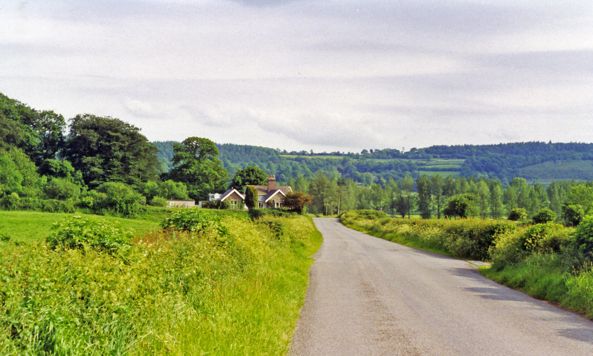
View southward from Cilsan Bridge, towards former level-crossing over ex-LNWR branch
Llandilo (to left) - (to right) Carmarthen, closed 9/9/63.
636:"}},"text\/plain":{"en":{"P275":"Creative Commons Attribution-ShareAlike 2.0 Generic"}}}}": -->
501:"}},"text\/plain":{"en":{"P2699":"https:\/\/www.geograph.org.uk\/profile\/44502"}}}}": -->
198:
704:"}},"text\/plain":{"en":{"P973":"https:\/\/www.geograph.org.uk\/photo\/3565441"}}}}": -->
727:
659:
615:
285:
747:
320:
1116:
This file contains additional information, probably added from the digital camera or scanner used to create or digitize it.
1152:
410:
542:
875:
848:
755:
711:
599:
563:
550:
535:
802:
770:
740:
643:
508:
467:
938:
933:
69:
42:
366:
1119:
If the file has been modified from its original state, some details may not fully reflect the modified file.
1068:
409:– If you remix, transform, or build upon the material, you must distribute your contributions under the
327:
on the
Geograph website for the photographer's contact details. The copyright on this image is owned by
592:"}},"text\/plain":{"en":{"P6216":"copyrighted"}}}}": -->
841:"}},"text\/plain":{"en":{"P7787":"180 degree"}}}}": -->
118:
230:
777:
762:
570:
363:
214:
8:
307:
291:
332:
105:
457:
1013:
1033:
187:
177:
858:
812:
721:
653:
609:
518:
1167:
949:
312:
970:
324:
906:
Click on a date/time to view the file as it appeared at that time.
277:
1103:
262:
51° 52′ 10.83″ N, 4° 03′ 03.55″ W
166:
93:
998:
1083:
1073:
1069:
Utente:BohemianRhapsody/Lista delle comunità del Galles
1058:
1048:
1038:
1023:
1008:
988:
451:
Add a one-line explanation of what this file represents
83:(2,392 × 1,437 pixels, file size: 3.05 MB, MIME type:
1093:
964:
979:
904:
205:
Creative
Commons Attribution Share-alike license 2.0
117:
Commons is a freely licensed media file repository.
660:
Creative
Commons Attribution-ShareAlike 2.0 Generic
634:
Creative
Commons Attribution-ShareAlike 2.0 Generic
143:Llangathen geograph-3565441-by-Ben-Brooksbank.jpg
154:Approaching site of Golden Grove station, 1993.
420:https://creativecommons.org/licenses/by-sa/2.0
245:Approaching site of Golden Grove station, 1993
226:Approaching site of Golden Grove station, 1993
98:
702:https:\/\/www.geograph.org.uk\/photo\/3565441
499:https:\/\/www.geograph.org.uk\/profile\/44502
426:Creative Commons Attribution-Share Alike 2.0
344:
193:
162:
140:
183:
172:
14:
838:
386:– to copy, distribute and transmit the work
981:The following other wikis use this file:
778:https://www.geograph.org.uk/photo/3565441
571:https://www.geograph.org.uk/profile/44502
1014:Defnyddiwr:Prosiect Wici Mon/Cymunedau
284:View this and other nearby images on:
237:
129:
1153:Adobe Photoshop Elements 3.0 Windows
331:and is licensed for reuse under the
252:
966:The following page uses this file:
897:
367:Attribution-Share Alike 2.0 Generic
355:
350:
335:Attribution-ShareAlike 2.0 license.
13:
1114:
1100:Usage on zh-min-nan.wikipedia.org
456:
450:
341:
318:
147:
130:
76:
1216:
1121:
455:
849:coordinates of the point of view
831:coordinates of the point of view
441:
397:Under the following conditions:
362:This file is licensed under the
354:
349:
343:
311:
290:
276:
268:
97:
31:
21:
1201:Date metadata was last modified
438:
148:
976:
901:
728:file available on the internet
678:file available on the internet
437:
319:This image was taken from the
26:
1:
1034:Utilisateur:Ælfgar/Brouillon7
36:
961:
748:Geograph Britain and Ireland
686:Geograph Britain and Ireland
536:object of statement has role
483:object of statement has role
463:Items portrayed in this file
303:
267:
7:
1193:Date and time of digitizing
1111:
995:Usage on ceb.wikipedia.org
864:51°52'10.830"N, 4°3'3.546"W
243:Ben Brooksbank /
224:Ben Brooksbank /
10:
1221:
1090:Usage on www.wikidata.org
1080:Usage on kw.wikipedia.org
1065:Usage on it.wikipedia.org
1055:Usage on gd.wikipedia.org
1045:Usage on ga.wikipedia.org
1030:Usage on fr.wikipedia.org
1020:Usage on eu.wikipedia.org
1005:Usage on cy.wikipedia.org
985:Usage on br.wikipedia.org
411:same or compatible license
137:
132:
1159:File change date and time
898:
16:
756:geograph.org.uk image ID
690:geograph.org.uk image ID
440:
377:
104:This is a file from the
41:
955:
215:required by the license
165:
108:. Information from its
325:this photograph's page
296:51.869675; -4.050985
111:description page there
46:Size of this preview:
1133:Horizontal resolution
934:09:13, 10 August 2013
70:2,392 × 1,437 pixels
1204:11:20, 22 July 2013
1196:11:19, 22 July 2013
1162:11:20, 22 July 2013
1141:Vertical resolution
392:– to adapt the work
52:Other resolutions:
551:author name string
491:author name string
66:1,280 × 769 pixels
62:1,024 × 615 pixels
1208:
1207:
977:Global file usage
959:
840:
644:copyright license
630:copyright license
449:
340:
339:
323:collection. See
301:
300:
250:
249:
218:
202:
199:Reusing this file
126:
125:
106:Wikimedia Commons
32:Global file usage
1212:
1122:
946:
908:
886:
885:
880:
780:
775:
771:described at URL
765:
760:
750:
745:
698:described at URL
600:copyright status
586:copyright status
573:
568:
558:
555:
545:
540:
447:
433:
430:
427:
424:
421:
413:as the original.
375:
364:Creative Commons
358:
357:
353:
352:
347:
346:
333:Creative Commons
321:Geograph project
315:
308:
297:
294:
280:
279:
273:
272:
271:
265:
264:
253:
212:
196:
168:
152:
144:
138:
122:
101:
100:
94:
88:
86:
73:
58:640 × 384 pixels
54:320 × 192 pixels
48:800 × 481 pixels
1220:
1219:
1215:
1214:
1213:
1211:
1210:
1209:
1110:
975:
960:
952:
944:
900:
899:
896:
895:
894:
893:
892:
891:
890:
889:
888:
887:
883:
881:
878:
869:
868:
867:
865:
855:
854:
853:
851:
828:
827:
826:
825:
824:
823:
822:
821:
819:
809:
808:
807:
805:
790:
789:
788:
787:
786:
785:
784:
783:
782:
781:
776:
773:
767:
766:
761:
758:
752:
751:
746:
743:
734:
733:
732:
730:
718:
717:
716:
714:
671:
670:
669:
668:
667:
666:
665:
664:
662:
650:
649:
648:
646:
627:
626:
625:
624:
623:
622:
621:
620:
618:
606:
605:
604:
602:
583:
582:
581:
580:
579:
578:
577:
576:
575:
574:
569:
566:
560:
559:
556:
553:
547:
546:
541:
538:
529:
528:
527:
525:
515:
514:
513:
511:
476:
475:
474:
473:
472:
470:
454:
453:
452:
435:
434:
431:
428:
425:
422:
419:
418:
376:
373:
370:
359:
336:
306:
295:
269:
260:
259:
256:Camera location
251:
240:
233:
221:
178:geograph.org.uk
158:
142:
135:
128:
127:
116:
115:
114:is shown below.
90:
84:
82:
75:
74:
51:
12:
11:
5:
1218:
1206:
1205:
1202:
1198:
1197:
1194:
1190:
1189:
1186:
1182:
1181:
1178:
1174:
1173:
1170:
1164:
1163:
1160:
1156:
1155:
1150:
1146:
1145:
1142:
1138:
1137:
1134:
1130:
1129:
1126:
1113:
1109:
1108:
1107:
1106:
1098:
1097:
1096:
1088:
1087:
1086:
1078:
1077:
1076:
1071:
1063:
1062:
1061:
1053:
1052:
1051:
1043:
1042:
1041:
1036:
1028:
1027:
1026:
1018:
1017:
1016:
1011:
1003:
1002:
1001:
993:
992:
991:
978:
974:
973:
963:
958:
957:
954:
950:
947:
943:2,392 × 1,437
941:
936:
931:
927:
926:
923:
920:
917:
914:
911:
903:
874:
873:
872:
871:
870:
866:
863:
861:
860:
859:
857:
856:
852:
847:
845:
844:
843:
842:
836:
832:
820:
817:
815:
814:
813:
811:
810:
806:
801:
799:
798:
797:
796:
794:
769:
768:
754:
753:
739:
738:
737:
736:
735:
731:
726:
724:
723:
722:
720:
719:
715:
712:source of file
710:
708:
707:
706:
705:
703:
699:
695:
691:
687:
683:
679:
675:
674:source of file
663:
658:
656:
655:
654:
652:
651:
647:
642:
640:
639:
638:
637:
635:
631:
619:
614:
612:
611:
610:
608:
607:
603:
598:
596:
595:
594:
593:
591:
587:
562:
561:
557:Ben Brooksbank
549:
548:
534:
533:
532:
531:
530:
526:
523:
521:
520:
519:
517:
516:
512:
507:
505:
504:
503:
502:
500:
496:
492:
488:
484:
480:
471:
466:
464:
461:
460:
459:
458:
446:
445:
442:
439:
417:
416:
415:
414:
404:
395:
394:
393:
387:
380:You are free:
374:Ben Brooksbank
371:
361:
360:
342:
338:
337:
329:Ben Brooksbank
316:
305:
302:
299:
298:
288:
282:
257:
248:
247:
241:
238:
235:
234:
229:
222:
219:
207:
206:
203:
191:
190:
188:Ben Brooksbank
185:
181:
180:
174:
170:
169:
164:
160:
159:
145:
136:
134:
131:
124:
123:
102:
92:
91:
45:
40:
39:
34:
29:
24:
19:
9:
6:
4:
3:
2:
1217:
1203:
1200:
1199:
1195:
1192:
1191:
1187:
1184:
1183:
1179:
1176:
1175:
1171:
1169:
1166:
1165:
1161:
1158:
1157:
1154:
1151:
1149:Software used
1148:
1147:
1143:
1140:
1139:
1135:
1132:
1131:
1127:
1124:
1123:
1120:
1117:
1105:
1102:
1101:
1099:
1095:
1092:
1091:
1089:
1085:
1082:
1081:
1079:
1075:
1072:
1070:
1067:
1066:
1064:
1060:
1057:
1056:
1054:
1050:
1047:
1046:
1044:
1040:
1037:
1035:
1032:
1031:
1029:
1025:
1022:
1021:
1019:
1015:
1012:
1010:
1007:
1006:
1004:
1000:
997:
996:
994:
990:
987:
986:
984:
983:
982:
972:
969:
968:
967:
953:
948:
942:
940:
937:
935:
932:
929:
928:
924:
921:
918:
915:
912:
910:
909:
907:
877:
862:
850:
846:
816:
804:
800:
779:
772:
764:
757:
749:
742:
729:
725:
713:
709:
661:
657:
645:
641:
617:
613:
601:
597:
572:
565:
552:
544:
537:
522:
510:
506:
469:
465:
462:
443:
436:
423:CC BY-SA 2.0
412:
408:
405:
402:
399:
398:
396:
391:
388:
385:
382:
381:
379:
378:
372:Attribution:
368:
365:
348:
334:
330:
326:
322:
317:
314:
310:
309:
293:
289:
287:
286:OpenStreetMap
283:
281:
263:
258:
255:
254:
246:
242:
236:
232:
228: /
227:
223:
216:
211:
209:
208:
204:
200:
195:
192:
189:
186:
182:
179:
175:
171:
161:
156:
155:
151:
146:
139:
120:
113:
112:
107:
103:
96:
95:
89:
80:
79:Original file
71:
67:
63:
59:
55:
49:
44:
38:
35:
33:
30:
28:
25:
23:
20:
18:
15:
1185:Image height
1118:
1115:
980:
965:
905:
902:File history
543:photographer
487:photographer
406:
400:
389:
383:
328:
266:
244:
231:CC BY-SA 2.0
225:
153:
149:
119:You can help
109:
77:
22:File history
1177:Image width
1168:Color space
1125:Orientation
818:1 June 1993
616:copyrighted
590:copyrighted
407:share alike
401:attribution
210:Attribution
167:1 June 1993
141:Description
1104:Llangathen
1084:Llangathen
1074:Llangathen
1059:Llangathen
1049:Llangathen
1039:Llangathen
1024:Llangathen
1009:Llangathen
999:Llangathen
989:Llangathen
971:Llangathen
962:File usage
919:Dimensions
524:some value
194:Permission
85:image/jpeg
27:File usage
945:(3.05 MB)
916:Thumbnail
913:Date/Time
803:inception
793:inception
304:Licensing
239:InfoField
220:InfoField
150:English:
1188:1,437 px
1180:2,392 px
1112:Metadata
1094:Q6661441
741:operator
682:operator
444:Captions
390:to remix
384:to share
369:license.
37:Metadata
1144:157 dpc
1136:157 dpc
930:current
925:Comment
876:heading
835:heading
763:3565441
694:3565441
509:creator
479:creator
468:depicts
448:English
133:Summary
81:
1128:Normal
951:Chevin
884:degree
839:degree
274:
184:Author
173:Source
176:From
1172:sRGB
922:User
882:180
432:true
429:true
163:Date
17:File
564:URL
495:URL
879::
774::
759::
744::
567::
554::
539::
68:|
64:|
60:|
56:|
50:.
217:)
213:(
201:)
197:(
121:.
87:)
72:.
Text is available under the Creative Commons Attribution-ShareAlike License. Additional terms may apply.
