542:"}},"text\/plain":{"en":{"":"inception"}}},"{\"value\":{\"time\":\"+2017-10-25T00:00:00Z\",\"timezone\":0,\"before\":0,\"after\":0,\"precision\":11,\"calendarmodel\":\"http:\\\/\\\/www.wikidata.org\\\/entity\\\/Q1985727\"},\"type\":\"time\"}":{"text\/html":{"en":{"P571":"25 October 2017"}},"text\/plain":{"en":{"P571":"25 October 2017"}}}}": -->
259:
38:
265:
270:
94:
498:"}},"text\/plain":{"en":{"":"copyright license"}}},"{\"value\":{\"entity-type\":\"item\",\"numeric-id\":19068220,\"id\":\"Q19068220\"},\"type\":\"wikibase-entityid\"}":{"text\/html":{"en":{"P275":"
454:"}},"text\/plain":{"en":{"":"copyright status"}}},"{\"value\":{\"entity-type\":\"item\",\"numeric-id\":50423863,\"id\":\"Q50423863\"},\"type\":\"wikibase-entityid\"}":{"text\/html":{"en":{"P6216":"
450:
648:
618:
311:– You must give appropriate credit, provide a link to the license, and indicate if changes were made. You may do so in any reasonable manner, but not in any way that suggests the licensor endorses you or your use.
370:
499:
455:
451:
539:
495:
754:
502:"}},"text\/plain":{"en":{"P275":"Creative Commons Attribution-ShareAlike 2.0 Generic"}}}}": -->
749:
243:
525:
481:
822:
60:
318:
56:
52:
48:
42:
105:
465:
73:
549:
509:
440:
647:
642:
280:
719:
369:
744:
709:
317:– If you remix, transform, or build upon the material, you must distribute your contributions under the
679:
458:"}},"text\/plain":{"en":{"P6216":"copyrighted"}}}}": -->
739:
724:
734:
113:
729:
699:
832:
812:
797:
277:
204:
This map may be incomplete, and may contain errors. Don't rely solely on it for navigation.
689:
8:
827:
807:
792:
714:
684:
617:
612:
64:
37:
704:
251:
100:
430:
393:
772:
694:
199:
559:
519:
475:
658:
628:
148:
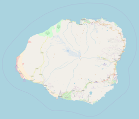
Location map for Kauai, exported from OpenStreetMap (standard layer)
585:
Click on a date/time to view the file as it appeared at that time.
222:
157:
88:
424:
Add a one-line explanation of what this file represents
402:
If inappropriate please set warp_status = skip to hide.
673:
78:(1,904 × 1,637 pixels, file size: 467 KB, MIME type:
763:
583:
112:
Commons is a freely licensed media file repository.
526:
Creative
Commons Attribution-ShareAlike 2.0 Generic
500:
Creative
Commons Attribution-ShareAlike 2.0 Generic
388:
254:Attribution-ShareAlike 2.0 license (CC-BY-SA 2.0).
250:OpenStreetMap data and maps are licensed under the
352:
833:Module:Location map/data/United States Kauai/doc
813:Module:Location map/data/United States Kauai/doc
798:Module:Location map/data/United States Kauai/doc
755:Module:Location map/data/United States Kauai/doc
328:https://creativecommons.org/licenses/by-sa/2.0
93:
334:Creative Commons Attribution-Share Alike 2.0
258:
238:
210:
190:
153:
135:
828:Module:Location map/data/United States Kauai
808:Module:Location map/data/United States Kauai
793:Module:Location map/data/United States Kauai
750:Module:Location map/data/United States Kauai
228:
218:
171:
163:
14:
294:– to copy, distribute and transmit the work
202:project data, collected by the community.
187:
765:The following other wikis use this file:
396:Georeference the map in Wikimaps Warper
675:The following 16 pages use this file:
124:
665:User created page with UploadWizard
635:Updated with closer view of island.
576:
281:Attribution-Share Alike 2.0 Generic
269:
264:
198:This map of Kauai was created from
13:
783:നാ പലി കോസ്റ്റ് സ്റ്റേറ്റ് പാർക്ക്
429:
423:
255:
142:
125:
71:
846:
428:
414:
368:
305:Under the following conditions:
276:This file is licensed under the
268:
263:
257:
92:
31:
21:
411:
143:
760:
580:
410:
26:
1:
720:Princeville Botanical Gardens
394:
773:Modèle:Géolocalisation/Kauai
670:
436:Items portrayed in this file
182:
7:
10:
851:
819:Usage on zh.wikipedia.org
804:Usage on uz.wikipedia.org
789:Usage on si.wikipedia.org
779:Usage on ml.wikipedia.org
769:Usage on fr.wikipedia.org
680:Grove Farm (Lihue, Hawaii)
356:
319:same or compatible license
233:OpenStreetMap contributors
132:
127:
577:
379:
359:
347:
16:
745:Waiʻoli Mission District
740:Waimea Canyon State Park
710:Nā Pali Coast State Park
413:
285:
99:This is a file from the
36:
735:Wailua River State Park
664:
634:
156:
103:. Information from its
730:Russian Fort Elizabeth
643:15:23, 25 October 2017
613:17:31, 25 October 2017
348: Geotemporal data
193:Location Map Kauai.png
138:Location Map Kauai.png
106:description page there
41:Size of this preview:
65:1,904 × 1,637 pixels
61:1,191 × 1,024 pixels
715:Polihale State Park
300:– to adapt the work
47:Other resolutions:
214:(see file history)
761:Global file usage
700:Kōkeʻe State Park
690:Haʻena State Park
668:
510:copyright license
496:copyright license
422:
407:
406:
403:
384:
383:
247:
244:Reusing this file
223:openstreetmap.org
205:
179:
178:
121:
120:
101:Wikimedia Commons
32:Global file usage
842:
725:Puʻuʻōpae Bridge
655:
625:
587:
466:copyright status
452:copyright status
420:
401:
400:
398:
397:
372:
357:
341:
338:
335:
332:
329:
321:as the original.
278:Creative Commons
272:
271:
267:
266:
261:
260:
252:Creative Commons
241:
203:
194:
188:
175:OSM contributors
159:
147:
139:
133:
117:
96:
95:
89:
83:
81:
68:
57:893 × 768 pixels
53:558 × 480 pixels
49:279 × 240 pixels
43:697 × 599 pixels
850:
849:
845:
844:
843:
841:
840:
839:
759:
669:
661:
653:
631:
623:
579:
578:
575:
574:
573:
572:
571:
570:
569:
568:
566:
565:25 October 2017
556:
555:
554:
552:
537:
536:
535:
534:
533:
532:
531:
530:
528:
516:
515:
514:
512:
493:
492:
491:
490:
489:
488:
487:
486:
484:
472:
471:
470:
468:
449:
448:
447:
446:
445:
443:
427:
426:
425:
408:
395:
392:
343:
342:
339:
336:
333:
330:
327:
326:
284:
273:
234:
206:
192:
185:
180:
158:25 October 2017
149:
137:
130:
123:
122:
111:
110:
109:is shown below.
85:
79:
77:
70:
69:
46:
12:
11:
5:
848:
838:
837:
836:
835:
830:
825:
817:
816:
815:
810:
802:
801:
800:
795:
787:
786:
785:
777:
776:
775:
762:
758:
757:
752:
747:
742:
737:
732:
727:
722:
717:
712:
707:
702:
697:
692:
687:
685:Hanapēpē River
682:
672:
667:
666:
663:
659:
656:
652:2,051 × 1,895
650:
645:
640:
637:
636:
633:
629:
626:
622:1,904 × 1,637
620:
615:
610:
606:
605:
602:
599:
596:
593:
590:
582:
567:
564:
562:
561:
560:
558:
557:
553:
548:
546:
545:
544:
543:
541:
529:
524:
522:
521:
520:
518:
517:
513:
508:
506:
505:
504:
503:
501:
497:
485:
480:
478:
477:
476:
474:
473:
469:
464:
462:
461:
460:
459:
457:
453:
444:
439:
437:
434:
433:
432:
431:
419:
418:
415:
412:
405:
404:
390:
389:Georeferencing
386:
385:
382:
381:
377:
376:
373:
366:
362:
361:
354:
350:
349:
345:
344:
325:
324:
323:
322:
312:
303:
302:
301:
295:
288:You are free:
275:
274:
256:
248:
236:
235:
232:
230:
226:
225:
220:
216:
215:
212:
208:
207:
197:
195:
186:
184:
181:
177:
176:
173:
169:
168:
165:
161:
160:
155:
151:
150:
140:
131:
129:
126:
119:
118:
97:
87:
86:
40:
35:
34:
29:
24:
19:
9:
6:
4:
3:
2:
847:
834:
831:
829:
826:
824:
821:
820:
818:
814:
811:
809:
806:
805:
803:
799:
796:
794:
791:
790:
788:
784:
781:
780:
778:
774:
771:
770:
768:
767:
766:
756:
753:
751:
748:
746:
743:
741:
738:
736:
733:
731:
728:
726:
723:
721:
718:
716:
713:
711:
708:
706:
703:
701:
698:
696:
695:Honopū Valley
693:
691:
688:
686:
683:
681:
678:
677:
676:
662:
657:
651:
649:
646:
644:
641:
639:
638:
632:
627:
621:
619:
616:
614:
611:
608:
607:
603:
600:
597:
594:
591:
589:
588:
586:
563:
551:
547:
527:
523:
511:
507:
483:
479:
467:
463:
442:
438:
435:
416:
409:
399:
391:
387:
378:
375:E: 159.2352°W
374:
371:
367:
365:W: 159.8579°W
364:
363:
358:
355:
351:
346:
331:CC BY-SA 2.0
320:
316:
313:
310:
307:
306:
304:
299:
296:
293:
290:
289:
287:
286:
282:
279:
262:
253:
249:
245:
240:
237:
231:
227:
224:
221:
217:
213:
209:
201:
200:OpenStreetMap
196:
189:
174:
170:
167:OpenStreetMap
166:
162:
152:
146:
141:
134:
115:
108:
107:
102:
98:
91:
90:
84:
75:
74:Original file
66:
62:
58:
54:
50:
44:
39:
33:
30:
28:
25:
23:
20:
18:
15:
764:
705:Kōʻula River
674:
584:
581:File history
380:S: 21.8086°N
353:Bounding box
314:
308:
297:
291:
144:
114:You can help
104:
72:
22:File history
482:copyrighted
456:copyrighted
360:N: 22.305°N
315:share alike
309:attribution
191:Description
136:Description
671:File usage
598:Dimensions
239:Permission
27:File usage
823:纳帕利海岸州立公园
595:Thumbnail
592:Date/Time
550:inception
540:inception
183:Licensing
145:English:
80:image/png
654:(454 KB)
624:(467 KB)
417:Captions
298:to remix
292:to share
283:license.
609:current
604:Comment
441:depicts
421:English
229:Creator
128:Summary
76:
660:Mliu92
630:Mliu92
219:Source
172:Author
164:Source
601:User
340:true
337:true
211:Date
154:Date
17:File
63:|
59:|
55:|
51:|
45:.
246:)
242:(
116:.
82:)
67:.
