644:"}},"text\/plain":{"en":{"":"inception"}}},"{\"value\":{\"time\":\"+2018-02-27T00:00:00Z\",\"timezone\":0,\"before\":0,\"after\":0,\"precision\":11,\"calendarmodel\":\"http:\\\/\\\/www.wikidata.org\\\/entity\\\/Q1985727\"},\"type\":\"time\"}":{"text\/html":{"en":{"P571":"27 February 2018"}},"text\/plain":{"en":{"P571":"27 February 2018"}}}}": -->
38:
405:
196:
411:
202:
416:
207:
583:"}},"text\/plain":{"en":{"P275":"Creative Commons Attribution-ShareAlike 4.0 International"}}},"{\"value\":{\"entity-type\":\"item\",\"numeric-id\":19068220,\"id\":\"Q19068220\"},\"type\":\"wikibase-entityid\"}":{"text\/html":{"en":{"P275":"
86:
579:"}},"text\/plain":{"en":{"":"copyright license"}}},"{\"value\":{\"entity-type\":\"item\",\"numeric-id\":18199165,\"id\":\"Q18199165\"},\"type\":\"wikibase-entityid\"}":{"text\/html":{"en":{"P275":"
535:"}},"text\/plain":{"en":{"":"copyright status"}}},"{\"value\":{\"entity-type\":\"item\",\"numeric-id\":50423863,\"id\":\"Q50423863\"},\"type\":\"wikibase-entityid\"}":{"text\/html":{"en":{"P6216":"
531:
457:– You must give appropriate credit, provide a link to the license, and indicate if changes were made. You may do so in any reasonable manner, but not in any way that suggests the licensor endorses you or your use.
248:– You must give appropriate credit, provide a link to the license, and indicate if changes were made. You may do so in any reasonable manner, but not in any way that suggests the licensor endorses you or your use.
307:
981:
1029:
584:
580:
536:
532:
641:
576:
776:
52:
48:
42:
97:
1011:
65:
791:
1006:
986:
916:
587:"}},"text\/plain":{"en":{"P275":"Creative Commons Attribution-ShareAlike 2.0 Generic"}}}}": -->
816:
180:
801:
766:
627:
610:
562:
856:
976:
966:
946:
464:
255:
991:
846:
546:
363:
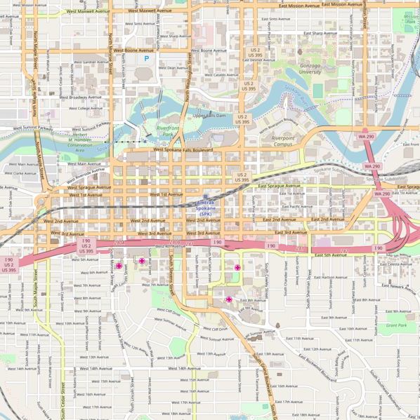
Riverfront area of
Spokane. Map extends 47.6721 (N edge), 47.6386 (S edge) & -117.4398 (W edge), -117.3900 (E edge)
911:
861:
651:
594:
521:
886:
891:
921:
896:
876:
786:
426:
217:
971:
761:
851:
771:
751:
306:
719:
714:
463:– If you remix, transform, or build upon the material, you must distribute your contributions under the
254:– If you remix, transform, or build upon the material, you must distribute your contributions under the
56:
37:
956:
941:
951:
841:
796:
539:"}},"text\/plain":{"en":{"P6216":"copyrighted"}}}}": -->
906:
781:
105:
1074:
1059:
931:
826:
1069:
1054:
423:
214:
141:
This map may be incomplete, and may contain errors. Don't rely solely on it for navigation.
8:
936:
871:
756:
961:
1079:
1044:
1039:
1001:
811:
188:
92:
511:
330:
806:
901:
836:
926:
866:
821:
136:
996:
982:
United States Post Office, Courthouse, and Custom House (Spokane, Washington)
661:
621:
604:
556:
831:
730:
881:
687:
Click on a date/time to view the file as it appeared at that time.
159:
611:
Creative
Commons Attribution-ShareAlike 4.0 International
581:
Creative
Commons Attribution-ShareAlike 4.0 International
372:
80:
505:
Add a one-line explanation of what this file represents
339:
If inappropriate please set warp_status = skip to hide.
777:
Cathedral of Our Lady of
Lourdes (Spokane, Washington)
745:
1020:
685:
104:
Commons is a freely licensed media file repository.
628:
Creative
Commons Attribution-ShareAlike 2.0 Generic
585:
Creative
Commons Attribution-ShareAlike 2.0 Generic
325:
191:Attribution-ShareAlike 2.0 license (CC-BY-SA 2.0).
187:OpenStreetMap data and maps are licensed under the
1075:Module:Location map/data/United States Spokane/doc
1060:Module:Location map/data/United States Spokane/doc
1012:Module:Location map/data/United States Spokane/doc
135:This map of Greater Spokane area was created from
289:
70:(988 × 990 pixels, file size: 790 KB, MIME type:
792:Christ the Redeemer Church (Spokane, Washington)
1070:Module:Location map/data/United States Spokane
1055:Module:Location map/data/United States Spokane
1007:Module:Location map/data/United States Spokane
987:West Downtown Historic Transportation Corridor
474:https://creativecommons.org/licenses/by-sa/4.0
265:https://creativecommons.org/licenses/by-sa/2.0
85:
917:Salvation Army Building (Spokane, Washington)
480:Creative Commons Attribution-Share Alike 4.0
404:
368:
350:
271:Creative Commons Attribution-Share Alike 2.0
195:
175:
147:
127:
386:
378:
165:
155:
14:
817:Empire State Building (Spokane, Washington)
440:– to copy, distribute and transmit the work
231:– to copy, distribute and transmit the work
139:project data, collected by the community.
124:
1080:Empire State Building Spokane, Washington
1022:The following other wikis use this file:
802:Desmet Avenue Warehouse Historic District
767:Bump Block-Bellevue House-Hawthorne Hotel
427:Attribution-Share Alike 4.0 International
333:Georeference the map in Wikimaps Warper
857:Marycliff-Cliff Park Historic District
747:The following 53 pages use this file:
353:Location Map United States Spokane.png
130:Location Map United States Spokane.png
977:The Globe Hotel (Spokane, Washington)
967:Spokane Public Library - Heath Branch
947:Spokane Club Building-Legion Building
116:
992:Westminster United Church of Christ
847:Knickerbocker (Spokane, Washington)
737:User created page with UploadWizard
678:
415:
410:
218:Attribution-Share Alike 2.0 Generic
206:
201:
13:
912:Riverside Avenue Historic District
862:Miller Block (Spokane, Washington)
510:
504:
401:
357:
192:
117:
63:
1093:
887:Peaceful Valley Historic District
509:
892:Peyton Building and Peyton Annex
495:
451:Under the following conditions:
422:This file is licensed under the
414:
409:
403:
305:
242:Under the following conditions:
213:This file is licensed under the
205:
200:
194:
84:
31:
21:
922:San Marco (Spokane, Washington)
897:Post Street Electric Substation
492:
358:
1045:Modèle:Géolocalisation/Spokane
1040:Exposition spécialisée de 1974
1017:
877:Ninth Avenue Historic District
787:Chinatown, Spokane, Washington
682:
491:
26:
1:
972:Spokane Public Library - Main
762:Breslin (Spokane, Washington)
331:
742:
517:Items portrayed in this file
397:
7:
852:Lewis and Clark High School
772:Cambern Dutch Shop Windmill
752:Amman (Spokane, Washington)
10:
1098:
1066:Usage on uz.wikipedia.org
1051:Usage on si.wikipedia.org
1036:Usage on fr.wikipedia.org
1026:Usage on bn.wikipedia.org
957:Spokane Fire Station No. 3
942:Spokane City Hall Building
842:Kemp & Hebert Building
465:same or compatible license
390:OpenStreetMap contributors
347:
293:
256:same or compatible license
170:OpenStreetMap contributors
119:
952:Spokane County Courthouse
679:
316:
296:
284:
16:
907:Riverfront Park Carousel
782:Central Steam Heat Plant
494:
431:
222:
91:This is a file from the
36:
736:
715:16:55, 27 February 2018
371:
95:. Information from its
285: Geotemporal data
98:description page there
41:Size of this preview:
932:Seehorn-Lang Building
827:Holley-Mason Building
797:Coolidge–Rising House
937:Spokane, Washington
872:Moore-Turner Garden
757:Benewah Milk Bottle
446:– to adapt the work
237:– to adapt the work
47:Other resolutions:
1030:স্পোকেন, ওয়াশিংটন
962:Spokane Flour Mill
151:(see file history)
1018:Global file usage
1002:User:SpokaneWilly
812:Eldridge Building
740:
595:copyright license
577:copyright license
503:
394:
393:
344:
343:
340:
321:
320:
184:
181:Reusing this file
160:openstreetmap.org
142:
113:
112:
93:Wikimedia Commons
32:Global file usage
1089:
807:Downtown Spokane
727:
689:
667:27 February 2018
547:copyright status
533:copyright status
501:
487:
484:
481:
478:
475:
467:as the original.
424:Creative Commons
418:
417:
413:
412:
407:
406:
374:
373:27 February 2018
362:
354:
348:
338:
337:
335:
334:
309:
294:
278:
275:
272:
269:
266:
258:as the original.
215:Creative Commons
209:
208:
204:
203:
198:
197:
189:Creative Commons
178:
140:
131:
125:
109:
88:
87:
81:
75:
73:
60:
57:988 × 990 pixels
53:479 × 480 pixels
49:240 × 240 pixels
43:598 × 599 pixels
1097:
1096:
1092:
1091:
1090:
1088:
1087:
1086:
1016:
902:Review Building
837:Hutton Building
741:
733:
725:
681:
680:
677:
676:
675:
674:
673:
672:
671:
670:
668:
658:
657:
656:
654:
639:
638:
637:
636:
635:
634:
633:
632:
630:
619:
618:
617:
616:
615:
613:
601:
600:
599:
597:
574:
573:
572:
571:
570:
569:
568:
567:
565:
553:
552:
551:
549:
530:
529:
528:
527:
526:
524:
508:
507:
506:
489:
488:
485:
482:
479:
476:
473:
472:
430:
419:
400:
395:
364:
352:
345:
332:
329:
280:
279:
276:
273:
270:
267:
264:
263:
221:
210:
171:
143:
129:
122:
115:
114:
103:
102:
101:is shown below.
77:
71:
69:
62:
61:
46:
12:
11:
5:
1095:
1085:
1084:
1083:
1082:
1077:
1072:
1064:
1063:
1062:
1057:
1049:
1048:
1047:
1042:
1034:
1033:
1032:
1019:
1015:
1014:
1009:
1004:
999:
994:
989:
984:
979:
974:
969:
964:
959:
954:
949:
944:
939:
934:
929:
927:Schade Brewery
924:
919:
914:
909:
904:
899:
894:
889:
884:
879:
874:
869:
867:Montvale Hotel
864:
859:
854:
849:
844:
839:
834:
829:
824:
822:Glover Mansion
819:
814:
809:
804:
799:
794:
789:
784:
779:
774:
769:
764:
759:
754:
744:
739:
738:
735:
731:
728:
722:
717:
712:
708:
707:
704:
701:
698:
695:
692:
684:
669:
666:
664:
663:
662:
660:
659:
655:
650:
648:
647:
646:
645:
643:
631:
626:
624:
623:
622:
620:
614:
609:
607:
606:
605:
603:
602:
598:
593:
591:
590:
589:
588:
586:
582:
578:
566:
561:
559:
558:
557:
555:
554:
550:
545:
543:
542:
541:
540:
538:
534:
525:
520:
518:
515:
514:
513:
512:
500:
499:
496:
493:
471:
470:
469:
468:
458:
449:
448:
447:
441:
434:You are free:
421:
420:
402:
399:
396:
392:
391:
388:
384:
383:
380:
376:
375:
370:
366:
365:
355:
346:
342:
341:
327:
326:Georeferencing
323:
322:
319:
318:
314:
313:
310:
303:
299:
298:
291:
287:
286:
282:
281:
262:
261:
260:
259:
249:
240:
239:
238:
232:
225:You are free:
212:
211:
193:
185:
173:
172:
169:
167:
163:
162:
157:
153:
152:
149:
145:
144:
134:
132:
123:
121:
118:
111:
110:
89:
79:
78:
40:
35:
34:
29:
24:
19:
9:
6:
4:
3:
2:
1094:
1081:
1078:
1076:
1073:
1071:
1068:
1067:
1065:
1061:
1058:
1056:
1053:
1052:
1050:
1046:
1043:
1041:
1038:
1037:
1035:
1031:
1028:
1027:
1025:
1024:
1023:
1013:
1010:
1008:
1005:
1003:
1000:
998:
997:Whitten Block
995:
993:
990:
988:
985:
983:
980:
978:
975:
973:
970:
968:
965:
963:
960:
958:
955:
953:
950:
948:
945:
943:
940:
938:
935:
933:
930:
928:
925:
923:
920:
918:
915:
913:
910:
908:
905:
903:
900:
898:
895:
893:
890:
888:
885:
883:
880:
878:
875:
873:
870:
868:
865:
863:
860:
858:
855:
853:
850:
848:
845:
843:
840:
838:
835:
833:
830:
828:
825:
823:
820:
818:
815:
813:
810:
808:
805:
803:
800:
798:
795:
793:
790:
788:
785:
783:
780:
778:
775:
773:
770:
768:
765:
763:
760:
758:
755:
753:
750:
749:
748:
734:
729:
723:
721:
718:
716:
713:
710:
709:
705:
702:
699:
696:
693:
691:
690:
688:
665:
653:
649:
629:
625:
612:
608:
596:
592:
564:
560:
548:
544:
523:
519:
516:
497:
490:
477:CC BY-SA 4.0
466:
462:
459:
456:
453:
452:
450:
445:
442:
439:
436:
435:
433:
432:
428:
425:
408:
389:
385:
382:OpenStreetMap
381:
377:
367:
361:
356:
349:
336:
328:
324:
315:
311:
308:
304:
302:W: 117.4398°W
301:
300:
295:
292:
288:
283:
268:CC BY-SA 2.0
257:
253:
250:
247:
244:
243:
241:
236:
233:
230:
227:
226:
224:
223:
219:
216:
199:
190:
186:
182:
177:
174:
168:
164:
161:
158:
154:
150:
146:
138:
137:OpenStreetMap
133:
126:
107:
100:
99:
94:
90:
83:
82:
76:
67:
66:Original file
58:
54:
50:
44:
39:
33:
30:
28:
25:
23:
20:
18:
15:
1021:
746:
686:
683:File history
460:
454:
443:
437:
359:
317:S: 47.6386°N
297:N: 47.6721°N
290:Bounding box
251:
245:
234:
228:
106:You can help
96:
64:
22:File history
832:Hotel Upton
563:copyrighted
537:copyrighted
461:share alike
455:attribution
351:Description
312:E: 117.39°W
252:share alike
246:attribution
128:Description
882:Otis Hotel
743:File usage
724:988 × 990
700:Dimensions
176:Permission
27:File usage
697:Thumbnail
694:Date/Time
652:inception
642:inception
398:Licensing
360:English:
72:image/png
726:(790 KB)
498:Captions
444:to remix
438:to share
429:license.
235:to remix
229:to share
220:license.
711:current
706:Comment
522:depicts
502:English
166:Creator
120:Summary
68:
732:Mliu92
387:Author
379:Source
156:Source
703:User
486:true
483:true
369:Date
277:true
274:true
148:Date
17:File
55:|
51:|
45:.
183:)
179:(
108:.
74:)
59:.
