679:"}},"text\/plain":{"en":{"":"coordinates of the point of view"}}},"{\"value\":{\"latitude\":59.03386,\"longitude\":-3.2216,\"altitude\":null,\"precision\":1.0e-5,\"globe\":\"http:\\\/\\\/www.wikidata.org\\\/entity\\\/Q2\"},\"type\":\"globecoordinate\"}":{"text\/html":{"en":{"P1259":"59\u00b02'1.90"N, 3\u00b013'17.76"W"}},"text\/plain":{"en":{"P1259":"59\u00b02'1.90\"N, 3\u00b013'17.76\"W"}}},"{\"value\":{\"entity-type\":\"property\",\"numeric-id\":7787,\"id\":\"P7787\"},\"type\":\"wikibase-entityid\"}":{"text\/html":{"en":{"":"
904:"}},"text\/plain":{"en":{"":"coordinates of depicted place"}}},"{\"value\":{\"latitude\":59.03107,\"longitude\":-3.2219,\"altitude\":null,\"precision\":1.0e-5,\"globe\":\"http:\\\/\\\/www.wikidata.org\\\/entity\\\/Q2\"},\"type\":\"globecoordinate\"}":{"text\/html":{"en":{"P9149":"59\u00b01'51.85"N, 3\u00b013'18.84"W"}},"text\/plain":{"en":{"P9149":"59\u00b01'51.85\"N, 3\u00b013'18.84\"W"}}},"{\"value\":{\"entity-type\":\"property\",\"numeric-id\":7787,\"id\":\"P7787\"},\"type\":\"wikibase-entityid\"}":{"text\/html":{"en":{"":"
488:"}},"text\/plain":{"en":{"":"author name string"}}},"{\"value\":\"Ian Balcombe\",\"type\":\"string\"}":{"text\/html":{"en":{"P2093":"Ian Balcombe"}},"text\/plain":{"en":{"P2093":"Ian Balcombe"}}},"{\"value\":{\"entity-type\":\"property\",\"numeric-id\":3831,\"id\":\"P3831\"},\"type\":\"wikibase-entityid\"}":{"text\/html":{"en":{"":"
747:"}},"text\/plain":{"en":{"":"inception"}}},"{\"value\":{\"time\":\"+2008-12-18T00:00:00Z\",\"timezone\":0,\"before\":0,\"after\":0,\"precision\":11,\"calendarmodel\":\"http:\\\/\\\/www.wikidata.org\\\/entity\\\/Q1985727\"},\"type\":\"time\"}":{"text\/html":{"en":{"P571":"18 December 2008"}},"text\/plain":{"en":{"P571":"18 December 2008"}}}}": -->
781:
281:
231:
900:
223:
295:
245:
316:
354:
359:
72:
789:"}},"text\/plain":{"en":{"P7482":"file available on the internet"}}},"{\"value\":{\"entity-type\":\"property\",\"numeric-id\":7384,\"id\":\"P7384\"},\"type\":\"wikibase-entityid\"}":{"text\/html":{"en":{"":"
492:"}},"text\/plain":{"en":{"":"object of statement has role"}}},"{\"value\":{\"entity-type\":\"item\",\"numeric-id\":33231,\"id\":\"Q33231\"},\"type\":\"wikibase-entityid\"}":{"text\/html":{"en":{"P3831":"
805:"}},"text\/plain":{"en":{"P137":"Geograph Britain and Ireland"}}},"{\"value\":{\"entity-type\":\"property\",\"numeric-id\":973,\"id\":\"P973\"},\"type\":\"wikibase-entityid\"}":{"text\/html":{"en":{"":"
635:"}},"text\/plain":{"en":{"":"copyright license"}}},"{\"value\":{\"entity-type\":\"item\",\"numeric-id\":19068220,\"id\":\"Q19068220\"},\"type\":\"wikibase-entityid\"}":{"text\/html":{"en":{"P275":"
591:"}},"text\/plain":{"en":{"":"copyright status"}}},"{\"value\":{\"entity-type\":\"item\",\"numeric-id\":50423863,\"id\":\"Q50423863\"},\"type\":\"wikibase-entityid\"}":{"text\/html":{"en":{"P6216":"
785:"}},"text\/plain":{"en":{"":"source of file"}}},"{\"value\":{\"entity-type\":\"item\",\"numeric-id\":74228490,\"id\":\"Q74228490\"},\"type\":\"wikibase-entityid\"}":{"text\/html":{"en":{"P7482":"
496:"}},"text\/plain":{"en":{"P3831":"photographer"}}},"{\"value\":{\"entity-type\":\"property\",\"numeric-id\":2699,\"id\":\"P2699\"},\"type\":\"wikibase-entityid\"}":{"text\/html":{"en":{"":"
801:"}},"text\/plain":{"en":{"":"operator"}}},"{\"value\":{\"entity-type\":\"item\",\"numeric-id\":1503119,\"id\":\"Q1503119\"},\"type\":\"wikibase-entityid\"}":{"text\/html":{"en":{"P137":"
908:"}},"text\/plain":{"en":{"":"heading"}}},"{\"value\":{\"amount\":\"+0\",\"unit\":\"http:\\\/\\\/www.wikidata.org\\\/entity\\\/Q28390\"},\"type\":\"quantity\"}":{"text\/html":{"en":{"P7787":"0
797:"}},"text\/plain":{"en":{"P7384":"1083736"}}},"{\"value\":{\"entity-type\":\"property\",\"numeric-id\":137,\"id\":\"P137\"},\"type\":\"wikibase-entityid\"}":{"text\/html":{"en":{"":"
683:"}},"text\/plain":{"en":{"":"heading"}}},"{\"value\":{\"amount\":\"+0\",\"unit\":\"http:\\\/\\\/www.wikidata.org\\\/entity\\\/Q28390\"},\"type\":\"quantity\"}":{"text\/html":{"en":{"P7787":"0
484:"}},"text\/plain":{"en":{"":"creator"}}},"{\"value\":{\"entity-type\":\"property\",\"numeric-id\":2093,\"id\":\"P2093\"},\"type\":\"wikibase-entityid\"}":{"text\/html":{"en":{"":"
587:
809:"}},"text\/plain":{"en":{"":"described at URL"}}},"{\"value\":\"https:\\\/\\\/www.geograph.org.uk\\\/photo\\\/1083736\",\"type\":\"string\"}":{"text\/html":{"en":{"P973":"
500:"}},"text\/plain":{"en":{"":"URL"}}},"{\"value\":\"https:\\\/\\\/www.geograph.org.uk\\\/profile\\\/5330\",\"type\":\"string\"}":{"text\/html":{"en":{"P2699":"
43:
793:"}},"text\/plain":{"en":{"":"geograph.org.uk image ID"}}},"{\"value\":\"1083736\",\"type\":\"string\"}":{"text\/html":{"en":{"P7384":"
264:
1027:== {{int:filedesc}} == {{Information |description={{en|1=Loch of Harray Looking southwards along the shoreline. Taken about 1.30 in the afternoon. Mind you, in June I could take the same photo at 1.30 in the morning... it might be a bit lighter then.}} |d
214:
406:– You must give appropriate credit, provide a link to the license, and indicate if changes were made. You may do so in any reasonable manner, but not in any way that suggests the licensor endorses you or your use.
278:
228:
126:
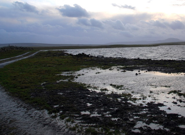
Loch of Harray
Looking southwards along the shoreline. Taken about 1.30 in the afternoon. Mind you, in June I could take the same photo at 1.30 in the morning... it might be a bit lighter then.
794:
786:
636:
592:
802:
493:
83:
905:
901:
790:
782:
680:
676:
588:
497:
489:
485:
51:
810:
806:
798:
744:
632:
501:
481:
1020:
639:"}},"text\/plain":{"en":{"P275":"Creative Commons Attribution-ShareAlike 2.0 Generic"}}}}": -->
813:"}},"text\/plain":{"en":{"P973":"https:\/\/www.geograph.org.uk\/photo\/1083736"}}}}": -->
504:"}},"text\/plain":{"en":{"P2699":"https:\/\/www.geograph.org.uk\/profile\/5330"}}}}": -->
836:
662:
618:
288:
238:
871:
323:
1072:
This file contains additional information, probably added from the digital camera or scanner used to create or digitize it.
413:
558:
946:
919:
849:
820:
721:
694:
602:
566:
551:
538:
879:
864:
754:
646:
511:
470:
1009:
1004:
42:
369:
1075:
If the file has been modified from its original state, some details may not fully reflect the modified file.
412:– If you remix, transform, or build upon the material, you must distribute your contributions under the
330:
on the
Geograph website for the photographer's contact details. The copyright on this image is owned by
595:"}},"text\/plain":{"en":{"P6216":"copyrighted"}}}}": -->
912:"}},"text\/plain":{"en":{"P7787":"0 degree"}}}}": -->
687:"}},"text\/plain":{"en":{"P7787":"0 degree"}}}}": -->
91:
183:
886:
856:
573:
366:
167:
8:
310:
294:
244:
335:
78:
460:
1041:
146:
156:
929:
830:
764:
704:
656:
612:
521:
315:
327:
977:
Click on a date/time to view the file as it appeared at that time.
280:
230:
1059:
265:
59° 01′ 52″ N, 3° 13′ 19″ W
215:
59° 02′ 02″ N, 3° 13′ 18″ W
135:
66:
454:
Add a one-line explanation of what this file represents
1035:
1050:
975:
90:
Commons is a freely licensed media file repository.
663:
Creative
Commons Attribution-ShareAlike 2.0 Generic
637:
Creative
Commons Attribution-ShareAlike 2.0 Generic
56:(640 × 470 pixels, file size: 77 KB, MIME type:
423:https://creativecommons.org/licenses/by-sa/2.0
116:Loch of Harray - geograph.org.uk - 1083736.jpg
71:
52:Loch_of_Harray_-_geograph.org.uk_-_1083736.jpg
811:https:\/\/www.geograph.org.uk\/photo\/1083736
429:Creative Commons Attribution-Share Alike 2.0
347:
131:
113:
502:https:\/\/www.geograph.org.uk\/profile\/5330
152:
141:
14:
909:
684:
389:– to copy, distribute and transmit the work
1052:The following other wikis use this file:
887:https://www.geograph.org.uk/photo/1083736
574:https://www.geograph.org.uk/profile/5330
287:View this and other nearby images on:
237:View this and other nearby images on:
190:
102:
334:and is licensed for reuse under the
255:
205:
1037:The following page uses this file:
968:
370:Attribution-Share Alike 2.0 Generic
358:
353:
338:Attribution-ShareAlike 2.0 license.
13:
1070:
459:
453:
344:
321:
120:
103:
49:
1096:
1077:
458:
695:coordinates of the point of view
677:coordinates of the point of view
444:
400:Under the following conditions:
365:This file is licensed under the
357:
352:
346:
314:
293:
279:
271:
243:
229:
221:
70:
31:
21:
441:
121:
46:No higher resolution available.
1047:
972:
837:file available on the internet
787:file available on the internet
440:
322:This image was taken from the
26:
1:
920:coordinates of depicted place
902:coordinates of depicted place
36:
1032:
872:Geograph Britain and Ireland
803:Geograph Britain and Ireland
552:object of statement has role
490:object of statement has role
466:Items portrayed in this file
306:
7:
1067:
10:
1101:
1056:Usage on fr.wikipedia.org
935:59°1'51.85"N, 3°13'18.84"W
414:same or compatible license
270:
220:
110:
105:
969:
710:59°2'1.90"N, 3°13'17.76"W
196:Ian Balcombe /
177:Ian Balcombe /
16:
850:geograph.org.uk image ID
791:geograph.org.uk image ID
443:
380:
77:This is a file from the
41:
1026:
1005:11:07, 24 February 2011
168:required by the license
134:
81:. Information from its
328:this photograph's page
299:59.031070; -3.221900
249:59.033860; -3.221600
84:description page there
395:– to adapt the work
539:author name string
486:author name string
1088:
1087:
1048:Global file usage
1030:
911:
686:
647:copyright license
633:copyright license
452:
343:
342:
326:collection. See
304:
303:
254:
253:
203:
202:
171:
99:
98:
79:Wikimedia Commons
32:Global file usage
1092:
1078:
1017:
979:
957:
956:
951:
889:
884:
880:described at URL
874:
869:
859:
854:
807:described at URL
770:18 December 2008
732:
731:
726:
603:copyright status
589:copyright status
576:
571:
561:
556:
546:
543:
450:
436:
433:
430:
427:
424:
416:as the original.
378:
367:Creative Commons
361:
360:
356:
355:
350:
349:
336:Creative Commons
324:Geograph project
318:
311:
300:
297:
283:
282:
276:
275:
274:
268:
267:
256:
250:
247:
233:
232:
226:
225:
224:
218:
217:
206:
165:
137:
136:18 December 2008
125:
117:
111:
95:
74:
73:
67:
61:
59:
1100:
1099:
1095:
1094:
1093:
1091:
1090:
1089:
1066:
1046:
1031:
1023:
1015:
971:
970:
967:
966:
965:
964:
963:
962:
961:
960:
959:
958:
954:
952:
949:
940:
939:
938:
936:
926:
925:
924:
922:
899:
898:
897:
896:
895:
894:
893:
892:
891:
890:
885:
882:
876:
875:
870:
867:
861:
860:
855:
852:
843:
842:
841:
839:
827:
826:
825:
823:
780:
779:
778:
777:
776:
775:
774:
773:
771:
761:
760:
759:
757:
742:
741:
740:
739:
738:
737:
736:
735:
734:
733:
729:
727:
724:
715:
714:
713:
711:
701:
700:
699:
697:
674:
673:
672:
671:
670:
669:
668:
667:
665:
653:
652:
651:
649:
630:
629:
628:
627:
626:
625:
624:
623:
621:
609:
608:
607:
605:
586:
585:
584:
583:
582:
581:
580:
579:
578:
577:
572:
569:
563:
562:
557:
554:
548:
547:
544:
541:
532:
531:
530:
528:
518:
517:
516:
514:
479:
478:
477:
476:
475:
473:
457:
456:
455:
438:
437:
434:
431:
428:
425:
422:
421:
379:
376:
373:
362:
339:
309:
298:
272:
263:
262:
259:Object location
248:
222:
213:
212:
209:Camera location
204:
193:
186:
174:
147:geograph.org.uk
127:
115:
108:
101:
100:
89:
88:
87:is shown below.
63:
57:
55:
48:
47:
12:
11:
5:
1098:
1086:
1085:
1082:
1069:
1065:
1064:
1063:
1062:
1060:Loch de Harray
1049:
1045:
1044:
1042:Loch of Harray
1034:
1029:
1028:
1025:
1021:
1018:
1012:
1007:
1002:
998:
997:
994:
991:
988:
985:
982:
974:
945:
944:
943:
942:
941:
937:
934:
932:
931:
930:
928:
927:
923:
918:
916:
915:
914:
913:
907:
903:
878:
877:
863:
862:
848:
847:
846:
845:
844:
840:
835:
833:
832:
831:
829:
828:
824:
821:source of file
819:
817:
816:
815:
814:
812:
808:
804:
800:
796:
792:
788:
784:
783:source of file
772:
769:
767:
766:
765:
763:
762:
758:
753:
751:
750:
749:
748:
746:
720:
719:
718:
717:
716:
712:
709:
707:
706:
705:
703:
702:
698:
693:
691:
690:
689:
688:
682:
678:
666:
661:
659:
658:
657:
655:
654:
650:
645:
643:
642:
641:
640:
638:
634:
622:
617:
615:
614:
613:
611:
610:
606:
601:
599:
598:
597:
596:
594:
590:
565:
564:
550:
549:
537:
536:
535:
534:
533:
529:
526:
524:
523:
522:
520:
519:
515:
510:
508:
507:
506:
505:
503:
499:
495:
491:
487:
483:
474:
469:
467:
464:
463:
462:
461:
449:
448:
445:
442:
420:
419:
418:
417:
407:
398:
397:
396:
390:
383:You are free:
374:
364:
363:
345:
341:
340:
319:
308:
305:
302:
301:
291:
285:
260:
252:
251:
241:
235:
210:
201:
200:
198:Loch of Harray
194:
191:
188:
187:
182:
179:Loch of Harray
175:
172:
160:
159:
154:
150:
149:
143:
139:
138:
133:
129:
128:
118:
109:
107:
104:
97:
96:
75:
65:
64:
45:
40:
39:
34:
29:
24:
19:
9:
6:
4:
3:
2:
1097:
1083:
1080:
1079:
1076:
1073:
1061:
1058:
1057:
1055:
1054:
1053:
1043:
1040:
1039:
1038:
1024:
1019:
1013:
1011:
1008:
1006:
1003:
1000:
999:
995:
992:
989:
986:
983:
981:
980:
978:
948:
933:
921:
917:
888:
881:
873:
866:
858:
851:
838:
834:
822:
818:
768:
756:
752:
723:
708:
696:
692:
664:
660:
648:
644:
620:
616:
604:
600:
575:
568:
560:
553:
540:
525:
513:
509:
472:
468:
465:
446:
439:
426:CC BY-SA 2.0
415:
411:
408:
405:
402:
401:
399:
394:
391:
388:
385:
384:
382:
381:
375:Attribution:
371:
368:
351:
337:
333:
329:
325:
320:
317:
313:
312:
296:
292:
290:
289:OpenStreetMap
286:
284:
266:
261:
258:
257:
246:
242:
240:
239:OpenStreetMap
236:
234:
216:
211:
208:
207:
199:
195:
189:
185:
181: /
180:
176:
169:
164:
162:
161:
158:
155:
151:
148:
144:
140:
130:
124:
119:
112:
93:
86:
85:
80:
76:
69:
68:
62:
53:
44:
38:
35:
33:
30:
28:
25:
23:
20:
18:
15:
1074:
1071:
1051:
1036:
976:
973:File history
559:photographer
545:Ian Balcombe
494:photographer
409:
403:
392:
386:
377:Ian Balcombe
332:Ian Balcombe
331:
269:
219:
197:
184:CC BY-SA 2.0
178:
157:Ian Balcombe
122:
92:You can help
82:
50:
22:File history
1022:GeographBot
619:copyrighted
593:copyrighted
410:share alike
404:attribution
163:Attribution
114:Description
1081:_error
1033:File usage
1014:640 × 470
990:Dimensions
527:some value
58:image/jpeg
27:File usage
987:Thumbnail
984:Date/Time
755:inception
745:inception
307:Licensing
192:InfoField
173:InfoField
123:English:
1068:Metadata
865:operator
799:operator
447:Captions
393:to remix
387:to share
372:license.
37:Metadata
1016:(77 KB)
1001:current
996:Comment
947:heading
906:heading
857:1083736
795:1083736
722:heading
681:heading
512:creator
482:creator
471:depicts
451:English
106:Summary
54:
955:degree
910:degree
730:degree
685:degree
277:
227:
153:Author
142:Source
145:From
993:User
435:true
432:true
132:Date
17:File
567:URL
498:URL
953:0
950::
883::
868::
853::
728:0
725::
570::
555::
542::
1084:0
170:)
166:(
94:.
60:)
Text is available under the Creative Commons Attribution-ShareAlike License. Additional terms may apply.
_heading:0.00&language=en)
_heading:0.00&language=en)
