788:"}},"text\/plain":{"en":{"":"coordinates of depicted place"}}},"{\"value\":{\"latitude\":43.978611,\"longitude\":-74.311667,\"altitude\":null,\"precision\":1.0e-6,\"globe\":\"http:\\\/\\\/www.wikidata.org\\\/entity\\\/Q2\"},\"type\":\"globecoordinate\"}":{"text\/html":{"en":{"P9149":"43\u00b058'43.000"N, 74\u00b018'42.001"W"}},"text\/plain":{"en":{"P9149":"43\u00b058'43.000\"N, 74\u00b018'42.001\"W"}}}}": -->
142:
750:"}},"text\/plain":{"en":{"":"inception"}}},"{\"value\":{\"time\":\"+2006-08-04T00:00:00Z\",\"timezone\":0,\"before\":0,\"after\":0,\"precision\":11,\"calendarmodel\":\"http:\\\/\\\/www.wikidata.org\\\/entity\\\/Q1985727\"},\"type\":\"time\"}":{"text\/html":{"en":{"P571":"4 August 2006"}},"text\/plain":{"en":{"P571":"4 August 2006"}}}}": -->
373:
291:
489:
326:
305:
379:
43:
99:
689:"}},"text\/plain":{"en":{"P275":"GNU Free Documentation License, version 1.2 or later"}}},"{\"value\":{\"entity-type\":\"item\",\"numeric-id\":14946043,\"id\":\"Q14946043\"},\"type\":\"wikibase-entityid\"}":{"text\/html":{"en":{"P275":"
384:
826:"}},"text\/plain":{"en":{"":"location of creation"}}},"{\"value\":{\"entity-type\":\"item\",\"numeric-id\":500569,\"id\":\"Q500569\"},\"type\":\"wikibase-entityid\"}":{"text\/html":{"en":{"P1071":"
685:"}},"text\/plain":{"en":{"":"copyright license"}}},"{\"value\":{\"entity-type\":\"item\",\"numeric-id\":50829104,\"id\":\"Q50829104\"},\"type\":\"wikibase-entityid\"}":{"text\/html":{"en":{"P275":"
641:"}},"text\/plain":{"en":{"":"copyright status"}}},"{\"value\":{\"entity-type\":\"item\",\"numeric-id\":50423863,\"id\":\"Q50423863\"},\"type\":\"wikibase-entityid\"}":{"text\/html":{"en":{"P6216":"
594:"}},"text\/plain":{"en":{"":"depicts"}}},"{\"value\":{\"entity-type\":\"item\",\"numeric-id\":357550,\"id\":\"Q357550\"},\"type\":\"wikibase-entityid\"}":{"text\/html":{"en":{"P180":"
822:
282:
432:– You must give appropriate credit, provide a link to the license, and indicate if changes were made. You may do so in any reasonable manner, but not in any way that suggests the licensor endorses you or your use.
288:
960:
955:
965:
918:
1098:
690:
686:
642:
827:
595:
823:
785:
638:
747:
682:
591:
506:
343:
1203:
1193:
993:
693:"}},"text\/plain":{"en":{"P275":"Creative Commons Attribution-ShareAlike 3.0 Unported"}}}}": -->
504:; with no Invariant Sections, no Front-Cover Texts, and no Back-Cover Texts. A copy of the license is included in the section entitled
341:; with no Invariant Sections, no Front-Cover Texts, and no Back-Cover Texts. A copy of the license is included in the section entitled
256:
733:
716:
668:
298:
65:
61:
57:
53:
47:
1173:
149:
110:
1261:
This file contains additional information, probably added from the digital camera or scanner used to create or digitize it.
1058:
853:
624:
439:
78:
195:
837:
795:
652:
930:
496:
333:
1088:
925:{{BotMoveToCommons|en.wikipedia}} {{Information |Description={{en|Long Pond, in the Saint Regis Canoe Area. Taken by
757:
700:
608:
199:
933:
264:
511:
393:
830:"}},"text\/plain":{"en":{"P1071":"St. Lawrence County"}}}}": -->
1264:
If the file has been modified from its original state, some details may not fully reflect the modified file.
1238:
501:
338:
598:"}},"text\/plain":{"en":{"P180":"Adirondack Park"}}}}": -->
438:– If you remix, transform, or build upon the material, you must distribute your contributions under the
1068:
645:"}},"text\/plain":{"en":{"P6216":"copyrighted"}}}}": -->
118:
970:
494:
Permission is granted to copy, distribute and/or modify this document under the terms of the
453:
331:
Permission is granted to copy, distribute and/or modify this document under the terms of the
390:
907:
902:
69:
42:
8:
975:
542:
488:
304:
158:
105:
480:
I, the copyright holder of this work, hereby publish it under the following license:
1248:
550:
240:
950:
1003:
560:
231:
189:
926:
961:
National
Register of Historic Places listings in Franklin County, New York
956:
National
Register of Historic Places listings in Clinton County, New York
847:
805:
767:
727:
710:
662:
618:
966:
National
Register of Historic Places listings in Warren County, New York
555:
Increased brightness for detail and fixed color. Reduced jpg file size.
1038:
565:
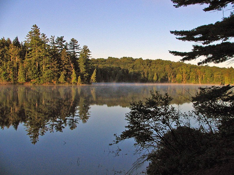
Long Pond, in the Saint Regis Canoe Area. Taken by ], 19 July, 2006.
1153:
483:
320:
1213:
1128:
1078:
1048:
1013:
875:
Click on a date/time to view the file as it appeared at that time.
1108:
290:
1028:
452:
This licensing tag was added to this file as part of the GFDL
148:
This is an image of a place or building that is listed on the
1143:
1118:
1073:
1008:
153:
1133:
1023:
283:
43° 58′ 43″ N, 74° 18′ 42″ W
93:
584:
Add a one-line explanation of what this file represents
1069:
Liste des parcs d'État de l'État de New York
944:
136:
83:(1,600 × 1,200 pixels, file size: 316 KB, MIME type:
1228:
1223:
984:
873:
734:
Creative
Commons Attribution-ShareAlike 3.0 Unported
717:
691:
Creative
Commons Attribution-ShareAlike 3.0 Unported
687:
500:, Version 1.2 or any later version published by the
337:, Version 1.2 or any later version published by the
117:
Commons is a freely licensed media file repository.
1183:
1163:
545:. All following user names refer to en.wikipedia.
263:GFDL-SELF-WITH-DISCLAIMERS; Released under the
459:http://creativecommons.org/licenses/by-sa/3.0/
98:
372:
251:
206:
173:
465:Creative Commons Attribution-Share Alike 3.0
225:
214:
14:
415:– to copy, distribute and transmit the work
244:
235:
219:
186:Long Pond, in the Saint Regis Canoe Area.
986:The following other wikis use this file:
536:
297:View this and other nearby images on:
946:The following 6 pages use this file:
931:en:Category:Hamilton County, New York
196:en:Category:Hamilton County, New York
129:
516:http://www.gnu.org/copyleft/fdl.html
394:Attribution-Share Alike 3.0 Unported
367:
349:http://www.gnu.org/copyleft/fdl.html
273:
210:4 August 2006 (original upload date)
150:National Register of Historic Places
934:en:Category:Images of New York City
866:
383:
378:
200:en:Category:Images of New York City
13:
1259:
1004:Geographie der Vereinigten Staaten
589:
583:
541:The original description page was
540:
479:
239:Later version(s) were uploaded by
180:
130:
76:
1285:
1266:
588:
574:
487:
426:Under the following conditions:
389:This file is licensed under the
382:
377:
371:
325:
324:
303:
289:
140:
97:
31:
21:
920:File Upload Bot (Magnus Manske)
571:
181:
981:
870:
811:43°58'43.000"N, 74°18'42.001"W
570:
522:GNU Free Documentation License
507:GNU Free Documentation License
497:GNU Free Documentation License
355:GNU Free Documentation License
344:GNU Free Documentation License
334:GNU Free Documentation License
265:GNU Free Documentation License
26:
1:
796:coordinates of depicted place
786:coordinates of depicted place
36:
941:
604:Items portrayed in this file
316:
7:
1256:
1245:Usage on zh.wikivoyage.org
1095:Usage on he.wikivoyage.org
1020:Usage on en.wikivoyage.org
563:1600×1200×8 (491057 bytes)
553:1600×1200×8 (323376 bytes)
10:
1290:
1235:Usage on zh.wikipedia.org
1220:Usage on www.wikidata.org
1210:Usage on uz.wikipedia.org
1200:Usage on uk.wikipedia.org
1190:Usage on tt.wikipedia.org
1180:Usage on sl.wikipedia.org
1170:Usage on ru.wikipedia.org
1160:Usage on pt.wikipedia.org
1150:Usage on pl.wikipedia.org
1140:Usage on no.wikipedia.org
1125:Usage on nl.wikipedia.org
1115:Usage on it.wikipedia.org
1105:Usage on ht.wikipedia.org
1085:Usage on he.wikipedia.org
1065:Usage on fr.wikipedia.org
1055:Usage on fa.wikipedia.org
1045:Usage on eu.wikipedia.org
1035:Usage on es.wikipedia.org
1000:Usage on de.wikipedia.org
990:Usage on ce.wikipedia.org
440:same or compatible license
170:
156:. Its reference number is
132:
867:
398:
370:
16:
1099:מדינות אזור המיד-אטלנטיק
1039:Santa Clara (Nueva York)
573:
502:Free Software Foundation
339:Free Software Foundation
176:Long Pond - St Regis.jpg
154:United States of America
104:This is a file from the
41:
1154:Santa Clara (Nowy Jork)
924:
209:
108:. Information from its
1214:Santa Clara (New York)
1204:Санта-Клара (Нью-Йорк)
1194:Санта-Клара (Нью-Йорк)
1129:Gebruiker:Heinonlein/2
1079:Santa Clara (New York)
1049:Santa Clara (New York)
1014:Santa Clara (New York)
994:Санта-Клара (Нью-Йорк)
309:43.978611; -74.311667
230:Original uploader was
111:description page there
46:Size of this preview:
1109:Santa Clara, New York
971:Santa Clara, New York
838:location of creation
824:location of creation
70:1,600 × 1,200 pixels
976:User:Mwanner/Photos
854:St. Lawrence County
828:St. Lawrence County
537:Original upload log
421:– to adapt the work
52:Other resolutions:
929:, 19 July, 2006.
903:00:37, 14 May 2008
66:1,280 × 960 pixels
62:1,024 × 768 pixels
1277:
1276:
982:Global file usage
939:
701:copyright license
683:copyright license
582:
559:2006-08-04 15:29
549:2008-04-09 11:31
533:
532:
476:
475:
366:
365:
314:
313:
271:
270:
260:
257:Reusing this file
218:Transferred from
192:, 19 July, 2006.
168:
167:
126:
125:
106:Wikimedia Commons
32:Global file usage
1281:
1267:
1174:Адирондак (парк)
1029:New York (state)
915:
877:
653:copyright status
639:copyright status
580:
529:
526:
523:
520:
517:
491:
484:
472:
469:
466:
463:
460:
457:
454:licensing update
442:as the original.
391:Creative Commons
386:
385:
381:
380:
375:
374:
368:
362:
359:
356:
353:
350:
328:
327:
321:
310:
307:
293:
292:
286:
285:
274:
254:
185:
177:
171:
161:
144:
143:
137:
122:
101:
100:
94:
88:
86:
73:
58:640 × 480 pixels
54:320 × 240 pixels
48:800 × 600 pixels
1289:
1288:
1284:
1283:
1282:
1280:
1279:
1278:
1255:
1144:Adirondack Park
1119:Adirondack Park
1074:Parc Adirondack
1009:Adirondack Park
980:
951:Adirondack Park
940:
936:}} |Source=Tran
927:en:User:Mwanner
921:
913:
869:
868:
865:
864:
863:
862:
861:
860:
859:
858:
856:
844:
843:
842:
840:
821:
820:
819:
818:
817:
816:
815:
814:
812:
802:
801:
800:
798:
783:
782:
781:
780:
779:
778:
777:
776:
774:
764:
763:
762:
760:
745:
744:
743:
742:
741:
740:
739:
738:
736:
725:
724:
723:
722:
721:
719:
707:
706:
705:
703:
680:
679:
678:
677:
676:
675:
674:
673:
671:
659:
658:
657:
655:
636:
635:
634:
633:
632:
631:
630:
629:
627:
625:Adirondack Park
615:
614:
613:
611:
596:Adirondack Park
587:
586:
585:
546:
539:
534:
527:
524:
521:
518:
515:
482:
481:
470:
467:
464:
461:
458:
451:
360:
357:
354:
351:
348:
319:
308:
281:
280:
277:Object location
272:
202:
190:en:User:Mwanner
175:
157:
141:
135:
128:
127:
116:
115:
114:is shown below.
90:
84:
82:
75:
74:
51:
12:
11:
5:
1287:
1275:
1274:
1271:
1258:
1254:
1253:
1252:
1251:
1243:
1242:
1241:
1233:
1232:
1231:
1226:
1218:
1217:
1216:
1208:
1207:
1206:
1198:
1197:
1196:
1188:
1187:
1186:
1178:
1177:
1176:
1168:
1167:
1166:
1158:
1157:
1156:
1148:
1147:
1146:
1138:
1137:
1136:
1134:Man and Nature
1131:
1123:
1122:
1121:
1113:
1112:
1111:
1103:
1102:
1101:
1093:
1092:
1091:
1083:
1082:
1081:
1076:
1071:
1063:
1062:
1061:
1059:پارک آدیرونداک
1053:
1052:
1051:
1043:
1042:
1041:
1033:
1032:
1031:
1026:
1018:
1017:
1016:
1011:
1006:
998:
997:
996:
983:
979:
978:
973:
968:
963:
958:
953:
943:
938:
937:
923:
919:
916:
912:1,600 × 1,200
910:
905:
900:
896:
895:
892:
889:
886:
883:
880:
872:
857:
852:
850:
849:
848:
846:
845:
841:
836:
834:
833:
832:
831:
829:
825:
813:
810:
808:
807:
806:
804:
803:
799:
794:
792:
791:
790:
789:
787:
775:
772:
770:
769:
768:
766:
765:
761:
756:
754:
753:
752:
751:
749:
737:
732:
730:
729:
728:
726:
720:
715:
713:
712:
711:
709:
708:
704:
699:
697:
696:
695:
694:
692:
688:
684:
672:
667:
665:
664:
663:
661:
660:
656:
651:
649:
648:
647:
646:
644:
640:
628:
623:
621:
620:
619:
617:
616:
612:
607:
605:
602:
601:
600:
599:
597:
593:
579:
578:
575:
572:
568:
567:
557:
538:
535:
531:
530:
492:
478:
477:
474:
473:
448:
447:
446:
445:
444:
443:
433:
424:
423:
422:
416:
409:You are free:
404:
403:
400:
399:
397:
387:
364:
363:
329:
318:
315:
312:
311:
301:
295:
278:
269:
268:
261:
249:
248:
227:
223:
222:
216:
212:
211:
208:
204:
203:
178:
169:
166:
165:
145:
134:
131:
124:
123:
102:
92:
91:
45:
40:
39:
34:
29:
24:
19:
9:
6:
4:
3:
2:
1286:
1272:
1269:
1268:
1265:
1262:
1250:
1247:
1246:
1244:
1240:
1237:
1236:
1234:
1230:
1227:
1225:
1222:
1221:
1219:
1215:
1212:
1211:
1209:
1205:
1202:
1201:
1199:
1195:
1192:
1191:
1189:
1185:
1182:
1181:
1179:
1175:
1172:
1171:
1169:
1165:
1162:
1161:
1159:
1155:
1152:
1151:
1149:
1145:
1142:
1141:
1139:
1135:
1132:
1130:
1127:
1126:
1124:
1120:
1117:
1116:
1114:
1110:
1107:
1106:
1104:
1100:
1097:
1096:
1094:
1090:
1089:פארק אדירונדק
1087:
1086:
1084:
1080:
1077:
1075:
1072:
1070:
1067:
1066:
1064:
1060:
1057:
1056:
1054:
1050:
1047:
1046:
1044:
1040:
1037:
1036:
1034:
1030:
1027:
1025:
1022:
1021:
1019:
1015:
1012:
1010:
1007:
1005:
1002:
1001:
999:
995:
992:
991:
989:
988:
987:
977:
974:
972:
969:
967:
964:
962:
959:
957:
954:
952:
949:
948:
947:
935:
932:
928:
922:
917:
911:
909:
906:
904:
901:
898:
897:
893:
890:
887:
884:
881:
879:
878:
876:
855:
851:
839:
835:
809:
797:
793:
773:4 August 2006
771:
759:
755:
735:
731:
718:
714:
702:
698:
670:
666:
654:
650:
626:
622:
610:
606:
603:
576:
569:
566:
562:
558:
556:
552:
548:
547:
544:
513:
510:. Subject to
509:
508:
503:
499:
498:
493:
490:
486:
485:
455:
450:
449:
441:
437:
434:
431:
428:
427:
425:
420:
417:
414:
411:
410:
408:
407:
406:
405:
402:
401:
395:
392:
388:
376:
369:
346:
345:
340:
336:
335:
330:
323:
322:
306:
302:
300:
299:OpenStreetMap
296:
294:
284:
279:
276:
275:
266:
262:
258:
253:
250:
246:
242:
238:
237:
233:
228:
224:
221:
217:
213:
205:
201:
198:
197:
193:
191:
184:
179:
172:
164:
163:
160:
155:
151:
146:
139:
138:
120:
113:
112:
107:
103:
96:
95:
89:
80:
79:Original file
71:
67:
63:
59:
55:
49:
44:
38:
35:
33:
30:
28:
25:
23:
20:
18:
15:
1263:
1260:
1024:Mid-Atlantic
985:
945:
874:
871:File history
564:
554:
505:
495:
462:CC BY-SA 3.0
435:
429:
418:
412:
342:
332:
245:en.wikipedia
236:en.wikipedia
229:
220:en.wikipedia
194:
187:
182:
147:
119:You can help
109:
77:
22:File history
669:copyrighted
643:copyrighted
512:disclaimers
436:share alike
430:attribution
174:Description
1270:_error
942:File usage
888:Dimensions
252:Permission
85:image/jpeg
27:File usage
885:Thumbnail
882:Date/Time
758:inception
748:inception
551:XcepticZP
396:license.
317:Licensing
241:XcepticZP
188:Taken by
183:English:
1257:Metadata
914:(316 KB)
577:Captions
419:to remix
413:to share
159:66000891
37:Metadata
1239:阿迪朗达克公园
1229:Q357550
1224:Q168198
899:current
894:Comment
609:depicts
592:depicts
581:English
561:Mwanner
232:Mwanner
152:in the
133:Summary
81:
1184:Ribnik
287:
226:Author
215:Source
1164:Lagoa
1249:中大西洋
891:User
543:here
528:true
525:true
519:GFDL
471:true
468:true
361:true
358:true
352:GFDL
207:Date
17:File
243:at
234:at
68:|
64:|
60:|
56:|
50:.
1273:0
514:.
456:.
347:.
267:.
259:)
255:(
247:.
162:.
121:.
87:)
72:.
Text is available under the Creative Commons Attribution-ShareAlike License. Additional terms may apply.
