760:"}},"text\/plain":{"en":{"":"coordinates of the point of view"}}},"{\"value\":{\"latitude\":51.406083,\"longitude\":-0.163843,\"altitude\":null,\"precision\":1.0e-6,\"globe\":\"http:\\\/\\\/www.wikidata.org\\\/entity\\\/Q2\"},\"type\":\"globecoordinate\"}":{"text\/html":{"en":{"P1259":"51\u00b024'21.899"N, 0\u00b09'49.835"W"}},"text\/plain":{"en":{"P1259":"51\u00b024'21.899\"N, 0\u00b09'49.835\"W"}}},"{\"value\":{\"entity-type\":\"property\",\"numeric-id\":7787,\"id\":\"P7787\"},\"type\":\"wikibase-entityid\"}":{"text\/html":{"en":{"":"
947:"}},"text\/plain":{"en":{"":"coordinates of depicted place"}}},"{\"value\":{\"latitude\":51.40609,\"longitude\":-0.16399,\"altitude\":null,\"precision\":1.0e-5,\"globe\":\"http:\\\/\\\/www.wikidata.org\\\/entity\\\/Q2\"},\"type\":\"globecoordinate\"}":{"text\/html":{"en":{"P9149":"51\u00b024'21.92"N, 0\u00b09'50.36"W"}},"text\/plain":{"en":{"P9149":"51\u00b024'21.92\"N, 0\u00b09'50.36\"W"}}},"{\"value\":{\"entity-type\":\"property\",\"numeric-id\":7787,\"id\":\"P7787\"},\"type\":\"wikibase-entityid\"}":{"text\/html":{"en":{"":"
531:"}},"text\/plain":{"en":{"":"author name string"}}},"{\"value\":\"Stephen Craven\",\"type\":\"string\"}":{"text\/html":{"en":{"P2093":"Stephen Craven"}},"text\/plain":{"en":{"P2093":"Stephen Craven"}}},"{\"value\":{\"entity-type\":\"property\",\"numeric-id\":2699,\"id\":\"P2699\"},\"type\":\"wikibase-entityid\"}":{"text\/html":{"en":{"":"
722:"}},"text\/plain":{"en":{"":"inception"}}},"{\"value\":{\"time\":\"+2010-05-10T00:00:00Z\",\"timezone\":0,\"before\":0,\"after\":0,\"precision\":11,\"calendarmodel\":\"http:\\\/\\\/www.wikidata.org\\\/entity\\\/Q1985727\"},\"type\":\"time\"}":{"text\/html":{"en":{"P571":"10 May 2010"}},"text\/plain":{"en":{"P571":"10 May 2010"}}}}": -->
824:
297:
247:
943:
239:
311:
261:
332:
370:
375:
72:
539:"}},"text\/plain":{"en":{"P2699":"https:\/\/www.geograph.org.uk\/profile\/6597"}}},"{\"value\":{\"entity-type\":\"property\",\"numeric-id\":3831,\"id\":\"P3831\"},\"type\":\"wikibase-entityid\"}":{"text\/html":{"en":{"":"
832:"}},"text\/plain":{"en":{"P7482":"file available on the internet"}}},"{\"value\":{\"entity-type\":\"property\",\"numeric-id\":137,\"id\":\"P137\"},\"type\":\"wikibase-entityid\"}":{"text\/html":{"en":{"":"
840:"}},"text\/plain":{"en":{"P137":"Geograph Britain and Ireland"}}},"{\"value\":{\"entity-type\":\"property\",\"numeric-id\":7384,\"id\":\"P7384\"},\"type\":\"wikibase-entityid\"}":{"text\/html":{"en":{"":"
543:"}},"text\/plain":{"en":{"":"object of statement has role"}}},"{\"value\":{\"entity-type\":\"item\",\"numeric-id\":33231,\"id\":\"Q33231\"},\"type\":\"wikibase-entityid\"}":{"text\/html":{"en":{"P3831":"
678:"}},"text\/plain":{"en":{"":"copyright license"}}},"{\"value\":{\"entity-type\":\"item\",\"numeric-id\":19068220,\"id\":\"Q19068220\"},\"type\":\"wikibase-entityid\"}":{"text\/html":{"en":{"P275":"
634:"}},"text\/plain":{"en":{"":"copyright status"}}},"{\"value\":{\"entity-type\":\"item\",\"numeric-id\":50423863,\"id\":\"Q50423863\"},\"type\":\"wikibase-entityid\"}":{"text\/html":{"en":{"P6216":"
828:"}},"text\/plain":{"en":{"":"source of file"}}},"{\"value\":{\"entity-type\":\"item\",\"numeric-id\":74228490,\"id\":\"Q74228490\"},\"type\":\"wikibase-entityid\"}":{"text\/html":{"en":{"P7482":"
480:"}},"text\/plain":{"en":{"":"depicts"}}},"{\"value\":{\"entity-type\":\"item\",\"numeric-id\":26640471,\"id\":\"Q26640471\"},\"type\":\"wikibase-entityid\"}":{"text\/html":{"en":{"P180":"
951:"}},"text\/plain":{"en":{"":"heading"}}},"{\"value\":{\"amount\":\"+270\",\"unit\":\"http:\\\/\\\/www.wikidata.org\\\/entity\\\/Q28390\"},\"type\":\"quantity\"}":{"text\/html":{"en":{"P7787":"270
836:"}},"text\/plain":{"en":{"":"operator"}}},"{\"value\":{\"entity-type\":\"item\",\"numeric-id\":1503119,\"id\":\"Q1503119\"},\"type\":\"wikibase-entityid\"}":{"text\/html":{"en":{"P137":"
764:"}},"text\/plain":{"en":{"":"heading"}}},"{\"value\":{\"amount\":\"+270\",\"unit\":\"http:\\\/\\\/www.wikidata.org\\\/entity\\\/Q28390\"},\"type\":\"quantity\"}":{"text\/html":{"en":{"P7787":"270
848:"}},"text\/plain":{"en":{"P7384":"1853146"}}},"{\"value\":{\"entity-type\":\"property\",\"numeric-id\":973,\"id\":\"P973\"},\"type\":\"wikibase-entityid\"}":{"text\/html":{"en":{"":"
527:"}},"text\/plain":{"en":{"":"creator"}}},"{\"value\":{\"entity-type\":\"property\",\"numeric-id\":2093,\"id\":\"P2093\"},\"type\":\"wikibase-entityid\"}":{"text\/html":{"en":{"":"
630:
852:"}},"text\/plain":{"en":{"":"described at URL"}}},"{\"value\":\"https:\\\/\\\/www.geograph.org.uk\\\/photo\\\/1853146\",\"type\":\"string\"}":{"text\/html":{"en":{"P973":"
535:"}},"text\/plain":{"en":{"":"URL"}}},"{\"value\":\"https:\\\/\\\/www.geograph.org.uk\\\/profile\\\/6597\",\"type\":\"string\"}":{"text\/html":{"en":{"P2699":"
844:"}},"text\/plain":{"en":{"":"geograph.org.uk image ID"}}},"{\"value\":\"1853146\",\"type\":\"string\"}":{"text\/html":{"en":{"P7384":"
43:
280:
230:
422:– You must give appropriate credit, provide a link to the license, and indicate if changes were made. You may do so in any reasonable manner, but not in any way that suggests the licensor endorses you or your use.
244:
294:
845:
829:
679:
635:
481:
837:
544:
948:
944:
841:
825:
761:
757:
631:
540:
532:
528:
853:
849:
833:
719:
675:
536:
524:
477:
51:
1089:
83:
682:"}},"text\/plain":{"en":{"P275":"Creative Commons Attribution-ShareAlike 2.0 Generic"}}}}": -->
167:
856:"}},"text\/plain":{"en":{"P973":"https:\/\/www.geograph.org.uk\/photo\/1853146"}}}}": -->
484:"}},"text\/plain":{"en":{"P180":"Clock Tower At Junction With Upper Green East"}}}}": -->
879:
705:
661:
510:
304:
254:
1107:
899:
339:
1130:
This file contains additional information, probably added from the digital camera or scanner used to create or digitize it.
429:
616:
989:
962:
907:
863:
802:
775:
645:
609:
594:
581:
922:
892:
729:
689:
554:
494:
1052:
1047:
42:
385:
1133:
If the file has been modified from its original state, some details may not fully reflect the modified file.
428:– If you remix, transform, or build upon the material, you must distribute your contributions under the
346:
on the
Geograph website for the photographer's contact details. The copyright on this image is owned by
547:"}},"text\/plain":{"en":{"P3831":"photographer"}}}}": -->
638:"}},"text\/plain":{"en":{"P6216":"copyrighted"}}}}": -->
955:"}},"text\/plain":{"en":{"P7787":"270 degree"}}}}": -->
768:"}},"text\/plain":{"en":{"P7787":"270 degree"}}}}": -->
91:
929:
914:
601:
382:
183:
8:
326:
310:
260:
351:
78:
199:
146:
156:
972:
873:
785:
739:
699:
655:
564:
504:
1063:
331:
343:
1020:
Click on a date/time to view the file as it appeared at that time.
1084:
296:
246:
281:
51° 24′ 21.9″ N, 0° 09′ 50″ W
231:
51° 24′ 21.9″ N, 0° 09′ 50″ W
135:
66:
1090:
Knowledge:WikiProject London/Public art/Wikidata/Merton
470:
Add a one-line explanation of what this file represents
1117:
1078:
1098:
1018:
174:
Creative
Commons Attribution Share-alike license 2.0
90:
Commons is a freely licensed media file repository.
706:
Creative
Commons Attribution-ShareAlike 2.0 Generic
680:
Creative
Commons Attribution-ShareAlike 2.0 Generic
56:(640 × 480 pixels, file size: 80 KB, MIME type:
439:https://creativecommons.org/licenses/by-sa/2.0
71:
854:https:\/\/www.geograph.org.uk\/photo\/1853146
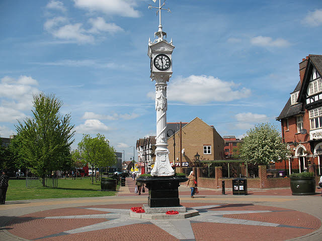
511:Clock Tower At Junction With Upper Green East
482:Clock Tower At Junction With Upper Green East
445:Creative Commons Attribution-Share Alike 2.0
363:
162:
131:
113:
537:https:\/\/www.geograph.org.uk\/profile\/6597
152:
141:
14:
952:
765:
405:– to copy, distribute and transmit the work
116:Mitcham clock tower (geograph 1853146).jpg
52:Mitcham_clock_tower_(geograph_1853146).jpg
1100:The following other wikis use this file:
930:https://www.geograph.org.uk/photo/1853146
602:https://www.geograph.org.uk/profile/6597
1070:Transferred from geograph.co.uk using
303:View this and other nearby images on:
253:View this and other nearby images on:
1080:The following 2 pages use this file:
206:
102:
350:and is licensed for reuse under the
271:
221:
1011:
386:Attribution-Share Alike 2.0 Generic
374:
369:
354:Attribution-ShareAlike 2.0 license.
13:
1128:
475:
469:
360:
337:
120:
103:
49:
1154:
1135:
474:
776:coordinates of the point of view
758:coordinates of the point of view
460:
416:Under the following conditions:
381:This file is licensed under the
373:
368:
362:
330:
309:
295:
287:
259:
245:
237:
70:
31:
21:
457:
121:
46:No higher resolution available.
1095:
1015:
880:file available on the internet
830:file available on the internet
456:
338:This image was taken from the
26:
1:
963:coordinates of depicted place
945:coordinates of depicted place
36:
1142:LEAD Technologies Inc. V1.01
1075:
900:Geograph Britain and Ireland
838:Geograph Britain and Ireland
791:51°24'21.899"N, 0°9'49.835"W
610:object of statement has role
541:object of statement has role
490:Items portrayed in this file
322:
286:
236:
7:
1125:
212:Stephen Craven /
193:Stephen Craven /
10:
1159:
1114:Usage on www.wikidata.org
1104:Usage on ar.wikipedia.org
978:51°24'21.92"N, 0°9'50.36"W
430:same or compatible license
110:
105:
1012:
16:
908:geograph.org.uk image ID
842:geograph.org.uk image ID
459:
396:
77:This is a file from the
41:
1069:
184:required by the license
134:
81:. Information from its
344:this photograph's page
315:51.406090; -0.163990
265:51.406083; -0.163843
84:description page there
411:– to adapt the work
214:Mitcham clock tower
195:Mitcham clock tower
126:Mitcham clock tower
1048:18:13, 19 May 2019
582:author name string
529:author name string
1146:
1145:
1139:JPEG file comment
1096:Global file usage
1073:
954:
767:
690:copyright license
676:copyright license
468:
359:
358:
342:collection. See
320:
319:
270:
269:
219:
218:
187:
171:
168:Reusing this file
99:
98:
79:Wikimedia Commons
32:Global file usage
1150:
1136:
1108:ميتشام (إنجلترا)
1060:
1022:
1000:
999:
994:
932:
927:
923:described at URL
917:
912:
902:
897:
850:described at URL
813:
812:
807:
646:copyright status
632:copyright status
619:
614:
604:
599:
589:
586:
466:
452:
449:
446:
443:
440:
432:as the original.
394:
383:Creative Commons
377:
376:
372:
371:
366:
365:
352:Creative Commons
340:Geograph project
334:
327:
316:
313:
299:
298:
292:
291:
290:
284:
283:
272:
266:
263:
249:
248:
242:
241:
240:
234:
233:
222:
181:
165:
137:
125:
117:
111:
95:
74:
73:
67:
61:
59:
1158:
1157:
1153:
1152:
1151:
1149:
1148:
1147:
1124:
1094:
1074:
1066:
1058:
1014:
1013:
1010:
1009:
1008:
1007:
1006:
1005:
1004:
1003:
1002:
1001:
997:
995:
992:
983:
982:
981:
979:
969:
968:
967:
965:
942:
941:
940:
939:
938:
937:
936:
935:
934:
933:
928:
925:
919:
918:
913:
910:
904:
903:
898:
895:
886:
885:
884:
882:
870:
869:
868:
866:
823:
822:
821:
820:
819:
818:
817:
816:
815:
814:
810:
808:
805:
796:
795:
794:
792:
782:
781:
780:
778:
755:
754:
753:
752:
751:
750:
749:
748:
746:
736:
735:
734:
732:
717:
716:
715:
714:
713:
712:
711:
710:
708:
696:
695:
694:
692:
673:
672:
671:
670:
669:
668:
667:
666:
664:
652:
651:
650:
648:
629:
628:
627:
626:
625:
624:
623:
622:
621:
620:
615:
612:
606:
605:
600:
597:
591:
590:
587:
584:
575:
574:
573:
571:
561:
560:
559:
557:
522:
521:
520:
519:
518:
517:
516:
515:
513:
501:
500:
499:
497:
473:
472:
471:
454:
453:
450:
447:
444:
441:
438:
437:
395:
392:
389:
378:
355:
325:
314:
288:
279:
278:
275:Object location
264:
238:
229:
228:
225:Camera location
220:
209:
202:
190:
147:geograph.org.uk
127:
115:
108:
101:
100:
89:
88:
87:is shown below.
63:
57:
55:
48:
47:
12:
11:
5:
1156:
1144:
1143:
1140:
1127:
1123:
1122:
1121:
1120:
1112:
1111:
1110:
1097:
1093:
1092:
1087:
1077:
1072:
1071:
1068:
1064:
1061:
1055:
1050:
1045:
1041:
1040:
1037:
1034:
1031:
1028:
1025:
1017:
988:
987:
986:
985:
984:
980:
977:
975:
974:
973:
971:
970:
966:
961:
959:
958:
957:
956:
950:
946:
921:
920:
906:
905:
891:
890:
889:
888:
887:
883:
878:
876:
875:
874:
872:
871:
867:
864:source of file
862:
860:
859:
858:
857:
855:
851:
847:
843:
839:
835:
831:
827:
826:source of file
801:
800:
799:
798:
797:
793:
790:
788:
787:
786:
784:
783:
779:
774:
772:
771:
770:
769:
763:
759:
747:
744:
742:
741:
740:
738:
737:
733:
728:
726:
725:
724:
723:
721:
709:
704:
702:
701:
700:
698:
697:
693:
688:
686:
685:
684:
683:
681:
677:
665:
660:
658:
657:
656:
654:
653:
649:
644:
642:
641:
640:
639:
637:
633:
608:
607:
593:
592:
588:Stephen Craven
580:
579:
578:
577:
576:
572:
569:
567:
566:
565:
563:
562:
558:
553:
551:
550:
549:
548:
546:
542:
538:
534:
530:
526:
514:
509:
507:
506:
505:
503:
502:
498:
493:
491:
488:
487:
486:
485:
483:
479:
465:
464:
461:
458:
436:
435:
434:
433:
423:
414:
413:
412:
406:
399:You are free:
393:Stephen Craven
390:
380:
379:
361:
357:
356:
348:Stephen Craven
335:
324:
321:
318:
317:
307:
301:
276:
268:
267:
257:
251:
226:
217:
216:
210:
207:
204:
203:
198:
191:
188:
176:
175:
172:
160:
159:
157:Stephen Craven
154:
150:
149:
143:
139:
138:
133:
129:
128:
118:
109:
107:
104:
97:
96:
75:
65:
64:
45:
40:
39:
34:
29:
24:
19:
9:
6:
4:
3:
2:
1155:
1141:
1138:
1137:
1134:
1131:
1119:
1116:
1115:
1113:
1109:
1106:
1105:
1103:
1102:
1101:
1091:
1088:
1086:
1083:
1082:
1081:
1067:
1062:
1056:
1054:
1051:
1049:
1046:
1043:
1042:
1038:
1035:
1032:
1029:
1026:
1024:
1023:
1021:
991:
976:
964:
960:
931:
924:
916:
909:
901:
894:
881:
877:
865:
861:
804:
789:
777:
773:
743:
731:
727:
707:
703:
691:
687:
663:
659:
647:
643:
618:
611:
603:
596:
583:
568:
556:
552:
512:
508:
496:
492:
489:
462:
455:
442:CC BY-SA 2.0
431:
427:
424:
421:
418:
417:
415:
410:
407:
404:
401:
400:
398:
397:
391:Attribution:
387:
384:
367:
353:
349:
345:
341:
336:
333:
329:
328:
312:
308:
306:
305:OpenStreetMap
302:
300:
282:
277:
274:
273:
262:
258:
256:
255:OpenStreetMap
252:
250:
232:
227:
224:
223:
215:
211:
205:
201:
197: /
196:
192:
185:
180:
178:
177:
173:
169:
164:
161:
158:
155:
151:
148:
144:
140:
130:
124:
119:
112:
93:
86:
85:
80:
76:
69:
68:
62:
53:
44:
38:
35:
33:
30:
28:
25:
23:
20:
18:
15:
1132:
1129:
1099:
1079:
1019:
1016:File history
617:photographer
545:photographer
425:
419:
408:
402:
347:
285:
235:
213:
200:CC BY-SA 2.0
194:
122:
92:You can help
82:
50:
22:File history
745:10 May 2010
662:copyrighted
636:copyrighted
426:share alike
420:attribution
179:Attribution
136:10 May 2010
114:Description
1076:File usage
1057:640 × 480
1033:Dimensions
570:some value
163:Permission
58:image/jpeg
27:File usage
1118:Q26640471
1030:Thumbnail
1027:Date/Time
730:inception
720:inception
323:Licensing
208:InfoField
189:InfoField
123:English:
1126:Metadata
893:operator
834:operator
463:Captions
409:to remix
403:to share
388:license.
37:Metadata
1085:Mitcham
1059:(80 KB)
1044:current
1039:Comment
990:heading
949:heading
915:1853146
846:1853146
803:heading
762:heading
555:creator
525:creator
495:depicts
478:depicts
467:English
106:Summary
54:
1065:Ham II
998:degree
953:degree
811:degree
766:degree
293:
243:
153:Author
142:Source
145:From
1036:User
996:270
809:270
451:true
448:true
132:Date
17:File
595:URL
533:URL
993::
926::
911::
896::
806::
613::
598::
585::
186:)
182:(
170:)
166:(
94:.
60:)
Text is available under the Creative Commons Attribution-ShareAlike License. Additional terms may apply.
.jpg)
.jpg¶ms=051.406083_N_-000.163843_E_globe:Earth_type:camera_source:geograph-osgb36(TQ27816905)_heading:270.00&language=en)
.jpg¶ms=051.406090_N_-000.163990_E_globe:Earth_class:object_type:object_source:geograph-osgb36(TQ27806905)_heading:270.00&language=en)
