782:"}},"text\/plain":{"en":{"":"coordinates of the point of view"}}},"{\"value\":{\"latitude\":50.94931,\"longitude\":-2.720257,\"altitude\":null,\"precision\":1.0e-6,\"globe\":\"http:\\\/\\\/www.wikidata.org\\\/entity\\\/Q2\"},\"type\":\"globecoordinate\"}":{"text\/html":{"en":{"P1259":"50\u00b056'57.516"N, 2\u00b043'12.925"W"}},"text\/plain":{"en":{"P1259":"50\u00b056'57.516\"N, 2\u00b043'12.925\"W"}}}}": -->
442:"}},"text\/plain":{"en":{"":"author name string"}}},"{\"value\":\"Jim Champion\",\"type\":\"string\"}":{"text\/html":{"en":{"P2093":"Jim Champion"}},"text\/plain":{"en":{"P2093":"Jim Champion"}}},"{\"value\":{\"entity-type\":\"property\",\"numeric-id\":3831,\"id\":\"P3831\"},\"type\":\"wikibase-entityid\"}":{"text\/html":{"en":{"":"
625:"}},"text\/plain":{"en":{"":"inception"}}},"{\"value\":{\"time\":\"+2005-10-27T00:00:00Z\",\"timezone\":0,\"before\":0,\"after\":0,\"precision\":11,\"calendarmodel\":\"http:\\\/\\\/www.wikidata.org\\\/entity\\\/Q1985727\"},\"type\":\"time\"}":{"text\/html":{"en":{"P571":"27 October 2005"}},"text\/plain":{"en":{"P571":"27 October 2005"}}}}": -->
659:
426:
241:
262:
300:
305:
72:
438:"}},"text\/plain":{"en":{"P2699":"https:\/\/www.geograph.org.uk\/profile\/1086"}}},"{\"value\":{\"entity-type\":\"property\",\"numeric-id\":2093,\"id\":\"P2093\"},\"type\":\"wikibase-entityid\"}":{"text\/html":{"en":{"":"
667:"}},"text\/plain":{"en":{"P7482":"file available on the internet"}}},"{\"value\":{\"entity-type\":\"property\",\"numeric-id\":137,\"id\":\"P137\"},\"type\":\"wikibase-entityid\"}":{"text\/html":{"en":{"":"
675:"}},"text\/plain":{"en":{"P137":"Geograph Britain and Ireland"}}},"{\"value\":{\"entity-type\":\"property\",\"numeric-id\":7384,\"id\":\"P7384\"},\"type\":\"wikibase-entityid\"}":{"text\/html":{"en":{"":"
446:"}},"text\/plain":{"en":{"":"object of statement has role"}}},"{\"value\":{\"entity-type\":\"item\",\"numeric-id\":33231,\"id\":\"Q33231\"},\"type\":\"wikibase-entityid\"}":{"text\/html":{"en":{"P3831":"
820:"}},"text\/plain":{"en":{"":"media type"}}},"{\"value\":\"image\\\/jpeg\",\"type\":\"string\"}":{"text\/html":{"en":{"P1163":"image\/jpeg"}},"text\/plain":{"en":{"P1163":"image\/jpeg"}}}}": -->
581:"}},"text\/plain":{"en":{"":"copyright license"}}},"{\"value\":{\"entity-type\":\"item\",\"numeric-id\":19068220,\"id\":\"Q19068220\"},\"type\":\"wikibase-entityid\"}":{"text\/html":{"en":{"P275":"
537:"}},"text\/plain":{"en":{"":"copyright status"}}},"{\"value\":{\"entity-type\":\"item\",\"numeric-id\":50423863,\"id\":\"Q50423863\"},\"type\":\"wikibase-entityid\"}":{"text\/html":{"en":{"P6216":"
663:"}},"text\/plain":{"en":{"":"source of file"}}},"{\"value\":{\"entity-type\":\"item\",\"numeric-id\":74228490,\"id\":\"Q74228490\"},\"type\":\"wikibase-entityid\"}":{"text\/html":{"en":{"P7482":"
671:"}},"text\/plain":{"en":{"":"operator"}}},"{\"value\":{\"entity-type\":\"item\",\"numeric-id\":1503119,\"id\":\"Q1503119\"},\"type\":\"wikibase-entityid\"}":{"text\/html":{"en":{"P137":"
683:"}},"text\/plain":{"en":{"P7384":"71079"}}},"{\"value\":{\"entity-type\":\"property\",\"numeric-id\":973,\"id\":\"P973\"},\"type\":\"wikibase-entityid\"}":{"text\/html":{"en":{"":"
430:"}},"text\/plain":{"en":{"":"creator"}}},"{\"value\":{\"entity-type\":\"property\",\"numeric-id\":2699,\"id\":\"P2699\"},\"type\":\"wikibase-entityid\"}":{"text\/html":{"en":{"":"
816:
679:"}},"text\/plain":{"en":{"":"geograph.org.uk image ID"}}},"{\"value\":\"71079\",\"type\":\"string\"}":{"text\/html":{"en":{"P7384":"
352:– You must give appropriate credit, provide a link to the license, and indicate if changes were made. You may do so in any reasonable manner, but not in any way that suggests the licensor endorses you or your use.
224:
43:
664:
582:
538:
680:
672:
447:
218:
817:
779:
676:
660:
534:
443:
439:
431:
684:
668:
622:
578:
435:
427:
688:
1209:
913:{{Information |Description=Montacute |Source=From |Date=2005-10-27 |Author= |Permission=Creative Commons Attribution Share-alike license 2.0 }}
585:"}},"text\/plain":{"en":{"P275":"Creative Commons Attribution-ShareAlike 2.0 Generic"}}}}": -->
155:
970:
691:"}},"text\/plain":{"en":{"P973":"https:\/\/www.geograph.org.uk\/photo\/71079"}}}}": -->
714:
608:
564:
234:
734:
269:
1103:
This file contains additional information, probably added from the digital camera or scanner used to create or digitize it.
359:
519:
827:
789:
742:
698:
548:
512:
499:
484:
937:
757:
727:
632:
592:
457:
416:
1240:
315:
1106:
If the file has been modified from its original state, some details may not fully reflect the modified file.
358:– If you remix, transform, or build upon the material, you must distribute your contributions under the
276:
on the
Geograph website for the photographer's contact details. The copyright on this image is owned by
83:
450:"}},"text\/plain":{"en":{"P3831":"photographer"}}}}": -->
541:"}},"text\/plain":{"en":{"P6216":"copyrighted"}}}}": -->
51:
91:
187:
1259:
491:
312:
171:
764:
749:
8:
1295:
256:
971:
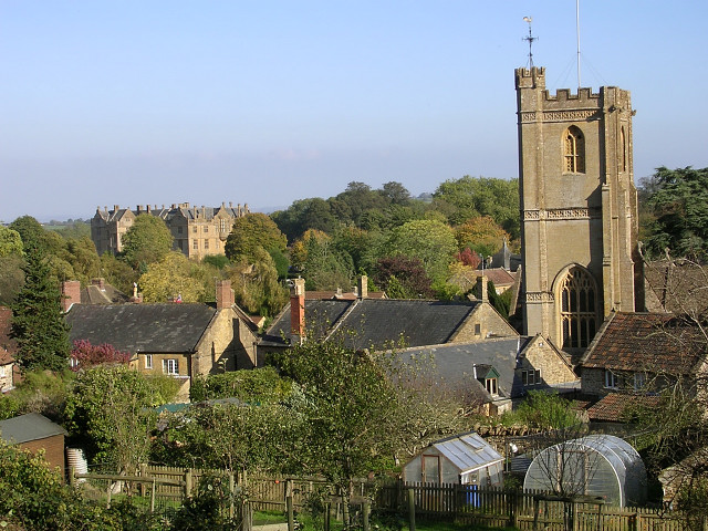
Montacute (lungsod sa
Hiniusang Gingharian, Inglatera, Somerset, lat 50,95, long -2,72)
240:
1065:
1368:
927:
281:
78:
406:
952:
947:
895:
890:
42:
1331:
1277:
1132:
1378:
1341:
1172:
932:
144:
134:
1305:
837:
799:
708:
642:
602:
558:
467:
261:
1152:
942:
906:
273:
1388:
1142:
863:
Click on a date/time to view the file as it appeared at that time.
1000:
226:
219:
50° 56′ 57.52″ N, 2° 43′ 12.93″ W
1090:
980:
1125:
1115:
123:
66:
1010:
400:
Add a one-line explanation of what this file represents
1060:
1050:
1040:
1030:
1020:
990:
1080:
1075:
921:
961:
861:
162:
Creative
Commons Attribution Share-alike license 2.0
90:
Commons is a freely licensed media file repository.
609:
Creative
Commons Attribution-ShareAlike 2.0 Generic
583:
Creative
Commons Attribution-ShareAlike 2.0 Generic
56:(640 × 480 pixels, file size: 154 KB, MIME type:
369:https://creativecommons.org/licenses/by-sa/2.0
71:
375:Creative Commons Attribution-Share Alike 2.0
293:
150:
119:
108:
1066:Somerset'teki civil parishlerin listesi
436:https:\/\/www.geograph.org.uk\/profile\/1086
140:
129:
14:
689:https:\/\/www.geograph.org.uk\/photo\/71079
335:– to copy, distribute and transmit the work
963:The following other wikis use this file:
492:https://www.geograph.org.uk/profile/1086
765:https://www.geograph.org.uk/photo/71079
233:View this and other nearby images on:
923:The following 6 pages use this file:
194:
102:
280:and is licensed for reuse under the
209:
854:
316:Attribution-Share Alike 2.0 Generic
304:
299:
284:Attribution-ShareAlike 2.0 license.
13:
1101:
1087:Usage on zh-min-nan.wikipedia.org
938:List of civil parishes in Somerset
405:
399:
290:
267:
103:
49:
1413:
1108:
404:
1163:Date and time of data generation
790:coordinates of the point of view
780:coordinates of the point of view
390:
346:Under the following conditions:
311:This file is licensed under the
303:
298:
292:
260:
239:
225:
70:
31:
21:
387:
46:No higher resolution available.
958:
858:
715:file available on the internet
665:file available on the internet
386:
268:This image was taken from the
26:
1:
1300:Flash did not fire, auto mode
805:50°56'57.516"N, 2°43'12.925"W
36:
918:
735:Geograph Britain and Ireland
673:Geograph Britain and Ireland
513:object of statement has role
444:object of statement has role
412:Items portrayed in this file
252:
7:
1251:Date and time of digitizing
1098:
1007:Usage on lld.wikipedia.org
967:Usage on ceb.wikipedia.org
10:
1418:
1352:Focal length in 35 mm film
1137:499/250,000 sec (0.001996)
1072:Usage on www.wikidata.org
1057:Usage on tr.wikipedia.org
1047:Usage on sv.wikipedia.org
1037:Usage on pl.wikipedia.org
1027:Usage on no.wikipedia.org
1017:Usage on nl.wikipedia.org
997:Usage on it.wikipedia.org
987:Usage on fr.wikipedia.org
977:Usage on de.wikipedia.org
360:same or compatible license
105:
1216:File change date and time
855:
200:Jim Champion /
181:Jim Champion /
16:
743:geograph.org.uk image ID
677:geograph.org.uk image ID
389:
326:
77:This is a file from the
41:
1315:Custom image processing
912:
172:required by the license
122:
81:. Information from its
1398:Subject distance range
1254:14:13, 27 October 2005
1219:22:44, 27 October 2005
1166:14:13, 27 October 2005
274:this photograph's page
245:50.949310; -2.720257
84:description page there
1269:Maximum land aperture
1190:Horizontal resolution
1210:Nikon Editor 6.1.0 W
1001:Montacute (Somerset)
1224:Y and C positioning
1198:Vertical resolution
1112:Camera manufacturer
891:20:14, 10 June 2009
341:– to adapt the work
1360:Scene capture type
1336:Auto white balance
500:author name string
440:author name string
1405:
1404:
981:John Cowper Powys
959:Global file usage
928:John Cowper Powys
916:
593:copyright license
579:copyright license
398:
289:
288:
272:collection. See
250:
249:
207:
206:
175:
159:
156:Reusing this file
99:
98:
79:Wikimedia Commons
32:Global file usage
1409:
1232:Exposure Program
1109:
903:
865:
767:
762:
758:described at URL
752:
747:
737:
732:
685:described at URL
549:copyright status
535:copyright status
522:
517:
507:
504:
494:
489:
396:
382:
379:
376:
373:
370:
362:as the original.
324:
313:Creative Commons
307:
306:
302:
301:
296:
295:
282:Creative Commons
270:Geograph project
264:
257:
246:
243:
229:
228:
222:
221:
210:
169:
153:
125:
112:
106:
95:
74:
73:
67:
61:
59:
1417:
1416:
1412:
1411:
1410:
1408:
1407:
1406:
1272:3 APEX (f/2.83)
1097:
957:
917:
909:
901:
857:
856:
853:
852:
851:
850:
849:
848:
847:
846:
844:
834:
833:
832:
830:
815:
814:
813:
812:
811:
810:
809:
808:
806:
796:
795:
794:
792:
777:
776:
775:
774:
773:
772:
771:
770:
769:
768:
763:
760:
754:
753:
748:
745:
739:
738:
733:
730:
721:
720:
719:
717:
705:
704:
703:
701:
658:
657:
656:
655:
654:
653:
652:
651:
649:
648:27 October 2005
639:
638:
637:
635:
620:
619:
618:
617:
616:
615:
614:
613:
611:
599:
598:
597:
595:
576:
575:
574:
573:
572:
571:
570:
569:
567:
555:
554:
553:
551:
532:
531:
530:
529:
528:
527:
526:
525:
524:
523:
518:
515:
509:
508:
505:
502:
496:
495:
490:
487:
478:
477:
476:
474:
464:
463:
462:
460:
425:
424:
423:
422:
421:
419:
403:
402:
401:
384:
383:
380:
377:
374:
371:
368:
367:
325:
322:
319:
308:
285:
255:
244:
217:
216:
213:Camera location
208:
197:
190:
178:
135:geograph.org.uk
124:27 October 2005
110:
101:
100:
89:
88:
87:is shown below.
63:
57:
55:
48:
47:
12:
11:
5:
1415:
1403:
1402:
1399:
1395:
1394:
1391:
1385:
1384:
1381:
1375:
1374:
1371:
1365:
1364:
1361:
1357:
1356:
1353:
1349:
1348:
1345:
1338:
1337:
1334:
1328:
1327:
1324:
1320:
1319:
1318:Normal process
1316:
1312:
1311:
1308:
1302:
1301:
1298:
1292:
1291:
1288:
1284:
1283:
1280:
1274:
1273:
1270:
1266:
1265:
1262:
1256:
1255:
1252:
1248:
1247:
1244:
1237:
1236:
1235:Normal program
1233:
1229:
1228:
1225:
1221:
1220:
1217:
1213:
1212:
1207:
1203:
1202:
1199:
1195:
1194:
1191:
1187:
1186:
1183:
1179:
1178:
1175:
1168:
1167:
1164:
1160:
1159:
1156:
1149:
1148:
1145:
1139:
1138:
1135:
1129:
1128:
1123:
1119:
1118:
1113:
1100:
1096:
1095:
1094:
1093:
1085:
1084:
1083:
1078:
1070:
1069:
1068:
1063:
1055:
1054:
1053:
1045:
1044:
1043:
1035:
1034:
1033:
1025:
1024:
1023:
1015:
1014:
1013:
1005:
1004:
1003:
995:
994:
993:
985:
984:
983:
975:
974:
973:
960:
956:
955:
953:South Somerset
950:
948:Philippa Powys
945:
940:
935:
930:
920:
915:
914:
911:
907:
904:
898:
893:
888:
884:
883:
880:
877:
874:
871:
868:
860:
845:
842:
840:
839:
838:
836:
835:
831:
826:
824:
823:
822:
821:
819:
807:
804:
802:
801:
800:
798:
797:
793:
788:
786:
785:
784:
783:
781:
756:
755:
741:
740:
726:
725:
724:
723:
722:
718:
713:
711:
710:
709:
707:
706:
702:
699:source of file
697:
695:
694:
693:
692:
690:
686:
682:
678:
674:
670:
666:
662:
661:source of file
650:
647:
645:
644:
643:
641:
640:
636:
631:
629:
628:
627:
626:
624:
612:
607:
605:
604:
603:
601:
600:
596:
591:
589:
588:
587:
586:
584:
580:
568:
563:
561:
560:
559:
557:
556:
552:
547:
545:
544:
543:
542:
540:
536:
511:
510:
498:
497:
483:
482:
481:
480:
479:
475:
472:
470:
469:
468:
466:
465:
461:
456:
454:
453:
452:
451:
449:
445:
441:
437:
433:
429:
420:
415:
413:
410:
409:
408:
407:
395:
394:
391:
388:
366:
365:
364:
363:
353:
344:
343:
342:
336:
329:You are free:
320:
310:
309:
291:
287:
286:
265:
254:
251:
248:
247:
237:
231:
214:
205:
204:
198:
195:
192:
191:
186:
179:
176:
164:
163:
160:
148:
147:
142:
138:
137:
131:
127:
126:
121:
117:
116:
113:
104:
97:
96:
75:
65:
64:
45:
40:
39:
34:
29:
24:
19:
9:
6:
4:
3:
2:
1414:
1400:
1397:
1396:
1392:
1390:
1387:
1386:
1382:
1380:
1377:
1376:
1372:
1370:
1367:
1366:
1362:
1359:
1358:
1354:
1351:
1350:
1346:
1343:
1340:
1339:
1335:
1333:
1332:White balance
1330:
1329:
1326:Auto exposure
1325:
1323:Exposure mode
1322:
1321:
1317:
1314:
1313:
1309:
1307:
1304:
1303:
1299:
1297:
1294:
1293:
1289:
1286:
1285:
1281:
1279:
1278:Metering mode
1276:
1275:
1271:
1268:
1267:
1263:
1261:
1260:Exposure bias
1258:
1257:
1253:
1250:
1249:
1245:
1242:
1239:
1238:
1234:
1231:
1230:
1226:
1223:
1222:
1218:
1215:
1214:
1211:
1208:
1206:Software used
1205:
1204:
1200:
1197:
1196:
1192:
1189:
1188:
1184:
1181:
1180:
1176:
1174:
1170:
1169:
1165:
1162:
1161:
1157:
1154:
1151:
1150:
1146:
1144:
1141:
1140:
1136:
1134:
1133:Exposure time
1131:
1130:
1127:
1124:
1121:
1120:
1117:
1114:
1111:
1110:
1107:
1104:
1092:
1089:
1088:
1086:
1082:
1079:
1077:
1074:
1073:
1071:
1067:
1064:
1062:
1059:
1058:
1056:
1052:
1049:
1048:
1046:
1042:
1039:
1038:
1036:
1032:
1029:
1028:
1026:
1022:
1019:
1018:
1016:
1012:
1009:
1008:
1006:
1002:
999:
998:
996:
992:
989:
988:
986:
982:
979:
978:
976:
972:
969:
968:
966:
965:
964:
954:
951:
949:
946:
944:
941:
939:
936:
934:
931:
929:
926:
925:
924:
910:
905:
899:
897:
894:
892:
889:
886:
885:
881:
878:
875:
872:
869:
867:
866:
864:
841:
829:
825:
803:
791:
787:
766:
759:
751:
744:
736:
729:
716:
712:
700:
696:
646:
634:
630:
610:
606:
594:
590:
566:
562:
550:
546:
521:
514:
501:
493:
486:
471:
459:
455:
418:
414:
411:
392:
385:
372:CC BY-SA 2.0
361:
357:
354:
351:
348:
347:
345:
340:
337:
334:
331:
330:
328:
327:
321:Attribution:
317:
314:
297:
283:
279:
275:
271:
266:
263:
259:
258:
242:
238:
236:
235:OpenStreetMap
232:
230:
220:
215:
212:
211:
203:
199:
193:
189:
185: /
184:
180:
173:
168:
166:
165:
161:
157:
152:
149:
146:
143:
139:
136:
132:
128:
118:
114:
111:Montacute.jpg
107:
93:
86:
85:
80:
76:
69:
68:
62:
53:
52:Montacute.jpg
44:
38:
35:
33:
30:
28:
25:
23:
20:
18:
15:
1342:Digital zoom
1287:Light source
1173:focal length
1122:Camera model
1105:
1102:
962:
933:Leland Trail
922:
862:
859:File history
520:photographer
506:Jim Champion
448:photographer
355:
349:
338:
332:
323:Jim Champion
278:Jim Champion
277:
201:
188:CC BY-SA 2.0
182:
145:Jim Champion
92:You can help
82:
50:
22:File history
1306:Color space
1182:Orientation
565:copyrighted
539:copyrighted
356:share alike
350:attribution
167:Attribution
109:Description
1379:Saturation
919:File usage
900:640 × 480
876:Dimensions
843:image/jpeg
828:media type
818:media type
473:some value
151:Permission
58:image/jpeg
27:File usage
1389:Sharpness
1153:ISO speed
1091:Montacute
1061:Montacute
1051:Montacute
1041:Montacute
1031:Montacute
1021:Montacute
1011:Montacute
991:Montacute
943:Montacute
873:Thumbnail
870:Date/Time
633:inception
623:inception
253:Licensing
202:Montacute
196:InfoField
183:Montacute
177:InfoField
115:Montacute
1369:Contrast
1363:Standard
1227:Centered
1143:F-number
1099:Metadata
1081:Q6520811
1076:Q2636589
902:(154 KB)
728:operator
669:operator
393:Captions
339:to remix
333:to share
318:license.
37:Metadata
1401:Unknown
1290:Unknown
1282:Pattern
1243:version
1201:300 dpi
1193:300 dpi
1177:11.6 mm
887:current
882:Comment
458:creator
428:creator
417:depicts
397:English
54:
1393:Normal
1383:Normal
1373:Normal
1185:Normal
1155:rating
223:
141:Author
130:Source
1355:76 mm
1344:ratio
1296:Flash
1171:Lens
1147:f/3.9
1126:E3100
1116:NIKON
750:71079
681:71079
133:From
1310:sRGB
1241:Exif
908:Rodw
879:User
381:true
378:true
120:Date
17:File
1246:2.2
1158:100
485:URL
432:URL
761::
746::
731::
516::
503::
488::
1347:0
1264:0
174:)
170:(
158:)
154:(
94:.
60:)
