772:"}},"text\/plain":{"en":{"":"inception"}}},"{\"value\":{\"time\":\"+2019-11-01T00:00:00Z\",\"timezone\":0,\"before\":0,\"after\":0,\"precision\":11,\"calendarmodel\":\"http:\\\/\\\/www.wikidata.org\\\/entity\\\/Q1985727\"},\"type\":\"time\"}":{"text\/html":{"en":{"P571":"1 November 2019"}},"text\/plain":{"en":{"P571":"1 November 2019"}}}}": -->
530:
43:
464:
536:
201:
632:
541:
99:
514:
728:"}},"text\/plain":{"en":{"":"copyright license"}}},"{\"value\":{\"entity-type\":\"item\",\"numeric-id\":42716613,\"id\":\"Q42716613\"},\"type\":\"wikibase-entityid\"}":{"text\/html":{"en":{"P275":"
684:"}},"text\/plain":{"en":{"":"copyright status"}}},"{\"value\":{\"entity-type\":\"item\",\"numeric-id\":50423863,\"id\":\"Q50423863\"},\"type\":\"wikibase-entityid\"}":{"text\/html":{"en":{"P6216":"
680:
866:
597:– You must give appropriate credit, provide a link to the license, and indicate if changes were made. You may do so in any reasonable manner, but not in any way that suggests the licensor endorses you or your use.
505:
This license and the rights granted hereunder will terminate automatically upon any breach by you of the terms of this license. Any of the above conditions can be waived if you get permission from the copyright
869:
729:
685:
681:
769:
725:
890:
732:"}},"text\/plain":{"en":{"P275":"Creative Commons Attribution-ShareAlike 3.0 Germany"}}}}": -->
215:
755:
711:
73:
69:
65:
61:
57:
53:
47:
1116:
This file contains additional information, probably added from the digital camera or scanner used to create or digitize it.
918:
604:
521:
110:
695:
82:
779:
739:
670:
885:
551:
900:
173:
440:
1119:
If the file has been modified from its original state, some details may not fully reflect the modified file.
208:
603:– If you remix, transform, or build upon the material, you must distribute your contributions under the
688:"}},"text\/plain":{"en":{"P6216":"copyrighted"}}}}": -->
118:
565:
495:
472:
502:
4. in the case of an adaptation, a credit identifying the use of the work in the adaptation.
938:
561:
548:
489:
468:
1073:
1018:
8:
200:
847:
842:
42:
1028:
988:
187:
177:
858:
105:
660:
250:
895:
508:
If you have questions or wish differing conditions, please contact me through
358:
322:
430:
421:
412:
403:
394:
385:
376:
367:
349:
340:
331:
313:
304:
295:
286:
277:
268:
259:
241:
232:
223:
1093:
1053:
978:
1043:
789:
749:
705:
968:
463:
867:
Category:SVG locator maps of regions in
Namibia (location map scheme)
1103:
948:
815:
Click on a date/time to view the file as it appeared at that time.
1008:
1083:
933:
958:
1038:
998:
87:(SVG file, nominally 1,300 × 1,252 pixels, file size: 79 KB)
1098:
496:
https://creativecommons.org/licenses/by-sa/3.0/de/legalcode
614:
https://creativecommons.org/licenses/by-sa/3.0/de/deed.en
486:
I recommend to respect the following licence conditions:
162:
93:
654:
Add a one-line explanation of what this file represents
494:
2. a copy of, or the URI for, the applicable license:
879:
1063:
928:
909:
891:
List of first-level administrative divisions by area
813:
117:
Commons is a freely licensed media file repository.
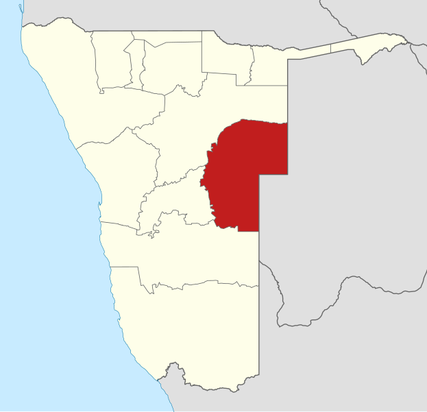
756:
Creative
Commons Attribution-ShareAlike 3.0 Germany
730:
Creative
Commons Attribution-ShareAlike 3.0 Germany
482:Legally binding is only the full legalcode. For a
207:This map has been made or improved in the German
620:Creative Commons Attribution-Share Alike 3.0 de
939:Liste der Gouverneure der namibischen Regionen
98:
529:
158:
140:
183:
168:
14:
580:– to copy, distribute and transmit the work
46:Size of this PNG preview of this SVG file:
911:The following other wikis use this file:
462:
881:The following 4 pages use this file:
129:
806:
552:Attribution-Share Alike 3.0 Germany
540:
535:
488:1. Provide my name as given above:
13:
1114:
1080:Usage on zh-min-nan.wikipedia.org
989:Ọbanife:GerardM/Regions of Namibia
659:
653:
630:
526:
206:
153:Lage der Region Omaheke in Namibia
147:
130:
80:
1148:
1121:
886:List of constituencies of Namibia
658:
1074:Oníṣe:GerardM/Regions of Namibia
644:
591:Under the following conditions:
547:This file is licensed under the
539:
534:
528:
512:
199:
97:
31:
21:
1094:User:GerardM/Regions of Namibia
1054:User:GerardM/Regions of Namibia
979:User:GerardM/Regions of Namibia
901:User:GerardM/Regions of Namibia
641:
251:
1035:Usage on simple.wikipedia.org
906:
870:Category:Files by NordNordWest
810:
640:
148:
26:
1:
566:Creative Commons by-sa-3.0 de
473:Creative Commons by-sa-3.0 de
36:
876:
666:Items portrayed in this file
451:
7:
1111:
10:
1153:
1090:Usage on zu.wikipedia.org
1070:Usage on yo.wikipedia.org
1060:Usage on www.wikidata.org
1050:Usage on ts.wikipedia.org
1025:Usage on mk.wikipedia.org
1015:Usage on ja.wikipedia.org
1005:Usage on it.wikipedia.org
995:Usage on io.wikipedia.org
985:Usage on ig.wikipedia.org
975:Usage on ha.wikipedia.org
969:Subdivisions de la Namibie
965:Usage on fr.wikipedia.org
955:Usage on eu.wikipedia.org
945:Usage on es.wikipedia.org
925:Usage on de.wikipedia.org
915:Usage on ar.wikipedia.org
605:same or compatible license
500:3. the title of the work,
195:
137:
132:
1044:Constituencies of Namibia
807:
524:
513:
359:
323:
16:
643:
571:
431:
422:
413:
404:
395:
386:
377:
368:
350:
341:
332:
314:
305:
296:
287:
278:
269:
260:
242:
233:
224:
174:Namibia location map.svg
104:This is a file from the
41:
1104:Izifunda zase Namibhiya
864:
457:Usage of this file with
161:
108:. Information from its
843:12:24, 1 November 2019
635:
475:
143:Omaheke in Namibia.svg
111:description page there
1009:Regioni della Namibia
634:
466:
934:Regionen von Namibia
218:to improve as well.
74:1,300 × 1,252 pixels
70:2,127 × 2,048 pixels
66:1,063 × 1,024 pixels
959:Omaheke (eskualdea)
586:– to adapt the work
52:Other resolutions:
636:
522:my discussion page
480:explanatory notes:
476:
252:Deutsch (Sie-Form)
1140:
1139:
949:Región de Omaheke
907:Global file usage
874:
740:copyright license
726:copyright license
652:
449:
448:
443:
193:
192:
126:
125:
106:Wikimedia Commons
32:Global file usage
1144:
1122:
855:
817:
696:copyright status
682:copyright status
650:
633:
627:
624:
621:
618:
615:
607:as the original.
569:
549:Creative Commons
543:
542:
538:
537:
532:
531:
519:
518:
516:
515:
444:
439:
203:
196:
172:Own work using:
164:
152:
144:
138:
122:
101:
100:
94:
88:
77:
62:797 × 768 pixels
58:498 × 480 pixels
54:249 × 240 pixels
48:623 × 600 pixels
1152:
1151:
1147:
1146:
1145:
1143:
1142:
1141:
1110:
999:Regiono Omaheke
905:
875:
861:
853:
809:
808:
805:
804:
803:
802:
801:
800:
799:
798:
796:
795:1 November 2019
786:
785:
784:
782:
767:
766:
765:
764:
763:
762:
761:
760:
758:
746:
745:
744:
742:
723:
722:
721:
720:
719:
718:
717:
716:
714:
702:
701:
700:
698:
679:
678:
677:
676:
675:
673:
657:
656:
655:
638:
637:
631:
628:
625:
622:
619:
617:CC BY-SA 3.0 de
616:
613:
612:
570:
558:
555:
544:
510:
509:
477:
454:
445:
433:
424:
415:
406:
397:
388:
379:
370:
361:
352:
343:
334:
325:
316:
307:
298:
289:
280:
271:
262:
253:
244:
235:
226:
222:
219:
209:Kartenwerkstatt
194:
163:1 November 2019
154:
142:
135:
128:
127:
116:
115:
114:is shown below.
90:
86:
79:
78:
51:
12:
11:
5:
1150:
1138:
1137:
1134:
1130:
1129:
1126:
1113:
1109:
1108:
1107:
1106:
1101:
1099:Omaheke Region
1096:
1088:
1087:
1086:
1078:
1077:
1076:
1068:
1067:
1066:
1058:
1057:
1056:
1048:
1047:
1046:
1041:
1039:Omaheke Region
1033:
1032:
1031:
1023:
1022:
1021:
1013:
1012:
1011:
1003:
1002:
1001:
993:
992:
991:
983:
982:
981:
973:
972:
971:
963:
962:
961:
953:
952:
951:
943:
942:
941:
936:
931:
923:
922:
921:
919:إقليم أوماهيكي
908:
904:
903:
898:
896:Omaheke Region
893:
888:
878:
873:
872:
863:
859:
856:
852:1,300 × 1,252
850:
845:
840:
836:
835:
832:
829:
826:
823:
820:
812:
797:
794:
792:
791:
790:
788:
787:
783:
778:
776:
775:
774:
773:
771:
759:
754:
752:
751:
750:
748:
747:
743:
738:
736:
735:
734:
733:
731:
727:
715:
710:
708:
707:
706:
704:
703:
699:
694:
692:
691:
690:
689:
687:
683:
674:
669:
667:
664:
663:
662:
661:
649:
648:
645:
642:
629:
611:
610:
609:
608:
598:
589:
588:
587:
581:
574:You are free:
556:
546:
545:
527:
461:
453:
450:
447:
446:
221:
204:
191:
190:
185:
181:
180:
170:
166:
165:
160:
156:
155:
145:
136:
134:
131:
124:
123:
102:
92:
91:
45:
40:
39:
34:
29:
24:
19:
9:
6:
4:
3:
2:
1149:
1135:
1132:
1131:
1127:
1124:
1123:
1120:
1117:
1105:
1102:
1100:
1097:
1095:
1092:
1091:
1089:
1085:
1082:
1081:
1079:
1075:
1072:
1071:
1069:
1065:
1062:
1061:
1059:
1055:
1052:
1051:
1049:
1045:
1042:
1040:
1037:
1036:
1034:
1030:
1027:
1026:
1024:
1020:
1017:
1016:
1014:
1010:
1007:
1006:
1004:
1000:
997:
996:
994:
990:
987:
986:
984:
980:
977:
976:
974:
970:
967:
966:
964:
960:
957:
956:
954:
950:
947:
946:
944:
940:
937:
935:
932:
930:
927:
926:
924:
920:
917:
916:
914:
913:
912:
902:
899:
897:
894:
892:
889:
887:
884:
883:
882:
871:
868:
862:
857:
851:
849:
846:
844:
841:
838:
837:
833:
830:
827:
824:
821:
819:
818:
816:
793:
781:
777:
757:
753:
741:
737:
713:
709:
697:
693:
672:
668:
665:
646:
639:
606:
602:
599:
596:
593:
592:
590:
585:
582:
579:
576:
575:
573:
572:
568:
567:
563:
557:Attribution:
553:
550:
533:
525:
523:
507:
503:
501:
499:
497:
493:
491:
487:
485:
481:
474:
470:
465:
460:
458:
442:
438:
434:
429:
425:
420:
416:
411:
407:
402:
398:
393:
389:
384:
380:
375:
371:
366:
362:
357:
353:
348:
344:
339:
335:
330:
326:
321:
317:
312:
308:
303:
299:
294:
290:
285:
281:
276:
272:
267:
263:
258:
254:
249:
245:
240:
236:
231:
227:
220:
217:
213:
210:
205:
202:
198:
197:
189:
186:
182:
179:
175:
171:
167:
157:
151:
146:
139:
120:
113:
112:
107:
103:
96:
95:
89:
84:
83:Original file
75:
71:
67:
63:
59:
55:
49:
44:
38:
35:
33:
30:
28:
25:
23:
20:
18:
15:
1118:
1115:
1084:Omaheke Chiu
910:
880:
860:NordNordWest
814:
811:File history
600:
594:
583:
577:
562:NordNordWest
559:
504:
490:NordNordWest
483:
479:
478:
469:NordNordWest
456:
455:
436:
427:
418:
409:
400:
391:
382:
373:
364:
355:
346:
337:
328:
324:Plattdüütsch
319:
310:
301:
292:
283:
274:
265:
256:
247:
238:
229:
225:azərbaycanca
216:propose maps
211:
188:NordNordWest
178:Uwe Dedering
149:
119:You can help
109:
81:
22:File history
712:copyrighted
686:copyrighted
601:share alike
595:attribution
517:t-online.de
471:, Licence:
369:slovenščina
141:Description
1136:1252.215px
877:File usage
828:Dimensions
564:, Lizenz:
484:free usage
387:македонски
315:Nederlands
214:. You can
27:File usage
825:Thumbnail
822:Date/Time
780:inception
770:inception
452:Licensing
360:sicilianu
342:português
212:(Map Lab)
150:Deutsch:
1112:Metadata
647:Captions
584:to remix
578:to share
554:license.
297:latviešu
288:italiano
279:français
37:Metadata
1064:Q838775
1029:Омахеке
929:Omaheke
854:(79 KB)
839:current
834:Comment
671:depicts
651:English
560:Karte:
506:holder.
414:հայերեն
405:ქართული
396:русский
270:español
261:English
243:Deutsch
234:čeština
133:Summary
85:
1133:Height
1128:1300px
511:nnwest
435:
426:
417:
408:
399:
390:
381:
372:
363:
354:
351:română
345:
336:
333:polski
327:
318:
309:
306:magyar
300:
291:
282:
273:
264:
255:
246:
237:
228:
184:Author
169:Source
1125:Width
1019:オマヘケ州
467:Map:
423:বাংলা
378:suomi
831:User
626:true
623:true
159:Date
17:File
520:or
441:+/−
432:ไทย
176:by
498:,
492:,
459::
72:|
68:|
64:|
60:|
56:|
50:.
437:∙
428:∙
419:∙
410:∙
401:∙
392:∙
383:∙
374:∙
365:∙
356:∙
347:∙
338:∙
329:∙
320:∙
311:∙
302:∙
293:∙
284:∙
275:∙
266:∙
257:∙
248:∙
239:∙
230:∙
121:.
76:.
Text is available under the Creative Commons Attribution-ShareAlike License. Additional terms may apply.

