524:"}},"text\/plain":{"en":{"":"inception"}}},"{\"value\":{\"time\":\"+2012-12-12T00:00:00Z\",\"timezone\":0,\"before\":0,\"after\":0,\"precision\":11,\"calendarmodel\":\"http:\\\/\\\/www.wikidata.org\\\/entity\\\/Q1985727\"},\"type\":\"time\"}":{"text\/html":{"en":{"P571":"12 December 2012"}},"text\/plain":{"en":{"P571":"12 December 2012"}}}}": -->
38:
260:
357:
369:
266:
271:
94:
480:"}},"text\/plain":{"en":{"":"copyright license"}}},"{\"value\":{\"entity-type\":\"item\",\"numeric-id\":14946043,\"id\":\"Q14946043\"},\"type\":\"wikibase-entityid\"}":{"text\/html":{"en":{"P275":"
436:"}},"text\/plain":{"en":{"":"copyright status"}}},"{\"value\":{\"entity-type\":\"item\",\"numeric-id\":50423863,\"id\":\"Q50423863\"},\"type\":\"wikibase-entityid\"}":{"text\/html":{"en":{"P6216":"
1113:
432:
1108:
600:
312:– You must give appropriate credit, provide a link to the license, and indicate if changes were made. You may do so in any reasonable manner, but not in any way that suggests the licensor endorses you or your use.
481:
437:
1143:
651:}} Quadratische Plattkarte, N-S-Streckung 107 %. Geographische Begrenzung der Karte: * N: 26.6° N * S: 16.5° N * W: 51.8° O * O: 60.1° O {{en|Physical location map of [[...
433:
521:
477:
935:
1078:
1063:
1267:
690:
640:
610:
484:"}},"text\/plain":{"en":{"P275":"Creative Commons Attribution-ShareAlike 3.0 Unported"}}}}": -->
1103:
249:
60:
56:
52:
48:
42:
105:
73:
507:
463:
875:
319:
447:
1058:
825:
629:
624:
531:
491:
422:
945:
880:
700:
695:
930:
281:
940:
356:
1093:
750:
218:
968:
318:– If you remix, transform, or build upon the material, you must distribute your contributions under the
895:
870:
780:
440:"}},"text\/plain":{"en":{"P6216":"copyrighted"}}}}": -->
963:
368:
685:
113:
790:
599:
594:
406:
physische
Positionskarte des Oman als quadratische Plattkarte mit einer N-S-Streckung vom 107%
64:
37:
1083:
1258:
1043:
800:
278:
8:
1018:
850:
815:
755:
1038:
810:
222:
149:
Quadratische
Plattkarte, N-S-Streckung 107 %. Geographische Begrenzung der Karte:
905:
177:
Equirectangular projection, N/S stretching 107 %. Geographic limits of the map:
100:
998:
412:
735:
725:
665:
1088:
1073:
1053:
740:
845:
745:
675:
1123:
1023:
925:
730:
238:
1068:
541:
501:
457:
1193:
1153:
1133:
915:
770:
765:
1208:
900:
760:
715:
705:
670:
978:
993:
910:
885:
835:
785:
680:
567:
Click on a date/time to view the file as it appeared at that time.
1218:
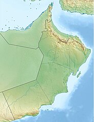
1013:
648:
144:
860:
855:
840:
820:
795:
775:
710:
1003:
647:{{Information |Description= {{de|Physische Positionskarte von
172:
1188:
1008:
920:
890:
865:
830:
805:
720:
1253:
1233:
1223:
1228:
1213:
200:
88:
1248:
1168:
936:
Template:Infobox mountain/test versus status quo ante 3
398:
Add a one-line explanation of what this file represents
1238:
1203:
659:
78:(1,537 × 2,000 pixels, file size: 909 KB, MIME type:
1033:
954:
565:
508:
Creative
Commons Attribution-ShareAlike 3.0 Unported
482:
Creative
Commons Attribution-ShareAlike 3.0 Unported
112:
Commons is a freely licensed media file repository.
1243:
1163:
988:
1173:
1198:
1183:
1178:
691:Archaeological Sites of Bat, Al-Khutm and Al-Ayn
1259:Knowledge:Kartenwerkstatt/Positionskarten/Asien
329:https://creativecommons.org/licenses/by-sa/3.0
93:
1044:Module:Mapa nin kinamumugtakan/datos/Oman/doc
335:Creative Commons Attribution-Share Alike 3.0
259:
244:
196:
130:
348:
234:
206:
14:
969:Módulu:Mapa de llocalización/datos/Omán/usu
295:– to copy, distribute and transmit the work
1039:Module:Mapa nin kinamumugtakan/datos/Oman
956:The following other wikis use this file:
964:Módulu:Mapa de llocalización/datos/Omán
1114:মডিউল:অবস্থান মানচিত্র/উপাত্ত/ওমান/নথি
876:Sultan Qaboos Grand Mosque, Al-Buraimi
661:The following 57 pages use this file:
124:
282:Attribution-Share Alike 3.0 Unported
558:
270:
265:
13:
1109:মডিউল:অবস্থান মানচিত্র/উপাত্ত/ওমান
826:National Bank of Oman Golf Classic
411:
405:
397:
256:
165:
137:
125:
71:
1279:
946:Module:Location map/data/Oman/doc
881:Sultan Qaboos Grand Mosque, Sohar
410:
388:
367:
355:
306:Under the following conditions:
277:This file is licensed under the
269:
264:
258:
92:
31:
21:
701:Ash Sharqiyah South Governorate
696:Ash Sharqiyah North Governorate
385:
166:
951:
931:User:Hike395/mountain bot diff
562:
384:
138:
26:
1:
941:Module:Location map/data/Oman
362:Equivalent administrative map
143:Physische Positionskarte von
1194:Al-Dschabal al-Achdar (Oman)
1154:Skabelon:Kortpositioner Oman
1124:Šablon:Lokacijska karta Oman
656:
418:Items portrayed in this file
133:Oman relief location map.jpg
7:
1209:Vorlage:Positionskarte Oman
1134:Plantilya:Location map Oman
1130:Usage on ceb.wikipedia.org
1030:Usage on bcl.wikipedia.org
975:Usage on azb.wikipedia.org
960:Usage on ast.wikipedia.org
751:Jabal Samhan Nature Reserve
228:STRM-30 data for the relief
10:
1284:
1160:Usage on de.wikipedia.org
1150:Usage on da.wikipedia.org
1140:Usage on ce.wikipedia.org
1120:Usage on bs.wikipedia.org
1100:Usage on bn.wikipedia.org
1050:Usage on bg.wikipedia.org
985:Usage on az.wikipedia.org
896:Wadi Bani Khalid (Wilayat)
871:Sultan Qaboos Grand Mosque
320:same or compatible license
219:File:Oman location map.svg
127:
781:Khazzan-Makarem gas field
559:
211:
171:Physical location map of
16:
1144:Кеп:Меттиган карта Ӏоман
999:Şablon:Yer xəritəsi Oman
387:
286:
99:This is a file from the
36:
686:Al Saleel National Park
646:
625:14:30, 12 December 2012
616:
595:20:17, 14 December 2012
199:
103:. Information from its
791:Khuriya Muriya Islands
106:description page there
41:Size of this preview:
1219:Churiya-Muriya-Inseln
801:Land of Frankincense
65:1,537 × 2,000 pixels
1079:Планина на слънцето
1064:Султан Кабус джамия
1019:Müsəndəm yarımadası
994:Kuriya-Muriya adası
851:Qurm Nature Reserve
816:Mukhaizna Oil Field
756:Jebel Akhdar (Oman)
301:– to adapt the work
47:Other resolutions:
811:Misfat al Abriyeen
374:French map of Oman
61:787 × 1,024 pixels
1268:more global usage
952:Global file usage
906:Wadi Khabb Shamsi
654:
492:copyright license
478:copyright license
404:
396:
381:
380:
253:
250:Reusing this file
121:
120:
101:Wikimedia Commons
32:Global file usage
1275:
1189:Hadschar-Gebirge
736:Gharif Formation
726:Dhofar Mountains
666:Al-Akhdhar, Oman
637:
607:
569:
547:12 December 2012
448:copyright status
434:copyright status
402:
394:
371:
359:
342:
339:
336:
333:
330:
322:as the original.
279:Creative Commons
273:
272:
268:
267:
262:
261:
247:
213:
202:
201:12 December 2012
170:
142:
134:
128:
117:
96:
95:
89:
83:
81:
68:
57:590 × 768 pixels
53:369 × 480 pixels
49:184 × 240 pixels
43:461 × 600 pixels
1283:
1282:
1278:
1277:
1276:
1274:
1273:
1272:
1254:Rimal Al Wahiba
1234:Dschabal Mischt
1224:Dschabal Schams
950:
741:Hajar Mountains
655:
643:
635:
613:
605:
561:
560:
557:
556:
555:
554:
553:
552:
551:
550:
548:
538:
537:
536:
534:
519:
518:
517:
516:
515:
514:
513:
512:
510:
498:
497:
496:
494:
475:
474:
473:
472:
471:
470:
469:
468:
466:
454:
453:
452:
450:
431:
430:
429:
428:
427:
425:
409:
408:
407:
400:
399:
382:
375:
372:
363:
360:
344:
343:
340:
337:
334:
331:
328:
327:
285:
274:
175:
147:
132:
123:
122:
111:
110:
109:is shown below.
85:
79:
77:
70:
69:
46:
12:
11:
5:
1281:
1270:of this file.
1264:
1263:
1262:
1261:
1256:
1251:
1246:
1241:
1236:
1231:
1226:
1221:
1216:
1211:
1206:
1201:
1196:
1191:
1186:
1181:
1176:
1171:
1166:
1158:
1157:
1156:
1148:
1147:
1146:
1138:
1137:
1136:
1128:
1127:
1126:
1118:
1117:
1116:
1111:
1106:
1098:
1097:
1096:
1091:
1086:
1081:
1076:
1071:
1066:
1061:
1059:Шаблон:ПК Оман
1056:
1048:
1047:
1046:
1041:
1036:
1028:
1027:
1026:
1021:
1016:
1011:
1006:
1001:
996:
991:
983:
982:
981:
973:
972:
971:
966:
953:
949:
948:
943:
938:
933:
928:
923:
918:
913:
908:
903:
898:
893:
888:
883:
878:
873:
868:
863:
858:
853:
848:
846:Qurayyat, Oman
843:
838:
833:
828:
823:
818:
813:
808:
803:
798:
793:
788:
783:
778:
773:
768:
763:
758:
753:
748:
746:Jabal Al Harim
743:
738:
733:
728:
723:
718:
713:
708:
703:
698:
693:
688:
683:
678:
676:Al Jalali Fort
673:
668:
658:
653:
652:
645:
641:
638:
634:1,537 × 2,000
632:
627:
622:
619:
618:
615:
611:
608:
604:1,537 × 2,000
602:
597:
592:
588:
587:
584:
581:
578:
575:
572:
564:
549:
546:
544:
543:
542:
540:
539:
535:
530:
528:
527:
526:
525:
523:
511:
506:
504:
503:
502:
500:
499:
495:
490:
488:
487:
486:
485:
483:
479:
467:
462:
460:
459:
458:
456:
455:
451:
446:
444:
443:
442:
441:
439:
435:
426:
421:
419:
416:
415:
414:
413:
401:
393:
392:
389:
386:
379:
378:
377:
376:
373:
366:
364:
361:
354:
350:
349:Other versions
346:
345:
326:
325:
324:
323:
313:
304:
303:
302:
296:
289:You are free:
276:
275:
257:
254:
242:
241:
236:
232:
231:
230:
229:
226:
208:
204:
203:
198:
194:
193:
192:
191:
188:
185:
182:
164:
163:
160:
157:
154:
135:
126:
119:
118:
97:
87:
86:
40:
35:
34:
29:
24:
19:
9:
6:
4:
3:
2:
1280:
1271:
1269:
1260:
1257:
1255:
1252:
1250:
1247:
1245:
1242:
1240:
1237:
1235:
1232:
1230:
1229:Dschabal Kawr
1227:
1225:
1222:
1220:
1217:
1215:
1212:
1210:
1207:
1205:
1202:
1200:
1197:
1195:
1192:
1190:
1187:
1185:
1182:
1180:
1177:
1175:
1172:
1170:
1167:
1165:
1162:
1161:
1159:
1155:
1152:
1151:
1149:
1145:
1142:
1141:
1139:
1135:
1132:
1131:
1129:
1125:
1122:
1121:
1119:
1115:
1112:
1110:
1107:
1105:
1102:
1101:
1099:
1095:
1092:
1090:
1087:
1085:
1082:
1080:
1077:
1075:
1072:
1070:
1067:
1065:
1062:
1060:
1057:
1055:
1052:
1051:
1049:
1045:
1042:
1040:
1037:
1035:
1032:
1031:
1029:
1025:
1024:Həcər dağları
1022:
1020:
1017:
1015:
1012:
1010:
1007:
1005:
1002:
1000:
997:
995:
992:
990:
987:
986:
984:
980:
977:
976:
974:
970:
967:
965:
962:
961:
959:
958:
957:
947:
944:
942:
939:
937:
934:
932:
929:
927:
926:Zawawi Mosque
924:
922:
919:
917:
914:
912:
909:
907:
904:
902:
899:
897:
894:
892:
889:
887:
884:
882:
879:
877:
874:
872:
869:
867:
864:
862:
859:
857:
854:
852:
849:
847:
844:
842:
839:
837:
834:
832:
829:
827:
824:
822:
819:
817:
814:
812:
809:
807:
804:
802:
799:
797:
794:
792:
789:
787:
784:
782:
779:
777:
774:
772:
769:
767:
764:
762:
759:
757:
754:
752:
749:
747:
744:
742:
739:
737:
734:
732:
731:Dibba Al-Baya
729:
727:
724:
722:
719:
717:
714:
712:
709:
707:
704:
702:
699:
697:
694:
692:
689:
687:
684:
682:
679:
677:
674:
672:
669:
667:
664:
663:
662:
650:
644:
639:
633:
631:
628:
626:
623:
621:
620:
614:
609:
603:
601:
598:
596:
593:
590:
589:
585:
582:
579:
576:
573:
571:
570:
568:
545:
533:
529:
509:
505:
493:
489:
465:
461:
449:
445:
424:
420:
417:
390:
383:
370:
365:
358:
353:
352:
351:
347:
332:CC BY-SA 3.0
321:
317:
314:
311:
308:
307:
305:
300:
297:
294:
291:
290:
288:
287:
283:
280:
263:
255:
251:
246:
243:
240:
237:
233:
227:
224:
220:
217:
216:
215:
209:
205:
195:
189:
186:
183:
180:
179:
178:
174:
169:
161:
158:
155:
152:
151:
150:
146:
141:
136:
129:
115:
108:
107:
102:
98:
91:
90:
84:
75:
74:Original file
66:
62:
58:
54:
50:
44:
39:
33:
30:
28:
25:
23:
20:
18:
15:
1265:
1214:Bucha (Oman)
1004:Masira adası
955:
660:
566:
563:File history
315:
309:
298:
292:
223:NordNordWest
210:
176:
167:
148:
139:
114:You can help
104:
72:
22:File history
1249:Haima (Ort)
1104:বাহলা দূর্গ
1094:Курия-Мурия
1009:Ras-əl-Cins
916:Wakan, Oman
771:Jebel Shams
766:Jebel Qihwi
464:copyrighted
438:copyrighted
316:share alike
310:attribution
131:Description
1169:Sur (Oman)
901:Wadi Hatta
761:Jebel Jais
716:Bilad Sayt
706:Bahla Fort
671:Al-Buraimi
657:File usage
580:Dimensions
245:Permission
190:E: 60.1° E
187:W: 51.8° E
184:S: 16.5° N
181:N: 26.6° N
162:O: 60.1° O
159:W: 51.8° O
156:S: 16.5° N
153:N: 26.6° N
80:image/jpeg
27:File usage
1239:Al-Chasab
1204:Khor Rori
911:Wadi Tiwi
886:Sur, Oman
836:Oman Open
786:Khor Rori
577:Thumbnail
574:Date/Time
532:inception
522:inception
168:English:
140:Deutsch:
1084:Мусандам
681:Al Qabil
636:(655 KB)
606:(909 KB)
391:Captions
299:to remix
293:to share
284:license.
214:, using
212:Own work
642:Carport
612:Carport
591:current
586:Comment
423:depicts
395:English
239:Carport
76:
1244:Kumzar
1164:Maskat
1089:Масира
1074:Хаджар
1054:Маскат
1034:Muscat
1014:Əş-Şam
989:Vaxiba
861:Samail
856:Rustaq
841:Qalhat
821:Muscat
796:Kumzar
776:Khasab
711:Bidiya
403:German
235:Author
207:Source
1266:View
1174:Suhar
1069:Бахла
921:Yibal
891:Taqah
866:Sohar
831:Nizwa
806:Madha
721:Bukha
1199:Taqa
1184:Oman
1179:Ubar
979:مسقط
649:Oman
583:User
341:true
338:true
197:Date
173:Oman
145:Oman
17:File
617:upd
221:by
63:|
59:|
55:|
51:|
45:.
252:)
248:(
225:.
116:.
82:)
67:.


