43:
258:
212:
264:
269:
95:
555:"}},"text\/plain":{"en":{"":"media type"}}},"{\"value\":\"image\\\/svg+xml\",\"type\":\"string\"}":{"text\/html":{"en":{"P1163":"image\/svg+xml"}},"text\/plain":{"en":{"P1163":"image\/svg+xml"}}}}": -->
511:"}},"text\/plain":{"en":{"":"copyright license"}}},"{\"value\":{\"entity-type\":\"item\",\"numeric-id\":19068220,\"id\":\"Q19068220\"},\"type\":\"wikibase-entityid\"}":{"text\/html":{"en":{"P275":"
467:"}},"text\/plain":{"en":{"":"copyright status"}}},"{\"value\":{\"entity-type\":\"item\",\"numeric-id\":50423863,\"id\":\"Q50423863\"},\"type\":\"wikibase-entityid\"}":{"text\/html":{"en":{"P6216":"
551:
721:
691:
661:
507:
310:– You must give appropriate credit, provide a link to the license, and indicate if changes were made. You may do so in any reasonable manner, but not in any way that suggests the licensor endorses you or your use.
369:
769:
1185:
1180:
231:
The ODbL does not require any particular license for maps produced from ODbL data. Prior to 1 August 2020, map tiles produced by the OpenStreetMap
Foundation were licensed under the
512:
468:
552:
464:
508:
1457:
69:
65:
61:
57:
53:
47:
418:
106:
1035:
78:
515:"}},"text\/plain":{"en":{"P275":"Creative Commons Attribution-ShareAlike 2.0 Generic"}}}}": -->
188:
865:
538:
494:
1170:
1165:
1150:
860:
1468:
This file contains additional information, probably added from the digital camera or scanner used to create or digitize it.
750:
745:
720:
715:
690:
685:
660:
655:
870:
317:
985:
562:
478:
1175:
522:
453:
955:
970:
965:
1085:
1155:
825:
790:
279:
1095:
1090:
1471:
If the file has been modified from its original state, some details may not fully reflect the modified file.
1010:
905:
368:
204:). Map tiles are licensed under the Creative Commons Attribution-ShareAlike 2.0 license (CC-BY-SA 2.0).
316:– If you remix, transform, or build upon the material, you must distribute your contributions under the
1075:
1055:
895:
820:
1100:
1030:
1025:
940:
910:
890:
845:
840:
805:
785:
471:"}},"text\/plain":{"en":{"P6216":"copyrighted"}}}}": -->
1125:
1115:
1060:
1045:
1000:
920:
885:
830:
630:
625:
42:
1105:
1040:
990:
114:
1140:
1050:
995:
960:
935:
1080:
800:
1110:
1005:
276:
149:
This map may be incomplete, and may contain errors. Don't rely solely on it for navigation.
8:
1135:
1130:
980:
900:
1120:
975:
875:
850:
1160:
915:
855:
835:
101:
443:
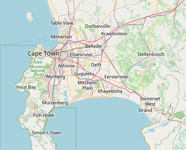
1020:
950:
925:
810:
392:
232:
224:
144:
1070:
1015:
930:
197:
1278:
1145:
1065:
880:
795:
201:
572:
532:
488:
1186:
Module:Location map/data/South Africa
Western Cape Greater Cape Town/doc
1378:
761:
731:
701:
671:
641:
211:
140:
815:
1181:
Module:Location map/data/South Africa
Western Cape Greater Cape Town
206:
945:
598:
Click on a date/time to view the file as it appeared at that time.
235:. Maps produced by other people may be subject to other licences.
220:
1263:
167:
1258:
1238:
1408:
83:(SVG file, nominally 496 × 399 pixels, file size: 10.71 MB)
1373:
1293:
1423:
1333:
89:
1418:
1368:
1343:
1303:
1298:
1433:
1428:
1413:
1338:
1308:
1253:
1223:
1203:
437:
Add a one-line explanation of what this file represents
401:
If inappropriate please set warp_status = skip to hide.
1398:
1393:
1388:
1363:
1353:
1348:
1328:
1323:
1318:
1313:
1273:
1233:
1208:
1438:
1358:
1283:
1243:
1228:
779:
1448:
1403:
1288:
1268:
1248:
1218:
1213:
1194:
596:
113:
Commons is a freely licensed media file repository.
1443:
1383:
539:
Creative
Commons Attribution-ShareAlike 2.0 Generic
513:
Creative
Commons Attribution-ShareAlike 2.0 Generic
387:
351:
1036:Red Cross War Memorial Children's Hospital
327:https://creativecommons.org/licenses/by-sa/2.0
94:
333:Creative Commons Attribution-Share Alike 2.0
257:
244:http://opendatacommons.org/licenses/odbl/1.0/
183:
155:
131:
173:
163:
14:
770:Category:OpenStreetMap maps of South Africa
293:– to copy, distribute and transmit the work
46:Size of this PNG preview of this SVG file:
419:OpenStreetMap Kaapstad klein Afrikaans.svg
196:OpenStreetMap data is available under the
147:project data, collected by the community.
128:
1196:The following other wikis use this file:
866:Community House (Salt River, Cape Town)
395:Georeference the map in Wikimaps Warper
1171:User:JJRetief/Rietvlei Wetland Reserve
1166:User:Axxter99/Cape Town Science Centre
781:The following 81 pages use this file:
1151:Woodstock railway station (Cape Town)
861:Claremont railway station (Cape Town)
768:{{OpenStreetMap|location=Cape Town}}
417:Derivative works of this file:
125:
871:Crawford railway station (Cape Town)
223:, which is made available under the
219:This work contains information from
986:Milnerton Racecourse Nature Reserve
589:
412:
280:Attribution-Share Alike 2.0 Generic
268:
263:
13:
1466:
1176:Module:Location map/data/Cape Town
442:
436:
254:
126:
76:
1500:
1473:
1086:Simon's Town railway station
956:List of windmills in South Africa
441:
134:OpenStreetMap Cape Town small.svg
971:Macassar Dunes Conservation Area
966:Lutheran Church in Strand Street
427:
367:
304:Under the following conditions:
275:This file is licensed under the
267:
262:
256:
210:
93:
31:
21:
1279:Kaapstad Internasionale Lughawe
1156:Zandvlei Estuary Nature Reserve
826:Cape Town International Airport
424:
1191:
791:Alexandra Hospital (Cape Town)
593:
423:
26:
1:
1096:Statue of Jan Hendrik Hofmeyr
1091:Somerset Hospital (Cape Town)
393:
36:
776:
449:Items portrayed in this file
225:Open Database License (ODbL)
209:
7:
1463:
1011:Observatory railway station
906:Edith Stephens Wetland Park
10:
1505:
1200:Usage on af.wikipedia.org
1076:Salt River railway station
1056:Rondebosch railway station
896:Diep River Fynbos Corridor
821:Cape Town Holocaust Centre
355:
318:same or compatible license
178:OpenStreetMap contributors
1101:Steenberg railway station
1031:Raapenberg Bird Sanctuary
1026:Pinelands railway station
941:Heart of Cape Town Museum
911:Fish Hoek railway station
891:Die Oog Conservation Area
846:Central Library Cape Town
841:Cape Town railway station
806:Bellville railway station
786:Air Force Base Ysterplaat
590:
378:
358:
346:
16:
1126:Tygerberg Nature Reserve
1116:Table Bay Nature Reserve
1061:Rosebank railway station
1046:Rietvlei Wetland Reserve
1001:Newlands railway station
921:Grand Parade (Cape Town)
886:Dick Dent Bird Sanctuary
831:Cape Town Science Centre
426:
284:
100:This is a file from the
41:
1106:Steenbras Power Station
1041:Retreat railway station
991:Mowbray railway station
767:
737:
707:
677:
647:
104:. Information from its
1141:Wolfgat Nature Reserve
1051:Robben Island (prison)
996:Mutual railway station
961:Little Hearts Festival
936:Groote Schuur Hospital
746:16:36, 3 February 2010
716:07:07, 12 January 2011
686:07:12, 12 January 2011
656:08:27, 16 January 2022
626:09:11, 16 January 2022
347: Geotemporal data
107:description page there
1379:Hoërskool Durbanville
1081:Selborne Graving Dock
801:Baxter Theatre Centre
238:Open Database License
198:Open Database License
1111:Sunnydale, Cape Town
1006:Noordhoek, Cape Town
233:CC-BY-SA-2.0 license
70:2,546 × 2,048 pixels
66:1,273 × 1,024 pixels
1264:Claremont, Kaapstad
1136:Wingfield Aerodrome
1131:Valkenberg Hospital
981:Meadowridge Library
901:District Six Museum
851:Chapman's Peak
299:– to adapt the work
52:Other resolutions:
1259:Rosebank, Kaapstad
1121:Tygerberg Hospital
976:Meadowridge Common
876:De Hel Nature Area
159:(see file history)
1492:
1491:
1458:more global usage
1192:Global file usage
1161:Zoarvlei Wetlands
916:Glencairn Wetland
856:Chavonnes Battery
836:Cape Town Stadium
774:
523:copyright license
509:copyright license
435:
406:
405:
402:
383:
382:
253:
252:
236:
192:
189:Reusing this file
168:openstreetmap.org
150:
143:was created from
122:
121:
102:Wikimedia Commons
32:Global file usage
1496:
1474:
1239:Strand, Wes-Kaap
1021:Palm Tree Mosque
951:Klein Constantia
926:Groot Constantia
811:Breakwater Lodge
758:
728:
698:
668:
648:customize labels
638:
600:
479:copyright status
465:copyright status
433:
413:derivative works
400:
399:
397:
396:
371:
356:
340:
337:
334:
331:
328:
320:as the original.
277:Creative Commons
271:
270:
266:
265:
260:
259:
248:
245:
242:
239:
230:
214:
207:
186:
148:
135:
129:
118:
97:
96:
90:
84:
73:
62:955 × 768 pixels
58:597 × 480 pixels
54:298 × 240 pixels
48:496 × 399 pixels
1504:
1503:
1499:
1498:
1497:
1495:
1494:
1493:
1462:
1409:Schotsche Kloof
1190:
775:
764:
756:
734:
726:
704:
696:
674:
666:
644:
636:
592:
591:
588:
587:
586:
585:
584:
583:
582:
581:
579:
569:
568:
567:
565:
550:
549:
548:
547:
546:
545:
544:
543:
541:
529:
528:
527:
525:
506:
505:
504:
503:
502:
501:
500:
499:
497:
485:
484:
483:
481:
462:
461:
460:
459:
458:
456:
440:
439:
438:
415:
407:
394:
391:
342:
341:
338:
335:
332:
329:
326:
325:
283:
272:
246:
243:
240:
237:
179:
151:
133:
124:
123:
112:
111:
110:is shown below.
86:
82:
75:
74:
51:
12:
11:
5:
1502:
1490:
1489:
1486:
1482:
1481:
1478:
1465:
1460:of this file.
1454:
1453:
1452:
1451:
1446:
1441:
1436:
1431:
1426:
1421:
1416:
1411:
1406:
1401:
1396:
1391:
1386:
1381:
1376:
1371:
1366:
1361:
1356:
1351:
1346:
1341:
1336:
1331:
1326:
1321:
1316:
1311:
1306:
1301:
1296:
1291:
1286:
1281:
1276:
1271:
1266:
1261:
1256:
1251:
1246:
1241:
1236:
1231:
1226:
1221:
1216:
1211:
1206:
1193:
1189:
1188:
1183:
1178:
1173:
1168:
1163:
1158:
1153:
1148:
1143:
1138:
1133:
1128:
1123:
1118:
1113:
1108:
1103:
1098:
1093:
1088:
1083:
1078:
1073:
1068:
1063:
1058:
1053:
1048:
1043:
1038:
1033:
1028:
1023:
1018:
1013:
1008:
1003:
998:
993:
988:
983:
978:
973:
968:
963:
958:
953:
948:
943:
938:
933:
928:
923:
918:
913:
908:
903:
898:
893:
888:
883:
878:
873:
868:
863:
858:
853:
848:
843:
838:
833:
828:
823:
818:
813:
808:
803:
798:
793:
788:
778:
773:
772:
766:
762:
759:
753:
748:
743:
740:
739:
736:
732:
729:
723:
718:
713:
710:
709:
706:
702:
699:
693:
688:
683:
680:
679:
676:
672:
669:
663:
658:
653:
650:
649:
646:
642:
639:
633:
628:
623:
619:
618:
615:
612:
609:
606:
603:
595:
580:
577:
575:
574:
573:
571:
570:
566:
561:
559:
558:
557:
556:
554:
542:
537:
535:
534:
533:
531:
530:
526:
521:
519:
518:
517:
516:
514:
510:
498:
493:
491:
490:
489:
487:
486:
482:
477:
475:
474:
473:
472:
470:
466:
457:
452:
450:
447:
446:
445:
444:
432:
431:
428:
425:
414:
411:
404:
403:
389:
388:Georeferencing
385:
384:
381:
380:
376:
375:
372:
365:
361:
360:
353:
349:
348:
344:
343:
324:
323:
322:
321:
311:
302:
301:
300:
294:
287:You are free:
274:
273:
255:
251:
250:
217:
215:
193:
181:
180:
177:
175:
171:
170:
165:
161:
160:
157:
153:
152:
138:
136:
127:
120:
119:
98:
88:
87:
45:
40:
39:
34:
29:
24:
19:
9:
6:
4:
3:
2:
1501:
1487:
1484:
1483:
1479:
1476:
1475:
1472:
1469:
1461:
1459:
1450:
1447:
1445:
1442:
1440:
1437:
1435:
1432:
1430:
1427:
1425:
1422:
1420:
1417:
1415:
1412:
1410:
1407:
1405:
1402:
1400:
1397:
1395:
1392:
1390:
1387:
1385:
1382:
1380:
1377:
1375:
1374:Tamboerskloof
1372:
1370:
1367:
1365:
1362:
1360:
1357:
1355:
1352:
1350:
1347:
1345:
1342:
1340:
1337:
1335:
1332:
1330:
1327:
1325:
1322:
1320:
1317:
1315:
1312:
1310:
1307:
1305:
1302:
1300:
1297:
1295:
1294:Drieankerbaai
1292:
1290:
1287:
1285:
1282:
1280:
1277:
1275:
1272:
1270:
1267:
1265:
1262:
1260:
1257:
1255:
1252:
1250:
1247:
1245:
1242:
1240:
1237:
1235:
1232:
1230:
1227:
1225:
1222:
1220:
1217:
1215:
1212:
1210:
1207:
1205:
1202:
1201:
1199:
1198:
1197:
1187:
1184:
1182:
1179:
1177:
1174:
1172:
1169:
1167:
1164:
1162:
1159:
1157:
1154:
1152:
1149:
1147:
1144:
1142:
1139:
1137:
1134:
1132:
1129:
1127:
1124:
1122:
1119:
1117:
1114:
1112:
1109:
1107:
1104:
1102:
1099:
1097:
1094:
1092:
1089:
1087:
1084:
1082:
1079:
1077:
1074:
1072:
1071:SAS Wingfield
1069:
1067:
1064:
1062:
1059:
1057:
1054:
1052:
1049:
1047:
1044:
1042:
1039:
1037:
1034:
1032:
1029:
1027:
1024:
1022:
1019:
1017:
1016:Ou Kaapse Weg
1014:
1012:
1009:
1007:
1004:
1002:
999:
997:
994:
992:
989:
987:
984:
982:
979:
977:
974:
972:
969:
967:
964:
962:
959:
957:
954:
952:
949:
947:
944:
942:
939:
937:
934:
932:
931:Groote Schuur
929:
927:
924:
922:
919:
917:
914:
912:
909:
907:
904:
902:
899:
897:
894:
892:
889:
887:
884:
882:
879:
877:
874:
872:
869:
867:
864:
862:
859:
857:
854:
852:
849:
847:
844:
842:
839:
837:
834:
832:
829:
827:
824:
822:
819:
817:
814:
812:
809:
807:
804:
802:
799:
797:
794:
792:
789:
787:
784:
783:
782:
771:
765:
760:
754:
752:
749:
747:
744:
742:
741:
735:
730:
724:
722:
719:
717:
714:
712:
711:
705:
700:
694:
692:
689:
687:
684:
682:
681:
675:
670:
664:
662:
659:
657:
654:
652:
651:
645:
640:
634:
632:
629:
627:
624:
621:
620:
616:
613:
610:
607:
604:
602:
601:
599:
578:image/svg+xml
576:
564:
560:
540:
536:
524:
520:
496:
492:
480:
476:
455:
451:
448:
429:
422:
421:
420:
410:
409:
398:
390:
386:
377:
373:
370:
366:
363:
362:
357:
354:
350:
345:
330:CC BY-SA 2.0
319:
315:
312:
309:
306:
305:
303:
298:
295:
292:
289:
288:
286:
285:
281:
278:
261:
249:
234:
228:
226:
222:
221:OpenStreetMap
218:
216:
213:
208:
205:
203:
199:
194:
190:
185:
182:
176:
172:
169:
166:
162:
158:
154:
146:
145:OpenStreetMap
142:
137:
130:
116:
109:
108:
103:
99:
92:
91:
85:
80:
79:Original file
71:
67:
63:
59:
55:
49:
44:
38:
35:
33:
30:
28:
25:
23:
20:
18:
15:
1470:
1467:
1455:
1424:Elsiesrivier
1334:Bishopscourt
1195:
1146:Woodhead Dam
1066:SAAO Library
881:De Waal Park
796:Auwal Mosque
780:
708:*tiny* tweak
597:
594:File history
416:
408:
352:Bounding box
313:
307:
296:
290:
229:
195:
139:This map of
115:You can help
105:
77:
22:File history
1419:Mouillepunt
1369:Oranjezicht
1344:Monte Vista
1304:Observatory
1299:Brackenfell
495:copyrighted
469:copyrighted
314:share alike
308:attribution
132:Description
1434:Blue Downs
1429:Bantrybaai
1414:Zonnebloem
1339:Heathfield
1309:Soutrivier
1254:Rondebosch
1224:Table View
1204:Constantia
777:File usage
755:496 × 399
725:424 × 351
695:424 × 351
667:(12.15 MB)
665:496 × 399
637:(10.71 MB)
635:496 × 399
611:Dimensions
563:media type
553:media type
379:S: 34.25°S
364:W: 18.25°E
359:N: 33.75°S
184:Permission
27:File usage
1399:Vredehoek
1394:Higgovale
1389:Kampsbaai
1364:Noordhoek
1354:Milnerton
1349:Lansdowne
1329:Bergvliet
1324:Llandudno
1319:Plumstead
1314:Woodstock
1274:Zwaanswyk
1234:Pinelands
1209:Steenberg
816:Camps Bay
757:(2.36 MB)
727:(1.72 MB)
697:(1.71 MB)
608:Thumbnail
605:Date/Time
141:Cape Town
1464:Metadata
1439:Crawford
1359:Kalkbaai
1284:Maitland
1244:Nuweland
1229:Goodwood
946:Hout Bay
430:Captions
297:to remix
291:to share
282:license.
37:Metadata
1449:Mfuleni
1404:Clifton
1289:Seepunt
1269:Mowbray
1249:Wynberg
1219:Bo-Kaap
1214:Athlone
622:current
617:Comment
454:depicts
434:English
374:E: 19°E
202:details
174:Creator
81:
1485:Height
1444:Ottery
1384:Belhar
738:bounds
678:update
164:Source
1488:319pt
1480:397pt
1477:Width
1456:View
763:Htonl
733:Htonl
703:Htonl
673:Htonl
643:Htonl
614:User
339:true
336:true
247:true
241:ODbL
156:Date
17:File
227:.
68:|
64:|
60:|
56:|
50:.
200:(
191:)
187:(
117:.
72:.
Text is available under the Creative Commons Attribution-ShareAlike License. Additional terms may apply.
