877:"}},"text\/plain":{"en":{"":"coordinates of the point of view"}}},"{\"value\":{\"latitude\":54.56338,\"longitude\":-1.2025,\"altitude\":null,\"precision\":1.0e-5,\"globe\":\"http:\\\/\\\/www.wikidata.org\\\/entity\\\/Q2\"},\"type\":\"globecoordinate\"}":{"text\/html":{"en":{"P1259":"54\u00b033'48.17"N, 1\u00b012'9.00"W"}},"text\/plain":{"en":{"P1259":"54\u00b033'48.17\"N, 1\u00b012'9.00\"W"}}},"{\"value\":{\"entity-type\":\"property\",\"numeric-id\":7787,\"id\":\"P7787\"},\"type\":\"wikibase-entityid\"}":{"text\/html":{"en":{"":"
945:"}},"text\/plain":{"en":{"":"coordinates of depicted place"}}},"{\"value\":{\"latitude\":54.56383,\"longitude\":-1.2031,\"altitude\":null,\"precision\":1.0e-5,\"globe\":\"http:\\\/\\\/www.wikidata.org\\\/entity\\\/Q2\"},\"type\":\"globecoordinate\"}":{"text\/html":{"en":{"P9149":"54\u00b033'49.79"N, 1\u00b012'11.16"W"}},"text\/plain":{"en":{"P9149":"54\u00b033'49.79\"N, 1\u00b012'11.16\"W"}}},"{\"value\":{\"entity-type\":\"property\",\"numeric-id\":7787,\"id\":\"P7787\"},\"type\":\"wikibase-entityid\"}":{"text\/html":{"en":{"":"
720:"}},"text\/plain":{"en":{"":"inception"}}},"{\"value\":{\"time\":\"+2008-06-19T00:00:00Z\",\"timezone\":0,\"before\":0,\"after\":0,\"precision\":11,\"calendarmodel\":\"http:\\\/\\\/www.wikidata.org\\\/entity\\\/Q1985727\"},\"type\":\"time\"}":{"text\/html":{"en":{"P571":"19 June 2008"}},"text\/plain":{"en":{"P571":"19 June 2008"}}}}": -->
445:
754:
276:
226:
941:
218:
290:
240:
311:
349:
354:
67:
770:"}},"text\/plain":{"en":{"P973":"https:\/\/www.geograph.org.uk\/photo\/854119"}}},"{\"value\":{\"entity-type\":\"property\",\"numeric-id\":7384,\"id\":\"P7384\"},\"type\":\"wikibase-entityid\"}":{"text\/html":{"en":{"":"
541:"}},"text\/plain":{"en":{"P2699":"https:\/\/www.geograph.org.uk\/profile\/343"}}},"{\"value\":{\"entity-type\":\"property\",\"numeric-id\":2093,\"id\":\"P2093\"},\"type\":\"wikibase-entityid\"}":{"text\/html":{"en":{"":"
545:"}},"text\/plain":{"en":{"":"author name string"}}},"{\"value\":\"Mick Garratt\",\"type\":\"string\"}":{"text\/html":{"en":{"P2093":"Mick Garratt"}},"text\/plain":{"en":{"P2093":"Mick Garratt"}}}}": -->
762:"}},"text\/plain":{"en":{"P7482":"file available on the internet"}}},"{\"value\":{\"entity-type\":\"property\",\"numeric-id\":973,\"id\":\"P973\"},\"type\":\"wikibase-entityid\"}":{"text\/html":{"en":{"":"
529:"}},"text\/plain":{"en":{"":"object of statement has role"}}},"{\"value\":{\"entity-type\":\"item\",\"numeric-id\":33231,\"id\":\"Q33231\"},\"type\":\"wikibase-entityid\"}":{"text\/html":{"en":{"P3831":"
676:"}},"text\/plain":{"en":{"":"copyright license"}}},"{\"value\":{\"entity-type\":\"item\",\"numeric-id\":19068220,\"id\":\"Q19068220\"},\"type\":\"wikibase-entityid\"}":{"text\/html":{"en":{"P275":"
632:"}},"text\/plain":{"en":{"":"copyright status"}}},"{\"value\":{\"entity-type\":\"item\",\"numeric-id\":50423863,\"id\":\"Q50423863\"},\"type\":\"wikibase-entityid\"}":{"text\/html":{"en":{"P6216":"
758:"}},"text\/plain":{"en":{"":"source of file"}}},"{\"value\":{\"entity-type\":\"item\",\"numeric-id\":74228490,\"id\":\"Q74228490\"},\"type\":\"wikibase-entityid\"}":{"text\/html":{"en":{"P7482":"
533:"}},"text\/plain":{"en":{"P3831":"photographer"}}},"{\"value\":{\"entity-type\":\"property\",\"numeric-id\":2699,\"id\":\"P2699\"},\"type\":\"wikibase-entityid\"}":{"text\/html":{"en":{"":"
949:"}},"text\/plain":{"en":{"":"heading"}}},"{\"value\":{\"amount\":\"+315\",\"unit\":\"http:\\\/\\\/www.wikidata.org\\\/entity\\\/Q28390\"},\"type\":\"quantity\"}":{"text\/html":{"en":{"P7787":"315
881:"}},"text\/plain":{"en":{"":"heading"}}},"{\"value\":{\"amount\":\"+315\",\"unit\":\"http:\\\/\\\/www.wikidata.org\\\/entity\\\/Q28390\"},\"type\":\"quantity\"}":{"text\/html":{"en":{"P7787":"315
782:"}},"text\/plain":{"en":{"":"operator"}}},"{\"value\":{\"entity-type\":\"item\",\"numeric-id\":1503119,\"id\":\"Q1503119\"},\"type\":\"wikibase-entityid\"}":{"text\/html":{"en":{"P137":"
778:"}},"text\/plain":{"en":{"P7384":"854119"}}},"{\"value\":{\"entity-type\":\"property\",\"numeric-id\":137,\"id\":\"P137\"},\"type\":\"wikibase-entityid\"}":{"text\/html":{"en":{"":"
525:"}},"text\/plain":{"en":{"":"creator"}}},"{\"value\":{\"entity-type\":\"property\",\"numeric-id\":3831,\"id\":\"P3831\"},\"type\":\"wikibase-entityid\"}":{"text\/html":{"en":{"":"
628:
766:"}},"text\/plain":{"en":{"":"described at URL"}}},"{\"value\":\"https:\\\/\\\/www.geograph.org.uk\\\/photo\\\/854119\",\"type\":\"string\"}":{"text\/html":{"en":{"P973":"
537:"}},"text\/plain":{"en":{"":"URL"}}},"{\"value\":\"https:\\\/\\\/www.geograph.org.uk\\\/profile\\\/343\",\"type\":\"string\"}":{"text\/html":{"en":{"P2699":"
38:
774:"}},"text\/plain":{"en":{"":"geograph.org.uk image ID"}}},"{\"value\":\"854119\",\"type\":\"string\"}":{"text\/html":{"en":{"P7384":"
259:
209:
401:– You must give appropriate credit, provide a link to the license, and indicate if changes were made. You may do so in any reasonable manner, but not in any way that suggests the licensor endorses you or your use.
273:
223:
775:
759:
677:
633:
783:
530:
946:
942:
878:
874:
771:
755:
629:
542:
534:
526:
78:
779:
767:
763:
717:
673:
522:
46:
538:
465:
454:
1061:
1068:== {{int:filedesc}} == {{Information |description={{en|1=Pallister Park}} |date=2008-06-19 |source=From |author= |permission= |other_versions= }
680:"}},"text\/plain":{"en":{"P275":"Creative Commons Attribution-ShareAlike 2.0 Generic"}}}}": -->
809:
703:
659:
283:
233:
859:
318:
1093:
This file contains additional information, probably added from the digital camera or scanner used to create or digitize it.
408:
586:
987:
960:
919:
892:
837:
793:
643:
609:
594:
579:
852:
822:
727:
687:
552:
511:
786:"}},"text\/plain":{"en":{"P137":"Geograph Britain and Ireland"}}}}": -->
1050:
1045:
37:
364:
1096:
If the file has been modified from its original state, some details may not fully reflect the modified file.
407:– If you remix, transform, or build upon the material, you must distribute your contributions under the
325:
on the
Geograph website for the photographer's contact details. The copyright on this image is owned by
461:
Please remove redundant categories and try to put this image in the most specific category/categories.
636:"}},"text\/plain":{"en":{"P6216":"copyrighted"}}}}": -->
953:"}},"text\/plain":{"en":{"P7787":"315 degree"}}}}": -->
885:"}},"text\/plain":{"en":{"P7787":"315 degree"}}}}": -->
86:
178:
1105:
844:
829:
361:
162:
601:
8:
305:
289:
239:
330:
73:
501:
1112:
1144:
141:
970:
902:
803:
737:
697:
653:
562:
151:
310:
1132:
1082:
322:
1122:
1018:
Click on a date/time to view the file as it appeared at that time.
275:
225:
451:
The categories of this image need checking. You can do so
260:
54° 33′ 50″ N, 1° 12′ 11″ W
210:
54° 33′ 48″ N, 1° 12′ 09″ W
130:
61:
495:
Add a one-line explanation of what this file represents
1076:
1016:
85:
Commons is a freely licensed media file repository.
704:
Creative
Commons Attribution-ShareAlike 2.0 Generic
678:
Creative
Commons Attribution-ShareAlike 2.0 Generic
51:(640 × 427 pixels, file size: 271 KB, MIME type:
438:
418:https://creativecommons.org/licenses/by-sa/2.0
66:
424:Creative Commons Attribution-Share Alike 2.0
342:
126:
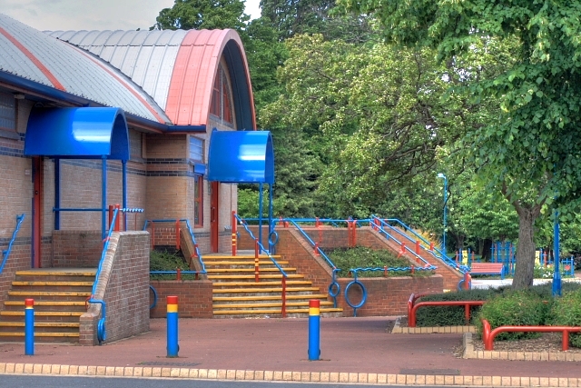
111:Pallister Park - geograph.org.uk - 854119.jpg
108:
47:Pallister_Park_-_geograph.org.uk_-_854119.jpg
768:https:\/\/www.geograph.org.uk\/photo\/854119
147:
136:
14:
950:
882:
539:https:\/\/www.geograph.org.uk\/profile\/343
384:– to copy, distribute and transmit the work
464:You can remove this template by clicking
830:https://www.geograph.org.uk/photo/854119
602:https://www.geograph.org.uk/profile/343
282:View this and other nearby images on:
232:View this and other nearby images on:
185:
97:
329:and is licensed for reuse under the
250:
200:
1078:The following page uses this file:
1009:
365:Attribution-Share Alike 2.0 Generic
353:
348:
333:Attribution-ShareAlike 2.0 license.
13:
1091:
500:
494:
339:
316:
115:
98:
44:
1169:
1098:
499:
1154:Date and time of data generation
893:coordinates of the point of view
875:coordinates of the point of view
485:
443:
395:Under the following conditions:
360:This file is licensed under the
352:
347:
341:
309:
288:
274:
266:
238:
224:
216:
65:
21:
482:
116:
41:No higher resolution available.
1013:
810:file available on the internet
760:file available on the internet
481:
317:This image was taken from the
26:
1:
961:coordinates of depicted place
943:coordinates of depicted place
31:
1073:
860:Geograph Britain and Ireland
784:Geograph Britain and Ireland
580:object of statement has role
527:object of statement has role
507:Items portrayed in this file
301:
265:
215:
7:
1088:
976:54°33'49.79"N, 1°12'11.16"W
10:
1174:
908:54°33'48.17"N, 1°12'9.00"W
442:
409:same or compatible license
105:
100:
1010:
191:Mick Garratt /
172:Mick Garratt /
16:
838:geograph.org.uk image ID
772:geograph.org.uk image ID
484:
375:
72:This is a file from the
36:
1067:
1046:02:56, 21 February 2011
468:(or on the first line).
163:required by the license
129:
76:. Information from its
1106:Canon EOS 400D DIGITAL
323:this photograph's page
294:54.563830; -1.203100
244:54.563380; -1.202500
79:description page there
1157:12:40, 19 June 2008
1117:1/160 sec (0.00625)
390:– to adapt the work
610:author name string
543:author name string
1161:
1160:
1071:
952:
884:
688:copyright license
674:copyright license
493:
474:
473:
338:
337:
321:collection. See
299:
298:
249:
248:
198:
197:
166:
94:
93:
74:Wikimedia Commons
1165:
1099:
1058:
1020:
998:
997:
992:
930:
929:
924:
862:
857:
847:
842:
832:
827:
823:described at URL
764:described at URL
644:copyright status
630:copyright status
617:
614:
604:
599:
589:
584:
491:
447:
446:
440:
439:
431:
428:
425:
422:
419:
411:as the original.
373:
362:Creative Commons
356:
355:
351:
350:
345:
344:
331:Creative Commons
319:Geograph project
313:
306:
295:
292:
278:
277:
271:
270:
269:
263:
262:
251:
245:
242:
228:
227:
221:
220:
219:
213:
212:
201:
160:
132:
120:
112:
106:
90:
69:
68:
62:
56:
54:
1173:
1172:
1168:
1167:
1166:
1164:
1163:
1162:
1087:
1072:
1064:
1056:
1012:
1011:
1008:
1007:
1006:
1005:
1004:
1003:
1002:
1001:
1000:
999:
995:
993:
990:
981:
980:
979:
977:
967:
966:
965:
963:
940:
939:
938:
937:
936:
935:
934:
933:
932:
931:
927:
925:
922:
913:
912:
911:
909:
899:
898:
897:
895:
872:
871:
870:
869:
868:
867:
866:
865:
864:
863:
858:
855:
849:
848:
843:
840:
834:
833:
828:
825:
816:
815:
814:
812:
800:
799:
798:
796:
753:
752:
751:
750:
749:
748:
747:
746:
744:
734:
733:
732:
730:
715:
714:
713:
712:
711:
710:
709:
708:
706:
694:
693:
692:
690:
671:
670:
669:
668:
667:
666:
665:
664:
662:
650:
649:
648:
646:
627:
626:
625:
624:
623:
622:
621:
620:
619:
618:
615:
612:
606:
605:
600:
597:
591:
590:
585:
582:
573:
572:
571:
569:
559:
558:
557:
555:
520:
519:
518:
517:
516:
514:
498:
497:
496:
479:
475:
444:
433:
432:
429:
426:
423:
420:
417:
416:
374:
371:
368:
357:
334:
304:
293:
267:
258:
257:
254:Object location
243:
217:
208:
207:
204:Camera location
199:
188:
181:
169:
142:geograph.org.uk
122:
110:
103:
96:
95:
84:
83:
82:is shown below.
58:
52:
50:
43:
42:
12:
11:
5:
1171:
1159:
1158:
1155:
1151:
1150:
1147:
1140:
1139:
1136:
1129:
1128:
1125:
1119:
1118:
1115:
1109:
1108:
1103:
1090:
1086:
1085:
1075:
1070:
1069:
1066:
1062:
1059:
1053:
1048:
1043:
1039:
1038:
1035:
1032:
1029:
1026:
1023:
1015:
986:
985:
984:
983:
982:
978:
975:
973:
972:
971:
969:
968:
964:
959:
957:
956:
955:
954:
948:
944:
918:
917:
916:
915:
914:
910:
907:
905:
904:
903:
901:
900:
896:
891:
889:
888:
887:
886:
880:
876:
851:
850:
836:
835:
821:
820:
819:
818:
817:
813:
808:
806:
805:
804:
802:
801:
797:
794:source of file
792:
790:
789:
788:
787:
785:
781:
777:
773:
769:
765:
761:
757:
756:source of file
745:
742:
740:
739:
738:
736:
735:
731:
726:
724:
723:
722:
721:
719:
707:
702:
700:
699:
698:
696:
695:
691:
686:
684:
683:
682:
681:
679:
675:
663:
658:
656:
655:
654:
652:
651:
647:
642:
640:
639:
638:
637:
635:
631:
608:
607:
593:
592:
578:
577:
576:
575:
574:
570:
567:
565:
564:
563:
561:
560:
556:
551:
549:
548:
547:
546:
544:
540:
536:
532:
528:
524:
515:
510:
508:
505:
504:
503:
502:
490:
489:
486:
483:
472:
471:
470:
469:
462:
448:
437:
415:
414:
413:
412:
402:
393:
392:
391:
385:
378:You are free:
369:
359:
358:
340:
336:
335:
314:
303:
300:
297:
296:
286:
280:
255:
247:
246:
236:
230:
205:
196:
195:
193:Pallister Park
189:
186:
183:
182:
177:
174:Pallister Park
170:
167:
155:
154:
149:
145:
144:
138:
134:
133:
128:
124:
123:
121:Pallister Park
113:
104:
102:
99:
92:
91:
70:
60:
59:
40:
35:
34:
29:
24:
19:
9:
6:
4:
3:
2:
1170:
1156:
1153:
1152:
1148:
1146:
1142:
1141:
1137:
1134:
1131:
1130:
1126:
1124:
1121:
1120:
1116:
1114:
1113:Exposure time
1111:
1110:
1107:
1104:
1101:
1100:
1097:
1094:
1084:
1081:
1080:
1079:
1065:
1060:
1054:
1052:
1049:
1047:
1044:
1041:
1040:
1036:
1033:
1030:
1027:
1024:
1022:
1021:
1019:
989:
974:
962:
958:
921:
906:
894:
890:
861:
854:
846:
839:
831:
824:
811:
807:
795:
791:
741:
729:
725:
705:
701:
689:
685:
661:
657:
645:
641:
611:
603:
596:
588:
581:
566:
554:
550:
513:
509:
506:
487:
480:
478:
477:
467:
463:
460:
459:
458:
456:
452:
449:
441:
436:
435:
421:CC BY-SA 2.0
410:
406:
403:
400:
397:
396:
394:
389:
386:
383:
380:
379:
377:
376:
370:Attribution:
366:
363:
346:
332:
328:
324:
320:
315:
312:
308:
307:
291:
287:
285:
284:OpenStreetMap
281:
279:
261:
256:
253:
252:
241:
237:
235:
234:OpenStreetMap
231:
229:
211:
206:
203:
202:
194:
190:
184:
180:
176: /
175:
171:
164:
159:
157:
156:
153:
150:
146:
143:
139:
135:
125:
119:
114:
107:
88:
81:
80:
75:
71:
64:
63:
57:
48:
39:
33:
30:
28:
25:
23:
20:
18:
15:
1145:focal length
1102:Camera model
1095:
1092:
1077:
1017:
1014:File history
743:19 June 2008
616:Mick Garratt
587:photographer
531:photographer
476:
453:
450:
434:
404:
398:
387:
381:
372:Mick Garratt
327:Mick Garratt
326:
264:
214:
192:
179:CC BY-SA 2.0
173:
152:Mick Garratt
131:19 June 2008
117:
87:You can help
77:
45:
22:File history
1063:GeographBot
660:copyrighted
634:copyrighted
405:share alike
399:attribution
158:Attribution
109:Description
1074:File usage
1055:640 × 427
1031:Dimensions
568:some value
53:image/jpeg
27:File usage
1133:ISO speed
1083:Pallister
1028:Thumbnail
1025:Date/Time
728:inception
718:inception
302:Licensing
187:InfoField
168:InfoField
118:English:
1123:F-number
1089:Metadata
1057:(271 KB)
853:operator
780:operator
488:Captions
388:to remix
382:to share
367:license.
32:Metadata
1042:current
1037:Comment
988:heading
947:heading
920:heading
879:heading
553:creator
523:creator
512:depicts
492:English
101:Summary
49:
1135:rating
996:degree
951:degree
928:degree
883:degree
845:854119
776:854119
272:
222:
148:Author
137:Source
1149:70 mm
1143:Lens
1127:f/5.6
140:From
1034:User
994:315
926:315
466:here
455:here
430:true
427:true
127:Date
17:File
1138:100
595:URL
535:URL
991::
923::
856::
841::
826::
613::
598::
583::
457:.
165:)
161:(
89:.
55:)
Text is available under the Creative Commons Attribution-ShareAlike License. Additional terms may apply.
_heading:315.00&language=en)
_heading:315.00&language=en)
