451:"}},"text\/plain":{"en":{"":"inception"}}},"{\"value\":{\"time\":\"+2011-02-26T00:00:00Z\",\"timezone\":0,\"before\":0,\"after\":0,\"precision\":11,\"calendarmodel\":\"http:\\\/\\\/www.wikidata.org\\\/entity\\\/Q1985727\"},\"type\":\"time\"}":{"text\/html":{"en":{"P571":"26 February 2011"}},"text\/plain":{"en":{"P571":"26 February 2011"}}}}": -->
38:
222:
228:
233:
94:
407:"}},"text\/plain":{"en":{"":"copyright license"}}},"{\"value\":{\"entity-type\":\"item\",\"numeric-id\":14946043,\"id\":\"Q14946043\"},\"type\":\"wikibase-entityid\"}":{"text\/html":{"en":{"P275":"
363:"}},"text\/plain":{"en":{"":"copyright status"}}},"{\"value\":{\"entity-type\":\"item\",\"numeric-id\":50423863,\"id\":\"Q50423863\"},\"type\":\"wikibase-entityid\"}":{"text\/html":{"en":{"P6216":"
359:
280:– You must give appropriate credit, provide a link to the license, and indicate if changes were made. You may do so in any reasonable manner, but not in any way that suggests the licensor endorses you or your use.
408:
364:
360:
448:
404:
411:"}},"text\/plain":{"en":{"P275":"Creative Commons Attribution-ShareAlike 3.0 Unported"}}}}": -->
68:
64:
60:
56:
52:
48:
42:
668:
211:
608:
105:
77:
434:
390:
588:
287:
374:
458:
418:
349:
184:
243:
286:– If you remix, transform, or build upon the material, you must distribute your contributions under the
367:"}},"text\/plain":{"en":{"P6216":"copyrighted"}}}}": -->
733:
798:
773:
693:
170:
113:
552:
highlighted. Equirectangular map projection on WGS 84 datum, with N/S stretched 150% |Source=
526:
521:
37:
240:
673:
8:
828:
100:
339:
167:
838:
553:
199:
537:
188:
713:
703:
468:
428:
384:
148:
Equirectangular map projection on WGS 84 datum, with N/S stretched 150%
177:
Coastline and administrative boundary data from
Boundary-Line product.
143:
570:
549:
494:
Click on a date/time to view the file as it appeared at that time.
251:
Contains
Ordnance Survey data © Crown copyright and database right
139:
82:(SVG file, nominally 1,292 × 1,187 pixels, file size: 1.43 MB)
818:
763:
723:
648:
545:
598:
743:
156:
88:
333:
Add a one-line explanation of what this file represents
808:
783:
753:
658:
638:
628:
618:
564:
683:
579:
492:
435:
Creative
Commons Attribution-ShareAlike 3.0 Unported
409:
Creative
Commons Attribution-ShareAlike 3.0 Unported
112:
Commons is a freely licensed media file repository.
788:
297:https://creativecommons.org/licenses/by-sa/3.0
93:
303:Creative Commons Attribution-Share Alike 3.0
221:
206:
152:
130:
195:
162:
14:
263:– to copy, distribute and transmit the work
41:Size of this PNG preview of this SVG file:
581:The following other wikis use this file:
556:[https://www.ordnancesurvey.co.uk/open
124:
244:Attribution-Share Alike 3.0 Unported
202:, created using Ordnance Survey data
566:The following page uses this file:
485:
232:
227:
13:
815:Usage on zh-min-nan.wikipedia.org
544:{{Information |Description=Map of
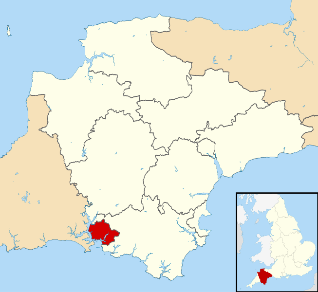
338:
332:
218:
180:Lake data from Meridian 2 product.
125:
75:
852:
337:
323:
274:Under the following conditions:
239:This file is licensed under the
231:
226:
220:
92:
31:
21:
320:
825:Usage on zh-yue.wikipedia.org
740:Usage on simple.wikipedia.org
714:Kategori:Personer fra Plymouth
704:Plymouth (Verenigd Koninkrijk)
576:
489:
319:
26:
1:
561:
345:Items portrayed in this file
7:
730:Usage on pnb.wikipedia.org
133:Plymouth UK locator map.svg
10:
857:
835:Usage on zh.wikipedia.org
805:Usage on www.wikidata.org
795:Usage on ur.wikipedia.org
780:Usage on tr.wikipedia.org
770:Usage on th.wikipedia.org
760:Usage on sv.wikipedia.org
750:Usage on sl.wikipedia.org
720:Usage on pl.wikipedia.org
710:Usage on no.wikipedia.org
700:Usage on nl.wikipedia.org
690:Usage on mr.wikipedia.org
680:Usage on lv.wikipedia.org
665:Usage on ja.wikipedia.org
655:Usage on it.wikipedia.org
645:Usage on io.wikipedia.org
635:Usage on id.wikipedia.org
625:Usage on fo.wikipedia.org
615:Usage on fi.wikipedia.org
605:Usage on fa.wikipedia.org
595:Usage on cy.wikipedia.org
585:Usage on bn.wikipedia.org
288:same or compatible license
127:
486:
16:
322:
254:
185:England location map.svg
99:This is a file from the
36:
543:
522:23:18, 26 February 2011
155:
103:. Information from its
106:description page there
69:1,292 × 1,187 pixels
65:2,229 × 2,048 pixels
61:1,115 × 1,024 pixels
269:– to adapt the work
183:Inset derived from
47:Other resolutions:
669:Category:プリマス出身の人物
609:پلیموث (انگلستان)
577:Global file usage
559:
419:copyright license
405:copyright license
331:
316:
315:
215:
212:Reusing this file
121:
120:
101:Wikimedia Commons
32:Global file usage
848:
764:City of Plymouth
724:City of Plymouth
649:Plymouth, Anglia
534:
496:
474:26 February 2011
375:copyright status
361:copyright status
329:
310:
307:
304:
301:
298:
290:as the original.
252:
241:Creative Commons
235:
234:
230:
229:
224:
223:
209:
158:
157:26 February 2011
134:
128:
117:
96:
95:
89:
83:
72:
57:836 × 768 pixels
53:523 × 480 pixels
49:261 × 240 pixels
43:653 × 600 pixels
856:
855:
851:
850:
849:
847:
846:
845:
575:
560:
554:Ordnance Survey
540:
532:
488:
487:
484:
483:
482:
481:
480:
479:
478:
477:
475:
465:
464:
463:
461:
446:
445:
444:
443:
442:
441:
440:
439:
437:
425:
424:
423:
421:
402:
401:
400:
399:
398:
397:
396:
395:
393:
381:
380:
379:
377:
358:
357:
356:
355:
354:
352:
336:
335:
334:
317:
312:
311:
308:
305:
302:
299:
296:
295:
253:
250:
247:
236:
168:Ordnance Survey
132:
123:
122:
111:
110:
109:is shown below.
85:
81:
74:
73:
46:
12:
11:
5:
854:
844:
843:
842:
841:
833:
832:
831:
823:
822:
821:
813:
812:
811:
803:
802:
801:
793:
792:
791:
786:
778:
777:
776:
768:
767:
766:
758:
757:
756:
748:
747:
746:
738:
737:
736:
728:
727:
726:
718:
717:
716:
708:
707:
706:
698:
697:
696:
688:
687:
686:
678:
677:
676:
671:
663:
662:
661:
653:
652:
651:
643:
642:
641:
633:
632:
631:
623:
622:
621:
613:
612:
611:
603:
602:
601:
599:Dinas Plymouth
593:
592:
591:
578:
574:
573:
563:
558:
557:
542:
538:
535:
531:1,292 × 1,187
529:
524:
519:
515:
514:
511:
508:
505:
502:
499:
491:
476:
473:
471:
470:
469:
467:
466:
462:
457:
455:
454:
453:
452:
450:
438:
433:
431:
430:
429:
427:
426:
422:
417:
415:
414:
413:
412:
410:
406:
394:
389:
387:
386:
385:
383:
382:
378:
373:
371:
370:
369:
368:
366:
362:
353:
348:
346:
343:
342:
341:
340:
328:
327:
324:
321:
314:
313:
294:
293:
292:
291:
281:
272:
271:
270:
264:
257:You are free:
248:
238:
237:
219:
216:
204:
203:
197:
193:
192:
182:
181:
178:
164:
160:
159:
154:
150:
149:
135:
126:
119:
118:
97:
87:
86:
40:
35:
34:
29:
24:
19:
9:
6:
4:
3:
2:
853:
840:
837:
836:
834:
830:
827:
826:
824:
820:
817:
816:
814:
810:
807:
806:
804:
800:
797:
796:
794:
790:
787:
785:
782:
781:
779:
775:
772:
771:
769:
765:
762:
761:
759:
755:
752:
751:
749:
745:
742:
741:
739:
735:
732:
731:
729:
725:
722:
721:
719:
715:
712:
711:
709:
705:
702:
701:
699:
695:
692:
691:
689:
685:
682:
681:
679:
675:
674:Category:プリマス
672:
670:
667:
666:
664:
660:
657:
656:
654:
650:
647:
646:
644:
640:
637:
636:
634:
630:
627:
626:
624:
620:
617:
616:
614:
610:
607:
606:
604:
600:
597:
596:
594:
590:
587:
586:
584:
583:
582:
572:
569:
568:
567:
555:
551:
547:
541:
536:
530:
528:
525:
523:
520:
517:
516:
512:
509:
506:
503:
500:
498:
497:
495:
472:
460:
456:
436:
432:
420:
416:
392:
388:
376:
372:
351:
347:
344:
325:
318:
300:CC BY-SA 3.0
289:
285:
282:
279:
276:
275:
273:
268:
265:
262:
259:
258:
256:
255:
249:Attribution:
245:
242:
225:
217:
213:
208:
205:
201:
198:
194:
190:
186:
179:
176:
175:
174:
172:
169:
165:
161:
151:
147:
146:highlighted.
145:
141:
136:
129:
115:
108:
107:
102:
98:
91:
90:
84:
79:
78:Original file
70:
66:
62:
58:
54:
50:
44:
39:
33:
30:
28:
25:
23:
20:
18:
15:
580:
565:
493:
490:File history
283:
277:
266:
260:
166:
137:
114:You can help
104:
76:
22:File history
391:copyrighted
365:copyrighted
284:share alike
278:attribution
131:Description
562:File usage
548:, UK with
507:Dimensions
207:Permission
142:, UK with
27:File usage
809:Q21674890
799:پلایماؤتھ
734:پلائیموتھ
589:প্লাইমাউথ
539:Nilfanion
533:(1.43 MB)
504:Thumbnail
501:Date/Time
459:inception
449:inception
200:Nilfanion
819:Plymouth
784:Plymouth
754:Plymouth
744:Plymouth
659:Plymouth
639:Plymouth
629:Plymouth
619:Plymouth
571:Plymouth
550:Plymouth
326:Captions
267:to remix
261:to share
246:license.
189:Spischot
171:OpenData
144:Plymouth
684:Plimuta
518:current
513:Comment
350:depicts
330:English
138:Map of
80:
774:พลิมัท
694:प्लिमथ
196:Author
163:Source
789:Devon
546:Devon
140:Devon
839:普利茅斯
829:普利茅夫
510:User
309:true
306:true
153:Date
17:File
187:by
173:.
67:|
63:|
59:|
55:|
51:|
45:.
214:)
210:(
191:.
116:.
71:.
