802:"}},"text\/plain":{"en":{"":"coordinates of depicted place"}}},"{\"value\":{\"latitude\":52.76028,\"longitude\":1.3268,\"altitude\":null,\"precision\":1.0e-5,\"globe\":\"http:\\\/\\\/www.wikidata.org\\\/entity\\\/Q2\"},\"type\":\"globecoordinate\"}":{"text\/html":{"en":{"P9149":"52\u00b045'37.01"N, 1\u00b019'36.48"E"}},"text\/plain":{"en":{"P9149":"52\u00b045'37.01\"N, 1\u00b019'36.48\"E"}}}}": -->
418:"}},"text\/plain":{"en":{"":"author name string"}}},"{\"value\":\"John Salmon\",\"type\":\"string\"}":{"text\/html":{"en":{"P2093":"John Salmon"}},"text\/plain":{"en":{"P2093":"John Salmon"}}},"{\"value\":{\"entity-type\":\"property\",\"numeric-id\":2699,\"id\":\"P2699\"},\"type\":\"wikibase-entityid\"}":{"text\/html":{"en":{"":"
720:"}},"text\/plain":{"en":{"":"inception"}}},"{\"value\":{\"time\":\"+2005-08-09T00:00:00Z\",\"timezone\":0,\"before\":0,\"after\":0,\"precision\":11,\"calendarmodel\":\"http:\\\/\\\/www.wikidata.org\\\/entity\\\/Q1985727\"},\"type\":\"time\"}":{"text\/html":{"en":{"P571":"9 August 2005"}},"text\/plain":{"en":{"P571":"9 August 2005"}}}}": -->
597:
402:
214:
238:
276:
281:
72:
885:"}},"text\/plain":{"en":{"":"f-number"}}},"{\"value\":{\"amount\":\"+4\",\"unit\":\"1\"},\"type\":\"quantity\"}":{"text\/html":{"en":{"P6790":"4"}},"text\/plain":{"en":{"P6790":"4"}}}}": -->
613:"}},"text\/plain":{"en":{"P973":"https:\/\/www.geograph.org.uk\/photo\/316170"}}},"{\"value\":{\"entity-type\":\"property\",\"numeric-id\":7384,\"id\":\"P7384\"},\"type\":\"wikibase-entityid\"}":{"text\/html":{"en":{"":"
605:"}},"text\/plain":{"en":{"P7482":"file available on the internet"}}},"{\"value\":{\"entity-type\":\"property\",\"numeric-id\":973,\"id\":\"P973\"},\"type\":\"wikibase-entityid\"}":{"text\/html":{"en":{"":"
410:"}},"text\/plain":{"en":{"":"object of statement has role"}}},"{\"value\":{\"entity-type\":\"item\",\"numeric-id\":33231,\"id\":\"Q33231\"},\"type\":\"wikibase-entityid\"}":{"text\/html":{"en":{"P3831":"
968:"}},"text\/plain":{"en":{"":"media type"}}},"{\"value\":\"image\\\/jpeg\",\"type\":\"string\"}":{"text\/html":{"en":{"P1163":"image\/jpeg"}},"text\/plain":{"en":{"P1163":"image\/jpeg"}}}}": -->
923:"}},"text\/plain":{"en":{"":"focal length"}}},"{\"value\":{\"amount\":\"+10.125\",\"unit\":\"http:\\\/\\\/www.wikidata.org\\\/entity\\\/Q174789\"},\"type\":\"quantity\"}":{"text\/html":{"en":{"P2151":"10.125
557:"}},"text\/plain":{"en":{"":"copyright license"}}},"{\"value\":{\"entity-type\":\"item\",\"numeric-id\":19068220,\"id\":\"Q19068220\"},\"type\":\"wikibase-entityid\"}":{"text\/html":{"en":{"P275":"
513:"}},"text\/plain":{"en":{"":"copyright status"}}},"{\"value\":{\"entity-type\":\"item\",\"numeric-id\":50423863,\"id\":\"Q50423863\"},\"type\":\"wikibase-entityid\"}":{"text\/html":{"en":{"P6216":"
1044:
840:"}},"text\/plain":{"en":{"":"exposure time"}}},"{\"value\":{\"amount\":\"+0.004\",\"unit\":\"http:\\\/\\\/www.wikidata.org\\\/entity\\\/Q11574\"},\"type\":\"quantity\"}":{"text\/html":{"en":{"P6757":"0.004
601:"}},"text\/plain":{"en":{"":"source of file"}}},"{\"value\":{\"entity-type\":\"item\",\"numeric-id\":74228490,\"id\":\"Q74228490\"},\"type\":\"wikibase-entityid\"}":{"text\/html":{"en":{"P7482":"
758:"}},"text\/plain":{"en":{"":"captured with"}}},"{\"value\":{\"entity-type\":\"item\",\"numeric-id\":932499,\"id\":\"Q932499\"},\"type\":\"wikibase-entityid\"}":{"text\/html":{"en":{"P4082":"
414:"}},"text\/plain":{"en":{"P3831":"photographer"}}},"{\"value\":{\"entity-type\":\"property\",\"numeric-id\":2093,\"id\":\"P2093\"},\"type\":\"wikibase-entityid\"}":{"text\/html":{"en":{"":"
625:"}},"text\/plain":{"en":{"":"operator"}}},"{\"value\":{\"entity-type\":\"item\",\"numeric-id\":1503119,\"id\":\"Q1503119\"},\"type\":\"wikibase-entityid\"}":{"text\/html":{"en":{"P137":"
621:"}},"text\/plain":{"en":{"P7384":"316170"}}},"{\"value\":{\"entity-type\":\"property\",\"numeric-id\":137,\"id\":\"P137\"},\"type\":\"wikibase-entityid\"}":{"text\/html":{"en":{"":"
406:"}},"text\/plain":{"en":{"":"creator"}}},"{\"value\":{\"entity-type\":\"property\",\"numeric-id\":3831,\"id\":\"P3831\"},\"type\":\"wikibase-entityid\"}":{"text\/html":{"en":{"":"
964:
422:"}},"text\/plain":{"en":{"":"URL"}}},"{\"value\":\"https:\\\/\\\/www.geograph.org.uk\\\/profile\\\/9419\",\"type\":\"string\"}":{"text\/html":{"en":{"P2699":"
191:
617:"}},"text\/plain":{"en":{"":"geograph.org.uk image ID"}}},"{\"value\":\"316170\",\"type\":\"string\"}":{"text\/html":{"en":{"P7384":"
328:– You must give appropriate credit, provide a link to the license, and indicate if changes were made. You may do so in any reasonable manner, but not in any way that suggests the licensor endorses you or your use.
197:
1054:
51:
83:
618:
602:
558:
514:
626:
759:
411:
965:
920:
882:
837:
799:
755:
614:
598:
510:
419:
415:
407:
717:
622:
610:
606:
554:
423:
403:
561:"}},"text\/plain":{"en":{"P275":"Creative Commons Attribution-ShareAlike 2.0 Generic"}}}}": -->
169:
426:"}},"text\/plain":{"en":{"P2699":"https:\/\/www.geograph.org.uk\/profile\/9419"}}}}": -->
1079:
652:
584:
540:
207:
1043:
1038:
702:
42:
245:
1150:
This file contains additional information, probably added from the digital camera or scanner used to create or digitize it.
785:
335:
467:
975:
934:
892:
851:
809:
769:
680:
636:
524:
488:
475:
460:
727:
695:
665:
568:
433:
392:
629:"}},"text\/plain":{"en":{"P137":"Geograph Britain and Ireland"}}}}": -->
1268:
762:"}},"text\/plain":{"en":{"P4082":"Canon PowerShot Pro1"}}}}": -->
291:
1153:
If the file has been modified from its original state, some details may not fully reflect the modified file.
927:"}},"text\/plain":{"en":{"P2151":"10.125 millimetre"}}}}": -->
334:– If you remix, transform, or build upon the material, you must distribute your contributions under the
252:
on the
Geograph website for the photographer's contact details. The copyright on this image is owned by
844:"}},"text\/plain":{"en":{"P6757":"0.004 second"}}}}": -->
517:"}},"text\/plain":{"en":{"P6216":"copyrighted"}}}}": -->
91:
1061:== Summary == {{Information |Description=St Andrew, Lamas, Norfolk |Source=From ; transferd by
1313:
1172:
687:
672:
495:
288:
8:
1341:
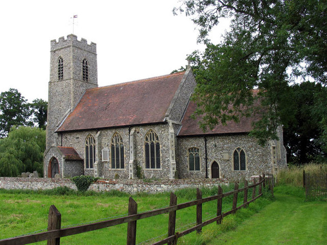
1245:
232:
213:
257:
78:
382:
1162:
1084:
1409:
1331:
1295:
1179:
1419:
1208:
158:
143:
139:
1351:
1062:
985:
944:
902:
861:
819:
779:
737:
646:
578:
534:
443:
237:
1122:
249:
1189:
1011:
Click on a date/time to view the file as it appeared at that time.
199:
147:
1112:
1102:
192:
52° 45′ 37″ N, 1° 19′ 36″ E
128:
66:
116:
St Andrew, Lamas, Norfolk - geograph.org.uk - 316170.jpg
52:
St_Andrew,_Lamas,_Norfolk_-_geograph.org.uk_-_316170.jpg
376:
Add a one-line explanation of what this file represents
1137:
1132:
1073:
1093:
1009:
176:
Creative
Commons Attribution Share-alike license 2.0
90:
Commons is a freely licensed media file repository.
585:
Creative
Commons Attribution-ShareAlike 2.0 Generic
559:
Creative
Commons Attribution-ShareAlike 2.0 Generic
56:(640 × 480 pixels, file size: 135 KB, MIME type:
345:https://creativecommons.org/licenses/by-sa/2.0
71:
351:Creative Commons Attribution-Share Alike 2.0
269:
164:
124:
113:
611:https:\/\/www.geograph.org.uk\/photo\/316170
424:https:\/\/www.geograph.org.uk\/profile\/9419
154:
134:
14:
924:
841:
311:– to copy, distribute and transmit the work
1095:The following other wikis use this file:
673:https://www.geograph.org.uk/photo/316170
496:https://www.geograph.org.uk/profile/9419
1080:Grade II* listed buildings in Broadland
206:View this and other nearby images on:
1075:The following 2 pages use this file:
102:
256:and is licensed for reuse under the
182:
1002:
292:Attribution-Share Alike 2.0 Generic
280:
275:
260:Attribution-ShareAlike 2.0 license.
13:
1148:
381:
375:
266:
243:
103:
49:
1445:
1155:
380:
1199:Date and time of data generation
366:
322:Under the following conditions:
287:This file is licensed under the
279:
274:
268:
236:
212:
198:
70:
31:
21:
1056:File Upload Bot (Magnus Manske)
363:
46:No higher resolution available.
1090:
1006:
653:file available on the internet
603:file available on the internet
362:
244:This image was taken from the
26:
1:
1346:Flash did not fire, auto mode
810:coordinates of depicted place
800:coordinates of depicted place
36:
1070:
703:Geograph Britain and Ireland
627:Geograph Britain and Ireland
461:object of statement has role
408:object of statement has role
388:Items portrayed in this file
228:
7:
1377:Focal plane resolution unit
1279:Date and time of digitizing
1145:
1123:Lammas with Little Hautbois
825:52°45'37.01"N, 1°19'36.48"E
10:
1450:
1388:One-chip color area sensor
1129:Usage on www.wikidata.org
1119:Usage on sv.wikipedia.org
1109:Usage on pl.wikipedia.org
1099:Usage on cy.wikipedia.org
336:same or compatible license
110:
105:
1252:File change date and time
1003:
120:St Andrew, Lamas, Norfolk
16:
1369:Focal plane Y resolution
1361:Focal plane X resolution
681:geograph.org.uk image ID
615:geograph.org.uk image ID
365:
302:
77:This is a file from the
41:
1393:Custom image processing
1060:
127:
81:. Information from its
1287:Image compression mode
1255:17:18, 20 January 2007
1039:02:24, 25 October 2009
250:this photograph's page
218:52.760280; 1.326800
84:description page there
1323:Maximum land aperture
1226:Horizontal resolution
1326:2.96875 APEX (f/2.8)
1282:15:33, 9 August 2005
1202:15:33, 9 August 2005
1173:Canon PowerShot Pro1
786:Canon PowerShot Pro1
760:Canon PowerShot Pro1
148:geograph_org2commons
1260:Y and C positioning
1246:Adobe Photoshop 7.0
1234:Vertical resolution
1159:Camera manufacturer
317:– to adapt the work
1430:Scene capture type
1414:Auto white balance
476:author name string
416:author name string
1437:
1436:
1184:1/250 sec (0.004)
1091:Global file usage
1068:
926:
843:
569:copyright license
555:copyright license
374:
265:
264:
248:collection. See
223:
222:
180:
179:
173:
170:Reusing this file
142:; transferred by
99:
98:
79:Wikimedia Commons
32:Global file usage
1441:
1372:9,415.3846153846
1364:9,406.3400576369
1156:
1051:
1013:
953:
870:
705:
700:
690:
685:
675:
670:
666:described at URL
607:described at URL
525:copyright status
511:copyright status
498:
493:
483:
480:
470:
465:
372:
358:
355:
352:
349:
346:
338:as the original.
300:
289:Creative Commons
283:
282:
278:
277:
272:
271:
258:Creative Commons
246:Geograph project
240:
233:
219:
216:
202:
201:
195:
194:
183:
167:
130:
117:
111:
95:
74:
73:
67:
61:
59:
1449:
1448:
1444:
1443:
1442:
1440:
1439:
1438:
1144:
1089:
1069:
1057:
1049:
1005:
1004:
1001:
1000:
999:
998:
997:
996:
995:
994:
992:
982:
981:
980:
978:
963:
962:
961:
960:
959:
958:
957:
956:
954:
951:
941:
940:
939:
937:
918:
917:
916:
915:
914:
913:
912:
911:
909:
899:
898:
897:
895:
880:
879:
878:
877:
876:
875:
874:
873:
871:
868:
858:
857:
856:
854:
835:
834:
833:
832:
831:
830:
829:
828:
826:
816:
815:
814:
812:
797:
796:
795:
794:
793:
792:
791:
790:
788:
776:
775:
774:
772:
753:
752:
751:
750:
749:
748:
747:
746:
744:
734:
733:
732:
730:
715:
714:
713:
712:
711:
710:
709:
708:
707:
706:
701:
698:
692:
691:
686:
683:
677:
676:
671:
668:
659:
658:
657:
655:
643:
642:
641:
639:
596:
595:
594:
593:
592:
591:
590:
589:
587:
575:
574:
573:
571:
552:
551:
550:
549:
548:
547:
546:
545:
543:
531:
530:
529:
527:
508:
507:
506:
505:
504:
503:
502:
501:
500:
499:
494:
491:
485:
484:
481:
478:
472:
471:
466:
463:
454:
453:
452:
450:
440:
439:
438:
436:
401:
400:
399:
398:
397:
395:
379:
378:
377:
360:
359:
356:
353:
350:
347:
344:
343:
301:
298:
295:
284:
261:
231:
217:
190:
189:
186:Object location
181:
140:geograph.org.uk
115:
108:
101:
100:
89:
88:
87:is shown below.
63:
57:
55:
48:
47:
12:
11:
5:
1447:
1435:
1434:
1431:
1427:
1426:
1423:
1416:
1415:
1412:
1406:
1405:
1402:
1398:
1397:
1396:Normal process
1394:
1390:
1389:
1386:
1385:Sensing method
1382:
1381:
1378:
1374:
1373:
1370:
1366:
1365:
1362:
1358:
1357:
1354:
1348:
1347:
1344:
1338:
1337:
1334:
1328:
1327:
1324:
1320:
1319:
1316:
1310:
1309:
1306:
1302:
1301:
1298:
1292:
1291:
1288:
1284:
1283:
1280:
1276:
1275:
1272:
1265:
1264:
1261:
1257:
1256:
1253:
1249:
1248:
1243:
1239:
1238:
1235:
1231:
1230:
1227:
1223:
1222:
1219:
1215:
1214:
1211:
1204:
1203:
1200:
1196:
1195:
1192:
1186:
1185:
1182:
1176:
1175:
1170:
1166:
1165:
1160:
1147:
1143:
1142:
1141:
1140:
1135:
1127:
1126:
1125:
1117:
1116:
1115:
1113:Lamas (Anglia)
1107:
1106:
1105:
1103:Lamas, Norfolk
1092:
1088:
1087:
1085:Lamas, Norfolk
1082:
1072:
1067:
1066:
1059:
1055:
1052:
1046:
1041:
1036:
1032:
1031:
1028:
1025:
1022:
1019:
1016:
1008:
993:
990:
988:
987:
986:
984:
983:
979:
974:
972:
971:
970:
969:
967:
955:
949:
947:
946:
945:
943:
942:
938:
933:
931:
930:
929:
928:
922:
910:
907:
905:
904:
903:
901:
900:
896:
891:
889:
888:
887:
886:
884:
872:
866:
864:
863:
862:
860:
859:
855:
850:
848:
847:
846:
845:
839:
827:
824:
822:
821:
820:
818:
817:
813:
808:
806:
805:
804:
803:
801:
789:
784:
782:
781:
780:
778:
777:
773:
768:
766:
765:
764:
763:
761:
757:
745:
742:
740:
739:
738:
736:
735:
731:
726:
724:
723:
722:
721:
719:
694:
693:
679:
678:
664:
663:
662:
661:
660:
656:
651:
649:
648:
647:
645:
644:
640:
637:source of file
635:
633:
632:
631:
630:
628:
624:
620:
616:
612:
608:
604:
600:
599:source of file
588:
583:
581:
580:
579:
577:
576:
572:
567:
565:
564:
563:
562:
560:
556:
544:
539:
537:
536:
535:
533:
532:
528:
523:
521:
520:
519:
518:
516:
512:
487:
486:
474:
473:
459:
458:
457:
456:
455:
451:
448:
446:
445:
444:
442:
441:
437:
432:
430:
429:
428:
427:
425:
421:
417:
413:
409:
405:
396:
391:
389:
386:
385:
384:
383:
371:
370:
367:
364:
342:
341:
340:
339:
329:
320:
319:
318:
312:
305:You are free:
296:
286:
285:
267:
263:
262:
241:
230:
227:
221:
220:
210:
204:
187:
178:
177:
174:
162:
161:
156:
152:
151:
136:
132:
131:
126:
122:
121:
118:
109:
107:
104:
97:
96:
75:
65:
64:
45:
40:
39:
34:
29:
24:
19:
9:
6:
4:
3:
2:
1446:
1432:
1429:
1428:
1424:
1421:
1418:
1417:
1413:
1411:
1410:White balance
1408:
1407:
1404:Auto exposure
1403:
1401:Exposure mode
1400:
1399:
1395:
1392:
1391:
1387:
1384:
1383:
1379:
1376:
1375:
1371:
1368:
1367:
1363:
1360:
1359:
1355:
1353:
1350:
1349:
1345:
1343:
1340:
1339:
1335:
1333:
1332:Metering mode
1330:
1329:
1325:
1322:
1321:
1317:
1315:
1314:Exposure bias
1312:
1311:
1307:
1305:APEX aperture
1304:
1303:
1299:
1297:
1296:Shutter speed
1294:
1293:
1289:
1286:
1285:
1281:
1278:
1277:
1273:
1270:
1267:
1266:
1262:
1259:
1258:
1254:
1251:
1250:
1247:
1244:
1242:Software used
1241:
1240:
1236:
1233:
1232:
1228:
1225:
1224:
1220:
1217:
1216:
1212:
1210:
1206:
1205:
1201:
1198:
1197:
1193:
1191:
1188:
1187:
1183:
1181:
1180:Exposure time
1178:
1177:
1174:
1171:
1168:
1167:
1164:
1161:
1158:
1157:
1154:
1151:
1139:
1136:
1134:
1131:
1130:
1128:
1124:
1121:
1120:
1118:
1114:
1111:
1110:
1108:
1104:
1101:
1100:
1098:
1097:
1096:
1086:
1083:
1081:
1078:
1077:
1076:
1064:
1058:
1053:
1047:
1045:
1042:
1040:
1037:
1034:
1033:
1029:
1026:
1023:
1020:
1017:
1015:
1014:
1012:
989:
977:
973:
948:
936:
932:
906:
894:
890:
865:
853:
852:exposure time
849:
838:exposure time
823:
811:
807:
787:
783:
771:
770:captured with
767:
756:captured with
743:9 August 2005
741:
729:
725:
704:
697:
689:
682:
674:
667:
654:
650:
638:
634:
586:
582:
570:
566:
542:
538:
526:
522:
497:
490:
477:
469:
462:
447:
435:
431:
394:
390:
387:
368:
361:
348:CC BY-SA 2.0
337:
333:
330:
327:
324:
323:
321:
316:
313:
310:
307:
306:
304:
303:
297:Attribution:
293:
290:
273:
259:
255:
251:
247:
242:
239:
235:
234:
226:
225:
215:
211:
209:
208:OpenStreetMap
205:
203:
193:
188:
185:
184:
175:
171:
166:
163:
160:
157:
153:
149:
145:
141:
137:
133:
129:9 August 2005
123:
119:
112:
93:
86:
85:
80:
76:
69:
68:
62:
53:
44:
38:
35:
33:
30:
28:
25:
23:
20:
18:
15:
1420:Digital zoom
1209:focal length
1169:Camera model
1152:
1149:
1094:
1074:
1010:
1007:File history
935:focal length
921:focal length
468:photographer
412:photographer
331:
325:
314:
308:
253:
224:
92:You can help
82:
50:
22:File history
1352:Color space
1218:Orientation
1063:User:oxyman
541:copyrighted
515:copyrighted
482:John Salmon
332:share alike
326:attribution
299:John Salmon
254:John Salmon
159:John Salmon
144:User:oxyman
114:Description
1071:File usage
1065:using . |D
1048:640 × 480
1024:Dimensions
991:image/jpeg
976:media type
966:media type
952:millimetre
925:millimetre
449:some value
165:Permission
58:image/jpeg
27:File usage
1213:10.125 mm
1138:Q17554316
1021:Thumbnail
1018:Date/Time
728:inception
718:inception
229:Licensing
1433:Standard
1263:Centered
1190:F-number
1146:Metadata
1133:Q4682506
1050:(135 KB)
893:f-number
883:f-number
696:operator
623:operator
369:Captions
315:to remix
309:to share
294:license.
37:Metadata
1336:Pattern
1300:7.96875
1271:version
1237:180 dpi
1229:180 dpi
1035:current
1030:Comment
950:10.125
434:creator
404:creator
393:depicts
373:English
106:Summary
54:
1380:inches
1221:Normal
869:second
867:0.004
842:second
688:316170
619:316170
196:
155:Author
146:using
135:Source
1422:ratio
1342:Flash
1207:Lens
1163:Canon
138:From
1356:sRGB
1274:2.21
1269:Exif
1027:User
357:true
354:true
125:Date
17:File
1194:f/4
489:URL
420:URL
699::
684::
669::
492::
479::
464::
1425:1
1318:0
1308:4
1290:3
908:4
172:)
168:(
150:.
94:.
60:)
_region:GB-GBN_&language=en)
