679:"}},"text\/plain":{"en":{"":"coordinates of the point of view"}}},"{\"value\":{\"latitude\":54.60781,\"longitude\":-3.1502,\"altitude\":null,\"precision\":1.0e-5,\"globe\":\"http:\\\/\\\/www.wikidata.org\\\/entity\\\/Q2\"},\"type\":\"globecoordinate\"}":{"text\/html":{"en":{"P1259":"54\u00b036'28.12"N, 3\u00b09'0.72"W"}},"text\/plain":{"en":{"P1259":"54\u00b036'28.12\"N, 3\u00b09'0.72\"W"}}},"{\"value\":{\"entity-type\":\"property\",\"numeric-id\":7787,\"id\":\"P7787\"},\"type\":\"wikibase-entityid\"}":{"text\/html":{"en":{"":"
904:"}},"text\/plain":{"en":{"":"coordinates of depicted place"}}},"{\"value\":{\"latitude\":54.60843,\"longitude\":-3.151,\"altitude\":null,\"precision\":1.0e-5,\"globe\":\"http:\\\/\\\/www.wikidata.org\\\/entity\\\/Q2\"},\"type\":\"globecoordinate\"}":{"text\/html":{"en":{"P9149":"54\u00b036'30.35"N, 3\u00b09'3.60"W"}},"text\/plain":{"en":{"P9149":"54\u00b036'30.35\"N, 3\u00b09'3.60\"W"}}},"{\"value\":{\"entity-type\":\"property\",\"numeric-id\":7787,\"id\":\"P7787\"},\"type\":\"wikibase-entityid\"}":{"text\/html":{"en":{"":"
747:"}},"text\/plain":{"en":{"":"inception"}}},"{\"value\":{\"time\":\"+2009-02-21T00:00:00Z\",\"timezone\":0,\"before\":0,\"after\":0,\"precision\":11,\"calendarmodel\":\"http:\\\/\\\/www.wikidata.org\\\/entity\\\/Q1985727\"},\"type\":\"time\"}":{"text\/html":{"en":{"P571":"21 February 2009"}},"text\/plain":{"en":{"P571":"21 February 2009"}}}}": -->
781:
281:
231:
900:
223:
295:
245:
316:
354:
359:
72:
500:"}},"text\/plain":{"en":{"P2699":"https:\/\/www.geograph.org.uk\/profile\/27744"}}},"{\"value\":{\"entity-type\":\"property\",\"numeric-id\":2093,\"id\":\"P2093\"},\"type\":\"wikibase-entityid\"}":{"text\/html":{"en":{"":"
797:"}},"text\/plain":{"en":{"P973":"https:\/\/www.geograph.org.uk\/photo\/1174364"}}},"{\"value\":{\"entity-type\":\"property\",\"numeric-id\":7384,\"id\":\"P7384\"},\"type\":\"wikibase-entityid\"}":{"text\/html":{"en":{"":"
1010:
504:"}},"text\/plain":{"en":{"":"author name string"}}},"{\"value\":\"Trevor Harris\",\"type\":\"string\"}":{"text\/html":{"en":{"P2093":"Trevor Harris"}},"text\/plain":{"en":{"P2093":"Trevor Harris"}}}}": -->
789:"}},"text\/plain":{"en":{"P7482":"file available on the internet"}}},"{\"value\":{\"entity-type\":\"property\",\"numeric-id\":973,\"id\":\"P973\"},\"type\":\"wikibase-entityid\"}":{"text\/html":{"en":{"":"
488:"}},"text\/plain":{"en":{"":"object of statement has role"}}},"{\"value\":{\"entity-type\":\"item\",\"numeric-id\":33231,\"id\":\"Q33231\"},\"type\":\"wikibase-entityid\"}":{"text\/html":{"en":{"P3831":"
635:"}},"text\/plain":{"en":{"":"copyright license"}}},"{\"value\":{\"entity-type\":\"item\",\"numeric-id\":19068220,\"id\":\"Q19068220\"},\"type\":\"wikibase-entityid\"}":{"text\/html":{"en":{"P275":"
591:"}},"text\/plain":{"en":{"":"copyright status"}}},"{\"value\":{\"entity-type\":\"item\",\"numeric-id\":50423863,\"id\":\"Q50423863\"},\"type\":\"wikibase-entityid\"}":{"text\/html":{"en":{"P6216":"
785:"}},"text\/plain":{"en":{"":"source of file"}}},"{\"value\":{\"entity-type\":\"item\",\"numeric-id\":74228490,\"id\":\"Q74228490\"},\"type\":\"wikibase-entityid\"}":{"text\/html":{"en":{"P7482":"
492:"}},"text\/plain":{"en":{"P3831":"photographer"}}},"{\"value\":{\"entity-type\":\"property\",\"numeric-id\":2699,\"id\":\"P2699\"},\"type\":\"wikibase-entityid\"}":{"text\/html":{"en":{"":"
908:"}},"text\/plain":{"en":{"":"heading"}}},"{\"value\":{\"amount\":\"+315\",\"unit\":\"http:\\\/\\\/www.wikidata.org\\\/entity\\\/Q28390\"},\"type\":\"quantity\"}":{"text\/html":{"en":{"P7787":"315
809:"}},"text\/plain":{"en":{"":"operator"}}},"{\"value\":{\"entity-type\":\"item\",\"numeric-id\":1503119,\"id\":\"Q1503119\"},\"type\":\"wikibase-entityid\"}":{"text\/html":{"en":{"P137":"
683:"}},"text\/plain":{"en":{"":"heading"}}},"{\"value\":{\"amount\":\"+315\",\"unit\":\"http:\\\/\\\/www.wikidata.org\\\/entity\\\/Q28390\"},\"type\":\"quantity\"}":{"text\/html":{"en":{"P7787":"315
805:"}},"text\/plain":{"en":{"P7384":"1174364"}}},"{\"value\":{\"entity-type\":\"property\",\"numeric-id\":137,\"id\":\"P137\"},\"type\":\"wikibase-entityid\"}":{"text\/html":{"en":{"":"
484:"}},"text\/plain":{"en":{"":"creator"}}},"{\"value\":{\"entity-type\":\"property\",\"numeric-id\":3831,\"id\":\"P3831\"},\"type\":\"wikibase-entityid\"}":{"text\/html":{"en":{"":"
587:
793:"}},"text\/plain":{"en":{"":"described at URL"}}},"{\"value\":\"https:\\\/\\\/www.geograph.org.uk\\\/photo\\\/1174364\",\"type\":\"string\"}":{"text\/html":{"en":{"P973":"
496:"}},"text\/plain":{"en":{"":"URL"}}},"{\"value\":\"https:\\\/\\\/www.geograph.org.uk\\\/profile\\\/27744\",\"type\":\"string\"}":{"text\/html":{"en":{"P2699":"
264:
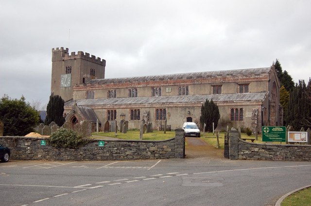
1027:== {{int:filedesc}} == {{Information |description={{en|1=St Kentigern's, Great Crosthwaite Crosthwaite parish church has this very "Celtic-sounding" saint's name for its dedication.}} |date=2009-02-21 |source=From [http://www.geograph.org.uk/photo/1174364
214:
801:"}},"text\/plain":{"en":{"":"geograph.org.uk image ID"}}},"{\"value\":\"1174364\",\"type\":\"string\"}":{"text\/html":{"en":{"P7384":"
406:– You must give appropriate credit, provide a link to the license, and indicate if changes were made. You may do so in any reasonable manner, but not in any way that suggests the licensor endorses you or your use.
83:
51:
228:
278:
802:
786:
636:
592:
810:
489:
905:
901:
798:
782:
680:
676:
588:
501:
493:
485:
794:
497:
806:
790:
744:
632:
481:
1069:
1020:
639:"}},"text\/plain":{"en":{"P275":"Creative Commons Attribution-ShareAlike 2.0 Generic"}}}}": -->
1009:
1004:
42:
1041:
836:
662:
618:
288:
238:
1051:
886:
323:
1102:
This file contains additional information, probably added from the digital camera or scanner used to create or digitize it.
1046:
413:
545:
946:
919:
864:
820:
721:
694:
602:
568:
553:
538:
879:
849:
754:
646:
511:
470:
813:"}},"text\/plain":{"en":{"P137":"Geograph Britain and Ireland"}}}}": -->
369:
1105:
If the file has been modified from its original state, some details may not fully reflect the modified file.
412:– If you remix, transform, or build upon the material, you must distribute your contributions under the
330:
on the
Geograph website for the photographer's contact details. The copyright on this image is owned by
595:"}},"text\/plain":{"en":{"P6216":"copyrighted"}}}}": -->
912:"}},"text\/plain":{"en":{"P7787":"315 degree"}}}}": -->
687:"}},"text\/plain":{"en":{"P7787":"315 degree"}}}}": -->
91:
183:
871:
856:
560:
366:
167:
8:
310:
294:
244:
335:
78:
460:
156:
146:
126:
St
Kentigern's parish church, Crosthwaite, Cumbria, seen from the southeast
929:
830:
764:
704:
656:
612:
521:
315:
327:
52:
St_Kentigern's,_Great_Crosthwaite_-_geograph.org.uk_-_1174364.jpg
977:
Click on a date/time to view the file as it appeared at that time.
116:
St
Kentigern's, Great Crosthwaite - geograph.org.uk - 1174364.jpg
280:
230:
265:
54° 36′ 30″ N, 3° 09′ 04″ W
215:
54° 36′ 28″ N, 3° 09′ 01″ W
135:
66:
1079:
454:
Add a one-line explanation of what this file represents
1089:
1035:
1060:
975:
90:
Commons is a freely licensed media file repository.
663:
Creative
Commons Attribution-ShareAlike 2.0 Generic
637:
Creative
Commons Attribution-ShareAlike 2.0 Generic
56:(640 × 425 pixels, file size: 59 KB, MIME type:
423:https://creativecommons.org/licenses/by-sa/2.0
71:
795:https:\/\/www.geograph.org.uk\/photo\/1174364
498:https:\/\/www.geograph.org.uk\/profile\/27744
429:Creative Commons Attribution-Share Alike 2.0
347:
131:
113:
152:
141:
14:
909:
684:
389:– to copy, distribute and transmit the work
1062:The following other wikis use this file:
857:https://www.geograph.org.uk/photo/1174364
561:https://www.geograph.org.uk/profile/27744
1052:St Kentigern's Church, Crosthwaite
1042:Grade II* listed buildings in Allerdale
287:View this and other nearby images on:
237:View this and other nearby images on:
1037:The following 3 pages use this file:
190:
102:
1047:Listed buildings in Keswick, Cumbria
334:and is licensed for reuse under the
255:
205:
968:
370:Attribution-Share Alike 2.0 Generic
358:
353:
338:Attribution-ShareAlike 2.0 license.
13:
1100:
459:
453:
344:
321:
120:
103:
49:
1126:
1107:
458:
198:St Kentigern's, Great Crosthwaite
179:St Kentigern's, Great Crosthwaite
695:coordinates of the point of view
677:coordinates of the point of view
444:
400:Under the following conditions:
365:This file is licensed under the
357:
352:
346:
314:
293:
279:
271:
243:
229:
221:
70:
31:
21:
441:
121:
46:No higher resolution available.
1057:
972:
837:file available on the internet
787:file available on the internet
440:
322:This image was taken from the
26:
1:
920:coordinates of depicted place
902:coordinates of depicted place
36:
1032:
887:Geograph Britain and Ireland
811:Geograph Britain and Ireland
539:object of statement has role
486:object of statement has role
466:Items portrayed in this file
306:
270:
220:
7:
1097:
1066:Usage on arz.wikipedia.org
10:
1131:
1086:Usage on www.wikidata.org
1076:Usage on sv.wikipedia.org
414:same or compatible license
196:Trevor Harris /
177:Trevor Harris /
110:
105:
969:
935:54°36'30.35"N, 3°9'3.60"W
710:54°36'28.12"N, 3°9'0.72"W
16:
865:geograph.org.uk image ID
799:geograph.org.uk image ID
443:
380:
77:This is a file from the
41:
1026:
1005:18:31, 25 February 2011
168:required by the license
134:
81:. Information from its
328:this photograph's page
299:54.608430; -3.151000
249:54.607810; -3.150200
84:description page there
1070:كنيسه ابرشيه كروستويت
395:– to adapt the work
569:author name string
502:author name string
1118:
1117:
1058:Global file usage
1030:
911:
686:
647:copyright license
633:copyright license
452:
343:
342:
326:collection. See
304:
303:
254:
253:
203:
202:
171:
99:
98:
79:Wikimedia Commons
32:Global file usage
1122:
1108:
1017:
979:
957:
956:
951:
889:
884:
874:
869:
859:
854:
850:described at URL
791:described at URL
770:21 February 2009
732:
731:
726:
603:copyright status
589:copyright status
576:
573:
563:
558:
548:
543:
450:
436:
433:
430:
427:
424:
416:as the original.
378:
367:Creative Commons
361:
360:
356:
355:
350:
349:
336:Creative Commons
324:Geograph project
318:
311:
300:
297:
283:
282:
276:
275:
274:
268:
267:
256:
250:
247:
233:
232:
226:
225:
224:
218:
217:
206:
165:
137:
136:21 February 2009
125:
117:
111:
95:
74:
73:
67:
61:
59:
1130:
1129:
1125:
1124:
1123:
1121:
1120:
1119:
1096:
1056:
1031:
1023:
1015:
971:
970:
967:
966:
965:
964:
963:
962:
961:
960:
959:
958:
954:
952:
949:
940:
939:
938:
936:
926:
925:
924:
922:
899:
898:
897:
896:
895:
894:
893:
892:
891:
890:
885:
882:
876:
875:
870:
867:
861:
860:
855:
852:
843:
842:
841:
839:
827:
826:
825:
823:
780:
779:
778:
777:
776:
775:
774:
773:
771:
761:
760:
759:
757:
742:
741:
740:
739:
738:
737:
736:
735:
734:
733:
729:
727:
724:
715:
714:
713:
711:
701:
700:
699:
697:
674:
673:
672:
671:
670:
669:
668:
667:
665:
653:
652:
651:
649:
630:
629:
628:
627:
626:
625:
624:
623:
621:
609:
608:
607:
605:
586:
585:
584:
583:
582:
581:
580:
579:
578:
577:
574:
571:
565:
564:
559:
556:
550:
549:
544:
541:
532:
531:
530:
528:
518:
517:
516:
514:
479:
478:
477:
476:
475:
473:
457:
456:
455:
438:
437:
434:
431:
428:
425:
422:
421:
379:
376:
373:
362:
339:
309:
298:
272:
263:
262:
259:Object location
248:
222:
213:
212:
209:Camera location
204:
193:
186:
174:
147:geograph.org.uk
127:
115:
108:
101:
100:
89:
88:
87:is shown below.
63:
57:
55:
48:
47:
12:
11:
5:
1128:
1116:
1115:
1112:
1099:
1095:
1094:
1093:
1092:
1084:
1083:
1082:
1074:
1073:
1072:
1059:
1055:
1054:
1049:
1044:
1034:
1029:
1028:
1025:
1021:
1018:
1012:
1007:
1002:
998:
997:
994:
991:
988:
985:
982:
974:
945:
944:
943:
942:
941:
937:
934:
932:
931:
930:
928:
927:
923:
918:
916:
915:
914:
913:
907:
903:
878:
877:
863:
862:
848:
847:
846:
845:
844:
840:
835:
833:
832:
831:
829:
828:
824:
821:source of file
819:
817:
816:
815:
814:
812:
808:
804:
800:
796:
792:
788:
784:
783:source of file
772:
769:
767:
766:
765:
763:
762:
758:
753:
751:
750:
749:
748:
746:
720:
719:
718:
717:
716:
712:
709:
707:
706:
705:
703:
702:
698:
693:
691:
690:
689:
688:
682:
678:
666:
661:
659:
658:
657:
655:
654:
650:
645:
643:
642:
641:
640:
638:
634:
622:
617:
615:
614:
613:
611:
610:
606:
601:
599:
598:
597:
596:
594:
590:
567:
566:
552:
551:
537:
536:
535:
534:
533:
529:
526:
524:
523:
522:
520:
519:
515:
510:
508:
507:
506:
505:
503:
499:
495:
491:
487:
483:
474:
469:
467:
464:
463:
462:
461:
449:
448:
445:
442:
420:
419:
418:
417:
407:
398:
397:
396:
390:
383:You are free:
374:
364:
363:
345:
341:
340:
319:
308:
305:
302:
301:
291:
285:
260:
252:
251:
241:
235:
210:
201:
200:
194:
191:
188:
187:
182:
175:
172:
160:
159:
154:
150:
149:
143:
139:
138:
133:
129:
128:
118:
109:
107:
104:
97:
96:
75:
65:
64:
45:
40:
39:
34:
29:
24:
19:
9:
6:
4:
3:
2:
1127:
1113:
1110:
1109:
1106:
1103:
1091:
1088:
1087:
1085:
1081:
1078:
1077:
1075:
1071:
1068:
1067:
1065:
1064:
1063:
1053:
1050:
1048:
1045:
1043:
1040:
1039:
1038:
1024:
1019:
1013:
1011:
1008:
1006:
1003:
1000:
999:
995:
992:
989:
986:
983:
981:
980:
978:
948:
933:
921:
917:
888:
881:
873:
866:
858:
851:
838:
834:
822:
818:
768:
756:
752:
723:
708:
696:
692:
664:
660:
648:
644:
620:
616:
604:
600:
575:Trevor Harris
570:
562:
555:
547:
540:
525:
513:
509:
472:
468:
465:
446:
439:
426:CC BY-SA 2.0
415:
411:
408:
405:
402:
401:
399:
394:
391:
388:
385:
384:
382:
381:
377:Trevor Harris
375:Attribution:
371:
368:
351:
337:
333:
332:Trevor Harris
329:
325:
320:
317:
313:
312:
296:
292:
290:
289:OpenStreetMap
286:
284:
266:
261:
258:
257:
246:
242:
240:
239:OpenStreetMap
236:
234:
216:
211:
208:
207:
199:
195:
189:
185:
181: /
180:
176:
169:
164:
162:
161:
158:
157:Trevor Harris
155:
151:
148:
144:
140:
130:
124:
119:
112:
93:
86:
85:
80:
76:
69:
68:
62:
53:
44:
38:
35:
33:
30:
28:
25:
23:
20:
18:
15:
1104:
1101:
1061:
1036:
976:
973:File history
546:photographer
490:photographer
409:
403:
392:
386:
331:
269:
219:
197:
184:CC BY-SA 2.0
178:
122:
92:You can help
82:
50:
22:File history
1080:Crosthwaite
1022:GeographBot
619:copyrighted
593:copyrighted
410:share alike
404:attribution
163:Attribution
114:Description
1111:_error
1033:File usage
1014:640 × 425
990:Dimensions
527:some value
58:image/jpeg
27:File usage
987:Thumbnail
984:Date/Time
755:inception
745:inception
307:Licensing
192:InfoField
173:InfoField
123:English:
1098:Metadata
1090:Q5188918
880:operator
807:operator
447:Captions
393:to remix
387:to share
372:license.
37:Metadata
1016:(59 KB)
1001:current
996:Comment
947:heading
906:heading
872:1174364
803:1174364
722:heading
681:heading
512:creator
482:creator
471:depicts
451:English
106:Summary
54:
955:degree
910:degree
730:degree
685:degree
277:
227:
153:Author
142:Source
145:From
993:User
953:315
728:315
435:true
432:true
132:Date
17:File
554:URL
494:URL
950::
883::
868::
853::
725::
572::
557::
542::
1114:0
170:)
166:(
94:.
60:)
Text is available under the Creative Commons Attribution-ShareAlike License. Additional terms may apply.
_heading:315.00&language=en)
_heading:315.00&language=en)
