717:"}},"text\/plain":{"en":{"":"coordinates of the point of view"}}},"{\"value\":{\"latitude\":51.59591,\"longitude\":0.2382,\"altitude\":null,\"precision\":1.0e-5,\"globe\":\"http:\\\/\\\/www.wikidata.org\\\/entity\\\/Q2\"},\"type\":\"globecoordinate\"}":{"text\/html":{"en":{"P1259":"51\u00b035'45.28"N, 0\u00b014'17.52"E"}},"text\/plain":{"en":{"P1259":"51\u00b035'45.28\"N, 0\u00b014'17.52\"E"}}},"{\"value\":{\"entity-type\":\"property\",\"numeric-id\":7787,\"id\":\"P7787\"},\"type\":\"wikibase-entityid\"}":{"text\/html":{"en":{"":"
904:"}},"text\/plain":{"en":{"":"coordinates of depicted place"}}},"{\"value\":{\"latitude\":51.59626,\"longitude\":0.2385,\"altitude\":null,\"precision\":1.0e-5,\"globe\":\"http:\\\/\\\/www.wikidata.org\\\/entity\\\/Q2\"},\"type\":\"globecoordinate\"}":{"text\/html":{"en":{"P9149":"51\u00b035'46.54"N, 0\u00b014'18.60"E"}},"text\/plain":{"en":{"P9149":"51\u00b035'46.54\"N, 0\u00b014'18.60\"E"}}},"{\"value\":{\"entity-type\":\"property\",\"numeric-id\":7787,\"id\":\"P7787\"},\"type\":\"wikibase-entityid\"}":{"text\/html":{"en":{"":"
1145:"}},"text\/plain":{"en":{"":"checksum"}}},"{\"value\":\"9b7bd33c1cf48801718d8435b01a99b89f16fd4b\",\"type\":\"string\"}":{"text\/html":{"en":{"P4092":"9b7bd33c1cf48801718d8435b01a99b89f16fd4b"}},"text\/plain":{"en":{"P4092":"9b7bd33c1cf48801718d8435b01a99b89f16fd4b"}}},"{\"value\":{\"entity-type\":\"property\",\"numeric-id\":459,\"id\":\"P459\"},\"type\":\"wikibase-entityid\"}":{"text\/html":{"en":{"":"
496:"}},"text\/plain":{"en":{"":"author name string"}}},"{\"value\":\"Ian Paterson\",\"type\":\"string\"}":{"text\/html":{"en":{"P2093":"Ian Paterson"}},"text\/plain":{"en":{"P2093":"Ian Paterson"}}},"{\"value\":{\"entity-type\":\"property\",\"numeric-id\":2699,\"id\":\"P2699\"},\"type\":\"wikibase-entityid\"}":{"text\/html":{"en":{"":"
679:"}},"text\/plain":{"en":{"":"inception"}}},"{\"value\":{\"time\":\"+2009-12-17T00:00:00Z\",\"timezone\":0,\"before\":0,\"after\":0,\"precision\":11,\"calendarmodel\":\"http:\\\/\\\/www.wikidata.org\\\/entity\\\/Q1985727\"},\"type\":\"time\"}":{"text\/html":{"en":{"P571":"17 December 2009"}},"text\/plain":{"en":{"P571":"17 December 2009"}}}}": -->
781:
281:
231:
1141:
223:
295:
245:
316:
354:
359:
72:
1250:
789:"}},"text\/plain":{"en":{"P7482":"file available on the internet"}}},"{\"value\":{\"entity-type\":\"property\",\"numeric-id\":137,\"id\":\"P137\"},\"type\":\"wikibase-entityid\"}":{"text\/html":{"en":{"":"
797:"}},"text\/plain":{"en":{"P137":"Geograph Britain and Ireland"}}},"{\"value\":{\"entity-type\":\"property\",\"numeric-id\":7384,\"id\":\"P7384\"},\"type\":\"wikibase-entityid\"}":{"text\/html":{"en":{"":"
488:"}},"text\/plain":{"en":{"":"object of statement has role"}}},"{\"value\":{\"entity-type\":\"item\",\"numeric-id\":33231,\"id\":\"Q33231\"},\"type\":\"wikibase-entityid\"}":{"text\/html":{"en":{"P3831":"
1149:"}},"text\/plain":{"en":{"":"determination method"}}},"{\"value\":{\"entity-type\":\"item\",\"numeric-id\":13414952,\"id\":\"Q13414952\"},\"type\":\"wikibase-entityid\"}":{"text\/html":{"en":{"P459":"
1107:"}},"text\/plain":{"en":{"":"media type"}}},"{\"value\":\"image\\\/jpeg\",\"type\":\"string\"}":{"text\/html":{"en":{"P1163":"image\/jpeg"}},"text\/plain":{"en":{"P1163":"image\/jpeg"}}}}": -->
635:"}},"text\/plain":{"en":{"":"copyright license"}}},"{\"value\":{\"entity-type\":\"item\",\"numeric-id\":19068220,\"id\":\"Q19068220\"},\"type\":\"wikibase-entityid\"}":{"text\/html":{"en":{"P275":"
591:"}},"text\/plain":{"en":{"":"copyright status"}}},"{\"value\":{\"entity-type\":\"item\",\"numeric-id\":50423863,\"id\":\"Q50423863\"},\"type\":\"wikibase-entityid\"}":{"text\/html":{"en":{"P6216":"
785:"}},"text\/plain":{"en":{"":"source of file"}}},"{\"value\":{\"entity-type\":\"item\",\"numeric-id\":74228490,\"id\":\"Q74228490\"},\"type\":\"wikibase-entityid\"}":{"text\/html":{"en":{"P7482":"
972:"}},"text\/plain":{"en":{"":"data size"}}},"{\"value\":{\"amount\":\"+75962\",\"unit\":\"http:\\\/\\\/www.wikidata.org\\\/entity\\\/Q8799\"},\"type\":\"quantity\"}":{"text\/html":{"en":{"P3575":"75,962
492:"}},"text\/plain":{"en":{"P3831":"photographer"}}},"{\"value\":{\"entity-type\":\"property\",\"numeric-id\":2093,\"id\":\"P2093\"},\"type\":\"wikibase-entityid\"}":{"text\/html":{"en":{"":"
1017:"}},"text\/plain":{"en":{"":"height"}}},"{\"value\":{\"amount\":\"+480\",\"unit\":\"http:\\\/\\\/www.wikidata.org\\\/entity\\\/Q355198\"},\"type\":\"quantity\"}":{"text\/html":{"en":{"P2048":"480
793:"}},"text\/plain":{"en":{"":"operator"}}},"{\"value\":{\"entity-type\":\"item\",\"numeric-id\":1503119,\"id\":\"Q1503119\"},\"type\":\"wikibase-entityid\"}":{"text\/html":{"en":{"P137":"
1062:"}},"text\/plain":{"en":{"":"width"}}},"{\"value\":{\"amount\":\"+640\",\"unit\":\"http:\\\/\\\/www.wikidata.org\\\/entity\\\/Q355198\"},\"type\":\"quantity\"}":{"text\/html":{"en":{"P2049":"640
908:"}},"text\/plain":{"en":{"":"heading"}}},"{\"value\":{\"amount\":\"+22\",\"unit\":\"http:\\\/\\\/www.wikidata.org\\\/entity\\\/Q28390\"},\"type\":\"quantity\"}":{"text\/html":{"en":{"P7787":"22
721:"}},"text\/plain":{"en":{"":"heading"}}},"{\"value\":{\"amount\":\"+22\",\"unit\":\"http:\\\/\\\/www.wikidata.org\\\/entity\\\/Q28390\"},\"type\":\"quantity\"}":{"text\/html":{"en":{"P7787":"22
805:"}},"text\/plain":{"en":{"P7384":"1623300"}}},"{\"value\":{\"entity-type\":\"property\",\"numeric-id\":973,\"id\":\"P973\"},\"type\":\"wikibase-entityid\"}":{"text\/html":{"en":{"":"
484:"}},"text\/plain":{"en":{"":"creator"}}},"{\"value\":{\"entity-type\":\"property\",\"numeric-id\":3831,\"id\":\"P3831\"},\"type\":\"wikibase-entityid\"}":{"text\/html":{"en":{"":"
1103:
809:"}},"text\/plain":{"en":{"":"described at URL"}}},"{\"value\":\"https:\\\/\\\/www.geograph.org.uk\\\/photo\\\/1623300\",\"type\":\"string\"}":{"text\/html":{"en":{"P973":"
500:"}},"text\/plain":{"en":{"":"URL"}}},"{\"value\":\"https:\\\/\\\/www.geograph.org.uk\\\/profile\\\/13639\",\"type\":\"string\"}":{"text\/html":{"en":{"P2699":"
264:
214:
801:"}},"text\/plain":{"en":{"":"geograph.org.uk image ID"}}},"{\"value\":\"1623300\",\"type\":\"string\"}":{"text\/html":{"en":{"P7384":"
406:– You must give appropriate credit, provide a link to the license, and indicate if changes were made. You may do so in any reasonable manner, but not in any way that suggests the licensor endorses you or your use.
83:
51:
278:
228:
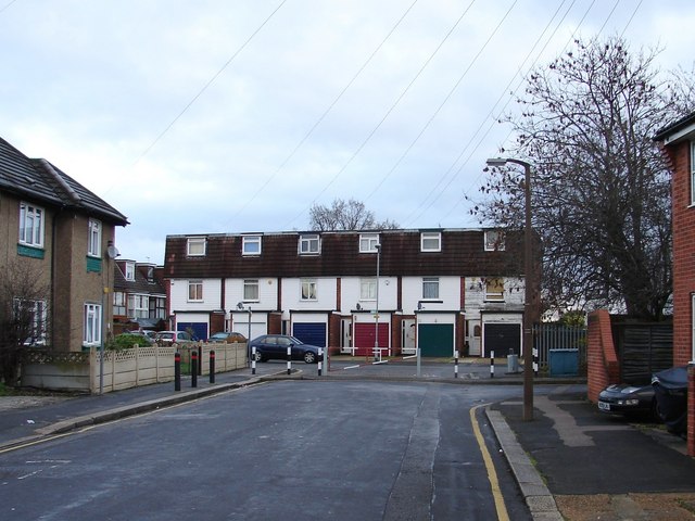
1267:== {{int:filedesc}} == {{Information |description={{en|1=Terraced housing at Queens Park Road The road to the right leads to the industrial estate.}} |date=2009-12-17 |source=From |author=[http://
802:
1150:
786:
636:
592:
794:
489:
1142:
1104:
1059:
1014:
969:
905:
901:
798:
782:
718:
714:
588:
497:
493:
485:
810:
501:
1146:
806:
790:
676:
632:
481:
1260:
639:"}},"text\/plain":{"en":{"P275":"Creative Commons Attribution-ShareAlike 2.0 Generic"}}}}": -->
504:"}},"text\/plain":{"en":{"P2699":"https:\/\/www.geograph.org.uk\/profile\/13639"}}}}": -->
1249:
1244:
813:"}},"text\/plain":{"en":{"P973":"https:\/\/www.geograph.org.uk\/photo\/1623300"}}}}": -->
42:
1194:
836:
662:
618:
288:
238:
856:
323:
1312:
This file contains additional information, probably added from the digital camera or scanner used to create or digitize it.
413:
545:
1160:
1114:
1073:
1028:
983:
946:
919:
864:
820:
759:
732:
602:
566:
553:
538:
1187:
879:
849:
686:
646:
511:
470:
369:
1315:
If the file has been modified from its original state, some details may not fully reflect the modified file.
412:– If you remix, transform, or build upon the material, you must distribute your contributions under the
330:
on the
Geograph website for the photographer's contact details. The copyright on this image is owned by
976:"}},"text\/plain":{"en":{"P3575":"75,962 byte"}}}}": -->
595:"}},"text\/plain":{"en":{"P6216":"copyrighted"}}}}": -->
1299:
1066:"}},"text\/plain":{"en":{"P2049":"640 pixel"}}}}": -->
1021:"}},"text\/plain":{"en":{"P2048":"480 pixel"}}}}": -->
912:"}},"text\/plain":{"en":{"P7787":"22 degree"}}}}": -->
725:"}},"text\/plain":{"en":{"P7787":"22 degree"}}}}": -->
91:
183:
1153:"}},"text\/plain":{"en":{"P459":"SHA-1"}}}}": -->
886:
871:
573:
366:
167:
126:
Terraced housing at Queens Park Road The road to the right leads to the industrial estate.
8:
310:
294:
244:
335:
78:
460:
156:
146:
1170:
1124:
1083:
1038:
993:
929:
830:
742:
696:
656:
612:
521:
1281:
315:
327:
116:
Terraced housing at Queens Park Road - geograph.org.uk - 1623300.jpg
52:
Terraced_housing_at_Queens_Park_Road_-_geograph.org.uk_-_1623300.jpg
1217:
Click on a date/time to view the file as it appeared at that time.
280:
230:
265:
51° 35′ 47″ N, 0° 14′ 19″ E
215:
51° 35′ 45″ N, 0° 14′ 18″ E
135:
66:
454:
Add a one-line explanation of what this file represents
1275:
1290:
1215:
90:
Commons is a freely licensed media file repository.
663:
Creative
Commons Attribution-ShareAlike 2.0 Generic
637:
Creative
Commons Attribution-ShareAlike 2.0 Generic
56:(640 × 480 pixels, file size: 74 KB, MIME type:
423:https://creativecommons.org/licenses/by-sa/2.0
71:
811:https:\/\/www.geograph.org.uk\/photo\/1623300
502:https:\/\/www.geograph.org.uk\/profile\/13639
429:Creative Commons Attribution-Share Alike 2.0
347:
131:
113:
152:
141:
14:
1063:
1018:
973:
909:
722:
389:– to copy, distribute and transmit the work
1292:The following other wikis use this file:
887:https://www.geograph.org.uk/photo/1623300
574:https://www.geograph.org.uk/profile/13639
1176:9b7bd33c1cf48801718d8435b01a99b89f16fd4b
287:View this and other nearby images on:
237:View this and other nearby images on:
190:
102:
334:and is licensed for reuse under the
255:
205:
198:Terraced housing at Queens Park Road
179:Terraced housing at Queens Park Road
1277:The following page uses this file:
1208:
370:Attribution-Share Alike 2.0 Generic
358:
353:
338:Attribution-ShareAlike 2.0 license.
13:
1310:
459:
453:
344:
321:
120:
103:
49:
1336:
1317:
458:
733:coordinates of the point of view
715:coordinates of the point of view
444:
400:Under the following conditions:
365:This file is licensed under the
357:
352:
346:
314:
293:
279:
271:
243:
229:
221:
70:
31:
21:
441:
121:
46:No higher resolution available.
1287:
1212:
837:file available on the internet
787:file available on the internet
440:
322:This image was taken from the
26:
1:
920:coordinates of depicted place
902:coordinates of depicted place
36:
1272:
857:Geograph Britain and Ireland
795:Geograph Britain and Ireland
539:object of statement has role
486:object of statement has role
466:Items portrayed in this file
306:
7:
1307:
935:51°35'46.54"N, 0°14'18.60"E
748:51°35'45.28"N, 0°14'17.52"E
270:
220:
10:
1341:
1296:Usage on ur.wikipedia.org
414:same or compatible license
110:
105:
1209:
196:Ian Paterson /
177:Ian Paterson /
16:
865:geograph.org.uk image ID
799:geograph.org.uk image ID
443:
380:
77:This is a file from the
41:
1266:
168:required by the license
134:
81:. Information from its
328:this photograph's page
299:51.596260; 0.238500
249:51.595910; 0.238200
84:description page there
1188:determination method
1147:determination method
1245:14:27, 4 March 2011
395:– to adapt the work
554:author name string
494:author name string
1328:
1327:
1288:Global file usage
1270:
1065:
1020:
975:
911:
724:
647:copyright license
633:copyright license
452:
343:
342:
326:collection. See
304:
303:
254:
253:
203:
202:
171:
99:
98:
79:Wikimedia Commons
32:Global file usage
1332:
1318:
1257:
1219:
1197:
1192:
1092:
1047:
1002:
957:
956:
951:
889:
884:
880:described at URL
874:
869:
859:
854:
807:described at URL
770:
769:
764:
702:17 December 2009
603:copyright status
589:copyright status
576:
571:
561:
558:
548:
543:
450:
436:
433:
430:
427:
424:
416:as the original.
378:
367:Creative Commons
361:
360:
356:
355:
350:
349:
336:Creative Commons
324:Geograph project
318:
311:
300:
297:
283:
282:
276:
275:
274:
268:
267:
256:
250:
247:
233:
232:
226:
225:
224:
218:
217:
206:
165:
137:
136:17 December 2009
125:
117:
111:
95:
74:
73:
67:
61:
59:
1340:
1339:
1335:
1334:
1333:
1331:
1330:
1329:
1306:
1286:
1271:
1263:
1255:
1211:
1210:
1207:
1206:
1205:
1204:
1203:
1202:
1201:
1200:
1199:
1198:
1193:
1190:
1181:
1180:
1179:
1177:
1167:
1166:
1165:
1163:
1140:
1139:
1138:
1137:
1136:
1135:
1134:
1133:
1131:
1121:
1120:
1119:
1117:
1102:
1101:
1100:
1099:
1098:
1097:
1096:
1095:
1093:
1090:
1080:
1079:
1078:
1076:
1057:
1056:
1055:
1054:
1053:
1052:
1051:
1050:
1048:
1045:
1035:
1034:
1033:
1031:
1012:
1011:
1010:
1009:
1008:
1007:
1006:
1005:
1003:
1000:
990:
989:
988:
986:
967:
966:
965:
964:
963:
962:
961:
960:
959:
958:
954:
952:
949:
940:
939:
938:
936:
926:
925:
924:
922:
899:
898:
897:
896:
895:
894:
893:
892:
891:
890:
885:
882:
876:
875:
870:
867:
861:
860:
855:
852:
843:
842:
841:
839:
827:
826:
825:
823:
780:
779:
778:
777:
776:
775:
774:
773:
772:
771:
767:
765:
762:
753:
752:
751:
749:
739:
738:
737:
735:
712:
711:
710:
709:
708:
707:
706:
705:
703:
693:
692:
691:
689:
674:
673:
672:
671:
670:
669:
668:
667:
665:
653:
652:
651:
649:
630:
629:
628:
627:
626:
625:
624:
623:
621:
609:
608:
607:
605:
586:
585:
584:
583:
582:
581:
580:
579:
578:
577:
572:
569:
563:
562:
559:
556:
550:
549:
544:
541:
532:
531:
530:
528:
518:
517:
516:
514:
479:
478:
477:
476:
475:
473:
457:
456:
455:
438:
437:
434:
431:
428:
425:
422:
421:
379:
376:
373:
362:
339:
309:
298:
272:
263:
262:
259:Object location
248:
222:
213:
212:
209:Camera location
204:
193:
186:
174:
147:geograph.org.uk
127:
115:
108:
101:
100:
89:
88:
87:is shown below.
63:
57:
55:
48:
47:
12:
11:
5:
1338:
1326:
1325:
1322:
1309:
1305:
1304:
1303:
1302:
1289:
1285:
1284:
1274:
1269:
1268:
1265:
1261:
1258:
1252:
1247:
1242:
1238:
1237:
1234:
1231:
1228:
1225:
1222:
1214:
1186:
1185:
1184:
1183:
1182:
1178:
1175:
1173:
1172:
1171:
1169:
1168:
1164:
1159:
1157:
1156:
1155:
1154:
1152:
1148:
1144:
1132:
1129:
1127:
1126:
1125:
1123:
1122:
1118:
1113:
1111:
1110:
1109:
1108:
1106:
1094:
1088:
1086:
1085:
1084:
1082:
1081:
1077:
1072:
1070:
1069:
1068:
1067:
1061:
1049:
1043:
1041:
1040:
1039:
1037:
1036:
1032:
1027:
1025:
1024:
1023:
1022:
1016:
1004:
998:
996:
995:
994:
992:
991:
987:
982:
980:
979:
978:
977:
971:
945:
944:
943:
942:
941:
937:
934:
932:
931:
930:
928:
927:
923:
918:
916:
915:
914:
913:
907:
903:
878:
877:
863:
862:
848:
847:
846:
845:
844:
840:
835:
833:
832:
831:
829:
828:
824:
821:source of file
819:
817:
816:
815:
814:
812:
808:
804:
800:
796:
792:
788:
784:
783:source of file
758:
757:
756:
755:
754:
750:
747:
745:
744:
743:
741:
740:
736:
731:
729:
728:
727:
726:
720:
716:
704:
701:
699:
698:
697:
695:
694:
690:
685:
683:
682:
681:
680:
678:
666:
661:
659:
658:
657:
655:
654:
650:
645:
643:
642:
641:
640:
638:
634:
622:
617:
615:
614:
613:
611:
610:
606:
601:
599:
598:
597:
596:
594:
590:
565:
564:
552:
551:
537:
536:
535:
534:
533:
529:
526:
524:
523:
522:
520:
519:
515:
510:
508:
507:
506:
505:
503:
499:
495:
491:
487:
483:
474:
469:
467:
464:
463:
462:
461:
449:
448:
445:
442:
420:
419:
418:
417:
407:
398:
397:
396:
390:
383:You are free:
374:
364:
363:
345:
341:
340:
319:
308:
305:
302:
301:
291:
285:
260:
252:
251:
241:
235:
210:
201:
200:
194:
191:
188:
187:
182:
175:
172:
160:
159:
154:
150:
149:
143:
139:
138:
133:
129:
128:
118:
109:
107:
104:
97:
96:
75:
65:
64:
45:
40:
39:
34:
29:
24:
19:
9:
6:
4:
3:
2:
1337:
1323:
1320:
1319:
1316:
1313:
1301:
1298:
1297:
1295:
1294:
1293:
1283:
1280:
1279:
1278:
1264:
1259:
1253:
1251:
1248:
1246:
1243:
1240:
1239:
1235:
1232:
1229:
1226:
1223:
1221:
1220:
1218:
1196:
1189:
1174:
1162:
1158:
1128:
1116:
1112:
1087:
1075:
1071:
1042:
1030:
1026:
997:
985:
981:
948:
933:
921:
917:
888:
881:
873:
866:
858:
851:
838:
834:
822:
818:
761:
746:
734:
730:
700:
688:
684:
664:
660:
648:
644:
620:
616:
604:
600:
575:
568:
555:
547:
540:
525:
513:
509:
472:
468:
465:
446:
439:
426:CC BY-SA 2.0
415:
411:
408:
405:
402:
401:
399:
394:
391:
388:
385:
384:
382:
381:
375:Attribution:
371:
368:
351:
337:
333:
329:
325:
320:
317:
313:
312:
296:
292:
290:
289:OpenStreetMap
286:
284:
266:
261:
258:
257:
246:
242:
240:
239:OpenStreetMap
236:
234:
216:
211:
208:
207:
199:
195:
189:
185:
181: /
180:
176:
169:
164:
162:
161:
158:
155:
151:
148:
144:
140:
130:
124:
119:
112:
93:
86:
85:
80:
76:
69:
68:
62:
53:
44:
38:
35:
33:
30:
28:
25:
23:
20:
18:
15:
1314:
1311:
1291:
1276:
1216:
1213:File history
560:Ian Paterson
546:photographer
490:photographer
409:
403:
392:
386:
377:Ian Paterson
332:Ian Paterson
331:
269:
219:
197:
184:CC BY-SA 2.0
178:
157:Ian Paterson
122:
92:You can help
82:
50:
22:File history
1282:Harold Wood
1262:GeographBot
619:copyrighted
593:copyrighted
410:share alike
404:attribution
163:Attribution
114:Description
1321:_error
1300:ہیرولڈ ووڈ
1273:File usage
1254:640 × 480
1230:Dimensions
1130:image/jpeg
1115:media type
1105:media type
527:some value
58:image/jpeg
27:File usage
1227:Thumbnail
1224:Date/Time
984:data size
970:data size
687:inception
677:inception
307:Licensing
192:InfoField
173:InfoField
123:English:
1308:Metadata
1161:checksum
1143:checksum
850:operator
791:operator
447:Captions
393:to remix
387:to share
372:license.
37:Metadata
1256:(74 KB)
1241:current
1236:Comment
999:75,962
947:heading
906:heading
872:1623300
803:1623300
760:heading
719:heading
512:creator
482:creator
471:depicts
451:English
106:Summary
54:
1029:height
1015:height
955:degree
910:degree
768:degree
723:degree
277:
227:
153:Author
142:Source
1195:SHA-1
1151:SHA-1
1091:pixel
1074:width
1064:pixel
1060:width
1046:pixel
1019:pixel
145:From
1233:User
1089:640
1044:480
1001:byte
974:byte
435:true
432:true
132:Date
17:File
953:22
766:22
567:URL
498:URL
1191::
950::
883::
868::
853::
763::
570::
557::
542::
1324:0
170:)
166:(
94:.
60:)
Text is available under the Creative Commons Attribution-ShareAlike License. Additional terms may apply.
_heading:22.00&language=en)
_heading:22.00&language=en)
