847:"}},"text\/plain":{"en":{"":"coordinates of the point of view"}}},"{\"value\":{\"latitude\":50.52223,\"longitude\":-4.25045,\"altitude\":null,\"precision\":1.0e-6,\"globe\":\"http:\\\/\\\/www.wikidata.org\\\/entity\\\/Q2\"},\"type\":\"globecoordinate\"}":{"text\/html":{"en":{"P1259":"50\u00b031'20.028"N, 4\u00b015'1.620"W"}},"text\/plain":{"en":{"P1259":"50\u00b031'20.028\"N, 4\u00b015'1.620\"W"}}},"{\"value\":{\"entity-type\":\"property\",\"numeric-id\":7787,\"id\":\"P7787\"},\"type\":\"wikibase-entityid\"}":{"text\/html":{"en":{"":"
915:"}},"text\/plain":{"en":{"":"coordinates of depicted place"}}},"{\"value\":{\"latitude\":50.52401,\"longitude\":-4.2536,\"altitude\":null,\"precision\":1.0e-5,\"globe\":\"http:\\\/\\\/www.wikidata.org\\\/entity\\\/Q2\"},\"type\":\"globecoordinate\"}":{"text\/html":{"en":{"P9149":"50\u00b031'26.44"N, 4\u00b015'12.96"W"}},"text\/plain":{"en":{"P9149":"50\u00b031'26.44\"N, 4\u00b015'12.96\"W"}}},"{\"value\":{\"entity-type\":\"property\",\"numeric-id\":7787,\"id\":\"P7787\"},\"type\":\"wikibase-entityid\"}":{"text\/html":{"en":{"":"
507:"}},"text\/plain":{"en":{"":"author name string"}}},"{\"value\":\"Tony Atkin\",\"type\":\"string\"}":{"text\/html":{"en":{"P2093":"Tony Atkin"}},"text\/plain":{"en":{"P2093":"Tony Atkin"}}},"{\"value\":{\"entity-type\":\"property\",\"numeric-id\":2699,\"id\":\"P2699\"},\"type\":\"wikibase-entityid\"}":{"text\/html":{"en":{"":"
809:"}},"text\/plain":{"en":{"":"inception"}}},"{\"value\":{\"time\":\"+2005-08-07T00:00:00Z\",\"timezone\":0,\"before\":0,\"after\":0,\"precision\":11,\"calendarmodel\":\"http:\\\/\\\/www.wikidata.org\\\/entity\\\/Q1985727\"},\"type\":\"time\"}":{"text\/html":{"en":{"P571":"7 August 2005"}},"text\/plain":{"en":{"P571":"7 August 2005"}}}}": -->
686:
491:
244:
911:
236:
308:
258:
327:
365:
370:
72:
1111:"}},"text\/plain":{"en":{"":"ISO speed"}}},"{\"value\":{\"amount\":\"+100\",\"unit\":\"1\"},\"type\":\"quantity\"}":{"text\/html":{"en":{"P6789":"100"}},"text\/plain":{"en":{"P6789":"100"}}}}": -->
1028:"}},"text\/plain":{"en":{"":"f-number"}}},"{\"value\":{\"amount\":\"+4.9\",\"unit\":\"1\"},\"type\":\"quantity\"}":{"text\/html":{"en":{"P6790":"4.9"}},"text\/plain":{"en":{"P6790":"4.9"}}}}": -->
983:"}},"text\/plain":{"en":{"":"exposure time"}}},"{\"value\":{\"amount\":\"+0.00284819139846197664\",\"unit\":\"http:\\\/\\\/www.wikidata.org\\\/entity\\\/Q11574\"},\"type\":\"quantity\"}":{"text\/html":{"en":{"P6757":"0.00284819139846197664
702:"}},"text\/plain":{"en":{"P973":"https:\/\/www.geograph.org.uk\/photo\/317830"}}},"{\"value\":{\"entity-type\":\"property\",\"numeric-id\":7384,\"id\":\"P7384\"},\"type\":\"wikibase-entityid\"}":{"text\/html":{"en":{"":"
1269:
694:"}},"text\/plain":{"en":{"P7482":"file available on the internet"}}},"{\"value\":{\"entity-type\":\"property\",\"numeric-id\":973,\"id\":\"P973\"},\"type\":\"wikibase-entityid\"}":{"text\/html":{"en":{"":"
499:"}},"text\/plain":{"en":{"":"object of statement has role"}}},"{\"value\":{\"entity-type\":\"item\",\"numeric-id\":33231,\"id\":\"Q33231\"},\"type\":\"wikibase-entityid\"}":{"text\/html":{"en":{"P3831":"
1149:"}},"text\/plain":{"en":{"":"media type"}}},"{\"value\":\"image\\\/jpeg\",\"type\":\"string\"}":{"text\/html":{"en":{"P1163":"image\/jpeg"}},"text\/plain":{"en":{"P1163":"image\/jpeg"}}}}": -->
646:"}},"text\/plain":{"en":{"":"copyright license"}}},"{\"value\":{\"entity-type\":\"item\",\"numeric-id\":19068220,\"id\":\"Q19068220\"},\"type\":\"wikibase-entityid\"}":{"text\/html":{"en":{"P275":"
602:"}},"text\/plain":{"en":{"":"copyright status"}}},"{\"value\":{\"entity-type\":\"item\",\"numeric-id\":50423863,\"id\":\"Q50423863\"},\"type\":\"wikibase-entityid\"}":{"text\/html":{"en":{"P6216":"
690:"}},"text\/plain":{"en":{"":"source of file"}}},"{\"value\":{\"entity-type\":\"item\",\"numeric-id\":74228490,\"id\":\"Q74228490\"},\"type\":\"wikibase-entityid\"}":{"text\/html":{"en":{"P7482":"
1066:"}},"text\/plain":{"en":{"":"focal length"}}},"{\"value\":{\"amount\":\"+24\",\"unit\":\"http:\\\/\\\/www.wikidata.org\\\/entity\\\/Q174789\"},\"type\":\"quantity\"}":{"text\/html":{"en":{"P2151":"24
503:"}},"text\/plain":{"en":{"P3831":"photographer"}}},"{\"value\":{\"entity-type\":\"property\",\"numeric-id\":2093,\"id\":\"P2093\"},\"type\":\"wikibase-entityid\"}":{"text\/html":{"en":{"":"
1187:"}},"text\/plain":{"en":{"":"instance of"}}},"{\"value\":{\"entity-type\":\"item\",\"numeric-id\":125191,\"id\":\"Q125191\"},\"type\":\"wikibase-entityid\"}":{"text\/html":{"en":{"P31":"
919:"}},"text\/plain":{"en":{"":"heading"}}},"{\"value\":{\"amount\":\"+315\",\"unit\":\"http:\\\/\\\/www.wikidata.org\\\/entity\\\/Q28390\"},\"type\":\"quantity\"}":{"text\/html":{"en":{"P7787":"315
851:"}},"text\/plain":{"en":{"":"heading"}}},"{\"value\":{\"amount\":\"+315\",\"unit\":\"http:\\\/\\\/www.wikidata.org\\\/entity\\\/Q28390\"},\"type\":\"quantity\"}":{"text\/html":{"en":{"P7787":"315
714:"}},"text\/plain":{"en":{"":"operator"}}},"{\"value\":{\"entity-type\":\"item\",\"numeric-id\":1503119,\"id\":\"Q1503119\"},\"type\":\"wikibase-entityid\"}":{"text\/html":{"en":{"P137":"
710:"}},"text\/plain":{"en":{"P7384":"317830"}}},"{\"value\":{\"entity-type\":\"property\",\"numeric-id\":137,\"id\":\"P137\"},\"type\":\"wikibase-entityid\"}":{"text\/html":{"en":{"":"
495:"}},"text\/plain":{"en":{"":"creator"}}},"{\"value\":{\"entity-type\":\"property\",\"numeric-id\":3831,\"id\":\"P3831\"},\"type\":\"wikibase-entityid\"}":{"text\/html":{"en":{"":"
1145:
698:"}},"text\/plain":{"en":{"":"described at URL"}}},"{\"value\":\"https:\\\/\\\/www.geograph.org.uk\\\/photo\\\/317830\",\"type\":\"string\"}":{"text\/html":{"en":{"P973":"
277:
511:"}},"text\/plain":{"en":{"":"URL"}}},"{\"value\":\"https:\\\/\\\/www.geograph.org.uk\\\/profile\\\/1324\",\"type\":\"string\"}":{"text\/html":{"en":{"P2699":"
706:"}},"text\/plain":{"en":{"":"geograph.org.uk image ID"}}},"{\"value\":\"317830\",\"type\":\"string\"}":{"text\/html":{"en":{"P7384":"
227:
417:– You must give appropriate credit, provide a link to the license, and indicate if changes were made. You may do so in any reasonable manner, but not in any way that suggests the licensor endorses you or your use.
83:
51:
241:
291:
1279:
707:
691:
647:
603:
715:
1188:
500:
1146:
1108:
1063:
1025:
980:
916:
912:
848:
844:
703:
687:
599:
508:
504:
496:
806:
711:
699:
695:
643:
512:
492:
1184:
650:"}},"text\/plain":{"en":{"P275":"Creative Commons Attribution-ShareAlike 2.0 Generic"}}}}": -->
1471:
164:
515:"}},"text\/plain":{"en":{"P2699":"https:\/\/www.geograph.org.uk\/profile\/1324"}}}}": -->
1268:
1263:
42:
741:
673:
629:
301:
251:
791:
334:
1365:
This file contains additional information, probably added from the digital camera or scanner used to create or digitize it.
1214:
424:
556:
1156:
1118:
1077:
1035:
994:
957:
930:
889:
862:
769:
725:
613:
577:
564:
549:
987:"}},"text\/plain":{"en":{"P6757":"0.00284819139846197664 second"}}}}": -->
816:
784:
754:
657:
522:
481:
718:"}},"text\/plain":{"en":{"P137":"Geograph Britain and Ireland"}}}}": -->
1198:
1502:
380:
1368:
If the file has been modified from its original state, some details may not fully reflect the modified file.
423:– If you remix, transform, or build upon the material, you must distribute your contributions under the
341:
on the
Geograph website for the photographer's contact details. The copyright on this image is owned by
1070:"}},"text\/plain":{"en":{"P2151":"24 millimetre"}}}}": -->
606:"}},"text\/plain":{"en":{"P6216":"copyrighted"}}}}": -->
923:"}},"text\/plain":{"en":{"P7787":"315 degree"}}}}": -->
855:"}},"text\/plain":{"en":{"P7787":"315 degree"}}}}": -->
1191:"}},"text\/plain":{"en":{"P31":"photograph"}}}}": -->
91:
196:
1550:
1286:{{Information |Description=The Northern Slope of Hingston Down |Source=From ; transferd by
776:
761:
584:
377:
180:
8:
1586:
138:
321:
1287:
307:
257:
1691:
346:
78:
471:
1646:
1568:
1394:
1304:
1701:
1656:
1434:
153:
134:
1604:
1208:
1166:
1128:
1087:
1045:
1004:
940:
872:
826:
735:
667:
623:
532:
326:
1414:
338:
1711:
1404:
1236:
Click on a date/time to view the file as it appeared at that time.
111:
The
Northern Slope of Hingston Down - geograph.org.uk - 317830.jpg
52:
The_Northern_Slope_of_Hingston_Down_-_geograph.org.uk_-_317830.jpg
293:
243:
228:
50° 31′ 20.03″ N, 4° 15′ 01.62″ W
142:
1387:
1377:
1322:
1342:
1332:
278:
50° 31′ 26″ N, 4° 15′ 13″ W
123:
66:
465:
Add a one-line explanation of what this file represents
1352:
1298:
1313:
1234:
171:
Creative
Commons Attribution Share-alike license 2.0
90:
Commons is a freely licensed media file repository.
674:
Creative
Commons Attribution-ShareAlike 2.0 Generic
648:
Creative
Commons Attribution-ShareAlike 2.0 Generic
56:(640 × 425 pixels, file size: 85 KB, MIME type:
434:https://creativecommons.org/licenses/by-sa/2.0
71:
440:Creative Commons Attribution-Share Alike 2.0
358:
159:
119:
108:
700:https:\/\/www.geograph.org.uk\/photo\/317830
513:https:\/\/www.geograph.org.uk\/profile\/1324
149:
129:
14:
1067:
984:
920:
852:
400:– to copy, distribute and transmit the work
1315:The following other wikis use this file:
762:https://www.geograph.org.uk/photo/317830
585:https://www.geograph.org.uk/profile/1324
300:View this and other nearby images on:
250:View this and other nearby images on:
203:
102:
345:and is licensed for reuse under the
268:
218:
1300:The following page uses this file:
1227:
381:Attribution-Share Alike 2.0 Generic
369:
364:
349:Attribution-ShareAlike 2.0 license.
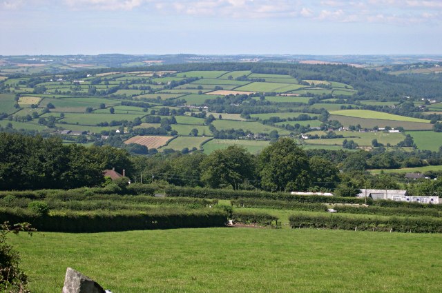
211:The Northern Slope of Hingston Down
192:The Northern Slope of Hingston Down
115:The Northern Slope of Hingston Down
13:
1363:
470:
464:
355:
332:
103:
49:
1736:
1370:
469:
1425:Date and time of data generation
1399:10/3,511 sec (0.002848191398462)
863:coordinates of the point of view
845:coordinates of the point of view
455:
411:Under the following conditions:
376:This file is licensed under the
368:
363:
357:
325:
306:
292:
284:
256:
242:
234:
70:
31:
21:
1281:File Upload Bot (Magnus Manske)
452:
46:No higher resolution available.
1310:
1231:
742:file available on the internet
692:file available on the internet
451:
333:This image was taken from the
26:
1:
1625:A directly photographed image
1591:Flash did not fire, auto mode
931:coordinates of depicted place
913:coordinates of depicted place
36:
1295:
878:50°31'20.028"N, 4°15'1.620"W
792:Geograph Britain and Ireland
716:Geograph Britain and Ireland
550:object of statement has role
497:object of statement has role
477:Items portrayed in this file
283:
233:
7:
1513:Date and time of digitizing
1360:
1319:Usage on ceb.wikipedia.org
946:50°31'26.44"N, 4°15'12.96"W
10:
1741:
1667:Focal length in 35 mm film
1596:Supported Flashpix version
1349:Usage on www.wikidata.org
1339:Usage on sh.wikipedia.org
1329:Usage on fr.wikipedia.org
425:same or compatible license
105:
1521:Meaning of each component
1478:File change date and time
1228:
16:
770:geograph.org.uk image ID
704:geograph.org.uk image ID
454:
391:
77:This is a file from the
41:
1630:Custom image processing
1285:
1010:0.00284819139846197664
209:Tony Atkin /
190:Tony Atkin /
181:required by the license
122:
81:. Information from its
1721:Subject distance range
1542:Image compression mode
339:this photograph's page
312:50.524010; -4.253600
262:50.522230; -4.250450
84:description page there
1560:Maximum land aperture
1452:Horizontal resolution
1617:Digital still camera
1516:14:48, 7 August 2005
1481:14:48, 7 August 2005
1428:14:48, 7 August 2005
1264:20:08, 11 March 2009
143:geograph_org2commons
1486:Y and C positioning
1460:Vertical resolution
1374:Camera manufacturer
406:– to adapt the work
1675:Scene capture type
1651:Auto white balance
1288:User:Magnus Manske
565:author name string
505:author name string
139:User:Magnus Manske
1728:
1727:
1311:Global file usage
1293:
1069:
986:
922:
854:
658:copyright license
644:copyright license
463:
354:
353:
337:collection. See
317:
316:
267:
266:
216:
215:
184:
168:
165:Reusing this file
137:; transferred by
99:
98:
79:Wikimedia Commons
32:Global file usage
1732:
1494:Exposure Program
1371:
1276:
1238:
1096:
1013:
968:
967:
962:
900:
899:
894:
794:
789:
779:
774:
764:
759:
755:described at URL
696:described at URL
614:copyright status
600:copyright status
587:
582:
572:
569:
559:
554:
461:
447:
444:
441:
438:
435:
427:as the original.
389:
378:Creative Commons
372:
371:
367:
366:
361:
360:
347:Creative Commons
335:Geograph project
329:
322:
313:
310:
296:
295:
289:
288:
287:
281:
280:
269:
263:
260:
246:
245:
239:
238:
237:
231:
230:
219:
178:
162:
125:
112:
106:
95:
74:
73:
67:
61:
59:
1740:
1739:
1735:
1734:
1733:
1731:
1730:
1729:
1563:3 APEX (f/2.83)
1359:
1309:
1294:
1282:
1274:
1230:
1229:
1226:
1225:
1224:
1223:
1222:
1221:
1220:
1219:
1217:
1205:
1204:
1203:
1201:
1182:
1181:
1180:
1179:
1178:
1177:
1176:
1175:
1173:
1163:
1162:
1161:
1159:
1144:
1143:
1142:
1141:
1140:
1139:
1138:
1137:
1135:
1125:
1124:
1123:
1121:
1106:
1105:
1104:
1103:
1102:
1101:
1100:
1099:
1097:
1094:
1084:
1083:
1082:
1080:
1061:
1060:
1059:
1058:
1057:
1056:
1055:
1054:
1052:
1042:
1041:
1040:
1038:
1023:
1022:
1021:
1020:
1019:
1018:
1017:
1016:
1014:
1011:
1001:
1000:
999:
997:
978:
977:
976:
975:
974:
973:
972:
971:
970:
969:
965:
963:
960:
951:
950:
949:
947:
937:
936:
935:
933:
910:
909:
908:
907:
906:
905:
904:
903:
902:
901:
897:
895:
892:
883:
882:
881:
879:
869:
868:
867:
865:
842:
841:
840:
839:
838:
837:
836:
835:
833:
823:
822:
821:
819:
804:
803:
802:
801:
800:
799:
798:
797:
796:
795:
790:
787:
781:
780:
775:
772:
766:
765:
760:
757:
748:
747:
746:
744:
732:
731:
730:
728:
685:
684:
683:
682:
681:
680:
679:
678:
676:
664:
663:
662:
660:
641:
640:
639:
638:
637:
636:
635:
634:
632:
620:
619:
618:
616:
597:
596:
595:
594:
593:
592:
591:
590:
589:
588:
583:
580:
574:
573:
570:
567:
561:
560:
555:
552:
543:
542:
541:
539:
529:
528:
527:
525:
490:
489:
488:
487:
486:
484:
468:
467:
466:
449:
448:
445:
442:
439:
436:
433:
432:
390:
387:
384:
373:
350:
311:
285:
276:
275:
272:Object location
261:
235:
226:
225:
222:Camera location
217:
206:
199:
187:
135:geograph.org.uk
110:
101:
100:
89:
88:
87:is shown below.
63:
57:
55:
48:
47:
12:
11:
5:
1738:
1726:
1725:
1722:
1718:
1717:
1714:
1708:
1707:
1704:
1698:
1697:
1694:
1688:
1687:
1684:
1680:
1679:
1676:
1672:
1671:
1668:
1664:
1663:
1660:
1653:
1652:
1649:
1643:
1642:
1639:
1635:
1634:
1633:Normal process
1631:
1627:
1626:
1623:
1619:
1618:
1615:
1611:
1610:
1607:
1601:
1600:
1597:
1593:
1592:
1589:
1583:
1582:
1579:
1575:
1574:
1571:
1565:
1564:
1561:
1557:
1556:
1553:
1547:
1546:
1543:
1539:
1538:
1537:
1536:
1535:does not exist
1533:
1530:
1527:
1522:
1518:
1517:
1514:
1510:
1509:
1506:
1499:
1498:
1497:Normal program
1495:
1491:
1490:
1487:
1483:
1482:
1479:
1475:
1474:
1469:
1465:
1464:
1461:
1457:
1456:
1453:
1449:
1448:
1445:
1441:
1440:
1437:
1430:
1429:
1426:
1422:
1421:
1418:
1411:
1410:
1407:
1401:
1400:
1397:
1391:
1390:
1385:
1381:
1380:
1375:
1362:
1358:
1357:
1356:
1355:
1347:
1346:
1345:
1337:
1336:
1335:
1327:
1326:
1325:
1312:
1308:
1307:
1297:
1292:
1291:
1284:
1280:
1277:
1271:
1266:
1261:
1257:
1256:
1253:
1250:
1247:
1244:
1241:
1233:
1218:
1213:
1211:
1210:
1209:
1207:
1206:
1202:
1197:
1195:
1194:
1193:
1192:
1190:
1186:
1174:
1171:
1169:
1168:
1167:
1165:
1164:
1160:
1155:
1153:
1152:
1151:
1150:
1148:
1136:
1133:
1131:
1130:
1129:
1127:
1126:
1122:
1117:
1115:
1114:
1113:
1112:
1110:
1098:
1092:
1090:
1089:
1088:
1086:
1085:
1081:
1076:
1074:
1073:
1072:
1071:
1065:
1053:
1050:
1048:
1047:
1046:
1044:
1043:
1039:
1034:
1032:
1031:
1030:
1029:
1027:
1015:
1009:
1007:
1006:
1005:
1003:
1002:
998:
993:
991:
990:
989:
988:
982:
956:
955:
954:
953:
952:
948:
945:
943:
942:
941:
939:
938:
934:
929:
927:
926:
925:
924:
918:
914:
888:
887:
886:
885:
884:
880:
877:
875:
874:
873:
871:
870:
866:
861:
859:
858:
857:
856:
850:
846:
834:
831:
829:
828:
827:
825:
824:
820:
815:
813:
812:
811:
810:
808:
783:
782:
768:
767:
753:
752:
751:
750:
749:
745:
740:
738:
737:
736:
734:
733:
729:
726:source of file
724:
722:
721:
720:
719:
717:
713:
709:
705:
701:
697:
693:
689:
688:source of file
677:
672:
670:
669:
668:
666:
665:
661:
656:
654:
653:
652:
651:
649:
645:
633:
628:
626:
625:
624:
622:
621:
617:
612:
610:
609:
608:
607:
605:
601:
576:
575:
563:
562:
548:
547:
546:
545:
544:
540:
537:
535:
534:
533:
531:
530:
526:
521:
519:
518:
517:
516:
514:
510:
506:
502:
498:
494:
485:
480:
478:
475:
474:
473:
472:
460:
459:
456:
453:
431:
430:
429:
428:
418:
409:
408:
407:
401:
394:You are free:
385:
375:
374:
356:
352:
351:
330:
315:
314:
304:
298:
273:
265:
264:
254:
248:
223:
214:
213:
207:
204:
201:
200:
195:
188:
185:
173:
172:
169:
157:
156:
151:
147:
146:
131:
127:
126:
121:
117:
116:
113:
104:
97:
96:
75:
65:
64:
45:
40:
39:
34:
29:
24:
19:
9:
6:
4:
3:
2:
1737:
1723:
1720:
1719:
1715:
1713:
1710:
1709:
1705:
1703:
1700:
1699:
1695:
1693:
1690:
1689:
1685:
1683:Scene control
1682:
1681:
1677:
1674:
1673:
1669:
1666:
1665:
1661:
1658:
1655:
1654:
1650:
1648:
1647:White balance
1645:
1644:
1641:Auto exposure
1640:
1638:Exposure mode
1637:
1636:
1632:
1629:
1628:
1624:
1621:
1620:
1616:
1613:
1612:
1608:
1606:
1603:
1602:
1598:
1595:
1594:
1590:
1588:
1585:
1584:
1580:
1577:
1576:
1572:
1570:
1569:Metering mode
1567:
1566:
1562:
1559:
1558:
1554:
1552:
1551:Exposure bias
1549:
1548:
1544:
1541:
1540:
1534:
1531:
1528:
1525:
1524:
1523:
1520:
1519:
1515:
1512:
1511:
1507:
1504:
1501:
1500:
1496:
1493:
1492:
1488:
1485:
1484:
1480:
1477:
1476:
1473:
1470:
1468:Software used
1467:
1466:
1462:
1459:
1458:
1454:
1451:
1450:
1446:
1443:
1442:
1438:
1436:
1432:
1431:
1427:
1424:
1423:
1419:
1416:
1413:
1412:
1408:
1406:
1403:
1402:
1398:
1396:
1395:Exposure time
1393:
1392:
1389:
1386:
1383:
1382:
1379:
1376:
1373:
1372:
1369:
1366:
1354:
1351:
1350:
1348:
1344:
1343:Hingston Down
1341:
1340:
1338:
1334:
1333:Hingston Down
1331:
1330:
1328:
1324:
1323:Hingston Down
1321:
1320:
1318:
1317:
1316:
1306:
1305:Hingston Down
1303:
1302:
1301:
1289:
1283:
1278:
1272:
1270:
1267:
1265:
1262:
1259:
1258:
1254:
1251:
1248:
1245:
1242:
1240:
1239:
1237:
1216:
1212:
1200:
1196:
1170:
1158:
1154:
1132:
1120:
1116:
1091:
1079:
1075:
1049:
1037:
1033:
1008:
996:
995:exposure time
992:
981:exposure time
959:
944:
932:
928:
891:
876:
864:
860:
832:7 August 2005
830:
818:
814:
793:
786:
778:
771:
763:
756:
743:
739:
727:
723:
675:
671:
659:
655:
631:
627:
615:
611:
586:
579:
566:
558:
551:
536:
524:
520:
483:
479:
476:
457:
450:
437:CC BY-SA 2.0
426:
422:
419:
416:
413:
412:
410:
405:
402:
399:
396:
395:
393:
392:
386:Attribution:
382:
379:
362:
348:
344:
340:
336:
331:
328:
324:
323:
320:
319:
309:
305:
303:
302:OpenStreetMap
299:
297:
279:
274:
271:
270:
259:
255:
253:
252:OpenStreetMap
249:
247:
229:
224:
221:
220:
212:
208:
202:
198:
194: /
193:
189:
182:
177:
175:
174:
170:
166:
161:
158:
155:
152:
148:
144:
140:
136:
132:
128:
124:7 August 2005
118:
114:
107:
93:
86:
85:
80:
76:
69:
68:
62:
53:
44:
38:
35:
33:
30:
28:
25:
23:
20:
18:
15:
1657:Digital zoom
1578:Light source
1435:focal length
1384:Camera model
1367:
1364:
1314:
1299:
1235:
1232:File history
1078:focal length
1064:focal length
557:photographer
501:photographer
420:
414:
403:
397:
342:
318:
282:
232:
210:
197:CC BY-SA 2.0
191:
92:You can help
82:
50:
22:File history
1614:File source
1605:Color space
1444:Orientation
1199:instance of
1185:instance of
630:copyrighted
604:copyrighted
421:share alike
415:attribution
176:Attribution
109:Description
1702:Saturation
1622:Scene type
1296:File usage
1273:640 × 425
1249:Dimensions
1215:photograph
1189:photograph
1172:image/jpeg
1157:media type
1147:media type
1095:millimetre
1068:millimetre
571:Tony Atkin
538:some value
388:Tony Atkin
343:Tony Atkin
160:Permission
154:Tony Atkin
58:image/jpeg
27:File usage
1712:Sharpness
1472:E4300v1.5
1415:ISO speed
1246:Thumbnail
1243:Date/Time
1119:ISO speed
1109:ISO speed
817:inception
807:inception
205:InfoField
186:InfoField
1692:Contrast
1678:Standard
1489:Co-sited
1405:F-number
1361:Metadata
1353:Q5767194
1036:f-number
1026:f-number
785:operator
712:operator
458:Captions
404:to remix
398:to share
383:license.
37:Metadata
1724:Unknown
1581:Unknown
1573:Pattern
1505:version
1463:300 dpi
1455:300 dpi
1275:(85 KB)
1260:current
1255:Comment
958:heading
917:heading
890:heading
849:heading
523:creator
493:creator
482:depicts
462:English
54:
1716:Normal
1706:Normal
1696:Normal
1670:114 mm
1447:Normal
1417:rating
1290:using
1012:second
985:second
966:degree
921:degree
898:degree
853:degree
777:317830
708:317830
290:
240:
150:Author
141:using
130:Source
1659:ratio
1587:Flash
1439:24 mm
1433:Lens
1409:f/4.9
1388:E4300
1378:NIKON
133:From
1686:None
1609:sRGB
1503:Exif
1252:User
964:315
896:315
446:true
443:true
120:Date
17:File
1508:2.2
1420:100
1134:100
1093:24
1051:4.9
578:URL
509:URL
1532:Cr
1529:Cb
961::
893::
788::
773::
758::
581::
568::
553::
1662:0
1599:1
1555:0
1545:3
1526:Y
183:)
179:(
167:)
163:(
145:.
94:.
60:)
Text is available under the Creative Commons Attribution-ShareAlike License. Additional terms may apply.
_region:GB-GBN_heading:315.00&language=en)
