840:"}},"text\/plain":{"en":{"":"coordinates of the point of view"}}},"{\"value\":{\"latitude\":50.48159,\"longitude\":-3.5535,\"altitude\":null,\"precision\":1.0e-5,\"globe\":\"http:\\\/\\\/www.wikidata.org\\\/entity\\\/Q2\"},\"type\":\"globecoordinate\"}":{"text\/html":{"en":{"P1259":"50\u00b028'53.72"N, 3\u00b033'12.60"W"}},"text\/plain":{"en":{"P1259":"50\u00b028'53.72\"N, 3\u00b033'12.60\"W"}}},"{\"value\":{\"entity-type\":\"property\",\"numeric-id\":7787,\"id\":\"P7787\"},\"type\":\"wikibase-entityid\"}":{"text\/html":{"en":{"":"
908:"}},"text\/plain":{"en":{"":"coordinates of depicted place"}}},"{\"value\":{\"latitude\":50.48186,\"longitude\":-3.5537,\"altitude\":null,\"precision\":1.0e-5,\"globe\":\"http:\\\/\\\/www.wikidata.org\\\/entity\\\/Q2\"},\"type\":\"globecoordinate\"}":{"text\/html":{"en":{"P9149":"50\u00b028'54.70"N, 3\u00b033'13.32"W"}},"text\/plain":{"en":{"P9149":"50\u00b028'54.70\"N, 3\u00b033'13.32\"W"}}},"{\"value\":{\"entity-type\":\"property\",\"numeric-id\":7787,\"id\":\"P7787\"},\"type\":\"wikibase-entityid\"}":{"text\/html":{"en":{"":"
500:"}},"text\/plain":{"en":{"":"author name string"}}},"{\"value\":\"Chris Allen\",\"type\":\"string\"}":{"text\/html":{"en":{"P2093":"Chris Allen"}},"text\/plain":{"en":{"P2093":"Chris Allen"}}},"{\"value\":{\"entity-type\":\"property\",\"numeric-id\":2699,\"id\":\"P2699\"},\"type\":\"wikibase-entityid\"}":{"text\/html":{"en":{"":"
802:"}},"text\/plain":{"en":{"":"inception"}}},"{\"value\":{\"time\":\"+2013-12-24T00:00:00Z\",\"timezone\":0,\"before\":0,\"after\":0,\"precision\":11,\"calendarmodel\":\"http:\\\/\\\/www.wikidata.org\\\/entity\\\/Q1985727\"},\"type\":\"time\"}":{"text\/html":{"en":{"P571":"24 December 2013"}},"text\/plain":{"en":{"P571":"24 December 2013"}}}}": -->
679:
419:
369:
411:
361:
904:
383:
174:
212:
217:
67:
687:"}},"text\/plain":{"en":{"P7482":"file available on the internet"}}},"{\"value\":{\"entity-type\":\"property\",\"numeric-id\":137,\"id\":\"P137\"},\"type\":\"wikibase-entityid\"}":{"text\/html":{"en":{"":"
695:"}},"text\/plain":{"en":{"P137":"Geograph Britain and Ireland"}}},"{\"value\":{\"entity-type\":\"property\",\"numeric-id\":7384,\"id\":\"P7384\"},\"type\":\"wikibase-entityid\"}":{"text\/html":{"en":{"":"
492:"}},"text\/plain":{"en":{"":"object of statement has role"}}},"{\"value\":{\"entity-type\":\"item\",\"numeric-id\":33231,\"id\":\"Q33231\"},\"type\":\"wikibase-entityid\"}":{"text\/html":{"en":{"P3831":"
639:"}},"text\/plain":{"en":{"":"copyright license"}}},"{\"value\":{\"entity-type\":\"item\",\"numeric-id\":19068220,\"id\":\"Q19068220\"},\"type\":\"wikibase-entityid\"}":{"text\/html":{"en":{"P275":"
595:"}},"text\/plain":{"en":{"":"copyright status"}}},"{\"value\":{\"entity-type\":\"item\",\"numeric-id\":50423863,\"id\":\"Q50423863\"},\"type\":\"wikibase-entityid\"}":{"text\/html":{"en":{"P6216":"
683:"}},"text\/plain":{"en":{"":"source of file"}}},"{\"value\":{\"entity-type\":\"item\",\"numeric-id\":74228490,\"id\":\"Q74228490\"},\"type\":\"wikibase-entityid\"}":{"text\/html":{"en":{"P7482":"
496:"}},"text\/plain":{"en":{"P3831":"photographer"}}},"{\"value\":{\"entity-type\":\"property\",\"numeric-id\":2093,\"id\":\"P2093\"},\"type\":\"wikibase-entityid\"}":{"text\/html":{"en":{"":"
912:"}},"text\/plain":{"en":{"":"heading"}}},"{\"value\":{\"amount\":\"+337\",\"unit\":\"http:\\\/\\\/www.wikidata.org\\\/entity\\\/Q28390\"},\"type\":\"quantity\"}":{"text\/html":{"en":{"P7787":"337
844:"}},"text\/plain":{"en":{"":"heading"}}},"{\"value\":{\"amount\":\"+337\",\"unit\":\"http:\\\/\\\/www.wikidata.org\\\/entity\\\/Q28390\"},\"type\":\"quantity\"}":{"text\/html":{"en":{"P7787":"337
691:"}},"text\/plain":{"en":{"":"operator"}}},"{\"value\":{\"entity-type\":\"item\",\"numeric-id\":1503119,\"id\":\"Q1503119\"},\"type\":\"wikibase-entityid\"}":{"text\/html":{"en":{"P137":"
703:"}},"text\/plain":{"en":{"P7384":"3855429"}}},"{\"value\":{\"entity-type\":\"property\",\"numeric-id\":973,\"id\":\"P973\"},\"type\":\"wikibase-entityid\"}":{"text\/html":{"en":{"":"
488:"}},"text\/plain":{"en":{"":"creator"}}},"{\"value\":{\"entity-type\":\"property\",\"numeric-id\":3831,\"id\":\"P3831\"},\"type\":\"wikibase-entityid\"}":{"text\/html":{"en":{"":"
591:
798:
38:
352:
699:"}},"text\/plain":{"en":{"":"geograph.org.uk image ID"}}},"{\"value\":\"3855429\",\"type\":\"string\"}":{"text\/html":{"en":{"P7384":"
264:– You must give appropriate credit, provide a link to the license, and indicate if changes were made. You may do so in any reasonable manner, but not in any way that suggests the licensor endorses you or your use.
416:
366:
1031:{{Information |description ={{en|1=Torbay Hospital}} |date =24 December 2013 |source = |author = |permission ={{Geograph|3855429|Chris Allen}} }}
700:
684:
640:
596:
692:
78:
493:
46:
909:
905:
841:
837:
696:
680:
592:
501:
497:
489:
708:
799:
704:
688:
636:
505:
485:
643:"}},"text\/plain":{"en":{"P275":"Creative Commons Attribution-ShareAlike 2.0 Generic"}}}}": -->
161:
711:"}},"text\/plain":{"en":{"P973":"https:\/\/www.geograph.org.uk\/photo\/3855429"}}}}": -->
508:"}},"text\/plain":{"en":{"P2699":"https:\/\/www.geograph.org.uk\/profile\/4264"}}}}": -->
734:
666:
622:
426:
376:
754:
181:
271:
549:
950:
923:
882:
855:
762:
718:
606:
570:
557:
542:
809:
777:
747:
650:
515:
474:
1013:
1008:
37:
1091:
227:
1032:
270:– If you remix, transform, or build upon the material, you must distribute your contributions under the
188:
on the
Geograph website for the photographer's contact details. The copyright on this image is owned by
599:"}},"text\/plain":{"en":{"P6216":"copyrighted"}}}}": -->
916:"}},"text\/plain":{"en":{"P7787":"337 degree"}}}}": -->
848:"}},"text\/plain":{"en":{"P7787":"337 degree"}}}}": -->
86:
321:
1076:
784:
769:
577:
305:
224:
8:
168:
432:
382:
193:
73:
464:
1048:
1024:
140:
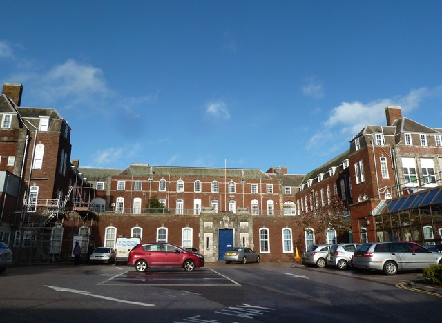
150:
933:
865:
819:
728:
660:
616:
525:
173:
185:
981:
Click on a date/time to view the file as it appeared at that time.
1092:
Wikidata:WikiProject
Medicine/Hospitals by country/United Kingdom
418:
368:
403:
50° 28′ 54.7″ N, 3° 33′ 13″ W
353:
50° 28′ 53.7″ N, 3° 33′ 13″ W
130:
61:
458:
Add a one-line explanation of what this file represents
1086:
1066:
1042:
1057:
979:
85:
Commons is a freely licensed media file repository.
667:
Creative
Commons Attribution-ShareAlike 2.0 Generic
641:
Creative
Commons Attribution-ShareAlike 2.0 Generic
51:(640 × 468 pixels, file size: 64 KB, MIME type:
111:Torbay Hospital - geograph.org.uk - 3855429.jpg
47:Torbay_Hospital_-_geograph.org.uk_-_3855429.jpg
281:https://creativecommons.org/licenses/by-sa/2.0
66:
709:https:\/\/www.geograph.org.uk\/photo\/3855429
287:Creative Commons Attribution-Share Alike 2.0
205:
156:
126:
108:
506:https:\/\/www.geograph.org.uk\/profile\/4264
146:
136:
14:
913:
845:
247:– to copy, distribute and transmit the work
1059:The following other wikis use this file:
785:https://www.geograph.org.uk/photo/3855429
578:https://www.geograph.org.uk/profile/4264
1077:Lista de construções de Charles Holden
425:View this and other nearby images on:
375:View this and other nearby images on:
328:
97:
393:
343:
192:and is licensed for reuse under the
1044:The following page uses this file:
972:
228:Attribution-Share Alike 2.0 Generic
216:
211:
196:Attribution-ShareAlike 2.0 license.
13:
463:
457:
202:
179:
115:
98:
44:
1105:
462:
856:coordinates of the point of view
838:coordinates of the point of view
448:
431:
417:
409:
381:
367:
359:
258:Under the following conditions:
223:This file is licensed under the
215:
210:
204:
172:
65:
31:
21:
445:
116:
41:No higher resolution available.
1054:
976:
735:file available on the internet
685:file available on the internet
444:
180:This image was taken from the
26:
1:
924:coordinates of depicted place
906:coordinates of depicted place
1039:
755:Geograph Britain and Ireland
693:Geograph Britain and Ireland
543:object of statement has role
490:object of statement has role
470:Items portrayed in this file
408:
358:
7:
1063:Usage on de.wikivoyage.org
1033:Category:Hospitals in Devon
939:50°28'54.70"N, 3°33'13.32"W
871:50°28'53.72"N, 3°33'12.60"W
10:
1110:
1083:Usage on www.wikidata.org
1073:Usage on pt.wikipedia.org
272:same or compatible license
105:
100:
973:
16:
763:geograph.org.uk image ID
697:geograph.org.uk image ID
447:
334:Chris Allen /
315:Chris Allen /
238:
72:This is a file from the
36:
1030:
1009:23:07, 23 November 2018
306:required by the license
129:
76:. Information from its
437:50.481860; -3.553700
387:50.481590; -3.553500
186:this photograph's page
79:description page there
253:– to adapt the work
558:author name string
498:author name string
1055:Global file usage
1037:
915:
847:
651:copyright license
637:copyright license
456:
442:
441:
392:
391:
341:
340:
309:
201:
200:
184:collection. See
165:
162:Reusing this file
94:
93:
74:Wikimedia Commons
32:Global file usage
1101:
1021:
983:
961:
960:
955:
893:
892:
887:
825:24 December 2013
787:
782:
778:described at URL
772:
767:
757:
752:
705:described at URL
607:copyright status
593:copyright status
580:
575:
565:
562:
552:
547:
454:
438:
435:
421:
420:
414:
413:
412:
406:
405:
394:
388:
385:
371:
370:
364:
363:
362:
356:
355:
344:
303:
294:
291:
288:
285:
282:
274:as the original.
236:
225:Creative Commons
219:
218:
214:
213:
208:
207:
194:Creative Commons
182:Geograph project
176:
169:
159:
132:
131:24 December 2013
120:
112:
106:
90:
69:
68:
62:
56:
54:
1109:
1108:
1104:
1103:
1102:
1100:
1099:
1098:
1053:
1049:Torbay Hospital
1038:
1027:
1019:
975:
974:
971:
970:
969:
968:
967:
966:
965:
964:
963:
962:
958:
956:
953:
944:
943:
942:
940:
930:
929:
928:
926:
903:
902:
901:
900:
899:
898:
897:
896:
895:
894:
890:
888:
885:
876:
875:
874:
872:
862:
861:
860:
858:
835:
834:
833:
832:
831:
830:
829:
828:
826:
816:
815:
814:
812:
797:
796:
795:
794:
793:
792:
791:
790:
789:
788:
783:
780:
774:
773:
768:
765:
759:
758:
753:
750:
741:
740:
739:
737:
725:
724:
723:
721:
678:
677:
676:
675:
674:
673:
672:
671:
669:
657:
656:
655:
653:
634:
633:
632:
631:
630:
629:
628:
627:
625:
613:
612:
611:
609:
590:
589:
588:
587:
586:
585:
584:
583:
582:
581:
576:
573:
567:
566:
563:
560:
554:
553:
548:
545:
536:
535:
534:
532:
522:
521:
520:
518:
483:
482:
481:
480:
479:
477:
461:
460:
459:
436:
410:
401:
400:
397:Object location
386:
360:
351:
350:
347:Camera location
342:
336:Torbay Hospital
331:
324:
317:Torbay Hospital
312:
296:
295:
292:
289:
286:
283:
280:
279:
237:
234:
231:
220:
197:
141:geograph.org.uk
122:
121:Torbay Hospital
110:
103:
96:
95:
84:
83:
82:is shown below.
58:
52:
50:
43:
42:
12:
11:
5:
1107:
1097:
1096:
1095:
1094:
1089:
1081:
1080:
1079:
1071:
1070:
1069:
1056:
1052:
1051:
1041:
1036:
1035:
1029:
1025:
1022:
1016:
1011:
1006:
1002:
1001:
998:
995:
992:
989:
986:
978:
949:
948:
947:
946:
945:
941:
938:
936:
935:
934:
932:
931:
927:
922:
920:
919:
918:
917:
911:
907:
881:
880:
879:
878:
877:
873:
870:
868:
867:
866:
864:
863:
859:
854:
852:
851:
850:
849:
843:
839:
827:
824:
822:
821:
820:
818:
817:
813:
808:
806:
805:
804:
803:
801:
776:
775:
761:
760:
746:
745:
744:
743:
742:
738:
733:
731:
730:
729:
727:
726:
722:
719:source of file
717:
715:
714:
713:
712:
710:
706:
702:
698:
694:
690:
686:
682:
681:source of file
670:
665:
663:
662:
661:
659:
658:
654:
649:
647:
646:
645:
644:
642:
638:
626:
621:
619:
618:
617:
615:
614:
610:
605:
603:
602:
601:
600:
598:
594:
569:
568:
556:
555:
541:
540:
539:
538:
537:
533:
530:
528:
527:
526:
524:
523:
519:
514:
512:
511:
510:
509:
507:
503:
499:
495:
491:
487:
478:
473:
471:
468:
467:
466:
465:
453:
452:
449:
446:
440:
439:
429:
423:
398:
390:
389:
379:
373:
348:
339:
338:
332:
329:
326:
325:
320:
313:
310:
298:
297:
278:
277:
276:
275:
265:
256:
255:
254:
248:
241:You are free:
232:
222:
221:
203:
199:
198:
177:
166:
154:
153:
148:
144:
143:
138:
134:
133:
128:
124:
123:
113:
104:
102:
99:
92:
91:
70:
60:
59:
40:
35:
34:
29:
24:
19:
9:
6:
4:
3:
2:
1106:
1093:
1090:
1088:
1085:
1084:
1082:
1078:
1075:
1074:
1072:
1068:
1065:
1064:
1062:
1061:
1060:
1050:
1047:
1046:
1045:
1034:
1028:
1023:
1017:
1015:
1012:
1010:
1007:
1004:
1003:
999:
996:
993:
990:
987:
985:
984:
982:
952:
937:
925:
921:
884:
869:
857:
853:
823:
811:
807:
786:
779:
771:
764:
756:
749:
736:
732:
720:
716:
668:
664:
652:
648:
624:
620:
608:
604:
579:
572:
559:
551:
544:
529:
517:
513:
476:
472:
469:
450:
443:
434:
430:
428:
427:OpenStreetMap
424:
422:
404:
399:
396:
395:
384:
380:
378:
377:OpenStreetMap
374:
372:
354:
349:
346:
345:
337:
333:
327:
323:
319: /
318:
314:
307:
302:
300:
299:
284:CC BY-SA 2.0
273:
269:
266:
263:
260:
259:
257:
252:
249:
246:
243:
242:
240:
239:
233:Attribution:
229:
226:
209:
195:
191:
187:
183:
178:
175:
171:
170:
167:
163:
158:
155:
152:
149:
145:
142:
139:
135:
125:
119:
114:
107:
88:
81:
80:
75:
71:
64:
63:
57:
48:
39:
33:
30:
28:
25:
23:
20:
18:
15:
1058:
1043:
980:
977:File history
550:photographer
494:photographer
407:
357:
335:
322:CC BY-SA 2.0
316:
267:
261:
250:
244:
189:
117:
87:You can help
77:
45:
22:File history
623:copyrighted
597:copyrighted
564:Chris Allen
301:Attribution
268:share alike
262:attribution
235:Chris Allen
190:Chris Allen
151:Chris Allen
109:Description
1040:File usage
1018:640 × 468
994:Dimensions
531:some value
157:Permission
53:image/jpeg
27:File usage
1026:Dormskirk
991:Thumbnail
988:Date/Time
810:inception
800:inception
330:InfoField
311:InfoField
118:English:
1087:Q7825446
748:operator
689:operator
451:Captions
251:to remix
245:to share
230:license.
1067:Torquay
1020:(64 KB)
1005:current
1000:Comment
951:heading
910:heading
883:heading
842:heading
770:3855429
701:3855429
516:creator
486:creator
475:depicts
455:English
101:Summary
49:
959:degree
914:degree
891:degree
846:degree
415:
365:
147:Author
137:Source
997:User
957:337
889:337
293:true
290:true
127:Date
17:File
571:URL
502:URL
954::
886::
781::
766::
751::
574::
561::
546::
308:)
304:(
164:)
160:(
89:.
55:)
Text is available under the Creative Commons Attribution-ShareAlike License. Additional terms may apply.

_region:GB-GBN_heading:337.00&language=en)
_region:GB-GBN_heading:337.00&language=en)