836:"}},"text\/plain":{"en":{"":"coordinates of the point of view"}}},"{\"value\":{\"latitude\":54.621122,\"longitude\":-3.06052,\"altitude\":null,\"precision\":1.0e-6,\"globe\":\"http:\\\/\\\/www.wikidata.org\\\/entity\\\/Q2\"},\"type\":\"globecoordinate\"}":{"text\/html":{"en":{"P1259":"54\u00b037'16.039"N, 3\u00b03'37.872"W"}},"text\/plain":{"en":{"P1259":"54\u00b037'16.039\"N, 3\u00b03'37.872\"W"}}},"{\"value\":{\"entity-type\":\"property\",\"numeric-id\":7787,\"id\":\"P7787\"},\"type\":\"wikibase-entityid\"}":{"text\/html":{"en":{"":"
904:"}},"text\/plain":{"en":{"":"coordinates of depicted place"}}},"{\"value\":{\"latitude\":54.6213,\"longitude\":-3.0604,\"altitude\":null,\"precision\":1.0e-5,\"globe\":\"http:\\\/\\\/www.wikidata.org\\\/entity\\\/Q2\"},\"type\":\"globecoordinate\"}":{"text\/html":{"en":{"P9149":"54\u00b037'16.68"N, 3\u00b03'37.44"W"}},"text\/plain":{"en":{"P9149":"54\u00b037'16.68\"N, 3\u00b03'37.44\"W"}}},"{\"value\":{\"entity-type\":\"property\",\"numeric-id\":7787,\"id\":\"P7787\"},\"type\":\"wikibase-entityid\"}":{"text\/html":{"en":{"":"
496:"}},"text\/plain":{"en":{"":"author name string"}}},"{\"value\":\"Ian Capper\",\"type\":\"string\"}":{"text\/html":{"en":{"P2093":"Ian Capper"}},"text\/plain":{"en":{"P2093":"Ian Capper"}}},"{\"value\":{\"entity-type\":\"property\",\"numeric-id\":2699,\"id\":\"P2699\"},\"type\":\"wikibase-entityid\"}":{"text\/html":{"en":{"":"
798:"}},"text\/plain":{"en":{"":"inception"}}},"{\"value\":{\"time\":\"+2008-04-06T00:00:00Z\",\"timezone\":0,\"before\":0,\"after\":0,\"precision\":11,\"calendarmodel\":\"http:\\\/\\\/www.wikidata.org\\\/entity\\\/Q1985727\"},\"type\":\"time\"}":{"text\/html":{"en":{"P571":"6 April 2008"}},"text\/plain":{"en":{"P571":"6 April 2008"}}}}": -->
675:
281:
231:
900:
223:
295:
245:
316:
354:
359:
72:
691:"}},"text\/plain":{"en":{"P973":"https:\/\/www.geograph.org.uk\/photo\/784017"}}},"{\"value\":{\"entity-type\":\"property\",\"numeric-id\":7384,\"id\":\"P7384\"},\"type\":\"wikibase-entityid\"}":{"text\/html":{"en":{"":"
683:"}},"text\/plain":{"en":{"P7482":"file available on the internet"}}},"{\"value\":{\"entity-type\":\"property\",\"numeric-id\":973,\"id\":\"P973\"},\"type\":\"wikibase-entityid\"}":{"text\/html":{"en":{"":"
488:"}},"text\/plain":{"en":{"":"object of statement has role"}}},"{\"value\":{\"entity-type\":\"item\",\"numeric-id\":33231,\"id\":\"Q33231\"},\"type\":\"wikibase-entityid\"}":{"text\/html":{"en":{"P3831":"
972:"}},"text\/plain":{"en":{"":"media type"}}},"{\"value\":\"image\\\/jpeg\",\"type\":\"string\"}":{"text\/html":{"en":{"P1163":"image\/jpeg"}},"text\/plain":{"en":{"P1163":"image\/jpeg"}}}}": -->
635:"}},"text\/plain":{"en":{"":"copyright license"}}},"{\"value\":{\"entity-type\":\"item\",\"numeric-id\":19068220,\"id\":\"Q19068220\"},\"type\":\"wikibase-entityid\"}":{"text\/html":{"en":{"P275":"
591:"}},"text\/plain":{"en":{"":"copyright status"}}},"{\"value\":{\"entity-type\":\"item\",\"numeric-id\":50423863,\"id\":\"Q50423863\"},\"type\":\"wikibase-entityid\"}":{"text\/html":{"en":{"P6216":"
679:"}},"text\/plain":{"en":{"":"source of file"}}},"{\"value\":{\"entity-type\":\"item\",\"numeric-id\":74228490,\"id\":\"Q74228490\"},\"type\":\"wikibase-entityid\"}":{"text\/html":{"en":{"P7482":"
492:"}},"text\/plain":{"en":{"P3831":"photographer"}}},"{\"value\":{\"entity-type\":\"property\",\"numeric-id\":2093,\"id\":\"P2093\"},\"type\":\"wikibase-entityid\"}":{"text\/html":{"en":{"":"
703:"}},"text\/plain":{"en":{"":"operator"}}},"{\"value\":{\"entity-type\":\"item\",\"numeric-id\":1503119,\"id\":\"Q1503119\"},\"type\":\"wikibase-entityid\"}":{"text\/html":{"en":{"P137":"
908:"}},"text\/plain":{"en":{"":"heading"}}},"{\"value\":{\"amount\":\"+0\",\"unit\":\"http:\\\/\\\/www.wikidata.org\\\/entity\\\/Q28390\"},\"type\":\"quantity\"}":{"text\/html":{"en":{"P7787":"0
840:"}},"text\/plain":{"en":{"":"heading"}}},"{\"value\":{\"amount\":\"+0\",\"unit\":\"http:\\\/\\\/www.wikidata.org\\\/entity\\\/Q28390\"},\"type\":\"quantity\"}":{"text\/html":{"en":{"P7787":"0
699:"}},"text\/plain":{"en":{"P7384":"784017"}}},"{\"value\":{\"entity-type\":\"property\",\"numeric-id\":137,\"id\":\"P137\"},\"type\":\"wikibase-entityid\"}":{"text\/html":{"en":{"":"
484:"}},"text\/plain":{"en":{"":"creator"}}},"{\"value\":{\"entity-type\":\"property\",\"numeric-id\":3831,\"id\":\"P3831\"},\"type\":\"wikibase-entityid\"}":{"text\/html":{"en":{"":"
1048:
968:
264:
695:"}},"text\/plain":{"en":{"":"geograph.org.uk image ID"}}},"{\"value\":\"784017\",\"type\":\"string\"}":{"text\/html":{"en":{"P7384":"
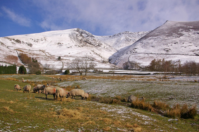
1065:== {{int:filedesc}} == {{Information |description={{en|1=Towards Blease Gill Blease Gill Farm can be seen behind the sheep. Blease Gill itself is the ravine in the background.}} |date=2008-04-06 |source=From [http://www.geograph.org.uk/photo/784017 geogr
214:
406:– You must give appropriate credit, provide a link to the license, and indicate if changes were made. You may do so in any reasonable manner, but not in any way that suggests the licensor endorses you or your use.
228:
278:
83:
696:
680:
636:
592:
51:
704:
489:
969:
905:
901:
837:
833:
692:
676:
588:
497:
493:
485:
501:
795:
700:
688:
684:
632:
481:
1058:
639:"}},"text\/plain":{"en":{"P275":"Creative Commons Attribution-ShareAlike 2.0 Generic"}}}}": -->
504:"}},"text\/plain":{"en":{"P2699":"https:\/\/www.geograph.org.uk\/profile\/16999"}}}}": -->
730:
662:
618:
288:
238:
780:
323:
1200:
This file contains additional information, probably added from the digital camera or scanner used to create or digitize it.
413:
545:
979:
946:
919:
878:
851:
758:
714:
602:
566:
553:
538:
126:
Towards Blease Gill Blease Gill Farm can be seen behind the sheep. Blease Gill itself is the ravine in the background.
805:
773:
743:
646:
511:
470:
707:"}},"text\/plain":{"en":{"P137":"Geograph Britain and Ireland"}}}}": -->
1047:
1042:
42:
369:
1203:
If the file has been modified from its original state, some details may not fully reflect the modified file.
412:– If you remix, transform, or build upon the material, you must distribute your contributions under the
330:
on the
Geograph website for the photographer's contact details. The copyright on this image is owned by
595:"}},"text\/plain":{"en":{"P6216":"copyrighted"}}}}": -->
912:"}},"text\/plain":{"en":{"P7787":"0 degree"}}}}": -->
844:"}},"text\/plain":{"en":{"P7787":"0 degree"}}}}": -->
91:
183:
573:
765:
750:
366:
167:
8:
310:
294:
244:
335:
78:
460:
1097:
1127:
156:
146:
989:
929:
861:
815:
724:
656:
612:
521:
315:
1079:
327:
1015:
Click on a date/time to view the file as it appeared at that time.
1107:
280:
230:
1187:
265:
54° 37′ 17″ N, 3° 03′ 37″ W
215:
54° 37′ 16″ N, 3° 03′ 38″ W
135:
66:
1157:
454:
Add a one-line explanation of what this file represents
1167:
1147:
1137:
1117:
1177:
1073:
1088:
1013:
90:
Commons is a freely licensed media file repository.
663:
Creative
Commons Attribution-ShareAlike 2.0 Generic
637:
Creative
Commons Attribution-ShareAlike 2.0 Generic
116:Towards Blease Gill - geograph.org.uk - 784017.jpg
52:Towards_Blease_Gill_-_geograph.org.uk_-_784017.jpg
56:(640 × 426 pixels, file size: 113 KB, MIME type:
423:https://creativecommons.org/licenses/by-sa/2.0
71:
502:https:\/\/www.geograph.org.uk\/profile\/16999
429:Creative Commons Attribution-Share Alike 2.0
347:
131:
113:
689:https:\/\/www.geograph.org.uk\/photo\/784017
152:
141:
14:
909:
841:
389:– to copy, distribute and transmit the work
1090:The following other wikis use this file:
574:https://www.geograph.org.uk/profile/16999
751:https://www.geograph.org.uk/photo/784017
287:View this and other nearby images on:
237:View this and other nearby images on:
190:
102:
334:and is licensed for reuse under the
255:
205:
1075:The following page uses this file:
1006:
370:Attribution-Share Alike 2.0 Generic
358:
353:
338:Attribution-ShareAlike 2.0 license.
13:
1198:
1184:Usage on zh-min-nan.wikipedia.org
459:
453:
344:
321:
120:
103:
49:
1224:
1205:
458:
852:coordinates of the point of view
834:coordinates of the point of view
444:
400:Under the following conditions:
365:This file is licensed under the
357:
352:
346:
314:
293:
279:
271:
243:
229:
221:
70:
31:
21:
441:
121:
46:No higher resolution available.
1085:
1010:
731:file available on the internet
681:file available on the internet
440:
322:This image was taken from the
26:
1:
920:coordinates of depicted place
902:coordinates of depicted place
36:
1070:
867:54°37'16.039"N, 3°3'37.872"W
781:Geograph Britain and Ireland
705:Geograph Britain and Ireland
539:object of statement has role
486:object of statement has role
466:Items portrayed in this file
306:
7:
1195:
1154:Usage on lld.wikipedia.org
1104:Usage on ceb.wikipedia.org
1094:Usage on azb.wikipedia.org
10:
1229:
1174:Usage on www.wikidata.org
1164:Usage on tr.wikipedia.org
1144:Usage on it.wikipedia.org
1134:Usage on fr.wikipedia.org
1124:Usage on fa.wikipedia.org
1114:Usage on cy.wikipedia.org
935:54°37'16.68"N, 3°3'37.44"W
414:same or compatible license
270:
220:
110:
105:
1007:
16:
759:geograph.org.uk image ID
693:geograph.org.uk image ID
443:
380:
77:This is a file from the
41:
1064:
1043:02:51, 20 February 2011
196:Ian Capper /
177:Ian Capper /
168:required by the license
134:
81:. Information from its
328:this photograph's page
299:54.621300; -3.060400
249:54.621122; -3.060520
84:description page there
1108:Threlkeld (lungsod)
395:– to adapt the work
198:Towards Blease Gill
179:Towards Blease Gill
554:author name string
494:author name string
1216:
1215:
1086:Global file usage
1068:
911:
843:
647:copyright license
633:copyright license
452:
343:
342:
326:collection. See
304:
303:
254:
253:
203:
202:
171:
99:
98:
79:Wikimedia Commons
32:Global file usage
1220:
1206:
1055:
1017:
957:
956:
951:
889:
888:
883:
783:
778:
768:
763:
753:
748:
744:described at URL
685:described at URL
603:copyright status
589:copyright status
576:
571:
561:
558:
548:
543:
450:
436:
433:
430:
427:
424:
416:as the original.
378:
367:Creative Commons
361:
360:
356:
355:
350:
349:
336:Creative Commons
324:Geograph project
318:
311:
300:
297:
283:
282:
276:
275:
274:
268:
267:
256:
250:
247:
233:
232:
226:
225:
224:
218:
217:
206:
165:
137:
125:
117:
111:
95:
74:
73:
67:
61:
59:
1228:
1227:
1223:
1222:
1221:
1219:
1218:
1217:
1194:
1084:
1069:
1061:
1053:
1009:
1008:
1005:
1004:
1003:
1002:
1001:
1000:
999:
998:
996:
986:
985:
984:
982:
967:
966:
965:
964:
963:
962:
961:
960:
959:
958:
954:
952:
949:
940:
939:
938:
936:
926:
925:
924:
922:
899:
898:
897:
896:
895:
894:
893:
892:
891:
890:
886:
884:
881:
872:
871:
870:
868:
858:
857:
856:
854:
831:
830:
829:
828:
827:
826:
825:
824:
822:
812:
811:
810:
808:
793:
792:
791:
790:
789:
788:
787:
786:
785:
784:
779:
776:
770:
769:
764:
761:
755:
754:
749:
746:
737:
736:
735:
733:
721:
720:
719:
717:
674:
673:
672:
671:
670:
669:
668:
667:
665:
653:
652:
651:
649:
630:
629:
628:
627:
626:
625:
624:
623:
621:
609:
608:
607:
605:
586:
585:
584:
583:
582:
581:
580:
579:
578:
577:
572:
569:
563:
562:
559:
556:
550:
549:
544:
541:
532:
531:
530:
528:
518:
517:
516:
514:
479:
478:
477:
476:
475:
473:
457:
456:
455:
438:
437:
434:
431:
428:
425:
422:
421:
379:
376:
373:
362:
339:
309:
298:
272:
263:
262:
259:Object location
248:
222:
213:
212:
209:Camera location
204:
193:
186:
174:
147:geograph.org.uk
127:
115:
108:
101:
100:
89:
88:
87:is shown below.
63:
57:
55:
48:
47:
12:
11:
5:
1226:
1214:
1213:
1210:
1197:
1193:
1192:
1191:
1190:
1182:
1181:
1180:
1172:
1171:
1170:
1162:
1161:
1160:
1152:
1151:
1150:
1142:
1141:
1140:
1132:
1131:
1130:
1122:
1121:
1120:
1112:
1111:
1110:
1102:
1101:
1100:
1087:
1083:
1082:
1072:
1067:
1066:
1063:
1059:
1056:
1050:
1045:
1040:
1036:
1035:
1032:
1029:
1026:
1023:
1020:
1012:
997:
994:
992:
991:
990:
988:
987:
983:
978:
976:
975:
974:
973:
971:
945:
944:
943:
942:
941:
937:
934:
932:
931:
930:
928:
927:
923:
918:
916:
915:
914:
913:
907:
903:
877:
876:
875:
874:
873:
869:
866:
864:
863:
862:
860:
859:
855:
850:
848:
847:
846:
845:
839:
835:
823:
820:
818:
817:
816:
814:
813:
809:
804:
802:
801:
800:
799:
797:
772:
771:
757:
756:
742:
741:
740:
739:
738:
734:
729:
727:
726:
725:
723:
722:
718:
715:source of file
713:
711:
710:
709:
708:
706:
702:
698:
694:
690:
686:
682:
678:
677:source of file
666:
661:
659:
658:
657:
655:
654:
650:
645:
643:
642:
641:
640:
638:
634:
622:
617:
615:
614:
613:
611:
610:
606:
601:
599:
598:
597:
596:
594:
590:
565:
564:
552:
551:
537:
536:
535:
534:
533:
529:
526:
524:
523:
522:
520:
519:
515:
510:
508:
507:
506:
505:
503:
499:
495:
491:
487:
483:
474:
469:
467:
464:
463:
462:
461:
449:
448:
445:
442:
420:
419:
418:
417:
407:
398:
397:
396:
390:
383:You are free:
374:
364:
363:
345:
341:
340:
319:
308:
305:
302:
301:
291:
285:
260:
252:
251:
241:
235:
210:
201:
200:
194:
191:
188:
187:
182:
175:
172:
160:
159:
154:
150:
149:
143:
139:
138:
133:
129:
128:
118:
109:
107:
104:
97:
96:
75:
65:
64:
45:
40:
39:
34:
29:
24:
19:
9:
6:
4:
3:
2:
1225:
1211:
1208:
1207:
1204:
1201:
1189:
1186:
1185:
1183:
1179:
1176:
1175:
1173:
1169:
1166:
1165:
1163:
1159:
1156:
1155:
1153:
1149:
1146:
1145:
1143:
1139:
1136:
1135:
1133:
1129:
1126:
1125:
1123:
1119:
1116:
1115:
1113:
1109:
1106:
1105:
1103:
1099:
1096:
1095:
1093:
1092:
1091:
1081:
1078:
1077:
1076:
1062:
1057:
1051:
1049:
1046:
1044:
1041:
1038:
1037:
1033:
1030:
1027:
1024:
1021:
1019:
1018:
1016:
993:
981:
977:
948:
933:
921:
917:
880:
865:
853:
849:
819:
807:
803:
782:
775:
767:
760:
752:
745:
732:
728:
716:
712:
664:
660:
648:
644:
620:
616:
604:
600:
575:
568:
555:
547:
540:
525:
513:
509:
472:
468:
465:
446:
439:
426:CC BY-SA 2.0
415:
411:
408:
405:
402:
401:
399:
394:
391:
388:
385:
384:
382:
381:
375:Attribution:
371:
368:
351:
337:
333:
329:
325:
320:
317:
313:
312:
296:
292:
290:
289:OpenStreetMap
286:
284:
266:
261:
258:
257:
246:
242:
240:
239:OpenStreetMap
236:
234:
216:
211:
208:
207:
199:
195:
189:
185:
181: /
180:
176:
169:
164:
162:
161:
158:
155:
151:
148:
144:
140:
130:
124:
119:
112:
93:
86:
85:
80:
76:
69:
68:
62:
53:
44:
38:
35:
33:
30:
28:
25:
23:
20:
18:
15:
1202:
1199:
1089:
1074:
1014:
1011:File history
821:6 April 2008
546:photographer
490:photographer
409:
403:
392:
386:
331:
269:
219:
197:
184:CC BY-SA 2.0
178:
136:6 April 2008
122:
92:You can help
82:
50:
22:File history
1060:GeographBot
619:copyrighted
593:copyrighted
410:share alike
404:attribution
163:Attribution
114:Description
1209:_error
1071:File usage
1052:640 × 426
1028:Dimensions
995:image/jpeg
980:media type
970:media type
560:Ian Capper
527:some value
377:Ian Capper
332:Ian Capper
157:Ian Capper
58:image/jpeg
27:File usage
1188:Threlkeld
1168:Threlkeld
1158:Threlkeld
1148:Threlkeld
1138:Threlkeld
1118:Threlkeld
1080:Threlkeld
1025:Thumbnail
1022:Date/Time
806:inception
796:inception
307:Licensing
192:InfoField
173:InfoField
123:English:
1196:Metadata
1178:Q1017077
1054:(113 KB)
774:operator
701:operator
447:Captions
393:to remix
387:to share
372:license.
37:Metadata
1039:current
1034:Comment
947:heading
906:heading
879:heading
838:heading
512:creator
482:creator
471:depicts
451:English
106:Summary
54:
1128:ترلکلد
1098:ترلکلد
955:degree
910:degree
887:degree
842:degree
766:784017
697:784017
277:
227:
153:Author
142:Source
145:From
1031:User
435:true
432:true
132:Date
17:File
567:URL
498:URL
953:0
950::
885:0
882::
777::
762::
747::
570::
557::
542::
1212:0
170:)
166:(
94:.
60:)
Text is available under the Creative Commons Attribution-ShareAlike License. Additional terms may apply.
_heading:0.00&language=en)
_heading:0.00&language=en)
