624:"}},"text\/plain":{"en":{"":"inception"}}},"{\"value\":{\"time\":\"+2021-02-01T00:00:00Z\",\"timezone\":0,\"before\":0,\"after\":0,\"precision\":11,\"calendarmodel\":\"http:\\\/\\\/www.wikidata.org\\\/entity\\\/Q1985727\"},\"type\":\"time\"}":{"text\/html":{"en":{"P571":"1 February 2021"}},"text\/plain":{"en":{"P571":"1 February 2021"}}}}": -->
43:
1298:
381:
1293:
231:
260:
265:
99:
393:"}},"text\/plain":{"en":{"P2699":"https:\/\/commons.wikimedia.org\/wiki\/user:SANtosito"}}},"{\"value\":{\"entity-type\":\"property\",\"numeric-id\":2093,\"id\":\"P2093\"},\"type\":\"wikibase-entityid\"}":{"text\/html":{"en":{"":"
401:"}},"text\/plain":{"en":{"P2093":"SANtosito","P4174":"SANtosito"}}},"{\"value\":{\"entity-type\":\"property\",\"numeric-id\":4174,\"id\":\"P4174\"},\"type\":\"wikibase-entityid\"}":{"text\/html":{"en":{"":"
662:"}},"text\/plain":{"en":{"":"media type"}}},"{\"value\":\"image\\\/svg+xml\",\"type\":\"string\"}":{"text\/html":{"en":{"P1163":"image\/svg+xml"}},"text\/plain":{"en":{"P1163":"image\/svg+xml"}}}}": -->
536:"}},"text\/plain":{"en":{"":"copyright license"}}},"{\"value\":{\"entity-type\":\"item\",\"numeric-id\":18199165,\"id\":\"Q18199165\"},\"type\":\"wikibase-entityid\"}":{"text\/html":{"en":{"P275":"
492:"}},"text\/plain":{"en":{"":"copyright status"}}},"{\"value\":{\"entity-type\":\"item\",\"numeric-id\":50423863,\"id\":\"Q50423863\"},\"type\":\"wikibase-entityid\"}":{"text\/html":{"en":{"P6216":"
580:"}},"text\/plain":{"en":{"":"source of file"}}},"{\"value\":{\"entity-type\":\"item\",\"numeric-id\":66458942,\"id\":\"Q66458942\"},\"type\":\"wikibase-entityid\"}":{"text\/html":{"en":{"P7482":"
385:"}},"text\/plain":{"en":{"":"creator"}}},"{\"value\":{\"entity-type\":\"property\",\"numeric-id\":2699,\"id\":\"P2699\"},\"type\":\"wikibase-entityid\"}":{"text\/html":{"en":{"":"
658:
397:"}},"text\/plain":{"en":{"":"author name string"}}},"{\"value\":\"SANtosito\",\"type\":\"string\"}":{"text\/html":{"en":{"P2093":"SANtosito","P4174":"
389:"}},"text\/plain":{"en":{"":"URL"}}},"{\"value\":\"https:\\\/\\\/commons.wikimedia.org\\\/wiki\\\/user:SANtosito\",\"type\":\"string\"}":{"text\/html":{"en":{"P2699":"
306:– You must give appropriate credit, provide a link to the license, and indicate if changes were made. You may do so in any reasonable manner, but not in any way that suggests the licensor endorses you or your use.
398:
1323:
581:
537:
493:
390:
1275:
766:
659:
577:
489:
402:
394:
386:
621:
533:
382:
1562:
73:
69:
65:
61:
57:
53:
47:
540:"}},"text\/plain":{"en":{"P275":"Creative Commons Attribution-ShareAlike 4.0 International"}}}}": -->
110:
82:
1233:
1078:
948:
607:
563:
519:
1123:
1573:
This file contains additional information, probably added from the digital camera or scanner used to create or digitize it.
1168:
918:
878:
313:
1058:
669:
591:
503:
467:
454:
439:
584:"}},"text\/plain":{"en":{"P7482":"original creation by uploader"}}}}": -->
631:
547:
412:
371:
204:
474:
275:
1576:
If the file has been modified from its original state, some details may not fully reflect the modified file.
765:
More than 100 pages use this file. The following list shows the first 100 pages that use this file only. A
828:
312:– If you remix, transform, or build upon the material, you must distribute your contributions under the
893:
405:"}},"text\/plain":{"en":{"":"Wikimedia username"}}}}": -->
1258:
853:
496:"}},"text\/plain":{"en":{"P6216":"copyrighted"}}}}": -->
737:
732:
42:
1023:
1033:
913:
838:
118:
1188:
446:
1263:
1093:
1013:
1003:
943:
938:
1313:
1253:
1133:
1113:
993:
988:
973:
272:
8:
1203:
1183:
1173:
1073:
1063:
903:
898:
1228:
1178:
1068:
888:
793:
1543:
1128:
843:
105:
1308:
361:
247:
I, the copyright holder of this work, hereby publish it under the following license:
1238:
1088:
958:
928:
818:
1213:
1193:
1098:
1043:
983:
908:
863:
813:
803:
219:
209:
Public domain data provided by the
National Atlas of the United States of America
1503:
1223:
1208:
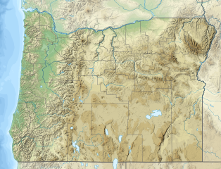
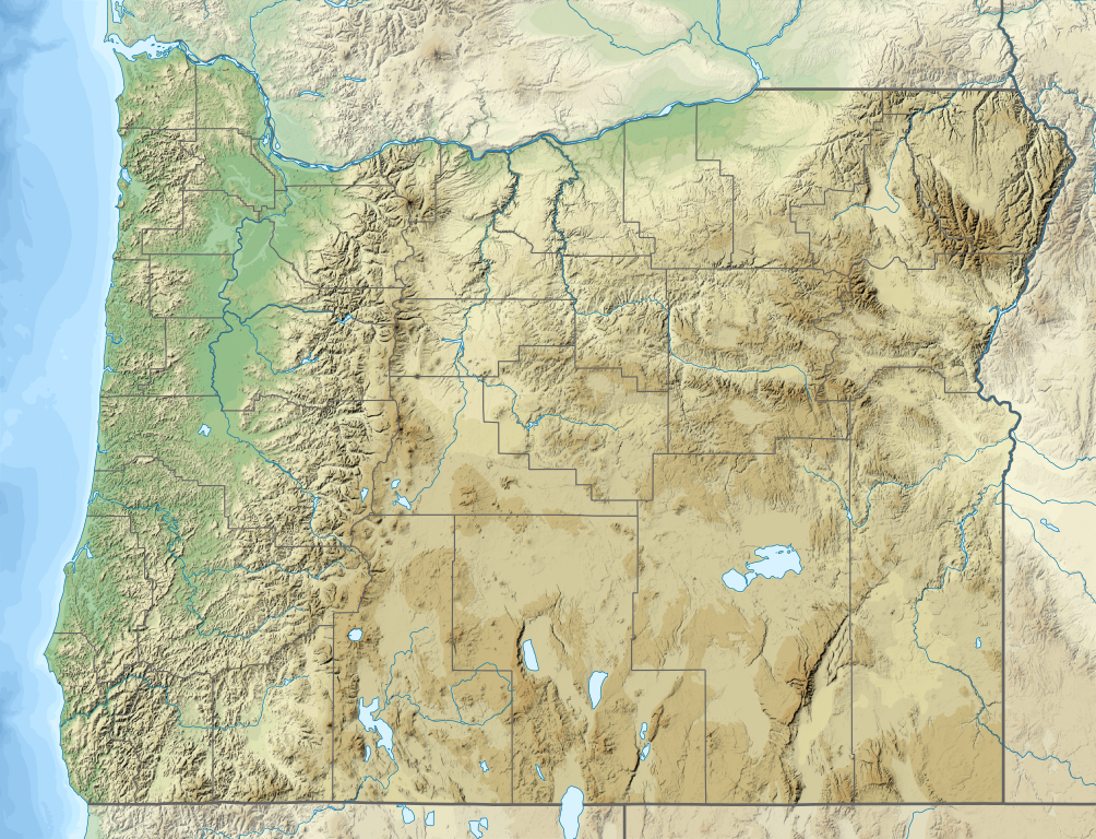
1163:
1053:
1038:
953:
883:
823:
788:
783:
773:
748:
1518:
1453:
1268:
1248:
1243:
1158:
1148:
1138:
1118:
1108:
1103:
1083:
1048:
1008:
978:
968:
923:
230:
1143:
1028:
873:
798:
1538:
679:
641:
601:
557:
513:
422:
1218:
1198:
1153:
1018:
998:
933:
868:
848:
808:
778:
963:
833:
1383:
1548:
1408:
705:
Click on a date/time to view the file as it appeared at that time.
1553:
1528:
1373:
154:
1473:
858:
1483:
1443:
1433:
1388:
1368:
1478:
1468:
1533:
1493:
1428:
87:(SVG file, nominally 1,501 × 1,148 pixels, file size: 4.8 MB)
1488:
1418:
1378:
1363:
1299:মডিউল:অবস্থান মানচিত্র/উপাত্ত/মার্কিন যুক্তরাষ্ট্র অরেগন/নথি
158:
1523:
1423:
1403:
1398:
1508:
1498:
1448:
1393:
1513:
1463:
1358:
564:
Creative
Commons Attribution-ShareAlike 4.0 International
538:
Creative
Commons Attribution-ShareAlike 4.0 International
186:
93:
1458:
1438:
1353:
1343:
1294:মডিউল:অবস্থান মানচিত্র/উপাত্ত/মার্কিন যুক্তরাষ্ট্র অরেগন
1413:
1348:
1338:
1333:
355:
Add a one-line explanation of what this file represents
763:
391:
https:\/\/commons.wikimedia.org\/wiki\/user:SANtosito
1284:
703:
117:
Commons is a freely licensed media file repository.
323:https://creativecommons.org/licenses/by-sa/4.0
98:
1234:Veterans Memorial Coliseum (Portland, Oregon)
329:Creative Commons Attribution-Share Alike 4.0
253:
182:
140:
447:https://commons.wikimedia.org/user:SANtosito
225:
215:
192:
14:
1079:Oregon Caves National Monument and Preserve
949:Little River (North Umpqua River tributary)
289:– to copy, distribute and transmit the work
46:Size of this PNG preview of this SVG file:
1286:The following other wikis use this file:
276:Attribution-Share Alike 4.0 International
1544:Peter Skene Ogden State Scenic Viewpoint
1314:Mòdul:Location map/data/USA Oregon/ús
1124:Salmon River (Lincoln County, Oregon)
129:
1169:Smith River (Umpqua River tributary)
919:John Day River (northwestern Oregon)
879:Devils Lake (Lincoln County, Oregon)
1059:Newberry National Volcanic Monument
755:Uploaded own work with UploadWizard
696:
264:
259:
13:
1571:
1504:Fish Lake (Jackson County, Oregon)
1309:Mòdul:Location map/data/USA Oregon
360:
354:
250:
246:
147:
143:USA Oregon relief location map.svg
130:
80:
1605:
1578:
1519:Yaquina Bay State Recreation Site
1454:Vorlage:Positionskarte USA Oregon
359:
345:
300:Under the following conditions:
271:This file is licensed under the
263:
258:
252:
229:
205:File:USA Oregon location map.svg
97:
31:
21:
342:
148:
1281:
700:
341:
162:Geographic limits of the map:
26:
1:
1539:The Cove Palisades State Park
1324:Кеп:Меттиган карта АЦШ Орегон
608:original creation by uploader
582:original creation by uploader
36:
760:
367:Items portrayed in this file
240:
7:
1568:
829:Coast Fork Willamette River
10:
1610:
1330:Usage on de.wikipedia.org
1320:Usage on ce.wikipedia.org
1305:Usage on ca.wikipedia.org
1290:Usage on bn.wikipedia.org
894:Elkhorn Mountains (Oregon)
314:same or compatible license
137:
132:
1259:Williamson River (Oregon)
854:Crater Lake National Park
697:
197:
16:
1384:Mount Jefferson (Oregon)
1024:Mount Jefferson (Oregon)
344:
280:
104:This is a file from the
41:
1549:Fort Stevens State Park
1034:Mount Mitchell (Oregon)
914:Illinois River (Oregon)
839:Coquille River (Oregon)
754:
185:
153:Relief location map of
108:. Information from its
1409:Three Sisters (Oregon)
1189:Sprague River (Oregon)
733:22:04, 1 February 2021
111:description page there
1554:Sunset Bay State Park
1529:Smith Rock State Park
1374:Detroit Lake (Oregon)
1264:Wilson River (Oregon)
1094:Powder River (Oregon)
1014:Mount Bailey (Oregon)
1004:Mohawk River (Oregon)
944:Little Nestucca River
939:Lewis and Clark River
1474:Summer Lake (Oregon)
1254:White River (Oregon)
1134:Sandy River (Oregon)
1114:Rogue River (Oregon)
994:Middle Santiam River
989:Miami River (Oregon)
974:Marys River (Oregon)
74:1,501 × 1,148 pixels
70:2,560 × 1,958 pixels
1204:Three Fingered Jack
1184:South Yamhill River
1174:South Santiam River
1074:North Yamhill River
1064:North Santiam River
904:Hood River (Oregon)
899:Grants Pass, Oregon
295:– to adapt the work
52:Other resolutions:
1484:Hole-in-the-Ground
1444:John-Day-Talsperre
1434:Siskiyou Mountains
1389:Upper Klamath Lake
1369:Tenasillahe Island
1229:Upper Klamath Lake
1179:South Umpqua River
1069:North Umpqua River
889:Elk River (Oregon)
794:Big River (Oregon)
468:Wikimedia username
455:author name string
403:Wikimedia username
395:author name string
66:1,280 × 979 pixels
62:1,004 × 768 pixels
1597:
1596:
1563:more global usage
1479:Big Hole (Vulkan)
1469:Wallowa Mountains
1282:Global file usage
1129:Salmonberry River
844:Corvallis, Oregon
758:
548:copyright license
534:copyright license
353:
237:
236:
126:
125:
106:Wikimedia Commons
32:Global file usage
1601:
1579:
1534:Ecola State Park
1494:Owyhee-Talsperre
1429:Mount McLoughlin
1239:Wallooskee River
1089:Portland, Oregon
959:Luckiamute River
929:Klaskanine River
819:Clatskanie River
745:
707:
504:copyright status
490:copyright status
477:
472:
462:
459:
449:
444:
351:
336:
333:
330:
327:
324:
316:as the original.
273:Creative Commons
267:
266:
262:
261:
256:
255:
233:
199:
188:
152:
144:
138:
122:
101:
100:
94:
88:
77:
58:628 × 480 pixels
54:314 × 240 pixels
48:784 × 600 pixels
1609:
1608:
1604:
1603:
1602:
1600:
1599:
1598:
1567:
1489:Fort Rock Basin
1419:Tumalo Mountain
1379:Multnomah Falls
1364:Steens Mountain
1280:
1214:Tillamook River
1194:Steens Mountain
1099:Providence Park
1044:Necanicum River
984:Medford, Oregon
909:Humbug Mountain
864:Deschutes River
814:Clackamas River
804:Calapooia River
759:
751:
743:
699:
698:
695:
694:
693:
692:
691:
690:
689:
688:
686:
676:
675:
674:
672:
657:
656:
655:
654:
653:
652:
651:
650:
648:
647:1 February 2021
638:
637:
636:
634:
619:
618:
617:
616:
615:
614:
613:
612:
610:
598:
597:
596:
594:
575:
574:
573:
572:
571:
570:
569:
568:
566:
554:
553:
552:
550:
531:
530:
529:
528:
527:
526:
525:
524:
522:
510:
509:
508:
506:
487:
486:
485:
484:
483:
482:
481:
480:
479:
478:
473:
470:
464:
463:
460:
457:
451:
450:
445:
442:
433:
432:
431:
429:
419:
418:
417:
415:
380:
379:
378:
377:
376:
374:
358:
357:
356:
339:
338:
337:
334:
331:
328:
325:
322:
321:
279:
268:
249:
248:
243:
238:
187:1 February 2021
178:
142:
135:
128:
127:
116:
115:
114:is shown below.
90:
86:
79:
78:
51:
12:
11:
5:
1607:
1595:
1594:
1591:
1587:
1586:
1583:
1570:
1565:of this file.
1559:
1558:
1557:
1556:
1551:
1546:
1541:
1536:
1531:
1526:
1524:Belknap Crater
1521:
1516:
1511:
1506:
1501:
1496:
1491:
1486:
1481:
1476:
1471:
1466:
1461:
1456:
1451:
1446:
1441:
1436:
1431:
1426:
1424:Mount Bachelor
1421:
1416:
1411:
1406:
1404:Mount Thielsen
1401:
1399:Bonneville Dam
1396:
1391:
1386:
1381:
1376:
1371:
1366:
1361:
1356:
1351:
1346:
1341:
1336:
1328:
1327:
1326:
1318:
1317:
1316:
1311:
1303:
1302:
1301:
1296:
1283:
1278:to this file.
1272:
1271:
1266:
1261:
1256:
1251:
1246:
1241:
1236:
1231:
1226:
1224:Tualatin River
1221:
1216:
1211:
1209:Tillamook Head
1206:
1201:
1196:
1191:
1186:
1181:
1176:
1171:
1166:
1164:Skipanon River
1161:
1156:
1151:
1146:
1141:
1136:
1131:
1126:
1121:
1116:
1111:
1106:
1101:
1096:
1091:
1086:
1081:
1076:
1071:
1066:
1061:
1056:
1054:Nestucca River
1051:
1046:
1041:
1039:Mount Thielsen
1036:
1031:
1026:
1021:
1016:
1011:
1006:
1001:
996:
991:
986:
981:
976:
971:
966:
961:
956:
954:Long Tom River
951:
946:
941:
936:
931:
926:
921:
916:
911:
906:
901:
896:
891:
886:
884:Dry Well Creek
881:
876:
871:
866:
861:
856:
851:
846:
841:
836:
831:
826:
824:Clatsop Plains
821:
816:
811:
806:
801:
796:
791:
789:Belknap Crater
786:
784:Autzen Stadium
781:
776:
774:Albany, Oregon
769:is available.
762:
757:
756:
753:
749:
746:
742:1,501 × 1,148
740:
735:
730:
726:
725:
722:
719:
716:
713:
710:
702:
687:
684:
682:
681:
680:
678:
677:
673:
668:
666:
665:
664:
663:
661:
649:
646:
644:
643:
642:
640:
639:
635:
630:
628:
627:
626:
625:
623:
611:
606:
604:
603:
602:
600:
599:
595:
592:source of file
590:
588:
587:
586:
585:
583:
579:
578:source of file
567:
562:
560:
559:
558:
556:
555:
551:
546:
544:
543:
542:
541:
539:
535:
523:
518:
516:
515:
514:
512:
511:
507:
502:
500:
499:
498:
497:
495:
491:
466:
465:
453:
452:
438:
437:
436:
435:
434:
430:
427:
425:
424:
423:
421:
420:
416:
411:
409:
408:
407:
406:
404:
400:
396:
392:
388:
384:
375:
370:
368:
365:
364:
363:
362:
350:
349:
346:
343:
320:
319:
318:
317:
307:
298:
297:
296:
290:
283:You are free:
270:
269:
251:
245:
244:
242:
239:
235:
234:
227:
226:Other versions
223:
222:
217:
213:
212:
211:
210:
207:
194:
190:
189:
184:
180:
179:
177:
176:
173:
170:
167:
145:
136:
134:
131:
124:
123:
102:
92:
91:
45:
40:
39:
34:
29:
24:
19:
9:
6:
4:
3:
2:
1606:
1592:
1589:
1588:
1584:
1581:
1580:
1577:
1574:
1566:
1564:
1555:
1552:
1550:
1547:
1545:
1542:
1540:
1537:
1535:
1532:
1530:
1527:
1525:
1522:
1520:
1517:
1515:
1512:
1510:
1509:Fourmile Lake
1507:
1505:
1502:
1500:
1499:Hart Mountain
1497:
1495:
1492:
1490:
1487:
1485:
1482:
1480:
1477:
1475:
1472:
1470:
1467:
1465:
1462:
1460:
1457:
1455:
1452:
1450:
1449:Mount Ashland
1447:
1445:
1442:
1440:
1437:
1435:
1432:
1430:
1427:
1425:
1422:
1420:
1417:
1415:
1412:
1410:
1407:
1405:
1402:
1400:
1397:
1395:
1394:Haystack Rock
1392:
1390:
1387:
1385:
1382:
1380:
1377:
1375:
1372:
1370:
1367:
1365:
1362:
1360:
1357:
1355:
1352:
1350:
1347:
1345:
1342:
1340:
1337:
1335:
1332:
1331:
1329:
1325:
1322:
1321:
1319:
1315:
1312:
1310:
1307:
1306:
1304:
1300:
1297:
1295:
1292:
1291:
1289:
1288:
1287:
1279:
1277:
1270:
1269:Yamhill River
1267:
1265:
1262:
1260:
1257:
1255:
1252:
1250:
1249:Wemme, Oregon
1247:
1245:
1244:Wallowa River
1242:
1240:
1237:
1235:
1232:
1230:
1227:
1225:
1222:
1220:
1217:
1215:
1212:
1210:
1207:
1205:
1202:
1200:
1197:
1195:
1192:
1190:
1187:
1185:
1182:
1180:
1177:
1175:
1172:
1170:
1167:
1165:
1162:
1160:
1159:Skinner Butte
1157:
1155:
1152:
1150:
1149:Siuslaw River
1147:
1145:
1142:
1140:
1139:Santiam River
1137:
1135:
1132:
1130:
1127:
1125:
1122:
1120:
1119:Salem, Oregon
1117:
1115:
1112:
1110:
1109:Reser Stadium
1107:
1105:
1104:Pudding River
1102:
1100:
1097:
1095:
1092:
1090:
1087:
1085:
1084:Pearsoll Peak
1082:
1080:
1077:
1075:
1072:
1070:
1067:
1065:
1062:
1060:
1057:
1055:
1052:
1050:
1049:Nehalem River
1047:
1045:
1042:
1040:
1037:
1035:
1032:
1030:
1027:
1025:
1022:
1020:
1017:
1015:
1012:
1010:
1009:Molalla River
1007:
1005:
1002:
1000:
997:
995:
992:
990:
987:
985:
982:
980:
979:McKenzie Pass
977:
975:
972:
970:
969:Malheur River
967:
965:
962:
960:
957:
955:
952:
950:
947:
945:
942:
940:
937:
935:
932:
930:
927:
925:
924:Kilchis River
922:
920:
917:
915:
912:
910:
907:
905:
902:
900:
897:
895:
892:
890:
887:
885:
882:
880:
877:
875:
872:
870:
867:
865:
862:
860:
857:
855:
852:
850:
847:
845:
842:
840:
837:
835:
832:
830:
827:
825:
822:
820:
817:
815:
812:
810:
807:
805:
802:
800:
797:
795:
792:
790:
787:
785:
782:
780:
777:
775:
772:
771:
770:
768:
752:
747:
741:
739:
736:
734:
731:
728:
727:
723:
720:
717:
714:
711:
709:
708:
706:
685:image/svg+xml
683:
671:
667:
645:
633:
629:
609:
605:
593:
589:
565:
561:
549:
545:
521:
517:
505:
501:
476:
469:
456:
448:
441:
426:
414:
410:
373:
369:
366:
347:
340:
326:CC BY-SA 4.0
315:
311:
308:
305:
302:
301:
299:
294:
291:
288:
285:
284:
282:
281:
277:
274:
257:
232:
228:
224:
221:
218:
214:
208:
206:
202:
201:
200:
195:
191:
181:
174:
171:
168:
165:
164:
163:
160:
156:
151:
146:
139:
120:
113:
112:
107:
103:
96:
95:
89:
84:
83:Original file
75:
71:
67:
63:
59:
55:
49:
44:
38:
35:
33:
30:
28:
25:
23:
20:
18:
15:
1575:
1572:
1560:
1514:Yaquina Head
1464:Hells Canyon
1359:Nestucca Bay
1285:
1273:
1144:Siletz River
1029:Mount Mazama
874:Detroit Lake
799:Bosley Butte
764:
704:
701:File history
309:
303:
292:
286:
196:
161:
149:
119:You can help
109:
81:
22:File history
1459:Mount Scott
1439:Aspen Butte
1354:Nehalem Bay
1344:Crater Lake
1219:Trask River
1199:Sycan River
1154:Sixes River
1019:Mount Emily
999:Moda Center
934:Lake Celilo
869:Detroit Dam
849:Crater Lake
809:Chetco Peak
779:Alsea River
520:copyrighted
494:copyrighted
310:share alike
304:attribution
175:E: 116.3° W
172:W: 124.9° W
141:Description
1414:Broken Top
1349:Youngs Bay
1339:Kap Meares
1334:Mount Hood
1276:more links
964:Maidu Lake
834:Coos River
761:File usage
718:Dimensions
670:media type
660:media type
428:some value
169:S: 41.8° N
166:N: 46.5° N
27:File usage
1593:1148.3765
1585:1500.8761
767:full list
750:SANtosito
715:Thumbnail
712:Date/Time
632:inception
622:inception
475:SANtosito
461:SANtosito
399:SANtosito
241:Licensing
220:SANtosito
203:Based on
150:English:
1569:Metadata
744:(4.8 MB)
348:Captions
293:to remix
287:to share
278:license.
198:Own work
37:Metadata
859:D River
729:current
724:Comment
413:creator
383:creator
372:depicts
352:English
133:Summary
85:
1590:Height
216:Author
193:Source
155:Oregon
1582:Width
1561:View
1274:View
721:User
335:true
332:true
183:Date
17:File
440:URL
387:URL
159:USA
471::
458::
443::
157:,
72:|
68:|
64:|
60:|
56:|
50:.
121:.
76:.

