849:"}},"text\/plain":{"en":{"":"coordinates of the point of view"}}},"{\"value\":{\"latitude\":39.432561,\"longitude\":-92.102224,\"altitude\":null,\"precision\":1.0e-6,\"globe\":\"http:\\\/\\\/www.wikidata.org\\\/entity\\\/Q2\"},\"type\":\"globecoordinate\"}":{"text\/html":{"en":{"P1259":"39\u00b025'57.220"N, 92\u00b06'8.006"W"}},"text\/plain":{"en":{"P1259":"39\u00b025'57.220\"N, 92\u00b06'8.006\"W"}}}}": -->
43:
723:"}},"text\/plain":{"en":{"":"inception"}}},"{\"value\":{\"time\":\"+2011-06-26T00:00:00Z\",\"timezone\":0,\"before\":0,\"after\":0,\"precision\":11,\"calendarmodel\":\"http:\\\/\\\/www.wikidata.org\\\/entity\\\/Q1985727\"},\"type\":\"time\"}":{"text\/html":{"en":{"P571":"26 June 2011"}},"text\/plain":{"en":{"P571":"26 June 2011"}}}}": -->
480:
235:
365:
249:
280:
285:
103:
662:"}},"text\/plain":{"en":{"P275":"GNU Free Documentation License, version 1.2 or later"}}},"{\"value\":{\"entity-type\":\"item\",\"numeric-id\":14946043,\"id\":\"Q14946043\"},\"type\":\"wikibase-entityid\"}":{"text\/html":{"en":{"P275":"
1015:"}},"text\/plain":{"en":{"":"ISO speed"}}},"{\"value\":{\"amount\":\"+100\",\"unit\":\"1\"},\"type\":\"quantity\"}":{"text\/html":{"en":{"P6789":"100"}},"text\/plain":{"en":{"P6789":"100"}}}}": -->
932:"}},"text\/plain":{"en":{"":"f-number"}}},"{\"value\":{\"amount\":\"+3.5\",\"unit\":\"1\"},\"type\":\"quantity\"}":{"text\/html":{"en":{"P6790":"3.5"}},"text\/plain":{"en":{"P6790":"3.5"}}}}": -->
887:"}},"text\/plain":{"en":{"":"exposure time"}}},"{\"value\":{\"amount\":\"+0.00148809523809523809\",\"unit\":\"http:\\\/\\\/www.wikidata.org\\\/entity\\\/Q11574\"},\"type\":\"quantity\"}":{"text\/html":{"en":{"P6757":"0.00148809523809523809
500:"}},"text\/plain":{"en":{"P2093":"Kbh3rd","P4174":"Kbh3rd"}}},"{\"value\":{\"entity-type\":\"property\",\"numeric-id\":4174,\"id\":\"P4174\"},\"type\":\"wikibase-entityid\"}":{"text\/html":{"en":{"":"
488:"}},"text\/plain":{"en":{"":"object of statement has role"}}},"{\"value\":{\"entity-type\":\"item\",\"numeric-id\":33231,\"id\":\"Q33231\"},\"type\":\"wikibase-entityid\"}":{"text\/html":{"en":{"P3831":"
1097:"}},"text\/plain":{"en":{"":"media type"}}},"{\"value\":\"image\\\/jpeg\",\"type\":\"string\"}":{"text\/html":{"en":{"P1163":"image\/jpeg"}},"text\/plain":{"en":{"P1163":"image\/jpeg"}}}}": -->
658:"}},"text\/plain":{"en":{"":"copyright license"}}},"{\"value\":{\"entity-type\":\"item\",\"numeric-id\":50829104,\"id\":\"Q50829104\"},\"type\":\"wikibase-entityid\"}":{"text\/html":{"en":{"P275":"
614:"}},"text\/plain":{"en":{"":"copyright status"}}},"{\"value\":{\"entity-type\":\"item\",\"numeric-id\":50423863,\"id\":\"Q50423863\"},\"type\":\"wikibase-entityid\"}":{"text\/html":{"en":{"P6216":"
805:"}},"text\/plain":{"en":{"":"source of file"}}},"{\"value\":{\"entity-type\":\"item\",\"numeric-id\":66458942,\"id\":\"Q66458942\"},\"type\":\"wikibase-entityid\"}":{"text\/html":{"en":{"P7482":"
970:"}},"text\/plain":{"en":{"":"focal length"}}},"{\"value\":{\"amount\":\"+10.7\",\"unit\":\"http:\\\/\\\/www.wikidata.org\\\/entity\\\/Q174789\"},\"type\":\"quantity\"}":{"text\/html":{"en":{"P2151":"10.7
761:"}},"text\/plain":{"en":{"":"captured with"}}},"{\"value\":{\"entity-type\":\"item\",\"numeric-id\":3341795,\"id\":\"Q3341795\"},\"type\":\"wikibase-entityid\"}":{"text\/html":{"en":{"P4082":"
504:"}},"text\/plain":{"en":{"":"Wikimedia username"}}},"{\"value\":{\"entity-type\":\"property\",\"numeric-id\":2699,\"id\":\"P2699\"},\"type\":\"wikibase-entityid\"}":{"text\/html":{"en":{"":"
492:"}},"text\/plain":{"en":{"P3831":"photographer"}}},"{\"value\":{\"entity-type\":\"property\",\"numeric-id\":2093,\"id\":\"P2093\"},\"type\":\"wikibase-entityid\"}":{"text\/html":{"en":{"":"
1053:"}},"text\/plain":{"en":{"":"instance of"}}},"{\"value\":{\"entity-type\":\"item\",\"numeric-id\":125191,\"id\":\"Q125191\"},\"type\":\"wikibase-entityid\"}":{"text\/html":{"en":{"P31":"
437:"}},"text\/plain":{"en":{"":"depicts"}}},"{\"value\":{\"entity-type\":\"item\",\"numeric-id\":976050,\"id\":\"Q976050\"},\"type\":\"wikibase-entityid\"}":{"text\/html":{"en":{"P180":"
484:"}},"text\/plain":{"en":{"":"creator"}}},"{\"value\":{\"entity-type\":\"property\",\"numeric-id\":3831,\"id\":\"P3831\"},\"type\":\"wikibase-entityid\"}":{"text\/html":{"en":{"":"
1093:
496:"}},"text\/plain":{"en":{"":"author name string"}}},"{\"value\":\"Kbh3rd\",\"type\":\"string\"}":{"text\/html":{"en":{"P2093":"Kbh3rd","P4174":"
508:"}},"text\/plain":{"en":{"":"URL"}}},"{\"value\":\"http:\\\/\\\/commons.wikimedia.org\\\/wiki\\\/User:Kbh3rd\",\"type\":\"string\"}":{"text\/html":{"en":{"P2699":"
326:– You must give appropriate credit, provide a link to the license, and indicate if changes were made. You may do so in any reasonable manner, but not in any way that suggests the licensor endorses you or your use.
232:
226:
497:
806:
663:
659:
615:
762:
1054:
438:
509:
69:
65:
61:
489:
57:
53:
47:
1094:
1012:
967:
929:
884:
846:
802:
758:
611:
505:
501:
493:
485:
114:
720:
655:
481:
434:
82:
1050:
382:
666:"}},"text\/plain":{"en":{"P275":"Creative Commons Attribution-ShareAlike 3.0 Unported"}}}}": -->
512:"}},"text\/plain":{"en":{"P2699":"http:\/\/commons.wikimedia.org\/wiki\/User:Kbh3rd"}}}}": -->
1258:
380:; with no Invariant Sections, no Front-Cover Texts, and no Back-Cover Texts. A copy of the license is included in the section entitled
177:
157:
1225:
1191:
441:"}},"text\/plain":{"en":{"P180":"Union Covered Bridge State Historic Site"}}}}": -->
832:
706:
689:
641:
242:
788:
1281:
This file contains additional information, probably added from the digital camera or scanner used to create or digitize it.
1080:
467:
333:
553:
1220:
1104:
1022:
981:
939:
898:
856:
816:
772:
625:
589:
574:
561:
546:
891:"}},"text\/plain":{"en":{"P6757":"0.00148809523809523809 second"}}}}": -->
809:"}},"text\/plain":{"en":{"P7482":"original creation by uploader"}}}}": -->
372:
730:
673:
519:
451:
1064:
1426:
1172:
1167:
73:
42:
295:
765:"}},"text\/plain":{"en":{"P4082":"Nikon Coolpix P7000"}}}}": -->
581:
1284:
If the file has been modified from its original state, some details may not fully reflect the modified file.
377:
974:"}},"text\/plain":{"en":{"P2151":"10.7 millimetre"}}}}": -->
332:– If you remix, transform, or build upon the material, you must distribute your contributions under the
169:
618:"}},"text\/plain":{"en":{"P6216":"copyrighted"}}}}": -->
161:
1203:
1057:"}},"text\/plain":{"en":{"P31":"photograph"}}}}": -->
1195:
122:
1453:
370:
Permission is granted to copy, distribute and/or modify this document under the terms of the
596:
292:
8:
1489:
1230:
248:
1259:
Liste der Einträge im
National Register of Historic Places im Monroe County (Missouri)
1562:
1253:
267:
I, the copyright holder of this work, hereby publish it under the following licenses:
109:
173:
1525:
1471:
1310:
1303:
1572:
1535:
1350:
209:
1114:
1074:
1032:
991:
949:
908:
866:
826:
782:
740:
700:
683:
635:
529:
461:
1499:
1183:
1395:
1330:
165:
1248:
359:
1582:
1320:
1199:
1140:
Click on a date/time to view the file as it appeared at that time.
234:
227:
39° 25′ 57.22″ N, 92° 06′ 08.01″ W
1293:
189:
97:
427:
Add a one-line explanation of what this file represents
1214:
87:(3,046 × 2,285 pixels, file size: 2.6 MB, MIME type:
1268:
1239:
1138:
707:
Creative
Commons Attribution-ShareAlike 3.0 Unported
690:
664:
Creative
Commons Attribution-ShareAlike 3.0 Unported
660:
376:, Version 1.2 or any later version published by the
121:
Commons is a freely licensed media file repository.
510:http:\/\/commons.wikimedia.org\/wiki\/User:Kbh3rd
1494:Flash did not fire, compulsory flash suppression
176:in Missouri, all of which are protected by the
343:https://creativecommons.org/licenses/by-sa/3.0
102:
349:Creative Commons Attribution-Share Alike 3.0
273:
185:
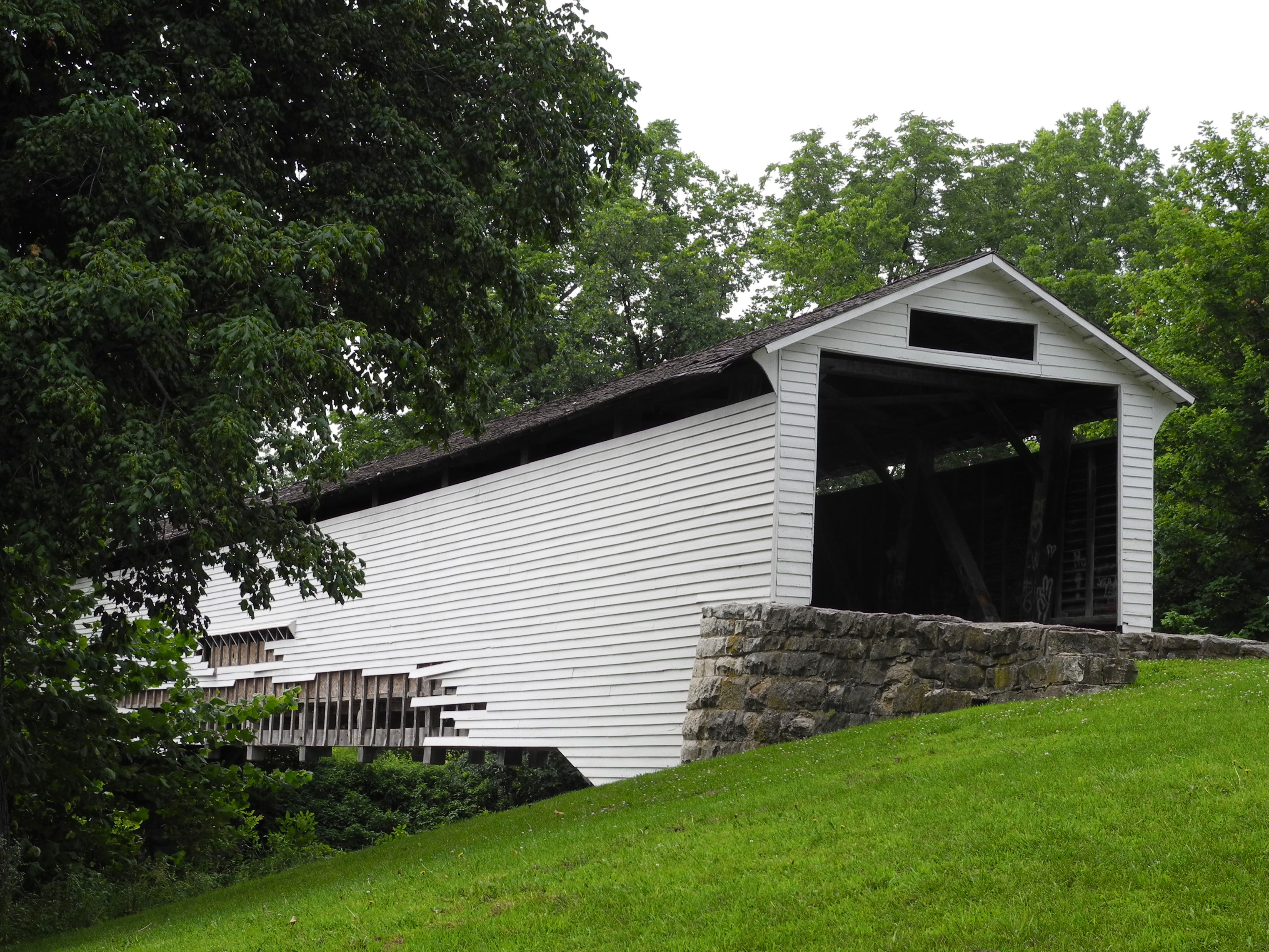
147:Union Covered Bridge SHS from southeast 1.jpg
144:
205:
195:
14:
971:
888:
309:– to copy, distribute and transmit the work
408:You may select the license of your choice.
1241:The following other wikis use this file:
1254:Union Covered Bridge State Historic Site
1226:Union Covered Bridge State Historic Site
597:http://commons.wikimedia.org/User:Kbh3rd
468:Union Covered Bridge State Historic Site
439:Union Covered Bridge State Historic Site
1190:{{Information |Description ={{en|1=
241:View this and other nearby images on:
1216:The following 3 pages use this file:
133:
388:http://www.gnu.org/copyleft/fdl.html
296:Attribution-Share Alike 3.0 Unported
217:
1221:List of covered bridges in Missouri
1131:
284:
279:
180:parks department as historic sites.
13:
1279:
1206:. This is one of four remaining [
432:
426:
407:
270:
266:
151:
134:
80:
1623:
1286:
431:
172:. This is one of four remaining
1341:Date and time of data generation
857:coordinates of the point of view
847:coordinates of the point of view
417:
364:
363:
320:Under the following conditions:
291:This file is licensed under the
283:
278:
272:
247:
233:
178:Department of Natural Resources'
101:
31:
21:
414:
152:
1315:1/672 sec (0.0014880952380952)
1236:
1135:
413:
394:GNU Free Documentation License
383:GNU Free Documentation License
373:GNU Free Documentation License
26:
1:
833:original creation by uploader
807:original creation by uploader
36:
1363:5,928 meters above sea level
1211:
872:39°25'57.220"N, 92°6'8.006"W
547:object of statement has role
486:object of statement has role
447:Items portrayed in this file
260:
7:
1437:Date and time of digitizing
1276:
10:
1628:
1546:Focal length in 35 mm film
1265:Usage on www.wikidata.org
1245:Usage on de.wikipedia.org
334:same or compatible license
141:
136:
1402:File change date and time
1132:
199:
16:
1249:Monroe County (Missouri)
416:
378:Free Software Foundation
300:
108:This is a file from the
41:
1600:North or south latitude
1509:Custom image processing
1189:
914:0.00148809523809523809
188:
112:. Information from its
1608:East or west longitude
1592:Subject distance range
1445:Image compression mode
253:39.432561; -92.102224
115:description page there
46:Size of this preview:
1463:Maximum land aperture
1376:Horizontal resolution
1192:Union Covered Bridge
158:Union Covered Bridge
74:3,046 × 2,285 pixels
70:2,560 × 1,920 pixels
1440:15:26, 26 June 2011
1410:Y and C positioning
1405:22:21, 26 June 2011
1384:Vertical resolution
1344:15:26, 26 June 2011
1290:Camera manufacturer
1168:03:59, 27 June 2011
789:Nikon Coolpix P7000
763:Nikon Coolpix P7000
315:– to adapt the work
52:Other resolutions:
1554:Scene capture type
1530:Auto white balance
1231:User:Kbh3rd/Images
575:Wikimedia username
562:author name string
502:Wikimedia username
494:author name string
66:1,280 × 960 pixels
62:1,024 × 768 pixels
1615:
1614:
1237:Global file usage
1209:
973:
890:
674:copyright license
656:copyright license
425:
405:
404:
258:
257:
215:
214:
130:
129:
110:Wikimedia Commons
32:Global file usage
1619:
1418:Exposure Program
1287:
1180:
1142:
1000:
917:
626:copyright status
612:copyright status
599:
594:
584:
579:
569:
566:
556:
551:
423:
401:
398:
395:
392:
389:
367:
366:
360:
356:
353:
350:
347:
344:
336:as the original.
293:Creative Commons
287:
286:
282:
281:
276:
275:
254:
251:
237:
236:
230:
229:
218:
201:
191:
156:
148:
142:
126:
105:
104:
98:
92:
90:
77:
58:640 × 480 pixels
54:320 × 240 pixels
48:799 × 599 pixels
1627:
1626:
1622:
1621:
1620:
1618:
1617:
1616:
1466:3 APEX (f/2.83)
1275:
1235:
1210:
1186:
1178:
1134:
1133:
1130:
1129:
1128:
1127:
1126:
1125:
1124:
1123:
1121:
1111:
1110:
1109:
1107:
1092:
1091:
1090:
1089:
1088:
1087:
1086:
1085:
1083:
1071:
1070:
1069:
1067:
1048:
1047:
1046:
1045:
1044:
1043:
1042:
1041:
1039:
1029:
1028:
1027:
1025:
1010:
1009:
1008:
1007:
1006:
1005:
1004:
1003:
1001:
998:
988:
987:
986:
984:
965:
964:
963:
962:
961:
960:
959:
958:
956:
946:
945:
944:
942:
927:
926:
925:
924:
923:
922:
921:
920:
918:
915:
905:
904:
903:
901:
882:
881:
880:
879:
878:
877:
876:
875:
873:
863:
862:
861:
859:
844:
843:
842:
841:
840:
839:
838:
837:
835:
823:
822:
821:
819:
800:
799:
798:
797:
796:
795:
794:
793:
791:
779:
778:
777:
775:
756:
755:
754:
753:
752:
751:
750:
749:
747:
737:
736:
735:
733:
718:
717:
716:
715:
714:
713:
712:
711:
709:
698:
697:
696:
695:
694:
692:
680:
679:
678:
676:
653:
652:
651:
650:
649:
648:
647:
646:
644:
632:
631:
630:
628:
609:
608:
607:
606:
605:
604:
603:
602:
601:
600:
595:
592:
586:
585:
580:
577:
571:
570:
567:
564:
558:
557:
552:
549:
540:
539:
538:
536:
526:
525:
524:
522:
479:
478:
477:
476:
475:
474:
473:
472:
470:
458:
457:
456:
454:
430:
429:
428:
411:
410:
409:
399:
396:
393:
390:
387:
358:
357:
354:
351:
348:
345:
342:
341:
299:
288:
269:
268:
263:
252:
225:
224:
221:Camera location
216:
181:
174:covered bridges
146:
139:
132:
131:
120:
119:
118:is shown below.
94:
88:
86:
79:
78:
51:
12:
11:
5:
1625:
1613:
1612:
1611:West longitude
1609:
1605:
1604:
1603:North latitude
1601:
1597:
1596:
1593:
1589:
1588:
1585:
1579:
1578:
1575:
1569:
1568:
1565:
1559:
1558:
1555:
1551:
1550:
1547:
1543:
1542:
1539:
1532:
1531:
1528:
1522:
1521:
1518:
1514:
1513:
1512:Normal process
1510:
1506:
1505:
1502:
1496:
1495:
1492:
1486:
1485:
1482:
1478:
1477:
1474:
1468:
1467:
1464:
1460:
1459:
1456:
1450:
1449:
1446:
1442:
1441:
1438:
1434:
1433:
1430:
1423:
1422:
1421:Normal program
1419:
1415:
1414:
1411:
1407:
1406:
1403:
1399:
1398:
1393:
1389:
1388:
1385:
1381:
1380:
1377:
1373:
1372:
1369:
1365:
1364:
1361:
1357:
1356:
1353:
1346:
1345:
1342:
1338:
1337:
1334:
1327:
1326:
1323:
1317:
1316:
1313:
1307:
1306:
1301:
1297:
1296:
1291:
1278:
1274:
1273:
1272:
1271:
1263:
1262:
1261:
1256:
1251:
1238:
1234:
1233:
1228:
1223:
1213:
1208:
1207:
1188:
1184:
1181:
1177:3,046 × 2,285
1175:
1170:
1165:
1161:
1160:
1157:
1154:
1151:
1148:
1145:
1137:
1122:
1119:
1117:
1116:
1115:
1113:
1112:
1108:
1103:
1101:
1100:
1099:
1098:
1096:
1084:
1079:
1077:
1076:
1075:
1073:
1072:
1068:
1063:
1061:
1060:
1059:
1058:
1056:
1052:
1040:
1037:
1035:
1034:
1033:
1031:
1030:
1026:
1021:
1019:
1018:
1017:
1016:
1014:
1002:
996:
994:
993:
992:
990:
989:
985:
980:
978:
977:
976:
975:
969:
957:
954:
952:
951:
950:
948:
947:
943:
938:
936:
935:
934:
933:
931:
919:
913:
911:
910:
909:
907:
906:
902:
897:
895:
894:
893:
892:
886:
874:
871:
869:
868:
867:
865:
864:
860:
855:
853:
852:
851:
850:
848:
836:
831:
829:
828:
827:
825:
824:
820:
817:source of file
815:
813:
812:
811:
810:
808:
804:
803:source of file
792:
787:
785:
784:
783:
781:
780:
776:
771:
769:
768:
767:
766:
764:
760:
748:
745:
743:
742:
741:
739:
738:
734:
729:
727:
726:
725:
724:
722:
710:
705:
703:
702:
701:
699:
693:
688:
686:
685:
684:
682:
681:
677:
672:
670:
669:
668:
667:
665:
661:
657:
645:
640:
638:
637:
636:
634:
633:
629:
624:
622:
621:
620:
619:
617:
613:
588:
587:
573:
572:
560:
559:
545:
544:
543:
542:
541:
537:
534:
532:
531:
530:
528:
527:
523:
518:
516:
515:
514:
513:
511:
507:
503:
499:
495:
491:
487:
483:
471:
466:
464:
463:
462:
460:
459:
455:
450:
448:
445:
444:
443:
442:
440:
436:
422:
421:
418:
415:
406:
403:
402:
368:
340:
339:
338:
337:
327:
318:
317:
316:
310:
303:You are free:
290:
289:
271:
265:
264:
262:
259:
256:
255:
245:
239:
222:
213:
212:
207:
203:
202:
197:
193:
192:
187:
183:
182:
149:
140:
138:
135:
128:
127:
106:
96:
95:
45:
40:
39:
34:
29:
24:
19:
9:
6:
4:
3:
2:
1624:
1610:
1607:
1606:
1602:
1599:
1598:
1594:
1591:
1590:
1586:
1584:
1581:
1580:
1576:
1574:
1571:
1570:
1566:
1564:
1561:
1560:
1556:
1553:
1552:
1548:
1545:
1544:
1540:
1537:
1534:
1533:
1529:
1527:
1526:White balance
1524:
1523:
1520:Auto exposure
1519:
1517:Exposure mode
1516:
1515:
1511:
1508:
1507:
1503:
1501:
1498:
1497:
1493:
1491:
1488:
1487:
1483:
1480:
1479:
1475:
1473:
1472:Metering mode
1470:
1469:
1465:
1462:
1461:
1457:
1455:
1454:Exposure bias
1452:
1451:
1447:
1444:
1443:
1439:
1436:
1435:
1431:
1428:
1425:
1424:
1420:
1417:
1416:
1412:
1409:
1408:
1404:
1401:
1400:
1397:
1394:
1392:Software used
1391:
1390:
1386:
1383:
1382:
1378:
1375:
1374:
1370:
1367:
1366:
1362:
1359:
1358:
1354:
1352:
1348:
1347:
1343:
1340:
1339:
1335:
1332:
1329:
1328:
1324:
1322:
1319:
1318:
1314:
1312:
1311:Exposure time
1309:
1308:
1305:
1304:COOLPIX P7000
1302:
1299:
1298:
1295:
1292:
1289:
1288:
1285:
1282:
1270:
1267:
1266:
1264:
1260:
1257:
1255:
1252:
1250:
1247:
1246:
1244:
1243:
1242:
1232:
1229:
1227:
1224:
1222:
1219:
1218:
1217:
1205:
1201:
1197:
1196:Monroe County
1193:
1187:
1182:
1176:
1174:
1171:
1169:
1166:
1163:
1162:
1158:
1155:
1152:
1149:
1146:
1144:
1143:
1141:
1118:
1106:
1102:
1082:
1078:
1066:
1062:
1036:
1024:
1020:
995:
983:
979:
953:
941:
937:
912:
900:
899:exposure time
896:
885:exposure time
870:
858:
854:
834:
830:
818:
814:
790:
786:
774:
773:captured with
770:
759:captured with
744:
732:
728:
708:
704:
691:
687:
675:
671:
643:
639:
627:
623:
598:
591:
583:
576:
563:
555:
548:
533:
521:
517:
469:
465:
453:
449:
446:
419:
412:
385:
384:
379:
375:
374:
369:
362:
361:
346:CC BY-SA 3.0
335:
331:
328:
325:
322:
321:
319:
314:
311:
308:
305:
304:
302:
301:
297:
294:
277:
250:
246:
244:
243:OpenStreetMap
240:
238:
228:
223:
220:
219:
211:
208:
204:
198:
194:
184:
179:
175:
171:
167:
163:
162:Monroe County
159:
155:
150:
143:
124:
117:
116:
111:
107:
100:
99:
93:
84:
83:Original file
75:
71:
67:
63:
59:
55:
49:
44:
38:
35:
33:
30:
28:
25:
23:
20:
18:
15:
1536:Digital zoom
1481:Light source
1351:focal length
1300:Camera model
1283:
1280:
1240:
1215:
1139:
1136:File history
982:focal length
968:focal length
746:26 June 2011
554:photographer
490:photographer
381:
371:
329:
323:
312:
306:
190:26 June 2011
153:
123:You can help
113:
81:
22:File history
1500:Color space
1368:Orientation
1065:instance of
1051:instance of
642:copyrighted
616:copyrighted
330:share alike
324:attribution
145:Description
1573:Saturation
1396:GIMP 2.6.6
1212:File usage
1153:Dimensions
1120:image/jpeg
1105:media type
1095:media type
1081:photograph
1055:photograph
999:millimetre
972:millimetre
535:some value
89:image/jpeg
27:File usage
1583:Sharpness
1331:ISO speed
1150:Thumbnail
1147:Date/Time
1023:ISO speed
1013:ISO speed
731:inception
721:inception
261:Licensing
154:English:
1563:Contrast
1557:Standard
1413:Co-sited
1360:Altitude
1321:F-number
1277:Metadata
1200:Missouri
1179:(2.6 MB)
940:f-number
930:f-number
420:Captions
313:to remix
307:to share
298:license.
200:Own work
166:Missouri
37:Metadata
1595:Unknown
1484:Unknown
1476:Pattern
1429:version
1355:10.7 mm
1269:Q976050
1164:current
1159:Comment
520:creator
482:creator
452:depicts
435:depicts
424:English
137:Summary
85:
1587:Normal
1577:Normal
1567:Normal
1387:72 dpi
1379:72 dpi
1371:Normal
1333:rating
1185:Kbh3rd
916:second
889:second
582:Kbh3rd
568:Kbh3rd
498:Kbh3rd
231:
210:Kbh3rd
206:Author
196:Source
1549:50 mm
1538:ratio
1490:Flash
1349:Lens
1325:f/3.5
1294:NIKON
997:10.7
1504:sRGB
1427:Exif
1156:User
400:true
397:true
391:GFDL
355:true
352:true
186:Date
17:File
1432:2.2
1336:100
1204:USA
1194:in
1038:100
955:3.5
590:URL
506:URL
170:USA
160:in
1202:,
1198:,
593::
578::
565::
550::
168:,
164:,
72:|
68:|
64:|
60:|
56:|
50:.
1541:0
1458:0
1448:4
386:.
125:.
91:)
76:.
Text is available under the Creative Commons Attribution-ShareAlike License. Additional terms may apply.